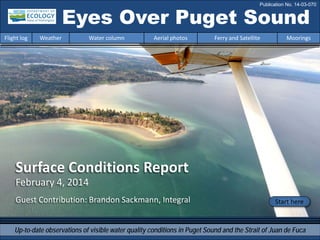
1. Surface Conditions Report
February 4, 2014
Guest Contribution: Brandon Sackmann, Integral
Eyes Over Puget Sound
Up-to-date observations of visible water quality conditions in Puget Sound and the Strait of Juan de Fuca
Flight log Weather Water column Aerial photos Ferry and Satellite Moorings
Start here
Publication No. 14-03-070
2. Personal flight log p. 3
Let your passion become your greatest qualification
and don’t lose sight of your dreams. Learn more about our
program from our video.
Weather conditions p. 5
Air temperatures have plummeted in the past week;
winds have been weak and from the north, which is atypical.
River flows are below normal.
Water column p. 6
A dry winter brings new Puget Sound conditions! Colder, saltier
conditions are developing in the northern regions. Oxygen has
stabilized within expected ranges. The recent fall in air
temperatures likely will further cool Puget Sound.
Aerial photography p. 10
Suspended sediment seen along wind and wave exposed
beaches and mud flats. Tidal eddies carry suspended sediment.
Long lines of foam follow convergences, currents, and eddies.
Jellyfish in Eld Inlet. Oil sheen in Commencement Bay.
Ferry and satellite p. 35
Clear skies and cooler temperatures over much of Puget Sound
and the Strait of Georgia. High resolution MODIS imagery
reveals widespread sediment transport off the coast.
LONG-TERMMARINEMONITORINGUNIT
Mya Keyzers
Laura Hermanson
Joe Leatherman
Skip Albertson
Dr. Christopher
Krembs
Dr. Brandon
Sackmann
Julia Bos
Suzan Pool
www.ecy.wa.gov/programs/eap/mar_wat/eops/Previous Eyes Over Puget Sound reports:
Marine conditions from 2-4-2014 at a glance
Flight log Weather Water column Aerial photos Ferry and Satellite Moorings
3. A fresh perspective from our WCC intern
We are lucky to have Clifton Herrmann on our team through the WA Conservation Corps.
Whether you aspire to be a marine ecologist, fisheries biologist, or physical oceanographer,
making it in the field can be a challenge. Clifton shares some tips!
2. Study, Study, Study!
I hate to say it, but science is competitive. Never miss an
opportunity to learn. Actively engage yourself in all classes!
Even if it doesn’t feel important, you will want that
knowledge someday. It’s not just a degree, it’s everything
you’ll need to know!
1. Find your passion and stick with it!
Science is not a job, it’s a way of thinking. Let your passion become
your greatest qualification, and don’t lose sight of your dreams. If
you don’t care about it, you won’t be good at it!
Personal flight log 2-4-2014
Flight log Weather Water column Aerial photos Ferry and Satellite Moorings
4. Advice for aspiring scientists
3. College graduation is only the beginning!
Keep an eye out for internships and volunteer work you might
like. You have to prove you’re willing to do it for free before
anyone will pay you. Your education is valuable, but
professionals want to see you in action.
4. Build your skills!
Spend time building new skills and honing your interests. My position is through
AmeriCorps, a federally funded professional development program. Opportunities like
mine are designed for young professionals transitioning out of school into the real world.
5. Ask questions!
Always. In every situation, even if there’s nobody around to answer. Scientists are curious
beasts. Never assume you already know the whole answer to something, because there
are always new underlying questions. The world is an unknown, and that’s what is so
exciting about it! Have fun, and never settle for less than your potential.
Personal flight log 2-4-2014
Flight log Weather Water column Aerial photos Ferry and Satellite Moorings
5. Flight log Weather Water column Aerial photos Ferry and Satellite Moorings
Weather of the past two weeks before 2-4-2014
Meteorological conditions typically explain up to half of the variance in observed marine
variables (Moore et al. 2008), particularly in shallower waters like those of south Puget
Sound. I summarized the specific conditions prevalent during the past two weeks, from north
to south. Source: http://www-k12.atmos.washington.edu/k12/grayskies/nw_weather.html
Moore et al. 2008. Local and large-scale climate forcing of Puget Sound oceanographic properties on seasonal to interdecadal timescales. Limnol. Oceanogr., 53(5), 1746–1758
Two week summary:
Air temperatures. Daily
average air temperatures have
plummeted during the past
week!
Sunshine is increasing after
weeks of clouds.
River flows are below normal.
Winds have been weak and
from the north for the past
two weeks, which is unusual
for winter time.
Moore et al. 2008. Local and large-scale climate forcing of Puget Sound oceanographic properties on seasonal to interdecadal timescales. Limnol. Oceanogr., 53(5), 1746–1758
6. We use a chartered float
plane to access our
monthly monitoring
stations most cost
effectively.
We communicate data and
environmental marine
conditions using:
1. Marine Water
Condition Index
(MWCI)
2. Eyes Over Puget
Sound (EOPS)
3. Anomalies and
source data
Flight log Weather Water column Aerial photos Ferry and Satellite Moorings
Our long-termmarinemonitoringstationsin Washington
Start here
Isl.
.
7. Dec. 2013: Temperature lower Salinity higher northward Oxygen normalizing
Flight log Weather Water column Aerial photos Ferry and Satellite Moorings
Physical conditions over the last two years
A dry winter brings new Puget Sound conditions! The 2011-2012 colder, fresher, higher oxygen conditions are gone. Colder
saltier conditions are developing, particularly in the northern regions. Oxygen has stabilized again within expected ranges.
The recent fall in temperatures will likely further cool Puget Sound, particularly in the shallower regions.
8. -25
-20
-15
-10
-5
0
5
10
15
20
25
-1.5
-1
-0.5
0
0.5
1
1.5
1945 1950 1955 1960 1965 1970 1975 1980 1985 1990 1995 2000 2005 2010 2015
a) Pacific Decadal Oscillation Index (PDO, temperature) (explanation)
b) Upwelling Index (anomalies) (Upwelling, low oxygen) (explanation)
c) North Pacific Gyre Oscillation Index (NPGO, productivity) (explanation)
NPGO(x10)
PDO/UpwellingIndex
Three-year running average of PDO, Upwelling, and NPGO indices scores
Ocean boundary conditions have been favorable for water quality in Puget Sound: (a) colder water (PDO),
(b) less upwelled low oxygen and high nutrient ocean water reaching Puget Sound (Upwelling Index), and
(c) higher surface productivity along the coast (NPGO). Where are we heading next?
Flight log Weather Water column Aerial photos Ferry and Satellite Moorings
.
The oceanaffectswater quality: Ocean ClimateIndices
9. Explore the data
Is the food web changing in Puget Sound?
The story in 5 min
Follow the experts
Hypothesis!
Should we pay
greater attention to
nutrient ratios,
energy transfer,
and material cycling
in Puget Sound?
Noctiluca blooms are
a visible harbinger of
a changing microbial
food web in Puget
Sound’s waters.
10. Summary: Aerial photography 2-4-2014
Suspended sediment along wind and wave exposed beaches and mud flats. Larger tidal eddies
in many places which carry suspended sediment. Long lines of foam follow convergences,
currents, and eddies. Jellyfish in Eld Inlet. Oil sheen in Commencement Bay.
Flight log Weather Water column Aerial photos Ferry and Satellite Moorings
Start here
Mixing and Fronts:
Many tidal eddies in Pitt and Pickering Passages and the
entrance to Quartermaster Harbor. River plumes relatively
small.
Debris:
Abundant lines of foam in Budd Inlet, Oakland Bay, and
Commencement Bay. Debris lines with driftwood and eelgrass
near Gordon Point.
Visible blooms: None.
Jellyfish: Infrequent large patch seen only in Eld Inlet.
BloomDebrisFront
Suspended sediment:
Abundant suspended sediment at wave exposed beaches and
mud flats facing north in South and Central Sound. Suspended
sediment in river plumes relatively small.
Plume
18 19
Cockpit temperatures warm as we take off
Sunrise over Puget Sound starting the day
2 3 4 7 8 9 10 11 13 14 15 17
2 3
19
12 15 191 2 3 4
Picture Joe Leatherman
11. Strait of
Juan de Fuca
San Juan Islands
Padilla Bay
Main Basin
Hood Canal
South Sound
Flight log Weather Water column Aerial photos Ferry and Satellite Moorings
Observation Maps:
Afternoon flight, photos 2-20:
Good visibility, wind, waves, and
cold.
Flight Information:
Morning flight, photo 1:
Low visibility, windy, and cold.
5
8
16
19
11
10
9
2
13
14
15
17
Aerial photography &
navigation guide
18
20
1
6
Central Sound
South Sound
Seattle: H. tide: 8:04 AM, 8:36 PM, L. tide: 1:33 AM, 2:34 PM
4
7 3
12
Whidbey Basin
12. Foam line parallel to shore leaving Budd Inlet and flowing towards Dana Passage past Boston Harbor.
Location: Budd Inlet (South Sound), 10:46 AM.
1 Aerial photography 2-4-2014 Navigate
Flight log Weather Water column Aerial photos Ferry and Satellite Moorings
Debris
13. 2 NavigateAerial photography 2-4-2014
Flight log Weather Water column Aerial photos Ferry and Satellite Moorings
South Sound water with different color leaving Tacoma Narrows and diverging at Vashon Island.
Location: Point Defiance (Tacoma), 12:52 PM.
Plume
14. 3 NavigateAerial photography 2-4-2014
Eddy and suspended sediment at entrance to Quartermaster Harbor with Puyallup River plume in the back.
Location: South Vashon Island, looking into Commencement Bay (Central Sound), 12:54 PM.
Flight log Weather Water column Aerial photos Ferry and Satellite Moorings
Front
Plume
Suspended
sediment
Eddy
Debris
15. A. B.
4 Navigate
Flight log Weather Water column Aerial photos Ferry and Satellite Moorings
Aerial photography 2-4-2014
Long suspended sediment ribbons along beaches.
Location: A. Quartermaster Harbor (Vashon Island), B. Dash Point (Federal Way, Tacoma), 12:55 PM.
Suspended
sediment
Suspended
sediment
Debris
16. 5 NavigateAerial photography 2-4-2014
Flight log Weather Water column Aerial photos Ferry and Satellite Moorings
Sizable oil sheen in a marina. Location: Commencement Bay (Tacoma), 12:57 PM.
Oil sheen
17. Diatom films growing on intertidal mudflats. Location: Cutts Island State Park (Carr Inlet), 2:44 PM.
6 NavigateAerial photography 2-4-2014
Flight log Weather Water column Aerial photos Ferry and Satellite Moorings
diatom films
18. Large tidal eddy transporting suspended sediment from beach into Carr Inlet.
Location: Near Pitt Passage (Carr Inlet ), 2:50 PM.
7 NavigateAerial photography 2-4-2014
Flight log Weather Water column Aerial photos Ferry and Satellite Moorings
Suspended
sediment
Suspended
sediment
Eddy
19. Large tidal eddy transporting suspended sediment from beach into Carr Inlet.
Location: Near Pitt Passage (Carr Inlet ), 2:50 PM.
8 NavigateAerial photography 2-4-2014
Flight log Weather Water column Aerial photos Ferry and Satellite Moorings
Suspended
sediment
Eddy
20. Large tidal eddy transporting suspended sediment from beach into Carr Inlet.
Location: Near Pitt Passage (Carr Inlet ), 2:50 PM.
9 NavigateAerial photography 2-4-2014
Flight log Weather Water column Aerial photos Ferry and Satellite Moorings
Suspended
sediment
Eddy
21. 10 NavigateAerial photography 2-4-2014
Suspended sediments washing off beaches. Location: Mayo Cove (Carr Inlet), 2:50 PM.
Flight log Weather Water column Aerial photos Ferry and Satellite Moorings
Suspended
sediment
Suspended
sediment
22. 11 NavigateAerial photography 2-4-2014
Suspended sediment near beach. Location: Von Geldern Cove (Carr Inlet), 2:51 PM.
Flight log Weather Water column Aerial photos Ferry and Satellite Moorings
Suspended
sediment
Suspended
sediment
23. Debris line and tidal eddy.
Location: Off Jarrell Cove, Pickering Passage (South Sound), 4:10 PM.
12 Navigate
Flight log Weather Water column Aerial photos Ferry and Satellite Moorings
Aerial photography 2-4-2014
EddyDebrisDebris
24. Very sediment-laden water near northern beach of Harstine Island facing Case Inlet.
Location: Harstine Island (South Sound), 4:13 PM.
13 Navigate
Flight log Weather Water column Aerial photos Ferry and Satellite Moorings
Aerial photography 2-4-2014
Suspended sediment
25. Very sediment-laden water near northern beach of Harstine Island facing Case Inlet.
Location: Harstine Island (South Sound), 4:13 PM.
14 Navigate
Flight log Weather Water column Aerial photos Ferry and Satellite Moorings
Aerial photography 2-4-2014
Suspended sediment
26. 15 Navigate
Flight log Weather Water column Aerial photos Ferry and Satellite Moorings
Foam lines, suspended sediment, and oyster beds become visible during ebbing tide.
Location: Oakland Bay (South Sound), 4:17 PM.
Aerial photography 2-4-2014
Suspended
sediment
Debris
Oyster beds
Debris
27. 16 Navigate
Flight log Weather Water column Aerial photos Ferry and Satellite Moorings
The southern extent of Puget Sound, Oakland Bay, and its port.
Location: Shelton Harbor (South Sound), 4:17 PM.
Aerial photography 2-4-2014
28. 17 Navigate
Flight log Weather Water column Aerial photos Ferry and Satellite Moorings
Sediment-laden water draining from mud flats.
Location: Totten Inlet (South Sound), 4:50 PM.
Aerial photography 2-4-2014
Suspended sediment
Suspended sediment
29. 18 Navigate
Flight log Weather Water column Aerial photos Ferry and Satellite Moorings
Jellyfish patch and suspended sediment near beach.
Location: Eld Inlet (South Sound), 5:18 PM.
Aerial photography 2-4-2014
Suspended sediment
Jellyfish
30. 19 Navigate
Flight log Weather Water column Aerial photos Ferry and Satellite Moorings
Foam line and suspended sediment near beach.
Location: Budd Inlet (South Sound), 5:19 PM.
Aerial photography 2-4-2014
Suspended sediment
Debris
31. 20 Navigate
Flight log Weather Water column Aerial photos Ferry and Satellite Moorings
Cold air chills our crew while sitting on the water before takeoff.
Location: Lake Washington (Seattle), 8:00 AM.
Aerial photography 2-4-2014
frost
Picture Joe Leatherman
32. Aerial photography observations in Central SoundObservations in Central Sound Navigate
Flight log Weather Water column Aerial photos Ferry and Satellite Moorings
Numbers on map refer to
picture numbers for spatial
reference
Date: 2-4-2014
5
4
2
3
4
20
33. Observations in South Sound
Numbers on map refer to picture numbers for spatial reference
Navigate
Flight log Weather Water column Aerial photos Ferry and Satellite Moorings
Date: 2-4-2014
19
1
12
15
16
17 18
11
10
8
7
9
14
13
6
34. Legend to map annotations
Comments:
Maps are produced by observers during and
after flights. They are intended to give an
approximate reconstruction of the surface
conditions on scales that connect to and
overlap with satellite images in the section that
follows.
Debris:
Debris can be distinguished into natural and
anthropogenic debris floating at the surface
sensu Moore and Allen (2000). The majority of
organic debris in Puget Sound is natural mixed
with discarded man-made pieces of plastic,
wood, etc. From the plane, we cannot
differentiate the quality of debris at the surface
and therefore, call it for reasons of practicality
just “debris”.
S.L. Moore, M. J. Allen. 2000. Distribution of
Anthropogenic and Natural Debris on the
Mainland Shelf of the Southern California Bight.
Marine Pollution Bulletin, 40(1), 83–88.
Navigate
Flight log Weather Water column Aerial photos Ferry and Satellite Moorings
35. Guest: Ferry and satellite observations 2-4-2014
Flight log Weather Water column Aerial photos Ferry and Satellite Moorings
Brandon Sackmann
Contact:
bsackmann@integral-corp.com
Start here
No Victoria Clipper data available – Hardware upgrades in progress!!!
Landsat 8 True Color (Operational Land Imager)
Clear Skies over Puget Sound and Strait of Georgia
Victoria Clipper IV leaving Elliott Bay
3 February 2014
36. Guest: Ferry and satellite observations 2-4-2014
Flight log Weather Water column Aerial photos Ferry and Satellite Moorings
Seasonal temperature fluctuations on land are more dramatic than what is observed over the open marine
waters of Puget Sound. In summer (A), land is noticeably warmer, whereas in winter (B), the opposite is
true. On 3 February 2014 measured air temperatures at West Point were ~38°F; surface water temperatures
in Port Susan (Whidbey Basin) were ~46°F. Darker tones = cooler (C), lighter tones = warmer (W)..
Thermal Infrared Imagery (Landsat 8) Reveals
Seasonal Temperature Differences in Puget Sound (Whidbey Basin)
Water Quality Sensors
3 February 2014
(Winter)
21 August 2013
(Summer)
W
WC
C
A. B.
37. Guest: Ferry and satellite observations 2-4-2014
Flight log Weather Water column Aerial photos Ferry and Satellite Moorings
MODIS-Aqua and MODIS-Terra for January 24, 2014
-- Hi-resolution (250-m) Turbidity Product --
MODIS-Aqua True ColorMODIS-Terra True Color
MODIS-Aqua TurbidityMODIS-Terra Turbidity
MODIS-Terra (left) and MODIS-Aqua (right)
provide synoptic coverage (2x per day) of key
water quality variables (e.g., turbidity) that allows
us to visualize dynamic processes, such as
sediment transport, taking place off our coast.
Bright white lines along the coast suggest
breaking waves…
Wave heights off Cape
Elizabeth were >10 ft. on
24 January!!!
wave
height
PMAM
AM PM
38. Strength through collaboration across agencies, academic institutions and companies.
We have plans to continue to collect data at our Admiralty Reach (UW Applied Physics Lab) and
Mukilteo (ORCA College) moorings into the future. Operations at all other mooring locations
have been suspended in order to reallocate existing resources.
Note: Due to state and federal budget reductions, our mooring program is being downscaled.
We are now focusing on measuring ocean intrusions!
Why? The importance of the ocean on water quality in Puget Sound is being emphasized by
Ecology’s mooring at Admiralty Reach, long term monitoring data, modeling studies, and
academic publications. Admiralty Reach is a challenge - it requires a team effort!
Upwelling along the coast can bring high nutrient, low oxygen and low pH ocean water into
Puget Sound. Such intrusions explain much of the year to year variability in water quality.
For intrusions to enter Puget Sound, several conditions have to align:
• Prolonged upwelling along the Washington coast. Driver: Northerly winds
• Estuarine circulation moving dense water from the coast into the Strait of Juan de
Fuca. Driver: High Fraser River flow during summer
• Neap-Spring tide phase and character favorable to intrusions along the 30 km length
of Admiralty Reach. Drivers: Neap tides and tidal harmonics
Future Focus of Mooring Operations
Flight log Weather Water column Aerial photos Ferry and Satellite Moorings
39. Access mooring
data:
ftp://www.ecy.wa.gov/ea
p/Mooring_Raw/Puget_S
ound/
Ferry and satellite :
Suzan.Pool@ecy.wa.gov
Get data from Ecology’s Monitoring Programs
Long–Term
Monitoring Network
Real–Time
Sensor Network
Access core
monitoring data:
http://www.ecy.wa.gov/a
pps/eap/marinewq/mwda
taset.asp
christopher.krembs@ecy.w
a.gov
Ecology’s long-term marine
monitoring stations
Ferry track
Morning flight
Evening flight
Flight log Weather Water column Aerial photos Ferry and Satellite Moorings
River and Stream Water Quality
Monitoring
http://www.ecy.wa.gov/programs/eap/fw_riv
/rv_main.html
40. You may subscribe or unsubscribe to the Eyes Over Puget Sound email listserv by going to:
http://listserv.wa.gov/cgi-bin/wa?A0=ECOLOGY-EYES-OVER-PUGET-SOUND
Many thanks to our business partners: Clipper Navigation, Swantown Marina, and Kenmore Air.
We are looking for feedback to improve our products.
Dr. Christopher Krembs
christopher.krembs@ecy.wa.gov
Marine Monitoring Unit
Environmental Assessment Program
WA Department of Ecology
Flight log Weather Water column Aerial photos Ferry and Satellite Moorings