
Recommended
Recommended
More Related Content
What's hot
What's hot (16)
Viewers also liked
Similar to ATS-15 Tools of the Trade: Prioritizing and Planning for Active Transportation, Karla Kingsley
Similar to ATS-15 Tools of the Trade: Prioritizing and Planning for Active Transportation, Karla Kingsley (20)
More from BTAOregon
More from BTAOregon (20)
Recently uploaded
Recently uploaded (20)
ATS-15 Tools of the Trade: Prioritizing and Planning for Active Transportation, Karla Kingsley
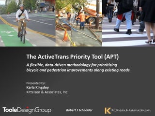
- 1. The ActiveTrans Priority Tool (APT) A flexible, data-driven methodology for prioritizing bicycle and pedestrian improvements along existing roads Robert J Schneider Presented by: Karla Kingsley Kittelson & Associates, Inc.
- 3. MOVING THINKINGFORWARD • PHOTO of 17th • PHOTO of 17th 3 My commute
- 4. MOVING THINKINGFORWARD • PHOTO of 17th • PHOTO of 17th 4 My commute
- 5. MOVING THINKINGFORWARD • Limited funding and resources • Decision-making seems (or is) political • Squeaky wheel gets the grease • Improvements happen after tragedies • Difficult to involve the public 5 Prioritization for agencies is a bit different
- 6. MOVING THINKINGFORWARD • Don’t reinvent the wheel • Open the “black box” • Offer guidance for important decision points • Provide flexibility and wide applicability NCHRP 07-17: ActiveTrans Priority Tool Photo by Robert Schneider
- 7. MOVING THINKINGFORWARD7 ActiveTrans Priority Tool (APT) Phase I Phase II
- 8. MOVING THINKINGFORWARD APT Pilot Agency: City of Miami Pedestrian Crossings
- 9. MOVING THINKINGFORWARD • Existing plan identified crossing treatments and potential locations • What to do first? Where should Miami focus efforts or investments? 1 2 3 4 5 6 7 8 9 10APT Step
- 10. MOVING THINKINGFORWARD • Mode? • Goals? • Project list or general needs? • Geographic area? • Number of locations? Step 1: Define Purpose
- 11. MOVING THINKINGFORWARD 1 2 3 4 5 6 7 8 9 10APT Step Factors Weight Variables Safety 10 Total Pedestrian Crashes Demand 8 Employment Density Number of Bus Stops Opportunities 7 Aligned with Future Construction Existing Conditions 6 Traffic Speed Total Crossing Distance Stakeholder Input 6 Input from Health District Plan
- 12. MOVING THINKINGFORWARD 1 2 3 4 5 6 7 8 9 10APT Step Factors Weight Variables Safety 10 Total Pedestrian Crashes Demand 8 Employment Density Building Sq Ft Number of Bus Stops Opportunities 7 Aligned with Future Construction Existing Conditions 6 Traffic Speed Speed Limit Total Crossing Distance Stakeholder Input 6 Input from Health District Plan
- 13. MOVING THINKINGFORWARD 1 2 3 4 5 6 7 8 9 10APT Step
- 14. MOVING THINKINGFORWARD 1 2 3 4 5 6 7 8 9 10APT Step Variables Range of values Scaled range Total Pedestrian Crashes 0 to 9 crashes 0 to 10 Building Square Footage Low, Med, or High Number of Bus Stops 0 to 4 stops Aligned with Future Construction Yes or No Speed Limit 30 to 40 mph Total Crossing Distance 34 to 117 feet Input from Health District Plan 1 to 5
- 15. MOVING THINKINGFORWARD 1 2 3 4 5 6 7 8 9 10APT Step
- 16. MOVING THINKINGFORWARD 1 2 3 4 5 6 7 8 9 10APT Step
- 17. MOVING THINKINGFORWARD In selecting FACTORS to represent community values Public/Stakeholder Input Opportunities in APT Framework 1 2 3 4 5 6 7 8 9 10 In WEIGHTING of the factors to prioritize what is most important As a final “gut check” on the RANKED LIST of improvements. In selecting VARIABLES of the factors to prioritize what is most important
- 18. MOVING THINKINGFORWARD Ongoing Example: ODOT Region 1 Active Transportation Needs Inventory (ATNI) Virtual Open House is open for input! www.oregon.gov/ODOT/ATNI
- 19. MOVING THINKINGFORWARD • APT Guidebook • Programmed Spreadsheet and User Guide • GIS guidance • Screencast • Brochure • NCHRP 07-17 Final Report with research approach and findings APT Resources www.pedbikeinfo.org/apt
- 20. MOVING THINKINGFORWARD Questions & Discussion Karla Kingsley Kittelson & Associates, Inc. kkingsley@kittelson.com
Editor's Notes
- Introduction NCHRP 07-17 - Develop a methodology to evaluate and prioritize pedestrian and bicycle facility improvements on existing roads Project is wrapping up, we anticipate acceptance by the NCHRP review panel this month and that all products will be made available in the first part of 2015. Acknowledge Project Team (TDG, KAI,) and Panel
- Think about one of your regular walk or bike trips. What is your top priority for an improvement?
- It’s a 10-step framework tool / process that draws on national research and best practices to help agencies prioritize investments in bicycle and pedestrian improvements. City of Miami, one of our pilot agencies, used the tool to prioritize pedestrian crossings.
- To prioritize crossing locations, Miami conducted a streamlined, yet data-driven prioritization process Defined their prioritization need – they had a limited area, and a pre-defined set of locations.
- Discuss content around each step within this slide.
- Mention that it’s not a GIS tool
- Pedestrian prioritization often focused on safety (crash data) while bicycle prioritization often used public input and opportunity.
- PBIC website