
Recommended
More Related Content
What's hot
What's hot (20)
Similar to Chennai flood 2015- causes and effects
Similar to Chennai flood 2015- causes and effects (20)
Recently uploaded
Recently uploaded (20)
Chennai flood 2015- causes and effects
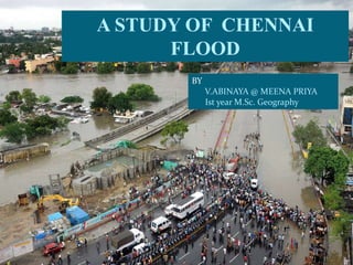
- 1. A STUDY OF CHENNAI FLOOD BY V.ABINAYA @ MEENA PRIYA Ist year M.Sc. Geography
- 2. FLOOD A flood is an overflow of water that submerges land which is usually dry. Flooding may occur as an overflow of water from water bodies, such as a river or lake, in which the water overtops or breaks levees(an embankment built to prevent the overflow of a river), resulting in some of that water escaping its usual boundaries, or it may occur due to an accumulation of rainwater on saturated ground in an areal flood.
- 3. URBAN FLOOD Flooding in urban areas can be caused by flash floods, or coastal floods, or river floods, but there is also a specific flood type that is called urban flooding. Urban flooding is specific in the fact that the cause is a lack of drainage in an urban area. As there is little open soil that can be used for water storage nearly all the precipitation needs to be transport to surface water or the sewage system. High intensity rainfall can cause flooding when the city sewage system and draining canals do not have the necessary capacity to drain away the amounts of rain that are precipitated. Water may even enter the sewage system in one place and then get deposited somewhere else in the city on the streets. Sometimes you see dancing drain covers.
- 4. CHENNAI Chennai is the capital city of the Indian state of Tamil Nadu. Located on the Coromandel Coast off the Bay of Bengal. Chennai is situated on the north-east end of Tamil Nadu on the coast of Bay of Bengal. It lies between 12°59' and 13°9' of the northern latitude and 80°12' and 80°19' of the eastern longitude at an average altitude of 6 metres above sea level on a 'sandy shelving breaker swept' beach. It stretches nearly 25.60 kms Chennai is a low-lying area and the land surface is almost flat like a pancake. The even topography of the land throughout the district renders sub-divisions into natural regions rather difficult (Google maps)
- 5. Cont…. Chennai has a tropical wet and dry climate. The city lies on the thermal equator and is also on the coast, which prevents extreme variation in seasonal temperature. The city gets most of its seasonal rainfall from the north–east monsoon winds, from mid–October to mid–December. Cyclones in the Bay of Bengal sometimes hit the city. The previous highest annual rainfall recorded is 421mm in 2005 . But now the highest rainfall in Chennai is recorded as 1218mm on December 01, 2015. The city is intersected by two languid streams, the Cooum and the Adyar. Cooum runs through the heart of the city and enters the sea in-between the university buildings and the Fort. St. George underneath the Napier Bridge, while the latter wends its way through the southern part of the city and enters the sea near Adyar. slow and relaxed. These two rivers are almost stagnant and do not carry enough water except during rainy seasons.
- 6. REASONS BEHIND CHENNAI FLOOD Chennai receives more rainfall during the month of November and December (North-East Monsoon). The northeast monsoon has been particularly vigorous over southern India in the previous year and more so in Tamil Nadu state, of which Chennai is the capital. According to Skymet data, during the month of November, Chennai recorded a whopping 1218.6 mm of rain – three times its monthly rainfall. The normal rainfall figures for November stand at 407.4 mm. According to Indian Meterological Department, due to El Nino effect several low pressure zones created near the coastal area of Bay of Bengal which influenced more rainfall in the coastal as well as interior parts of Tamil Nadu. As a city on the high-energy coast facing the Bay of Bengal, Chennai is no stranger to heavy rains and cyclonic storms. Chennai has experienced particularly heavy rains roughly once every 10 years—1969, 1976, 1985, 1996, 1998, 2005, and 2015.
- 8. EL NINO EFFECT El Niño means The Little Boy, or Christ Child in Spanish. El Niño was originally recognized by fishermen off the coast of South America in the 1600s, with the appearance of unusually warm water in the Pacific Ocean. The name was chosen based on the time of year (around December) during which these warm waters events tended to occur. The term El Niño refers to the large-scale ocean-atmosphere climate interaction linked to a periodic warming in sea surface temperatures across the central and east-central Equatorial Pacific. Climate experts say El Nino responsible for heavy Chennai rains Also blame poor town planning as the canals are blocked and there is no way the excess rain could be drained "As of now, El Nino continues to be strong. In an El Nino year, the South west monsoon will have deficit rains and North East monsoon will see excess rainfall," said G P Sharma, vice president, meteorology at Skymet, the private met agency.
- 9. CHEMBARAMBAKKAM RESERVOIR All the reservoirs that cater to Chennai and its suburbs were empty before Diwali. Consistent rains started on November 8, lasting a week, and were followed by another spell on November 23, which was not forecast. By the end of November, the level in the reservoir had reached its limit. Water in the Chembarambakkam reservoir — one of the city’s main water sources — stood at 22 ft at this time, against its capacity of 24 ft. Official data shows outflow from the reservoir, into the Adyar River, as 900 cubsec (1 cusec= 28.7 Litres of water) It started raining again on December 1, and continued into December 2. By December 1 afternoon, the water in Chembarambakkam had swollen to 3,396 million cubic feet — almost its full capacity. Engineers started to increase the outflow.
- 10. On December 01, Chennai received 200 mm rainfall over 14 hours. Given the advance warning, and another by the Met department on November 30. Following an increased outflow from Chembarambakkam lake and from over 40 tanks in its catchment area, low-lying areas in the city were already swollen. In few hours the discharge from the Chembarambakkam at 5pm, the outflow was around 7500 cusec raised to 29400 cusec ,which caused an alarming effect on the Chennai’s flood. By around 10 pm, the water was being released at 29,400 cubsec into the Adyar River, which was already in spate, as engineers feared a breach of Chembarambakkam’s boundary. It took three to four hours for the water to reach the city from the reservoir 25 km away, but by midnight of December 2, land in more than a 4-km radius around Adyar, which flows through the heart of Chennai, had gone completely under water.
- 14. chennai wikipedia retrieved dec 17
- 15. Table 1. Causes of Chennai Floods CAUSES TYPES OF FACTORS ELEMENTS Direct Factors Increase in rainfall Due to global climatic change Urbanization Encroachment of all water bodies, wetlands, etc., Construction of transportation networks all along the major watercourses Increase in concrete spaces which stops percolation of water into the ground Decrease in open areas/green spaces Lack of Transportation facilities (esp. in slums) Topography Plain terrain lacking natural gradient for freerun-off Indirect Factors Inadequate & poor drainage systems Sewage systems were planned originally before 4 decades and only few minor modifications made which is far below the required capacity Heavy siltation all along the drainage channels Lack of coordination between the agencies Disposal of solid waste & other debris Attitude of people Lack of management measures by the agencies Vehicle parking on roads Increase in concrete spaces Discrepancies between public & local authority
- 16. FINDINGS AND RECOMMENDATION Both humans and nature put together the ground for the perennial flood tribulations. The immediate need is to create a scientific inventory of water bodies and delineate flood zones within the city. The flood zone will have to be identified based on the location of the water bodies, natural drains, water shed area and it has to be made as a no building zone. More campaigns have to be conducted at the local level in order to create awareness to the public about the causative factors for the flood disasters. In addition to the above, the wide-ranging management measures will help Chennai to be relieved from the recurrent flood menaces almost every monsoon
- 18. Bibliography Chambers, C. (2002). Wild Weather Flood. Chicago. Chennai - Wikipedia, the free encyclopedia. (n.d.). Retrieved December 17, 2015, from Chennai - Wikipedia, the free encyclopedia: https://en.wikipedia.org/wiki/Chennai District Administration, C. (n.d.). Chennai District Welcomes You. Retrieved December 17, 2015, from Chennai District Welcomes You: http://www.chennai.tn.nic.in Geography of Chennai. (n.d.). Retrieved December 17, 2015, from Geography of Chennai - Wikipedia, the free encyclopedia: https://en.wikipedia.org/wiki/Geography_of_Chennai Google maps. (n.d.). Retrieved December 17, 2015, from Google maps: https://maps.google.com India Meteorological Department. (n.d.). Retrieved December 17, 2015, from India Meteorological Department: www.imd.gov.in
- 19. Janardhanan, A. (2015, December 14). Chennai floods: The day city went under, who did what — and who did not . The Indian Express . Kanthimathinathan, T. (2011, December 30). Cooum Sub Basin Restoration & Management. Lavanya, A. (2012). Urban Flood Management – A Case Study of Chennai City. Architecture Research , 2, 115-221. Maps of India. (n.d.). Retrieved December 17, 2015, from Maps of India: http://www.mapsofindia.com (2007). Master Plan - II for Chennai Metropolitan Area - 2026. Tamil Nadu: Chennai Metropolitan Development Authority. Metrowater Lake Level - Chennai Metro Water. (n.d.). Retrieved December 17, 2015, from Metrowater Lake Level - Chennai Metro Water: www.chennaimetrowater.tn.nic.in/reserve.asp Regional Meterological Department. (n.d.). Retrieved December 17, 2015, from Regional Meterological Department: www.rmg.nic.in The Indian Express. (n.d.). Retrieved December 17, 2015, from The Indian Express: www.indianexpress.com 6The mounting economic toll of the record rainfall in Chennai. (n.d.). Retrieved December 17, 2015, from QUARTZ: http://www.qz.com/ Welcome to Chennai Metro Water. (n.d.). Retrieved from Welcome to Chennai Metro Water: www.chennaimetrowater.tn.nic.in
- 20. THANK YOU