

Recommended
More Related Content
What's hot
What's hot (20)
Viewers also liked
Viewers also liked (20)
Similar to Floods
Similar to Floods (20)
More from Prashant Katti
More from Prashant Katti (20)
Recently uploaded
Recently uploaded (20)
Floods
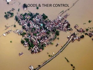
- 1. Floods &their controlFLOODS & THEIR CONTROL
- 2. 12/10/2016 Floods- Disaster Managment 2
- 3. 12/10/2016 Floods- Disaster Managment 3
- 4. • Floods are a common feature in the country that occur every year in many parts of India. 4Floods- Disaster Managment
- 5. INTRODUCTION A flood occurs when the Geomorphic Equilibrium in the river system is disturbed because of intrinsic or extrinsic factors or when a system crosses the geomorphic threshold. (a) Flooding in a river due to aggradation of river bed (intrinsic threshold); (b) Flooding in a river due to heavy rainfall (extrinsic threshold) Floods in major cities especially during rainy season are proving to disastrous not only to the environment but also have serious implications for human life and property. 5
- 6. Causes of flooding Torrential rain Urbanisation increases surface run-off
- 7. Causes of flooding… Dam collapse Tsunami caused by underwater earthquake Snow melt
- 8. Causes of flooding…. Monsoon rain Global warming Deforestation
- 9. TYPES OF FLOODS • Types of floods •Flash floods •River floods •Coastal Floods •Urban Flood • According to their duration flood can be divided into different categories: •Slow-Onset Floods: Slow Onset Floods usually last for a relatively longer period, it may last for one or more peeks, or even months. •Rapid-Onset Floods: Rapid Onset Floods last for a relatively shorter period, they usually last for one or two days only. •Flash Floods: Flash Floods may occur within minutes or a few hours after heavy rainfall, tropical storm, failure of dams or levees or releases of ice dams. And it causes the greatest damages to society.
- 10. The soil becomes saturated and overland flow and through flow reach the river and discharge increases. Overland flow arrives first. The time from peak rainfall to peak discharge is the LAG TIME. The discharge starts to fall slowly as water is added from through flow and groundwater flows which are much slower. The base flow supplies the river with water between storms and keeps it flowing in summer.Rainfall is intercepted or infiltrated into the soil moisture store Start of the storm there is a slow rise in discharge, as only a small amount of water falls into the channel
- 11. Contd…. Floods Natural Storm Surge, Tsunami, Glacial Melt, Landslide, Riverine, Estuarine & Marine Flood Eg: bursting of landslide blockades in the catchment areaof the Bhagirathi River in August 1978 (Gupta and Dave, 1982). Man made Breach of Dam/ Barrage/ Embankment Release from Reservoir, Urban Flood Eg: In the year 2009,Almatti and Naryanpur dams on the Krishna River in Karnataka. This water along with rain water reached Andhra Pradesh near the Srisailam dam. It causes a hevy floods in andhrapradesh 12/10/2016 11Floods- Disaster Managment
- 12. Causes of floods
- 13. FACTORS VEGETATION COVER This varies seasonally. The type and amount will affect interception and stemflow/throughfall. Overland flow is reduced. Lag time will be increased. ROCK TYPE Impermeable rocks prevent groundwater flow and encourage through flow and overland flow. These rocks will decrease lag time. Permeable rock will have the opposite effect. LAKES & RESERVOIRS These will store floodwater and thus reduce lag time and control river response to heavy rainfall. SOIL TYPE & DEPTH Deep soils store more water, pipes in the soil encourage through flow. Soils with small pore spaces will reduce infiltration and increase overland flow. LAND USE Impermeable surfaces created by urbanisation will reduce infiltration and encourage overland flow. Different types of crops affect interception rates e.g. cereals 7-15%. RAINFALL INTENSITY & DURATION Intense rain will increase overland flow and reduce lag times. Gentle rain over a longer time will allow more infiltration. SLOPES Steep slopes will encourage overland flow and gentle slope will slow run off down. CLIMATE The distribution of rainfall over the year and the temperatures will affect the lag times.
- 14. Flood Control • In many countries around the world, waterways prone to floods are often carefully managed. Defences such as levees, bunds, reservoirs, and weirs are used to prevent waterways from overflowing their banks. • In the riparian zone near rivers and streams, erosion control measures can be taken to try and slow down or reverse the natural forces that cause many waterways to meander over long periods of time. • Flood controls, such as dams, can be built and maintained over time to try and reduce the occurrence and severity of floods as well.
- 15. Flood prone zones , areas in INDIA
- 17. Methods of flood control
- 18. FLOOD PLAIN ZONING WATER SUPPLY FACTORY POWER HOUSE UNIVERSITYRESIDENTIAL AREA GOVT. OFFICE HOSPITAL NORMAL CHANNEL PARK FREQUENT FLOOD FLOOD ONCE IN 25 YEARS FLOOD ONCE IN 100 YEARS III IIII III I I
- 19. FLOOD PLAIN ZONING PROHIBITIVERESTRICTIVEWARNING WARNINGRESTRICTIVE I II III II I RIVER CHANNEL
- 20. FLOOD PLAIN ZONING PRIORITY - I ACTIVITY LIMITED TO WATER LEVELS CORRESPONDING TO 100 YEARS FLOOD FREQUENCY AND DRAINAGE CONGESTION FOR 50 YEARS RAINFALL. ZONE REGULATION
- 21. FLOOD PLAIN ZONING PRIORITY - II ACTIVITY LIMITED TO LEVELS CORRESPONDING TO 25 YEARS FLOOD FREQUENCY AND DRAINAGE CONGESTION FOR 10 YEARS RAINFALL FREQUENCY. ZONE REGULATION
- 22. FLOOD PLAIN ZONING PRIORITY - III LESS ECONOMIC AND COMMUNITY ACTIVITY IN AREAS VULNERABLE TO FREQUENT FLOODS. ZONE REGULATION
- 23. 12/10/2016 Floods- Disaster Managment 23
- 24. To control flooding….. 1. Control the water level dams pumping stations 2. Build barriers embankments flood walls 3. Alter the river’s channel Straighten it Widen and deepen it 4. Control land use around the river (land use zoning)
- 25. 1. To control the water level Dam and pumping station
- 26. 2.Build barriers
- 27. 3. Alter the river’s channel
- 28. 4. Control land use
- 31. Mississippi, USA
- 32. Levee on the Mississippi Note the school bus for scale and the seepage along the side of the levee.
- 33. 12/10/2016 Floods- Disaster Managment 33