
Download to read offline

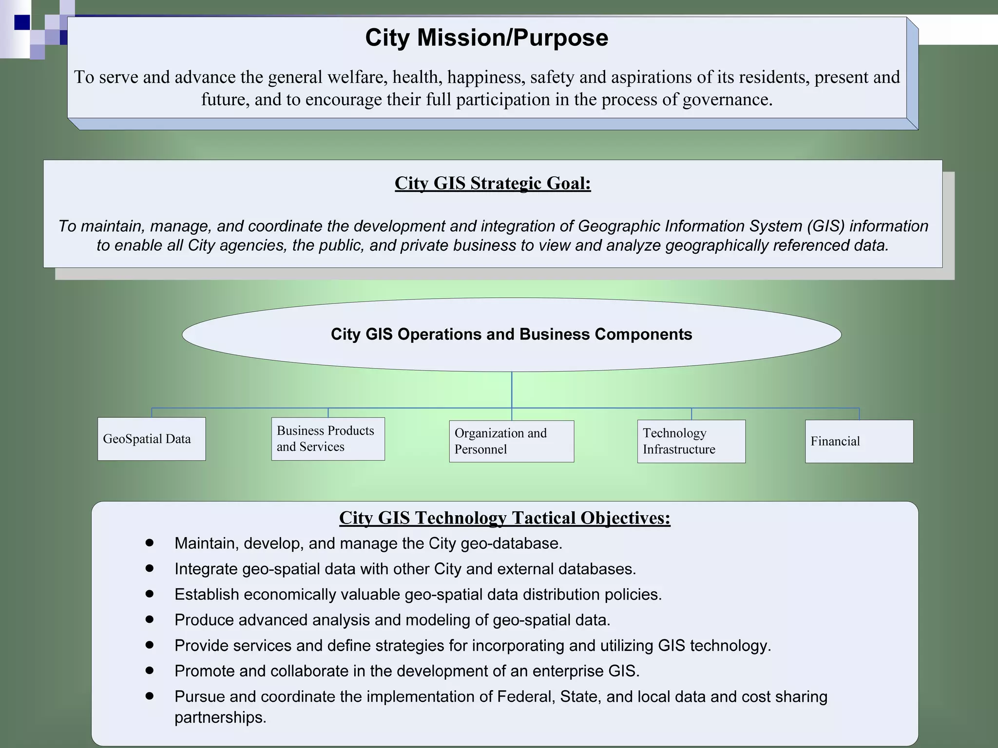
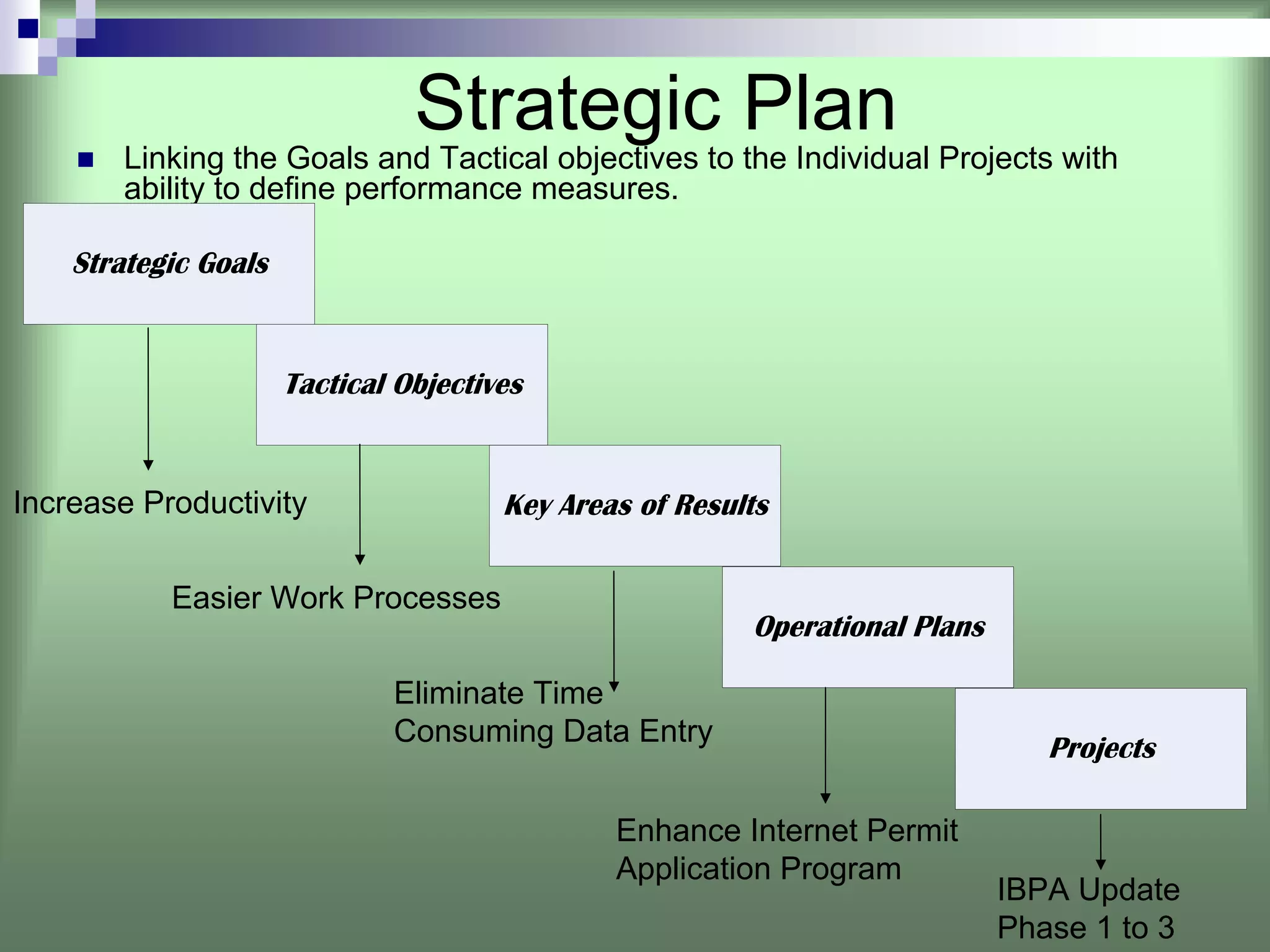
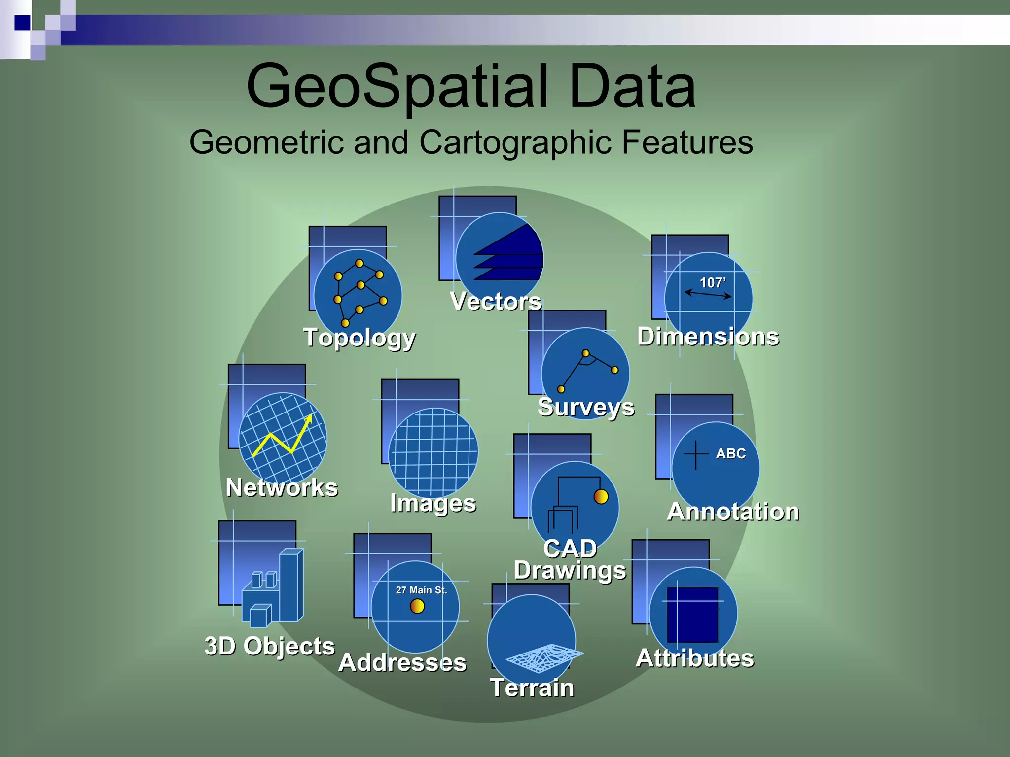
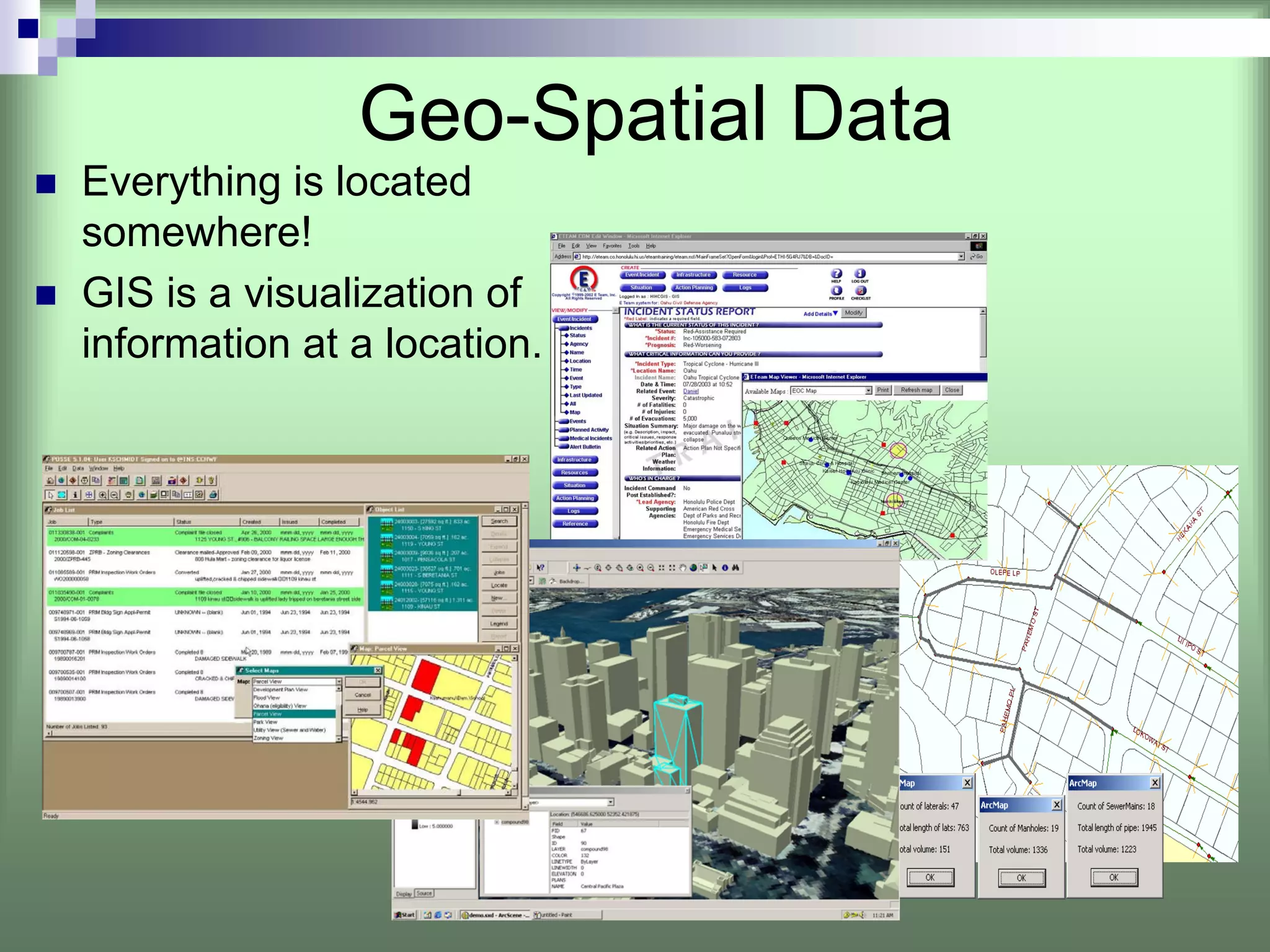
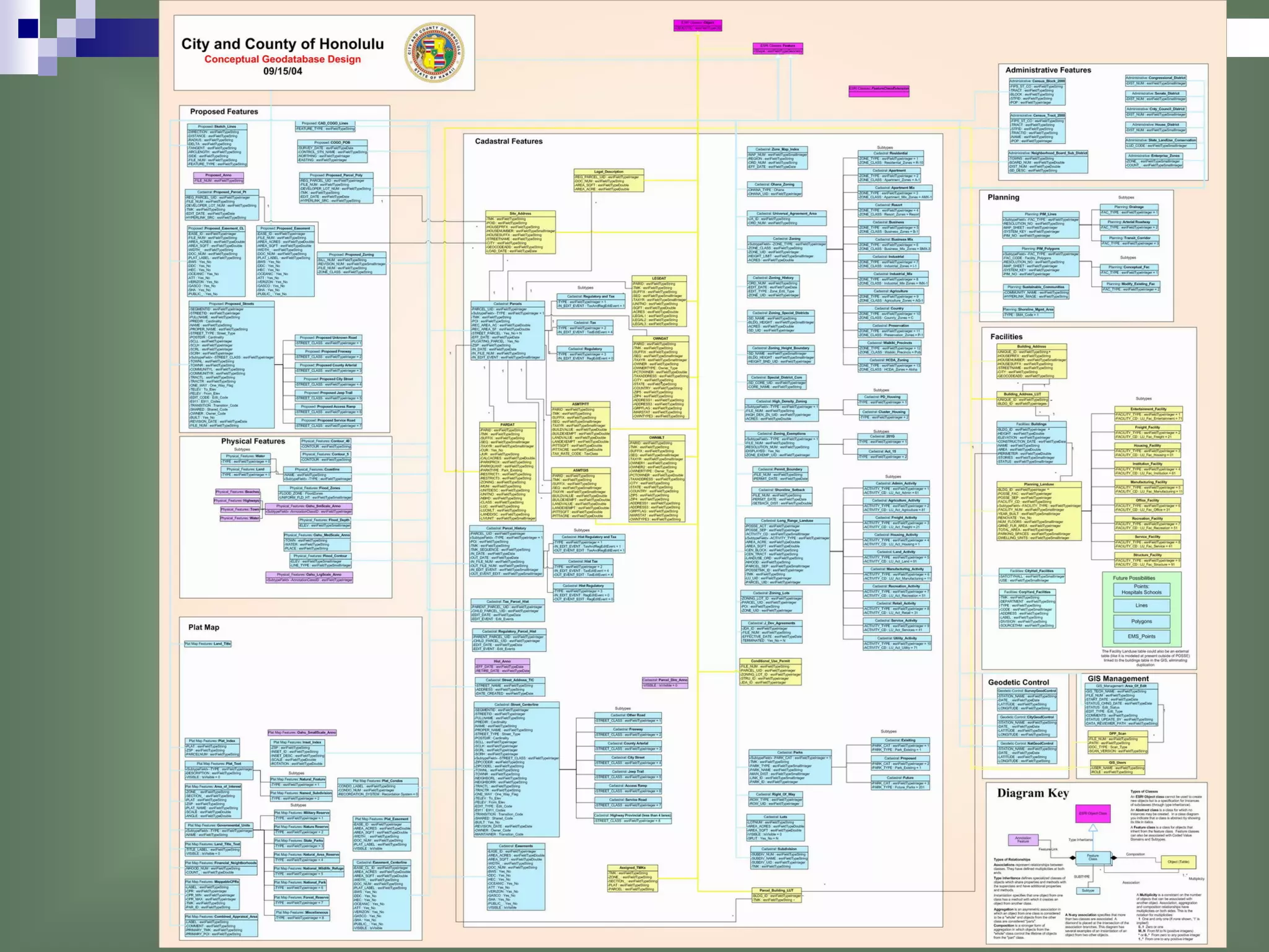
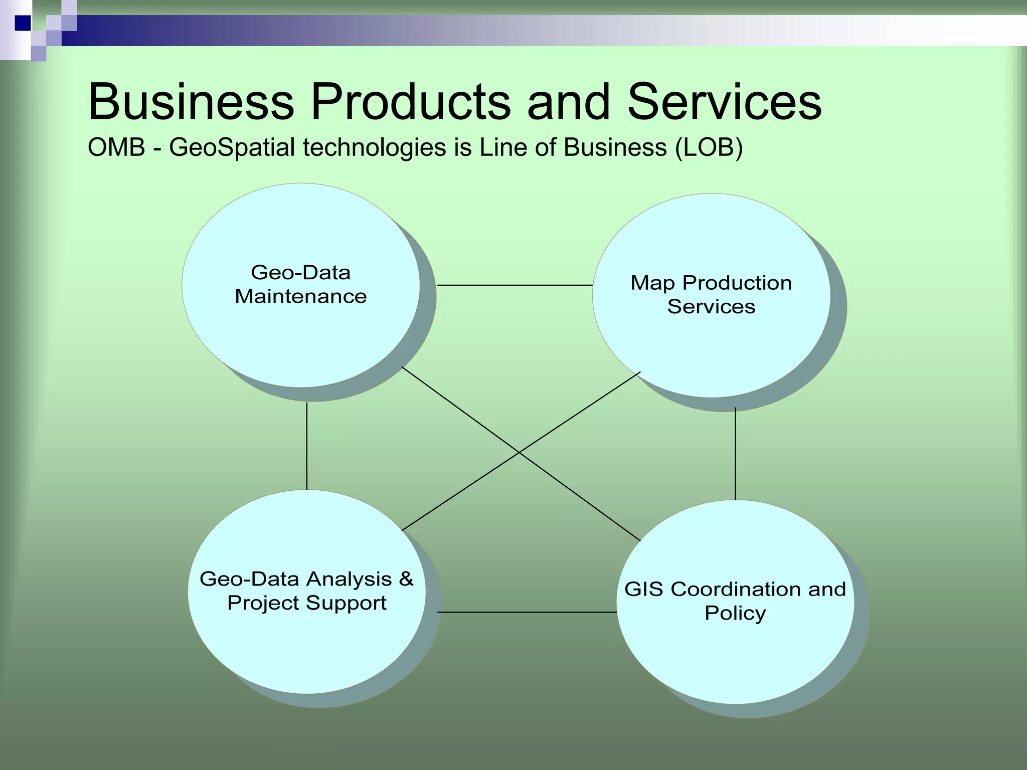
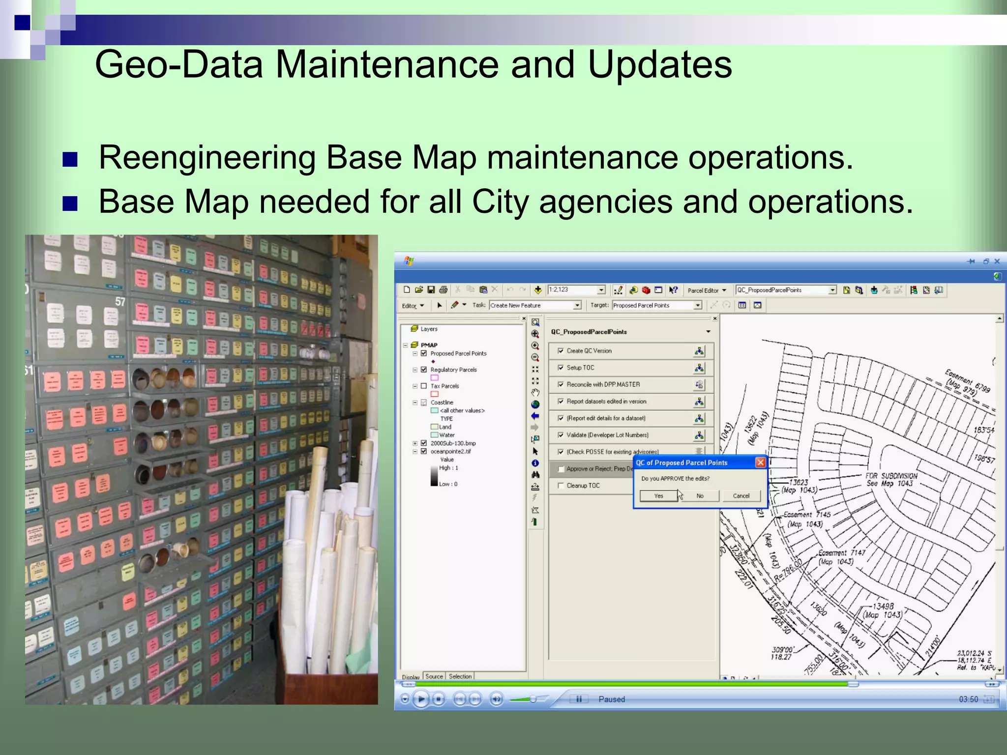
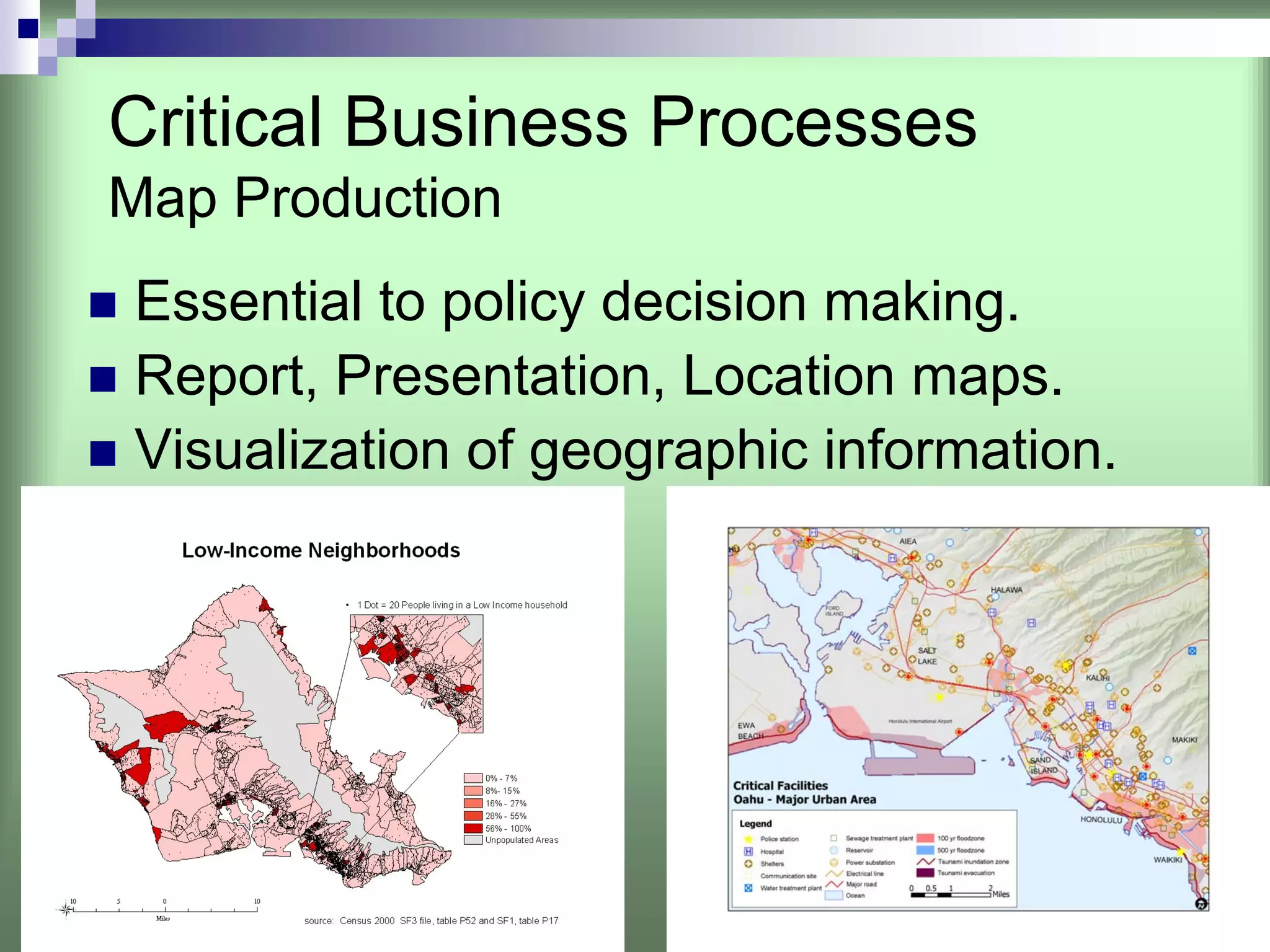
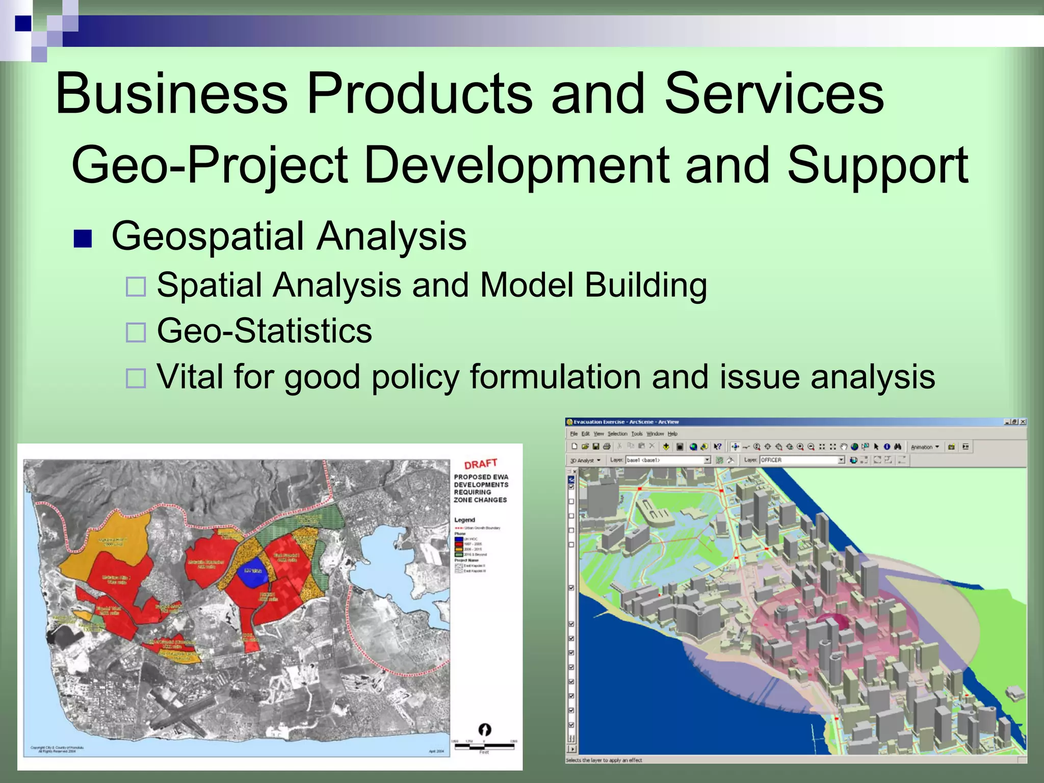
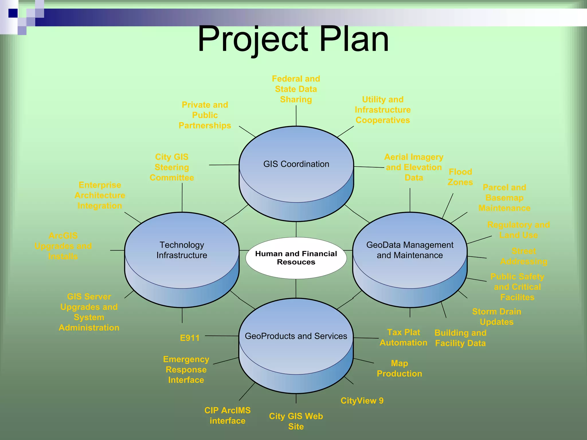
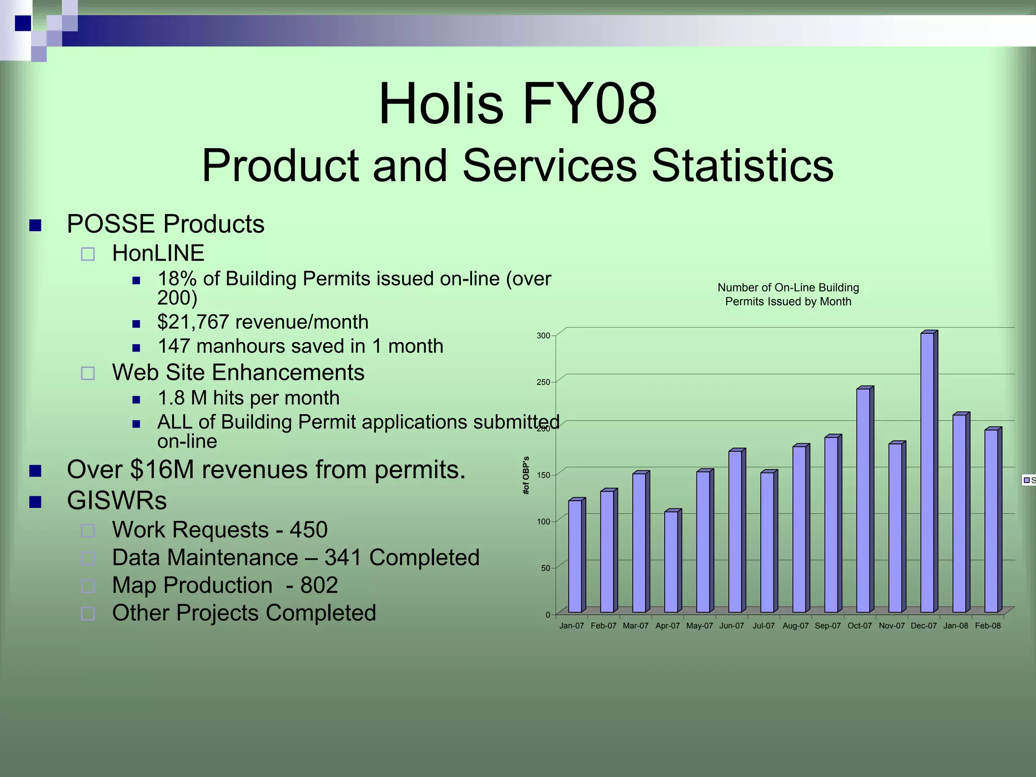

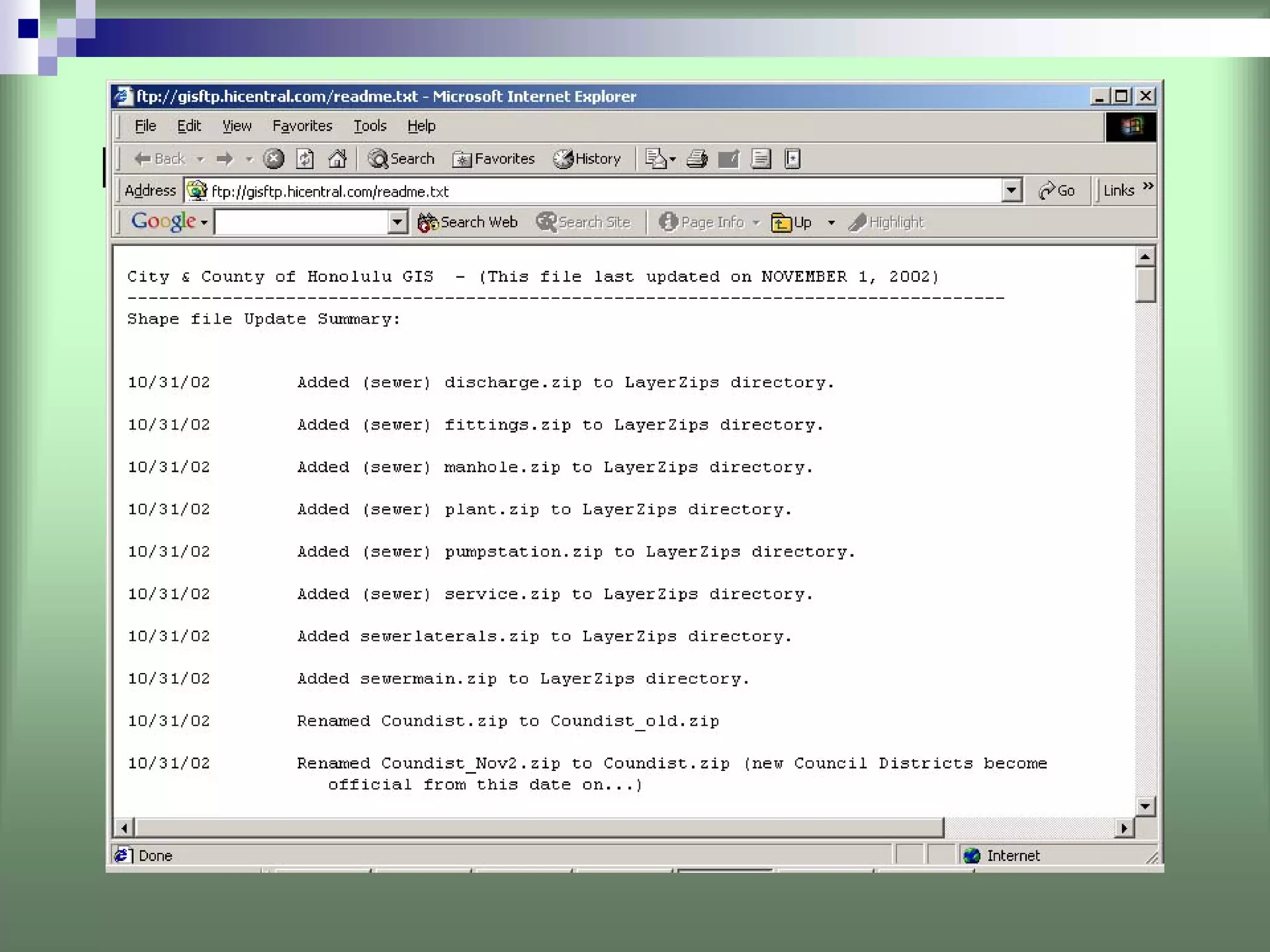
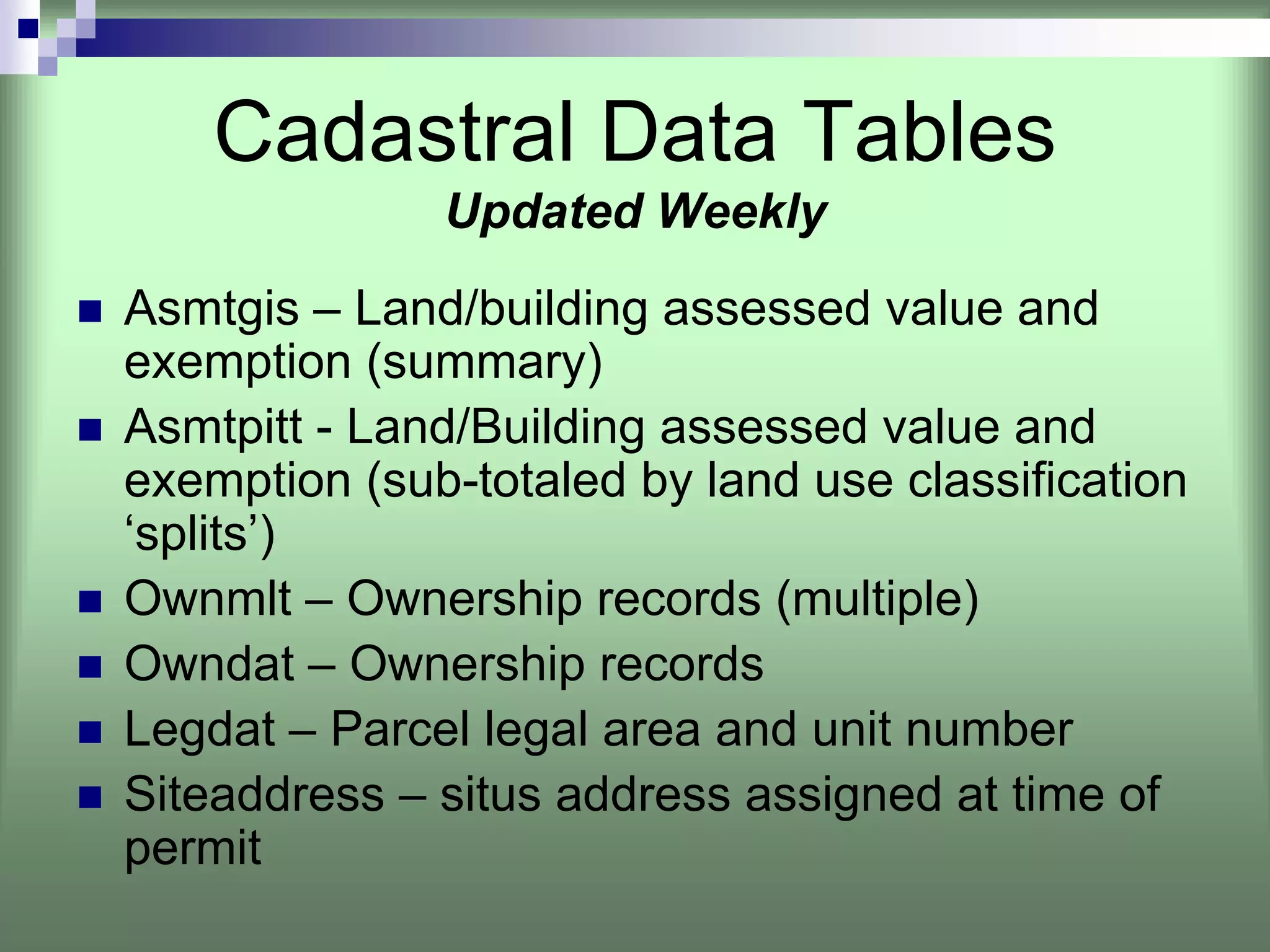
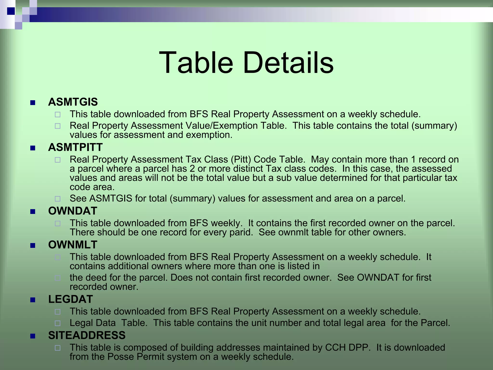
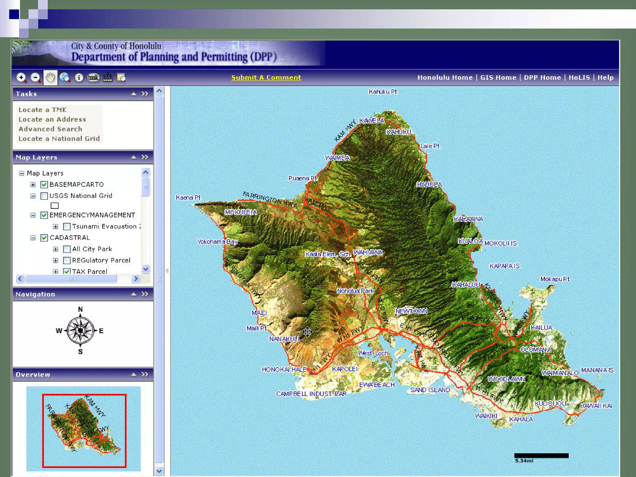
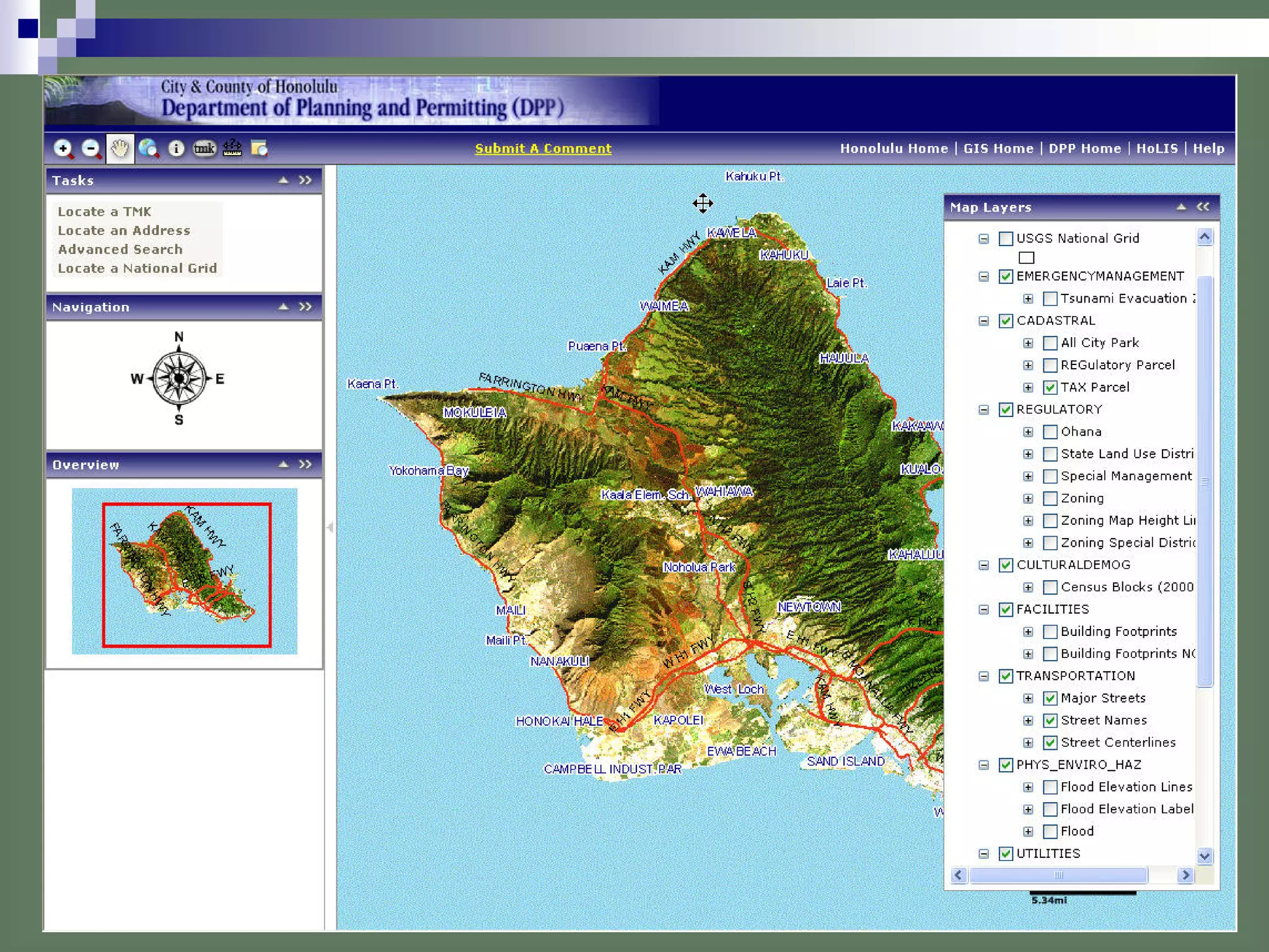
This document summarizes the strategic plan and activities of the Honolulu Land Information System (Holis) department. Holis provides critical geospatial data and services to support business processes and decision making across the city. Key accomplishments in recent years include updating parcel and infrastructure data, producing maps, and developing web-based GIS interfaces. Holis aims to continue enhancing productivity through improved work processes, data management, and new technologies.


![[Case study] City of Peoria Municipality: Getting the most impact for GIS tec...](https://cdn.slidesharecdn.com/ss_thumbnails/peoria20124pg-130320052338-phpapp02-thumbnail.jpg?width=640&height=640&fit=bounds)


