Downloaded 40 times
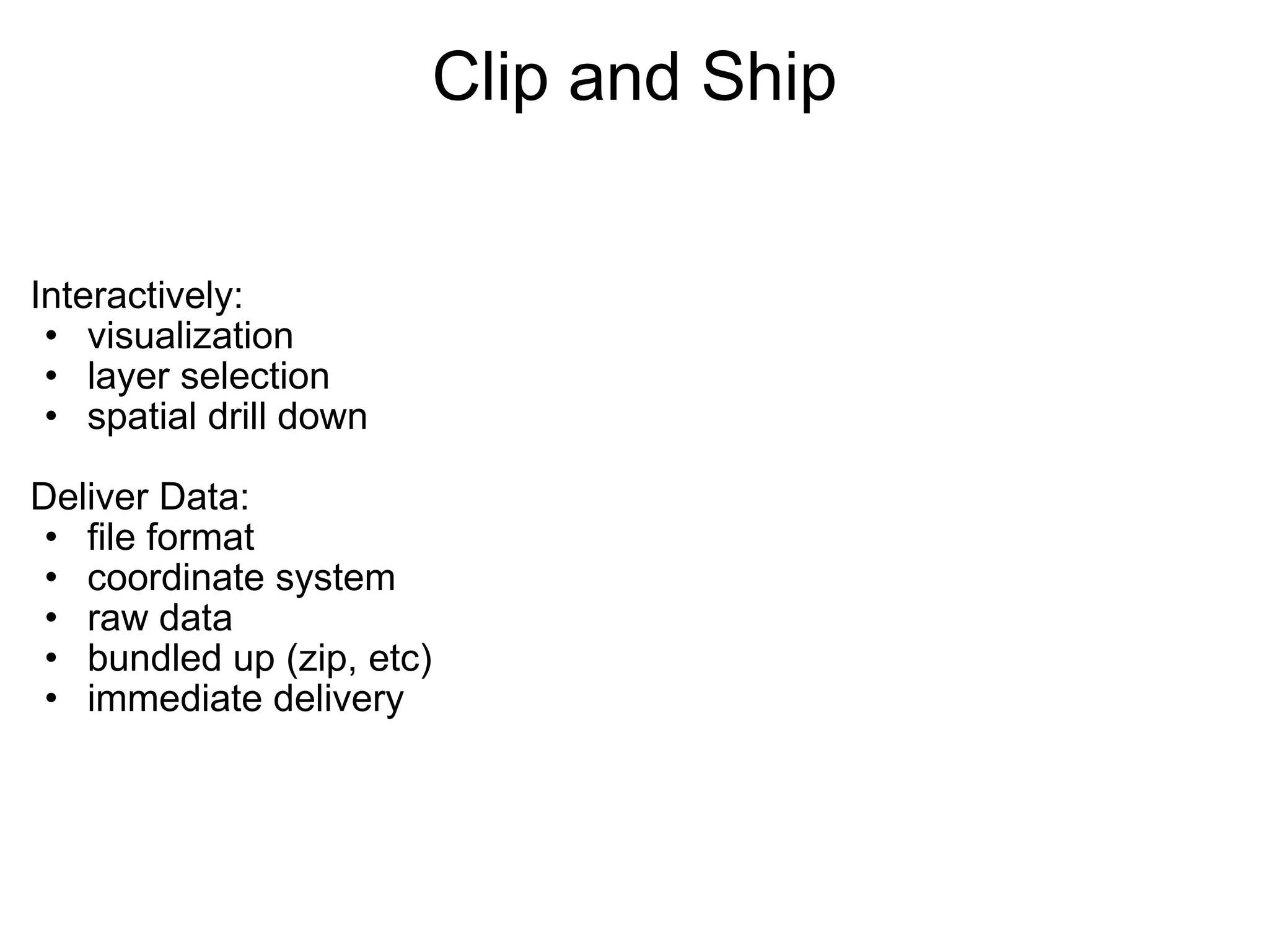
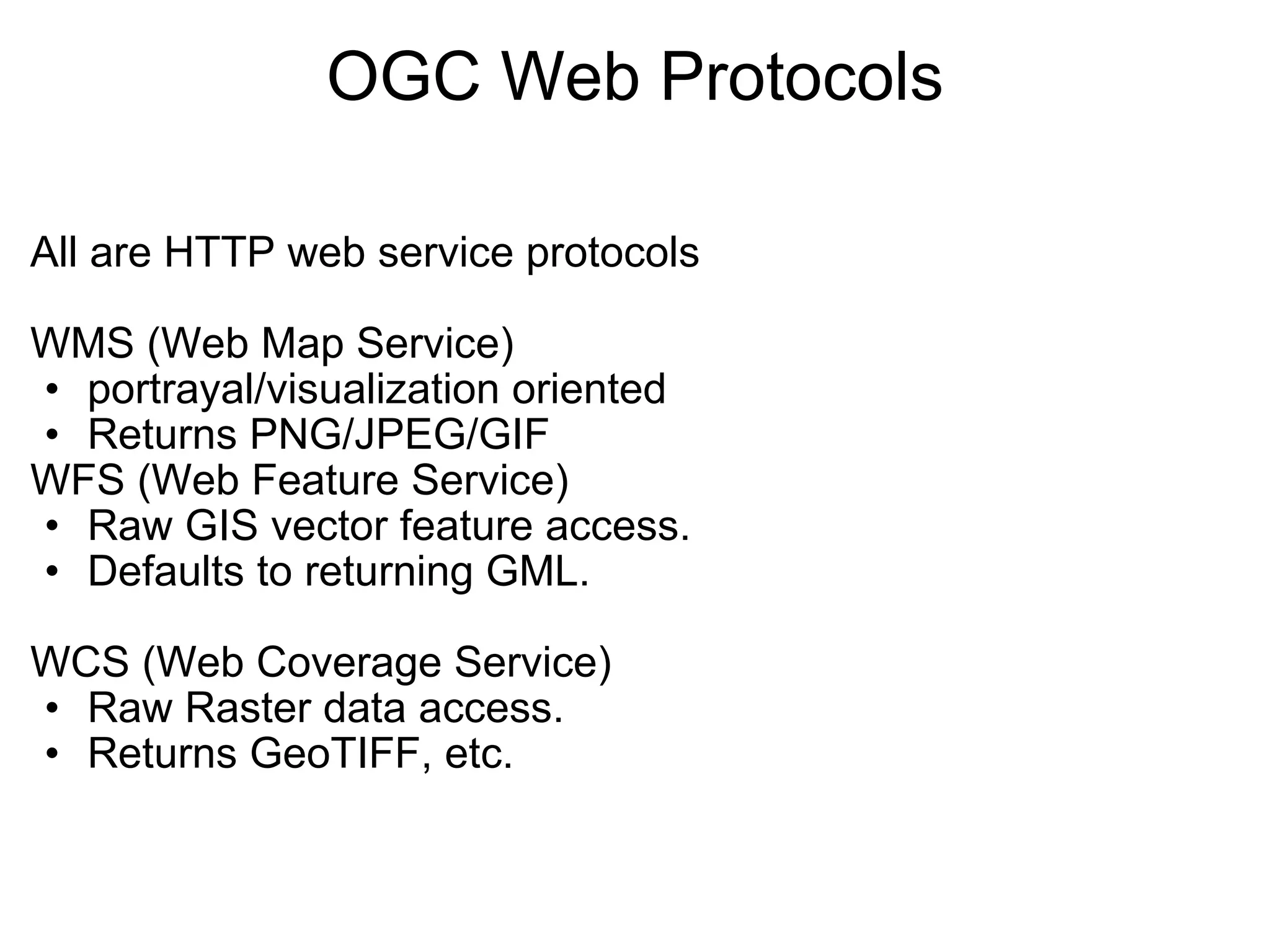
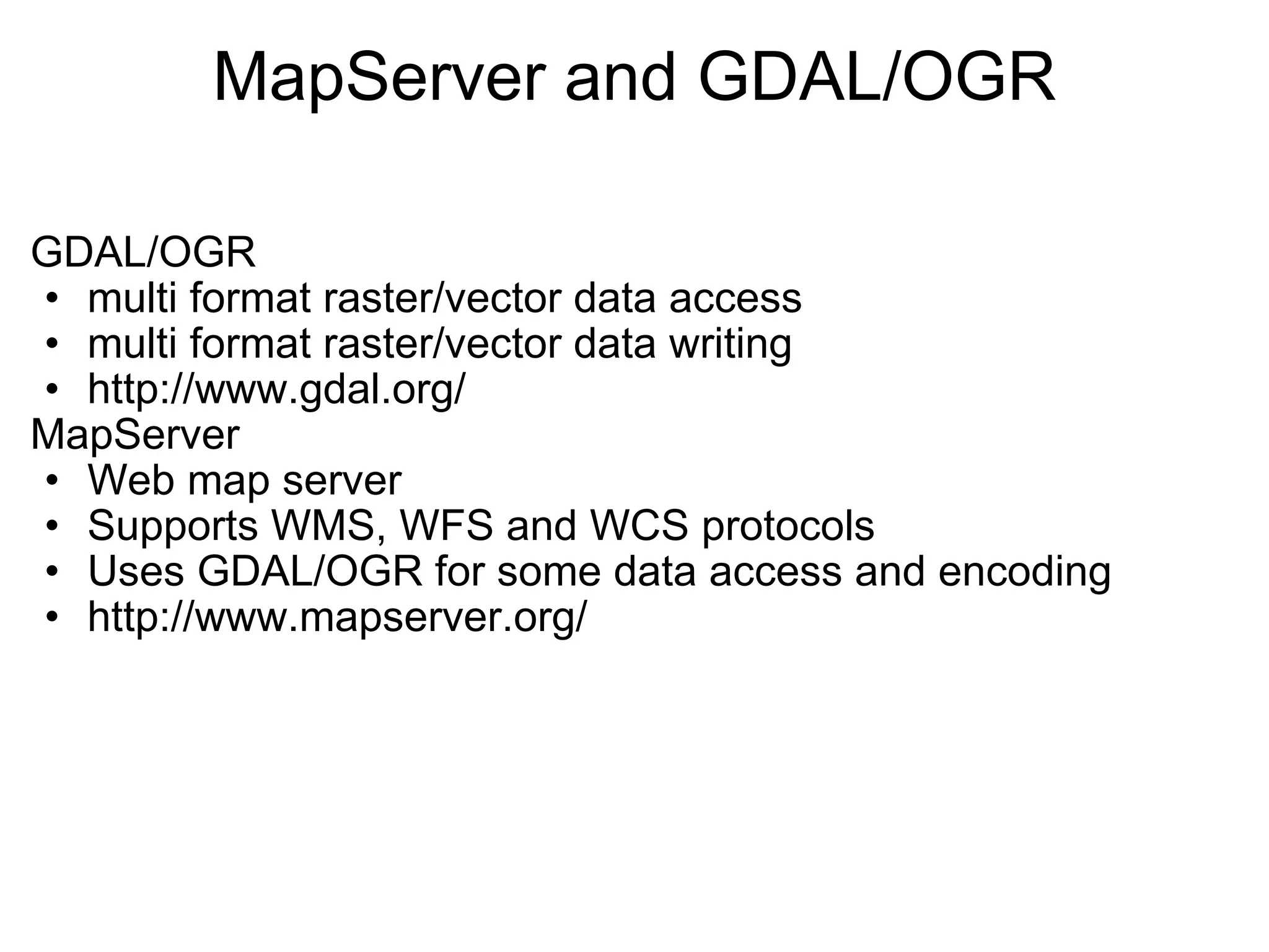
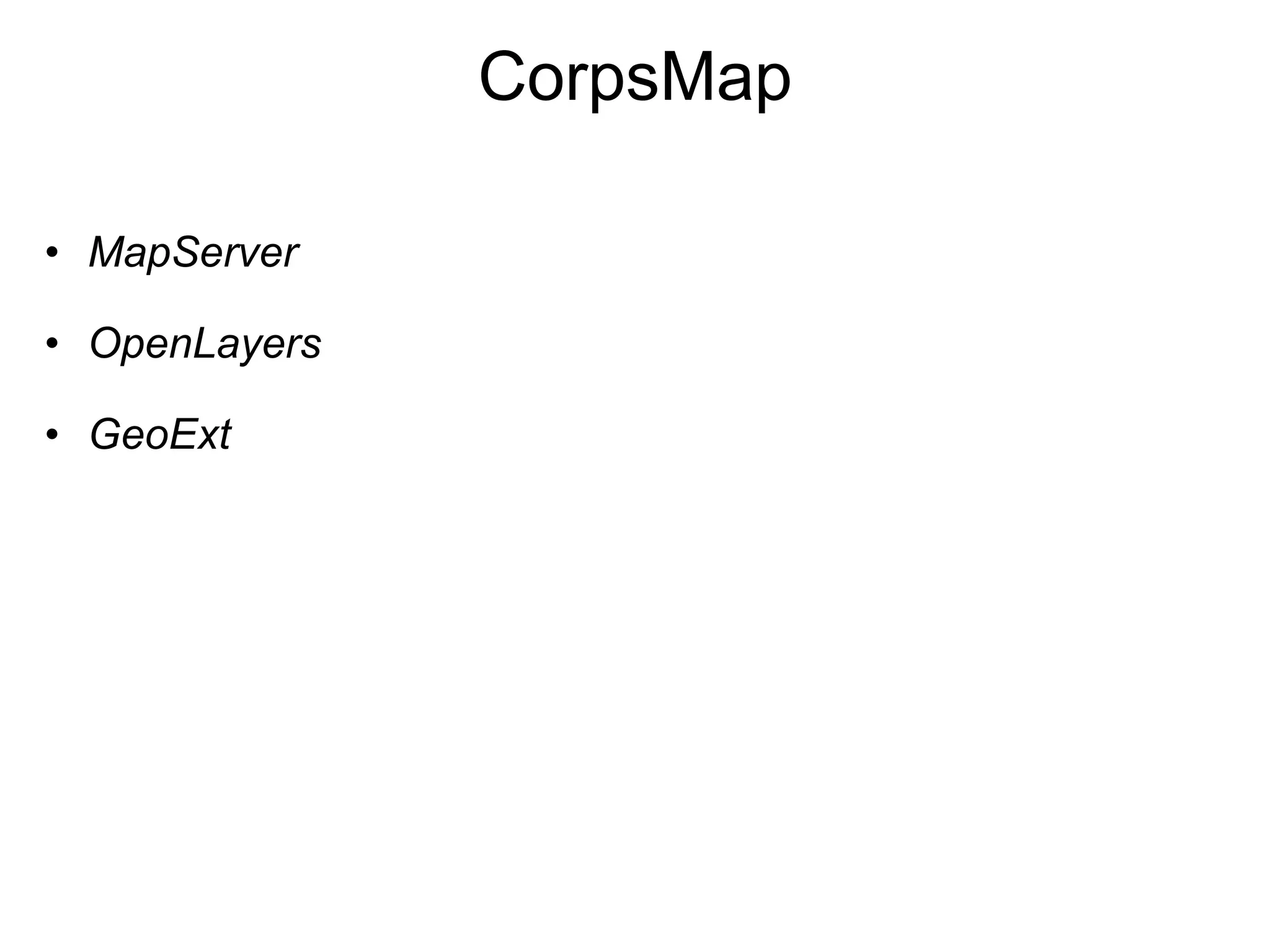
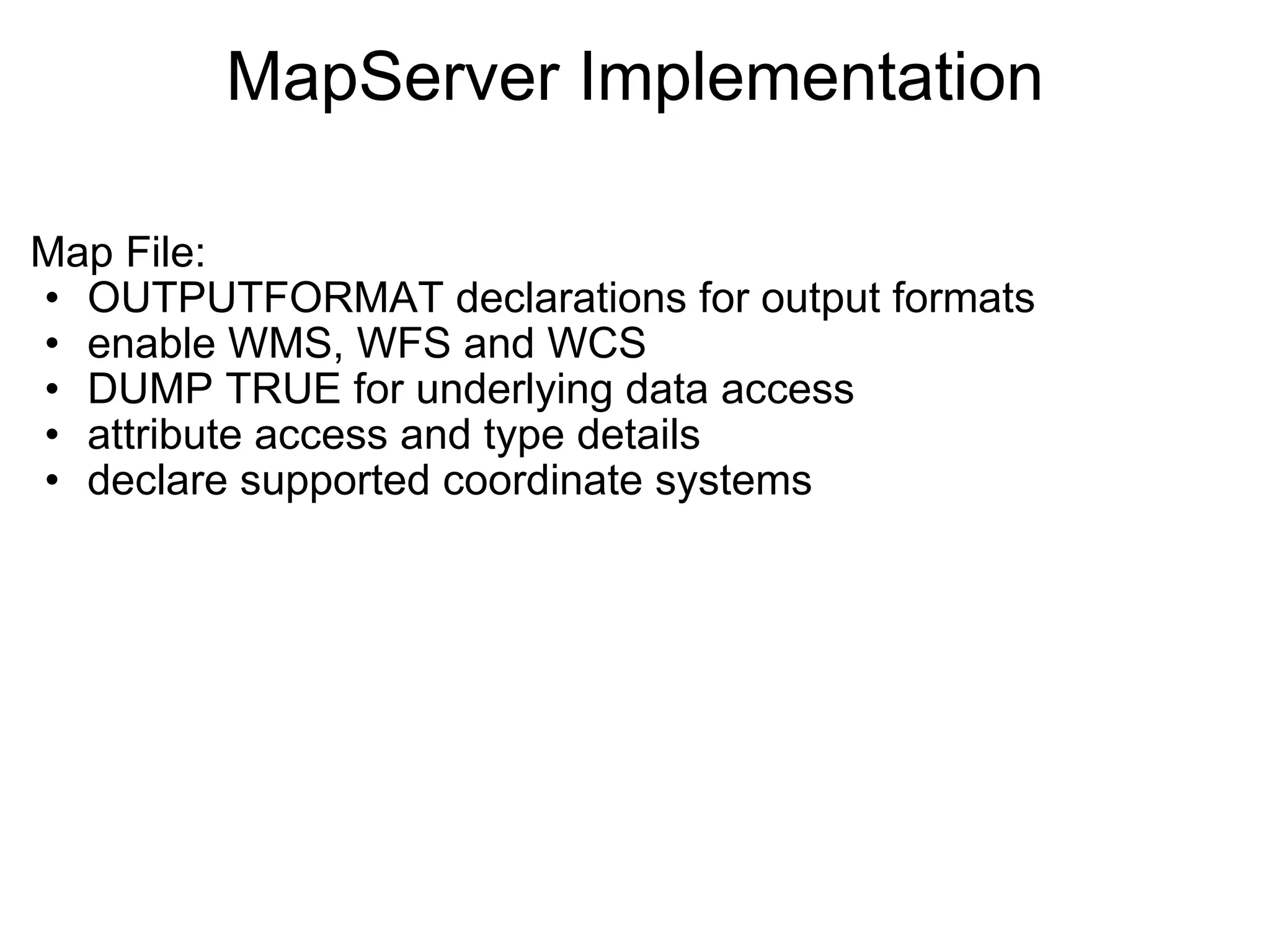
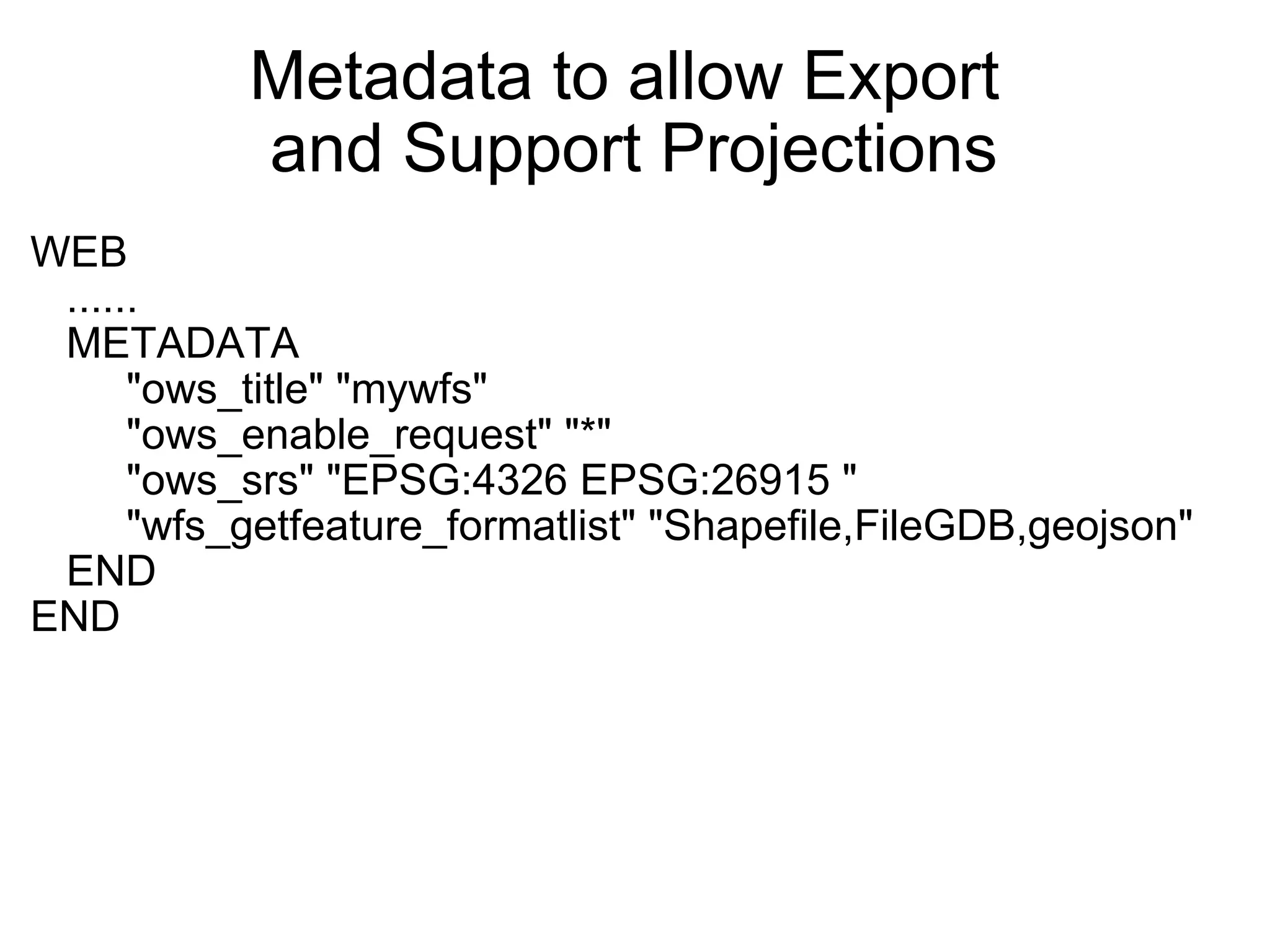
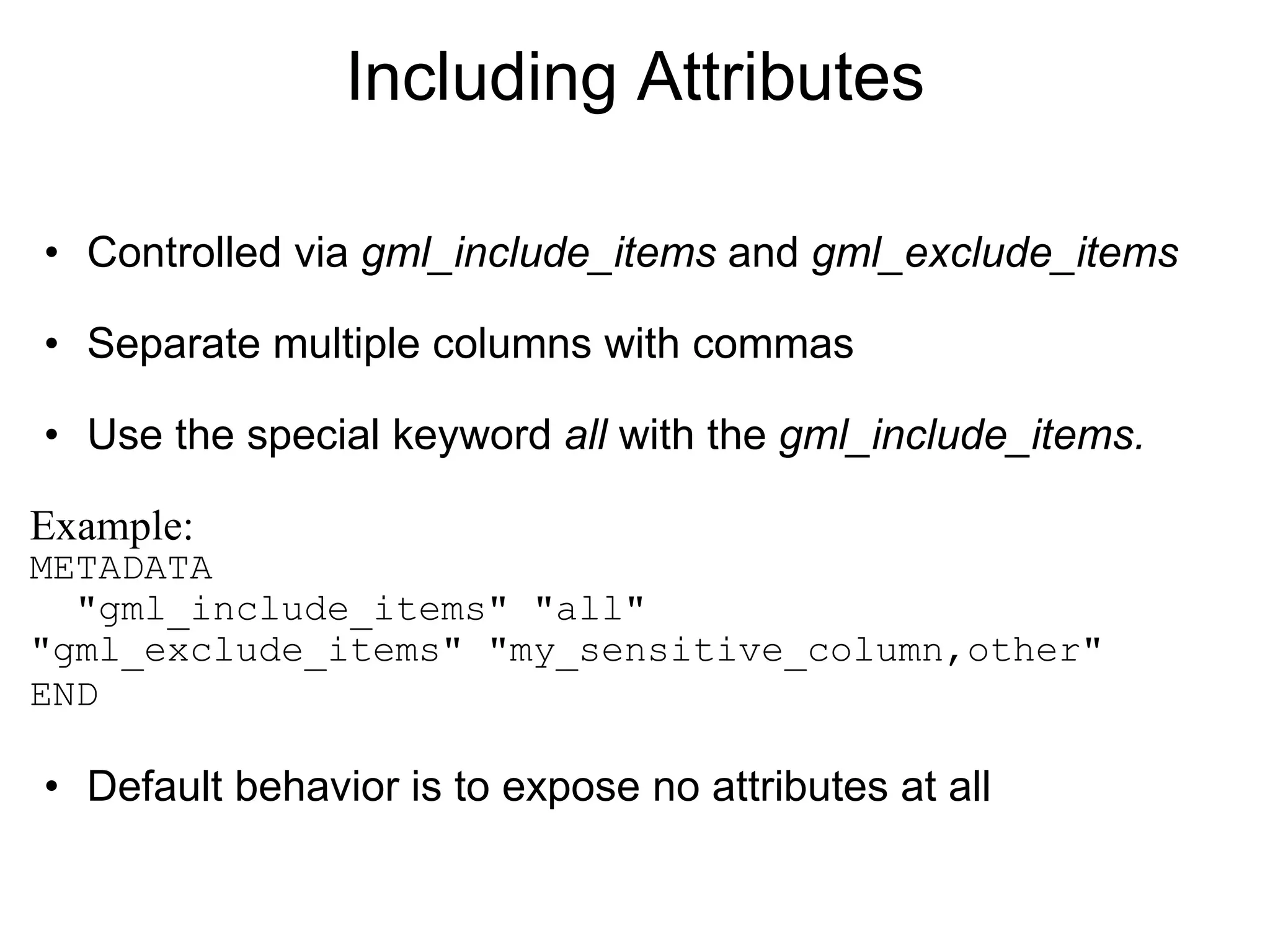
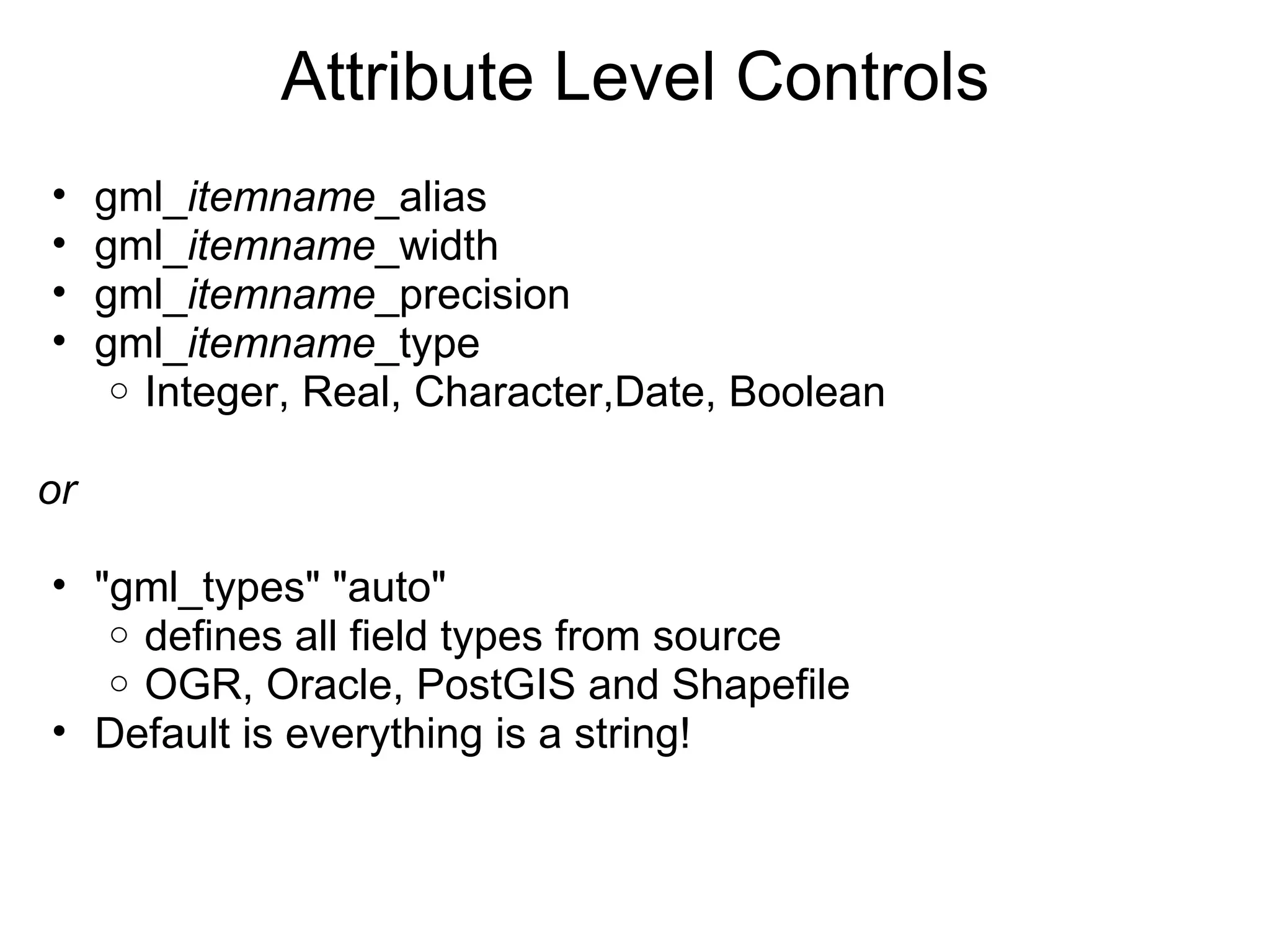
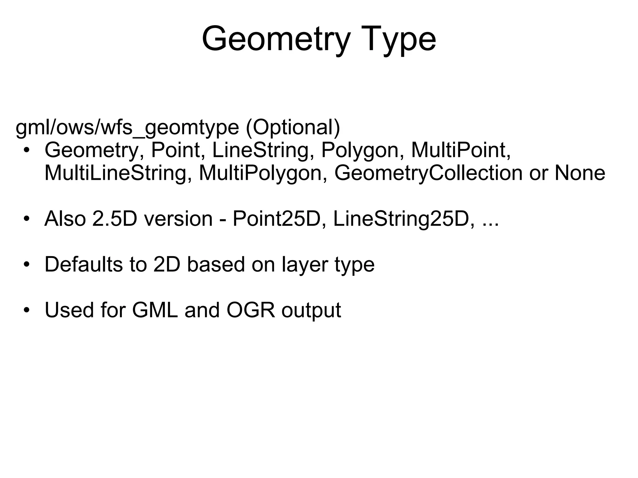
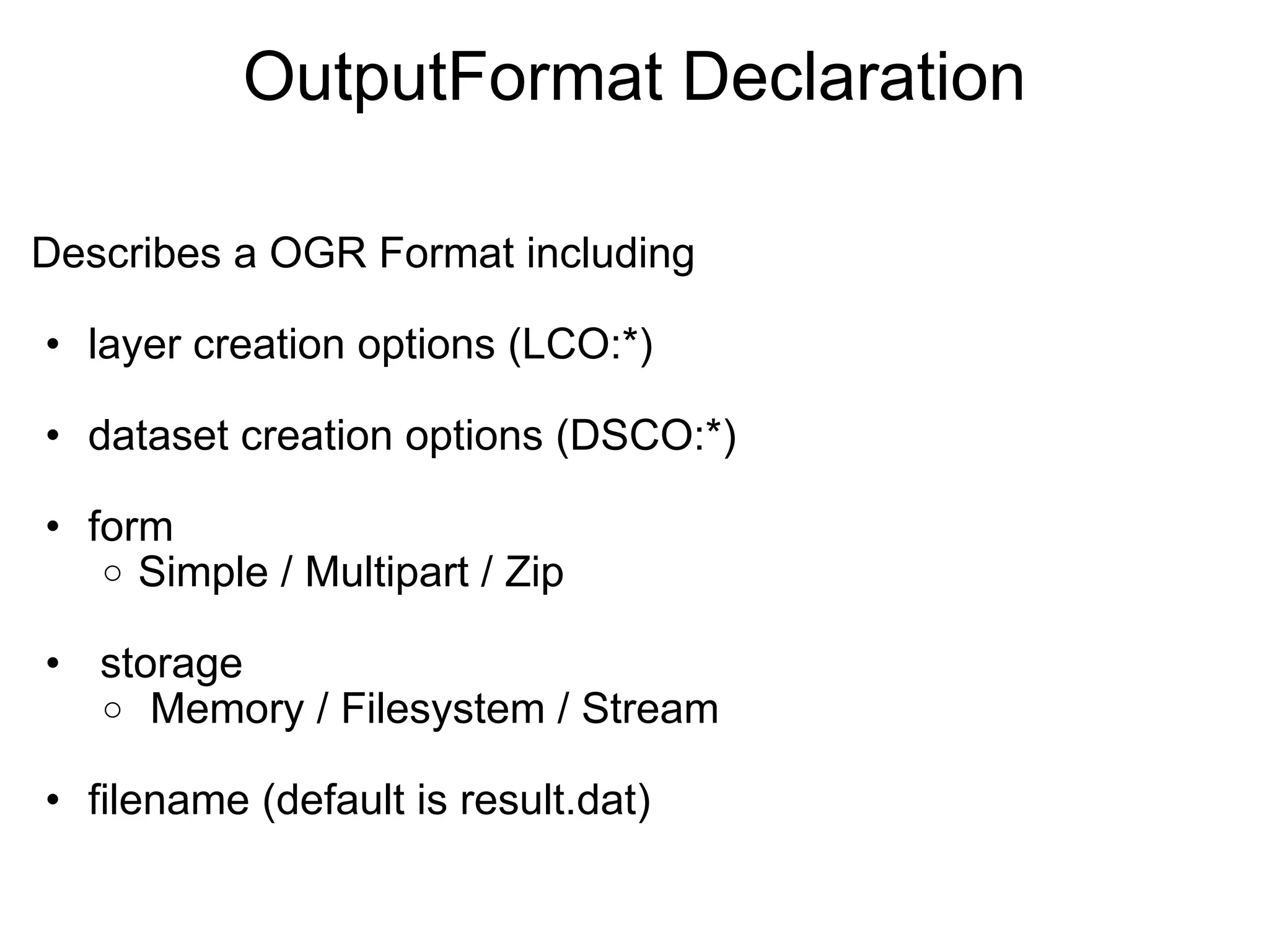
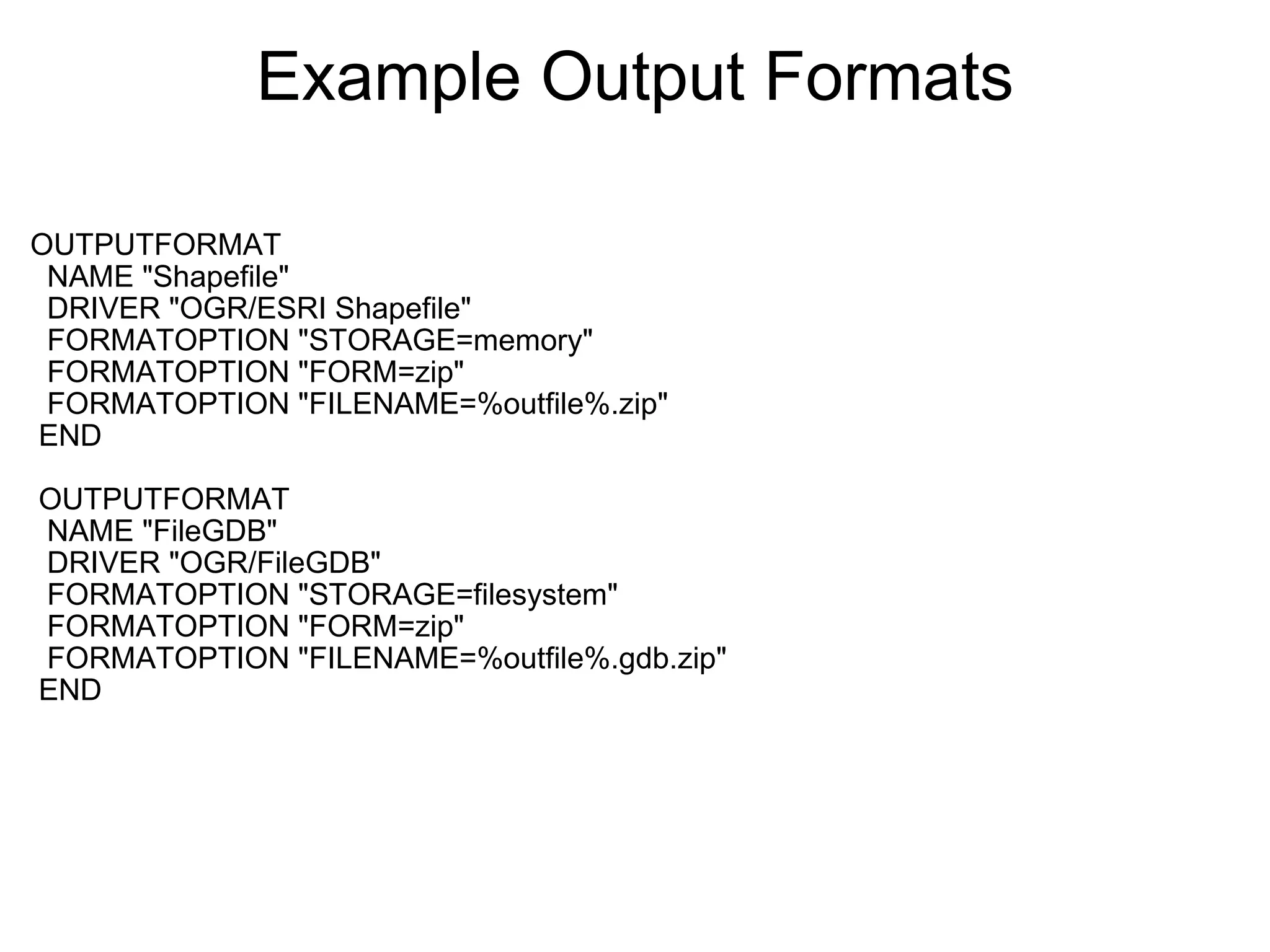
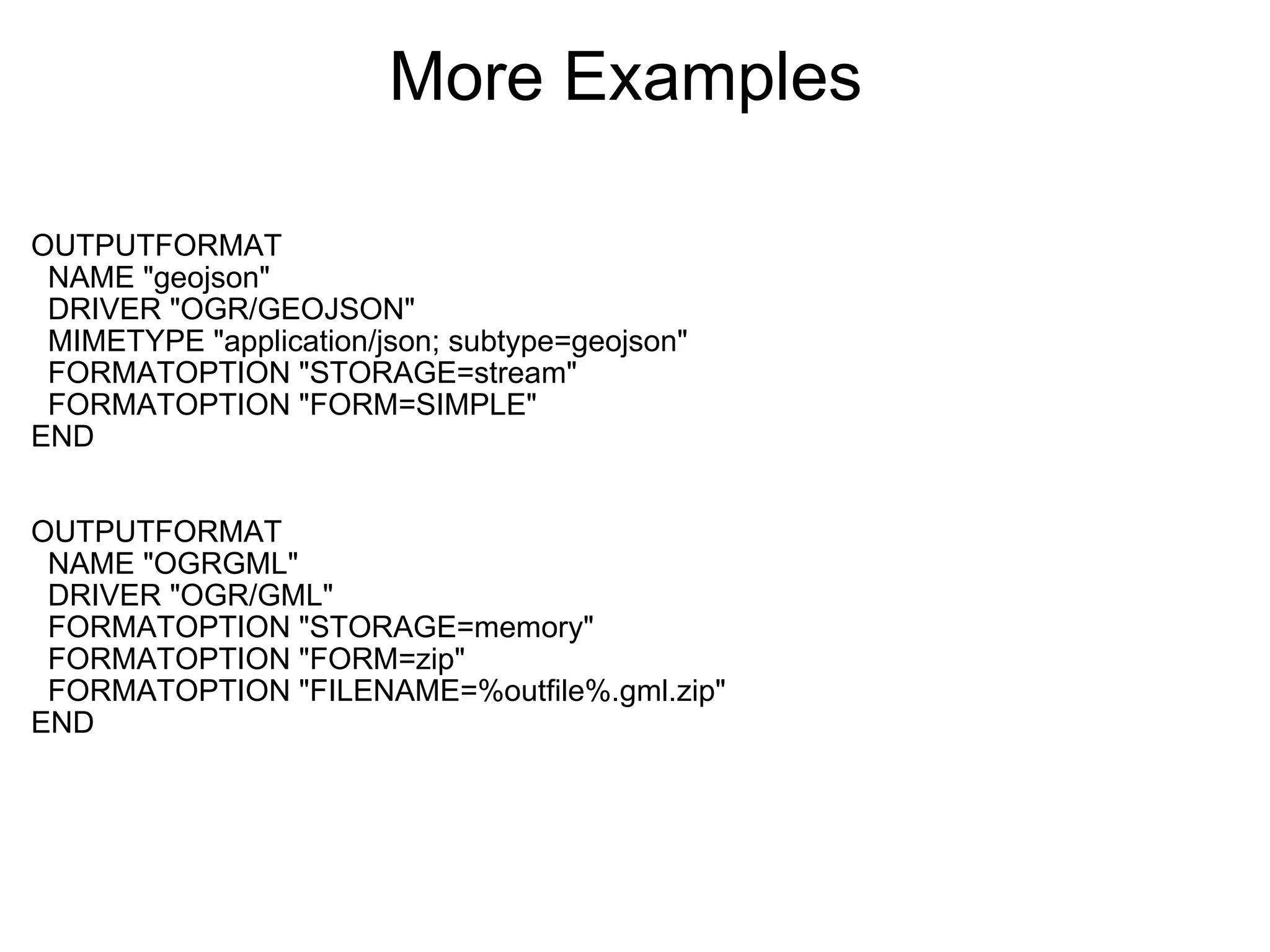
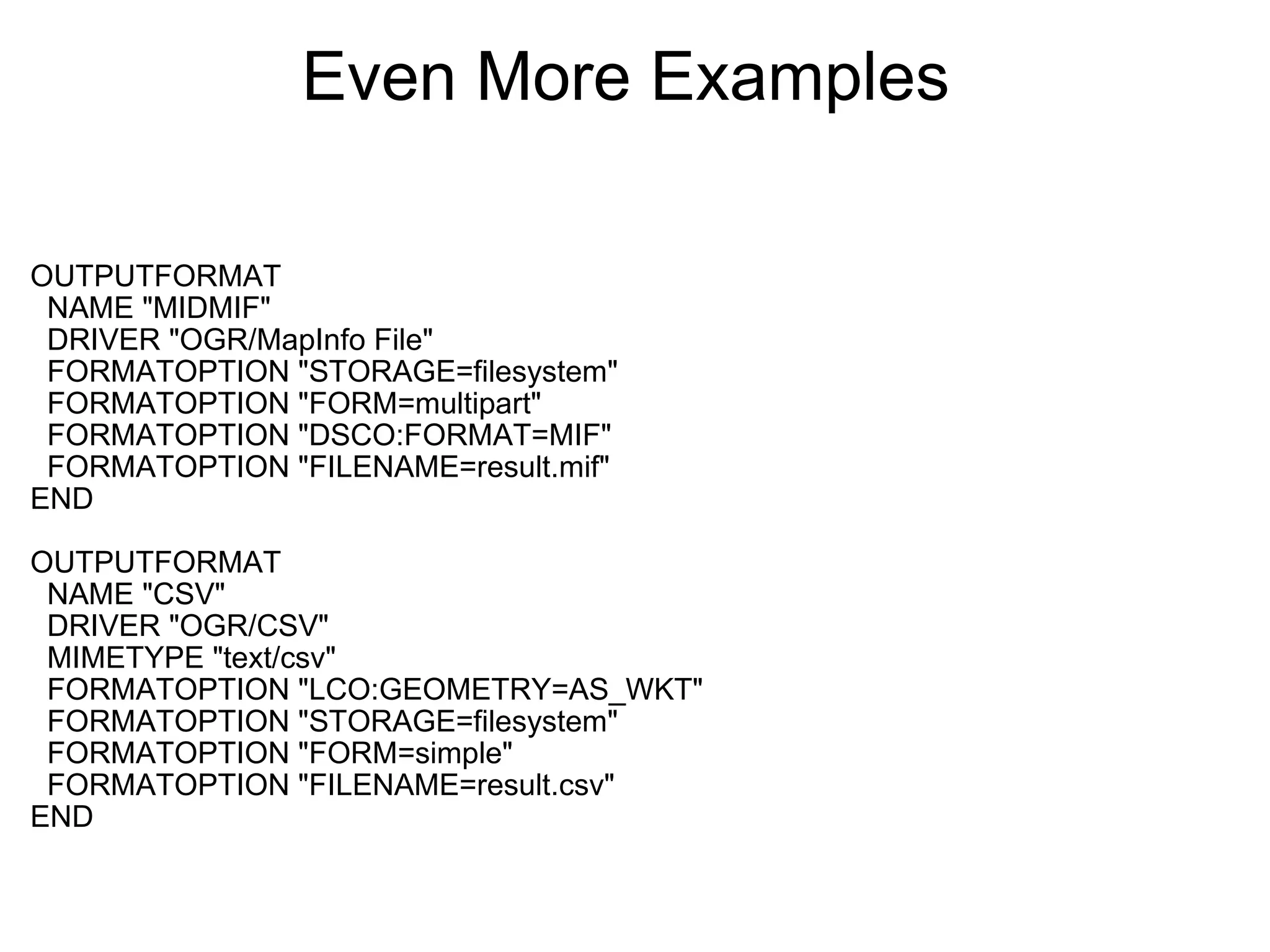
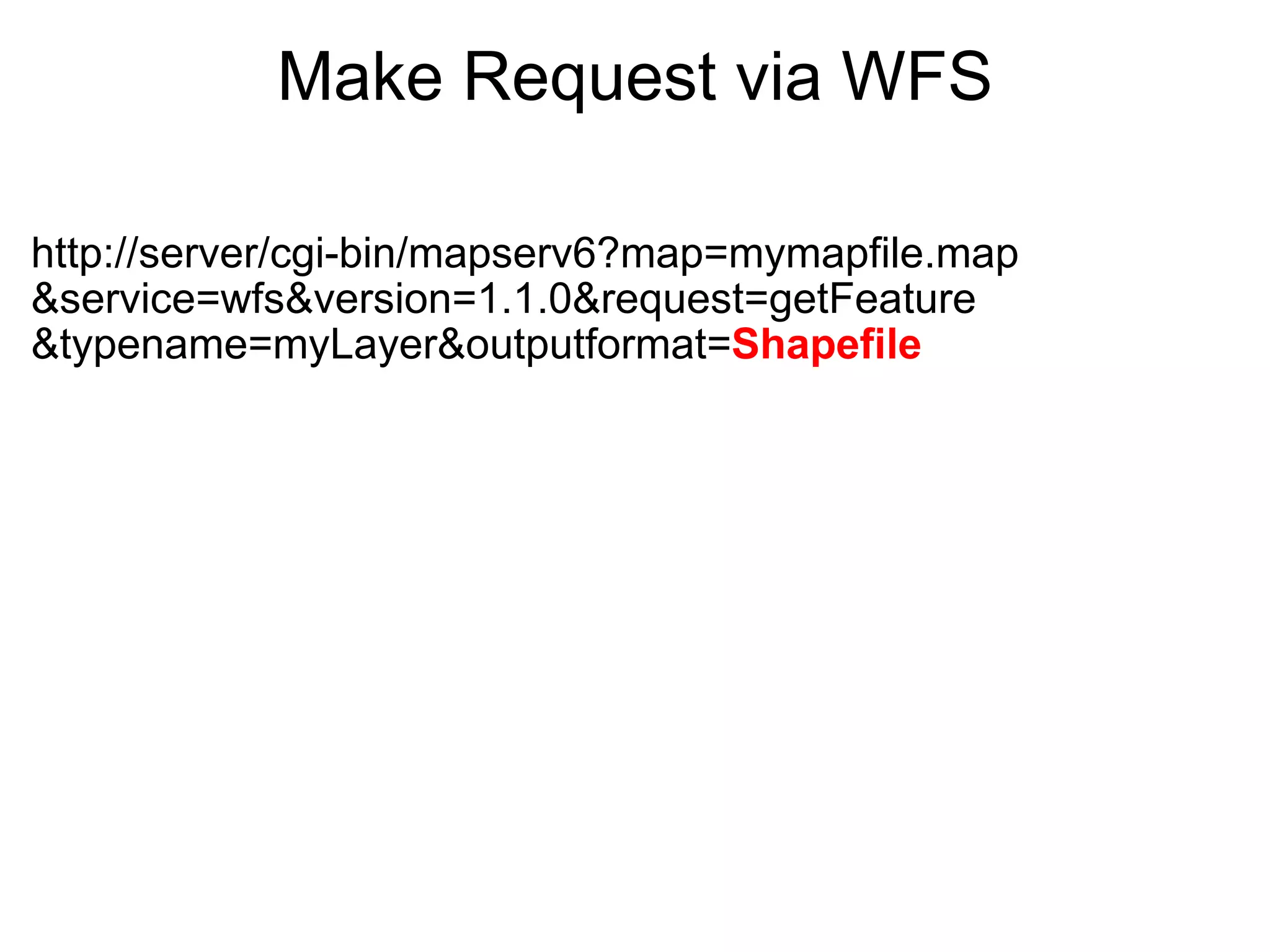
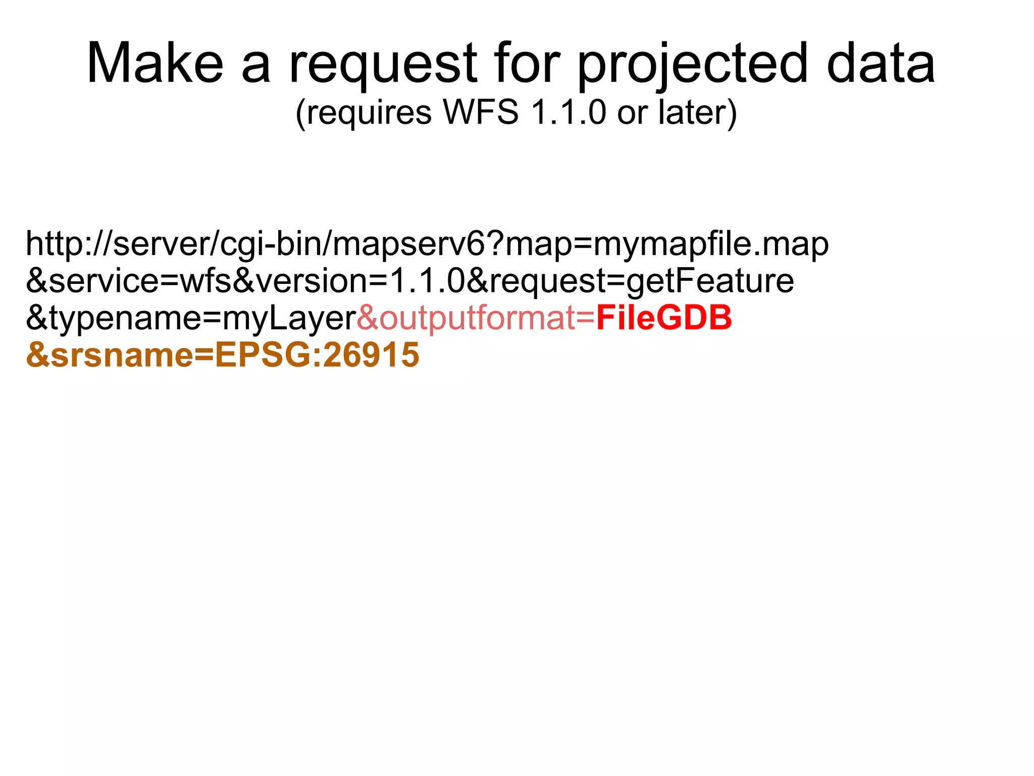
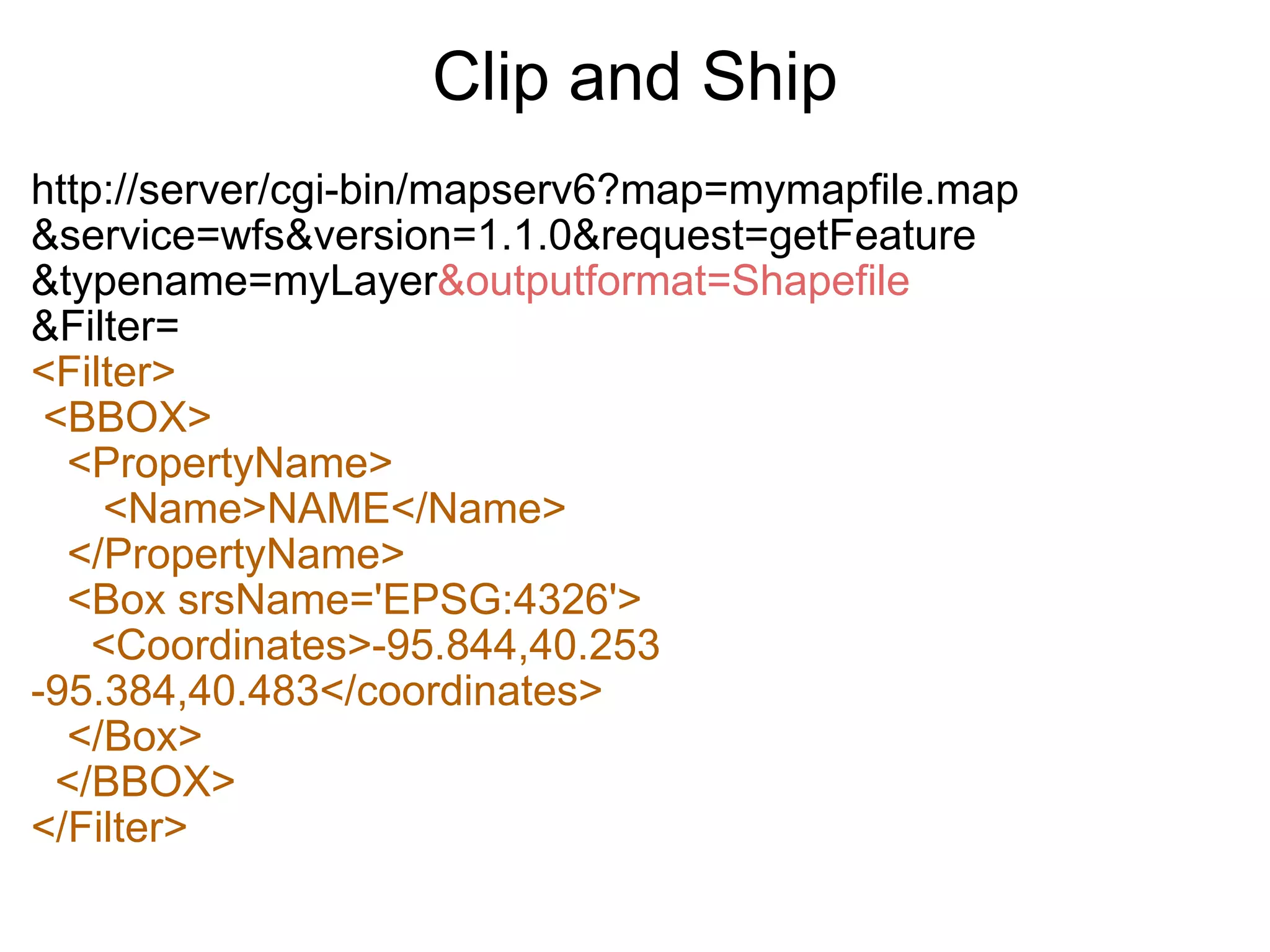
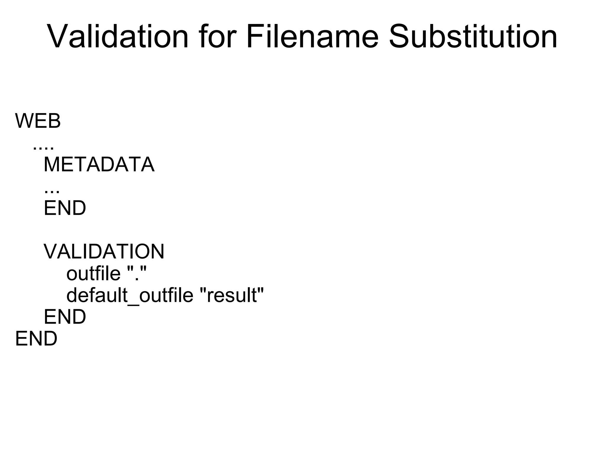
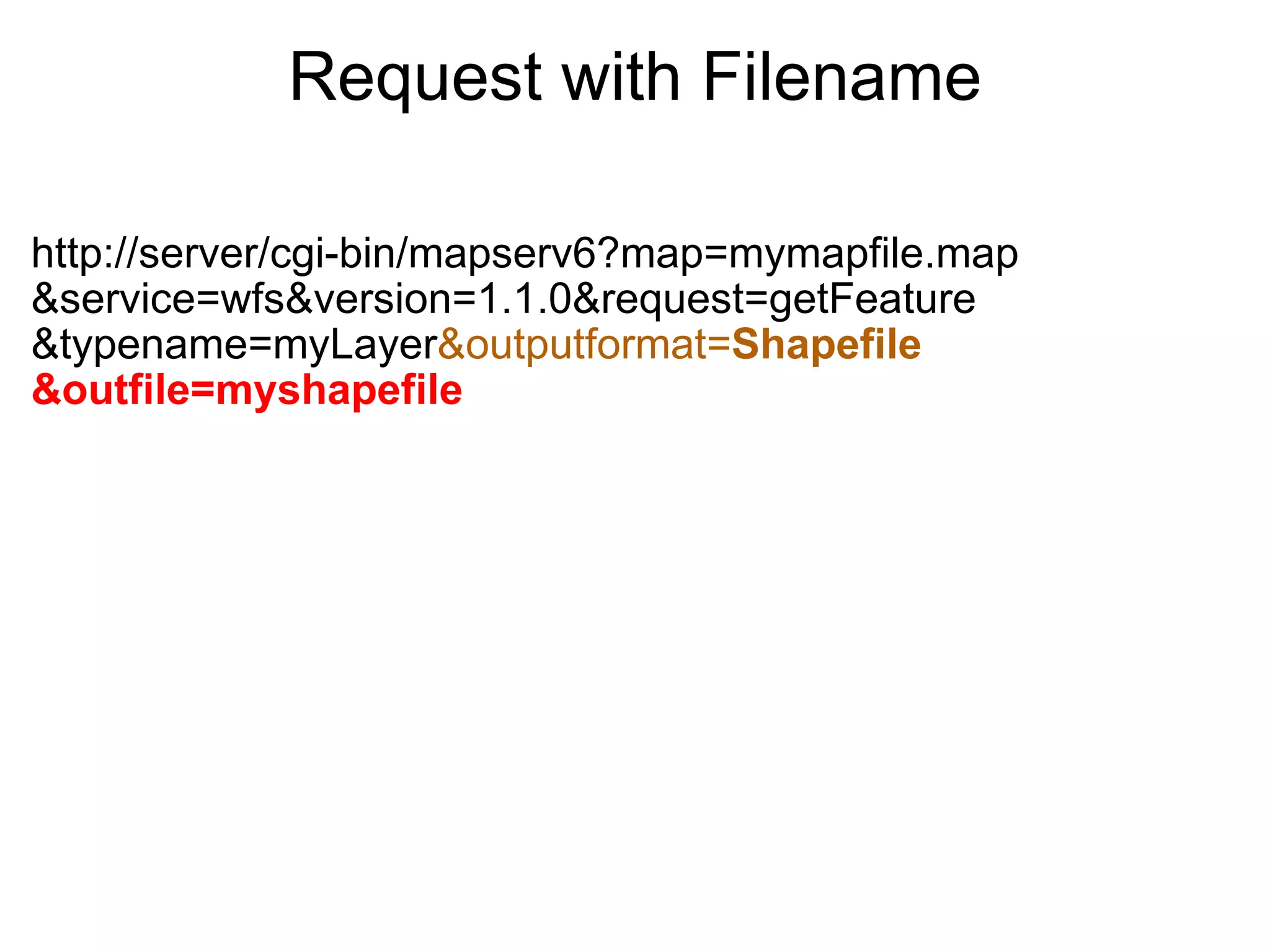
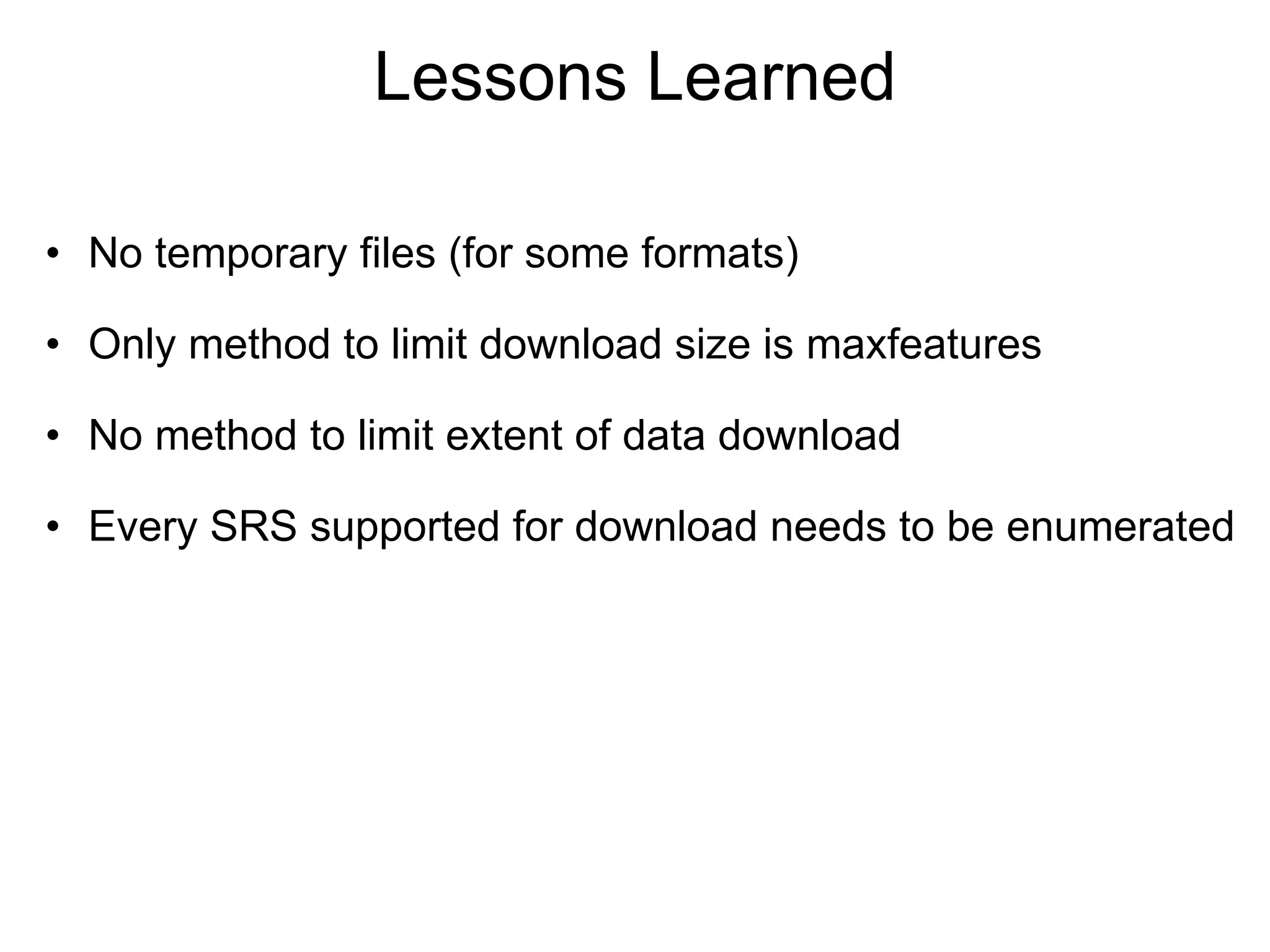
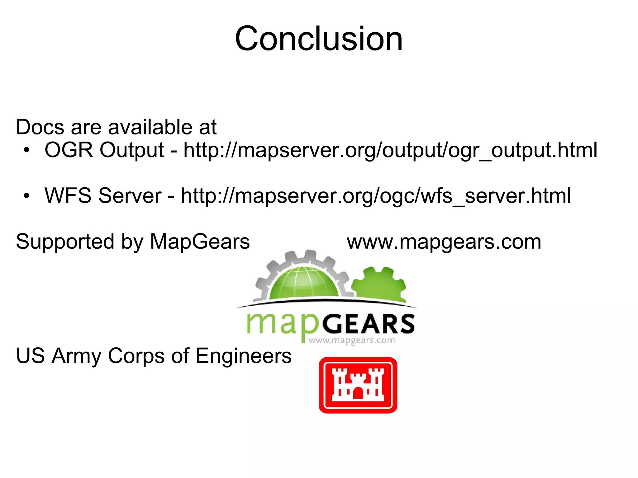
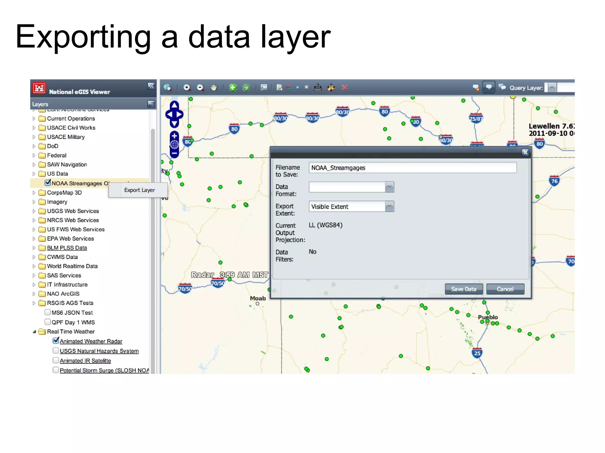
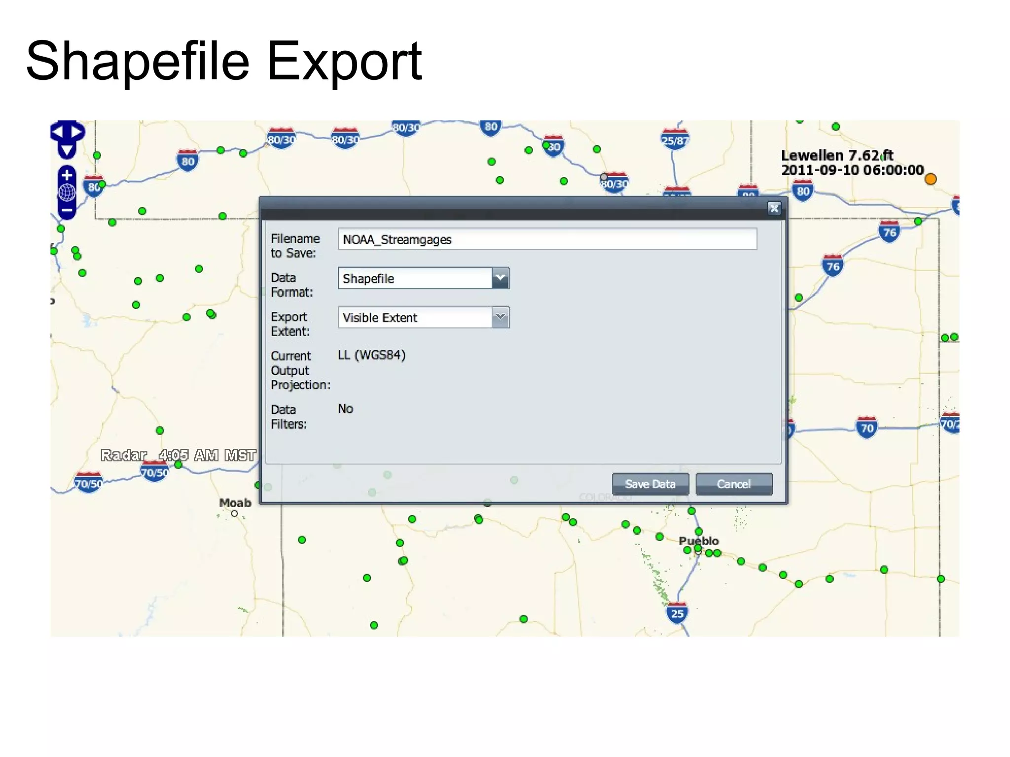
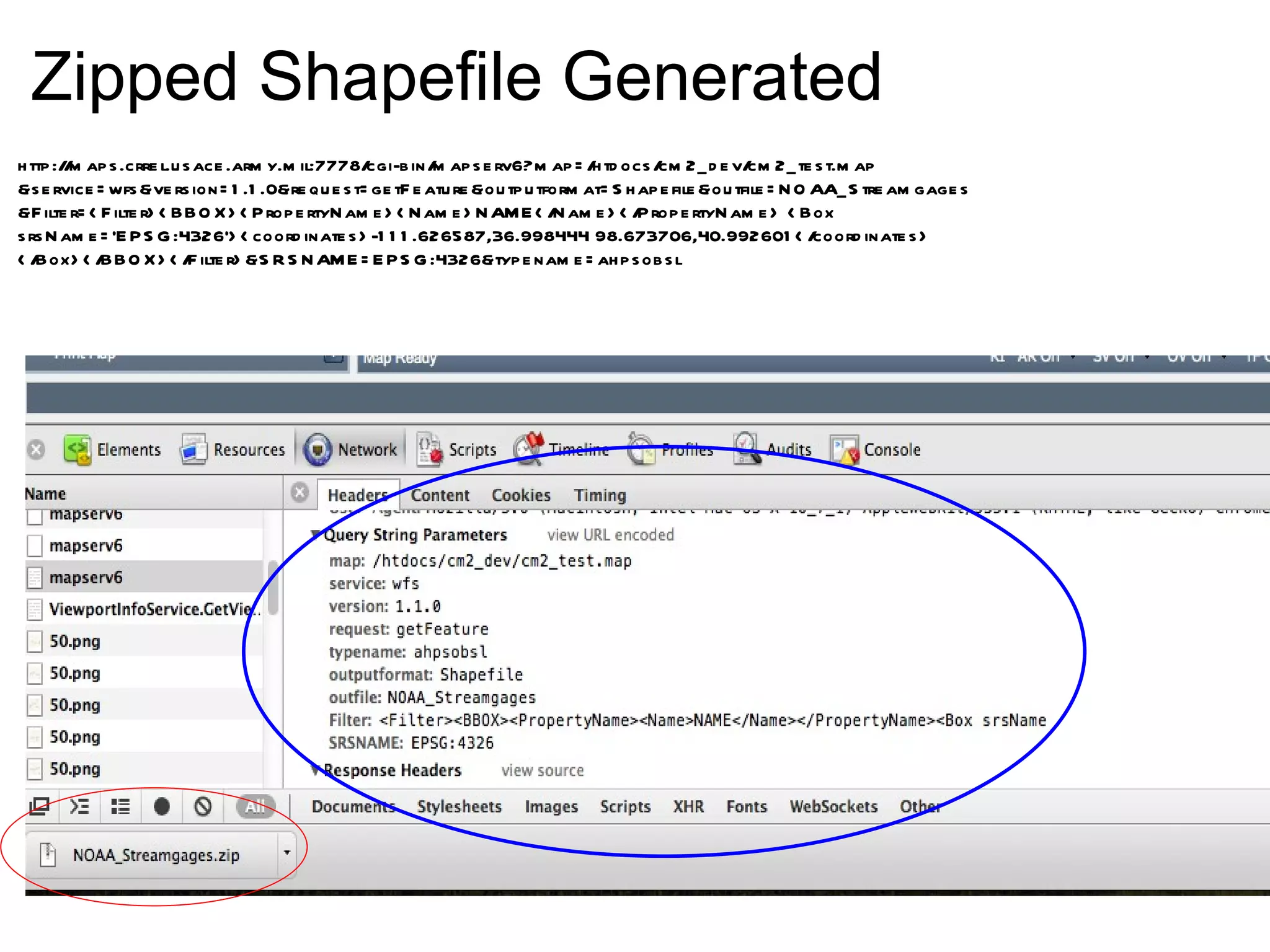

The document discusses the 'Clip and Ship' functionality of MapServer, which enables data distribution through various web services including WMS, WFS, and WCS. It covers details about data formats, metadata management, and examples of requests for feature retrieval, particularly focusing on GIS data export in formats such as shapefile and GeoJSON. The document also outlines configuration options, limitations, and resources for further information regarding the implementation.


![Coded Agents – with UiPath SDK + LangGraph [Virtual Hands-on Workshop]](https://cdn.slidesharecdn.com/ss_thumbnails/codedagentsdeck-251215155422-5497c599-thumbnail.jpg?width=640&height=640&fit=bounds)


![Vibe Coding vs. Spec-Driven Development [Free Meetup]](https://cdn.slidesharecdn.com/ss_thumbnails/vibecodingvsspecdrivendevelopment-251209105622-43f455e7-thumbnail.jpg?width=640&height=640&fit=bounds)


