Basic map reading
•Download as PPT, PDF•
7 likes•7,740 views

This document provides guidance on map reading skills for students. It defines what a map is and explains the importance of maps for planning. It covers various map categories and components such as grid coordinates, scale, direction, and marginal information. It describes how to determine distances and locations on a map using scale, grid squares, and navigation techniques. The document emphasizes best practices for map handling, storage, marking, and folding.

Recommended
More Related Content
What's hot
What's hot (20)
Viewers also liked
Viewers also liked (15)
Similar to Basic map reading
Similar to Basic map reading (20)
More from Studying at SSCT Surigao City
More from Studying at SSCT Surigao City (7)
Recently uploaded
Recently uploaded (20)
Basic map reading
- 2. REFERENCE: UNITED STATE ARMY MANUAL DEPARTMENT OF THE ARMY, 1987
- 3. To provide the Students the knowledge and develop their skill in map reading and to impart to them the importance of map information in the future planning.
- 4. Definition, Importance and Caring of Map Categories and uses of Maps Marginal Information Colors used on a Military Map Grid Coordinates Scale and Distance Directions
- 5. MAP- is a graphic representation of the earth’s surface or part of it, drawn into scale as seen from above.
- 6. A map can give accurate information. It becomes more & more necessary to rely upon maps. By necessity, planning must be done on maps. Adequate supply of maps.
- 7. • Protect fm water, mud & tearing. • Map should be carried in waterproof cases, in pocket or in place where it is handy for use. • If you put a mark on a map, use of pencil.
- 8. • Use light lines so they maybe erased easily without smearing and smudging, or leaving marks that may later cause confusion. • Should be folded properly.
- 9. ACCORDING TO SCALE Scale - is expressed as a fraction and gives the ratio of map distance to the ground distance. Small Scale Medium Scale Large Scale
- 10. • The map scale is 1:50,000 • RF = 1/50,000 • The map distance from point A to B is 5 units • 5 X 50,000 = 250,000 units of ground distance
- 11. Types of Maps Planimetric map Topographic map Photomap Joint operations graphics Photomosaic map
- 13. Military Use General map Strategic map Strategic-Tactical map Tactical map Artillery map Situation map
- 15. Sheet Name Sheet Number Series Name Scale Serial Number Edition Number Index to Boundaries
- 16. Adjoining Sheet Diagram Elevation Guide Declination Diagram Bar Scale Contour Interval Note Spheroid Note Projection note
- 21. 7173 III 7272 III 7171 II7171 III 7172 II 7171 IV 7271 IV 7271 III 7171 I Adjoining Sheets Diagram
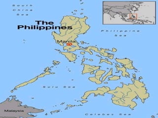
- 23. Serial Number Example: S701 S – word series 7 – scale of the map as follows; 8 – 1:25,000, 7 – 1: 50,000 6 – 1:100,000 0 – Sub-geographical area as follows; 0 – Philippines 1 – Luzon 2 – Visayas 3 – Panay 4 – Sulu 5 – Mindanao
- 24. Black – man-made objects Blue – drainage/bodies of water Brown – relief & elevation Green –vegetation
- 25. Red – roads, built-up areas and special features. Reddish-Brown – cultural features, all relief features and elevation
- 26. Representative Fraction (RF) Example is as shown: The map scale is 1:50,000 or RF = 1/50,000 The map distance from point A to B is 5 units 5 x 50,000 = 250,000 units of ground distance
- 27. Comparison with the Ground distance Example: 1/X, RF = 1/X = MD/GD MD = 4.32 centimeters GD = 2.16kms (216,000 cms) 1 4.32 4.32X = 216,000 X 216,000 4.32 4.32 X =50,000 RF
- 28. RF = 1/X = MD/GD Ex: MD = GD/Denominator of RF GD = 2,200 meters RF = 1:50,000 MD = 2,200/50,000 = 0.044 mtr x 100 (cm in a mtr) = 4.4 centimeters
- 29. Graphic (Bar) Scales 1 ½ 0 1 2 3 Substitute Miles 1 ½ 0 1 2 3 Nautical miles Meters 1000 0 1 2 3 4 5 Kilometers Secondary Scale Primary Scale Transferring map distance to paper strip Measuring straight-line map distance Measuring curved lines
- 30. Method of expressing Directions Degree – the most common unit of angular measure. Mil – used in arty, tank & mortar gunnery. Grad – a metric unit of measure found on some foreign maps.
- 31. Base Lines True North Magnetic North Grid North GN or Y
- 32. Azimuths - is a horizontal angle, measured in a clockwise manner fm a north base line. Back Azimuth – reverse direction ADD 180O - AZIMUTH IS 180O OR LESS. SUBTRACT 180O - AZIMUTH IS 180O OR MORE.
- 33. 270O 0 or 360O 90O 180O Azimuth Back Azimuth 115O 295O
- 34. Back Azimuth Azimuth less than 180 degrees - plus 180 degrees Azimuth more than 180 degrees - minus 180 degrees
- 35. Method of Locating Points Intersection Resection Polar Plot Modified resection
- 36. Directions ®Methods of Expressing Directions Degree ( 1 degree = 60 min) Mil (Artillery, tank, and mortar gunnery)
- 37. 90270 0 or 360 180 BASELINE Direction Line ORIGIN 64 degrees
- 38. Grid Square Grid Coordinate scales Determining grids Precision
- 40. RULE OF DUMB READ RIGHT AND UP
- 41. GS67 88 66 67 68 69 90 89 88 87
- 42. GS68 88 66 67 68 69 90 89 88 87
- 43. GS67 89 66 67 68 69 90 89 88 87
- 44. GS68 89 66 67 68 69 90 89 88 87
- 45. GS68 87 66 67 68 69 90 89 88 87
- 46. GS66 88 66 67 68 69 90 89 88 87
- 47. GS66 89 66 67 68 69 90 89 88 87
- 48. 66 67 68 69 90 89 88 87
- 49. 6 DIGITS NEAREST 100 METERS
- 50. 66 67 68 69 90 89 88 87
- 51. 1 2 3 4 5 6 7 8 9 1 2 3 4 5 6 7 8 9 67 89 88 68 GC 67 ___ 88____5 5GC 675885
- 52. 1 2 3 4 5 6 7 8 9 1 2 3 4 5 6 7 8 9 67 89 88 68 GC 67 ___ 88____7 6GC 677886
- 53. 1 2 3 4 5 6 7 8 9 1 2 3 4 5 6 7 8 9 67 89 88 68 GC 67 ___ 88__2 9GC 672889
- 54. 1 2 3 4 5 6 7 8 9 1 2 3 4 5 6 7 8 9 67 89 88 68 GC 67 ___ 88___9 1GC 679881
- 55. 1 2 3 4 5 6 7 8 9 1 2 3 4 5 6 7 8 9 67 89 88 68 GC 67 ___ 88___0 0GC 670880
- 56. 1 2 3 4 5 6 7 8 9 1 2 3 4 5 6 7 8 9 67 89 88 68 GC 67 ___88___7 0GC 677880
- 57. 1 2 3 4 5 6 7 8 9 1 2 3 4 5 6 7 8 9 67 89 88 68 GC 67 ___88___0 7GC 670887
- 58. 1 2 3 4 5 6 7 8 9 1 2 3 4 5 6 7 8 9 67 89 88 68 GC 68 ___ 88___0 0GC 680880
- 59. 1 2 3 4 5 6 7 8 9 1 2 3 4 5 6 7 8 9 67 89 88 68 GC 67 ___ 89___0 0GC 670890
- 60. 1 2 3 4 5 6 7 8 9 1 2 3 4 5 6 7 8 9 67 89 88 68 GC 68 ___ 89___0 0GC 680890
- 61. 1 2 3 4 5 6 7 8 9 1 2 3 4 5 6 7 8 9 67 89 88 68 GC 67 ___ 88___7 6GC 677886 +_ 100
- 62. 1 2 3 4 5 6 7 8 9 1 2 3 4 5 6 7 8 9 67 89 88 68 GC 67 ___ 88___7 6GC 677886 +_ 100
- 63. 1 2 3 4 5 6 7 8 9 1 2 3 4 5 6 7 8 9 67 89 88 68 GC 67 ___ 88___7 7GC 677887+_ 100
- 64. 1 2 3 4 5 6 7 8 9 1 2 3 4 5 6 7 8 9 67 89 88 68 GC 67 ___ 88___8 7GC 677887+_ 100
- 65. 8 DIGITS NEAREST 10 METERS
- 66. 1 2 3 4 5 6 7 8 9 1 2 3 4 5 6 7 8 9 67 89 88 68 GC 67 ____ 88____7 74 0GC 67748870
- 67. 1 2 3 4 5 6 7 8 9 1 2 3 4 5 6 7 8 9 67 89 88 68 GC 67 ____ 88____7 70 3GC 67708873
- 68. 1 2 3 4 5 6 7 8 9 1 2 3 4 5 6 7 8 9 67 89 88 68 GC 67 ____ 88____7 60 5GC 67708865
- 69. 1 2 3 4 5 6 7 8 9 1 2 3 4 5 6 7 8 9 67 89 88 68 GC 67 ____ 88____4 45 0GC 67458840