Protecting Mangroves During Site Development Using Integrated Design and Land Improvement Practices
•
0 likes•653 views

Presented by: Sara Schmieg

Recommended
Recommended
More Related Content
What's hot
What's hot (19)
Similar to Protecting Mangroves During Site Development Using Integrated Design and Land Improvement Practices
Similar to Protecting Mangroves During Site Development Using Integrated Design and Land Improvement Practices (20)
More from Society of Women Engineers
More from Society of Women Engineers (20)
Recently uploaded
Recently uploaded (20)
Protecting Mangroves During Site Development Using Integrated Design and Land Improvement Practices
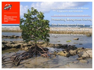
- 1. Sara Schmieg, Environmental Engineer International Conference of Women Engineers and Scientists Protecting Mangroves During Site Development Using Integrated Design and Land Improvement Practices CIVIL GOVERNMENT SERVICES MINING & METALS OIL, GAS & CHEMICALS POWER
- 2. The Challenges I.Coastal regions of Queensland, Australia have a tropical climate with a thriving ecology and biodiversity dependent on mangroves II.Acid sulfate soils are common in coastal mudflat zones of Queensland III.Erosion of the acid sulfate soils causes the surrounding water and soils to become acidic IV.Maintaining the biodiversity requires preventing erosion of the acid sulfate soils and preserving the coastal mangroves
- 3. The Solution Site Development –Erosion control –Managing acid sulfate soils Site Hydrology –Estimating volumetric flow rate of runoff Site Ecology –Protecting mangroves
- 4. “The exposure of acid sulfate soils to oxygen (e.g. by drainage, excavation or filling) results in production of sulfuric acid and toxic quantities of aluminium and other heavy metals…the acid corrodes concrete and steel infrastructure and, together with the metal contaminants, can kill or damage fish, other aquatic organisms, native vegetation and crops.” © Bechtel | 4 2FeS2 (pyrite) + 7O2 + 2H2O 2Fe+2 + 4SO4-2 + 4H+ Site Development Queensland State Planning Policy 2/02
- 5. Site Development © Bechtel | 5 •Careful consideration is taken during planning and design phases to protect mudflats and mangrove areas (preserve ecosystems) •Site development eliminated or minimized in areas with acid sulfate soils •Disturbed acid sulfate soil is treated and contained on site •Grading site in manner to not disrupt natural flow channels Design outfalls for site drainage in areas with natural channels
- 6. Site Hydrology © Bechtel | 6 •Grading site in manner to not disrupt natural flow channels •Design and plan for appropriate Annual Recurrence Interval (ARI) Reviewed low tide conditions for 100 yr flood •Design outfall(s) capacity to handle increased flow •Prevent disruption and erosion of acid sulfate soils Q = 퐀 퐑ퟐ/ퟑ퐒ퟏ/ퟐ 퐧
- 7. Site Ecology © Bechtel | 7 •Characterize the mangroves to understand the impact they have on site flows Identify parameters to determine mangrove roughness or Manning’s n •Estimate site flow velocities for assessing erosion potential •Protect and preserve mangroves and biodiversity of the coastal region n = 퐀 퐑ퟐ/ퟑ퐒ퟏ/ퟐ 퐐
- 8. Identify Mangrove Parameters © Bechtel | 8 Five parameters were considered: •Vegetation species and maturity •Vegetation density and volumetric occupancy •Vegetation effective length and flow depth •Reynolds number and flow velocity •Vegetation drag and roughness factor
- 9. Vegetation Species and Maturity © Bechtel | 9 Sources: •Husrin, S., and Oumeraci, H. 2009. Parameterization of coastal forest vegetation and hydraulic resistance coefficients for tsunami modeling. •Husrin, S., Strusinska, A., and Oumeraci, H. 2012. Global and local processes of tsunami attenuation by mangrove forests-laboratory test results.
- 10. Vegetation Density and Volumetric Occupancy © Bechtel | 10 Sources: •Mazda, Y. Wolanski, E.J., King, B.A., Sase, A., Ohtsuka, D. and Magi, M. 1997. Drag force due to vegetation in mangrove swamps. •Latief, H., and Hadi, S. (2006). “The role of forests and trees in protecting coastal areas against tsunamis,” Proceedings of Regional Technical Workshop. Khao Lak, Thailand.
- 11. Vegetation Effective Length and Flow Depth © Bechtel | 11 Source: McIvor et al., 2012. Reduction of wind and swell waves by mangroves. NCP Report 2012-01.
- 12. Reynolds Number and Drag © Bechtel | 12 Source: Mazda, Y. Wolanski, E.J., King, B.A., Sase, A., Ohtsuka, D. and Magi, M. 1997. Drag fore due to vegetation in mangrove swamps.
- 13. Conclusions © Bechtel | 13 •Identifying and evaluating the mangrove parameters allowed for the site outfall velocities to be determined •The outfalls were designed to control and manage site flows to protect mangroves and prevent erosion of soils This meant increasing riprap sizing of the outfall channel and changing outfall channel lengths to decrease velocities •Manning’s n or mangrove roughness was estimated to be between n = 0.05-0.2 (depending on mangrove parameters)
- 14. References © Bechtel | 14 Husrin, S., and Oumeraci, H. 2009. Parameterization of coastal forest vegetation and hydraulic resistance coefficients for tsunami modeling. Husrin, S., Strusinska, A., and Oumeraci, H. 2012. Global and local processes of tsunami attenuation by mangrove forests-laboratory test results. Latief, H., and Hadi, S. (2006). “The role of forests and trees in protecting coastal areas against tsunamis,” Proceedings of Regional Technical Workshop. Khao Lak, Thailand. Mazda, Y. Wolanski, E.J., King, B.A., Sase, A., Ohtsuka, D. and Magi, M. 1997. Drag fore due to vegetation in mangrove swamps. Mazda, Y. Wolanski, E.J., King, B.A., Sase, A., Ohtsuka, D. and Magi, M. 1997. Drag fore due to vegetation in mangrove swamps. McIvor et al., 2012. Reduction of wind and swell waves by mangroves. NCP Report 2012-01.
- 15. © Bechtel | 15 Contact Information: Sara Schmieg Bechtel National Inc. Geotechnical and Hydraulic Engineering Services sschmieg@bechtel.com