Sage may 18 2017 bennett webinarfinal
•
0 likes•65 views

Recent presentation on assessing how U.S. Fish and Wildlife Service Hurricane Sandy Resilience projects will improve community and ecosystem resilience to sea level rise, storm events and other threats. Presentation highlights development of ecological and socio-economic metrics and provides project examples, marsh restoration, beach restoration, living shorelines and aquatic connectivity (dam removal) of metrics being used to evaluate project performance.

Recommended
Recommended
More Related Content
What's hot
What's hot (20)
Similar to Sage may 18 2017 bennett webinarfinal
Similar to Sage may 18 2017 bennett webinarfinal (20)
Recently uploaded
Recently uploaded (20)
Sage may 18 2017 bennett webinarfinal
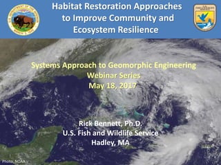
- 1. Habitat Restoration Approaches to Improve Community and Ecosystem Resilience Rick Bennett, Ph.D. U.S. Fish and Wildlife Service Hadley, MA Photo: NOAA Systems Approach to Geomorphic Engineering Webinar Series May 18, 2017
- 2. 1. Reduce the impacts of coastal storm surge, wave velocity, sea level rise and associated natural threats on coastal and inland communities. 2. Strengthen the ecological integrity and functionality of coastal/inland ecosystems to protect communities and to enhance fish and wildlife and their associated habitats. 3. Enhance our understanding of the impacts of storm events and identify cost effective, resilience tools that help mitigate for future storms. DOI Resilience Program Overarching Goals Marsh migration
- 3. USFWS Conservation Design Resilience Projects Projects designed to provide ecosystem and community resilience to flooding, storm surge, SLR and increased storm events • Marsh Restoration • Beach Restoration • Aquatic Connectivity • Science Support Tools http://www.fws.gov/hurricane/sandy/
- 4. Measuring Success Are Resilience Projects Effective? Program Assessment: • Identify ecological system performance metrics • Identify socio-economic performance metrics • Link ecological performance metrics with the socio-economic metrics • Enhanced data collection (performance metrics), modeling, and analysis • Provide results to evaluation/assessment of DOI project contributions to coastal resilience (5-10 year timeframe) Subbottom profiles in nearshore (Photo: USGS) SET Installation (Photo: USGS)Fish Survey (Photo: NFWF)Saltmarsh Bird Survey (Photo: FWS)
- 5. Measuring Success - Ecological Metrics www.doi.gov/hurricanesandy/news/hurricane-sandy-project-metrics-report DOI Metrics Expert Group Report provides Ecological Performance Metrics Organized by Coastal Feature • Beach, Barrier Island, and Dunes • Nearshore Shallow and Nearshore Deep • Riverine and Riparian Zone • Marshes and Wetlands • Uplands and Watersheds • Maritime Forests and Shrublands • Estuaries and Ponds • Grey infrastructure • Green Infrastructure Identifies Abiotic, Biotic, and Structural Metrics
- 6. 3. Overview of Metric Workgroups • Organized metrics around coastal 6 features (project comparison) • Identify core metrics (abiotic, biotical, structural) • Peer review DOI Sandy Program Core Performance Metrics: A set of performance metrics that are applied to multiple projects and at the full range of temporal and spatial scales to represent a change in resilience in one or more coastal features.
- 7. Ecological Monitoring Core Metrics Marsh Restoration • Nekton abundance, species richness • Salt marsh plant community monitoring • Water Quality • Marsh surface elevation change trend • Marsh accretion and erosion • Groundwater dynamics Aquatic Connectivity • Fish migration rates and patterns • Invasive species extent, mobility • Fish assemblage/abundance • Habitat availability • Riparian plant communities, pre and post • Water temperature, salinity • Flooding extent and depth • Sediment composition and contaminants • River Flow and depth SET Installation Norton Dam, CT
- 8. Ecological Monitoring Core Metrics Beach and Dune Restoration • Fish, wildlife population, recruitment, overwintering, stopover weight • Vegetation cover of dunes, pre and post • Dune characterization • Beach width, elevation, volume, shoreline position • Post-storm volume of sand in active shoreface Living Shorelines • Oyster length/frequency • Oyster coverage & population • Vegetation cover • Water temperature, salinity • Vertical accretion rates • Shoreline position • Wave and Current Energy
- 9. Measuring Success Socio-Economic Metrics • Objective: Develop socio-economic metrics and assign to each project • Classify 167 projects (project activity, project outcome) • Develop resilience framework to organize and assign metrics • Identify methodologies and data for measures • Causal mapping to develop socio-economic metrics and link to ecological metrics http://www.nfwf.org/hurricanesandy/Documents/DOI_NFWF_Hurricane _Sandy_Socio-Economic_Metrics_Report.pdf
- 10. The Result • RFP Issued by NFWF Oct. 24, 2016 • Ecological monitoring & data collection • Monitoring socio-economic impacts • Resilience assessment of DOI & NFWF Projects
- 12. Hurricane Sandy Evaluation Products Core Ecological Metrics of Resilience (available) Core Socioeconomic Metrics of Resilience (available) • Resilience Monitoring Database (Dec. ‘18) • Phase I Evaluation w/Seven Case Studies (April ’18) • 5-7 Years of Monitoring Data (annually 2017-2023) • Phase II Evaluation (Dec. ’23) www.nfwf.org/hurricanesandy www.doi.gov/hurricanesandy
- 13. Prime Hook NWR Marsh & Beach Restoration • On the western shore of the Delaware Bay, in southern DE • Established in 1963 • 10,132 acres, primarily wetlands • Refuge divided into management units • Dune breaches are in Units I & II
- 14. Prime Hook NWR Impoundment Management • ~4000 acres of freshwater impoundments • Tidal water restricted by water control structures • Culverts between Unit II and Unit III • Successful freshwater impoundment management for 20+ years
- 15. Tidal Marsh and Barrier Beach Restoration at Prime Hook NWR Issues • Freshwater impoundment management unsustainable • Substantial historic accretion deficit • Elevation deficit has led to peat collapse and conversion to open water • Impacts to habitat, wildlife, and coastal communities Hurricane Sandy Disaster Relief Funds • $19 M in Recovery Funds - Fore beach, dune, back barrier platform • $19.8 M in Resilience Funds - Marsh restoration
- 16. Prime Hook NWR Beach & Marsh Restoration Restore a Barrier Beach & Salt Marsh Complex • Close breaches • Dredge a network of tidal channels • Eliminate water control structures • Remove road and alterations to roads and/or culverts • Use dredge material to augment marsh Prime Hook National Wildlife Refuge (Photos: USFWS)
- 17. Prime Hook NWR Beach & Marsh Restoration The Result • Restored Hydrology o Establish tidal channels • Restored ecosystem services o Storm surge and flood protection o Carbon Sequestration o Habitat • Increased public support Restoring hydrology, recreating channels (Photo: USFWS) Replanting saltmarsh vegetation (Photo: USFWS) Closing breaches along beach (Photo: USFWS) Sand Pumping to Close Breaches (Tim Boyle, USACE)
- 19. Abiotic & Biotic Monitoring • Water Monitoring • Sediment Monitoring • Marsh Elevation, Accretion • Groundwater Influence • Vegetation Communities • Bird Communities • Fish Communities
- 20. Ecological Monitoring: Marsh Restoration Core Metrics Metric Methods • Nekton abundance, species richness • Ditch nets & Throw traps (SMI); 1x/yr • Fyke/Clover Trap/Electofishing; 3x/yr • Acoustic tagging; continuous • Salt marsh plant community (spp composition, % cover, areal coverage) • 50m radius plot (SMI/SHARP); 1x/yr • NVDI remote sensing; 1x/yr • MidTRAM habitat attribute metrics; 1x/yr • Photo Points; 1x/yr • Water quality • YSI EXO sondes (or similar); continuous • Nutrient grab samples; monthly • Marsh surface elevation change trend • Surface Elevation Tables (SET); 1x/year • MidTRAM habitat attribute metrics; 1x/yr • Aerial LiDAR surveys; Year 1 and Year 5 • NEW – local tide levels/datums • HOBO water level loggers; continuous • Marsh accretion and erosion • Feldspar horizons at SETs; 2x/year • Sediment flux monitoring; continuous • Groundwater dynamics • HOBO water level loggers on marsh surface; continuous for defined durations, e.g. 1-2 months • GDSNWR - 25 sites have groundwater level monitoring; 11 have continuous recordings
- 21. Ecological Monitoring Core Beach & Dune Metrics Metric Methods (multiple projects) • Vegetation cover of dunes pre and post event GIS analysis of orthophotos • Dune characterization (height, width, length, texture, substrate), and change over time) Dune profiles (NPS (NCBN) Coastal Topography Protocol; LiDAR, Grain size analysis; Digital Elevation Models • Beach characterization (width, elevation, volume, shoreline position and change over time) Beach profiles NPS (NCBN) Coastal Topography Protocol); Shoreline position NPS (NCBN) Shoreline Position Protocol); Digital Elevation Models • Dune Crest Position – change over time Dune profiles Digital Elevation Models • Dune Volume – change over time Digital Elevation Models • Shorebird nest success (piping plover and American oyster catcher) Number of nests/nest attempts and clutch sizes Signs of predators and disturbance; Fledglings • Shorebird nest elevation Nest location (GPS); Nest elevation (DEM)
- 22. Delaware Bay – An Important Place • One of the world’s most significant migratory shorebird stopovers • Critical foraging area for Red Knot • World’s largest spawning population of Horseshoe Crabs • Important area for ecotourism
- 23. Hurricane Sandy Impacts • 70% decrease in optimal horseshoe crab spawning habitat (Niles, 2012) • Loss of sand, exposure of debris, threats to marshes and infrastructure.
- 24. Delaware Bay Beach Habitat Resilience Project • 5 beaches selected; Reeds, Pierces Point, Kimbles, Moores, Cooks • $1.65 million budget • Restored 1.5 miles, 80-foot-wide berm, 45,500 tons of sand • Removed about 800 tons of debris
- 25. Science Behind Restoration Efforts Beach template design by Stockton College Coastal Research Center Oyster aquaculture to provide additional protection.
- 26. Science to Achieve Biological Outcomes Before After Shorebird Banding / Weight Measurements Horseshoe Crab Tagging • Shorebird Abundance • HC egg abundance • Restored, control, and unrestored beaches
- 27. Ecological Monitoring Core Beach & Dune Metrics Metric Methods (multiple projects) • Beach Profile Topography/Elevation; Transects, RTK GPS surveys Control and restored Beaches NAD 83/NAVD 88 Horizontal and vertical datums • Sand Transport Wind, Wave & Nearshore currents, Littoral Environment Observation Data Collection Program USACE • Beach characterization (width, elevation, volume, shoreline position and change over time) Shoreline position, RTK surveys; Grain size analysis; 2x annually • Horseshoe Crab spawning/egg abundance Transects and 3 meter quadrants, 3x weekly (May) 50 -100m sections, minimum 5 transects/beach Shallow and deep sampling 1x week (May) • Shorebirds – body condition and population estimates Cannon nets, spotting scopes Weight 50 m beach segments, Surveys 3x/week (May) Counts by species and behavior (roosting vs. feeding)
- 28. Aquatic Connectivity • Restore fish passage • Restore riparian habitat, reconnect the floodplain • Remove unsafe and obsolete dams • Reduce community flood risk • Protect roads and infrastructure Photos: USFWS
- 29. Aquatic connectivity and flood resilience 29 To what extent have dam removal and culvert replacement projects lead to improved ecological and social resilience outcomes? Pond Lily Dam Removal, Woodbridge, CT
- 30. Ecological Monitoring Core Aquatic Connectivity Metrics Metric Methods (multiple projects) • Fish Migration Rate, Assemblage and Abundance Video monitoring and iSpy software, Fyke nets, PIT tag arrays, cameras, back pack electrofishing unit, 50 foot bag seine Frequency: Often weekly in spring migration for 5 years • Flooding Depth, Extent and Inundation Pattern HEC-RAS model of water surface elevations; previously modeled flood maps • River Flow/Depth River morphology survey, USGS gage, cross sections, LIDAR • Habitat Availability ArcGIS spatial analysis, physical habitat variables, macroinvertebrate surveys, EPA Visual Habitat Assessment tool, Wolman pebble counts, stream profile and sediment deposition assessment techniques • Sediment composition and contaminants Bathymetric survey and sediment samples, DREAM sediment transport model, LIDAR • Water Quality Bacteria, dissolved oxygen, salinity, pH, conductivity, water temperature, chlorophyll a, total phosphorus, orthophosphate, ammonia, nitrate, total nitrogen, TSS, turbidity Frequency: Some parameters continuously • Riparian composition Transects and plots, georeferenced photos Frequency: Growing season annually
- 31. Living Shoreline Project Fog Point, Glen L. Martin NWR Smith Island, MD Subtidal bottom Peat Scarp Exposed Peat terrace Sandy berm High marsh Typical shoreline near low tide • 4,423 acre tract of tidal marsh • Located at the northern end of Smith Island • 12 miles offshore • Supports largest concentration of wintering waterfowl • Important habitat for fisheries and non-game wildlife, two large and diverse wading bird nesting colonies The refuge is:
- 32. Living Shoreline Project Glenn L. Martin NWR Smith Island, MD The Issue • Broad fetch on northern and western shorelines • Shoreline retreat - 10 to 15 feet/year • Loss of nearly 3.3 acres of habitat annually Actions taken to: • Protect Habitat - wetlands and SAV beds • Provide community protection • Protect commercial crabbing grounds (soft shell crabs)
- 33. Erosion Control Living Shoreline Project Fog Point, Glenn L. Martin NWR Smith Island, MD Cost: $9 million • Stabilize ~ 21,000 linear feet of shoreline Headland control structures Sand nourishment Wetland plantings • Construction completed summer 2016
- 34. Living Shoreline Project Fog Point, Martin NWR Smith Island, MD • Plantings completed Fall 2016 • Implement ecological and socio-economic metrics, 2017- 2023
- 35. Living Shoreline Project Gandy’s Beach, NJ • Partnership project with TNC • Nature Conservancy Preserve • NJ shoreline on Delaware Bay • Habitat for species like horseshoe crabs and red knots
- 36. Living Shoreline Project Gandy’s Beach, NJ The Issue: • Shoreline increasingly vulnerable to erosion • Shoreline has shrunk by nearly 500 feet since 1930 • Significantly impacted by storm surge from Hurricane Sandy • Continued marsh loss will result in increased flood risk to community • Loss of habitat Saltmarsh streams Eroded peat
- 37. Living Shoreline Project Gandy’s Beach, NJ Erosion Control Credit: Mary Conti/TNC Putting Oyster Castles Together Cost: $880,000 • Use living shorelines bagged shell and oyster castles • Stabilize 3,000 feet of beach and tidal marsh shoreline • Restore 337 acres of salt marsh and adjacent uplands.
- 38. Living Shoreline Project Gandy’s Beach, NJ Bagged Shell in Action • Collected as part of a shell recycling program • Bagged oyster shells created by local schools • Volunteers move shell bags across beach Credit: Project PORTSCredit: Project PORTS
- 39. Living Shoreline Project Gandy’s Beach, NJ Project Benefits • Reduce erosion rates • Improve ecosystem connectivity • Provide community protection from flooding • Restores and enhances habitat • Improves near-shore water quality • Provides suitable oyster habitat to promote the growth of oyster reefs Partners New Jersey Department of Environmental Protection, Bureau of Coastal Engineering, The Nature Conservancy Downe Township, Cumberland County, American Littoral Society, The Partnership for the Delaware Estuary, Rutgers University, Haskin Shellfish Research Lab
- 40. Ecological Monitoring: Living Shoreline Core Metrics Metric Methods • Shoreline Position • Annual RTK survey of shoreline profiles in treated and untreated areas before and after construction (BACI) • Vertical Accretion • Annual RTK survey of elevation plots in treated and untreated areas before and after construction (BACI) • Vegetation Cover and Structure • Intertidal vegetation plots read annually in treated and untreated areas before and after construction (BACI) • Submerged aquatic vegetation transects surveyed 2x/yr • Oyster coverage and population • Stratified Biological Plot Sampling • Oyster length frequency • Site level sampling within select plots • Water temperature and salinity • YSI logger • Nekton abundance and species richness • Seine and block net sampling • Wave height, frequency, duration • Wave gauge • Wave and Current Energy • SWaTH, SWAN, FUNWAVE
- 41. Final Thought “If resilience is built through a project, and no perfect resilience metric is around to measure it, does it have an impact?” Anonymous, National Adaptation Forum, St. Louis, MO 2015
Editor's Notes
- Good afternoon. I’m pleased to be here today to present the approach the DOI has taken to assess project performance to meet resilience goals of Hurricane Sandy funded projects and secondly to highlight the implementation of identified ecological performance metrics at Prime Hook NWR.
- Program Framework Creates a landscape scale coastal resilience program Targets key geographies Addresses immediate community threats while building long-term resilience into natural systems
- The U.S. Fish and Wildlife Service resilience projects were designed to provide ecosystem and community resilience to flooding, storm surge, sea level rise and increased storm events. Specifically, Fifteen coastal marsh, beach, dune and barrier island restoration projects, totaling more than $77 million, were implemented to preserve and enhance habitat and help protect coastal communities from erosion, storm surge and predicted sea level rise; Nine aquatic connectivity/flood mitigation projects, totaling more than $10 million, were initiated to remove obsolete dams and improve road culverts, restoring more than 170 miles of river and tributary habitat for migrating fish species and protect adjacent communities from storm flooding and dam failure; and Seven science/decision support projects, totaling more than $14 million, were undertaken to guide future allocation of resources for conservation efforts and will assist the USFWS and partners in determining where actions will increase the persistence of marsh, beach, and aquatic habitats for fish and wildlife resources as well as improving recreational opportunities and ecosystem services that will help protect coastal communities from the effects of future storms and sea level rise.
- This presentation focused on the development and implementation of ecological metrics for assessment of DOI Hurricane Sandy resilience projects. In the coming presentations you will hear about the development and implementation of socio-economic metrics and how they will be linked with the ecological performance metrics. Additionally, you will learn about the approach DOI is taking to assess the contribution of DOI Hurricane Sandy resilience projects to coastal resilience.
- In order to assess the ecological performance of projects and to have compatible information across similar projects the DOI convened a team of experts to identify metrics to assess changes in coastal resilience. Metrics were: Organized by Natural and Artificial Coastal Features, Identified core metrics (abiotic, biotic, and structural), and Biotic Metrics: Fish and Wildlife Species; Habitat; Landscape Context Metrics Abiotic Metrics: Hydrology/Wave Energy; Water/Air Quality; Soils/Sediment Structural/Engineering Metrics: Shoreline Position; Coastal Topography/Elevation Underwent peer review, This approach allows for projects comparisons at both the project scale, as well as, larger regional scales. Core Performance Metric Definition: A set of performance metrics that are applied to multiple projects and at the full range of temporal and spatial scales to represent a change in resilience in one or more coastal features.
- This slide provides examples of the types of metrics being collected for marsh restoration and aquatic connectivity projects and includes: Marsh Restoration: Including information on nekton abundance and species richness; characterization of the salt marsh plant community; various water quality parameters; changes in marsh surface elevation; changes in marsh accretion and erosion; and groundwater dynamics Aquatic Connectivity: Including information on Fish migration rates; the extent of invasive species; fish assemblages and abundance; habitat availability; riparian plant communities, pre and post event; water temperature and salinity levels; the extent of flooding; and sediment composition and contaminants; and river flow and depth.
- This slide provides examples of the types of metrics being collected for beach and dune restoration and Living shoreline projects and includes: Beach and Dune Restoration: : Including information on fish and wildlife information, such as, population, recruitment, overwintering, and stopover weights; vegetative cover of dunes, pre and post event; physical characterization of the dune; beach width, elevation, volume, and shoreline position; and the post-storm volume of sand in the active shoreface. Living Shorelines: : Including information on oyster length and frequency; oyster coverage & population levels; vegetative cover; water temperature and salinity levels; vertical accretion rates; and shoreline position.
- Challenges Lack of clear measures for change in resilience Far less work to date on social and economic benefits
- This slide provides examples of the types of metrics being collected for marsh restoration and aquatic connectivity projects and includes: Marsh Restoration: Including information on nekton abundance and species richness; characterization of the salt marsh plant community; various water quality parameters; changes in marsh surface elevation; changes in marsh accretion and erosion; and groundwater dynamics Aquatic Connectivity: Including information on Fish migration rates; the extent of invasive species; fish assemblages and abundance; habitat availability; riparian plant communities, pre and post event; water temperature and salinity levels; the extent of flooding; and sediment composition and contaminants; and river flow and depth.
- Was the project completed as planned? Was the dune planting in North Beach the extent, density and location planned? If not, why not? Is each project delivering the anticipated ecological benefits? To what extent Is this eel grass planting on the Shinnecock Reservation providing improved habitat? To what extent are the projects collectively providing ecological benefits? Is the total greater than the sum of the parts? What are the socio-economic benefits of projects? Is this living shoreline on the Delaware Bay shore reducing flooding impacts from storm surge? Collectively are the projects increasing community resilience? Pictures (clockwise) 1) Town of North Beach, Maryland - Protecting North Beach's Salt Marsh and Emergency Route (MD); Create, restore, and improve North Beach's shoreline in Calvert County, Maryland. Project will prevent further erosion to North Beach's 105-acre salt marsh, protect the surrounding communities, and prevent damage to MD Route 261, an emergency vehicle route. 2) Shinnecock Indian Nation - Improving Shinnecock Reservation's Shoreline Habitats (NY) ; Restore Shinnecock Reservation's eelgrass, oyster, marsh, and beach habitats in Southampton, New York. Project will reduce erosion, increase habitat, and strengthen shoreline resiliency. 3) The Nature Conservancy - Green Infrastructure in Accomack and Northampton Counties (VA) ; Implement green infrastructure projects and enhance decision makers' coastal resiliency knowledge in Accomack and Northampton Counties, Virginia. Project will provide tools, knowledge, and a stakeholder process that can aid decision makers' policies and actions. 4) American Littoral Society - Creating a Resilient Delaware Bay Shoreline in Cape May and Cumberland Counties (NJ) ; Restore 5 acres of Delaware Bay's wetlands and six miles of beach in Cape May and Cumberland Counties, New Jersey. Project will improve horseshoe crab spawning, provide shorebird stopover area, and improve ecological and economic community resilience.
- The remainder of my presentation will focus on the marsh restoration project at Prime Hook NWR, the largest marsh restoration project undertaken on the east coast, and will outline the management challenges, the restoration effort, and the approach taken to assess the projects ecological performance. Prime Hook is located on the Delaware portion of the Delaware Bay and is comprised of over 10,000 acres (primarily wetlands) and is divided into 4 management units. Through a series of storms dune breaches occurred in Units 1 and 2 that were further exacerbated by Hurricane Sandy.
- In the past, the units were managed as freshwater impoundments for waterfowl, through the use of water control structures, and were successful for over 20 years.
- This management approach resulted in an elevation deficit of the marsh, a result of not allowing the sediment rich Delaware Bay waters to infiltrate the marsh and allow the marsh to accrete and sustain it’s elevation in response to sea level rise. As a result, Prime Hook NWR has been losing beach habitat, has had multiple breaches resulting in the destabilization of freshwater impoundments due to increasing SLR. This has resulted in the collapse of the marsh and conversion to open water in the Back Bay areas. These changes impact both the natural resources and local communities in the area.
- This project is converting the freshwater impoundments to salt marsh and has re-established the hydrologic connection to Delaware Bay. The project has stabilized the beach and marsh complex, re-built the ecosystem processes, resulting in a functioning marsh complex that provides habitat for fish and wildlife resources and community benefits to storm surge and flooding. This was accomplished by: Closing the breaches, one time, to allow for the establishment of salt marsh vegetation; Dredging a network of over 22 miles of tidal channels to allow for hydrologic connection of the marsh with Delaware Bay; Maintaining the connection to Delaware Bay through removal of the water control structures; Removing roads and making road alterations that allow for better movement of water between units (hydrologic connectivity); and Through the use of dredged material to augment marsh elevations
- The result is a functioning beach/dune/salt marsh system with a restored hydrology that can keep pace with sea level rise, i.e. it is sustainable. This restored complex provides benefits to fish and wildlife resources by providing functioning habitat, provides storm surge and flood protection to local communities, as well as, other ecosystem services such as carbon sequestration and enhanced recreational opportunities.
- The results will be monitored over time, at a minimum until 2023, using the DOI core ecological metrics previously discussed. Abiotic and Biotic monitoring will examine: Water and Sediment Monitoring; Sediment Monitoring Marsh Elevation, Accretion Groundwater Influence Vegetation Communities Fish and Bird Communities The design of the project is based on significant science/data collection (hydrologic modeling, sediment, salinity, elevation and flow data etc.) ensuring the highest probability of success and will serve to inform other coastal resilience projects in the future.
- This slide provides examples of the types of metrics being collected for beach and dune restoration and Living shoreline projects and includes: Beach and Dune Restoration: : Including information on fish and wildlife information, such as, population, recruitment, overwintering, and stopover weights; vegetative cover of dunes, pre and post event; physical characterization of the dune; beach width, elevation, volume, and shoreline position; and the post-storm volume of sand in the active shoreface. Living Shorelines: : Including information on oyster length and frequency; oyster coverage & population levels; vegetative cover; water temperature and salinity levels; vertical accretion rates; and shoreline position.
- This slide provides examples of the types of metrics being collected for beach and dune restoration and Living shoreline projects and includes: Beach and Dune Restoration: : Including information on fish and wildlife information, such as, population, recruitment, overwintering, and stopover weights; vegetative cover of dunes, pre and post event; physical characterization of the dune; beach width, elevation, volume, and shoreline position; and the post-storm volume of sand in the active shoreface. Living Shorelines: : Including information on oyster length and frequency; oyster coverage & population levels; vegetative cover; water temperature and salinity levels; vertical accretion rates; and shoreline position.
- One of the most significant concentration areas of migratory stopovers in the world (estimated 800,000 to 1.5 million shorebirds pass through Cape May every spring). Critical foraging areas for Red Knot (proposed for listing) Red knots travel 9,000+ miles from wintering grounds in South America to nesting areas in the Arctic and stop in the Delaware Bay to feed on HSC eggs. This forage stop is critical to continuing the journey as well as successful nesting in the Arctic. This area is the world’s largest spawning population of horseshoe crabs (around 1.5 million). Crabs may lay 100,000 eggs/female providing a critical food source for migrating shorebirds. In 1998, over 90,000 birders alone spent $5.5 million in Cape May. Cape May County (2009 estimate) generates an estimated $522 million in Eco-tourism, as a component of its $5.1 billion in total tourism. Main point: Project was mobilized quickly and beach restoration completed at 5 beaches, restoring 1.5 miles of beach, for the spring migration of shorebirds and spawning of horseshoe crabs The project involved significant partnerships to make it happen quickly (1st Hurricane Sandy project completed) with American Littoral Society, and Conserve Wildlife Foundation, and quick permitting assistance through the New Jersey Department of Environmental Protection and USCOE. Restoration goals: 5 beaches selected; Reeds, Pierces Point, Kimble's, Moore's, Cooks $1.65 million budget Restored 1.5 miles, 80-foot-wide berm, 45,500 tons of sand Removed about 800 tons of debris 70% decrease in optimal horseshoe crab spawning habitat (Niles, 2012) Loss of sand, exposure of debris, threats to marshes and infrastructure. Science behind Restoration Efforts Stockton College Coastal Research Center completed the beach template design based on control beaches to ensure optimal sand depth for Horseshoe crab spawning (avoiding anoxic conditions). Investigating using Oyster Aquaculture in the nearshore to serve a storm protection function.
- Delaware Bay Beach Habitat Resilience Project 5 beaches selected (Reeds, Pierces Point, Kimbles, Moores, Cooks) $1.65 million budget Restored approximately 1.5 miles with and 80-foot-wide berm with 45,500 tons of sand Removed about 800 tons of debris The project involved significant partnerships to make it happen quickly (1st Hurricane Sandy project completed) with American Littoral Society, and Conserve Wildlife Foundation, and quick permitting assistance through the New Jersey Department of Environmental Protection and USCOE.
- Science behind Restoration Efforts Stockton College Coastal Research Center completed the beach template design based on control beaches and to ensure optimal sand depth for Horseshoe crab spawning (avoiding anoxic conditions). Investigating using Oyster Aquaculture in the nearshore to serve a storm protection function.
- Science behind Biological Outcomes Horseshoe Crab spawning counts in Spring 2014 on multiple beaches in NJ and DE (part of a long term population data set used by ASMFC) Shorebird banding and biological measurements (weight gain) completed by international team of shorebird experts. ALS, CWF and other partners initiated additional biological monitoring including shallow and deep horseshoe crab egg abundance sampling, and shorebird abundance counts in May 2014 comparing restored, control, and unrestored beaches. USFWS refuges organized several HSC tagging efforts
- This slide provides examples of the types of metrics being collected for beach and dune restoration and Living shoreline projects and includes: Beach and Dune Restoration: : Including information on fish and wildlife information, such as, population, recruitment, overwintering, and stopover weights; vegetative cover of dunes, pre and post event; physical characterization of the dune; beach width, elevation, volume, and shoreline position; and the post-storm volume of sand in the active shoreface. Living Shorelines: : Including information on oyster length and frequency; oyster coverage & population levels; vegetative cover; water temperature and salinity levels; vertical accretion rates; and shoreline position.
- Slide 9. Aquatic Connectivity Nine (9) Aquatic connectivity projects will build resilience into the future by helping to: prevent future flooding, making communities more resilient during storm events restore and recover aquatic species and their habitat, provide fish passage for American shad, river herring, American eels and resident species Restore natural stream channels, restore riparian habitat and provide increased floodplain connectivity decrease coastal beach and marsh erosion that occurs when natural river sediment transport is disrupted at dams, and provide for the protection of roads and other infrastructure that is otherwise threatened in major storm events reduce potential catastrophic dam failures and increase public safety Project Restoration Goals 13 dams removed or evaluated for removal in 4 states: $10.5 million; partner contributions 1 culvert replacement 138 miles of stream restored for fish passage and 526 acres of pond habitat projects are expected to deliver approximately $50 million in socioeconomic benefit to local economies1. 1Charbonneau, J.J., and J. Caudill, 2010, Conserving America’s Fisheries: An Assessment of Economic Contributions from Fisheries and Aquatic Resource Conservation. USFWS.
- Project Partners Connecticut Fund for the Environment / Save the Sound Restore America's Estuaries (RAE) National Oceanographic and Atmospheric Administration (NOAA) City of New Haven Town of Woodbridge New Haven Land Trust (NHLT) Solar Youth Common Ground High School Connecticut Department of Energy and Environmental Protection (CT DEEP) Funding Awarded: $661,500
- This slide provides examples of the types of metrics being collected for beach and dune restoration and Living shoreline projects and includes: Beach and Dune Restoration: : Including information on fish and wildlife information, such as, population, recruitment, overwintering, and stopover weights; vegetative cover of dunes, pre and post event; physical characterization of the dune; beach width, elevation, volume, and shoreline position; and the post-storm volume of sand in the active shoreface. Living Shorelines: : Including information on oyster length and frequency; oyster coverage & population levels; vegetative cover; water temperature and salinity levels; vertical accretion rates; and shoreline position.
- Project Partners New Jersey Department of Environmental Protection (NJDEP), Bureau of Coastal Engineering The Nature Conservancy Downe Township Cumberland County American Littoral Society The Partnership for the Delaware Estuary Rutgers University, Haskin Shellfish Research Lab
- The first phase of the Hurricane Sandy-funded living shoreline installation in Downe Township, New Jersey, part of the Gandy’s Beach shoreline protection project, was completed in October 2015. For three days, partners and local volunteers placed a combination of “oyster castles” -- stackable, interlocking blocks of concrete, limestone, crushed shell and silica that encourage oyster larvae to settle -- and bagged oyster shells created by local schools, just offshore. Partner organizations will monitor the integrity of the structure through winter and apply findings to inform future reef installations in the same area next year. The work of this partnership will help stabilize approximately 3,000 feet of beach and tidal marsh shoreline, allowing the coast to heal itself. The Service will construct 3,000 feet of living shoreline and breakwater to restore 337 acres of salt marsh and adjacent uplands. This project will substantially improve the ability of the site to withstand storm surges and coastal erosion. Gandy's Beach is currently a Nature Conservancy Preserve along an area of undeveloped shoreline on the Delaware Bay that provides valuable habitat for a variety of fish and wildlife. Its shore has been increasingly vulnerable to coastal erosion and was considerably impacted by storm surge from Hurricane Sandy. This project will build a shell-based living shoreline one mile offshore that will act as a breakwater and protect about one mile of sandy beach shoreline and adjacent salt marsh. Once constructed, the breakwater is projected to reduce incoming wave energy by up to 40 percent.
- The construction of the reef included creating “oyster castles," stackable, interlocking blocks of concrete, limestone, crushed shell and silica that encourage oyster larvae to settle.
- The Nature Conservancy and Project PORTS to engage several thousand students to build 15,000 shell bags. A student at West Avenue School in Bridgeton, N.J. proudly shows off a shell bag built for the Gandy’s Beach oyster reef. Volunteers form a bucket brigade to move bags more efficiently across the beach.
- This slide provides examples of the types of metrics being collected for beach and dune restoration and Living shoreline projects and includes: Beach and Dune Restoration: : Including information on fish and wildlife information, such as, population, recruitment, overwintering, and stopover weights; vegetative cover of dunes, pre and post event; physical characterization of the dune; beach width, elevation, volume, and shoreline position; and the post-storm volume of sand in the active shoreface. Living Shorelines: : Including information on oyster length and frequency; oyster coverage & population levels; vegetative cover; water temperature and salinity levels; vertical accretion rates; and shoreline position.
- This slide provides examples of the types of metrics being collected for marsh restoration and aquatic connectivity projects and includes: Marsh Restoration: Including information on nekton abundance and species richness; characterization of the salt marsh plant community; various water quality parameters; changes in marsh surface elevation; changes in marsh accretion and erosion; and groundwater dynamics Aquatic Connectivity: Including information on Fish migration rates; the extent of invasive species; fish assemblages and abundance; habitat availability; riparian plant communities, pre and post event; water temperature and salinity levels; the extent of flooding; and sediment composition and contaminants; and river flow and depth.