Achieve Optimal Use of Land Resources Management.pptx
•
0 likes•12 views

Integrated watershed management: Achieve optimal use of land and water resources of Bangladesh

Recommended
More Related Content
Similar to Achieve Optimal Use of Land Resources Management.pptx
Similar to Achieve Optimal Use of Land Resources Management.pptx (20)
Recently uploaded
Recently uploaded (20)
Achieve Optimal Use of Land Resources Management.pptx
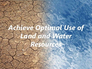
- 1. Achieve Optimal Use of Land and Water Resources
- 2. Course Title: Watershed and Wetland Management Course No: SWE- 3103 Soil, Water and Environment Discipline Khulna University
- 3. Group F Group Mates MD Rakib Hasan Student ID: 171319 Nasmin Naher Student ID: 171349 Adity Saha Student ID: 171350
- 4. Bangladesh Delta Plan • A holistic, adaptive and long-term (50 to 100 years) strategic plan for inter-linked land and water management. • The purpose is to maintain a sustainable living environment for the people • BDP provides a vision, scenario and strategies with long-term interventions and an investment plan
- 5. • There are six goals of Bangladesh Delta Plan including achieve optimal use of land and water resources. • Land management is the process of managing the use and development (urban & rural) of land resources. • Water resource management is the activity of planning, developing, distributing and managing the optimum use of water resources.
- 6. Land Use Integrating urban & rural land Guarding of floodplains Prioritizing decision- making. Natural Amenities & constraints Planting and maintaining vegetation
- 7. Water Resources Groundwater Storage Water quantity & quality Mitigation of aquifer salinization
- 8. Satisfactory Levels of Water Quantity and Quality • Quality of water suitable for human needs can vary widely. Sustainable development must ideally maintain the equilibrium of the natural ecosystem. • Minimal use of non-renewable sources could mitigate ambient environmental loss. • Improved irrigation methods should be encouraged, decreasing net water loss by employing drip rather than sprinkler or canal irrigation.
- 9. • Maximally treated effluents applied as primary sources for agricultural irrigation could ensuring minimal negative impact to groundwater quality and integrity of soils.
- 10. Satisfactory Groundwater Storage • Water supply management planning should ideally take drought periods into account, during which rainfall depths are smaller than the minimal amount required for recharge of a groundwater basin. • A desired level of efficient capture of natural rainfall drainage, tied to sustainable usage, would enable proper levels of recharge.
- 11. Mitigation of Aquifer Salinization by Preventing Sea Level Rise (SLR) • On-going sea level rise (SLR) can salinate coastal aquifers. • To minimize climate change that could lead to glacial melting and consequent SLR, appropriate measures would need to be adopted by all nations.
- 12. Guarding of Floodplains • Building in floodplains entails danger of significant potential loss to residents. • Proper flood plain management could preclude such loss. • Land-use alteration in floodplains for the purposes of residential or commercial purposes should be discouraged.
- 13. Planting and Maintaining Vegetation and Tree Cover • Vegetation enhances soil fertility by retaining soil aeration and often returning needed nitrogen by means of rhizobic nitrogen-fixing bacteria symbiotically tied to the roots of legumes. • Tree-cover and other vegetation filter the air, cleansing it of excess CO2 in return for added O2. • Root systems protect soil from erosion.
- 14. Integrating Urban & Rural Land- Use • A proper blend of urban and rural land-use could provide adequate rural amenities to urban areas and adequate urban amenities to rural areas. • Urban areas could enjoy clean air and water, maintenance of maximal tree and ground vegetative cover as well as maximal public access to natural amenities. • Rural areas could enjoy efficient and rapid public transportation access to such urban amenities as employment and education complexes, cultural centers, and sports facilities.
- 15. Prioritizing Decision-Making • People’s needs for sustainable natural resources and effective environmentally- oriented regional land-use planning begin with personal requirements for self- preservation. • Local concerns should integrate with neighborhood issues, and be tied in to regional needs and national and international priorities.
- 16. Natural Amenities and Constraints • A productive, cost-effective, and aesthetically pleasing approach towards land-use alteration, is based upon adjusting long-term regional planning. • This approach utilizes three critical natural parameters affecting regional land-use capabilities: lithology, soil type, and geomorphology. • Optimal land-use planning would be that which best cooperates with nature’s amenities and constraints by, for instance, enabling major anthropogenic land-use alteration on highlands and plateaus while reserving steeper slopes and flood plains for agriculture, open space, and recreation.
- 17. • One encourages and maximizes urban benefits in rural areas and rural benefits in urban areas. • An example of such a principle in urban areas encourages residential homes and blocks of flats, commercial centers, and even industrial buildings to gain significant visual appeal and corresponding financial worth by being surrounded by trees and well-planned vegetative cover, a practice long substantiated by real estate agents.
- 18. THANK YOU