Types of Clouds and Their Role in the Atmosphere
•Download as PPT, PDF•
2 likes•303 views

Earth Science Material with double languages 1. Basic Clouds (Dasar-Dasar Awan) 2. Cloud Type 1 (Type Awan 1) 3. Clouds Type 2 (Type Awan 2)

Recommended
More Related Content
Similar to Types of Clouds and Their Role in the Atmosphere
Similar to Types of Clouds and Their Role in the Atmosphere (20)
More from Roni Marudut Situmorang
More from Roni Marudut Situmorang (11)
Recently uploaded
Recently uploaded (20)
Types of Clouds and Their Role in the Atmosphere
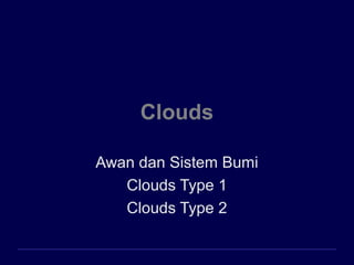
- 1. Clouds Awan dan Sistem Bumi Clouds Type 1 Clouds Type 2
- 2. Awan dan Sistem Bumi Roni Marudut Situmorang (@ronimarudut)
- 3. Awan Kumpulan butiran-butiran kecil air atau kristal-kristal es yang melayang di udara
- 4. Identifikasi Awan Awan tinggi * biasanya terbentuk diatas ketinggian 6000m * terbentuk hampir seluruhnya dari kristal es * agak tipis dan putih; menjelang matahari terbit/terbenam berwarna merah, orange dan kuning
- 5. Awan tinggi Cirrus seperti belaian tipis rambut/bulu melintas dari barat ke timur mencirikan cuaca yang baik dan nyaman Cirrocumulus seperti gumpalan kecil kapas, putih-bundar, individu atau dalam barisan menutupi hanya sebagian kecil dari langit bintik-bintik yang memantulkan warna merah dan kuning menjadikan awan ini paling indah Cirrostratus tipis seperti lembaran-lembaran menutupi seluruh langit matahari dan bulan dibalik awan ini masih terlihat kalau awan ini tebal, langit seperti putih berkilauan terbentuk sebelum badai sehingga dapat digunakan meramal hujan dalam 12 – 24 jam
- 6. Awan menengah * Berada pada ketinggian 2000 – 7000 m * Terdiri dari butiran-butiran air bila suhu cukup rendah terdapat juga kristal es Awan rendah * Berada pada ketinggian < 2000 m * Hampir seluruhnya terdiri dari butiran air
- 7. Awan Menengah Alto cumulus seperti gumpalan kapas lebih besar dari cirrocumulus, abu-abu, bergulung dalam gelombang yang sejajar kalau muncul pada pagi hari musim panas mengisyaratkan hujan menjelang sore hari Altostratus berwarna abu-abu atau biru abu-abu menutup langit sampai beratus-ratus kilometer pada bagian awan yang tipis, matahari/bulan masih terlihat lebih tebal dari cirrostratus sehingga pada permukaan tanah tidak menimbulkan bayangan mengisyaratkan hujan yang terus menerus, relatif lama
- 8. Awan rendah Nimbostratus berwarna abu-abu gelap matahari dan bulan dibalik awan ini tidak terlihat karena rendah sering tersapu angin membentuk sebaran- sebaran awan stratus fructus Mengisyaratkan hujan yang terus menerus dengan intensitas rendah Stratocumulus awan bergumpal yang rendah, berwarna cerah sampai abu-abu gelap muncul dalam kelompok dengan langit biru diantaranya sering muncul menjelang matahari terbenam jarang terjadi hujan dari awan ini Stratus awan keabu-abuan yang seragam menutup seluruh langit menyerupai kabut tetapi tidak menyentuh tanah biasanya tidak terjadi hujan atau kadang-kadang hanya rintik- rintik
- 9. Awan yang tumbuh vertikal Cumulus : seperti kapas, garis luar yang jelas, dasar rata 1000 m diatas tanah, lebar sekitar 1 km puncak awan berbentuk menara terpisah-pisah dengan langit biru diantaranya puncak seperti kubah/menara menjelang sore menjadi jauh lebih besar, tumbuh vertikal, mirip kembang kol menjadi cumulus congetus menyebabkan hujan yang menyebar Cumulus Cumulus congetus Cumulonimbus
- 10. Jika cumulus congetus terus bertumbuh vertikal akan terbentuk cumulonimbus Cumulonimbus awan badai dengan dasar gelap ketinggian dasar 300 m puncaknya > 12.000 m
- 11. Clouds Type 1
- 12. ENVI 1400 : Meteorology and Forecasting 12 Cloud Classification Four latin terms form the basis for the naming of clouds: – Cirrus : fibrous or hair-like – Cumulus : a heap or pile – Stratus : a horizontal sheet or layer – Nimbus : rain-bearing The prefix Alto is used to indicate medium altitude clouds. Terms, and basic classifications first proposed by Luke Howard in 1803. http://ww2010.atmos.uiuc.edu/(Gh)/guides/mtr/cld/cldtyp/home.rxml - good online guide
- 13. ENVI 1400 : Meteorology and Forecasting 13 High Level: – Cloud base above 6000m – Are all forms of cirrus (ice clouds) Medium Level: – Cloud base 2000-6000m Low level: – Cloud base below 2000m (within boundary layer)
- 14. ENVI 1400 : Meteorology and Forecasting 14 High-Level Clouds Cirrus (Ci): White, delicate, fibrous in appearance. Forms in patches or narrow bands. May for comma- shaped streaks or “mare’s tails” (cirrus uncinus) Cirrus clouds are formed entirely of ice crystals. These grow and evaporate slowly, leading to soft edges to clouds.
- 15. ENVI 1400 : Meteorology and Forecasting 15 Cirrostratus (Cs): Thin, transparent sheet or veil; sun clearly visible & casting shadows at surface. A halo may be seen around the sun (or moon). Sheets of cirrostratus may cover entire sky, and be up to several 1000m deep.
- 16. ENVI 1400 : Meteorology and Forecasting 16 Cirrocumulus (Cc): Thin white patch or sheet of cloud; appears dappled or rippled. Dappling results from convective overturning within the cloud, ripples from gravity waves. Aircraft contrails: condensation from aircraft exhaust. May dissipate quickly, or be very long- lived depending on conditions.
- 17. ENVI 1400 : Meteorology and Forecasting 17 Medium-Level Clouds Altostratus (As): A greyish sheet of cloud, may be fibrous or uniform in appearance. Thin enough in parts to make out the sun, but no halo.
- 18. ENVI 1400 : Meteorology and Forecasting 18 Altocumulus (Ac): white or grey patches arranged in sheets. Shape and texture are variable. There are several distinct sub-classes of altocumulus
- 19. ENVI 1400 : Meteorology and Forecasting 19 Altocumulus lenticularis (Ac len): white or grey lenticular (lens shaped) clouds formed by the lifting of air over a topographic barrier.
- 20. ENVI 1400 : Meteorology and Forecasting 20 Altocumulus castellanus (Ac cas): white or grey, broken cumulus-like clouds; upper part appearing castle-like. Sometimes arranged in lines.
- 21. ENVI 1400 : Meteorology and Forecasting 21 Altocumulus undulatus (Ac und): white or grey patches or sheets of cloud with an undulating or rippled appearance.
- 22. ENVI 1400 : Meteorology and Forecasting 22 Low-Level Clouds Cumulus (Cu): Brilliant white to grey, dense detached clouds. Forms clumped or heaped (cauliflower-like) shapes, usually with sharp outlines and flat base. Field of Cu often have bases all at same (lifting condensation) level.
- 23. ENVI 1400 : Meteorology and Forecasting 23 Cumulus humilis (Cu hum): small cumulus, of limited vertical extent, may have a flattened appearance. Also called fair- weather cumulus
- 24. ENVI 1400 : Meteorology and Forecasting 24 Cumulus mediocris : cumulus, of moderate vertical extent.
- 25. ENVI 1400 : Meteorology and Forecasting 25 Cumulus congestus: crowded (congested) field of cumulus or greater vertical extent. May produce rain.
- 26. ENVI 1400 : Meteorology and Forecasting 26 Pileus : cap clouds that form above large cumulus as the upward motion of the convective cloud distorts the layer of air above (pileus is latin for skull-cap)
- 27. ENVI 1400 : Meteorology and Forecasting 27
- 28. ENVI 1400 : Meteorology and Forecasting 28 Cumulonimbus (Cb) : huge towering cloud, dark base and white sides. Associated with heavy rain, thunderstorms, and hail. Frequently has an anvil shaped top.
- 29. ENVI 1400 : Meteorology and Forecasting 29 mammatus : smooth, rounded shapes sometimes formed on the underside of cumulonimbus; they result from downdrafts within the cloud.
- 30. ENVI 1400 : Meteorology and Forecasting 30 Stratocumulus (Sc) : white or grey sheet of cloud, usually formed in mounds or rolls.
- 31. ENVI 1400 : Meteorology and Forecasting 31
- 32. ENVI 1400 : Meteorology and Forecasting 32
- 33. ENVI 1400 : Meteorology and Forecasting 33 Stratocumulus with virga – hair-like strands of falling rain, which evaporate below cloud before reaching the surface.
- 34. ENVI 1400 : Meteorology and Forecasting 34 Stratus (St) : grey featureless layer of cloud with a uniform base. Often associated with drizzle or snow.
- 35. ENVI 1400 : Meteorology and Forecasting 35 Nimbostratus (Ns) : Dark grey, featureless, thick layer of cloud. Associated with prolonged precipitation. Commonly forms in frontal systems
- 36. ENVI 1400 : Meteorology and Forecasting 36 Precipitation • Cloud droplets require a condensation nuclei on which to form; growth then occurs by deposition of water molecules from vapour. – Growth is limited by local supersaturation of the vapour – Growth rate decreases as droplet size increases • Cloud droplets are typically 10 to 30 µm in diameter. Growth/evaporation can occur within a few 10s of seconds. • Rain drops are typically 0.5 to 5 mm in diameter, growth from the vapour would take several hours – longer than the lifetime of typical convective clouds.
- 37. ENVI 1400 : Meteorology and Forecasting 37 • In order to grow into rain drops, cloud droplets must grow by coalescence – Larger droplets fall faster than small ones, and can collide with them – The process by which a sufficient number of large enough droplets is generated remains a topic of active research • Ice crystals provide a more efficient process – Saturation vapour pressure over ice is less than that over water ⇒ ice crystals grow at expense of water droplets – If ice crystal touches a droplet, the droplet freezes – Once large enough, ice crystals – or clumps of crystals – fall past droplets and collect them. Rapid growth of soft hail pellet (graupel) by riming. – Graupel falls from cloud, melting before reaching the surface as rain
- 38. ENVI 1400 : Meteorology and Forecasting 38 Cloud Radiative Effects • Clouds play an important controlling role in the global radiation budget. – Reflection of incoming solar (short-wave) radiation – Absorption of both solar and thermal infra red (long- wave) radiation (incoming & outgoing) – Emission of infra red radiation (up and down) • The altitude, type, and thickness of cloud, along with that of clouds above & below determines whether the local net effect is to warm or cool the air & surface below.
- 39. ENVI 1400 : Meteorology and Forecasting 39 Vertical Transport • Deep convective clouds play a major role in mixing boundary layer air – along with moisture, aerosol particles, and gases (both natural and man-made pollutants) – up into the free-troposphere.
- 40. ENVI 1400 : Meteorology and Forecasting 40 Chemistry • Clouds provide an environment within which aqueous phase chemical reactions can take place within the atmosphere • Aerosol particles can be substantially modified within clouds – Aqueous phase reactions with gases dissolved in droplets – Coalescence of droplets brings multiple aerosol particles together • Chemically different aerosol may react • On evaporation of droplet, a single aerosol particle is formed, containing material from all contributing droplets
- 41. Clouds Type 2
- 42. Cloud classification • Originally by Luke Howard (1850’s) • Currently used nomeclature based on Abercromy & Hildebrandsson (1887) • Linnean system (genus, species) • morphological only, not genealogical Latin Root Translation Example cumulus heap fair weather cumulus stratus layer altostratus cirrus curl of hair cirrus nimbus rain cumulonimbus
- 43. Cloud subclassification Further classification identifies clouds by height of cloud base. 3 levels Examples: the prefix "cirr-" (as in cirrus clouds) refers to high levels, the prefix "alto-" (as in altostratus) refers to middle levels.
- 44. Relative heights vary zonally 0 2,000 4,000 6,000 8,000 10,000 12,000 14,000 16,000 18,000 20,000 metersagl Tropics Midlatitudes Poles H M L H M L H M L tropopause
- 45. Cloud types and relative altitudes
- 46. High clouds composed of ice crystals fibrous or filamentous shape ice crystal concentration generally very small
- 47. Cirrus uncinus (mares’ tails) Height (km): 7-10 km+ Falling light snow [fallstreaks], not reaching the ground. distorted by upper-tropospheric wind shear.
- 48. Cirrus uncinus Cirrus floccus Cirrus uncinus Cirrus fibratus vertibratus Cirrus
- 49. Cirrus Cirrus spissatus Cirrus spissatus with virga Cirrus uncinus
- 50. Cirrostratus continuous sun shines thru, no precipitation process: widespread ascent aloft, or old thunderstorm anvil halo
- 51. Cirrocumulus Cs broken into waves sun shine thru, no precipitation process: widespread ascent combined with convective overturning in a thin layer.
- 52. Middle clouds Altostratus clouds occur as uniformly gray or white layers that totally or partially cover the sky. They are usually so thick that the sun is only dimly visible, as if viewed through frosted glass. * occur at altitudes where temperatures range between 0 and -25ºC (32 and -13ºF). * composed of supercooled water droplets, or are in mixed-phase (supercooled water droplets and ice crystals).
- 53. Altostratus Height (km): base=2-6 km, can be thick, liquid or ice, no precipitation reaching the ground. Process: widespread stable ascent, often preceding a surface warm front. Altostratus has a uniform and diffuse coverage
- 55. Altocumulus base=2-6 km, usually thin, usually liquid, no precipitation. Process: widespread ascent combined with convective overturning aloft (left) or with wave activity (right) clear regions descending air cloudy regions ascending air
- 56. Altocumulus Altocumulus castellanus Altocumulus stratiformis Sharp cloud boundaries indicate the presence of water droplets rather than ice crystals.
- 58. Low-Level Clouds * usually at temperatures above -5ºC (23ºF) * composed mostly of water droplets. geostationary satellite precipitation
- 59. Stratus Base>0.1 km, top<3 km, liquid (or ice), may have drizzle falling. Process: stable ascent, mixing Fog occurs when stratus meets the ground; when it lifts, it may break up into stratocumulus.
- 62. Stratocumulus Shallow, usually liquid, no precipitation Process: forced or spontaneous overturning in a shallow layer
- 64. cumulus Buoyantly rising air parcels (thermals) become saturated Cu cloud base … LCL Shallow or deep LCL→ Cu humulis Cu mediocris Cumulonimbus
- 65. Fair-Weather Cumulus Widely separated heap clouds of small vertical development. With flat bottoms and rounded tops, they resemble a flock of sheep grazing in a pasture.
- 66. Cu humilis or mediocris
- 67. Cumulus congestus Larger and deeper → cauliflower appearances to the tops. Base is flattish, representing the LCL. Can produce showers. Cloud top=5-7 km, above the freezing level but usually still liquid.
- 68. Cumulonimbus Look at this animation
- 70. 12 June 2004, Hastings NE. Photo by Doug Raflik
- 71. Cumulonimbus: the most active member of the cumulus family Convective family over the South China Sea
- 72. Cumulonimbus
- 73. Pop quizzes: cloud identification A: cirrusA: cirrus B: cirrostratusB: cirrostratus C: cirrocumulusC: cirrocumulus D: altostratusD: altostratus E: altocumulusE: altocumulus F: stratusF: stratus G: stratocumulusG: stratocumulus H: cumulus humilisH: cumulus humilis I: cumulus congestusI: cumulus congestus J: cumulonimbusJ: cumulonimbus J: nimbostratusJ: nimbostratus
- 74. a mid-level cloud in the lee of mountain ranges cirruscirrus cirrostratuscirrostratus cirrocumuluscirrocumulus altostratusaltostratus altocumulusaltocumulus stratusstratus stratocumulusstratocumulus cumulus humiliscumulus humilis cumulus congestuscumulus congestus cumulonimbuscumulonimbus nimbostratusnimbostratus
- 75. cirruscirrus cirrostratuscirrostratus cirrocumuluscirrocumulus altostratusaltostratus altocumulusaltocumulus stratusstratus stratocumulusstratocumulus cumulus humiliscumulus humilis cumulus congestuscumulus congestus cumulonimbuscumulonimbus nimbostratusnimbostratus
- 76. cirruscirrus cirrostratuscirrostratus cirrocumuluscirrocumulus altostratusaltostratus altocumulusaltocumulus stratusstratus stratocumulusstratocumulus cumulus humiliscumulus humilis cumulus congestuscumulus congestus cumulonimbuscumulonimbus nimbostratusnimbostratus
- 77. Hint: it is overcast, but not raining cirruscirrus cirrostratuscirrostratus cirrocumuluscirrocumulus altostratusaltostratus altocumulusaltocumulus stratusstratus stratocumulusstratocumulus cumulus humiliscumulus humilis cumulus congestuscumulus congestus cumulonimbuscumulonimbus nimbostratusnimbostratus
- 78. cirruscirrus cirrostratuscirrostratus cirrocumuluscirrocumulus altostratusaltostratus altocumulusaltocumulus stratusstratus stratocumulusstratocumulus cumulus humiliscumulus humilis cumulus congestuscumulus congestus cumulonimbuscumulonimbus nimbostratusnimbostratus
- 79. cirruscirrus cirrostratuscirrostratus cirrocumuluscirrocumulus altostratusaltostratus altocumulusaltocumulus stratusstratus stratocumulusstratocumulus cumulus humiliscumulus humilis cumulus congestuscumulus congestus cumulonimbuscumulonimbus nimbostratusnimbostratus
- 80. Hint: this cloud layer is low cirruscirrus cirrostratuscirrostratus cirrocumuluscirrocumulus altostratusaltostratus altocumulusaltocumulus stratusstratus stratocumulusstratocumulus cumulus humiliscumulus humilis cumulus congestuscumulus congestus cumulonimbuscumulonimbus nimbostratusnimbostratus
- 81. Hint: this cloud layer is high cirruscirrus cirrostratuscirrostratus cirrocumuluscirrocumulus altostratusaltostratus altocumulusaltocumulus stratusstratus stratocumulusstratocumulus cumulus humiliscumulus humilis cumulus congestuscumulus congestus cumulonimbuscumulonimbus nimbostratusnimbostratus
- 82. this is a halo cirruscirrus cirrostratuscirrostratus cirrocumuluscirrocumulus altostratusaltostratus altocumulusaltocumulus stratusstratus stratocumulusstratocumulus cumulus humiliscumulus humilis cumulus congestuscumulus congestus cumulonimbuscumulonimbus nimbostratusnimbostratus
- 83. Hint: it is raining cirruscirrus cirrostratuscirrostratus cirrocumuluscirrocumulus altostratusaltostratus altocumulusaltocumulus stratusstratus stratocumulusstratocumulus cumulus humiliscumulus humilis cumulus congestuscumulus congestus cumulonimbuscumulonimbus nimbostratusnimbostratus
- 85. A few other cloud visual clues 1. anvil development process: buoyant ascent lightning usual (lightning is rare over the oceans) much precip evaporates if LCL is high view this animation
- 86. Cumulonimbus: Severe weather lightning, thunder, heavy rains, hail, strong winds, and tornadoes … Model simulations: Typical thunderstorm Severe thunderstorm
- 87. Cumulonimbus: Shelf clouds We are just ahead of a severe thunderstorm. Dewpoints are in the mid-70s. Winds gust to over 40 mph with the passage of this shelf cloud. Evaporatively cooled air is pushed out of the precipitation area by the downdraft, warm air slides up and over the gust front forming the concave- shaped shelf cloud.
- 88. Cumulonimbus: Mammatus clouds pockets of negatively-buoyant air, filled with snow suspended from the anvil base
- 89. Mesoscale Convective Complexes Radar animation
- 90. Orographic and wave clouds Orographic clouds are produced by the flow of air interacting with mountainous terrain. They often indicate areas of clear air turbulence. mountain wave lee wave
- 92. Lenticular clouds Altocumulus lenticularis are the "mountain-wave clouds." As strong horizontal winds encounter a mountain range, gravity waves propagate upwards, and leeward. Mountain waves are stationary.
- 93. Ac lenticularis elsewhere RH stratification may yield a ‘stack of pancakes’ Plymouth, NH, 3 Dec ‘96 Which one is liquid which one ice ?
- 95. Mountain-wave turbulence Föhn wall cloud, Rockies turbulent rotor cloud in Owens Valley, CA, downwind of the Sierras.
- 96. Mountain-wave turbulence : Banner clouds
- 97. Banner cloud or lenticular cloud ? (same mountain)
- 98. Kelvin-Helmholtz waves and KH billows KH waves form when strong wind shear overturns a stable layer (i.e., an inversion). They are usually invisible! (CAT)
- 100. Breaking billows – an aviation hazard
- 101. ← Kelvin- Helmholtz waves on Jupiter. Colors indicate the clouds' altitudes: blue is lowest through red as highest.
- 102. Cap clouds Pileus, Latin for "skullcap," is a smooth cloud that forms when a stable, humid layer aloft forced to rise by a penetrating Thunderstorm cell. ← cap cloud on a Cb Pileus cloud attached to the top of a cumuliform cloud.
- 103. “Morning glory” roll clouds These occur when a deep stable layer overruns a shallower stable layer. Gravity waves ahead of the deep layer result in roll clouds, and may cause severe turbulence. λ ~1000 km
- 104. Air rises and condenses at the leading edge, and evaporates behind
- 105. These cigar-shaped clouds also occur in the US, mainly in spring
- 106. note the stably stratified layer below, and the more turbulent one above
Editor's Notes
- In the tropics, air temperatures cold enough to glaciate clouds (thereby forming cirrus clouds) occur only above ~7000 m. In polar regions, these same temperatures can be found at altitudes as low as ~3000 m.
- Lenticular (Plymouth State College)
- Cirrus
- Cumulonimbus with small pileus
- Stratus
- Cumulus congestus
- Fair weather cumulus
- Stratocumulus
- Altocumulus
- Cirrostratus with halo
- Nimbostratus (Plymouth State College Photo)
- Lenticular (Plymouth State College)
- Downslope winds gather dust on the valley floor and serve as a tracer of the air rising suddenly into the cloud. Over the mountains themselves, (upper right) a portion of a Föhn wall cloud can be seen. Downslope winds gather dust on the valley floor and serve as a tracer of the air rising suddenly into the cloud. Over the mountains themselves, (upper right) a portion of a Föhn wall cloud can be seen. Downslope winds gather dust on the valley floor and serve as a tracer of the air rising suddenly into the cloud. Over the mountains themselves, (upper right) a portion of a Föhn wall cloud can be seen.