Energy is the beat of life irrespective of the domains. ATP- the energy curre...
Meteorology final mc neace
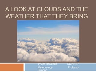
1. A LOOK AT CLOUDS AND THE
WEATHER THAT THEY BRING
Tyyler McNeace SCIN 137
Meteorology Professor
Strahan
2. What is a cloud?
Before we look at the different types of clouds and
the weather that they bring, it is important to
understand what a cloud is, and how they form.
Clouds are tiny drops of water/ice that settle onto
dust into the atmosphere.
They are 100th of mm with one cubic metre having
up to 100million droplets
They form when water vapor in air condenses into
water droplets or ice crystals. When cooled, the
water vapor sticks to aerosols through
condensation. Larger droplets will form around
the particles, adhering to each other. This is how a
cloud forms! (Met Office, 2013).
3. How do they form?
Clouds can form in two ways
1. The amount of water in the air has increased
This can occur during evaporation. The air will no
longer be able to hold the water and form clouds.
2. Air becomes cooled to its dew point
The dew point is the point at which condensation
occurs.
Warm air can hold more water vapor. As the warm air
rises it cools down from temperature. Once cooled the
air is no longer able to hold the water vapor and
condensation begins. (Met Office, 2013).
5. 5 Factors Which Cause Clouds to
Form
Surface Heating- This happens when the ground is
heated by the sun which heats the air in contact with it
causing it to rise.
Topography or orographic forcing- Shape and features
of an area can cause clouds to form as it rises over
mountains, hills, barriers, it will cool as it rises.
Frontal- Clouds are forms when warm air rises up
over a mass of cold, dense air over large areas along
front.
Convergence- Streams of air flowing from different
directions are forced to rise where the flow together.
Turbulence- A sudden change in wind speed with
height creating turbulent eddies in the a air. (Met
Office, 2013).
6. Cloud Types
Different cloud formations can be identified base on both their
shape and height in the sky. Clouds can be found very low to the
ground, as well high up into the sky with colors ranging to
grey/black to bright white. (Met Office, 2013).
High Clouds:
Cirrocumulus
Cirrus
Cirrostratus
Mid-Level Clouds:
Altocumulus
Altostratus
Low-Level Clouds:
Stratus
Cumulus
Stratocumulus
Cumulonimbus
9. High Clouds
Cirrocumulus Cirrus Cirrostratus
Cirrocumulus-clouds are small rounded puffs that usually appear in long rows high in the sky.
Cirrocumulus are usually white, but sometimes appear gray.. When these clouds cover a lot of
the sky, they can look like the scales of a fish, which is it is called a "mackerel sky.”
Cirrocumulus are common in winter and indicate fair, but cold, weather.
Cirrus- clouds are made of ice crystals and look like long, thin, wispy white streamers high in
the sky. They are commonly known as "mare's tails" because they are shaped like the tail of a
horse. Cirrus clouds predict fair weather.
Cirrostratus- clouds are high, thin sheet-like thin clouds that usually cover the entire sky. The
clouds are so thin that the Sun or moon can sometimes shine through and appear to have a
halo as light hits the ice crystals and bends. The halo is the width of your hand held at arm's
length. Cirrostratus clouds usually come 12 to 24 hours before a rain or snowstorm (UCAR
10. Mid-Level Clouds
Altocumulus Altostratus
Altocumulus-clouds are mid-level, grayish-white with one part darker than the other.
Altocumulus clouds usually form in groups and are about one kilometer thick. If you see
altocumulus clouds on a warm, humid morning, there might be a thunderstorm by late
afternoon.
Nimbostratus- clouds are dark gray, have ragged bases and sit low in the sky. Nimbostratus
clouds are associated with continuous rain or snow. Sometimes they cover the whole sky and
you can't see the edges of the cloud.
Altostratus- clouds are mid-level, gray or blue-gray clouds that usually covers the whole sky.
The Sun or moon may shine through an altostratus cloud, but will appear watery or fuzzy. If you
see altostratus clouds, a storm with continuous rain or snow might be on its way. Occasionally,
rain falls from an altostratus cloud. If the rain hits the ground, then the cloud has become a
Nimbostratus
11. Low-Level Clouds
Stratus Cumulus Stratocumulus
Stratus-clouds are low and have a uniform gray in color and can cover most or all of the sky.
Stratus clouds can look like a fog that doesn't reach the ground. Light mist or drizzle is
sometimes falling when stratus clouds are in the sky.
Cumulus- clouds have vertical growth. They are puffy white or light gray clouds that look like
floating cotton balls. Cumulus clouds have sharp outlines and a flat base at a height of 1000m.
Cumulus clouds can be associated with fair or stormy weather.
Stratocumulus-Stratocumulus clouds are low, lumpy, and gray. Sometimes they line up in rows
and other times they spread out. Only light rain (usually drizzle) falls from stratocumulus clouds.
To distinguish between a stratocumulus and an altocumulus cloud, point your hand toward the
cloud. If the cloud is about the size of your fist, then it is stratocumulus (UCAR Center for
Education and Science, 2015).
12. Low-Level Clouds (Cont.)
Cumulonimbus
Cumulonimbus- clouds also have vertical growth and can grow up to 10 km high. At this height,
high winds will flatten the top of the cloud out into an anvil-like shape. Cumulonimbus clouds are
thunderstorm clouds and are associated with heavy rain, snow, hail, lightning, and sometimes
tornadoes (UCAR Center for Education and Science, 2015).
13. References:
Cloud formation Jpg. (n.d.). Retrieved May 15, 2015, from
https://s-media-cache-
ak0.pinimg.com/originals/0d/1b/e7/0d1be749a1fcd89a322c145d
e40507c0.jpg.
UCAR Center for Education and Science. (2015). Cloud Image
Gallery. Retrieved May 18, 2015, from
https://scied.ucar.edu/cloud-image-gallery.
Met Office. (2013). Weather Phenomena. What are clouds and
how do they form?. Retrieved May 16, 2015, from
http://www.metoffice.gov.uk/learning/clouds/what-are-clouds.
Editor's Notes
Met Office. (2013). Weather Phenomena. What are clouds and how do they form?. Retrieved May 16, 2015, from http://www.metoffice.gov.uk/learning/clouds/what-are-clouds.
Met Office. (2013). Weather Phenomena. What are clouds and how do they form?. Retrieved May 16, 2015, from http://www.metoffice.gov.uk/learning/clouds/what-are-clouds.
Cloud formation Jpg. (n.d.). Retrieved May 15, 2015, from https://s-media-cache-ak0.pinimg.com/originals/0d/1b/e7/0d1be749a1fcd89a322c146de40507c0.jpg.
Met Office. (2013). Weather Phenomena. What are clouds and how do they form?. Retrieved May 16, 2015, from http://www.metoffice.gov.uk/learning/clouds/what-are-clouds.
Met Office. (2013). Weather Phenomena. What are clouds and how do they form?. Retrieved May 16, 2015, from http://www.metoffice.gov.uk/learning/clouds/what-are-clouds.
NOVA PBS. (2013). Clouds and Weather. Retrieved May 23, 2015, from https://www.youtube.com/watch?v=hJ6aeSv8xIU.
Cloud formation Jpg. (n.d.). Retrieved May 15, 2015, from https://s-media-cache-ak0.pinimg.com/originals/0d/1b/e7/0d1be749a1fcd89a322c146de40507c0.jpg.
UCAR Center for Education and Science. (2015). Cloud Image Gallery. Retrieved May 18, 2015, from https://scied.ucar.edu/cloud-image-gallery.
UCAR Center for Education and Science. (2015). Cloud Image Gallery. Retrieved May 18, 2015, from https://scied.ucar.edu/cloud-image-gallery.
UCAR Center for Education and Science. (2015). Cloud Image Gallery. Retrieved May 18, 2015, from https://scied.ucar.edu/cloud-image-gallery.
UCAR Center for Education and Science. (2015). Cloud Image Gallery. Retrieved May 18, 2015, from https://scied.ucar.edu/cloud-image-gallery.