SlideShare a Scribd company logo
1 of 51
Download to read offline
CERTIFICATE
This is to certify that , Students of M.Tech (I), Urban Planning has successfully completed
the Study Vist Report on the “Educational Tour: Jaipur” under the guidance of Dr. Chetan R.
Patel during the year 2017- 2018 in partial fulfillment of course of subject of Planning Studio
(CE-637) conducted under P.G. Section of Urban Planning, SVNIT, Surat.
Kishan Movaliya (P17UP001)
Abhishek Jariwala (P17UP0003)
Dharmesh Tarasariya (P17UP005)
Akshit Panchani (P17UP006)
Ketan Vora (P17UP007)
Nitesh Shukla (P17UP008)
Ashwani Yadav (P17UP009)
Yajush Sonar (P17UP010)
Rumendra Babu (P17UP011)
Himani Jayswal (P17UP012)
Pooja Mahajan (P17UP013)
Swapnil Pharande (P17UP014)
Neelam Pasi (P17UP015)
Saurabh Baderao (P17UP016)
Arnab Halder (P17UP017)
Jigar Patel (P17UP018)
Vaibhavi Patel (P17UP019)
Manisha Garasia (P17UP020)
Faculty Advisor,
Dr. Chetan R. Patel
December-2017
P.G Section (Urban Planning),
Department of Civil Engineering,
सरदार वल्लभभाई रा�ीय �ौ�ोिगक� संस्थान, सूरत
Sardar Vallabhbhai National Institute of Technology,
Surat, Gujarat
ACKNOWLEDGEMENT
We earnestly wish to express our heartfelt thanks and a sense of gratitude to Dr. Chetan R.
Patel (Asst. Professor and P.G. Section Head, Urban Planning, SVNIT) and Dr. Ravin M.
Tailor (Asst. Professor and P.G. Incharge, Urban Planning, SVNIT) for his valuable
guidance and constant inspiration in preparing this report by arranging an Educational tour
for us. We also acknowledge the inspiration and encouragement provided by him. Frequent
interactions with him in all aspects of the report making have been a great learning
experience. We shall always cherish his support and encouragement.
Kishan Movaliya (P17UP001)
Abhishek Jariwala (P17UP0003)
Dharmesh Tarasariya (P17UP005)
Akshit Panchani (P17UP006)
Ketan Vora (P17UP007)
Nitesh Shukla (P17UP008)
Ashwani Yadav (P17UP009)
Yajush Sonar (P17UP010)
Rumendra Babu (P17UP011)
Himani Jayswal (P17UP012)
Pooja Mahajan (P17UP013)
Swapnil Pharande (P17UP014)
Neelam Pasi (P17UP015)
Saurabh Baderao (P17UP016)
Arnab Halder (P17UP017)
Jigar Patel (P17UP018)
Vaibhavi Patel (P17UP019)
Manisha Garasia (P17UP020)
CONTENTS
List of Figures
List of tables
1. Introduction 1-3
1.1. General
1.2. Schedule of activities
2. Study Area: Jaipur 4-36
2.1. City overview
2.1.1. General
2.1.2. Origin of the city and its subsequent layout
2.1.3. Planning of the city
2.1.4. Conceptual Prastara plan
2.1.5. Concept behind Pink colour
2.1.6. Road network
2.1.7. Public spaces
2.1.8. Conceptual plan – Chaupar
2.1.9. Streetscapes and Chowks
2.1.10. Bazaars
2.2. Survey of various important visit places
2.2.1. Jaigarh Fort
2.2.2. Nahargarh Fort
2.2.3. Amer Fort
2.2.4. City Palace
2.2.5. Hawa Mahal
2.2.6. Jantar Mantar
2.2.7. Birla Mandir
2.2.8. Vidyadhar Nagar
3. Study Area: Pushkar and Ajmer 37-40
3.1. City overview
3.1.1. Pushkar City overview
3.1.2. Ajmer City overview
4. Summary 41-42
LIST OF FIGURES
Jaipur Location Map
Sr. No. Figure Name Page No.
1. Jaipur Master DP-2025 5
2. Jaipur Location Map 6
3. Site selection 7
4. Military strategy for site selection 8
5. Geographical reasons behind site selection 8
6. Pink City Plan 9
7. Conceptual Prastara Plan (Vaastu Purush) 10
8. Badi Chaupar Conceptual plan 12
9. Jaigarh Fort 14
10. Jaivana cannon 15
11. Part of rain water harvesting, Jaigarh 16
12. Nahargarh Fort view 17
13. Nahargarh Check posts 18
14. Madhvendra Palace, Nahargarh 18
15. Ganesh Gate, Amer Fort 19
16. Sukh Niwas, Amer Fort 19
17. Diwan-i-am, Amer Fort 22
18. City palace Jaipur 22
19. City Palace Entrance gate 23
20. City Palace Chandra Mahal 24
21. City Palace Mubarak Mahal 24
22. City Palace Diwan-i-aam 25
23. City Palace Diwan-i-khas 25
24. Hawa Mahal 26
25. Hawa Mahal Jharokha’s 27
26. Jantar Mantar 28
27. Chakra Yantra 29
28. Dakshin Bhittin Yantra 29
29. Digamsha Yantra 30
30. Jaiprakash Yantra 30
31. Kapali Yantra 31
32. Vrihat Samrat Yantra 32
33. Birla Mandir 35
34. Vidyadhar Nagar Master Plan 36
35. Location Map of Pushkar 37
36. Brahma Ghat, Pushkar 38
37. Location Map of Ajmer 39
38. Group Photo 42
LIST OF TABLES
Sr. No. Table Name Page No.
1. Journey Schedule 1
CHAPTER 1
INTRODUCTION
1.1. General:
This Educational Tour was done for the Academic fulfilment of the course of CE-637,
Planning Studio 1. It was expected to study and survey the places of Historic and
Architectural importance. Being the students of Urban planning, different aspects from
planning fundamentals, History, Origin, Transportation, Housing elements, etc is to be
analysed through various case studies by visiting the different places rich in concepts from
Town planning, Architecture, etc. Jaipur being a City of great Indian History along-with
application of vaastu-shastra and shilp-shastra for Town Planning.
1.2. Schedule of activities:
Table.1. Journey Schedule
Departure
Date and
Time
Arrival
Date and
Time
Location Date of
Visit
Places Of Visit Travel
mode
4th
Dec.
2017 at
10:40 pm
5th
Dec.
2017 at
2:00 pm
Surat to
Jaipur
5/12/17 1. Birla Mandir as a
Social
Infrastructure.
2. Pink City and
Interaction with
Public and
Authority.
Mumbai
Jaipur
Express
(Indian
Railways
6/12/17 1. Water conservation
model of Jaigarh.
2. Protection strategy
for Pink City and
Fort planning of
Nahargarh.
3. Jal Mahal.
4. Planning of Amer
Fort.
7/12/17 1. Study of planning of
Hawa Mahal, Jantar
Mantar and Pink
City, its design,
architecture and
history.
8th
Dec.
2017 at
7:00 am
8th
Dec.
2017 at
11:30 am
Jaipur to
Pushkar
8/12/17 Visit to pilgrim cities of
Pushkar and Ajmer for the
study of Urban Design.
Local
traveller Bus
8th
Dec.
2017 at
2:00 pm
8th
Dec.
2017 at
2:45 pm
Pushkar to
Ajmer
Local
traveller Bus
8th
Dec.
2017 at
9th
Dec.
2017 at
Ajmer to
Surat
Ajmer Puri
Express via
5:30 pm 6:30 am Surat
CHAPTER 2
STUDY AREA: JAIPUR
2. 1. City overview:
2.1.1. General:
Jaipur is the capital and the largest city of the Indian state of Rajasthan in Western India. It
was founded on 18 November 1727 by Jai Singh II, the ruler of Amer after whom the city is
named. As of 2011, the city has a population of 3.1 million, making it the tenth most
populous city in the country. Jaipur is also known as the Pink City of India. Jaipur is located
280 km (174 miles) from the Indian capital New Delhi. Jaipur forms a part of the
west Golden Triangle tourist circuit along with Agra (240 km, 149 mi). Jaipur is a
popular tourist destination in India and serves as a gateway to other tourist destinations in
Rajasthan such as Jodhpur (348 km, 216 mi), Jaisalmer (571 km, 355 mi) Udaipur (421 km,
262 mi) and Mount Abu (520 km, 323 mi). Jaipur is home to two UNESCO World Heritage
Sites: the Jantar Mantar and the Amer Fort.
The city was planned according to Indian Vastu shastra by Vidyadhar Bhattacharya in 1727.
There are three gates facing east, west, and north. The eastern gate is called Suraj pol (sun
gate), the western gate is called Chand pol (moon gate) and the northern gate faces the
ancestral capital of Amer.
The city is unusual among pre-modern Indian cities in the regularity of its streets, and the
division of the city into six sectors by broad streets 34 m (111 ft) wide. The urban quarters
are further divided by networks of gridded streets. Five quarters wrap around the east, south,
and west sides of a central palace quarter, with a sixth quarter immediately to the east. The
Palace quarter encloses the Hawa Mahal palace complex, formal gardens, and a small lake.
Nahargarh Fort, which was the residence of the King Sawai Jai Singh II, crowns the hill in
the northwest corner of the old city.
Fig.1. Jaipur Master DP-2025
Fig.2. Jaipur Location Map
2.1.2. Origin of the city and its subsequent layout:
The need of a new capital for 18th century Dhoondhar as the earlier one of Amber built on a
hill was getting congested. Sawai Raja Jai Singh’s vision of the new capital as a strong
political statement at par with Mughal cities and as a thriving trade and commerce hub for the
region.
• Site: a valley located south of Amber and the plains beyond, a terrain that was the bed
of a dried lake; dense forest cover to the north and the east of the site.
• Physical constraints: hills on the north that housed the fort of Jaigarh and the Amber
palace beyond, and the hills on the east, which contained the sacred spot of Galtaji.
• Water supply: the Darbhavati river in the north was dammed to create the Jai Sagar
and Man Sagar (that later housed the Jal Mahal) lakes. Later the Jhotwara River in the
north west was diverted through the Amani Shah Nallah and a number of canals were
channelized through Brahmapuri and Jai Niwas to supply water to the city. The site
with the natural east west ridge and the surrounding forts as defence. The medieval
towns of Rajasthan were of military, agrarian, mercantile or religious nature. The
presence of a deity marked the reference point for the ruler’s abode and the rest of the
city. The name of the town was usually associated with the political or religious
centre (with the Ambikeshwar temple in the case of Amber and with Sawai Jai Singh
in the case of Jaipur). The hill town of Dausa with an organic layout guided by the
topography Town with the Fort on top of the hill and the walled.
2.1.3. Planning of the city:
• Unlike Dausa and Amber, the two previous capital cities of the Dhoondhar region
established on hilltop, whose planning was guided by topographical structure of the
areas, Jaipur city was revolutionary both in terms of its grid-iron pattern planning and
its location at the base of the hills.
• There was also a significant economic shift from an agricultural base in Dausa and
Amber to trading in the capital of Jaipur.
• The layout of the city of Jaipur wonderfully links the concept of a Shastric city with
the practicalities of the chosen site.
• First, the straight line of the ridge suggested itself as the route for one of the main
east-west thorough fares and building a road along its crest makes best possible use of
the topography for the purpose of drainage.
• What followed then was to regularize the Amber Sanganer road as a north-south route
at right angles to it.
• The point of intersection would be one of the city’s main cross-roads (chaupar). The
intersection of the axes to define the Badi Chaupar (City Square).
• A road cutting the plain from N to S linking Amber, the capital to Sanganer, the
principal trading town. This road had to be preserved and controlled and therefore had
to fall within the city’s boundaries
• A second road ran E to W between the Mughal cities of Agra and Ajmer and placing
the new city on this already established communication line would help secure its
economic success. However since this was an imperial road that could not be
encroached on, thus the city had to be contained to the north of this line.
• Also, a natural ridge runs across the plain, N of the road and parallel to it, in a roughly
EW alignment (with a slight deviation of 15 deg. from the cardinal axes). The area to
its S is flat while that to its N slopes down gently. In Shastric terms, this is an ideal
arrangement as declivity towards the north-east is considered the best site. In practical
terms, the ridge too had to be accommodated.
• It is a model of town planning the first planned city in India. It is based on Hindu
systems of town planning and followed the principles prescribed in the Shilpa-shastra,
an ancient Indian treatise on architecture .according to this shastra the site should be
divided into grids or mandalas ranging from 2x 2 to 10 x 10.
• Planned according to the Prastara type of layout, which gives prominence to the
cardinal directions.
• Thus plan of jaipur is a grid of 3x3 with gridlines being the city’s main streets.
Fig.2. Site selection
Fig.3. Military strategy for site selection
Fig.4. Geographical reasons behind site selection
Fig.5. Pink City Plan
2.1.4. Conceptual Prastara plan:
• The central axis of the town was laid from East to West between the gates of the Sun
(Suraj pol) and the moon (Chandpol).
• This was crossed by two roads at right angles dividing the town into nine almost
square, almost equally sized blocks, which were further sub divided by lanes and
alleys all at right angles.
• By building the western boundary of the city right up to the hill’s southern apex, it
provided a continuous line of defence.
• The mandala could not be complete in the NW due to the presence of the hills.
• On the other hand in the SE an extra square has been added that plugged the gap
between the city and the eastern hills.
• South of the main road were four almost equal rectangles. The rectangle opposite the
palace has been broken up into two equal and smaller rectangles by the Chaura Rasta.
Thus altogether there are now five rectangles on the south of the main road called
Chowkris.
• On the North of the main road from West to East are the Purani Basti, the Palace and
Ramchandraji.
The principal bazaar leads from the western gate in the city wall, The Chandpole, passing in
front of the Tripolia Gate, to the eastern city gate, the Surajpole. The palace building covered
two blocks, the town six and the remaining ninth block was not usable on account of steep
hills. So this North-West ward was transferred to the South-East corner of the city, making
the shape of the plan as a whole asymmetrical rather than square. Following the directions of
the Hindu Shilpa shastra, width of the main streets & other lanes were fixed. Thus the main
streets of the city were 111ft. wide, secondary streets 55 ft. wide & the smaller ones 27ft.
wide.
Fig.6. Conceptual Prastara Plan (Vaastu Purush)
2.1.5. Concept behind Pink colour:
Jaipur is known as the Pink City, a rather idealized description of the terra-cotta coloured
lime plaster that coats the old part of the city's walls, buildings, and temples.
The reasons for painting the town pink are unknown, but various theories have been tossed
about:
• Using pink to cut down glare
• Jai Singh II's apparent devotion to Lord Shiva (whose favourite colour is reputedly
terra cotta).
• Others believe Singh wanted to imitate the colour of the sandstone used in the forts
and palaces of his Mughal emperor-friends.
• The most popular reason (spread no doubt by "Britishers" during the Raj era) is that
pink is the traditional colour of hospitality, and the city was freshly painted and paved
with pink gravel to warmly welcome Edward VII for his visit here in 1876.
2.1.6. Road network:
Jaipur’s road network follows a definite hierarchy. The major east-west and north-south road
form the sector boundaries and are called Rajmarg as they lead to the city gates. These
measure 33m. wide. Next there is a network of 16.5m wide which runs north-south in each
sector linking the internal areas of the sectors to the major activity spine. An orthogonal grid
of 8.25mx4.00m roads in the prastara-chessboard pattern further divide sectors into Mohallas.
2.1.7. Public spaces:
• Chaupars
• Bazaars
• Mohallas
• Streets
• Temples
2.1.8. Conceptual plan – Chaupar:
A square that occurs at the intersection of east west roads with three north south roads. 100m
x 100m used for public gathering on festive occasions. The distance between two chaupars is
about 700m which is ideal for pedestrian movement. It has controlled facade treatment
enveloping it.
Fig.7. Badi Chaupar Conceptual plan
2.1.9. Streetscapes and Chowks:
View of a main bazaar street - the width of the main roads was kept 39 1/4 gaz - 108 feet,
secondary roads are half this size - 54 feet, the tertiary roads are 27 feet and the inner mohalla
streets are 13 feet wide. View of a chaupar today, the main markets, havelis and temples on
the main streets in Jaipur were constructed by the state in the 18th century, thus ensuring that
a uniform street facade is maintained. The widths of roads were predetermined. Junctions of
the main axial streets formed the two square civic open spaces called chaupars (Badi chaupar
and Chhoti chaupar). The width of the square chaupars was three times that of the main
street. Historically, the chaupars were outlets for intense social use with water structures
connected by underground aqueducts, supplying numerous sources of drinking water at street
level. Presently, the centre of each chaupar has square enclosures with ornamental fountains.
The streets and chowks (central open squares in a town) of the internal chowkries (sectors)
with numerous clusters or mohallas were not predetermined; hence show a mix of grid iron
and organic pattern, with the basic unit of built form being the rectangular haveli.
2.1.10. Bazaars:
Original markets in the city include Kishanpole bazaar, Gangauri bazaar, Johari bazaar, Sireh
Deorhi bazaar, along the main north-south and east-west axes that intersect at Chhoti and
Badi Chaupars. Typical architectural features of the bazaar streets are - use of chhajjas
(sunshades) resulting in strong horizontal lines, projecting vertical blocks on brackets, a
modular system of arches filled with delicate latticed screens to cut direct sun and glare of
reflected sun in the street. Bazaar streets have temples above shops with wide staircase
starting from pavement to the temple level. Space above shops at first floor level originally
functioned as galleries for watching royal processions, religious festivals and public
celebrations On the main streets strict control was exercised on the street façade, along which
were located shops and arcades- one storey high, but beyond the frontage the buildings could
be of any height or any shape, some built with flat roofs & others with traditional chattris.
2.2. Survey of various important visit places:
2.2.1. Jaigarh Fort:
• History:
a) The magnificent Jaigarh fort is located near Jaipur. Jaigarh fort or the fort of victory
was constructed by Sawai Jai Singh of Jaipur in 1726.
b) It is located at a distance of 15 kms from the Pink City of India, Jaipur the
magnificent royal construction Jaigarh Fort grabs the attention of travellers with its
unique approach.
Fig.8. Jaigarh Fort
• Architecture:
a) Jaigarh Fort is protected by thick walls of red sandstone, the fort houses some of the
most exquisite architectures including Lalit Mandir, Vilas Mandir, Laxmi Vilas and
Aram Mandir. Two other temples, Ram Harihar built in 10th century and Kal Bhairav
temple built in the 12th century add to the fascination of the fort.
b) The red sandstone walls of the Jaigarh Fort are spread over a length of 3 kilometres
and are about a kilometre wide, making the establishment an impregnable one. A
well-tended square garden it within the bounds of the fort and embankments are
constructed to provide access to the upper levels of the structure.
c) Courtrooms and halls are delicately embellished with screened windows while a
central watch tower overlooks the entire surrounding landscape. The entry to the
Aram Mandir is through the Awani Darwaza which is a magnificent triple - arched
entrance. Aram Mandir provides an exquisite view of the Sagar Lake located nearby.
Fig.9. Jaivana cannon
• Purpose of Jaigarh Fort:
Jaigarh fort was built with the purpose of protecting Amer Fort, the palace within the
complex of Jaigarh fort is architecturally similar to the Amer Fort. Other than
its elaborate architecture, the fort is also known for its huge treasure that was believed
to be buried under it. It is said that the treasure, when discovered during the 1970s,
was seized by the government of Rajasthan.
• Features of Jaigarh Fort in Jaipur
a) Jaivana, the world's largest cannon on wheels, was constructed in the foundry of the
fort in 1720, and its barrel alone weighs 50 tons.
The ramparts and wide water channels formed a very efficient system for rainwater
harvesting and bringing in water from across the hills into the underground tanks of
the fort.
b) Vijay Garh , the Armoury contains a 50-kg cannonball, various swords, shields,
muskets, war bugles, armour and guns. Other than military treasures, the Museum has
photos of old Jaipur, its royalties, and royal processions.
c) Diwa Burj, the seven-storied watchtower will let you have excellent view of Jaipur
and the fort.
• Rain water harvesting:
a) The water supply of Jaigarh fort and its storage reservoirs are a marvel of engineering.
The Jaigarh Fort has a number of water channels, constructed with the aim of
harvesting rainwater. Besides the water channels, there are underground tanks at the
fort. The fort could withstand long sieges without much difficulty as a result of the
ingenious water supply arrangements.
b) Pucca canals which are located on the surrounding hills brought rain water to those.
Emergency requirements are fulfilled by these tanks.
c) Out of these the largest tank is 158 feet long, 138 feet wide and 40 feet deep; water is
stored in this tank which has a capacity of 60 lakhs gallon. The height of this canon is
5 km . By creating water harvesting structures, the water supply facilities in the fort
was done in the Aravalli and conveying water through a canal on the west side of the
fort which is located over a height 4 kilometres distance to be stored in three
underground tanks below the central courtyard. Out of which one tank was used by
prisoners for bathing, the second was used to store gold and jewellery and the third
one was empty.
d) These tanks also created a stir in the recent political history of the fort when they were
searched for hidden treasure stashed for gemstones and jewellery of their Royal
relatives which turned out is untrue. A water tank is located here which is linked to
the canal. It is said that the kings of Amber or Jaipur used the compartments which
are located below these water tanks to keep the gold and jewellery of their Royal
relatives.
e) A 69 feet in length , 52 feet wide and 52 feet deep tank is located just behind the large
tank and one room is also made under each hole. The treasury by the Rajas is also
stored in these rooms under the rule of Raja Sawai Jai Singh. He used that money in
founding the Jaipur City. The garden and the Aram Mandir in the courtyard , on the
northern side of the fort , has a triple entrance and known as “The Awani Darwaza”
which has now joined with Sagar lake , so water from this lake is used to be
transported to the fort.
Fig.10. Part of rain water harvesting, Jaigarh
f) Pucca canals which are situated on the hills are responsible for bringing the rain water
to these tanks. The tank water in the fort was stored for emergency; generally the
water was taken from the water tanks which are located below the hills on Amber
side.
2.2.2. Nahargarh Fort:
• General:
a) The Indian state of Rajasthan is famous for its royal heritage. Formed by the union of
many princely states ruled mainly by Rajputs, Rajasthan has many forts and palaces.
Some of these palaces and forts are associated with important historical events as
well.
b) Nahargarh Fort, along with other two forts viz., Amer Fort and Jaigarh Fort, once
formed a strong defense for Jaipur city. Built by Maharaja Sawai Jai Singh II in 1734,
this fort was originally named Sudarshangarh Fort. Later, it was given a new name,
Nahargarh which means 'abode of tigers'. Located in one of the oldest mountain
ranges of the world, the Aravalli Hills, this fort gives you a breathtaking view of the
scenic surroundings.
c) One of the major tourist attractions of Jaipur, Nahargarh Fort is noted for its extended
wall which connects it to the Jaigarh Fort.
Fig.11. Nahargarh Fort view
• Architectural Layout:
a) The fort follows Indo-European architecture and there are many structures inside the
fort. To the left of the entrance gate 'Tadigate', there is a temple dedicated to the deity
of Jaipur rulers.
b) Apart from this, there is another temple inside the fort, dedicated to the Rathore
prince, Nahar Singh Bhomia.
c) Another attraction in the fort is the 'Madhavendra Bhawan' built by Sawai Madho
Singh. This is a two-storey building which has suites for the king and his twelve
queens.
d) It is divided into nine similar apartments and each of these apartments has a lobby,
bedrooms, toilets, kitchen and store. Other structures inside the palace include Diwan-
I-Aam, an open air enclosure where the king met the common men and listened to
their problems and complaints.
Fig.12. Nahargarh Check posts
Fig.13. Madhvendra Palace, Nahargarh
2.2.3. Amer Fort:
• Construction:
a) The construction of Amber Fort was started in 1592. It was modified on regular
intervals by several rulers and the trend continued up until late 1600. The fort was
mostly constructed using red sandstone and white marble.
b) Though basically a fort, it also served as the main residence of the Rajput Maharajas.
Hence, in its subsequent modifications, the fort was deliberately made to look more
like a lavish palace.
c) There is also another palace, which was constructed before the construction of Amber
fort. The older palace rests on a valley behind the fort. This palace is one of the oldest
in India.
Fig.14. Ganesh Gate, Amer Fort
Fig.15. Sukh Niwas, Amer Fort
• Layout of the Fort:
a) Four different sections combine to form the fort or the palace. Each section has its
own gate and courtyard.
b) The first gate, which is also the main entrance, is called Suraj Pol or Sun Gate. The
gate faces east, witnessing the sunrise every morning and hence the name. This gate
leads to the first courtyard named Jalebi Chowk.
c) When the place was still being ruled by the Rajputs, the soldiers used to assemble and
celebrate their victory in this very courtyard. This was a visual treat and was often
viewed by women through windows.
d) Since the royal dignitaries used to enter through the Sun Gate, the place was heavily
guarded. The front courtyard of the fort complex is adorned with the splendid, pillared
hall of the Diwan-i-Am, and the two-tiered painted gateway, Ganesh Pol.
e) The entrance of the Amber fort is through the Dil-e-Aaram Garden, which is laid out
in the traditional Mughal style. An impressive flight of stairs leads to the Diwan-e-Am
(hall of public audience) which has latticed galleries and double row of columns, each
having a capital in the shape of elephants on the top.
f) This hall is laid on the second courtyard. To the right are steps that lead to a small
temple of Goddess Sila Devi. The temple has massive doors made of silver.
g) There are two magnificent buildings laid out in the third courtyard. The buildings are
situated opposite to each other. On the left, the beautiful Jai Mandir, which is also
called Sheesh Mahal (palace of mirrors) is situated. As the name suggests, Jai Mandir
was used to celebrate victories. Other celebrations too, were held in this building. The
building opposite to Jai Mandir is called Sukh Mahal (Hall of Pleasure).
h) This place was used by the royal family whenever they felt like they had to rest or
spend some quality time alone. Towards the southern region of this courtyard, lies the
famous palace built by Raja Man Singh I.
i) This is the oldest structure in the entire fort as it stands today. The exit route from this
palace leads directly to the town of Amer. The fourth courtyard is rather an interesting
one. The royal women including the mistresses lived in this part of the palace. They
were collectively known as the Zenana.
j) Even the queens and queen mother lived in this part. This part of the palace was
extremely secluded as the kings used to visit the queens or their mistresses without
getting noticed by anyone.
• Architecture
a) The architectural style of the fort is a blend of Mughal and Rajput architecture. One of
the best examples of this style within the fort is the Ganesh Pol.
b) Mirza Raja Jai Singh, who ruled the place from 1621 to 1627, was instrumental in
building the Ganesh Pol. The gate is embellished with mosaics, which makes it look
colourful and grand. Among the main attractions of the fort are Jai Mandir and Sheesh
Mahal.
c) While the Sheesh Mahal has walls inlaid with exquisite mirrors, the Jai Mandir,
hanging on the upper floor, is a superb blend of Mughal and Rajput style of
architecture. This is evident from the elegantly carved Jali screens and stucco work.
Jal Mandir has a huge opening which is covered with sandalwood doors.
d) A special feature of this structure is the flow of water through the building, making
the entire hall air-conditioned. Sheesh Mahal too, has a special feature.
e) Back then, the entire edifice would glow even at the light of a few candles, such was
the architectural brilliance of this specially designed structure. The mirrors used in
this palace are convex in nature. It was built during the reign of King Man Singh in
the late 1600s.
f) Other major architectural attractions of the fort include the magic flower, palace of
Man Singh and the garden. While the magic flower depicts two hovering butterflies,
the palace is known for its pavilion.
g) The garden resembles the Chahar Bagh or the famous Mughal Garden. Also, there is
a pool which is star-shaped at the center of the garden.
h) Another interesting architectural design of the fort is the fourth courtyard. Since the
kings had to visit their queens and mistresses in secret, the courtyard demanded a
special design. It was built in such a way that no one could guess which room the king
would enter as the courtyard, with multiple rooms, had a common corridor.
i) The walls of Amber fort are adorned with paintings of hunting and war along with
precious stones and mirrors set into the plaster. The Maota Lake at the forefront of the
fort gives spectacular and beautiful reflections of the magnificent Amber Fort-Palace.
Fig.16. Diwan-i-am, Amer Fort
2.2.4. City Palace:
The City Palace is an awesome historic architectural heritage specimen of architectural
brilliance in the city of Jaipur.
Fig.17. City palace Jaipur
• Town or city: Jaipur
• Construction started: 1729
• Completed: 1732
• Built by: Maharaja Sawai Jai Singh II. The Royal Palace was built in the 18th century
by the Maharaja Jai Singh II, who was the Rajput king of Amber. In 1727, Maharaja
Sawai Jai Singh II, shifted their capital from Amber to Jaipur due to water scarcity
and increase in population, the city palace was built.
• Architect: Sir Samuel Swinton Jacob and Vidyadar Bhattacharya
• Technical details:
a) Structural system: Red and pink sand stone
b) Design and construction:
The City Palace is in the central-northeast part of the Jaipur city, which is laid
in a grid pattern with wide avenues. It is a unique and arresting complex of
several palaces, pavilions, gardens and temples. The most prominent and most
visited structures in the complex are the Chandra Mahal, Mubarak Mahal,
Mukut Mahal, Maharani's Palace, Shri Govind Dev Temple and the City
Palace Museum.
Some of the special features such as magnificent pillars, lattice or jali work,
carved marble interiors and inlaid ornamentations make the palace beautiful in
appearance.
City Palace is an overwhelming complex of exquisite palaces, gardens and
courtyards, decorative art and carved doorways.
The architect designed the Palace Complex according to the texts of
Vaastushastra.
• Structures:
a) Entrance Gate: There are two main entrance of the palace, namely Tripolia Gate and
Jaleb Chowk.
Fig.18. City Palace Entrance gate
b) Chandra Mahal: It is a seven-storeyed building .It contains many unique paintings,
mirror work on walls and floral decorations. At present time most of this palace is
used as residence by the royal families.
Fig.19. City Palace Chandra Mahal
c) Mubarak Mahal (welcome Palace): It was built with plaster and stone but the outdoor
view looks like the Lumber homes. This stroker is made by thin carving in stone.
Now it has been transformed into a Museum.
Fig.20. City Palace Mubarak Mahal
d) Diwan-i-Aam: Diwan-i-Aam, the Hall of Public Audience, is a marble floored
chamber located between the armoury and the art gallery.
Fig.21. City Palace Diwan-i-aam
e) Diwan-E-Khas: The 'Diwan-E-Khas' (Sabha Niwas) or the 'Hall of Private Audience'
is a square courtyard, open at all four sides with beautiful arches and chandeliers
making it a truly special place.
Fig.22. City Palace Diwan-i-khas
2.2.5. Hawa Mahal:
Fig.23. Hawa Mahal
• General:
a) 'Hawa Mahal' means "Palace of Winds".It was built in 1799 by Maharaja Sawai
Pratap Singh. Hawa Mahal was designed by Lal Chand Ustad. The palace is a five-
story pyramidal shaped monument which is situated on the main thorough fare in the
heart of Jaipur’s business centre. The top offers stunning views over Jantar Mantar
and the City Palace in one direction and over Sireh Deori Bazaar in the other.
b) Its cultural and architectural heritage is a true reflection of a fusion of Hindu Rajput
architecture and Mughal architecture; the Rajput style is seen in the form of domed
canopies, fluted pillars, lotus and floral patterns, and the Islamic style as evident in its
stone work and arches.
• Features:
a) It is constructed of red and pink sandstone.
b) Hawa Mahal was also known as the chef-d'œuvre of Maharaja Jai Singh as it was his
favourite resort because of the elegance and built-in interior of the Mahal.
c) The cooling effect in the chambers, provided by the breeze passing through the small
windows of the façade, was enhanced by the fountains provided at the centre of each
of the chambers.
d) One of the main reasons of constructing this beautiful mahal decorated with fine
lattice windows and screened balconies was to facilitate the royal Rajput women, who
otherwise followed the strict Purdah system and refrained from appearing in public, in
getting a glimpse of the daily events, royal processions and festivals taking place on
the streets. This way they could enjoy their sense of freedom while maintaining their
customs.
e) There are a total of 953 elaborately carved jharokhas or windows, some of which are
made of wood. These jharokhas were build in such a manner that air circulates
naturally through them creating Venturi effect thus air conditioning the entire
structure during the hot summers. Each jharokha has a small chamber where one can
sit and view the street.
Fig.24. Hawa Mahal Jharokha’s
2.2.6. Jantar Mantar:
• General:
a) In the early 18th century Maharaja Sawai Jai Singh II of Jaipur constructed five Jantar
Mantar in total in New Delhi, Jaipur, Ujjain, Mathura and Varanasi. They were
completed between 1724 -1735. The Jantar Mantar observatory was constructed
between 1728 -1734.
b) The theories behind the instruments are found in texts by the 5th century CE
Aryabhatta, 6th century CE Brahmagupta and Varahamihira, 9th century Lalla, 11th
century Sripati and Bhaskara. The texts of Bhaskara have dedicated chapters on
instruments and he calls them Yantra-adhyaya.
c) The Jantar Mantar monument in Jaipur, Rajasthan is a collection of nineteen
astronomical instruments. It features the world's largest stone sundial and is a
UNESCO World Heritage site. It is located near City Palace and Hawa Mahal of
Jaipur.
d) The monument features masonry, stone and brass instruments that were built using
astronomy and instrument design principles of ancient Hindu Sanskrit texts.
e) Jantar Mantar is managed under the Archeological Sites and Monuments Act of
Rajasthan since 1961, and protected as a National Monument of Rajasthan since 1968.
Fig.25. Jantar Mantar
• Salient Features:
a) The observatory is an example of the Ptolemaic positional astronomy which was
shared by many civilizations.
b) The monument features instruments operating in each of the three main
classical celestial coordinate systems: the horizon-zenith local system, the equatorial
system and the ecliptic system.
c) The observatory consists of nineteen instruments for measuring time, predicting
eclipses, tracking location of major stars as the earth orbits around the sun,
ascertaining the declinations of planets, and determining the celestial altitudes and
related ephemerides.
• Instruments:
a) Instrument 1: Chakra Yantra
Fig.26. Chakra Yantra
Chakra Yantra (four semicircular arcs on which a gnomon casts a shadow, thereby
giving the declination of the Sun at four specified times of the day. This data
corresponds to noon at four observatories around the world (Greenwich in UK,
Zurich in Switzerland, Notke in Japan and Saitchen in the Pacific); this is equivalent
of a wall of clocks registering local times in different parts of the world.)
b) Instrument 2: Dakshin Bhitti Yantra
Fig.27. Dakshin Bhittin Yantra
Dakshin Bhitti Yantra (measures meridian, altitude and zenith distances of celestial
bodies).
c) Instrument 3: Digamsha Yantra
Fig.28. Digamsha Yantra
Digamsha Yantra (a pillar in the middle of two concentric outer circles, used to
measure azimuth of the sun, and to calculate the time of sunrise and sunset forecasts).
d) Instrument 6: Jai Prakash Yantra
Fig.29. Jaiprakash Yantra
Jai Prakash Yantra (two hemispherical bowl-based sundial with marked marble slabs
that map inverted image of sky and allows the observer to move inside the instrument,
measures altitudes, azimuths, hour angles and declinations).
e) Instrument 7: Kapali Yantra
Fig.30. Kapali Yantra
Kapali Yantra (measures coordinates of celestial bodies in azimuth and equatorial
systems, any point in sky can be visually transformed from one coordinate system to
another).
f) Instrument 8: Kanali Yantra
g) Instrument 9: Kranti Vritta Yantra
Kranti Vritta Yantra (measures longitude and latitude of celestial bodies).
h) Instrument 10: Laghu Samrat Yantra.
Laghu Samrat Yantra (the smaller sundial at the monument, inclined at 27 degrees, to
measure time, less accurate than Vrihat Samrat Yantra).
i) Instrument 11: Misra Yantra
j) Instrument 12: Nadi Valaya Yantra
Nadi Valaya Yantra (two sundials on different faces of the instrument, the two faces
represent north and south hemispheres, the accuracy of the instrument in measuring
the time is less than a minute).
k) Instrument 13: Palbha Yantra
l) Instrument 14: Rama Yantra
Rama Yantra (a double cylinder instrument that measures azimuth and altitudes of
celestial bodies).
m) Instrument 15: Rashi Valaya Yantra
Rashi Valaya Yantra (12 gnomon dials that measure ecliptic coordinates of stars,
planets and all 12 constellation systems).
n) Instrument 16: Shastansh Yantra
Shastansh Yantra (next to Vrihat Samrat Yantra, this instrument is a 60 degree arc
built in the meridian plane within a dark chamber. At noon, the sun's pinhole image
falls on a scale below enabling the observer to measure the zenith distance,
declination, and the diameter of the Sun.).
o) Instrument 17: Unnatasha Yantra
Unnatasha Yantra (a metal ring divided into four segments by horizontal and vertical
lines, with a hole in the middle; the position and orientation of the instrument allows
measurement of the altitude of celestial bodies).
p) Instrument 18: Vrihat Samrat Yantra
Fig.31. Vrihat Samrat Yantra
Vrihat Samrat Yantra (world's largest gnomon sundial, measures time in intervals of 2
seconds using shadow cast from the sunlight).
q) Instrument 19: Yantra Raj Yantra
Yantra Raj Yantra (a 2.43-metre bronze astrolabe, one of the largest in the world,
used only once a year, calculates the Hindu calendar)
• Materials of construction:
Built from local stone and marble, each instrument carries an astronomical scale,
generally marked on the marble inner lining. Bronze tablets, bricks and mortar were
also employed in building the instruments in the monument spread over about 18,700
square metres. It was in continuous use until about 1800, then fell in disuse and
disrepair. Restored again several times during the British colonial rule, particularly in
1902, the Jantar Mantar was declared a national monument in 1948. It was restored in
2006. The restoration process in early 20th century replaced some of the original
materials of construction with different materials.
2.2.7. Birla Mandir:
• General:
a) Birla Temple, Jaipur At the foot of Moti Dungri fort is the Birla Temple. This temple
forms one of the most beautiful attractions of Jaipur.
b) Birla Temple of Jaipur looks stunning, when it is brightly lit in the night. The
construction of the temple started in 1977 and it went on till 1985. On 22nd February
1985, the temple deity was invoked and was opened for public to visit. the temple was
built by Birla Group of Industries, one of the business tycoons of India.
c) The Temple is dedicated to Lord Vishnu (Narayan), the preserver and his consort
Lakshmi, the Goddess of wealth. Due to this reason, Birla Temple is also known as
Laxmi Narayan Temple.
• Architectural features:
a) Birla Mandir is constructed in the finest quality of white marble.
b) The three huge domes of the temple represent three different approaches to the
religion. The beautiful white marble temple mesmerizes the onlookers, when it glows
at night. Stained glass windows depict the scenes from Hindu scriptures.
c) Ganesh the protector of households, is above the lintel, and the fine quality of marble
is evident when you enter the temple and look back at the entrance way.
d) The images of Lakshmi and Narayan attract the attention, being made out from one
piece of marble. Many of the deities of the Hindu pantheon are depicted inside the
temple, and on the outside walls great historical personages and figures from all
religions are shown, including Socrates, Zarathustra, Christ, Buddha, and Confucius.
e) The Laxmi Narayan Mandir is a modern architectural marvel, surrounded by lush
green gardens. The fascinating exteriors of the temple are carved splendidly with
beautiful sculptures based on mythological themes, while the interiors have a large
marble panel portraying mythological events.
Fig.32. Birla Mandir
2.2.8. Vidyadhar Nagar:
• General:
a) The city planning was inspired partly from Le Corbusier’s work in Chandigarh and
partly from the study of Old Jaipur. Therefore, the resulting plan is a mix of wide
central avenues and sector- based planning like that in Chandigarh as well as tight
secondary streets with protective approach roads that reflect the traditional street
patterns.
• The major observations in the city planning are:
a) Each intersection of streets has been used to create a larger open space and thus is
used in creation of a hierarchy of open spaces.
b) Each sector has a square perimeter and roads around it for making it accessible from
the outside while the arrangement within a sector assumes a more protective
approach.
c) The major axis is running North-east to south-west, crossed by a secondary axis along
the main transversal road.
d) Orientation is determined by the path of the sun so as to minimize solar contact with
built surfaces.
e) Doshi has interpreted the lessons of traditional desert towns with their tight clusters,
courtyards, havelis and lanes of transition from public to private space.
f) There is an understanding of the social and cultural heritage and thus there is a
response to the needs of the user group.
g) The housing in Vidhyadhar Nagar is more responsive to the social and economic
needs of the designated resident as is clear from its motto-“Vidyadhar Nagar: A city
symbolic of permanence and order. Faith, safety, security and social, economic,
technical opportunities.”
• Master plan of Vidyadhar Nagar:
Fig.33. Vidyadhar Nagar Master Plan
CHAPTER 3
STUDY AREA: PUSHKAR AND AJMER
3.1. City overview:
3.1.1. Pushkar City overview:
• General:
a) Pushkar is a town in the Ajmer district in the Indian state of Rajasthan. It is situated
about 10 km (6.2 mi) northwest of Ajmer and about 150 kilometres (93 mi) southwest
of Jaipur. It is a pilgrimage site for Hindus and Sikhs. Pushkar has many temples.
Most of the temples and ghats in Pushkar are from the 18th century and later, because
many temples were destroyed during Muslim conquests in the area. Subsequently, the
destroyed temples were rebuilt. The most famous among Pushkar temples is the red
spired Brahma Temple built during the 14th century CE.
b) Pushkar is famous for its annual fair (Pushkar Camel Fair) featuring a trading fete of
cattle, horses and camels. It is held over seven days in autumn marking Kartika
Purnima according to the Hindu calendar (Kartik (month), October or November). It
attracts nearly 200,000 people. In 1998, Pushkar hosted about 1 million domestic
(95%) and international tourists over the year.
Fig.34. Location Map of Pushkar
• Town Profile:
Pushkar is a Mid population range town with population 21626. The town is lake
based settlement around Pushkar Lake. It can be categorised as Tourist Town due to
its tourist and pilgrimage importance. The town is in irregular shaped with ring road
around centre and star like road pattern around ring road. Other Details are as under,
Total Population- 21626
Literacy- 80%
Total Houses- 4250. Nos.
Fig.35. Brahma Ghat, Pushkar
3.1.2. Ajmer City overview:
• General:
a) Ajmer is one of the major cities in the Indian state of Rajasthan and is the centre of
the eponymous Ajmer District. According to the 2011 census, Ajmer has a population
of around 552,360 in its urban agglomeration and 542,580 in the city. The city is
located at a distance of 135 km from the state capital Jaipur and 391 km from the
national capital New Delhi.
b) The city was established as "Ajayameru" by a Shakambhari Chahamana (Chauhan)
ruler, either Ajayaraja I or Ajayaraja II, and served as the Chahamana capital until the
12th century CE.
c) Ajmer is surrounded by the Aravalli Mountains. It is a pilgrimage centre for the shrine
of the Sufi Saint Khwaja Moinuddin Chishti and is also the base for visiting Pushkar
(11 km), an ancient Hindu pilgrimage city, famous for the temple of Brahma. Ajmer
has been selected as one of the heritage cities for the HRIDAY - Heritage City
Development and Augmentation Yojana scheme of Government of India.
Fig.36. Location Map of Ajmer
• Development Bodies:
a) Ajmer Development Authority
b) Ajmer Municipal Corporation.
• City Profile:
The Ajmer City is having irregular shape and near to Star like road pattern. It is a lake
oriented settlement with Ana Sagar Lake which is an artificial Lake.
Major Population settlement is around central lake and South side of lake. Other
details of city are as under,
Area- 223 Sq. Km
Population of City- 0.75 Million
Population Density- 305 per Sq. Km
Language- Rajasthani, Urdu
CHAPTER 4
CONCLUSION
• Use of Indian Vaastu-Shastra and Shilp-Shastra in City planning can be seen as a
Case Study.
• The planning of Jaipur City is TOD (Transit oriented development) wherein, all the
basic facilities are available at walkable distance.
• Such planning is observed in core city area, i.e., Pink City.
• Original characteristics of Pink City are still conserved in the current planning
scenario.
• The Urban design of the Pink City like, Colour code, Building Height, Road width,
Monotony is maintained till now.
• Similarly, the ground floor dedicated to commercial and upper floors to residential.
• The houses and buildings are planned in courtyard style.
• Jaigarh Fort is a good example for observing past centuries rain water harvesting and
conservation and primary as well as secondary water treatment.
• The purposeful construction of forts implies the future strategic planning.
• Hawa Mahal is the world’s tallest building without foundation.
Fig.37. Group Photo

More Related Content

What's hot (20)

Gwalior, Madhya Pradesh
Gwalior, Madhya PradeshGwalior, Madhya Pradesh
Gwalior, Madhya Pradesh
 
Planning principles of hindu citites jaipur
Planning principles of hindu citites jaipurPlanning principles of hindu citites jaipur
Planning principles of hindu citites jaipur
 
Mt. abu
Mt. abuMt. abu
Mt. abu
 
Nasik as a city with Cultural Aesthetics
Nasik as a city with Cultural AestheticsNasik as a city with Cultural Aesthetics
Nasik as a city with Cultural Aesthetics
 
TEMPLE TOWN - Madurai and Omkareswar, India
TEMPLE TOWN - Madurai and Omkareswar, IndiaTEMPLE TOWN - Madurai and Omkareswar, India
TEMPLE TOWN - Madurai and Omkareswar, India
 
Maratha architecture
Maratha architectureMaratha architecture
Maratha architecture
 
Sri rangam
Sri rangamSri rangam
Sri rangam
 
Nizamuddin
NizamuddinNizamuddin
Nizamuddin
 
Qutub minar
Qutub minarQutub minar
Qutub minar
 
UDAIPUR TOWN PLANNING
UDAIPUR TOWN PLANNINGUDAIPUR TOWN PLANNING
UDAIPUR TOWN PLANNING
 
Mysore Town Planning By Akash Thottarath
Mysore Town Planning By Akash ThottarathMysore Town Planning By Akash Thottarath
Mysore Town Planning By Akash Thottarath
 
Qutub minar
Qutub  minarQutub  minar
Qutub minar
 
Mughalgardens
MughalgardensMughalgardens
Mughalgardens
 
Town palnning.india
Town palnning.indiaTown palnning.india
Town palnning.india
 
Udaipur city palace, udaipur [Rajasthan]India
Udaipur city palace, udaipur [Rajasthan]IndiaUdaipur city palace, udaipur [Rajasthan]India
Udaipur city palace, udaipur [Rajasthan]India
 
Mughal Gardens
Mughal GardensMughal Gardens
Mughal Gardens
 
Jaipur planning
Jaipur planningJaipur planning
Jaipur planning
 
Urban Sprawl: A Case Study of Lucknow City
Urban Sprawl: A Case Study of Lucknow CityUrban Sprawl: A Case Study of Lucknow City
Urban Sprawl: A Case Study of Lucknow City
 
Jaipur: Evolution Of an Indian City
Jaipur: Evolution Of an Indian CityJaipur: Evolution Of an Indian City
Jaipur: Evolution Of an Indian City
 
Forts and palaces
Forts and palacesForts and palaces
Forts and palaces
 

Similar to Study Tour Report: Jaipur

Jaipur City Planning - Urban Design
Jaipur City Planning - Urban DesignJaipur City Planning - Urban Design
Jaipur City Planning - Urban DesignZohab K.V
 
JAIPUR CITY PLANNING.................pdf
JAIPUR CITY PLANNING.................pdfJAIPUR CITY PLANNING.................pdf
JAIPUR CITY PLANNING.................pdfKritikaSharma606087
 
Urban History and Planning Theories
Urban History and Planning Theories Urban History and Planning Theories
Urban History and Planning Theories VijayParmar141592
 
Evolution of town in india
Evolution of town in indiaEvolution of town in india
Evolution of town in indiaVishal Khangar
 
“Study of Tourism Potential: A Case study of Bharatpur City, Rajasthan”
“Study of Tourism Potential: A Case study of Bharatpur City, Rajasthan”“Study of Tourism Potential: A Case study of Bharatpur City, Rajasthan”
“Study of Tourism Potential: A Case study of Bharatpur City, Rajasthan”IRJET Journal
 
IRJET- Study and Effect of Abrasive Wear Behavior of Kevlar
IRJET- Study and Effect of Abrasive Wear Behavior of KevlarIRJET- Study and Effect of Abrasive Wear Behavior of Kevlar
IRJET- Study and Effect of Abrasive Wear Behavior of KevlarIRJET Journal
 
Jaipur revised
Jaipur revisedJaipur revised
Jaipur revisedNida18181
 
casestudy-jaipurcity-191010194318.pptx
casestudy-jaipurcity-191010194318.pptxcasestudy-jaipurcity-191010194318.pptx
casestudy-jaipurcity-191010194318.pptxAbdihakiimMohamed3
 
INDEX SHEETS PROTRAIT
INDEX SHEETS PROTRAITINDEX SHEETS PROTRAIT
INDEX SHEETS PROTRAITSandy: Life
 
TOWN PLANNING unit 1. on town settlement for better urban planning
TOWN PLANNING unit 1. on town settlement for better urban planningTOWN PLANNING unit 1. on town settlement for better urban planning
TOWN PLANNING unit 1. on town settlement for better urban planningRiyaVerma969022
 
AMRITSAR - A HOSTORIC CITY OF MANY VIRTUES
  AMRITSAR - A HOSTORIC CITY OF MANY VIRTUES  AMRITSAR - A HOSTORIC CITY OF MANY VIRTUES
AMRITSAR - A HOSTORIC CITY OF MANY VIRTUESJIT KUMAR GUPTA
 
Indian_Ancient Town Planning.pptx.pdf
Indian_Ancient Town Planning.pptx.pdfIndian_Ancient Town Planning.pptx.pdf
Indian_Ancient Town Planning.pptx.pdfssuser5614bb
 

Similar to Study Tour Report: Jaipur (20)

Jaipur City Planning - Urban Design
Jaipur City Planning - Urban DesignJaipur City Planning - Urban Design
Jaipur City Planning - Urban Design
 
JAIPUR CITY PLANNING.................pdf
JAIPUR CITY PLANNING.................pdfJAIPUR CITY PLANNING.................pdf
JAIPUR CITY PLANNING.................pdf
 
Ravindra manch jaipur
Ravindra manch jaipurRavindra manch jaipur
Ravindra manch jaipur
 
Urban History and Planning Theories
Urban History and Planning Theories Urban History and Planning Theories
Urban History and Planning Theories
 
Jawahar kala kendra
Jawahar kala kendra Jawahar kala kendra
Jawahar kala kendra
 
Jaipur
JaipurJaipur
Jaipur
 
Evolution of town in india
Evolution of town in indiaEvolution of town in india
Evolution of town in india
 
Jaipur
JaipurJaipur
Jaipur
 
City planning of Jaipur
City planning of JaipurCity planning of Jaipur
City planning of Jaipur
 
JAIPUR.pptx
JAIPUR.pptxJAIPUR.pptx
JAIPUR.pptx
 
“Study of Tourism Potential: A Case study of Bharatpur City, Rajasthan”
“Study of Tourism Potential: A Case study of Bharatpur City, Rajasthan”“Study of Tourism Potential: A Case study of Bharatpur City, Rajasthan”
“Study of Tourism Potential: A Case study of Bharatpur City, Rajasthan”
 
IRJET- Study and Effect of Abrasive Wear Behavior of Kevlar
IRJET- Study and Effect of Abrasive Wear Behavior of KevlarIRJET- Study and Effect of Abrasive Wear Behavior of Kevlar
IRJET- Study and Effect of Abrasive Wear Behavior of Kevlar
 
Case study.pptx
Case study.pptxCase study.pptx
Case study.pptx
 
Jaipur revised
Jaipur revisedJaipur revised
Jaipur revised
 
casestudy-jaipurcity-191010194318.pptx
casestudy-jaipurcity-191010194318.pptxcasestudy-jaipurcity-191010194318.pptx
casestudy-jaipurcity-191010194318.pptx
 
INDEX SHEETS PROTRAIT
INDEX SHEETS PROTRAITINDEX SHEETS PROTRAIT
INDEX SHEETS PROTRAIT
 
TOWN PLANNING unit 1. on town settlement for better urban planning
TOWN PLANNING unit 1. on town settlement for better urban planningTOWN PLANNING unit 1. on town settlement for better urban planning
TOWN PLANNING unit 1. on town settlement for better urban planning
 
AMRITSAR - A HOSTORIC CITY OF MANY VIRTUES
  AMRITSAR - A HOSTORIC CITY OF MANY VIRTUES  AMRITSAR - A HOSTORIC CITY OF MANY VIRTUES
AMRITSAR - A HOSTORIC CITY OF MANY VIRTUES
 
Indian_Ancient Town Planning.pptx.pdf
Indian_Ancient Town Planning.pptx.pdfIndian_Ancient Town Planning.pptx.pdf
Indian_Ancient Town Planning.pptx.pdf
 
Jaipur converted
Jaipur convertedJaipur converted
Jaipur converted
 

More from Yajush Sonar

Environmental Audits
Environmental AuditsEnvironmental Audits
Environmental AuditsYajush Sonar
 
Draft Proposal of Town Planning Scheme
Draft Proposal of Town Planning SchemeDraft Proposal of Town Planning Scheme
Draft Proposal of Town Planning SchemeYajush Sonar
 
Rural Infrastructure development and Technology misssions
Rural Infrastructure development and Technology misssionsRural Infrastructure development and Technology misssions
Rural Infrastructure development and Technology misssionsYajush Sonar
 
Planning principles of Bus Terminals and Logistics Parks
Planning principles of Bus Terminals and Logistics ParksPlanning principles of Bus Terminals and Logistics Parks
Planning principles of Bus Terminals and Logistics ParksYajush Sonar
 
Urban Design at different levels of Planning
Urban Design at different levels of PlanningUrban Design at different levels of Planning
Urban Design at different levels of PlanningYajush Sonar
 
Milk distribution system- as an Infrastructure in India
Milk distribution system- as an Infrastructure in IndiaMilk distribution system- as an Infrastructure in India
Milk distribution system- as an Infrastructure in IndiaYajush Sonar
 
A study report on Kutch-Bhuj
A study report on Kutch-BhujA study report on Kutch-Bhuj
A study report on Kutch-BhujYajush Sonar
 

More from Yajush Sonar (9)

Surety Bonds
Surety BondsSurety Bonds
Surety Bonds
 
Environmental Audits
Environmental AuditsEnvironmental Audits
Environmental Audits
 
Draft Proposal of Town Planning Scheme
Draft Proposal of Town Planning SchemeDraft Proposal of Town Planning Scheme
Draft Proposal of Town Planning Scheme
 
Rural Infrastructure development and Technology misssions
Rural Infrastructure development and Technology misssionsRural Infrastructure development and Technology misssions
Rural Infrastructure development and Technology misssions
 
Planning principles of Bus Terminals and Logistics Parks
Planning principles of Bus Terminals and Logistics ParksPlanning principles of Bus Terminals and Logistics Parks
Planning principles of Bus Terminals and Logistics Parks
 
Planning Surveys
Planning SurveysPlanning Surveys
Planning Surveys
 
Urban Design at different levels of Planning
Urban Design at different levels of PlanningUrban Design at different levels of Planning
Urban Design at different levels of Planning
 
Milk distribution system- as an Infrastructure in India
Milk distribution system- as an Infrastructure in IndiaMilk distribution system- as an Infrastructure in India
Milk distribution system- as an Infrastructure in India
 
A study report on Kutch-Bhuj
A study report on Kutch-BhujA study report on Kutch-Bhuj
A study report on Kutch-Bhuj
 

Recently uploaded

High Profile Call Girls Nagpur Meera Call 7001035870 Meet With Nagpur Escorts
High Profile Call Girls Nagpur Meera Call 7001035870 Meet With Nagpur EscortsHigh Profile Call Girls Nagpur Meera Call 7001035870 Meet With Nagpur Escorts
High Profile Call Girls Nagpur Meera Call 7001035870 Meet With Nagpur EscortsCall Girls in Nagpur High Profile
 
main PPT.pptx of girls hostel security using rfid
main PPT.pptx of girls hostel security using rfidmain PPT.pptx of girls hostel security using rfid
main PPT.pptx of girls hostel security using rfidNikhilNagaraju
 
Artificial-Intelligence-in-Electronics (K).pptx
Artificial-Intelligence-in-Electronics (K).pptxArtificial-Intelligence-in-Electronics (K).pptx
Artificial-Intelligence-in-Electronics (K).pptxbritheesh05
 
CCS355 Neural Network & Deep Learning UNIT III notes and Question bank .pdf
CCS355 Neural Network & Deep Learning UNIT III notes and Question bank .pdfCCS355 Neural Network & Deep Learning UNIT III notes and Question bank .pdf
CCS355 Neural Network & Deep Learning UNIT III notes and Question bank .pdfAsst.prof M.Gokilavani
 
HARMONY IN THE NATURE AND EXISTENCE - Unit-IV
HARMONY IN THE NATURE AND EXISTENCE - Unit-IVHARMONY IN THE NATURE AND EXISTENCE - Unit-IV
HARMONY IN THE NATURE AND EXISTENCE - Unit-IVRajaP95
 
Oxy acetylene welding presentation note.
Oxy acetylene welding presentation note.Oxy acetylene welding presentation note.
Oxy acetylene welding presentation note.eptoze12
 
Software and Systems Engineering Standards: Verification and Validation of Sy...
Software and Systems Engineering Standards: Verification and Validation of Sy...Software and Systems Engineering Standards: Verification and Validation of Sy...
Software and Systems Engineering Standards: Verification and Validation of Sy...VICTOR MAESTRE RAMIREZ
 
GDSC ASEB Gen AI study jams presentation
GDSC ASEB Gen AI study jams presentationGDSC ASEB Gen AI study jams presentation
GDSC ASEB Gen AI study jams presentationGDSCAESB
 
SPICE PARK APR2024 ( 6,793 SPICE Models )
SPICE PARK APR2024 ( 6,793 SPICE Models )SPICE PARK APR2024 ( 6,793 SPICE Models )
SPICE PARK APR2024 ( 6,793 SPICE Models )Tsuyoshi Horigome
 
Study on Air-Water & Water-Water Heat Exchange in a Finned Tube Exchanger
Study on Air-Water & Water-Water Heat Exchange in a Finned Tube ExchangerStudy on Air-Water & Water-Water Heat Exchange in a Finned Tube Exchanger
Study on Air-Water & Water-Water Heat Exchange in a Finned Tube ExchangerAnamika Sarkar
 
Heart Disease Prediction using machine learning.pptx
Heart Disease Prediction using machine learning.pptxHeart Disease Prediction using machine learning.pptx
Heart Disease Prediction using machine learning.pptxPoojaBan
 
Decoding Kotlin - Your guide to solving the mysterious in Kotlin.pptx
Decoding Kotlin - Your guide to solving the mysterious in Kotlin.pptxDecoding Kotlin - Your guide to solving the mysterious in Kotlin.pptx
Decoding Kotlin - Your guide to solving the mysterious in Kotlin.pptxJoão Esperancinha
 
(MEERA) Dapodi Call Girls Just Call 7001035870 [ Cash on Delivery ] Pune Escorts
(MEERA) Dapodi Call Girls Just Call 7001035870 [ Cash on Delivery ] Pune Escorts(MEERA) Dapodi Call Girls Just Call 7001035870 [ Cash on Delivery ] Pune Escorts
(MEERA) Dapodi Call Girls Just Call 7001035870 [ Cash on Delivery ] Pune Escortsranjana rawat
 
VIP Call Girls Service Hitech City Hyderabad Call +91-8250192130
VIP Call Girls Service Hitech City Hyderabad Call +91-8250192130VIP Call Girls Service Hitech City Hyderabad Call +91-8250192130
VIP Call Girls Service Hitech City Hyderabad Call +91-8250192130Suhani Kapoor
 
Application of Residue Theorem to evaluate real integrations.pptx
Application of Residue Theorem to evaluate real integrations.pptxApplication of Residue Theorem to evaluate real integrations.pptx
Application of Residue Theorem to evaluate real integrations.pptx959SahilShah
 
Introduction to Microprocesso programming and interfacing.pptx
Introduction to Microprocesso programming and interfacing.pptxIntroduction to Microprocesso programming and interfacing.pptx
Introduction to Microprocesso programming and interfacing.pptxvipinkmenon1
 
Gurgaon ✡️9711147426✨Call In girls Gurgaon Sector 51 escort service
Gurgaon ✡️9711147426✨Call In girls Gurgaon Sector 51 escort serviceGurgaon ✡️9711147426✨Call In girls Gurgaon Sector 51 escort service
Gurgaon ✡️9711147426✨Call In girls Gurgaon Sector 51 escort servicejennyeacort
 
HARMONY IN THE HUMAN BEING - Unit-II UHV-2
HARMONY IN THE HUMAN BEING - Unit-II UHV-2HARMONY IN THE HUMAN BEING - Unit-II UHV-2
HARMONY IN THE HUMAN BEING - Unit-II UHV-2RajaP95
 
chaitra-1.pptx fake news detection using machine learning
chaitra-1.pptx  fake news detection using machine learningchaitra-1.pptx  fake news detection using machine learning
chaitra-1.pptx fake news detection using machine learningmisbanausheenparvam
 

Recently uploaded (20)

High Profile Call Girls Nagpur Meera Call 7001035870 Meet With Nagpur Escorts
High Profile Call Girls Nagpur Meera Call 7001035870 Meet With Nagpur EscortsHigh Profile Call Girls Nagpur Meera Call 7001035870 Meet With Nagpur Escorts
High Profile Call Girls Nagpur Meera Call 7001035870 Meet With Nagpur Escorts
 
main PPT.pptx of girls hostel security using rfid
main PPT.pptx of girls hostel security using rfidmain PPT.pptx of girls hostel security using rfid
main PPT.pptx of girls hostel security using rfid
 
Artificial-Intelligence-in-Electronics (K).pptx
Artificial-Intelligence-in-Electronics (K).pptxArtificial-Intelligence-in-Electronics (K).pptx
Artificial-Intelligence-in-Electronics (K).pptx
 
CCS355 Neural Network & Deep Learning UNIT III notes and Question bank .pdf
CCS355 Neural Network & Deep Learning UNIT III notes and Question bank .pdfCCS355 Neural Network & Deep Learning UNIT III notes and Question bank .pdf
CCS355 Neural Network & Deep Learning UNIT III notes and Question bank .pdf
 
HARMONY IN THE NATURE AND EXISTENCE - Unit-IV
HARMONY IN THE NATURE AND EXISTENCE - Unit-IVHARMONY IN THE NATURE AND EXISTENCE - Unit-IV
HARMONY IN THE NATURE AND EXISTENCE - Unit-IV
 
Oxy acetylene welding presentation note.
Oxy acetylene welding presentation note.Oxy acetylene welding presentation note.
Oxy acetylene welding presentation note.
 
Software and Systems Engineering Standards: Verification and Validation of Sy...
Software and Systems Engineering Standards: Verification and Validation of Sy...Software and Systems Engineering Standards: Verification and Validation of Sy...
Software and Systems Engineering Standards: Verification and Validation of Sy...
 
GDSC ASEB Gen AI study jams presentation
GDSC ASEB Gen AI study jams presentationGDSC ASEB Gen AI study jams presentation
GDSC ASEB Gen AI study jams presentation
 
SPICE PARK APR2024 ( 6,793 SPICE Models )
SPICE PARK APR2024 ( 6,793 SPICE Models )SPICE PARK APR2024 ( 6,793 SPICE Models )
SPICE PARK APR2024 ( 6,793 SPICE Models )
 
Study on Air-Water & Water-Water Heat Exchange in a Finned Tube Exchanger
Study on Air-Water & Water-Water Heat Exchange in a Finned Tube ExchangerStudy on Air-Water & Water-Water Heat Exchange in a Finned Tube Exchanger
Study on Air-Water & Water-Water Heat Exchange in a Finned Tube Exchanger
 
Heart Disease Prediction using machine learning.pptx
Heart Disease Prediction using machine learning.pptxHeart Disease Prediction using machine learning.pptx
Heart Disease Prediction using machine learning.pptx
 
Decoding Kotlin - Your guide to solving the mysterious in Kotlin.pptx
Decoding Kotlin - Your guide to solving the mysterious in Kotlin.pptxDecoding Kotlin - Your guide to solving the mysterious in Kotlin.pptx
Decoding Kotlin - Your guide to solving the mysterious in Kotlin.pptx
 
(MEERA) Dapodi Call Girls Just Call 7001035870 [ Cash on Delivery ] Pune Escorts
(MEERA) Dapodi Call Girls Just Call 7001035870 [ Cash on Delivery ] Pune Escorts(MEERA) Dapodi Call Girls Just Call 7001035870 [ Cash on Delivery ] Pune Escorts
(MEERA) Dapodi Call Girls Just Call 7001035870 [ Cash on Delivery ] Pune Escorts
 
9953056974 Call Girls In South Ex, Escorts (Delhi) NCR.pdf
9953056974 Call Girls In South Ex, Escorts (Delhi) NCR.pdf9953056974 Call Girls In South Ex, Escorts (Delhi) NCR.pdf
9953056974 Call Girls In South Ex, Escorts (Delhi) NCR.pdf
 
VIP Call Girls Service Hitech City Hyderabad Call +91-8250192130
VIP Call Girls Service Hitech City Hyderabad Call +91-8250192130VIP Call Girls Service Hitech City Hyderabad Call +91-8250192130
VIP Call Girls Service Hitech City Hyderabad Call +91-8250192130
 
Application of Residue Theorem to evaluate real integrations.pptx
Application of Residue Theorem to evaluate real integrations.pptxApplication of Residue Theorem to evaluate real integrations.pptx
Application of Residue Theorem to evaluate real integrations.pptx
 
Introduction to Microprocesso programming and interfacing.pptx
Introduction to Microprocesso programming and interfacing.pptxIntroduction to Microprocesso programming and interfacing.pptx
Introduction to Microprocesso programming and interfacing.pptx
 
Gurgaon ✡️9711147426✨Call In girls Gurgaon Sector 51 escort service
Gurgaon ✡️9711147426✨Call In girls Gurgaon Sector 51 escort serviceGurgaon ✡️9711147426✨Call In girls Gurgaon Sector 51 escort service
Gurgaon ✡️9711147426✨Call In girls Gurgaon Sector 51 escort service
 
HARMONY IN THE HUMAN BEING - Unit-II UHV-2
HARMONY IN THE HUMAN BEING - Unit-II UHV-2HARMONY IN THE HUMAN BEING - Unit-II UHV-2
HARMONY IN THE HUMAN BEING - Unit-II UHV-2
 
chaitra-1.pptx fake news detection using machine learning
chaitra-1.pptx  fake news detection using machine learningchaitra-1.pptx  fake news detection using machine learning
chaitra-1.pptx fake news detection using machine learning
 

Study Tour Report: Jaipur

  • 1.
  • 2.
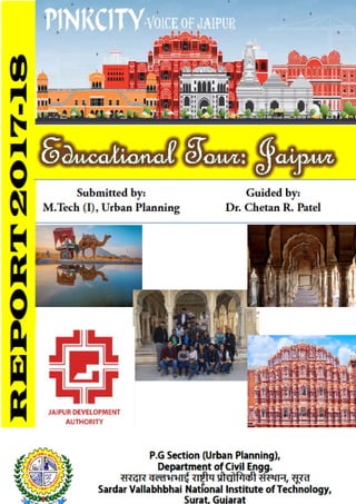
  • 3. CERTIFICATE This is to certify that , Students of M.Tech (I), Urban Planning has successfully completed the Study Vist Report on the “Educational Tour: Jaipur” under the guidance of Dr. Chetan R. Patel during the year 2017- 2018 in partial fulfillment of course of subject of Planning Studio (CE-637) conducted under P.G. Section of Urban Planning, SVNIT, Surat. Kishan Movaliya (P17UP001) Abhishek Jariwala (P17UP0003) Dharmesh Tarasariya (P17UP005) Akshit Panchani (P17UP006) Ketan Vora (P17UP007) Nitesh Shukla (P17UP008) Ashwani Yadav (P17UP009) Yajush Sonar (P17UP010) Rumendra Babu (P17UP011) Himani Jayswal (P17UP012) Pooja Mahajan (P17UP013) Swapnil Pharande (P17UP014) Neelam Pasi (P17UP015) Saurabh Baderao (P17UP016) Arnab Halder (P17UP017) Jigar Patel (P17UP018) Vaibhavi Patel (P17UP019) Manisha Garasia (P17UP020) Faculty Advisor, Dr. Chetan R. Patel December-2017 P.G Section (Urban Planning), Department of Civil Engineering, सरदार वल्लभभाई रा�ीय �ौ�ोिगक� संस्थान, सूरत Sardar Vallabhbhai National Institute of Technology, Surat, Gujarat
  • 4. ACKNOWLEDGEMENT We earnestly wish to express our heartfelt thanks and a sense of gratitude to Dr. Chetan R. Patel (Asst. Professor and P.G. Section Head, Urban Planning, SVNIT) and Dr. Ravin M. Tailor (Asst. Professor and P.G. Incharge, Urban Planning, SVNIT) for his valuable guidance and constant inspiration in preparing this report by arranging an Educational tour for us. We also acknowledge the inspiration and encouragement provided by him. Frequent interactions with him in all aspects of the report making have been a great learning experience. We shall always cherish his support and encouragement. Kishan Movaliya (P17UP001) Abhishek Jariwala (P17UP0003) Dharmesh Tarasariya (P17UP005) Akshit Panchani (P17UP006) Ketan Vora (P17UP007) Nitesh Shukla (P17UP008) Ashwani Yadav (P17UP009) Yajush Sonar (P17UP010) Rumendra Babu (P17UP011) Himani Jayswal (P17UP012) Pooja Mahajan (P17UP013) Swapnil Pharande (P17UP014) Neelam Pasi (P17UP015) Saurabh Baderao (P17UP016) Arnab Halder (P17UP017) Jigar Patel (P17UP018) Vaibhavi Patel (P17UP019) Manisha Garasia (P17UP020)
  • 5. CONTENTS List of Figures List of tables 1. Introduction 1-3 1.1. General 1.2. Schedule of activities 2. Study Area: Jaipur 4-36 2.1. City overview 2.1.1. General 2.1.2. Origin of the city and its subsequent layout 2.1.3. Planning of the city 2.1.4. Conceptual Prastara plan 2.1.5. Concept behind Pink colour 2.1.6. Road network 2.1.7. Public spaces 2.1.8. Conceptual plan – Chaupar 2.1.9. Streetscapes and Chowks 2.1.10. Bazaars 2.2. Survey of various important visit places 2.2.1. Jaigarh Fort
  • 6. 2.2.2. Nahargarh Fort 2.2.3. Amer Fort 2.2.4. City Palace 2.2.5. Hawa Mahal 2.2.6. Jantar Mantar 2.2.7. Birla Mandir 2.2.8. Vidyadhar Nagar 3. Study Area: Pushkar and Ajmer 37-40 3.1. City overview 3.1.1. Pushkar City overview 3.1.2. Ajmer City overview 4. Summary 41-42
  • 7. LIST OF FIGURES Jaipur Location Map Sr. No. Figure Name Page No. 1. Jaipur Master DP-2025 5 2. Jaipur Location Map 6 3. Site selection 7 4. Military strategy for site selection 8 5. Geographical reasons behind site selection 8 6. Pink City Plan 9 7. Conceptual Prastara Plan (Vaastu Purush) 10 8. Badi Chaupar Conceptual plan 12 9. Jaigarh Fort 14 10. Jaivana cannon 15 11. Part of rain water harvesting, Jaigarh 16 12. Nahargarh Fort view 17 13. Nahargarh Check posts 18 14. Madhvendra Palace, Nahargarh 18 15. Ganesh Gate, Amer Fort 19 16. Sukh Niwas, Amer Fort 19 17. Diwan-i-am, Amer Fort 22 18. City palace Jaipur 22 19. City Palace Entrance gate 23 20. City Palace Chandra Mahal 24 21. City Palace Mubarak Mahal 24 22. City Palace Diwan-i-aam 25 23. City Palace Diwan-i-khas 25 24. Hawa Mahal 26 25. Hawa Mahal Jharokha’s 27 26. Jantar Mantar 28 27. Chakra Yantra 29 28. Dakshin Bhittin Yantra 29
  • 8. 29. Digamsha Yantra 30 30. Jaiprakash Yantra 30 31. Kapali Yantra 31 32. Vrihat Samrat Yantra 32 33. Birla Mandir 35 34. Vidyadhar Nagar Master Plan 36 35. Location Map of Pushkar 37 36. Brahma Ghat, Pushkar 38 37. Location Map of Ajmer 39 38. Group Photo 42
  • 9. LIST OF TABLES Sr. No. Table Name Page No. 1. Journey Schedule 1
  • 10. CHAPTER 1 INTRODUCTION 1.1. General: This Educational Tour was done for the Academic fulfilment of the course of CE-637, Planning Studio 1. It was expected to study and survey the places of Historic and Architectural importance. Being the students of Urban planning, different aspects from planning fundamentals, History, Origin, Transportation, Housing elements, etc is to be analysed through various case studies by visiting the different places rich in concepts from Town planning, Architecture, etc. Jaipur being a City of great Indian History along-with application of vaastu-shastra and shilp-shastra for Town Planning. 1.2. Schedule of activities: Table.1. Journey Schedule Departure Date and Time Arrival Date and Time Location Date of Visit Places Of Visit Travel mode 4th Dec. 2017 at 10:40 pm 5th Dec. 2017 at 2:00 pm Surat to Jaipur 5/12/17 1. Birla Mandir as a Social Infrastructure. 2. Pink City and Interaction with Public and Authority. Mumbai Jaipur Express (Indian Railways
  • 11. 6/12/17 1. Water conservation model of Jaigarh. 2. Protection strategy for Pink City and Fort planning of Nahargarh. 3. Jal Mahal. 4. Planning of Amer Fort. 7/12/17 1. Study of planning of Hawa Mahal, Jantar Mantar and Pink City, its design, architecture and history. 8th Dec. 2017 at 7:00 am 8th Dec. 2017 at 11:30 am Jaipur to Pushkar 8/12/17 Visit to pilgrim cities of Pushkar and Ajmer for the study of Urban Design. Local traveller Bus 8th Dec. 2017 at 2:00 pm 8th Dec. 2017 at 2:45 pm Pushkar to Ajmer Local traveller Bus 8th Dec. 2017 at 9th Dec. 2017 at Ajmer to Surat Ajmer Puri Express via
  • 12. 5:30 pm 6:30 am Surat
  • 13. CHAPTER 2 STUDY AREA: JAIPUR 2. 1. City overview: 2.1.1. General: Jaipur is the capital and the largest city of the Indian state of Rajasthan in Western India. It was founded on 18 November 1727 by Jai Singh II, the ruler of Amer after whom the city is named. As of 2011, the city has a population of 3.1 million, making it the tenth most populous city in the country. Jaipur is also known as the Pink City of India. Jaipur is located 280 km (174 miles) from the Indian capital New Delhi. Jaipur forms a part of the west Golden Triangle tourist circuit along with Agra (240 km, 149 mi). Jaipur is a popular tourist destination in India and serves as a gateway to other tourist destinations in Rajasthan such as Jodhpur (348 km, 216 mi), Jaisalmer (571 km, 355 mi) Udaipur (421 km, 262 mi) and Mount Abu (520 km, 323 mi). Jaipur is home to two UNESCO World Heritage Sites: the Jantar Mantar and the Amer Fort. The city was planned according to Indian Vastu shastra by Vidyadhar Bhattacharya in 1727. There are three gates facing east, west, and north. The eastern gate is called Suraj pol (sun gate), the western gate is called Chand pol (moon gate) and the northern gate faces the ancestral capital of Amer. The city is unusual among pre-modern Indian cities in the regularity of its streets, and the division of the city into six sectors by broad streets 34 m (111 ft) wide. The urban quarters are further divided by networks of gridded streets. Five quarters wrap around the east, south, and west sides of a central palace quarter, with a sixth quarter immediately to the east. The Palace quarter encloses the Hawa Mahal palace complex, formal gardens, and a small lake. Nahargarh Fort, which was the residence of the King Sawai Jai Singh II, crowns the hill in the northwest corner of the old city.
  • 15. Fig.2. Jaipur Location Map 2.1.2. Origin of the city and its subsequent layout: The need of a new capital for 18th century Dhoondhar as the earlier one of Amber built on a hill was getting congested. Sawai Raja Jai Singh’s vision of the new capital as a strong political statement at par with Mughal cities and as a thriving trade and commerce hub for the region. • Site: a valley located south of Amber and the plains beyond, a terrain that was the bed of a dried lake; dense forest cover to the north and the east of the site. • Physical constraints: hills on the north that housed the fort of Jaigarh and the Amber palace beyond, and the hills on the east, which contained the sacred spot of Galtaji. • Water supply: the Darbhavati river in the north was dammed to create the Jai Sagar and Man Sagar (that later housed the Jal Mahal) lakes. Later the Jhotwara River in the
  • 16. north west was diverted through the Amani Shah Nallah and a number of canals were channelized through Brahmapuri and Jai Niwas to supply water to the city. The site with the natural east west ridge and the surrounding forts as defence. The medieval towns of Rajasthan were of military, agrarian, mercantile or religious nature. The presence of a deity marked the reference point for the ruler’s abode and the rest of the city. The name of the town was usually associated with the political or religious centre (with the Ambikeshwar temple in the case of Amber and with Sawai Jai Singh in the case of Jaipur). The hill town of Dausa with an organic layout guided by the topography Town with the Fort on top of the hill and the walled. 2.1.3. Planning of the city: • Unlike Dausa and Amber, the two previous capital cities of the Dhoondhar region established on hilltop, whose planning was guided by topographical structure of the areas, Jaipur city was revolutionary both in terms of its grid-iron pattern planning and its location at the base of the hills. • There was also a significant economic shift from an agricultural base in Dausa and Amber to trading in the capital of Jaipur. • The layout of the city of Jaipur wonderfully links the concept of a Shastric city with the practicalities of the chosen site. • First, the straight line of the ridge suggested itself as the route for one of the main east-west thorough fares and building a road along its crest makes best possible use of the topography for the purpose of drainage. • What followed then was to regularize the Amber Sanganer road as a north-south route at right angles to it. • The point of intersection would be one of the city’s main cross-roads (chaupar). The intersection of the axes to define the Badi Chaupar (City Square). • A road cutting the plain from N to S linking Amber, the capital to Sanganer, the principal trading town. This road had to be preserved and controlled and therefore had to fall within the city’s boundaries • A second road ran E to W between the Mughal cities of Agra and Ajmer and placing the new city on this already established communication line would help secure its
  • 17. economic success. However since this was an imperial road that could not be encroached on, thus the city had to be contained to the north of this line. • Also, a natural ridge runs across the plain, N of the road and parallel to it, in a roughly EW alignment (with a slight deviation of 15 deg. from the cardinal axes). The area to its S is flat while that to its N slopes down gently. In Shastric terms, this is an ideal arrangement as declivity towards the north-east is considered the best site. In practical terms, the ridge too had to be accommodated. • It is a model of town planning the first planned city in India. It is based on Hindu systems of town planning and followed the principles prescribed in the Shilpa-shastra, an ancient Indian treatise on architecture .according to this shastra the site should be divided into grids or mandalas ranging from 2x 2 to 10 x 10. • Planned according to the Prastara type of layout, which gives prominence to the cardinal directions. • Thus plan of jaipur is a grid of 3x3 with gridlines being the city’s main streets. Fig.2. Site selection
  • 18. Fig.3. Military strategy for site selection Fig.4. Geographical reasons behind site selection
  • 19. Fig.5. Pink City Plan 2.1.4. Conceptual Prastara plan: • The central axis of the town was laid from East to West between the gates of the Sun (Suraj pol) and the moon (Chandpol). • This was crossed by two roads at right angles dividing the town into nine almost square, almost equally sized blocks, which were further sub divided by lanes and alleys all at right angles. • By building the western boundary of the city right up to the hill’s southern apex, it provided a continuous line of defence. • The mandala could not be complete in the NW due to the presence of the hills. • On the other hand in the SE an extra square has been added that plugged the gap between the city and the eastern hills. • South of the main road were four almost equal rectangles. The rectangle opposite the palace has been broken up into two equal and smaller rectangles by the Chaura Rasta.
  • 20. Thus altogether there are now five rectangles on the south of the main road called Chowkris. • On the North of the main road from West to East are the Purani Basti, the Palace and Ramchandraji. The principal bazaar leads from the western gate in the city wall, The Chandpole, passing in front of the Tripolia Gate, to the eastern city gate, the Surajpole. The palace building covered two blocks, the town six and the remaining ninth block was not usable on account of steep hills. So this North-West ward was transferred to the South-East corner of the city, making the shape of the plan as a whole asymmetrical rather than square. Following the directions of the Hindu Shilpa shastra, width of the main streets & other lanes were fixed. Thus the main streets of the city were 111ft. wide, secondary streets 55 ft. wide & the smaller ones 27ft. wide. Fig.6. Conceptual Prastara Plan (Vaastu Purush)
  • 21. 2.1.5. Concept behind Pink colour: Jaipur is known as the Pink City, a rather idealized description of the terra-cotta coloured lime plaster that coats the old part of the city's walls, buildings, and temples. The reasons for painting the town pink are unknown, but various theories have been tossed about: • Using pink to cut down glare • Jai Singh II's apparent devotion to Lord Shiva (whose favourite colour is reputedly terra cotta). • Others believe Singh wanted to imitate the colour of the sandstone used in the forts and palaces of his Mughal emperor-friends. • The most popular reason (spread no doubt by "Britishers" during the Raj era) is that pink is the traditional colour of hospitality, and the city was freshly painted and paved with pink gravel to warmly welcome Edward VII for his visit here in 1876. 2.1.6. Road network: Jaipur’s road network follows a definite hierarchy. The major east-west and north-south road form the sector boundaries and are called Rajmarg as they lead to the city gates. These measure 33m. wide. Next there is a network of 16.5m wide which runs north-south in each sector linking the internal areas of the sectors to the major activity spine. An orthogonal grid of 8.25mx4.00m roads in the prastara-chessboard pattern further divide sectors into Mohallas. 2.1.7. Public spaces: • Chaupars • Bazaars • Mohallas • Streets • Temples
  • 22. 2.1.8. Conceptual plan – Chaupar: A square that occurs at the intersection of east west roads with three north south roads. 100m x 100m used for public gathering on festive occasions. The distance between two chaupars is about 700m which is ideal for pedestrian movement. It has controlled facade treatment enveloping it. Fig.7. Badi Chaupar Conceptual plan
  • 23. 2.1.9. Streetscapes and Chowks: View of a main bazaar street - the width of the main roads was kept 39 1/4 gaz - 108 feet, secondary roads are half this size - 54 feet, the tertiary roads are 27 feet and the inner mohalla streets are 13 feet wide. View of a chaupar today, the main markets, havelis and temples on the main streets in Jaipur were constructed by the state in the 18th century, thus ensuring that a uniform street facade is maintained. The widths of roads were predetermined. Junctions of the main axial streets formed the two square civic open spaces called chaupars (Badi chaupar and Chhoti chaupar). The width of the square chaupars was three times that of the main street. Historically, the chaupars were outlets for intense social use with water structures connected by underground aqueducts, supplying numerous sources of drinking water at street level. Presently, the centre of each chaupar has square enclosures with ornamental fountains. The streets and chowks (central open squares in a town) of the internal chowkries (sectors) with numerous clusters or mohallas were not predetermined; hence show a mix of grid iron and organic pattern, with the basic unit of built form being the rectangular haveli. 2.1.10. Bazaars: Original markets in the city include Kishanpole bazaar, Gangauri bazaar, Johari bazaar, Sireh Deorhi bazaar, along the main north-south and east-west axes that intersect at Chhoti and Badi Chaupars. Typical architectural features of the bazaar streets are - use of chhajjas (sunshades) resulting in strong horizontal lines, projecting vertical blocks on brackets, a modular system of arches filled with delicate latticed screens to cut direct sun and glare of reflected sun in the street. Bazaar streets have temples above shops with wide staircase starting from pavement to the temple level. Space above shops at first floor level originally functioned as galleries for watching royal processions, religious festivals and public celebrations On the main streets strict control was exercised on the street façade, along which were located shops and arcades- one storey high, but beyond the frontage the buildings could be of any height or any shape, some built with flat roofs & others with traditional chattris.
  • 24. 2.2. Survey of various important visit places: 2.2.1. Jaigarh Fort: • History: a) The magnificent Jaigarh fort is located near Jaipur. Jaigarh fort or the fort of victory was constructed by Sawai Jai Singh of Jaipur in 1726. b) It is located at a distance of 15 kms from the Pink City of India, Jaipur the magnificent royal construction Jaigarh Fort grabs the attention of travellers with its unique approach. Fig.8. Jaigarh Fort • Architecture: a) Jaigarh Fort is protected by thick walls of red sandstone, the fort houses some of the most exquisite architectures including Lalit Mandir, Vilas Mandir, Laxmi Vilas and Aram Mandir. Two other temples, Ram Harihar built in 10th century and Kal Bhairav temple built in the 12th century add to the fascination of the fort. b) The red sandstone walls of the Jaigarh Fort are spread over a length of 3 kilometres and are about a kilometre wide, making the establishment an impregnable one. A well-tended square garden it within the bounds of the fort and embankments are constructed to provide access to the upper levels of the structure. c) Courtrooms and halls are delicately embellished with screened windows while a central watch tower overlooks the entire surrounding landscape. The entry to the Aram Mandir is through the Awani Darwaza which is a magnificent triple - arched entrance. Aram Mandir provides an exquisite view of the Sagar Lake located nearby.
  • 25. Fig.9. Jaivana cannon • Purpose of Jaigarh Fort: Jaigarh fort was built with the purpose of protecting Amer Fort, the palace within the complex of Jaigarh fort is architecturally similar to the Amer Fort. Other than its elaborate architecture, the fort is also known for its huge treasure that was believed to be buried under it. It is said that the treasure, when discovered during the 1970s, was seized by the government of Rajasthan. • Features of Jaigarh Fort in Jaipur a) Jaivana, the world's largest cannon on wheels, was constructed in the foundry of the fort in 1720, and its barrel alone weighs 50 tons. The ramparts and wide water channels formed a very efficient system for rainwater harvesting and bringing in water from across the hills into the underground tanks of the fort. b) Vijay Garh , the Armoury contains a 50-kg cannonball, various swords, shields, muskets, war bugles, armour and guns. Other than military treasures, the Museum has photos of old Jaipur, its royalties, and royal processions. c) Diwa Burj, the seven-storied watchtower will let you have excellent view of Jaipur and the fort. • Rain water harvesting: a) The water supply of Jaigarh fort and its storage reservoirs are a marvel of engineering. The Jaigarh Fort has a number of water channels, constructed with the aim of harvesting rainwater. Besides the water channels, there are underground tanks at the
  • 26. fort. The fort could withstand long sieges without much difficulty as a result of the ingenious water supply arrangements. b) Pucca canals which are located on the surrounding hills brought rain water to those. Emergency requirements are fulfilled by these tanks. c) Out of these the largest tank is 158 feet long, 138 feet wide and 40 feet deep; water is stored in this tank which has a capacity of 60 lakhs gallon. The height of this canon is 5 km . By creating water harvesting structures, the water supply facilities in the fort was done in the Aravalli and conveying water through a canal on the west side of the fort which is located over a height 4 kilometres distance to be stored in three underground tanks below the central courtyard. Out of which one tank was used by prisoners for bathing, the second was used to store gold and jewellery and the third one was empty. d) These tanks also created a stir in the recent political history of the fort when they were searched for hidden treasure stashed for gemstones and jewellery of their Royal relatives which turned out is untrue. A water tank is located here which is linked to the canal. It is said that the kings of Amber or Jaipur used the compartments which are located below these water tanks to keep the gold and jewellery of their Royal relatives. e) A 69 feet in length , 52 feet wide and 52 feet deep tank is located just behind the large tank and one room is also made under each hole. The treasury by the Rajas is also stored in these rooms under the rule of Raja Sawai Jai Singh. He used that money in founding the Jaipur City. The garden and the Aram Mandir in the courtyard , on the northern side of the fort , has a triple entrance and known as “The Awani Darwaza” which has now joined with Sagar lake , so water from this lake is used to be transported to the fort. Fig.10. Part of rain water harvesting, Jaigarh
  • 27. f) Pucca canals which are situated on the hills are responsible for bringing the rain water to these tanks. The tank water in the fort was stored for emergency; generally the water was taken from the water tanks which are located below the hills on Amber side. 2.2.2. Nahargarh Fort: • General: a) The Indian state of Rajasthan is famous for its royal heritage. Formed by the union of many princely states ruled mainly by Rajputs, Rajasthan has many forts and palaces. Some of these palaces and forts are associated with important historical events as well. b) Nahargarh Fort, along with other two forts viz., Amer Fort and Jaigarh Fort, once formed a strong defense for Jaipur city. Built by Maharaja Sawai Jai Singh II in 1734, this fort was originally named Sudarshangarh Fort. Later, it was given a new name, Nahargarh which means 'abode of tigers'. Located in one of the oldest mountain ranges of the world, the Aravalli Hills, this fort gives you a breathtaking view of the scenic surroundings. c) One of the major tourist attractions of Jaipur, Nahargarh Fort is noted for its extended wall which connects it to the Jaigarh Fort. Fig.11. Nahargarh Fort view • Architectural Layout: a) The fort follows Indo-European architecture and there are many structures inside the fort. To the left of the entrance gate 'Tadigate', there is a temple dedicated to the deity of Jaipur rulers.
  • 28. b) Apart from this, there is another temple inside the fort, dedicated to the Rathore prince, Nahar Singh Bhomia. c) Another attraction in the fort is the 'Madhavendra Bhawan' built by Sawai Madho Singh. This is a two-storey building which has suites for the king and his twelve queens. d) It is divided into nine similar apartments and each of these apartments has a lobby, bedrooms, toilets, kitchen and store. Other structures inside the palace include Diwan- I-Aam, an open air enclosure where the king met the common men and listened to their problems and complaints. Fig.12. Nahargarh Check posts Fig.13. Madhvendra Palace, Nahargarh
  • 29. 2.2.3. Amer Fort: • Construction: a) The construction of Amber Fort was started in 1592. It was modified on regular intervals by several rulers and the trend continued up until late 1600. The fort was mostly constructed using red sandstone and white marble. b) Though basically a fort, it also served as the main residence of the Rajput Maharajas. Hence, in its subsequent modifications, the fort was deliberately made to look more like a lavish palace. c) There is also another palace, which was constructed before the construction of Amber fort. The older palace rests on a valley behind the fort. This palace is one of the oldest in India. Fig.14. Ganesh Gate, Amer Fort Fig.15. Sukh Niwas, Amer Fort
  • 30. • Layout of the Fort: a) Four different sections combine to form the fort or the palace. Each section has its own gate and courtyard. b) The first gate, which is also the main entrance, is called Suraj Pol or Sun Gate. The gate faces east, witnessing the sunrise every morning and hence the name. This gate leads to the first courtyard named Jalebi Chowk. c) When the place was still being ruled by the Rajputs, the soldiers used to assemble and celebrate their victory in this very courtyard. This was a visual treat and was often viewed by women through windows. d) Since the royal dignitaries used to enter through the Sun Gate, the place was heavily guarded. The front courtyard of the fort complex is adorned with the splendid, pillared hall of the Diwan-i-Am, and the two-tiered painted gateway, Ganesh Pol. e) The entrance of the Amber fort is through the Dil-e-Aaram Garden, which is laid out in the traditional Mughal style. An impressive flight of stairs leads to the Diwan-e-Am (hall of public audience) which has latticed galleries and double row of columns, each having a capital in the shape of elephants on the top. f) This hall is laid on the second courtyard. To the right are steps that lead to a small temple of Goddess Sila Devi. The temple has massive doors made of silver. g) There are two magnificent buildings laid out in the third courtyard. The buildings are situated opposite to each other. On the left, the beautiful Jai Mandir, which is also called Sheesh Mahal (palace of mirrors) is situated. As the name suggests, Jai Mandir was used to celebrate victories. Other celebrations too, were held in this building. The building opposite to Jai Mandir is called Sukh Mahal (Hall of Pleasure). h) This place was used by the royal family whenever they felt like they had to rest or spend some quality time alone. Towards the southern region of this courtyard, lies the famous palace built by Raja Man Singh I. i) This is the oldest structure in the entire fort as it stands today. The exit route from this palace leads directly to the town of Amer. The fourth courtyard is rather an interesting one. The royal women including the mistresses lived in this part of the palace. They were collectively known as the Zenana. j) Even the queens and queen mother lived in this part. This part of the palace was extremely secluded as the kings used to visit the queens or their mistresses without getting noticed by anyone.
  • 31. • Architecture a) The architectural style of the fort is a blend of Mughal and Rajput architecture. One of the best examples of this style within the fort is the Ganesh Pol. b) Mirza Raja Jai Singh, who ruled the place from 1621 to 1627, was instrumental in building the Ganesh Pol. The gate is embellished with mosaics, which makes it look colourful and grand. Among the main attractions of the fort are Jai Mandir and Sheesh Mahal. c) While the Sheesh Mahal has walls inlaid with exquisite mirrors, the Jai Mandir, hanging on the upper floor, is a superb blend of Mughal and Rajput style of architecture. This is evident from the elegantly carved Jali screens and stucco work. Jal Mandir has a huge opening which is covered with sandalwood doors. d) A special feature of this structure is the flow of water through the building, making the entire hall air-conditioned. Sheesh Mahal too, has a special feature. e) Back then, the entire edifice would glow even at the light of a few candles, such was the architectural brilliance of this specially designed structure. The mirrors used in this palace are convex in nature. It was built during the reign of King Man Singh in the late 1600s. f) Other major architectural attractions of the fort include the magic flower, palace of Man Singh and the garden. While the magic flower depicts two hovering butterflies, the palace is known for its pavilion. g) The garden resembles the Chahar Bagh or the famous Mughal Garden. Also, there is a pool which is star-shaped at the center of the garden. h) Another interesting architectural design of the fort is the fourth courtyard. Since the kings had to visit their queens and mistresses in secret, the courtyard demanded a special design. It was built in such a way that no one could guess which room the king would enter as the courtyard, with multiple rooms, had a common corridor. i) The walls of Amber fort are adorned with paintings of hunting and war along with precious stones and mirrors set into the plaster. The Maota Lake at the forefront of the fort gives spectacular and beautiful reflections of the magnificent Amber Fort-Palace.
  • 32. Fig.16. Diwan-i-am, Amer Fort 2.2.4. City Palace: The City Palace is an awesome historic architectural heritage specimen of architectural brilliance in the city of Jaipur. Fig.17. City palace Jaipur • Town or city: Jaipur • Construction started: 1729 • Completed: 1732 • Built by: Maharaja Sawai Jai Singh II. The Royal Palace was built in the 18th century by the Maharaja Jai Singh II, who was the Rajput king of Amber. In 1727, Maharaja
  • 33. Sawai Jai Singh II, shifted their capital from Amber to Jaipur due to water scarcity and increase in population, the city palace was built. • Architect: Sir Samuel Swinton Jacob and Vidyadar Bhattacharya • Technical details: a) Structural system: Red and pink sand stone b) Design and construction: The City Palace is in the central-northeast part of the Jaipur city, which is laid in a grid pattern with wide avenues. It is a unique and arresting complex of several palaces, pavilions, gardens and temples. The most prominent and most visited structures in the complex are the Chandra Mahal, Mubarak Mahal, Mukut Mahal, Maharani's Palace, Shri Govind Dev Temple and the City Palace Museum. Some of the special features such as magnificent pillars, lattice or jali work, carved marble interiors and inlaid ornamentations make the palace beautiful in appearance. City Palace is an overwhelming complex of exquisite palaces, gardens and courtyards, decorative art and carved doorways. The architect designed the Palace Complex according to the texts of Vaastushastra. • Structures: a) Entrance Gate: There are two main entrance of the palace, namely Tripolia Gate and Jaleb Chowk. Fig.18. City Palace Entrance gate
  • 34. b) Chandra Mahal: It is a seven-storeyed building .It contains many unique paintings, mirror work on walls and floral decorations. At present time most of this palace is used as residence by the royal families. Fig.19. City Palace Chandra Mahal c) Mubarak Mahal (welcome Palace): It was built with plaster and stone but the outdoor view looks like the Lumber homes. This stroker is made by thin carving in stone. Now it has been transformed into a Museum. Fig.20. City Palace Mubarak Mahal d) Diwan-i-Aam: Diwan-i-Aam, the Hall of Public Audience, is a marble floored chamber located between the armoury and the art gallery.
  • 35. Fig.21. City Palace Diwan-i-aam e) Diwan-E-Khas: The 'Diwan-E-Khas' (Sabha Niwas) or the 'Hall of Private Audience' is a square courtyard, open at all four sides with beautiful arches and chandeliers making it a truly special place. Fig.22. City Palace Diwan-i-khas
  • 36. 2.2.5. Hawa Mahal: Fig.23. Hawa Mahal • General: a) 'Hawa Mahal' means "Palace of Winds".It was built in 1799 by Maharaja Sawai Pratap Singh. Hawa Mahal was designed by Lal Chand Ustad. The palace is a five- story pyramidal shaped monument which is situated on the main thorough fare in the heart of Jaipur’s business centre. The top offers stunning views over Jantar Mantar and the City Palace in one direction and over Sireh Deori Bazaar in the other. b) Its cultural and architectural heritage is a true reflection of a fusion of Hindu Rajput architecture and Mughal architecture; the Rajput style is seen in the form of domed canopies, fluted pillars, lotus and floral patterns, and the Islamic style as evident in its stone work and arches. • Features: a) It is constructed of red and pink sandstone. b) Hawa Mahal was also known as the chef-d'œuvre of Maharaja Jai Singh as it was his favourite resort because of the elegance and built-in interior of the Mahal. c) The cooling effect in the chambers, provided by the breeze passing through the small windows of the façade, was enhanced by the fountains provided at the centre of each of the chambers. d) One of the main reasons of constructing this beautiful mahal decorated with fine lattice windows and screened balconies was to facilitate the royal Rajput women, who otherwise followed the strict Purdah system and refrained from appearing in public, in
  • 37. getting a glimpse of the daily events, royal processions and festivals taking place on the streets. This way they could enjoy their sense of freedom while maintaining their customs. e) There are a total of 953 elaborately carved jharokhas or windows, some of which are made of wood. These jharokhas were build in such a manner that air circulates naturally through them creating Venturi effect thus air conditioning the entire structure during the hot summers. Each jharokha has a small chamber where one can sit and view the street. Fig.24. Hawa Mahal Jharokha’s 2.2.6. Jantar Mantar: • General: a) In the early 18th century Maharaja Sawai Jai Singh II of Jaipur constructed five Jantar Mantar in total in New Delhi, Jaipur, Ujjain, Mathura and Varanasi. They were completed between 1724 -1735. The Jantar Mantar observatory was constructed between 1728 -1734. b) The theories behind the instruments are found in texts by the 5th century CE Aryabhatta, 6th century CE Brahmagupta and Varahamihira, 9th century Lalla, 11th century Sripati and Bhaskara. The texts of Bhaskara have dedicated chapters on instruments and he calls them Yantra-adhyaya. c) The Jantar Mantar monument in Jaipur, Rajasthan is a collection of nineteen astronomical instruments. It features the world's largest stone sundial and is a
  • 38. UNESCO World Heritage site. It is located near City Palace and Hawa Mahal of Jaipur. d) The monument features masonry, stone and brass instruments that were built using astronomy and instrument design principles of ancient Hindu Sanskrit texts. e) Jantar Mantar is managed under the Archeological Sites and Monuments Act of Rajasthan since 1961, and protected as a National Monument of Rajasthan since 1968. Fig.25. Jantar Mantar • Salient Features: a) The observatory is an example of the Ptolemaic positional astronomy which was shared by many civilizations. b) The monument features instruments operating in each of the three main classical celestial coordinate systems: the horizon-zenith local system, the equatorial system and the ecliptic system. c) The observatory consists of nineteen instruments for measuring time, predicting eclipses, tracking location of major stars as the earth orbits around the sun, ascertaining the declinations of planets, and determining the celestial altitudes and related ephemerides.
  • 39. • Instruments: a) Instrument 1: Chakra Yantra Fig.26. Chakra Yantra Chakra Yantra (four semicircular arcs on which a gnomon casts a shadow, thereby giving the declination of the Sun at four specified times of the day. This data corresponds to noon at four observatories around the world (Greenwich in UK, Zurich in Switzerland, Notke in Japan and Saitchen in the Pacific); this is equivalent of a wall of clocks registering local times in different parts of the world.) b) Instrument 2: Dakshin Bhitti Yantra Fig.27. Dakshin Bhittin Yantra Dakshin Bhitti Yantra (measures meridian, altitude and zenith distances of celestial bodies). c) Instrument 3: Digamsha Yantra
  • 40. Fig.28. Digamsha Yantra Digamsha Yantra (a pillar in the middle of two concentric outer circles, used to measure azimuth of the sun, and to calculate the time of sunrise and sunset forecasts). d) Instrument 6: Jai Prakash Yantra Fig.29. Jaiprakash Yantra Jai Prakash Yantra (two hemispherical bowl-based sundial with marked marble slabs that map inverted image of sky and allows the observer to move inside the instrument, measures altitudes, azimuths, hour angles and declinations). e) Instrument 7: Kapali Yantra
  • 41. Fig.30. Kapali Yantra Kapali Yantra (measures coordinates of celestial bodies in azimuth and equatorial systems, any point in sky can be visually transformed from one coordinate system to another). f) Instrument 8: Kanali Yantra g) Instrument 9: Kranti Vritta Yantra Kranti Vritta Yantra (measures longitude and latitude of celestial bodies). h) Instrument 10: Laghu Samrat Yantra. Laghu Samrat Yantra (the smaller sundial at the monument, inclined at 27 degrees, to measure time, less accurate than Vrihat Samrat Yantra). i) Instrument 11: Misra Yantra j) Instrument 12: Nadi Valaya Yantra Nadi Valaya Yantra (two sundials on different faces of the instrument, the two faces represent north and south hemispheres, the accuracy of the instrument in measuring the time is less than a minute). k) Instrument 13: Palbha Yantra l) Instrument 14: Rama Yantra Rama Yantra (a double cylinder instrument that measures azimuth and altitudes of celestial bodies).
  • 42. m) Instrument 15: Rashi Valaya Yantra Rashi Valaya Yantra (12 gnomon dials that measure ecliptic coordinates of stars, planets and all 12 constellation systems). n) Instrument 16: Shastansh Yantra Shastansh Yantra (next to Vrihat Samrat Yantra, this instrument is a 60 degree arc built in the meridian plane within a dark chamber. At noon, the sun's pinhole image falls on a scale below enabling the observer to measure the zenith distance, declination, and the diameter of the Sun.). o) Instrument 17: Unnatasha Yantra Unnatasha Yantra (a metal ring divided into four segments by horizontal and vertical lines, with a hole in the middle; the position and orientation of the instrument allows measurement of the altitude of celestial bodies). p) Instrument 18: Vrihat Samrat Yantra Fig.31. Vrihat Samrat Yantra Vrihat Samrat Yantra (world's largest gnomon sundial, measures time in intervals of 2 seconds using shadow cast from the sunlight). q) Instrument 19: Yantra Raj Yantra Yantra Raj Yantra (a 2.43-metre bronze astrolabe, one of the largest in the world, used only once a year, calculates the Hindu calendar)
  • 43. • Materials of construction: Built from local stone and marble, each instrument carries an astronomical scale, generally marked on the marble inner lining. Bronze tablets, bricks and mortar were also employed in building the instruments in the monument spread over about 18,700 square metres. It was in continuous use until about 1800, then fell in disuse and disrepair. Restored again several times during the British colonial rule, particularly in 1902, the Jantar Mantar was declared a national monument in 1948. It was restored in 2006. The restoration process in early 20th century replaced some of the original materials of construction with different materials. 2.2.7. Birla Mandir: • General: a) Birla Temple, Jaipur At the foot of Moti Dungri fort is the Birla Temple. This temple forms one of the most beautiful attractions of Jaipur. b) Birla Temple of Jaipur looks stunning, when it is brightly lit in the night. The construction of the temple started in 1977 and it went on till 1985. On 22nd February 1985, the temple deity was invoked and was opened for public to visit. the temple was built by Birla Group of Industries, one of the business tycoons of India. c) The Temple is dedicated to Lord Vishnu (Narayan), the preserver and his consort Lakshmi, the Goddess of wealth. Due to this reason, Birla Temple is also known as Laxmi Narayan Temple. • Architectural features: a) Birla Mandir is constructed in the finest quality of white marble. b) The three huge domes of the temple represent three different approaches to the religion. The beautiful white marble temple mesmerizes the onlookers, when it glows at night. Stained glass windows depict the scenes from Hindu scriptures. c) Ganesh the protector of households, is above the lintel, and the fine quality of marble is evident when you enter the temple and look back at the entrance way. d) The images of Lakshmi and Narayan attract the attention, being made out from one piece of marble. Many of the deities of the Hindu pantheon are depicted inside the
  • 44. temple, and on the outside walls great historical personages and figures from all religions are shown, including Socrates, Zarathustra, Christ, Buddha, and Confucius. e) The Laxmi Narayan Mandir is a modern architectural marvel, surrounded by lush green gardens. The fascinating exteriors of the temple are carved splendidly with beautiful sculptures based on mythological themes, while the interiors have a large marble panel portraying mythological events. Fig.32. Birla Mandir 2.2.8. Vidyadhar Nagar: • General: a) The city planning was inspired partly from Le Corbusier’s work in Chandigarh and partly from the study of Old Jaipur. Therefore, the resulting plan is a mix of wide central avenues and sector- based planning like that in Chandigarh as well as tight secondary streets with protective approach roads that reflect the traditional street patterns. • The major observations in the city planning are: a) Each intersection of streets has been used to create a larger open space and thus is used in creation of a hierarchy of open spaces. b) Each sector has a square perimeter and roads around it for making it accessible from the outside while the arrangement within a sector assumes a more protective approach.
  • 45. c) The major axis is running North-east to south-west, crossed by a secondary axis along the main transversal road. d) Orientation is determined by the path of the sun so as to minimize solar contact with built surfaces. e) Doshi has interpreted the lessons of traditional desert towns with their tight clusters, courtyards, havelis and lanes of transition from public to private space. f) There is an understanding of the social and cultural heritage and thus there is a response to the needs of the user group. g) The housing in Vidhyadhar Nagar is more responsive to the social and economic needs of the designated resident as is clear from its motto-“Vidyadhar Nagar: A city symbolic of permanence and order. Faith, safety, security and social, economic, technical opportunities.” • Master plan of Vidyadhar Nagar: Fig.33. Vidyadhar Nagar Master Plan
  • 46. CHAPTER 3 STUDY AREA: PUSHKAR AND AJMER 3.1. City overview: 3.1.1. Pushkar City overview: • General: a) Pushkar is a town in the Ajmer district in the Indian state of Rajasthan. It is situated about 10 km (6.2 mi) northwest of Ajmer and about 150 kilometres (93 mi) southwest of Jaipur. It is a pilgrimage site for Hindus and Sikhs. Pushkar has many temples. Most of the temples and ghats in Pushkar are from the 18th century and later, because many temples were destroyed during Muslim conquests in the area. Subsequently, the destroyed temples were rebuilt. The most famous among Pushkar temples is the red spired Brahma Temple built during the 14th century CE. b) Pushkar is famous for its annual fair (Pushkar Camel Fair) featuring a trading fete of cattle, horses and camels. It is held over seven days in autumn marking Kartika Purnima according to the Hindu calendar (Kartik (month), October or November). It attracts nearly 200,000 people. In 1998, Pushkar hosted about 1 million domestic (95%) and international tourists over the year. Fig.34. Location Map of Pushkar
  • 47. • Town Profile: Pushkar is a Mid population range town with population 21626. The town is lake based settlement around Pushkar Lake. It can be categorised as Tourist Town due to its tourist and pilgrimage importance. The town is in irregular shaped with ring road around centre and star like road pattern around ring road. Other Details are as under, Total Population- 21626 Literacy- 80% Total Houses- 4250. Nos. Fig.35. Brahma Ghat, Pushkar 3.1.2. Ajmer City overview: • General: a) Ajmer is one of the major cities in the Indian state of Rajasthan and is the centre of the eponymous Ajmer District. According to the 2011 census, Ajmer has a population of around 552,360 in its urban agglomeration and 542,580 in the city. The city is located at a distance of 135 km from the state capital Jaipur and 391 km from the national capital New Delhi. b) The city was established as "Ajayameru" by a Shakambhari Chahamana (Chauhan) ruler, either Ajayaraja I or Ajayaraja II, and served as the Chahamana capital until the 12th century CE.
  • 48. c) Ajmer is surrounded by the Aravalli Mountains. It is a pilgrimage centre for the shrine of the Sufi Saint Khwaja Moinuddin Chishti and is also the base for visiting Pushkar (11 km), an ancient Hindu pilgrimage city, famous for the temple of Brahma. Ajmer has been selected as one of the heritage cities for the HRIDAY - Heritage City Development and Augmentation Yojana scheme of Government of India. Fig.36. Location Map of Ajmer • Development Bodies: a) Ajmer Development Authority b) Ajmer Municipal Corporation. • City Profile: The Ajmer City is having irregular shape and near to Star like road pattern. It is a lake oriented settlement with Ana Sagar Lake which is an artificial Lake. Major Population settlement is around central lake and South side of lake. Other details of city are as under, Area- 223 Sq. Km Population of City- 0.75 Million
  • 49. Population Density- 305 per Sq. Km Language- Rajasthani, Urdu
  • 50. CHAPTER 4 CONCLUSION • Use of Indian Vaastu-Shastra and Shilp-Shastra in City planning can be seen as a Case Study. • The planning of Jaipur City is TOD (Transit oriented development) wherein, all the basic facilities are available at walkable distance. • Such planning is observed in core city area, i.e., Pink City. • Original characteristics of Pink City are still conserved in the current planning scenario. • The Urban design of the Pink City like, Colour code, Building Height, Road width, Monotony is maintained till now. • Similarly, the ground floor dedicated to commercial and upper floors to residential. • The houses and buildings are planned in courtyard style. • Jaigarh Fort is a good example for observing past centuries rain water harvesting and conservation and primary as well as secondary water treatment. • The purposeful construction of forts implies the future strategic planning. • Hawa Mahal is the world’s tallest building without foundation.