SlideShare a Scribd company logo
1 of 10
WELCOME
WELCOME
ES 231 Remote
Sensing
Definition
Remote Sensing is the science and art of obtaining
information about an object area or phenomenon
through the analysis of data acquired by a devise that is
not in contact with the object area or phenomenon under
observation
Best Example: Eyes while reading
Eyes act as sensors, which reflects light from the page
Data acquired is the impulses corresponding to the
amount of light reflected
Data analyzed and interpreted by the mental computer
Data
The remotely collected data can be of many forms
including:
variations in force distributions
Acoustic wave distribution
Electromagnetic wave distribution
Eg.
A gravity meter acquires data on variations of the
force of gravity
Sonar obtains data on variations in sound
Illustration of Generalized process and elements in EM Remote Sensing of Earth resources
Basic Processes involved in Remote Sensing
- Data Acquisition
- Data Analysis
Data Acquisition includes
(a) Propagation of energy through atmosphere
(b) Energy interaction with earth surface features
(c) Retransmission of energy through atmosphere
(d) air-borne or space-borne sensors
(e) generation of sensor data in digital or pictorial
form
In short, we use sensors to record variations in the way
earth surface features reflect and emit electromagnetic
energy
Data Analysis
Include:
(f) examining data using various viewing and
interpretation devices to analyze pictorial data and/or a
computer to analyze digital sensor data
Ground Truthing
Collection of reference data about the resources being
studied are used when and where available to assist data
analysis
Examples for this:
soil maps, crop statistics, field check data etc.
The ground reference data are used by the analyst to extract
information about the type, extend, location and condition
of various resources of which sensor data has been collected
(g) The information is then compiled
The compilation can be in the form of
hard copy maps
tables
computer files that can be merged with other layers
of information in the form of a Geographic Information
System (GIS)
(h) The information is then presented to users which is
supplied to the decision making process
Ground Truthing
THANK YOU

More Related Content

What's hot

MEASUREMENT OF SURFACE TEMPERATURE OF A GLACIER USING AN UNMANNED AERIAL VEHI...
MEASUREMENT OF SURFACE TEMPERATURE OF A GLACIER USING AN UNMANNED AERIAL VEHI...MEASUREMENT OF SURFACE TEMPERATURE OF A GLACIER USING AN UNMANNED AERIAL VEHI...
MEASUREMENT OF SURFACE TEMPERATURE OF A GLACIER USING AN UNMANNED AERIAL VEHI...Nepal Flying Labs
 
Environmental Remote Sensing
 Environmental Remote Sensing  Environmental Remote Sensing
Environmental Remote Sensing Ghassan Hadi
 
Team Lesson Plan4.08
Team Lesson Plan4.08Team Lesson Plan4.08
Team Lesson Plan4.08li5disc
 
Geographic Information System unit 5
Geographic Information System   unit 5Geographic Information System   unit 5
Geographic Information System unit 5sridevi5983
 
Spatial analysis & interpolation in ARC GIS
Spatial analysis & interpolation in ARC GISSpatial analysis & interpolation in ARC GIS
Spatial analysis & interpolation in ARC GISKU Leuven
 
Getting started with GIS
Getting started with GISGetting started with GIS
Getting started with GISEsri India
 
Ahmad Mauliddin Vol Of Water In Bili Bili
Ahmad Mauliddin Vol Of Water In Bili BiliAhmad Mauliddin Vol Of Water In Bili Bili
Ahmad Mauliddin Vol Of Water In Bili BiliHartanto Sanjaya
 
QUERY AND NETWORK ANALYSIS IN GIS
QUERY AND NETWORK ANALYSIS IN GISQUERY AND NETWORK ANALYSIS IN GIS
QUERY AND NETWORK ANALYSIS IN GISDEVANG KAPADIA
 
Geographic query and analysis
Geographic query and analysisGeographic query and analysis
Geographic query and analysisMohsin Siddique
 
Tools for weather forecasting
Tools for weather forecastingTools for weather forecasting
Tools for weather forecastingammulachu
 
K venkata reddy
K venkata reddyK venkata reddy
K venkata reddyClimDev15
 

What's hot (20)

functions of GIS
functions of GISfunctions of GIS
functions of GIS
 
MEASUREMENT OF SURFACE TEMPERATURE OF A GLACIER USING AN UNMANNED AERIAL VEHI...
MEASUREMENT OF SURFACE TEMPERATURE OF A GLACIER USING AN UNMANNED AERIAL VEHI...MEASUREMENT OF SURFACE TEMPERATURE OF A GLACIER USING AN UNMANNED AERIAL VEHI...
MEASUREMENT OF SURFACE TEMPERATURE OF A GLACIER USING AN UNMANNED AERIAL VEHI...
 
Environmental Remote Sensing
 Environmental Remote Sensing  Environmental Remote Sensing
Environmental Remote Sensing
 
Team Lesson Plan4.08
Team Lesson Plan4.08Team Lesson Plan4.08
Team Lesson Plan4.08
 
Icelandic Bathy model
Icelandic Bathy modelIcelandic Bathy model
Icelandic Bathy model
 
GPS and SRTM Accuracy
GPS and SRTM AccuracyGPS and SRTM Accuracy
GPS and SRTM Accuracy
 
Lodha govardhan
Lodha govardhanLodha govardhan
Lodha govardhan
 
Geographic Information System unit 5
Geographic Information System   unit 5Geographic Information System   unit 5
Geographic Information System unit 5
 
Spatial analysis & interpolation in ARC GIS
Spatial analysis & interpolation in ARC GISSpatial analysis & interpolation in ARC GIS
Spatial analysis & interpolation in ARC GIS
 
Getting started with GIS
Getting started with GISGetting started with GIS
Getting started with GIS
 
Satellite
SatelliteSatellite
Satellite
 
Nature Conservation Drones
Nature Conservation DronesNature Conservation Drones
Nature Conservation Drones
 
Ahmad Mauliddin Vol Of Water In Bili Bili
Ahmad Mauliddin Vol Of Water In Bili BiliAhmad Mauliddin Vol Of Water In Bili Bili
Ahmad Mauliddin Vol Of Water In Bili Bili
 
QUERY AND NETWORK ANALYSIS IN GIS
QUERY AND NETWORK ANALYSIS IN GISQUERY AND NETWORK ANALYSIS IN GIS
QUERY AND NETWORK ANALYSIS IN GIS
 
Geographic query and analysis
Geographic query and analysisGeographic query and analysis
Geographic query and analysis
 
Poster
PosterPoster
Poster
 
weather forecasting
weather forecasting weather forecasting
weather forecasting
 
Weather forecasting
Weather forecastingWeather forecasting
Weather forecasting
 
Tools for weather forecasting
Tools for weather forecastingTools for weather forecasting
Tools for weather forecasting
 
K venkata reddy
K venkata reddyK venkata reddy
K venkata reddy
 

Similar to Remote sensing

remote sensing for study.docx
remote sensing for study.docxremote sensing for study.docx
remote sensing for study.docxbbc37142
 
APPLICATION OF REMOTE SENSING AND GIS IN AGRICULTURE
APPLICATION OF REMOTE SENSING AND GIS IN AGRICULTUREAPPLICATION OF REMOTE SENSING AND GIS IN AGRICULTURE
APPLICATION OF REMOTE SENSING AND GIS IN AGRICULTURELagnajeetRoy
 
Introduction to remote sensing and gis
Introduction to remote sensing and gisIntroduction to remote sensing and gis
Introduction to remote sensing and gisMohsin Siddique
 
Chapter 1 (Introduction to remote sensing)
Chapter 1 (Introduction to remote sensing)Chapter 1 (Introduction to remote sensing)
Chapter 1 (Introduction to remote sensing)Shankar Gangaju
 
Applications of remote sensing in geological aspects
Applications of remote sensing in geological aspectsApplications of remote sensing in geological aspects
Applications of remote sensing in geological aspectsPramoda Raj
 
applicationsofremotesensingingeologicalaspects-170606133459.pdf
applicationsofremotesensingingeologicalaspects-170606133459.pdfapplicationsofremotesensingingeologicalaspects-170606133459.pdf
applicationsofremotesensingingeologicalaspects-170606133459.pdfCIVIL48
 
Remote sensing ppt
Remote sensing pptRemote sensing ppt
Remote sensing pptcoolmridul92
 
MSc-4.Platforms, Orbit, Sensors.pdf
MSc-4.Platforms, Orbit, Sensors.pdfMSc-4.Platforms, Orbit, Sensors.pdf
MSc-4.Platforms, Orbit, Sensors.pdfDuromiRedwan
 
Fundamental of Remote Sensing.pptx
Fundamental of Remote Sensing.pptxFundamental of Remote Sensing.pptx
Fundamental of Remote Sensing.pptxSonalGosai2
 
Fundamental of Remote Sensing.pptx
Fundamental of Remote Sensing.pptxFundamental of Remote Sensing.pptx
Fundamental of Remote Sensing.pptxSonalGosai2
 
GEOSPATIAL DATA ANALYSIS OF GIS SOFTWARES
GEOSPATIAL DATA ANALYSIS OF GIS SOFTWARESGEOSPATIAL DATA ANALYSIS OF GIS SOFTWARES
GEOSPATIAL DATA ANALYSIS OF GIS SOFTWARESranu bhardwaj
 
Module 5 Remote Sensing in Civil Engineering.pptx
Module 5 Remote Sensing in Civil Engineering.pptxModule 5 Remote Sensing in Civil Engineering.pptx
Module 5 Remote Sensing in Civil Engineering.pptxsurekha1287
 
Concepts of Remote Sensing: Process and Stages of Remote Sensing, Remote Sens...
Concepts of Remote Sensing: Process and Stages of Remote Sensing, Remote Sens...Concepts of Remote Sensing: Process and Stages of Remote Sensing, Remote Sens...
Concepts of Remote Sensing: Process and Stages of Remote Sensing, Remote Sens...ShavnamMehta
 
Remote sensing principles-spectral signature-spectural range
Remote sensing principles-spectral signature-spectural rangeRemote sensing principles-spectral signature-spectural range
Remote sensing principles-spectral signature-spectural rangeMohsin Siddique
 
Geoinformatics ppt
Geoinformatics pptGeoinformatics ppt
Geoinformatics pptRevathy1993
 
Basics of remote sensing and GIS.pptx
Basics of remote sensing and GIS.pptxBasics of remote sensing and GIS.pptx
Basics of remote sensing and GIS.pptxFUCKAGAIN
 
Remote sensing: Its Application & Types
Remote sensing: Its Application & TypesRemote sensing: Its Application & Types
Remote sensing: Its Application & Typesasdfg484362
 

Similar to Remote sensing (20)

remote sensing for study.docx
remote sensing for study.docxremote sensing for study.docx
remote sensing for study.docx
 
APPLICATION OF REMOTE SENSING AND GIS IN AGRICULTURE
APPLICATION OF REMOTE SENSING AND GIS IN AGRICULTUREAPPLICATION OF REMOTE SENSING AND GIS IN AGRICULTURE
APPLICATION OF REMOTE SENSING AND GIS IN AGRICULTURE
 
Introduction to remote sensing and gis
Introduction to remote sensing and gisIntroduction to remote sensing and gis
Introduction to remote sensing and gis
 
Chapter 1 (Introduction to remote sensing)
Chapter 1 (Introduction to remote sensing)Chapter 1 (Introduction to remote sensing)
Chapter 1 (Introduction to remote sensing)
 
Applications of remote sensing in geological aspects
Applications of remote sensing in geological aspectsApplications of remote sensing in geological aspects
Applications of remote sensing in geological aspects
 
applicationsofremotesensingingeologicalaspects-170606133459.pdf
applicationsofremotesensingingeologicalaspects-170606133459.pdfapplicationsofremotesensingingeologicalaspects-170606133459.pdf
applicationsofremotesensingingeologicalaspects-170606133459.pdf
 
Remote sensing ppt
Remote sensing pptRemote sensing ppt
Remote sensing ppt
 
Remote+Sensing
Remote+SensingRemote+Sensing
Remote+Sensing
 
Remote sensing 1
Remote sensing 1Remote sensing 1
Remote sensing 1
 
MSc-4.Platforms, Orbit, Sensors.pdf
MSc-4.Platforms, Orbit, Sensors.pdfMSc-4.Platforms, Orbit, Sensors.pdf
MSc-4.Platforms, Orbit, Sensors.pdf
 
Fundamental of Remote Sensing.pptx
Fundamental of Remote Sensing.pptxFundamental of Remote Sensing.pptx
Fundamental of Remote Sensing.pptx
 
Fundamental of Remote Sensing.pptx
Fundamental of Remote Sensing.pptxFundamental of Remote Sensing.pptx
Fundamental of Remote Sensing.pptx
 
Ch 5 b remote sensing
Ch 5 b remote sensingCh 5 b remote sensing
Ch 5 b remote sensing
 
GEOSPATIAL DATA ANALYSIS OF GIS SOFTWARES
GEOSPATIAL DATA ANALYSIS OF GIS SOFTWARESGEOSPATIAL DATA ANALYSIS OF GIS SOFTWARES
GEOSPATIAL DATA ANALYSIS OF GIS SOFTWARES
 
Module 5 Remote Sensing in Civil Engineering.pptx
Module 5 Remote Sensing in Civil Engineering.pptxModule 5 Remote Sensing in Civil Engineering.pptx
Module 5 Remote Sensing in Civil Engineering.pptx
 
Concepts of Remote Sensing: Process and Stages of Remote Sensing, Remote Sens...
Concepts of Remote Sensing: Process and Stages of Remote Sensing, Remote Sens...Concepts of Remote Sensing: Process and Stages of Remote Sensing, Remote Sens...
Concepts of Remote Sensing: Process and Stages of Remote Sensing, Remote Sens...
 
Remote sensing principles-spectral signature-spectural range
Remote sensing principles-spectral signature-spectural rangeRemote sensing principles-spectral signature-spectural range
Remote sensing principles-spectral signature-spectural range
 
Geoinformatics ppt
Geoinformatics pptGeoinformatics ppt
Geoinformatics ppt
 
Basics of remote sensing and GIS.pptx
Basics of remote sensing and GIS.pptxBasics of remote sensing and GIS.pptx
Basics of remote sensing and GIS.pptx
 
Remote sensing: Its Application & Types
Remote sensing: Its Application & TypesRemote sensing: Its Application & Types
Remote sensing: Its Application & Types
 

Recently uploaded

SOCIAL AND HISTORICAL CONTEXT - LFTVD.pptx
SOCIAL AND HISTORICAL CONTEXT - LFTVD.pptxSOCIAL AND HISTORICAL CONTEXT - LFTVD.pptx
SOCIAL AND HISTORICAL CONTEXT - LFTVD.pptxiammrhaywood
 
Alper Gobel In Media Res Media Component
Alper Gobel In Media Res Media ComponentAlper Gobel In Media Res Media Component
Alper Gobel In Media Res Media ComponentInMediaRes1
 
Incoming and Outgoing Shipments in 1 STEP Using Odoo 17
Incoming and Outgoing Shipments in 1 STEP Using Odoo 17Incoming and Outgoing Shipments in 1 STEP Using Odoo 17
Incoming and Outgoing Shipments in 1 STEP Using Odoo 17Celine George
 
Science 7 - LAND and SEA BREEZE and its Characteristics
Science 7 - LAND and SEA BREEZE and its CharacteristicsScience 7 - LAND and SEA BREEZE and its Characteristics
Science 7 - LAND and SEA BREEZE and its CharacteristicsKarinaGenton
 
Sanyam Choudhary Chemistry practical.pdf
Sanyam Choudhary Chemistry practical.pdfSanyam Choudhary Chemistry practical.pdf
Sanyam Choudhary Chemistry practical.pdfsanyamsingh5019
 
POINT- BIOCHEMISTRY SEM 2 ENZYMES UNIT 5.pptx
POINT- BIOCHEMISTRY SEM 2 ENZYMES UNIT 5.pptxPOINT- BIOCHEMISTRY SEM 2 ENZYMES UNIT 5.pptx
POINT- BIOCHEMISTRY SEM 2 ENZYMES UNIT 5.pptxSayali Powar
 
APM Welcome, APM North West Network Conference, Synergies Across Sectors
APM Welcome, APM North West Network Conference, Synergies Across SectorsAPM Welcome, APM North West Network Conference, Synergies Across Sectors
APM Welcome, APM North West Network Conference, Synergies Across SectorsAssociation for Project Management
 
“Oh GOSH! Reflecting on Hackteria's Collaborative Practices in a Global Do-It...
“Oh GOSH! Reflecting on Hackteria's Collaborative Practices in a Global Do-It...“Oh GOSH! Reflecting on Hackteria's Collaborative Practices in a Global Do-It...
“Oh GOSH! Reflecting on Hackteria's Collaborative Practices in a Global Do-It...Marc Dusseiller Dusjagr
 
Measures of Central Tendency: Mean, Median and Mode
Measures of Central Tendency: Mean, Median and ModeMeasures of Central Tendency: Mean, Median and Mode
Measures of Central Tendency: Mean, Median and ModeThiyagu K
 
Hybridoma Technology ( Production , Purification , and Application )
Hybridoma Technology  ( Production , Purification , and Application  ) Hybridoma Technology  ( Production , Purification , and Application  )
Hybridoma Technology ( Production , Purification , and Application ) Sakshi Ghasle
 
Presiding Officer Training module 2024 lok sabha elections
Presiding Officer Training module 2024 lok sabha electionsPresiding Officer Training module 2024 lok sabha elections
Presiding Officer Training module 2024 lok sabha electionsanshu789521
 
Contemporary philippine arts from the regions_PPT_Module_12 [Autosaved] (1).pptx
Contemporary philippine arts from the regions_PPT_Module_12 [Autosaved] (1).pptxContemporary philippine arts from the regions_PPT_Module_12 [Autosaved] (1).pptx
Contemporary philippine arts from the regions_PPT_Module_12 [Autosaved] (1).pptxRoyAbrique
 
The basics of sentences session 2pptx copy.pptx
The basics of sentences session 2pptx copy.pptxThe basics of sentences session 2pptx copy.pptx
The basics of sentences session 2pptx copy.pptxheathfieldcps1
 
Accessible design: Minimum effort, maximum impact
Accessible design: Minimum effort, maximum impactAccessible design: Minimum effort, maximum impact
Accessible design: Minimum effort, maximum impactdawncurless
 
Q4-W6-Restating Informational Text Grade 3
Q4-W6-Restating Informational Text Grade 3Q4-W6-Restating Informational Text Grade 3
Q4-W6-Restating Informational Text Grade 3JemimahLaneBuaron
 
Employee wellbeing at the workplace.pptx
Employee wellbeing at the workplace.pptxEmployee wellbeing at the workplace.pptx
Employee wellbeing at the workplace.pptxNirmalaLoungPoorunde1
 
Kisan Call Centre - To harness potential of ICT in Agriculture by answer farm...
Kisan Call Centre - To harness potential of ICT in Agriculture by answer farm...Kisan Call Centre - To harness potential of ICT in Agriculture by answer farm...
Kisan Call Centre - To harness potential of ICT in Agriculture by answer farm...Krashi Coaching
 
Mastering the Unannounced Regulatory Inspection
Mastering the Unannounced Regulatory InspectionMastering the Unannounced Regulatory Inspection
Mastering the Unannounced Regulatory InspectionSafetyChain Software
 
URLs and Routing in the Odoo 17 Website App
URLs and Routing in the Odoo 17 Website AppURLs and Routing in the Odoo 17 Website App
URLs and Routing in the Odoo 17 Website AppCeline George
 

Recently uploaded (20)

SOCIAL AND HISTORICAL CONTEXT - LFTVD.pptx
SOCIAL AND HISTORICAL CONTEXT - LFTVD.pptxSOCIAL AND HISTORICAL CONTEXT - LFTVD.pptx
SOCIAL AND HISTORICAL CONTEXT - LFTVD.pptx
 
Alper Gobel In Media Res Media Component
Alper Gobel In Media Res Media ComponentAlper Gobel In Media Res Media Component
Alper Gobel In Media Res Media Component
 
Incoming and Outgoing Shipments in 1 STEP Using Odoo 17
Incoming and Outgoing Shipments in 1 STEP Using Odoo 17Incoming and Outgoing Shipments in 1 STEP Using Odoo 17
Incoming and Outgoing Shipments in 1 STEP Using Odoo 17
 
Science 7 - LAND and SEA BREEZE and its Characteristics
Science 7 - LAND and SEA BREEZE and its CharacteristicsScience 7 - LAND and SEA BREEZE and its Characteristics
Science 7 - LAND and SEA BREEZE and its Characteristics
 
Sanyam Choudhary Chemistry practical.pdf
Sanyam Choudhary Chemistry practical.pdfSanyam Choudhary Chemistry practical.pdf
Sanyam Choudhary Chemistry practical.pdf
 
POINT- BIOCHEMISTRY SEM 2 ENZYMES UNIT 5.pptx
POINT- BIOCHEMISTRY SEM 2 ENZYMES UNIT 5.pptxPOINT- BIOCHEMISTRY SEM 2 ENZYMES UNIT 5.pptx
POINT- BIOCHEMISTRY SEM 2 ENZYMES UNIT 5.pptx
 
APM Welcome, APM North West Network Conference, Synergies Across Sectors
APM Welcome, APM North West Network Conference, Synergies Across SectorsAPM Welcome, APM North West Network Conference, Synergies Across Sectors
APM Welcome, APM North West Network Conference, Synergies Across Sectors
 
“Oh GOSH! Reflecting on Hackteria's Collaborative Practices in a Global Do-It...
“Oh GOSH! Reflecting on Hackteria's Collaborative Practices in a Global Do-It...“Oh GOSH! Reflecting on Hackteria's Collaborative Practices in a Global Do-It...
“Oh GOSH! Reflecting on Hackteria's Collaborative Practices in a Global Do-It...
 
Measures of Central Tendency: Mean, Median and Mode
Measures of Central Tendency: Mean, Median and ModeMeasures of Central Tendency: Mean, Median and Mode
Measures of Central Tendency: Mean, Median and Mode
 
Hybridoma Technology ( Production , Purification , and Application )
Hybridoma Technology  ( Production , Purification , and Application  ) Hybridoma Technology  ( Production , Purification , and Application  )
Hybridoma Technology ( Production , Purification , and Application )
 
Presiding Officer Training module 2024 lok sabha elections
Presiding Officer Training module 2024 lok sabha electionsPresiding Officer Training module 2024 lok sabha elections
Presiding Officer Training module 2024 lok sabha elections
 
Contemporary philippine arts from the regions_PPT_Module_12 [Autosaved] (1).pptx
Contemporary philippine arts from the regions_PPT_Module_12 [Autosaved] (1).pptxContemporary philippine arts from the regions_PPT_Module_12 [Autosaved] (1).pptx
Contemporary philippine arts from the regions_PPT_Module_12 [Autosaved] (1).pptx
 
The basics of sentences session 2pptx copy.pptx
The basics of sentences session 2pptx copy.pptxThe basics of sentences session 2pptx copy.pptx
The basics of sentences session 2pptx copy.pptx
 
Accessible design: Minimum effort, maximum impact
Accessible design: Minimum effort, maximum impactAccessible design: Minimum effort, maximum impact
Accessible design: Minimum effort, maximum impact
 
Código Creativo y Arte de Software | Unidad 1
Código Creativo y Arte de Software | Unidad 1Código Creativo y Arte de Software | Unidad 1
Código Creativo y Arte de Software | Unidad 1
 
Q4-W6-Restating Informational Text Grade 3
Q4-W6-Restating Informational Text Grade 3Q4-W6-Restating Informational Text Grade 3
Q4-W6-Restating Informational Text Grade 3
 
Employee wellbeing at the workplace.pptx
Employee wellbeing at the workplace.pptxEmployee wellbeing at the workplace.pptx
Employee wellbeing at the workplace.pptx
 
Kisan Call Centre - To harness potential of ICT in Agriculture by answer farm...
Kisan Call Centre - To harness potential of ICT in Agriculture by answer farm...Kisan Call Centre - To harness potential of ICT in Agriculture by answer farm...
Kisan Call Centre - To harness potential of ICT in Agriculture by answer farm...
 
Mastering the Unannounced Regulatory Inspection
Mastering the Unannounced Regulatory InspectionMastering the Unannounced Regulatory Inspection
Mastering the Unannounced Regulatory Inspection
 
URLs and Routing in the Odoo 17 Website App
URLs and Routing in the Odoo 17 Website AppURLs and Routing in the Odoo 17 Website App
URLs and Routing in the Odoo 17 Website App
 

Remote sensing

  • 3. Definition Remote Sensing is the science and art of obtaining information about an object area or phenomenon through the analysis of data acquired by a devise that is not in contact with the object area or phenomenon under observation Best Example: Eyes while reading Eyes act as sensors, which reflects light from the page Data acquired is the impulses corresponding to the amount of light reflected Data analyzed and interpreted by the mental computer
  • 4. Data The remotely collected data can be of many forms including: variations in force distributions Acoustic wave distribution Electromagnetic wave distribution Eg. A gravity meter acquires data on variations of the force of gravity Sonar obtains data on variations in sound
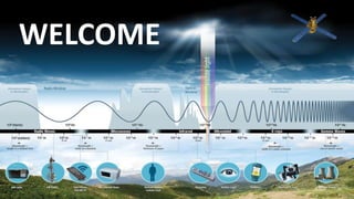
  • 5. Illustration of Generalized process and elements in EM Remote Sensing of Earth resources
  • 6. Basic Processes involved in Remote Sensing - Data Acquisition - Data Analysis Data Acquisition includes (a) Propagation of energy through atmosphere (b) Energy interaction with earth surface features (c) Retransmission of energy through atmosphere (d) air-borne or space-borne sensors (e) generation of sensor data in digital or pictorial form In short, we use sensors to record variations in the way earth surface features reflect and emit electromagnetic energy
  • 7. Data Analysis Include: (f) examining data using various viewing and interpretation devices to analyze pictorial data and/or a computer to analyze digital sensor data Ground Truthing Collection of reference data about the resources being studied are used when and where available to assist data analysis Examples for this: soil maps, crop statistics, field check data etc.
  • 8. The ground reference data are used by the analyst to extract information about the type, extend, location and condition of various resources of which sensor data has been collected (g) The information is then compiled The compilation can be in the form of hard copy maps tables computer files that can be merged with other layers of information in the form of a Geographic Information System (GIS) (h) The information is then presented to users which is supplied to the decision making process