SlideShare a Scribd company logo
1 of 180
Geospatial Analysis of Remote
Sensing Data using different Image
Processing Softwares and
Programming in MATLAB
Ranu Bhardwaj
Ph.D. Scholar
(Amity University)
Syllabus
Basic concept of Remote Sensing
Geographic Information System (GIS)
Photogrammetry
Spatial Analysis
Image Processing techniques
2
Day 1
Geospatial data
Geospatial Technology
Natural Remote Sensing
Remote Sensing in daily life
Definition of Remote Sensing
Concept of Remote Sensing
History of Remote Sensing
Modern day Remote Sensing using satellites
Early Pictures of satellites
Evolvement of Remote sensing
3
Geospatial means…?
Geographic + locational
• Static - For ex. Current location
• Dynamic- For ex. Live location
4
What is
Geo-spatial
data
The word geospatial is used to indicate that data that has a geographic
component to it. This means that the records in a dataset have
locational information tied to them such as geographic data in the form
of coordinates, address, city, or ZIP code. GIS data is a form of geospatial
data. Other geospatial data can originate from GPS data, satellite
imagery, and geotagging.
5
What is the Importance
of Geospatial data..?
6
What is Geospatial
Technology
Geospatial technology refers to all of the
technology used to acquire, manipulate, and
store geographic information.
GIS is one form of geospatial
technology. GPS, remote sensing are other
examples of geospatial technology.
7
What do you understand
by Remote sensing
8
Natural
Remote
sensing
9
Remote Sensing in
Layman terms
10
Remote Sensing in Daily life
11
Eye Telescope Camera
Definition of
Remote
Sensing
Remote sensing is the science of acquiring
information about an object or phenomenon
by measuring emitted and reflected
radiations.
12
13
(A) Energy Source or Illumination – Emits Electromagnetic radiation towards earth surface.
(B) Radiation and the Atmosphere – As energy source emits its radiation, it passes through the atmosphere and comes towards
the earth. There are many atmospheric particles in the atmosphere, due to which some of the energy reflected, some of the energy
scattered in the atmosphere and rest energy strikes on the earth features.
(C) Interaction with the Target - once the energy makes its way to the target through the atmosphere, it interacts with the target
depending on the properties of both the target and the radiation.
(D) Recording of Energy by the Sensor- after the energy has been scattered by, or emitted from the target, we require a sensor
(remote - not in contact with the target) to collect and record the electromagnetic radiation.
(E) Transmission, Reception, and Processing- the energy recorded by the sensor has to be transmitted, often in electronic form, to
a receiving and processing station where the data are processed into an image (hardcopy and/or digital).
(F) Interpretation and Analysis- the processed image is interpreted, visually and/or digitally or electronically, to extract information
about the target which was illuminated.
(G) Application
Concept of Remote Sensing
14
Definitionsof
RemoteSensing
 Theterm“remote sensing”initsbroadest sensemerely means “reconnaissanceat
a distance.”(Colwell,1966, p. 71)
 Remotesensinghasbeenvariouslydefined but basically it istheart or science of
telling something about an object without touching it. (Fischer et al., 1976, p.
34)
 Remote sensing is the acquisition of physical data of an object without touch or
contact.(Lintzand Simonett,1976, p. 1)
 Remote sensing is the observation of a target by a device separated from it by
somedistance.(Barrett and Curtis,1976, p. 3)
 Remote sensing is the art, science and technology of obtaining reliable
information about physical objects and the environment, through the process of
recording, measuring and interpreting imagery and digital representations of
energy patterns derived from noncontact sensor systems (Lecture Note by
Wataru, 2009)
15
Historyof
Remote Sensing
Natural:
Oldest Compound Eyes
Artificial:
 1800: Discoveryof Infrared by SirWilliam Herschel
 1826: JosephNiepce tookthefirst photograph
 1839: Beginningof practice of photography
 1858: Gaspard Tournachontakesfirst aerial photographfrom a balloon
 1847: Infrared spectrumshownbyA.H.L.Fizeauand J.B.L.Foucaultto share properties with visible
light
 1873: Theoryof electromagnetic energy developed by JamesClerk Maxwell
 1909: Photographyfrom airplanes
 1914-1918 World War I:Aerial reconnaissance
 1920–1930: Developmentand initial applications of aerial photography and photogrammetry
16
 1929–1939: Economicdepressiongeneratesenvironmentalcrisesthat lead to
governmentalapplicationsof aerial photography
 1930–1940: Developmentof radarsinGermany,US,and UK
 1939–1945: World War II:applicationsof nonvisibleportionsof electromagnetic
spectrum;trainingof personsinacquisitionandinterpretationof airphotos
 1950–1960: Military researchand development
 1956: Colwell’sresearchonplant diseasedetectionwithinfrared photography
 1960–1970: Firstuseof termremotesensingTIROSweathersatellite Skylab remote sensing
observationsfromspace
 1972: Launchof Landsat1
 1970–1980: Rapidadvancesindigital image processing
 1980–1990: Landsat4: newgenerationof Landsatsensors
 1986: SPOTFrenchEarthobservationsatellite
 1980s: Developmentof hyperspectral sensors
 1990s: Global remotesensingsystems,lidars
Historyof
Remote Sensing
17
Historyof Remote Sensing
10
Joseph Niepce
First Photograph- 1826
(copyright Gernsheim Collection, U-Texas)
18
HistoryofRemote Sensing
11
First Aerial Photograph from Airplane:
Italy 24-04-1909 (Oblique view of walls
of Centocelli Italy, by Wibur Wright)
The first photo taken
from balloon (1858) 19
Historyof Remote Sensing
12
Early aerial photography by the U.S. Navy, 1914. This photograph illustrates
difficulties encountered in early efforts to match the camera with the airplane
20
Historyof Remote Sensing
Aerial photography, World War I Aerial photography, World War II
13
21
Modern day Remote
Sensing using
satellites
14
22
EarlyPicturesof Satellites
15
Saudi Arabia Eastern India, Bangladesh &
Himalayas (20N, 88E)
Gulf of California and
Southern California
23
Evolvement
of Remote
Sensing
24
25
Whatdowesensein
Remote Sensing
By recording emitted or reflected radiation and
applying knowledge of its behaviour as it passes
through the Earth’s atmosphere and interacts with
objects, remote sensing analysts develop knowledge
of the character of features such as vegetation,
structures, soils, rock, or water bodies on the
Earth’s surface.
17
26
Electromagnetic(EM) Spectrum
18
The most familiar form of EMR is visible light, which forms only a small (but very important) portion of the full EM spectrum.
The large segments of this spectrum that lie outside the visible range require our special attention because they may behave in
ways that are quite foreign to our everyday experience with visible radiation.
Entertainment/communication Use it as Invisible to human eye Visible range can damage Produce by Useful for
heat source but its heat can be feel tissue accelerating killing cancer
Electrons cells
Entertainment/communication Use it as Invisible to human eye Visible range can damage Produce by Useful for
heat source but its heat can be feel tissue accelerating killing cancer
Electrons cells
27
28
Various Stepsin RS
23
(A) Energy Source
(B) Radiation and the Atmosphere
(C) Interaction with the Target
(D) Recording of Energy by the
Sensor
(E) Transmission, Reception, and
Processing
(F) Interpretation and Analysis
(G) Application
29
Active Remote sensing
For example, RADAR & LIDAR
30
Passive Remote sensing
For example- Spectroradiometer, Imaging radiometer
31
Image Resolution-Spatial,
Spectral, Temporal,
Radiometric…???
32
All remote sensing systems have four types of resolution:
• Spatial
• Spectral
• Temporal
• Radiometric
33
High vs. Low?
Spatial Resolution
Source: Jensen (2000)
34
Source: Jensen (2000)
Spectral Resolution
35
36
37
Radiometric Resolution
Imagery data are represented by
positive digital numbers which
vary from 0 to (one less than) a
selected power of 2.
This range corresponds to the
number of bits used for coding
numbers in binary format. Each bit
records an exponent of power 2
(e.g. 1 bit=2 1=2).
The maximum number of
brightness levels available depends
on the number of bits used in
representing the energy recorded.
Thus, if a sensor used 8 bits to
record the data, there would be
28=256 digital values available,
ranging from 0 to 255.
38
Elements of Image Interpretation
Shape:
• Many natural and human-made features have unique
shapes.
• Often used are adjectives like linear, curvilinear, circular,
elliptical, radial, square, rectangular, triangular,
hexagonal, star, elongated, and amorphous.
39
Jensen (2000)
40
Shadow:
 Shadow reduction is of concern in remote sensing because shadows
tend to obscure objects that might otherwise be detected.
 However, the shadow cast by an object may be
the only real clue to its identity.
 Shadows can also provide information on the height of an
object either qualitatively or quantitatively.
41
Jensen (2000)
42
Elements of Image Interpretation
 Tone and Color:
 A band of EMR recorded by a remote sensing instrument can be
displayed on an image in shades of gray ranging from black to white.
 These shades are called “tones”, and can be qualitatively referred to as
dark, light, or intermediate (humans can see 40-50 tones).
 Tone is related to the amount of light reflected from the scene in a specific
wavelength interval (band).
43
Jensen (2000)
Tone and Color
44
Elements of Image Interpretation
Texture:
 Texture refers to the arrangement of tone or color
in an image.
 Useful because Earth features that exhibit similar
tones often exhibit different textures.
 Adjectives include smooth (uniform, homogeneous), intermediate, and
rough (coarse, heterogeneous).
45
Jensen (2000)
46
Elements of Image Interpretation
Pattern:
 Pattern is the spatial arrangement of objects on
the landscape.
 General descriptions include random and systematic; natural
and human-made.
 More specific descriptions include circular, oval,
curvilinear, linear, radiating, rectangular, etc.
47
...KEEPTAKI NG NOTES...
Jensen (2000)
48
Elements of Image Interpretation
Height and Depth:
 As discussed, shadows can often offer clues to the
height of objects.
 In turn, relative heights can be used to interpret
objects.
 In a similar fashion, relative depths can often be
interpreted.
 Descriptions include tall, intermediate, and short; deep, intermediate, and
shallow.
49
50
Elements of Image Interpretation
Association:
 This is very important when trying to interpret an object or
activity.
Association refers to the fact that certain features and activities
are almost always related to the presence of certain other
features and activities.
51
Jensen (2000)
52
53
54
Sentinel 1A
11 Aug 2015
55
Sentinel 1A
22 Oct 2015
56
The problem with clouds…
57
Landsat 8 OLI
10 Jan 2016
58
Landsat 8 OLI
26 Jan 2016
59
Landsat 8 OLI
11 Feb 2016
60
Landsat 8 OLI
27 Feb 2016
61
Landsat 8 OLI
14 Mar 2016
62
Landsat 8 OLI
30 Mar 2016
63
Landsat 8 OLI
15 Apr 2016
64
Landsat 8 OLI
01 May 2016
65
Landsat 8 OLI
17 May 2016
66
Landsat 8 OLI
02 Jun 2016
67
Landsat 8 OLI
18 Jun 2016
68
Landsat 8 OLI
04 Jul 2016
69
Only 1 out of 11 Landsat 8 OLI images are usable for
the current year!
For Sentinel 2A, there are only 2 usable images…
70
The solution is to use active microwave sensors (SAR)
that can see through clouds!
71
Sentinel 1A
17 Jan 2016
72
Sentinel 1A
05 Mar 2016
73
Sentinel 1A
29 Mar 2016
74
Sentinel 1A
22 Apr 2016
75
Sentinel 1A
16 May 2016
76
Sentinel 1A
09 Jun 2016
77
Sentinel 1A
03 Jul 2016
78
Sentinel 1A
20 Aug 2016
79
Sentinel 1A
13 Sep 2016
80
Spatial Resolution: Landsat 8 OLI vs. Sentinel 2A vs. Sentinel 1A
81
Landsat 8 OLI
04 Jul 2016
82
Sentinel 2A
30 Jun 2016
83
Sentinel 1A
03 Jul 2016
84
A close-up of the river vegetation
85
Landsat 8 OLI
04 Jul 2016
86
Sentinel 2A
30 Jun 2016
87
Sentinel 1A
03 Jul 2016
88
Various Platforms of RS torecordEM spectrum
22
89
Applications of Remote
Sensing
90
Application of RS and GIS
35
Agriculture and Soil
• Precision Agriculture,
Crop Acreage and
Production
Estimation, Soil and
Land Degradation
Mapping
Forest, Biodiversity
and Environment
• Forest Cover and
Type Mapping,
Biodiversity
Characterisation,
Environmental
Impact Studies,
Monitoring of
Environmental
Sensitive Area,
Monitoring of
Wetland Areas,
Forest Fire and Risk
Mapping
Engineering and
Geology
• Mineral Potential
Mapping,
Groundwater
Potential Zoning,
Infrastructure
Planning
Regional/ Land
Development
• Town and Country
Planning, Land
Alienation, Solid
Waste Disposal
91
Applicationof RS and GIS
36
Marine and
Oceanography
• Potential Fishing
Zone (PFZ),
Coastal Zone
Mapping, Marine
Resources,
Physical
Oceanography
Disaster
Management
• Monitoring and
Mapping of
Disaster Areas
(Forest fire,
Flood and
Landslide),
Landslide Hazard
Zonation, Flood
Damage
Assessment,
Forest Fire
Meteorology
• Extended Range
Monsoon
Forecasting,
Ocean State
Forecasting
Water
• Potential
Drinking Water
Zones,
Monitoring of
Catchment and
Reservoir Areas,
Surface Water,
Watershed
Development
92
Applicationof RS and GIS
37
Environmental Health
• Dengue Risk
Mapping Zoning,
Children Malnutrition
Study, Air Pollution
Study, Tick Borne
Disease
Landuse Monitoring
• Landuse/ Land Cover
Mapping, Wasteland
Mapping,
Topography and
Geographic
Positioning, Urban
Development,
Geology
National Security
• Intelligence,
Territorial Security
Management,
Mapping and Rescue
Planning, Strategic
and Tactical, Ground
Mobility
93
Application of RS:CropGrowth Monitoring
38
94
Global Normalized difference
vegetation index (NDVI) map
by MODIS(2003)
ApplicationofRS:CropGrowth Monitoring
[GSFC, 2003]
39
95
ApplicationofRS:
Forest Monitoring
40
96
ApplicationofRS:UrbanHeatIsland Monitoring
Land Surface temperature is clearly enhanced by land cover
41
97
ApplicationofRS:WildFire Monitoring
42
98
ApplicationofRS:Disaster Management
43
99
ApplicationofRS:Land Uses
44
Newfoundland , Canada
Landsat Composite Image
100
ApplicationofRS:LandUse change
45
101
ApplicationofRS:
Water
46
102
ApplicationofRS:Flood Mapping
47
satellite image of St. Louis on
July 4, 1988, during normal river
levels.
St. Louis on July 18, 1993,
during the height of the
flooding.
103
ApplicationofRS:Military Use
48
104
49
ApplicationofRS:Military Use
105
• BooksonRemotesensing
BooksandTutorials
55
James B. Campbell, Randolph H. Wynne (2011):Introduction to Remote Sensing, Fifth Edition
Canada Centre for Remote Sensing Fundamentals of Remote sensing
Thomas M. Lillesand (eds.), 2007. Remote sensing and image interpretation, Willey.
106
BooksandTutorials
Paul R. Wolf (eds.), 2000. Elements of photogrammetry with applications in GIS, McGraw-Hill Science.
Qihao Weng, Remote Sensing and GIS Integration, Theory, Methods and Applications
BooksonRemoteSensingand GIS
56
107
BooksandTutorials
• BooksonGIS
Shahab Fazal, GIS Basics
Michael N. DeMers, GIS for Dummies
Julie Delaney & Kimberly Van Niel, Geographic Information system An introduction
57
108
BooksandTutorials
 BooksonGIS
T. Sutton, O. Dassau, M. Sutton, A gentle introduction to GIS
To be added with the help
of Sir Google … . 
58
109
 RemoteSensing (RS)
□ Remotelysensingtheuseful information of object (earth)
□ Processof recording, measuring and interpreting imagery and
digital representations of energy patterns derived from
noncontactsensor systems
 GeographicInformation System(GIS)
□ Asystemdesigned to capture, store, manipulate, analyze,
manage, and present all types of geographically
referenced data
3
110
Geographically Referenced
image
 Geographically Referenced Data
separate GIS from other
Information Systems.
 Georeferencing means that the
internal coordinate system of an
image or aerial photo image can
be related to a geographic
coordinate system.
 Georeference something means
to define its existence in physical
space. That is, establishing its
location in terms of coordinate
systems.
 Before we begin discussing GIS,
we must understand data nature
used with GIS applications.
111
For example, roads-
To describe a road, we need locations
(where it is), and its characteristics: length,
name, speed limit, and direction).
The location, also called geometry or shape,
represents spatial data,
whereas the characteristics are attribute
data.
So, the road, like any other geographically
referenced data, has two main components:
spatial data & attribute data.
112
113
Can you recall
Google Earth?
The information in the Google earth is obtained
through Remote Sensing
While its representation and management on
geographical locations is made possible
through GIS
4
114
Can you recall
Google Earth?
Let's look at small movies about Google earth to
learn more about the remotely sensed
information and its geographical referencing of
the information
5
115
Google Earth Engine allows
observation of dynamic changes in
agriculture, natural resources, and
climate using geospatial data
from the Landsat satellite
program, which passes over the
same places on the Earth every
sixteen days.
116
Nitin Chauhan - Department of Remote Sensing
GEOGRAPHICAL
INFORMATION SYSTEM
117
Geography….
The Science of Earth’s Physical
features, resources, climate,
population etc.
Nitin Chauhan - Department of Remote Sensing 118
Geography….
What & Where
Location is important
What & Where
4
GEOGRAPHY = Geo + Graphy
SNAKES & LADDER
Nitin Chauhan - Department of Remote Sensing 119
E L
P P A
O G D
C A
T
Data…
5
Nitin Chauhan - Department of Remote Sensing 120
L E
G
D O
C A T
Information
6
A P P
Nitin Chauhan - Department of Remote Sensing 121
Data Information
Factual information,
especially information
organized for analysis
or used to reason or
make decisions.
Information is the
result of processing,
manipulating and
organizing data in a
way that adds to the
knowledge of the
person receiving it.
Data versus Information….
7
Nitin Chauhan - Department of Remote Sensing 122
Nitin Chauhan - Department of Remote Sensing
GIS
⚫ Geographic
 GIS tend to deal primarily with geographic or spatialfeatures.
 These objects can be referenced or related to a specific location in space.
⚫ Information
 Large volumes of data, handled within a GIS
 Real world objects with set of characteristics or descriptive attributes
⚫ System
 Complex environments are broken down into their component parts for ease of
understanding and handling but
 Are considered to from an integrated whole
123
What GIS can do? Real world problems
Identification Where ?
Locate What is there?
Optimum path What is the best route?
Patterns What relations exists between?
Trend What has changed ?
Models What if ?
What GIS can do???
9
Nitin Chauhan - Department of Remote Sensing 124
GIS Definition
⚫Toolbox based
- set of tools
- a system
- an information system
⚫Database definitions
- a database system in which most of the data are spatially indexed, and
upon which a set of procedures are operated in order to answer queries
about spatial entities in the database.
⚫Organization based definitions
- a decision support system involving the integration of spatially referenced
data in a problem solving environment
for capturing, storing, retrieving,
analyzing and displaying which
are spatially referenced to earth
Nitin Chauhan - Department of Remote Sensing 125
C + S + T + A + R + D = GIS
Defining GIS….the easy way
11
Nitin Chauhan - Department of Remote Sensing 126
GIS is a tool that can:
C = Collect
S = Store
Defining GIS….the easy way
12
T = Transform
A = Analyze
R = Retrieve
D = Display
d
Nitin
a
Cht
aua
han - Department of Remote Sensing
127
History of GIS
⚫ Ian L. McHarg is Known as “ Father of GIS”
⚫ 1963 : Canada Geographic Information System (CGIS) :
http://geogratis.cgdi.gc.ca/CLI/index_agriculture.html). It was given by Roger
Tomlinson to analyze Canada's national land inventory
⚫ 1964 : Harvard Laboratory for Computer Graphics (and Spatial Analysis) was
established by Howard Fisher. This lab had major influence on the development
of GIS until early 1980
⚫ 1965 : The development of the GBF-DIME (Geographic Base Files - Dual
Independent Map Encoding) files by the
U.S. Census Bureau. term DIME itself was first coined by
George Farnsworth
13
Nitin Chauhan - Department of Remote Sensing 128
History of GIS
⚫1966 : Howard Fisher developed
SYMAP (Synagraphic Mapping
a general-purpose
System)
mapping package, producing
• isoline, choropleth and proximal maps on a line
printer.
• 1966 : Howard Fisher developed SYMAP (Synagraphic
Mapping System) a general-purpose mapping package,
producing isoline, choropleth and proximal maps on a
line printer.
14
Nitin Chauhan - Department of Remote Sensing 129
History of GIS
⚫1969 : Data formats begin to emerge and private
vendors began offering GIS packages:
 Environmental Science Research Institute (ESRI) is founded
by Jack and Laura Dangermond
 Jim Meadlock establishes Intergraph Corporation (originally
called M & S Computing Inc)
⚫1972 : IBM's GFIS (Geographic Information
Systems)
15
Nitin Chauhan - Department of Remote Sensing 130
History of GIS
⚫ 1976 : Minnesota Land Management Information System
(MLMIS), developed at the Centre for Urban and Regional
Analysis, University of Minnesota.
⚫ 1977 : The USGS (U.S. Geological Survey) develops the
Digital Line Graph (DLG) spatial data format
⚫ 1978 : ESRI developed the first version of Arc/Info, the
current leading GIS software package.
⚫ 1978 : ERDAS (Earth Resource Data Analysis System) was
founded
16
Nitin Chauhan - Department of Remote Sensing 131
History of GIS
⚫ 1980 : GIS was pushed to evolve towards analysis
⚫ 1982 : ESRI's ARC/INFO® 1.0, the first commercially
available GIS software package, which ran on mainframe
computers
⚫ 1985 : Army Corps of Engineers at the Construction
Engineering Research Laboratory (CERL) started the
development of the GIS GRASS – Geographic Resources
Analysis Support System – as a raster based GIS
programme
17
Nitin Chauhan - Department of Remote Sensing 132
History of GIS
18
⚫ 1986 : Mapinfo was founded. ESRI's PC ARC/INFO® 1.0, the
first GIS software available for the personal computer, was
released
⚫ 1987 : SPANS( Spatial Analysis System) GIS and IDRISI by Clark
University.
⚫ 1988 : US bureau of Census „TIGER‟(Topographically Integrated
Geographic Encoding and Referencing) digital data products.
⚫ 1988 : The National Centre for Geographic Information and
Analysis (NCGIA) was established in the USA
Nitin Chauhan - Department of Remote Sensing 133
History of GIS
19
⚫ 1989 : ER Mapper was launched. Intergraph launched MGE (Modular
GIS Environment)
⚫ 1990 : Third phase of evolution : GIS became a real Management
Information System (MIS), and thus able to support decision making
processes
⚫ 1992 : Lebanon, decided to rebuild the entire nations electricity
network in GIS environment
⚫ 1993 : XEROX PARC Map Viewer : first Web-based interactive map
Viewer was developed by Steve Putz
⚫ 1994 : OGC (Open Geospatial Consortium ) was founded
Nitin Chauhan - Department of Remote Sensing 134
History of GIS
⚫ Beyond 2000 :



Mobile GIS
Location based services
Open access to satellite images (ex. Google Earth)
20
⚫ 1997 : Internet GIS –
( ArcIMS – Arcview Internet Map Server)
( Mapserver – Developed by University of Minnesota – open source)
Nitin Chauhan - Department of Remote Sensing 135
Geographical information systemsevolved from centuriesof mapmakingand thecompilation
of spatial data
HistoryandDevelopmentof GIS
31
Map prepared by Eratosthenes
The Greek mathematician, astronomer, and geographerEratosthenes (ca. 276 –
194B.C.) laid the foundations of scientific cartography
136
HistoryandDevelopmentof GIS
Ptolemy’s map of the world, about A.D. 150, republished in 1482. Notice the
use of latitude and longitude lines and the distinctive projection of this map
32
137
History and Developmentof GIS
Al-Idrisi’s map of the world, 1456. He completed a map of the known world in
the 12th century. Drawn with south at the top, this later example has been
inverted for easier viewing.
33
138
Components/ Elements of GIS
Application
Hardware
⚫ There are namely 5 components of GIS
People
Software
Data
Nitin Chauhan - Department of Remote Sensing 139
RS and GIS ofEarthResources
24
GIS
Data
Product
Interpre
tation Products Users
Electromagetic remote sensing of earth and its processing
Remote Sensing Sensing System
Geo referencing
Pictorial and
Numerical data
140
 Geographic Information Systems (GIS)systemdesigned to capture, store,manipulate,analyze, manage,and
present all types of geographically referenced data
 GISare computerizedsystemsdesigned for thestorage, retrieval and
analysisof geographically referenced data
 GISusesadvanced analytical tools to explore at a scientificlevel the spatial relationships, patterns, and
processesof cultural, biological, demographic, economic,geographic, and physical phenomena
Unique capabilities of GIS
 GISstoresrelated geographic features inseparate collectionsof files called map layers
 Map layers canbe reusedeasily and assembledinto any numberof mapcompositionsand overlaid for
analysis
GeographicInformationSystem(GIS)
25
141
GeographicInformationSystem(GIS)
26
142
 Information
□ Remotesensingdata
□ Geographic data
 Hardware
□ Computer
□ Digitizer
□ Scanner
□ Printer/Plotter
 Software
□ Desktop GIS
□ Internet GIS
□ CADSoftware
□ Database Software
 Multimedia (photos, videos, 3D models)
ToolsforGIS
27
Information
Hardware/
software
Multimedia
143
 Location:Whatis at...?Whereis it…?
□ (Locationquestion;what existsata particular location)
 Condition:Statusof features…?
□ (Conditionalquestion;whichlocationssatisfy certainconditions)
 Trends:Whathas changed since...?
□ (Trendyquestion;identifiesgeographic occurrenceortrendsthathave changed orin the
processof changing)
 Patterns:Whatspatial patterns exist…?
□ (Relationalquestion:analyzes thespatial relationshipbetweenobjects ofgeographic
features)
 Modeling:Whatif…?
□ (Model based question;computersand displays an optimumpath,a suitableland, risky
area against disasters etc.based on model)
GIS answersthefollowing
28
144
 Location:Whatis at...?Where is it…?
 Condition:Statusof features…?
 Trends:Whathas changed
since...?
 Patterns:Whatspatial patterns
exist…?
 Modeling: Whatif…?
GIS answersthefollowing…
29
Mohsin
145
Basicdatamanipulationin
RS &GIS
30
One of the most
common products
of a GIS is a map
Global to local
146
Tools for GIS
 Hardware
 Computer
 Digitizer
 Scanner
 Printer/Plotter
 Software
 Desktop GIS
 Internet GIS
 CAD Software
 Database Software
 Multimedia (photos, videos, 3D models)
14
7
Unique capabilities of GIS
 GIS stores related geographic features in separate collections of files
called map layers
 Map layers can be reused easily and assembled into any number
of map compositions and overlaid for analysis
14
8
....KEEP TAKING NOTES....
GIS answers the following
 Location: What is at...? Where is it?
 Condition: Status of features?
 Trends: What has changed since...?
 Patterns: What spatial patterns exist?
 Modeling: What if…?
14
9
Scale of GIS data
15
0
Vector data
 Map features
 Vector data comprise Points (x & y) , lines (segment of arcs), polygons
(lines with same start & end points)
 Data comprise explicit spatial coordinates
 Feature attributes
 Every feature has attributes (e.g. name,
• area, population)
Shape Name Class Pop2000 State
Point New York City 8,008,278 NY
Point Los Angeles City 3,694,820 CA
Point Chicago City 2,896,016 IL
Vector
data is
also
called
‘spaghet
ti’ data 151
Vector data
15
2
....KEEP TAKING NOTES....
Line feature comprises of two forms of point locations (vertices), which represent change
in direction of ARCS…
NODES which represent the start & end of arcs,
including locations where different arcs connect…
Vector data are divided into their SPATIAL component and ATTRIBUTE component.
Attribute linked to each spatial feature are stored using RELATIONAL DATABASE SYSTEM.
Raster Data
Stored electronic image or picture
taken as an aerial photograph or
satellite image
Composed of a rectangular array of
square cells, called pixels, with a
number in each cell representing the
solid color fill of that cell…
153
15
4
....KEEP TAKING NOTES....
15
5
....KEEP TAKING NOTES....
TOPOLOGY
 Topology can be defined as “The mathematical study of objects
which are preserved through deformation, twistings and
stretchings.”
 Operations concerned with connections between objects
are dependent on information about topological
relationships.
15
6
....KEEP TAKING NOTES....
GIS DATA AND LAYERS
157
GIS example
 Identify polluting companies and their proximity to populations
in poverty, water features, or schools.
 Start with
1. Databases
2. Map layers
15
8
....KEEP TAKING NOTES....
Databases
Not easy to interpret
15
9
....KEEP TAKING NOTES....
Data shown as GIS layers
16
0
Additional layers
Political features (municipalities)
16
1
....KEEP TAKING NOTES....
Additional layers
Physical features (lakes, rivers, etc.)
162
Additional layers
Administrative data (schools)
163
Maps and tables are interactive
Identify features
164
Maps and tables are interactive
Select features
....KEEP TAKING NOTES....
Advanced GIS functions
Proximity selections
....KEEP TAKING NOTES....
166
Advanced GIS functions
Buffers
 Select top polluting companies and show the number of schools within 2 miles of these
companies.
167
GIS APPLICATIONS AND
EXAMPLES
168
GIS applications
Engineering Civil engineering, surveying, property mapping
Business Site location, delivery systems, marketing, media and press, real
estate.
Defense/intelligen
ce
Military operations, geospatial intelligence
Government Federal, state, local, economic development, elections, urban
and regional planning.
Health Public health, health and human services, hospitals, managed
care, research.
Natural resources Agriculture, archaeology, climate change, conservation,
environmental management, forestry, marine and coast, mining,
petroleum, water resources.
Public safety Computer-Aided Dispatch, emergency/disaster management,
EMS, homeland security, law enforcement, fire protection,
wildfire management
Transportation Aviation, highways, logistics, railways, ports and maritime, public
transit
Utilities/communic
ations
Electric, gas, pipeline, telecommunications, water/wastewater
.8..5.KEEPTAKING NOTES....
169
ImportantMilestonesinTheDevelopmentof GIS
170
Remote sensing
advantages and
limitations
171
How to collect scientific data
In-situ Remotely
172
Importance of Remote Sensing
Remote sensing makes it possible to collect data from dangerous or inaccessible areas, with growing relevance in
modern society.
It replaces slower, costly data collection on the ground, providing fast and repetitive coverage of extremely large
areas for everyday applications, ranging from weather forecasts to reports on natural disasters or climate change.
Remote sensing is also an unobstructive method, allowing users to collect data and perform data processing and
GIS analysis offsite without disturbing the target area or object.
Monitoring floods and forest fires, deforestation, polar bears, chemical concentrations, and earthquakes are just a
few cases in which geospatial remote sensing provides a global perspective and actionable insights that would
otherwise be unattainable.
173
Why Remote Sensing
SYSTEMATIC DATA
COLLECTION
INFORMATION ABOUT
THREE DIMENSIONS OF REAL
OBJECTS
REPEATABILITY GLOBAL COVERAGE
THE ONLY SOLUTION
SOMETIMES FOR THE
OTHERWISE INACCESSIBLE
AREAS.
MULTIPURPOSE
INFORMATION
174
Suppose you have a digital image which has a
radiometric resolution of 6 bits. What is the maximum
value of the digital number which could be represented
in that image?
175
 Searchand InstallGoogle earth or UseGoogle Mapsto locate you home
 Thepurposeisto get interaction with remotely sensed informationand its
processingusinginternetGIS systems
 Noformal submissionisrequired. However,youhaveto report about your
interaction with Google earth or Google Map
 Deadline:Innext class
Assignment
62
176
A Model…
 A model is simply a means of representing “reality” and, spatial data models provide abstraction of
spatially referenced features in the real world.
 Representation of real world is often divided into,
(1) Entities (distinct objects like points, locations, roads, admin boundaries)
(2) Fields (convey the idea of values of some property at all locations)
 Objects that are well described as distinct entities are sensibly represented using the
VECTOR DATA MODEL.
 Properties that tend to vary quite smoothly from place to place are
frequently represented using RASTER DATA MODEL.
 Exceptions are isolines / contours / temperature elevation etc…
17
7
....KEEP TAKING NOTES....
What is GIS?
17
8
Geographic Information Systems
(GIS) are computerized systems
designed for the storage, retrieval
and analysis of geographically
referenced data
GIS uses advanced analytical tools
to explore at a scientific level the
spatial relationships, patterns, and
processes of cultural, biological,
demographic, economic,
geographic, and physical
phenomena
GIS & Image
Processing
softwares
ENVI
ERDAS Imagine
ArcMap
QGIS
MATLAB
Python
179
 Providethestudentwitha basicunderstandingof thescienceandtechnology of remotesensingand geographic information system
 Enablethestudentto understandthedifferencesbetweenthevarioussatellite remotesensingsystemsinexistencetoday
 Enablethestudentto differentiate betweenthedifferent typesof information provided by thesesystems
 Enablethestudentto understandtheintegration of remotesensingand GIS
 Providethestudentwithbasicunderstandingof GISsystemsand their processingof remotesensingand geographic data
 Enablethestudentto perform basicmanipulatationof data usingcommercial softwaresuchasArcGISetc
Goal oftheCourse
180

More Related Content

Similar to GEOSPATIAL DATA ANALYSIS OF GIS SOFTWARES

Chapter 1 (Introduction to remote sensing)
Chapter 1 (Introduction to remote sensing)Chapter 1 (Introduction to remote sensing)
Chapter 1 (Introduction to remote sensing)Shankar Gangaju
 
Remote sensing and image interpretation
Remote sensing and image interpretationRemote sensing and image interpretation
Remote sensing and image interpretationMd. Nazir Hossain
 
Remote sensing: Its Application & Types
Remote sensing: Its Application & TypesRemote sensing: Its Application & Types
Remote sensing: Its Application & Typesasdfg484362
 
Forestry rs introduction 2021
Forestry  rs introduction  2021Forestry  rs introduction  2021
Forestry rs introduction 2021Devesh Walia
 
Remote sensing by jitendra thakor
Remote sensing by jitendra thakorRemote sensing by jitendra thakor
Remote sensing by jitendra thakorgandhinagar
 
Remote sensing [compatibility mode]
Remote sensing [compatibility mode]Remote sensing [compatibility mode]
Remote sensing [compatibility mode]Sumanta Das
 
remote sensing for study.docx
remote sensing for study.docxremote sensing for study.docx
remote sensing for study.docxbbc37142
 
Remote Sensing and its Applications in Agriculture
Remote Sensing and its Applications in AgricultureRemote Sensing and its Applications in Agriculture
Remote Sensing and its Applications in AgricultureVikas Kashyap
 
REMOTE SENSING
REMOTE SENSINGREMOTE SENSING
REMOTE SENSINGijsrd.com
 
Basics of remote sensing and GIS.pptx
Basics of remote sensing and GIS.pptxBasics of remote sensing and GIS.pptx
Basics of remote sensing and GIS.pptxFUCKAGAIN
 
Remote Sensing_2020-21 (1).pdf
Remote Sensing_2020-21  (1).pdfRemote Sensing_2020-21  (1).pdf
Remote Sensing_2020-21 (1).pdfBAGARAGAZAROMUALD2
 
Remote sensing by abhishek mahajan
Remote sensing by abhishek mahajanRemote sensing by abhishek mahajan
Remote sensing by abhishek mahajanAbhishek Mahajan
 

Similar to GEOSPATIAL DATA ANALYSIS OF GIS SOFTWARES (20)

Chapter 1 (Introduction to remote sensing)
Chapter 1 (Introduction to remote sensing)Chapter 1 (Introduction to remote sensing)
Chapter 1 (Introduction to remote sensing)
 
Remote sensing and image interpretation
Remote sensing and image interpretationRemote sensing and image interpretation
Remote sensing and image interpretation
 
Remote sensing: Its Application & Types
Remote sensing: Its Application & TypesRemote sensing: Its Application & Types
Remote sensing: Its Application & Types
 
Remote sensing overview
Remote sensing overviewRemote sensing overview
Remote sensing overview
 
Forestry rs introduction 2021
Forestry  rs introduction  2021Forestry  rs introduction  2021
Forestry rs introduction 2021
 
Remote sensing by jitendra thakor
Remote sensing by jitendra thakorRemote sensing by jitendra thakor
Remote sensing by jitendra thakor
 
remote sensing
remote sensingremote sensing
remote sensing
 
REMOTE SENSING
REMOTE SENSINGREMOTE SENSING
REMOTE SENSING
 
Remote sensing
Remote sensingRemote sensing
Remote sensing
 
Remote sensing [compatibility mode]
Remote sensing [compatibility mode]Remote sensing [compatibility mode]
Remote sensing [compatibility mode]
 
remote sensing for study.docx
remote sensing for study.docxremote sensing for study.docx
remote sensing for study.docx
 
Remote Sensing and its Applications in Agriculture
Remote Sensing and its Applications in AgricultureRemote Sensing and its Applications in Agriculture
Remote Sensing and its Applications in Agriculture
 
REMOTE SENSING
REMOTE SENSINGREMOTE SENSING
REMOTE SENSING
 
Basics of remote sensing and GIS.pptx
Basics of remote sensing and GIS.pptxBasics of remote sensing and GIS.pptx
Basics of remote sensing and GIS.pptx
 
Remote Sensing_2020-21 (1).pdf
Remote Sensing_2020-21  (1).pdfRemote Sensing_2020-21  (1).pdf
Remote Sensing_2020-21 (1).pdf
 
Remote sensing
Remote sensingRemote sensing
Remote sensing
 
Remote sensing in fruit crops
Remote sensing in fruit cropsRemote sensing in fruit crops
Remote sensing in fruit crops
 
Remote sensing
Remote sensingRemote sensing
Remote sensing
 
Remote sensing by abhishek mahajan
Remote sensing by abhishek mahajanRemote sensing by abhishek mahajan
Remote sensing by abhishek mahajan
 
Remote sensing
 Remote sensing Remote sensing
Remote sensing
 

Recently uploaded

Isotopic evidence of long-lived volcanism on Io
Isotopic evidence of long-lived volcanism on IoIsotopic evidence of long-lived volcanism on Io
Isotopic evidence of long-lived volcanism on IoSérgio Sacani
 
9654467111 Call Girls In Raj Nagar Delhi Short 1500 Night 6000
9654467111 Call Girls In Raj Nagar Delhi Short 1500 Night 60009654467111 Call Girls In Raj Nagar Delhi Short 1500 Night 6000
9654467111 Call Girls In Raj Nagar Delhi Short 1500 Night 6000Sapana Sha
 
Nanoparticles synthesis and characterization​ ​
Nanoparticles synthesis and characterization​  ​Nanoparticles synthesis and characterization​  ​
Nanoparticles synthesis and characterization​ ​kaibalyasahoo82800
 
Stunning ➥8448380779▻ Call Girls In Panchshil Enclave Delhi NCR
Stunning ➥8448380779▻ Call Girls In Panchshil Enclave Delhi NCRStunning ➥8448380779▻ Call Girls In Panchshil Enclave Delhi NCR
Stunning ➥8448380779▻ Call Girls In Panchshil Enclave Delhi NCRDelhi Call girls
 
Animal Communication- Auditory and Visual.pptx
Animal Communication- Auditory and Visual.pptxAnimal Communication- Auditory and Visual.pptx
Animal Communication- Auditory and Visual.pptxUmerFayaz5
 
Green chemistry and Sustainable development.pptx
Green chemistry  and Sustainable development.pptxGreen chemistry  and Sustainable development.pptx
Green chemistry and Sustainable development.pptxRajatChauhan518211
 
Discovery of an Accretion Streamer and a Slow Wide-angle Outflow around FUOri...
Discovery of an Accretion Streamer and a Slow Wide-angle Outflow around FUOri...Discovery of an Accretion Streamer and a Slow Wide-angle Outflow around FUOri...
Discovery of an Accretion Streamer and a Slow Wide-angle Outflow around FUOri...Sérgio Sacani
 
Natural Polymer Based Nanomaterials
Natural Polymer Based NanomaterialsNatural Polymer Based Nanomaterials
Natural Polymer Based NanomaterialsAArockiyaNisha
 
Biological Classification BioHack (3).pdf
Biological Classification BioHack (3).pdfBiological Classification BioHack (3).pdf
Biological Classification BioHack (3).pdfmuntazimhurra
 
Botany 4th semester series (krishna).pdf
Botany 4th semester series (krishna).pdfBotany 4th semester series (krishna).pdf
Botany 4th semester series (krishna).pdfSumit Kumar yadav
 
Lucknow 💋 Russian Call Girls Lucknow Finest Escorts Service 8923113531 Availa...
Lucknow 💋 Russian Call Girls Lucknow Finest Escorts Service 8923113531 Availa...Lucknow 💋 Russian Call Girls Lucknow Finest Escorts Service 8923113531 Availa...
Lucknow 💋 Russian Call Girls Lucknow Finest Escorts Service 8923113531 Availa...anilsa9823
 
DIFFERENCE IN BACK CROSS AND TEST CROSS
DIFFERENCE IN  BACK CROSS AND TEST CROSSDIFFERENCE IN  BACK CROSS AND TEST CROSS
DIFFERENCE IN BACK CROSS AND TEST CROSSLeenakshiTyagi
 
Forensic Biology & Its biological significance.pdf
Forensic Biology & Its biological significance.pdfForensic Biology & Its biological significance.pdf
Forensic Biology & Its biological significance.pdfrohankumarsinghrore1
 
Recombination DNA Technology (Nucleic Acid Hybridization )
Recombination DNA Technology (Nucleic Acid Hybridization )Recombination DNA Technology (Nucleic Acid Hybridization )
Recombination DNA Technology (Nucleic Acid Hybridization )aarthirajkumar25
 
Presentation Vikram Lander by Vedansh Gupta.pptx
Presentation Vikram Lander by Vedansh Gupta.pptxPresentation Vikram Lander by Vedansh Gupta.pptx
Presentation Vikram Lander by Vedansh Gupta.pptxgindu3009
 
Recombinant DNA technology (Immunological screening)
Recombinant DNA technology (Immunological screening)Recombinant DNA technology (Immunological screening)
Recombinant DNA technology (Immunological screening)PraveenaKalaiselvan1
 
Zoology 4th semester series (krishna).pdf
Zoology 4th semester series (krishna).pdfZoology 4th semester series (krishna).pdf
Zoology 4th semester series (krishna).pdfSumit Kumar yadav
 
Nightside clouds and disequilibrium chemistry on the hot Jupiter WASP-43b
Nightside clouds and disequilibrium chemistry on the hot Jupiter WASP-43bNightside clouds and disequilibrium chemistry on the hot Jupiter WASP-43b
Nightside clouds and disequilibrium chemistry on the hot Jupiter WASP-43bSérgio Sacani
 
CALL ON ➥8923113531 🔝Call Girls Kesar Bagh Lucknow best Night Fun service 🪡
CALL ON ➥8923113531 🔝Call Girls Kesar Bagh Lucknow best Night Fun service  🪡CALL ON ➥8923113531 🔝Call Girls Kesar Bagh Lucknow best Night Fun service  🪡
CALL ON ➥8923113531 🔝Call Girls Kesar Bagh Lucknow best Night Fun service 🪡anilsa9823
 

Recently uploaded (20)

Isotopic evidence of long-lived volcanism on Io
Isotopic evidence of long-lived volcanism on IoIsotopic evidence of long-lived volcanism on Io
Isotopic evidence of long-lived volcanism on Io
 
9654467111 Call Girls In Raj Nagar Delhi Short 1500 Night 6000
9654467111 Call Girls In Raj Nagar Delhi Short 1500 Night 60009654467111 Call Girls In Raj Nagar Delhi Short 1500 Night 6000
9654467111 Call Girls In Raj Nagar Delhi Short 1500 Night 6000
 
Nanoparticles synthesis and characterization​ ​
Nanoparticles synthesis and characterization​  ​Nanoparticles synthesis and characterization​  ​
Nanoparticles synthesis and characterization​ ​
 
Stunning ➥8448380779▻ Call Girls In Panchshil Enclave Delhi NCR
Stunning ➥8448380779▻ Call Girls In Panchshil Enclave Delhi NCRStunning ➥8448380779▻ Call Girls In Panchshil Enclave Delhi NCR
Stunning ➥8448380779▻ Call Girls In Panchshil Enclave Delhi NCR
 
Animal Communication- Auditory and Visual.pptx
Animal Communication- Auditory and Visual.pptxAnimal Communication- Auditory and Visual.pptx
Animal Communication- Auditory and Visual.pptx
 
Green chemistry and Sustainable development.pptx
Green chemistry  and Sustainable development.pptxGreen chemistry  and Sustainable development.pptx
Green chemistry and Sustainable development.pptx
 
Discovery of an Accretion Streamer and a Slow Wide-angle Outflow around FUOri...
Discovery of an Accretion Streamer and a Slow Wide-angle Outflow around FUOri...Discovery of an Accretion Streamer and a Slow Wide-angle Outflow around FUOri...
Discovery of an Accretion Streamer and a Slow Wide-angle Outflow around FUOri...
 
Natural Polymer Based Nanomaterials
Natural Polymer Based NanomaterialsNatural Polymer Based Nanomaterials
Natural Polymer Based Nanomaterials
 
Biological Classification BioHack (3).pdf
Biological Classification BioHack (3).pdfBiological Classification BioHack (3).pdf
Biological Classification BioHack (3).pdf
 
Botany 4th semester series (krishna).pdf
Botany 4th semester series (krishna).pdfBotany 4th semester series (krishna).pdf
Botany 4th semester series (krishna).pdf
 
Lucknow 💋 Russian Call Girls Lucknow Finest Escorts Service 8923113531 Availa...
Lucknow 💋 Russian Call Girls Lucknow Finest Escorts Service 8923113531 Availa...Lucknow 💋 Russian Call Girls Lucknow Finest Escorts Service 8923113531 Availa...
Lucknow 💋 Russian Call Girls Lucknow Finest Escorts Service 8923113531 Availa...
 
DIFFERENCE IN BACK CROSS AND TEST CROSS
DIFFERENCE IN  BACK CROSS AND TEST CROSSDIFFERENCE IN  BACK CROSS AND TEST CROSS
DIFFERENCE IN BACK CROSS AND TEST CROSS
 
Forensic Biology & Its biological significance.pdf
Forensic Biology & Its biological significance.pdfForensic Biology & Its biological significance.pdf
Forensic Biology & Its biological significance.pdf
 
Recombination DNA Technology (Nucleic Acid Hybridization )
Recombination DNA Technology (Nucleic Acid Hybridization )Recombination DNA Technology (Nucleic Acid Hybridization )
Recombination DNA Technology (Nucleic Acid Hybridization )
 
Presentation Vikram Lander by Vedansh Gupta.pptx
Presentation Vikram Lander by Vedansh Gupta.pptxPresentation Vikram Lander by Vedansh Gupta.pptx
Presentation Vikram Lander by Vedansh Gupta.pptx
 
Recombinant DNA technology (Immunological screening)
Recombinant DNA technology (Immunological screening)Recombinant DNA technology (Immunological screening)
Recombinant DNA technology (Immunological screening)
 
Zoology 4th semester series (krishna).pdf
Zoology 4th semester series (krishna).pdfZoology 4th semester series (krishna).pdf
Zoology 4th semester series (krishna).pdf
 
Nightside clouds and disequilibrium chemistry on the hot Jupiter WASP-43b
Nightside clouds and disequilibrium chemistry on the hot Jupiter WASP-43bNightside clouds and disequilibrium chemistry on the hot Jupiter WASP-43b
Nightside clouds and disequilibrium chemistry on the hot Jupiter WASP-43b
 
CALL ON ➥8923113531 🔝Call Girls Kesar Bagh Lucknow best Night Fun service 🪡
CALL ON ➥8923113531 🔝Call Girls Kesar Bagh Lucknow best Night Fun service  🪡CALL ON ➥8923113531 🔝Call Girls Kesar Bagh Lucknow best Night Fun service  🪡
CALL ON ➥8923113531 🔝Call Girls Kesar Bagh Lucknow best Night Fun service 🪡
 
CELL -Structural and Functional unit of life.pdf
CELL -Structural and Functional unit of life.pdfCELL -Structural and Functional unit of life.pdf
CELL -Structural and Functional unit of life.pdf
 

GEOSPATIAL DATA ANALYSIS OF GIS SOFTWARES

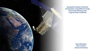
  • 1. Geospatial Analysis of Remote Sensing Data using different Image Processing Softwares and Programming in MATLAB Ranu Bhardwaj Ph.D. Scholar (Amity University)
  • 2. Syllabus Basic concept of Remote Sensing Geographic Information System (GIS) Photogrammetry Spatial Analysis Image Processing techniques 2
  • 3. Day 1 Geospatial data Geospatial Technology Natural Remote Sensing Remote Sensing in daily life Definition of Remote Sensing Concept of Remote Sensing History of Remote Sensing Modern day Remote Sensing using satellites Early Pictures of satellites Evolvement of Remote sensing 3
  • 4. Geospatial means…? Geographic + locational • Static - For ex. Current location • Dynamic- For ex. Live location 4
  • 5. What is Geo-spatial data The word geospatial is used to indicate that data that has a geographic component to it. This means that the records in a dataset have locational information tied to them such as geographic data in the form of coordinates, address, city, or ZIP code. GIS data is a form of geospatial data. Other geospatial data can originate from GPS data, satellite imagery, and geotagging. 5
  • 6. What is the Importance of Geospatial data..? 6
  • 7. What is Geospatial Technology Geospatial technology refers to all of the technology used to acquire, manipulate, and store geographic information. GIS is one form of geospatial technology. GPS, remote sensing are other examples of geospatial technology. 7
  • 8. What do you understand by Remote sensing 8
  • 11. Remote Sensing in Daily life 11 Eye Telescope Camera
  • 12. Definition of Remote Sensing Remote sensing is the science of acquiring information about an object or phenomenon by measuring emitted and reflected radiations. 12
  • 13. 13
  • 14. (A) Energy Source or Illumination – Emits Electromagnetic radiation towards earth surface. (B) Radiation and the Atmosphere – As energy source emits its radiation, it passes through the atmosphere and comes towards the earth. There are many atmospheric particles in the atmosphere, due to which some of the energy reflected, some of the energy scattered in the atmosphere and rest energy strikes on the earth features. (C) Interaction with the Target - once the energy makes its way to the target through the atmosphere, it interacts with the target depending on the properties of both the target and the radiation. (D) Recording of Energy by the Sensor- after the energy has been scattered by, or emitted from the target, we require a sensor (remote - not in contact with the target) to collect and record the electromagnetic radiation. (E) Transmission, Reception, and Processing- the energy recorded by the sensor has to be transmitted, often in electronic form, to a receiving and processing station where the data are processed into an image (hardcopy and/or digital). (F) Interpretation and Analysis- the processed image is interpreted, visually and/or digitally or electronically, to extract information about the target which was illuminated. (G) Application Concept of Remote Sensing 14
  • 15. Definitionsof RemoteSensing  Theterm“remote sensing”initsbroadest sensemerely means “reconnaissanceat a distance.”(Colwell,1966, p. 71)  Remotesensinghasbeenvariouslydefined but basically it istheart or science of telling something about an object without touching it. (Fischer et al., 1976, p. 34)  Remote sensing is the acquisition of physical data of an object without touch or contact.(Lintzand Simonett,1976, p. 1)  Remote sensing is the observation of a target by a device separated from it by somedistance.(Barrett and Curtis,1976, p. 3)  Remote sensing is the art, science and technology of obtaining reliable information about physical objects and the environment, through the process of recording, measuring and interpreting imagery and digital representations of energy patterns derived from noncontact sensor systems (Lecture Note by Wataru, 2009) 15
  • 16. Historyof Remote Sensing Natural: Oldest Compound Eyes Artificial:  1800: Discoveryof Infrared by SirWilliam Herschel  1826: JosephNiepce tookthefirst photograph  1839: Beginningof practice of photography  1858: Gaspard Tournachontakesfirst aerial photographfrom a balloon  1847: Infrared spectrumshownbyA.H.L.Fizeauand J.B.L.Foucaultto share properties with visible light  1873: Theoryof electromagnetic energy developed by JamesClerk Maxwell  1909: Photographyfrom airplanes  1914-1918 World War I:Aerial reconnaissance  1920–1930: Developmentand initial applications of aerial photography and photogrammetry 16
  • 17.  1929–1939: Economicdepressiongeneratesenvironmentalcrisesthat lead to governmentalapplicationsof aerial photography  1930–1940: Developmentof radarsinGermany,US,and UK  1939–1945: World War II:applicationsof nonvisibleportionsof electromagnetic spectrum;trainingof personsinacquisitionandinterpretationof airphotos  1950–1960: Military researchand development  1956: Colwell’sresearchonplant diseasedetectionwithinfrared photography  1960–1970: Firstuseof termremotesensingTIROSweathersatellite Skylab remote sensing observationsfromspace  1972: Launchof Landsat1  1970–1980: Rapidadvancesindigital image processing  1980–1990: Landsat4: newgenerationof Landsatsensors  1986: SPOTFrenchEarthobservationsatellite  1980s: Developmentof hyperspectral sensors  1990s: Global remotesensingsystems,lidars Historyof Remote Sensing 17
  • 18. Historyof Remote Sensing 10 Joseph Niepce First Photograph- 1826 (copyright Gernsheim Collection, U-Texas) 18
  • 19. HistoryofRemote Sensing 11 First Aerial Photograph from Airplane: Italy 24-04-1909 (Oblique view of walls of Centocelli Italy, by Wibur Wright) The first photo taken from balloon (1858) 19
  • 20. Historyof Remote Sensing 12 Early aerial photography by the U.S. Navy, 1914. This photograph illustrates difficulties encountered in early efforts to match the camera with the airplane 20
  • 21. Historyof Remote Sensing Aerial photography, World War I Aerial photography, World War II 13 21
  • 22. Modern day Remote Sensing using satellites 14 22
  • 23. EarlyPicturesof Satellites 15 Saudi Arabia Eastern India, Bangladesh & Himalayas (20N, 88E) Gulf of California and Southern California 23
  • 25. 25
  • 26. Whatdowesensein Remote Sensing By recording emitted or reflected radiation and applying knowledge of its behaviour as it passes through the Earth’s atmosphere and interacts with objects, remote sensing analysts develop knowledge of the character of features such as vegetation, structures, soils, rock, or water bodies on the Earth’s surface. 17 26
  • 27. Electromagnetic(EM) Spectrum 18 The most familiar form of EMR is visible light, which forms only a small (but very important) portion of the full EM spectrum. The large segments of this spectrum that lie outside the visible range require our special attention because they may behave in ways that are quite foreign to our everyday experience with visible radiation. Entertainment/communication Use it as Invisible to human eye Visible range can damage Produce by Useful for heat source but its heat can be feel tissue accelerating killing cancer Electrons cells Entertainment/communication Use it as Invisible to human eye Visible range can damage Produce by Useful for heat source but its heat can be feel tissue accelerating killing cancer Electrons cells 27
  • 28. 28
  • 29. Various Stepsin RS 23 (A) Energy Source (B) Radiation and the Atmosphere (C) Interaction with the Target (D) Recording of Energy by the Sensor (E) Transmission, Reception, and Processing (F) Interpretation and Analysis (G) Application 29
  • 30. Active Remote sensing For example, RADAR & LIDAR 30
  • 31. Passive Remote sensing For example- Spectroradiometer, Imaging radiometer 31
  • 33. All remote sensing systems have four types of resolution: • Spatial • Spectral • Temporal • Radiometric 33
  • 34. High vs. Low? Spatial Resolution Source: Jensen (2000) 34
  • 36. 36
  • 37. 37
  • 38. Radiometric Resolution Imagery data are represented by positive digital numbers which vary from 0 to (one less than) a selected power of 2. This range corresponds to the number of bits used for coding numbers in binary format. Each bit records an exponent of power 2 (e.g. 1 bit=2 1=2). The maximum number of brightness levels available depends on the number of bits used in representing the energy recorded. Thus, if a sensor used 8 bits to record the data, there would be 28=256 digital values available, ranging from 0 to 255. 38
  • 39. Elements of Image Interpretation Shape: • Many natural and human-made features have unique shapes. • Often used are adjectives like linear, curvilinear, circular, elliptical, radial, square, rectangular, triangular, hexagonal, star, elongated, and amorphous. 39
  • 41. Shadow:  Shadow reduction is of concern in remote sensing because shadows tend to obscure objects that might otherwise be detected.  However, the shadow cast by an object may be the only real clue to its identity.  Shadows can also provide information on the height of an object either qualitatively or quantitatively. 41
  • 43. Elements of Image Interpretation  Tone and Color:  A band of EMR recorded by a remote sensing instrument can be displayed on an image in shades of gray ranging from black to white.  These shades are called “tones”, and can be qualitatively referred to as dark, light, or intermediate (humans can see 40-50 tones).  Tone is related to the amount of light reflected from the scene in a specific wavelength interval (band). 43
  • 45. Elements of Image Interpretation Texture:  Texture refers to the arrangement of tone or color in an image.  Useful because Earth features that exhibit similar tones often exhibit different textures.  Adjectives include smooth (uniform, homogeneous), intermediate, and rough (coarse, heterogeneous). 45
  • 47. Elements of Image Interpretation Pattern:  Pattern is the spatial arrangement of objects on the landscape.  General descriptions include random and systematic; natural and human-made.  More specific descriptions include circular, oval, curvilinear, linear, radiating, rectangular, etc. 47
  • 49. Elements of Image Interpretation Height and Depth:  As discussed, shadows can often offer clues to the height of objects.  In turn, relative heights can be used to interpret objects.  In a similar fashion, relative depths can often be interpreted.  Descriptions include tall, intermediate, and short; deep, intermediate, and shallow. 49
  • 50. 50
  • 51. Elements of Image Interpretation Association:  This is very important when trying to interpret an object or activity. Association refers to the fact that certain features and activities are almost always related to the presence of certain other features and activities. 51
  • 53. 53
  • 54. 54
  • 57. The problem with clouds… 57
  • 58. Landsat 8 OLI 10 Jan 2016 58
  • 59. Landsat 8 OLI 26 Jan 2016 59
  • 60. Landsat 8 OLI 11 Feb 2016 60
  • 61. Landsat 8 OLI 27 Feb 2016 61
  • 62. Landsat 8 OLI 14 Mar 2016 62
  • 63. Landsat 8 OLI 30 Mar 2016 63
  • 64. Landsat 8 OLI 15 Apr 2016 64
  • 65. Landsat 8 OLI 01 May 2016 65
  • 66. Landsat 8 OLI 17 May 2016 66
  • 67. Landsat 8 OLI 02 Jun 2016 67
  • 68. Landsat 8 OLI 18 Jun 2016 68
  • 69. Landsat 8 OLI 04 Jul 2016 69
  • 70. Only 1 out of 11 Landsat 8 OLI images are usable for the current year! For Sentinel 2A, there are only 2 usable images… 70
  • 71. The solution is to use active microwave sensors (SAR) that can see through clouds! 71
  • 81. Spatial Resolution: Landsat 8 OLI vs. Sentinel 2A vs. Sentinel 1A 81
  • 82. Landsat 8 OLI 04 Jul 2016 82
  • 85. A close-up of the river vegetation 85
  • 86. Landsat 8 OLI 04 Jul 2016 86
  • 89. Various Platforms of RS torecordEM spectrum 22 89
  • 91. Application of RS and GIS 35 Agriculture and Soil • Precision Agriculture, Crop Acreage and Production Estimation, Soil and Land Degradation Mapping Forest, Biodiversity and Environment • Forest Cover and Type Mapping, Biodiversity Characterisation, Environmental Impact Studies, Monitoring of Environmental Sensitive Area, Monitoring of Wetland Areas, Forest Fire and Risk Mapping Engineering and Geology • Mineral Potential Mapping, Groundwater Potential Zoning, Infrastructure Planning Regional/ Land Development • Town and Country Planning, Land Alienation, Solid Waste Disposal 91
  • 92. Applicationof RS and GIS 36 Marine and Oceanography • Potential Fishing Zone (PFZ), Coastal Zone Mapping, Marine Resources, Physical Oceanography Disaster Management • Monitoring and Mapping of Disaster Areas (Forest fire, Flood and Landslide), Landslide Hazard Zonation, Flood Damage Assessment, Forest Fire Meteorology • Extended Range Monsoon Forecasting, Ocean State Forecasting Water • Potential Drinking Water Zones, Monitoring of Catchment and Reservoir Areas, Surface Water, Watershed Development 92
  • 93. Applicationof RS and GIS 37 Environmental Health • Dengue Risk Mapping Zoning, Children Malnutrition Study, Air Pollution Study, Tick Borne Disease Landuse Monitoring • Landuse/ Land Cover Mapping, Wasteland Mapping, Topography and Geographic Positioning, Urban Development, Geology National Security • Intelligence, Territorial Security Management, Mapping and Rescue Planning, Strategic and Tactical, Ground Mobility 93
  • 94. Application of RS:CropGrowth Monitoring 38 94
  • 95. Global Normalized difference vegetation index (NDVI) map by MODIS(2003) ApplicationofRS:CropGrowth Monitoring [GSFC, 2003] 39 95
  • 97. ApplicationofRS:UrbanHeatIsland Monitoring Land Surface temperature is clearly enhanced by land cover 41 97
  • 100. ApplicationofRS:Land Uses 44 Newfoundland , Canada Landsat Composite Image 100
  • 103. ApplicationofRS:Flood Mapping 47 satellite image of St. Louis on July 4, 1988, during normal river levels. St. Louis on July 18, 1993, during the height of the flooding. 103
  • 106. • BooksonRemotesensing BooksandTutorials 55 James B. Campbell, Randolph H. Wynne (2011):Introduction to Remote Sensing, Fifth Edition Canada Centre for Remote Sensing Fundamentals of Remote sensing Thomas M. Lillesand (eds.), 2007. Remote sensing and image interpretation, Willey. 106
  • 107. BooksandTutorials Paul R. Wolf (eds.), 2000. Elements of photogrammetry with applications in GIS, McGraw-Hill Science. Qihao Weng, Remote Sensing and GIS Integration, Theory, Methods and Applications BooksonRemoteSensingand GIS 56 107
  • 108. BooksandTutorials • BooksonGIS Shahab Fazal, GIS Basics Michael N. DeMers, GIS for Dummies Julie Delaney & Kimberly Van Niel, Geographic Information system An introduction 57 108
  • 109. BooksandTutorials  BooksonGIS T. Sutton, O. Dassau, M. Sutton, A gentle introduction to GIS To be added with the help of Sir Google … .  58 109
  • 110.  RemoteSensing (RS) □ Remotelysensingtheuseful information of object (earth) □ Processof recording, measuring and interpreting imagery and digital representations of energy patterns derived from noncontactsensor systems  GeographicInformation System(GIS) □ Asystemdesigned to capture, store, manipulate, analyze, manage, and present all types of geographically referenced data 3 110
  • 111. Geographically Referenced image  Geographically Referenced Data separate GIS from other Information Systems.  Georeferencing means that the internal coordinate system of an image or aerial photo image can be related to a geographic coordinate system.  Georeference something means to define its existence in physical space. That is, establishing its location in terms of coordinate systems.  Before we begin discussing GIS, we must understand data nature used with GIS applications. 111
  • 112. For example, roads- To describe a road, we need locations (where it is), and its characteristics: length, name, speed limit, and direction). The location, also called geometry or shape, represents spatial data, whereas the characteristics are attribute data. So, the road, like any other geographically referenced data, has two main components: spatial data & attribute data. 112
  • 113. 113
  • 114. Can you recall Google Earth? The information in the Google earth is obtained through Remote Sensing While its representation and management on geographical locations is made possible through GIS 4 114
  • 115. Can you recall Google Earth? Let's look at small movies about Google earth to learn more about the remotely sensed information and its geographical referencing of the information 5 115
  • 116. Google Earth Engine allows observation of dynamic changes in agriculture, natural resources, and climate using geospatial data from the Landsat satellite program, which passes over the same places on the Earth every sixteen days. 116
  • 117. Nitin Chauhan - Department of Remote Sensing GEOGRAPHICAL INFORMATION SYSTEM 117
  • 118. Geography…. The Science of Earth’s Physical features, resources, climate, population etc. Nitin Chauhan - Department of Remote Sensing 118
  • 119. Geography…. What & Where Location is important What & Where 4 GEOGRAPHY = Geo + Graphy SNAKES & LADDER Nitin Chauhan - Department of Remote Sensing 119
  • 120. E L P P A O G D C A T Data… 5 Nitin Chauhan - Department of Remote Sensing 120
  • 121. L E G D O C A T Information 6 A P P Nitin Chauhan - Department of Remote Sensing 121
  • 122. Data Information Factual information, especially information organized for analysis or used to reason or make decisions. Information is the result of processing, manipulating and organizing data in a way that adds to the knowledge of the person receiving it. Data versus Information…. 7 Nitin Chauhan - Department of Remote Sensing 122
  • 123. Nitin Chauhan - Department of Remote Sensing GIS ⚫ Geographic  GIS tend to deal primarily with geographic or spatialfeatures.  These objects can be referenced or related to a specific location in space. ⚫ Information  Large volumes of data, handled within a GIS  Real world objects with set of characteristics or descriptive attributes ⚫ System  Complex environments are broken down into their component parts for ease of understanding and handling but  Are considered to from an integrated whole 123
  • 124. What GIS can do? Real world problems Identification Where ? Locate What is there? Optimum path What is the best route? Patterns What relations exists between? Trend What has changed ? Models What if ? What GIS can do??? 9 Nitin Chauhan - Department of Remote Sensing 124
  • 125. GIS Definition ⚫Toolbox based - set of tools - a system - an information system ⚫Database definitions - a database system in which most of the data are spatially indexed, and upon which a set of procedures are operated in order to answer queries about spatial entities in the database. ⚫Organization based definitions - a decision support system involving the integration of spatially referenced data in a problem solving environment for capturing, storing, retrieving, analyzing and displaying which are spatially referenced to earth Nitin Chauhan - Department of Remote Sensing 125
  • 126. C + S + T + A + R + D = GIS Defining GIS….the easy way 11 Nitin Chauhan - Department of Remote Sensing 126
  • 127. GIS is a tool that can: C = Collect S = Store Defining GIS….the easy way 12 T = Transform A = Analyze R = Retrieve D = Display d Nitin a Cht aua han - Department of Remote Sensing 127
  • 128. History of GIS ⚫ Ian L. McHarg is Known as “ Father of GIS” ⚫ 1963 : Canada Geographic Information System (CGIS) : http://geogratis.cgdi.gc.ca/CLI/index_agriculture.html). It was given by Roger Tomlinson to analyze Canada's national land inventory ⚫ 1964 : Harvard Laboratory for Computer Graphics (and Spatial Analysis) was established by Howard Fisher. This lab had major influence on the development of GIS until early 1980 ⚫ 1965 : The development of the GBF-DIME (Geographic Base Files - Dual Independent Map Encoding) files by the U.S. Census Bureau. term DIME itself was first coined by George Farnsworth 13 Nitin Chauhan - Department of Remote Sensing 128
  • 129. History of GIS ⚫1966 : Howard Fisher developed SYMAP (Synagraphic Mapping a general-purpose System) mapping package, producing • isoline, choropleth and proximal maps on a line printer. • 1966 : Howard Fisher developed SYMAP (Synagraphic Mapping System) a general-purpose mapping package, producing isoline, choropleth and proximal maps on a line printer. 14 Nitin Chauhan - Department of Remote Sensing 129
  • 130. History of GIS ⚫1969 : Data formats begin to emerge and private vendors began offering GIS packages:  Environmental Science Research Institute (ESRI) is founded by Jack and Laura Dangermond  Jim Meadlock establishes Intergraph Corporation (originally called M & S Computing Inc) ⚫1972 : IBM's GFIS (Geographic Information Systems) 15 Nitin Chauhan - Department of Remote Sensing 130
  • 131. History of GIS ⚫ 1976 : Minnesota Land Management Information System (MLMIS), developed at the Centre for Urban and Regional Analysis, University of Minnesota. ⚫ 1977 : The USGS (U.S. Geological Survey) develops the Digital Line Graph (DLG) spatial data format ⚫ 1978 : ESRI developed the first version of Arc/Info, the current leading GIS software package. ⚫ 1978 : ERDAS (Earth Resource Data Analysis System) was founded 16 Nitin Chauhan - Department of Remote Sensing 131
  • 132. History of GIS ⚫ 1980 : GIS was pushed to evolve towards analysis ⚫ 1982 : ESRI's ARC/INFO® 1.0, the first commercially available GIS software package, which ran on mainframe computers ⚫ 1985 : Army Corps of Engineers at the Construction Engineering Research Laboratory (CERL) started the development of the GIS GRASS – Geographic Resources Analysis Support System – as a raster based GIS programme 17 Nitin Chauhan - Department of Remote Sensing 132
  • 133. History of GIS 18 ⚫ 1986 : Mapinfo was founded. ESRI's PC ARC/INFO® 1.0, the first GIS software available for the personal computer, was released ⚫ 1987 : SPANS( Spatial Analysis System) GIS and IDRISI by Clark University. ⚫ 1988 : US bureau of Census „TIGER‟(Topographically Integrated Geographic Encoding and Referencing) digital data products. ⚫ 1988 : The National Centre for Geographic Information and Analysis (NCGIA) was established in the USA Nitin Chauhan - Department of Remote Sensing 133
  • 134. History of GIS 19 ⚫ 1989 : ER Mapper was launched. Intergraph launched MGE (Modular GIS Environment) ⚫ 1990 : Third phase of evolution : GIS became a real Management Information System (MIS), and thus able to support decision making processes ⚫ 1992 : Lebanon, decided to rebuild the entire nations electricity network in GIS environment ⚫ 1993 : XEROX PARC Map Viewer : first Web-based interactive map Viewer was developed by Steve Putz ⚫ 1994 : OGC (Open Geospatial Consortium ) was founded Nitin Chauhan - Department of Remote Sensing 134
  • 135. History of GIS ⚫ Beyond 2000 :    Mobile GIS Location based services Open access to satellite images (ex. Google Earth) 20 ⚫ 1997 : Internet GIS – ( ArcIMS – Arcview Internet Map Server) ( Mapserver – Developed by University of Minnesota – open source) Nitin Chauhan - Department of Remote Sensing 135
  • 136. Geographical information systemsevolved from centuriesof mapmakingand thecompilation of spatial data HistoryandDevelopmentof GIS 31 Map prepared by Eratosthenes The Greek mathematician, astronomer, and geographerEratosthenes (ca. 276 – 194B.C.) laid the foundations of scientific cartography 136
  • 137. HistoryandDevelopmentof GIS Ptolemy’s map of the world, about A.D. 150, republished in 1482. Notice the use of latitude and longitude lines and the distinctive projection of this map 32 137
  • 138. History and Developmentof GIS Al-Idrisi’s map of the world, 1456. He completed a map of the known world in the 12th century. Drawn with south at the top, this later example has been inverted for easier viewing. 33 138
  • 139. Components/ Elements of GIS Application Hardware ⚫ There are namely 5 components of GIS People Software Data Nitin Chauhan - Department of Remote Sensing 139
  • 140. RS and GIS ofEarthResources 24 GIS Data Product Interpre tation Products Users Electromagetic remote sensing of earth and its processing Remote Sensing Sensing System Geo referencing Pictorial and Numerical data 140
  • 141.  Geographic Information Systems (GIS)systemdesigned to capture, store,manipulate,analyze, manage,and present all types of geographically referenced data  GISare computerizedsystemsdesigned for thestorage, retrieval and analysisof geographically referenced data  GISusesadvanced analytical tools to explore at a scientificlevel the spatial relationships, patterns, and processesof cultural, biological, demographic, economic,geographic, and physical phenomena Unique capabilities of GIS  GISstoresrelated geographic features inseparate collectionsof files called map layers  Map layers canbe reusedeasily and assembledinto any numberof mapcompositionsand overlaid for analysis GeographicInformationSystem(GIS) 25 141
  • 143.  Information □ Remotesensingdata □ Geographic data  Hardware □ Computer □ Digitizer □ Scanner □ Printer/Plotter  Software □ Desktop GIS □ Internet GIS □ CADSoftware □ Database Software  Multimedia (photos, videos, 3D models) ToolsforGIS 27 Information Hardware/ software Multimedia 143
  • 144.  Location:Whatis at...?Whereis it…? □ (Locationquestion;what existsata particular location)  Condition:Statusof features…? □ (Conditionalquestion;whichlocationssatisfy certainconditions)  Trends:Whathas changed since...? □ (Trendyquestion;identifiesgeographic occurrenceortrendsthathave changed orin the processof changing)  Patterns:Whatspatial patterns exist…? □ (Relationalquestion:analyzes thespatial relationshipbetweenobjects ofgeographic features)  Modeling:Whatif…? □ (Model based question;computersand displays an optimumpath,a suitableland, risky area against disasters etc.based on model) GIS answersthefollowing 28 144
  • 145.  Location:Whatis at...?Where is it…?  Condition:Statusof features…?  Trends:Whathas changed since...?  Patterns:Whatspatial patterns exist…?  Modeling: Whatif…? GIS answersthefollowing… 29 Mohsin 145
  • 146. Basicdatamanipulationin RS &GIS 30 One of the most common products of a GIS is a map Global to local 146
  • 147. Tools for GIS  Hardware  Computer  Digitizer  Scanner  Printer/Plotter  Software  Desktop GIS  Internet GIS  CAD Software  Database Software  Multimedia (photos, videos, 3D models) 14 7
  • 148. Unique capabilities of GIS  GIS stores related geographic features in separate collections of files called map layers  Map layers can be reused easily and assembled into any number of map compositions and overlaid for analysis 14 8 ....KEEP TAKING NOTES....
  • 149. GIS answers the following  Location: What is at...? Where is it?  Condition: Status of features?  Trends: What has changed since...?  Patterns: What spatial patterns exist?  Modeling: What if…? 14 9
  • 150. Scale of GIS data 15 0
  • 151. Vector data  Map features  Vector data comprise Points (x & y) , lines (segment of arcs), polygons (lines with same start & end points)  Data comprise explicit spatial coordinates  Feature attributes  Every feature has attributes (e.g. name, • area, population) Shape Name Class Pop2000 State Point New York City 8,008,278 NY Point Los Angeles City 3,694,820 CA Point Chicago City 2,896,016 IL Vector data is also called ‘spaghet ti’ data 151
  • 152. Vector data 15 2 ....KEEP TAKING NOTES.... Line feature comprises of two forms of point locations (vertices), which represent change in direction of ARCS… NODES which represent the start & end of arcs, including locations where different arcs connect… Vector data are divided into their SPATIAL component and ATTRIBUTE component. Attribute linked to each spatial feature are stored using RELATIONAL DATABASE SYSTEM.
  • 153. Raster Data Stored electronic image or picture taken as an aerial photograph or satellite image Composed of a rectangular array of square cells, called pixels, with a number in each cell representing the solid color fill of that cell… 153
  • 156. TOPOLOGY  Topology can be defined as “The mathematical study of objects which are preserved through deformation, twistings and stretchings.”  Operations concerned with connections between objects are dependent on information about topological relationships. 15 6 ....KEEP TAKING NOTES....
  • 157. GIS DATA AND LAYERS 157
  • 158. GIS example  Identify polluting companies and their proximity to populations in poverty, water features, or schools.  Start with 1. Databases 2. Map layers 15 8 ....KEEP TAKING NOTES....
  • 159. Databases Not easy to interpret 15 9 ....KEEP TAKING NOTES....
  • 160. Data shown as GIS layers 16 0
  • 161. Additional layers Political features (municipalities) 16 1 ....KEEP TAKING NOTES....
  • 162. Additional layers Physical features (lakes, rivers, etc.) 162
  • 164. Maps and tables are interactive Identify features 164
  • 165. Maps and tables are interactive Select features ....KEEP TAKING NOTES....
  • 166. Advanced GIS functions Proximity selections ....KEEP TAKING NOTES.... 166
  • 167. Advanced GIS functions Buffers  Select top polluting companies and show the number of schools within 2 miles of these companies. 167
  • 169. GIS applications Engineering Civil engineering, surveying, property mapping Business Site location, delivery systems, marketing, media and press, real estate. Defense/intelligen ce Military operations, geospatial intelligence Government Federal, state, local, economic development, elections, urban and regional planning. Health Public health, health and human services, hospitals, managed care, research. Natural resources Agriculture, archaeology, climate change, conservation, environmental management, forestry, marine and coast, mining, petroleum, water resources. Public safety Computer-Aided Dispatch, emergency/disaster management, EMS, homeland security, law enforcement, fire protection, wildfire management Transportation Aviation, highways, logistics, railways, ports and maritime, public transit Utilities/communic ations Electric, gas, pipeline, telecommunications, water/wastewater .8..5.KEEPTAKING NOTES.... 169
  • 172. How to collect scientific data In-situ Remotely 172
  • 173. Importance of Remote Sensing Remote sensing makes it possible to collect data from dangerous or inaccessible areas, with growing relevance in modern society. It replaces slower, costly data collection on the ground, providing fast and repetitive coverage of extremely large areas for everyday applications, ranging from weather forecasts to reports on natural disasters or climate change. Remote sensing is also an unobstructive method, allowing users to collect data and perform data processing and GIS analysis offsite without disturbing the target area or object. Monitoring floods and forest fires, deforestation, polar bears, chemical concentrations, and earthquakes are just a few cases in which geospatial remote sensing provides a global perspective and actionable insights that would otherwise be unattainable. 173
  • 174. Why Remote Sensing SYSTEMATIC DATA COLLECTION INFORMATION ABOUT THREE DIMENSIONS OF REAL OBJECTS REPEATABILITY GLOBAL COVERAGE THE ONLY SOLUTION SOMETIMES FOR THE OTHERWISE INACCESSIBLE AREAS. MULTIPURPOSE INFORMATION 174
  • 175. Suppose you have a digital image which has a radiometric resolution of 6 bits. What is the maximum value of the digital number which could be represented in that image? 175
  • 176.  Searchand InstallGoogle earth or UseGoogle Mapsto locate you home  Thepurposeisto get interaction with remotely sensed informationand its processingusinginternetGIS systems  Noformal submissionisrequired. However,youhaveto report about your interaction with Google earth or Google Map  Deadline:Innext class Assignment 62 176
  • 177. A Model…  A model is simply a means of representing “reality” and, spatial data models provide abstraction of spatially referenced features in the real world.  Representation of real world is often divided into, (1) Entities (distinct objects like points, locations, roads, admin boundaries) (2) Fields (convey the idea of values of some property at all locations)  Objects that are well described as distinct entities are sensibly represented using the VECTOR DATA MODEL.  Properties that tend to vary quite smoothly from place to place are frequently represented using RASTER DATA MODEL.  Exceptions are isolines / contours / temperature elevation etc… 17 7 ....KEEP TAKING NOTES....
  • 178. What is GIS? 17 8 Geographic Information Systems (GIS) are computerized systems designed for the storage, retrieval and analysis of geographically referenced data GIS uses advanced analytical tools to explore at a scientific level the spatial relationships, patterns, and processes of cultural, biological, demographic, economic, geographic, and physical phenomena
  • 179. GIS & Image Processing softwares ENVI ERDAS Imagine ArcMap QGIS MATLAB Python 179
  • 180.  Providethestudentwitha basicunderstandingof thescienceandtechnology of remotesensingand geographic information system  Enablethestudentto understandthedifferencesbetweenthevarioussatellite remotesensingsystemsinexistencetoday  Enablethestudentto differentiate betweenthedifferent typesof information provided by thesesystems  Enablethestudentto understandtheintegration of remotesensingand GIS  Providethestudentwithbasicunderstandingof GISsystemsand their processingof remotesensingand geographic data  Enablethestudentto perform basicmanipulatationof data usingcommercial softwaresuchasArcGISetc Goal oftheCourse 180

Editor's Notes

  1. Innundated paddies are dark
  2. After growing and/or harvest, more backscatter. The river, however, has flooded!
  3. Healthy vegetation is bright. Resolution is nominally 10m but despeckling reduces that a bit.
  4. Landsat is good but the 30m resolution loses to Sentinel 2A on the next slide.
  5. Sentinel 1 is not as good as Sentinel 2 because it has much less spectral resolution, however, given the prevalence of clouds, it is a great resource.