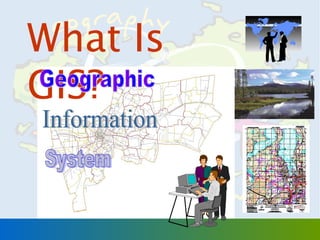
Submit Search
Upload
What Is GIS?
•
Download as PPT, PDF
•
1 like
•
680 views
Prapaporn Boonplord
Follow
วิชาเทคโนโลยีภูมิสารสนเทศ โดย ดร.ประภาพร บุญปลอด มหาวิทยาลัยราชภัฎสุรินทร์
Read less
Read more
Report
Share
Report
Share
1 of 39
Download now
Recommended
เครื่องมือและข้อมูลทางภูมิศาสตร์
chanok
Gis กับงานวิจัยทางอาชญาวิทยา
bigdog Loo
แคปจอ1
แคปจอ1
creaminiie
Deploying Geospatial Analysis through Web Processing Service: A Case Study of...
Chingchai Humhong
Introduction to SLD (Styled Layer Descriptor)
Chingchai Humhong
Research and Development of Early Natural Disaster Warning System with Real-T...
Chingchai Humhong
โรงไฟฟ้าพลังงานทดแทนและPDP (8 พ.ค.58)
nuchida suwapaet
What is BIPV, Building Integrated Photovoltaics
Teodor Galitev
Maps and the Geospatial Revolution: Lesson 2, Lecture 2
Anthony Robinson
GIS #8
GIS #8
Jessica Meyer
Wfs claims
Wfs claims
hmfowler
The Seven Environments
bozzellik
Stone national spatial reference system heights
GeCo in the Rockies
Maps and the Geospatial Revolution: Lesson 1, Lecture 1
Anthony Robinson
ArcGIS
ArcGIS
Esri
Evolution of GIS Technologies in a Web 2.0
pdscomp
GIS Presentation
GIS Presentation
Athiwat Phinyoyang
GIS Electrical and Instrumentation Web
Joshua Clemens
Esri Ireland "ArcGIS - The Platform Story" Esri maps for Sharepoint - Nigel ...
Esri Ireland
South_Blakey_Evolution of GIS Based Analysis ECIM Haugesund 2010
Bernie South
The future of oblique and 3 d mapping for city planning and management tren...
Armando Guevara
Esri South Africa ArcGIS 10.2 Rollout
Esri South Africa
Arabia mountain gis water presentation
Arabia Mountain HS Library
Knownledge Gis
Knownledge Gis
tanakorntanat
ระบบสารสนเทศภูมิศาสตร์
PraewfulWonderwonder WonderfulWonderwonder
Gis
Gis
Praewful
What is GIS
What is GIS
IT for Society Club
เทคโนโลยีสารสนเทศ Work3-39
Thamonwan Phasopbuchatham
10 Conclusion
10 Conclusion
Sarit Tiyawongsuwan
Cw059 12 การพัฒนาความเป็นผู้นำ
Prapaporn Boonplord
More Related Content
Viewers also liked
Maps and the Geospatial Revolution: Lesson 2, Lecture 2
Anthony Robinson
GIS #8
GIS #8
Jessica Meyer
Wfs claims
Wfs claims
hmfowler
The Seven Environments
bozzellik
Stone national spatial reference system heights
GeCo in the Rockies
Maps and the Geospatial Revolution: Lesson 1, Lecture 1
Anthony Robinson
ArcGIS
ArcGIS
Esri
Evolution of GIS Technologies in a Web 2.0
pdscomp
GIS Presentation
GIS Presentation
Athiwat Phinyoyang
GIS Electrical and Instrumentation Web
Joshua Clemens
Esri Ireland "ArcGIS - The Platform Story" Esri maps for Sharepoint - Nigel ...
Esri Ireland
South_Blakey_Evolution of GIS Based Analysis ECIM Haugesund 2010
Bernie South
The future of oblique and 3 d mapping for city planning and management tren...
Armando Guevara
Esri South Africa ArcGIS 10.2 Rollout
Esri South Africa
Arabia mountain gis water presentation
Arabia Mountain HS Library
Viewers also liked
(15)
Maps and the Geospatial Revolution: Lesson 2, Lecture 2
GIS #8
GIS #8
Wfs claims
Wfs claims
The Seven Environments
Stone national spatial reference system heights
Maps and the Geospatial Revolution: Lesson 1, Lecture 1
ArcGIS
ArcGIS
Evolution of GIS Technologies in a Web 2.0
GIS Presentation
GIS Presentation
GIS Electrical and Instrumentation Web
Esri Ireland "ArcGIS - The Platform Story" Esri maps for Sharepoint - Nigel ...
South_Blakey_Evolution of GIS Based Analysis ECIM Haugesund 2010
The future of oblique and 3 d mapping for city planning and management tren...
Esri South Africa ArcGIS 10.2 Rollout
Arabia mountain gis water presentation
Similar to What Is GIS?
Knownledge Gis
Knownledge Gis
tanakorntanat
ระบบสารสนเทศภูมิศาสตร์
PraewfulWonderwonder WonderfulWonderwonder
Gis
Gis
Praewful
What is GIS
What is GIS
IT for Society Club
เทคโนโลยีสารสนเทศ Work3-39
Thamonwan Phasopbuchatham
10 Conclusion
10 Conclusion
Sarit Tiyawongsuwan
Similar to What Is GIS?
(6)
Knownledge Gis
Knownledge Gis
ระบบสารสนเทศภูมิศาสตร์
Gis
Gis
What is GIS
What is GIS
เทคโนโลยีสารสนเทศ Work3-39
10 Conclusion
10 Conclusion
More from Prapaporn Boonplord
Cw059 12 การพัฒนาความเป็นผู้นำ
Prapaporn Boonplord
Cw059 11 พลภาพของความสำเร็จ
Prapaporn Boonplord
Cw059 09 ความเป็นผู้นำ ประสบการณ์จากนักบริหารนานาชาติ
Prapaporn Boonplord
Cw059 08 ผิดให้เป็นครู และ ล้มแล้วรู้จักลุก
Prapaporn Boonplord
Cw059 08 การสร้างและใช้เครือข่าย
Prapaporn Boonplord
Cw059 08 การสร้างมิตร ขยายพวก
Prapaporn Boonplord
Cw059 07 สู่ความสำเร็จในการเปลี่ยนแปลงตนเองและองค์การ
Prapaporn Boonplord
Cw059 07 ผู้นำกับการจัดองค์การให้มีประสิทธิภาพ
Prapaporn Boonplord
Cw059 07 การนำด้วยการเปลี่ยนแปลง
Prapaporn Boonplord
Cw059 06 การเข้าสู่ตำแหน่งงานใหม่
Prapaporn Boonplord
Cw059 05 a ผู้นำกับการตัดสินใจ
Prapaporn Boonplord
Cw059 05 a ผู้นำกับการตัดสินใจ(v2)
Prapaporn Boonplord
Cw059 04 รูปแบบการนำที่เป็นปัญหา
Prapaporn Boonplord
Cw059 04 ปัญหาผู้นำระดับสูง
Prapaporn Boonplord
Cw059 03 eq ทำงานอย่างไร
Prapaporn Boonplord
Cw059 01 บทบาทของนักบริหารการศึกษา
Prapaporn Boonplord
Cw059 01 ความเป็นผู้นำ(leadership) กรณีเพื่อการศึกษา
Prapaporn Boonplord
Cw059 01 กิจกรรม ความเป็นผู้นำ
Prapaporn Boonplord
Cw059 01 aบทบาทของผู้นำ (roles leaders play)
Prapaporn Boonplord
Cw059 00 ประมวลการสอน ความเป็นผู้นำ ..
Prapaporn Boonplord
More from Prapaporn Boonplord
(20)
Cw059 12 การพัฒนาความเป็นผู้นำ
Cw059 11 พลภาพของความสำเร็จ
Cw059 09 ความเป็นผู้นำ ประสบการณ์จากนักบริหารนานาชาติ
Cw059 08 ผิดให้เป็นครู และ ล้มแล้วรู้จักลุก
Cw059 08 การสร้างและใช้เครือข่าย
Cw059 08 การสร้างมิตร ขยายพวก
Cw059 07 สู่ความสำเร็จในการเปลี่ยนแปลงตนเองและองค์การ
Cw059 07 ผู้นำกับการจัดองค์การให้มีประสิทธิภาพ
Cw059 07 การนำด้วยการเปลี่ยนแปลง
Cw059 06 การเข้าสู่ตำแหน่งงานใหม่
Cw059 05 a ผู้นำกับการตัดสินใจ
Cw059 05 a ผู้นำกับการตัดสินใจ(v2)
Cw059 04 รูปแบบการนำที่เป็นปัญหา
Cw059 04 ปัญหาผู้นำระดับสูง
Cw059 03 eq ทำงานอย่างไร
Cw059 01 บทบาทของนักบริหารการศึกษา
Cw059 01 ความเป็นผู้นำ(leadership) กรณีเพื่อการศึกษา
Cw059 01 กิจกรรม ความเป็นผู้นำ
Cw059 01 aบทบาทของผู้นำ (roles leaders play)
Cw059 00 ประมวลการสอน ความเป็นผู้นำ ..
What Is GIS?
1.
What Is GIS? 1
2.
ระบบสารสนเทศภูม ศ าสตร์ ิ Geographic
Information Syste “เครือ งมือ ทีไ ด้ร บ การพัฒ นาให้ม ป ระสิท ธิภ าพในการ ่ ่ ั ี จัด เก็บ สืบ ค้น ปรับ ปรุง แก้ไ ข วิเ คราะห์ และแสดงผล ข้อ มูล ในสภาพความเป็น จริง ทีม ีก ารอ้า งอิง พิก ด ทาง ่ ั ภูม ิศ าสตร์ เป็น ตัว เชือ มโยง เพือ นำา ไปประยุก ต์ใ ช้ใ น ่ ่ การดำา เนิน งานด้า นต่า งๆ ” 2
3.
Geographic Information System ระบบสารสนเทศที่ใ
ช้ใ นการ จัด เก็บ จัด การ วิเ คราะห์ แสดง ผล ข้อ มูล ทางภูม ิศ าสตร์ 3
4.
องค์ป ระกอบของ GIS 4
5.
Hardware เป็น อุป กรณ์ต
า งๆที่ใ ช้ก ับ โปรแกรม GIS ่ อุป กรณ์น ร วมถึง อุป กรณ์ท ี่ใ ช้ใ นการนำา ี้ เข้า การประมวลผล และการแสดงผล ข้อ มูล และผลิต ผลลัพ ธ์ข องการทำา งาน เช่น – Computer – Digitizer, Scanner, GPS – Plotter, Printer 5
6.
Software 6
7.
Software คือ โปรแกรมคอมพิว เตอร์ท
ี่ใ ช้ใ นการจัด การ ข้อ มูล ในระบบ GIS เช่น – Arc/Info เป็น โปรแกรมทีท ำา งานได้ท ง บนเครือ ง ่ ั้ ่ ทีม ร ะบบปฏิบ ต ิก าร PC, UNIX, และ NT version ่ ี ั – ArcView เป็น โปรแกรมทีใ ช้ใ นการ Display ่ ข้อ มูล ทัง ทีเ ป็น Graphic และ ข้อ มูล เชิง บรรยาย ้ ่ โปรแกรมนี้ส ามารถใช้ใ นการวิเ คราะห์เ บือ งต้น ้ ได้ – R2V เป็น โปรแกรมทีใ ช้ใ นการนำา เข้า ข้อ มูล โดย ่ วิธ ก าร Scan/ Vectorize ี – ERDAS เป็น โปรแกรมทีใ ช้ใ นการแปลและ ่ วิเ คราะห์ข ้อ มูล Raster – PAMAP เป็น โปรแกรมทีใ ช้ง านได้ก ับ ข้อ มูล ่ Vector 7
8.
People People หรือ บุค ลากร •
เป็น องค์ป ระกอบทีส ำา คัญ ทีส ุด ่ ่ ของ GIS เนื่อ งจากถ้า ขาด บุค ลากรก็จ ะไม่ม ีก ารพัฒ นา โปรแกรม อุป กรณ์ หรือ ข้อ มูล ทีม ีค ณ ภาพ ่ ุ • “ไม่ม ีบ ค ลากร ไม่ม ี GIS” ุ 8
9.
Data GIS Stores Data
as Layers UTILITIES BUILDINGS TRANSPORTATION HYDROLOGY TOPOGRAPHIC PARCEL REAL WORLD 1121 1120 200 1124 1123 - - 9
10.
GIS Features on
Real World Aerial Photo ถน น แหล่ง นำ้า และ อาคาร สถานที่ สำา คัญ 10
11.
GIS Feature Type:
Point POINT Node X2,Y2 Node X3,Y3 Node X1,Y1 11
12.
Point Feature ตำำ แหน่ง
พิก ัด ที่ไ ม่ม ี ขนำดและทิศ ทำง ข้อ มูล ภูม ิศ ำสตร์แ สดงตำม ลัก ษณะภูม ิป ระเทศและตำม ขนำดมำตรำส่ว นของ แผนที่ ตัว อย่ำ งเช่น บน แผนที่ม ำตรำส่ว นใหญ่ อำจ เห็น ตำำ แหน่ง หมู่บ ้ำ นเป็น เพีย งจุด (Point) บนพื้น ที่ อำณำเขตจัง หวัด ที่เ ป็น รูป หลำยเหลี่ย ม (Polygon) เมื่อ แผนที่ม ำตรำส่ว นเล็ก ลงสำมำรถแสดงรำย ละเอีย ดได้ม ำกขึ้น อำจเห็น รูป หลำยเหลี่ย มของ ขอบเขตชุม ชนเพิ่ม จำกที่ เดิม เป็น เพีย งจุด พิก ัด 12 ตำำ แหน่ง
13.
GIS Feature Type:
Arc ARC Vertex X2,Y2 Node X1,Y1 Length = 15.26 Node X3,Y3 13
14.
Line Feature มีร ะยะและทิศ
ทำงระหว่ำ งจุด เริ่ม ต้น ไปยัง จุด แนวทำง (Vector) และ จุด สิน สุด ้ แต่ไ ม่ม ค วำม ี กว้ำ ง a b ลำำ นำ้ำ เห็น เป็น แนว เส้น บนแผนที่ มำตรำส่ว นใหญ่ เมื่อ แผนที่ม ี มำตรำส่ว นเล็ก ลง อำจเห็น ควำมกว้ำ ง ของลำำ นำ้ำ เป็น รูป หลำยเหลี่ย ม (Polygon)
15.
GIS Feature Type:
Polygon POLYGON Coord. Perimeter Area Coord. Perimeter Area x1,y1 L A x1,y1 L A x2,y2 x2,y2 x3,y3 x3,y3 x4,y4 x4,y4 xN,yN xN,yN 15
16.
Polygon Feature มีร ะยะและทิศ
ทำงระหว่ำ งจุด เริ่ม ต้น จุด แนวทำง (Vector) และจุด สิน ้ สุด ทีป ระกอบกัน เป็น รูป หลำย ่ เหลี่ย มมีข นำดพื้น ที่ (Area) และเส้น รอบรูป (Perimeter) b c a d บริเ วณป่ำ ไม้ม ีข นำดที่ สำมำรถแสดงเป็น รูป หลำยเหลี่ย ม (Polygon Feature) ได้บ นแผนที่ร ะดับ จัง หวัด
17.
GIS Feature Type:
Annotation ANNOTATION 17
18.
Combined Feature Types
on Map POINT POLYGON ARC ANNOTATION 18
19.
GIS Data Format Vector
Format Raster Format 19
20.
กำรเก็บ ข้อ มูล แบบ
Vector X1 ,Y1 X2 ,Y2 X3 ,Y3 X5 ,Y5 X4 ,Y4 X6 ,Y6 •เก็บ ข้อ มูล ในรูป แบบของ ข้อ มูล เชิง เส้น (Vector) •ข้อ มูล แต่ล ะเส้น มี ตำำ แหน่ง ค่ำ พิก ัด ของจุด ต่ำ งๆ •เหมำะสำำ หรับ 20 กำรวิเ ครำะห์
21.
การเก็บ ข้อ มูล แบบ
Raster ล ในรูป •เก็บ ข้อ มู X, Y แบบของ ข้อ มูล เชิง จุด (Cell-based) ใน ตารางกริต (GRID) •แต่ล ะช่อ งใช้ เก็บ ค่า ของ ข้อ มูล เรีย กว่า 21 Pixel
22.
ข้อ มูล ทั้ง
สองรูป แบบสามารถ แปลงไปมาได้ Raster Vector 22
23.
GIS Data Architecture Related Spatial Data Attribute
Data 23
24.
GIS DATA พื้น ที่
= 204.56 ตร.กม. ประชากร = 20,000 คน พื้น ทีเ พาะปลูก = นาข้า ว ่ : : : Spatial or Graphic Attribute 24
25.
GIS Data =
Graphics + Attributes Feature Examples จุด - เสา Point - หม้อ แปลง - สวิท ช์ เส้น Arc - ถนน - สายไฟ พืน ที่ - เขตอำา เภอ ้ Polygon แหล่ง นำ้า - Graphic Data Attribute Data - ความสูง ของเสา - Rating KVA - สถานะของสวิท ช์ - ประเภทของถนน - ขนาดของสายไฟ - จำา นวนประชากร - ประเภทแหล่ง นำ้า 25
26.
Methods ขั้น ตอนการ ทำา งาน ในระบบสารสนเทศ ภูม
ิศ าสตร์ ความถูก The Real Softwareต้อ งของข้อ มูล เป็น สิ่ง สำา คัญ ที่ส ุด เพราะ W orld Tool การวิเ คราะห์แ ละ ตัด สิน ใจจากข้อ มูล ที่ ผิด พลาดสามารถจะ Procedure เป็น ผลเสีย อย่า งใหญ่ หลวง แรงงานความ GIS Database พยายามและค่า ใช้ จ่า ยทุก อย่า งที่ล งทุน ไปกลายเป็น ความสูญ เปล่า การสร้า งฐาน ั้น Graphic Data Attribute Data ข้อ มูล ที่ด ีจ ึง ต้อ งมีข26 ตอนการทำา งานที่ ละเอีย ดถูก ต้อ ง เพื่อ
27.
การประยุก ต์ก ารใช้ง
านของ GIS ใช้ส อบถามข้อ มูล Data Query 27
28.
การวิเ คราะห์ซ ้อ
นทับ พื้น ที่ (Spatial Overlay Analysis) C B D A B-2 B-1 E C-2 D-2 พื้น ที่เ พาะปลูก A-1 D-3 A-3 E-3 2 1 การเพาะปลูก พืช ในพืน ทีจ ัง หวัด ต่า ้ ่ 3 เขตจัง หวัด 28
29.
การวิเ คราะห์ร ะบบเครือ
ข่า ย (Network Analysis) B 15 กม. 12 กม. A การค้น หาเส้น ทางที่ส น ที่ส ด ั้ ุ 29
30.
ตำา แหน่ง วัต
ถุแ บบ Real-time Automatic Vehicle Locating System 30
31.
การใช้ข ้อ มูล
Remote Sensing เพือ วิจ ัย ด้า นสิ่ง แวดล้อ ม ่ ปี 1990 ปี 1996 31
32.
การผสมภาพถ่ายดาวเทียมกับ ข้อมูลชั้นความสูงเพื่อสร้าง visualization
33.
How are GIS
Data created? Paper Maps + Film/ Images Data Conversion + Tabulation DIGITAL GIS Database 33
34.
Data Conversion ข้อมูล Vector Digitizing แผนที่ หรือ ภาพถ่า
ยทางอากาศ Ground Survey Input Surveyข้อ มูล สำา รวจ Data ฐานข้อ มูล GIS 34
35.
Technology ทีใ ช้ใ
นการจัด ่ เก็บ ข้อ มูล Digitization 35
36.
Technology ที่ใ ช้ใ
นการ จัด เก็บ ข้อ มูล - Scanner Vectorization 36
37.
Technology ที่ใ ช้ใ
นการ จัด เก็บ ข้อ มูล Remote Sensing Image Processing 37
38.
Technology ที่ใ ช้ใ
นการ จัด เก็บ ข้อ มูล Global Positioning System (GPS) GPS 38
39.
การผลิต แผนที่ (Cartography) 39
Download now