WATERWAY INSPECTIONS: HOW FREQUENT SHOULD IT BE PERFORMED?
•Download as PPTX, PDF•
0 likes•77 views

This is an obligation by PHMSA Regulations that pipeline water crossings need to be monitored frequently and protected.
Report
Share
Report
Share

Recommended
Introduction to River Systems
Rivers are characterized by their velocity, discharge, gradient, channel development, drainage area, and sediment yield. Velocity is the speed of water flow, discharge is the volume of water flowing per second, and gradient refers to the steepness of the river channel and floodplain. Drainage area is the land area that drains into the river, and sediment yield measures the amount of sediment exported from the drainage basin.
REVISION AS CAMBRIDGE GEOGRAPHY: RIVERS - CHANNEL EFFICIENCY
Channel efficiency is measured by calculating the hydraulic radius of the channel cross-section, which is the cross-sectional area divided by the wetted perimeter. A higher hydraulic radius results in a more efficient channel that can transfer water downstream at a higher velocity. Some channel shapes are more efficient because they have a higher proportion of water not in contact with bed and bank materials, experiencing less frictional effects. Channel efficiency normally increases downstream as the channel deepens and widens, resulting in less friction from smoothed bed and bank materials despite additional water inputs.
geographyalltheway.com - IB Geography - The Bradshaw Model
The document describes how characteristics of a river channel change from upstream to downstream. It explains that discharge, occupied channel width, channel depth, and average velocity all increase downstream as the drainage basin and input to the river increases. Channel depth and width increase to accommodate higher discharges. Average velocity increases downstream because the river becomes more efficient with less contact with its bed and banks, shown by a higher hydraulic radius and lower channel bed roughness.
Stream flow by Arslan
This document discusses streamflow, factors affecting streamflow quality, and methods of measuring streamflow quantity. It describes the three main mechanisms that generate streamflow: Hortonian overland flow, subsurface flow, and saturation overland flow. It also outlines common issues affecting streamflow quality and provides details on stage-discharge relationships, including guidelines for gauge location and types of gauges used to measure stream stage. Measurement of stream discharge is also briefly discussed.
Week2 lecture 3 dredging engineering_13_jun2020
Myanmar Engineers are experiencing a transition between traditional way of development and sustainable development approaches. For that reason, a 12 week course on Dredging Engineering has been created and delivered free of charge. This is the third lecture.
Stream gauging ppt
This document discusses stream gauging techniques used to measure stream discharge. It begins by explaining that stream flow represents the runoff phase of the hydrologic cycle and is the most important data for hydrologic studies. It then describes various methods for measuring stream stage including staff gauges, suspended wire gauges, automatic stage recorders, and bubble gauges. Common techniques for directly measuring stream discharge are also summarized, such as area-velocity methods using current meters and floats, as well as moving boat methods. Site selection criteria and types of stage data collected are also briefly outlined.
Stream flow
This document discusses various techniques for measuring stream flow, which is the volume of water moving through a designated point over time. It describes common methods like the velocity-area method, using a weir, and the bucket method. It also outlines different types of meters that can directly measure flow properties like velocity, including pygmy meters, vortex meters, and current meters. Accurately measuring stream flow is important for applications like flood prediction, assessing water and sediment levels over time, and monitoring long-term climate changes. A combination of techniques may be needed to account for variability in flow across seasons.
Stream flow measurement technique
introduction about stream flow and emerging technique related to remote sensing like surface velocity Radar (SVR) and probability concept
L4 stream flow
This document discusses methods for measuring stream flow. It describes what a stream and drainage basin are and defines stream flow as surface runoff. Direct stream flow measurement methods include area-velocity, dilution technique, and current meter methods. Indirect methods use hydraulic structures like weirs and the slope-area method. Current meters are commonly used to measure velocity and must be calibrated. The area-velocity method divides the cross section into segments and multiplies width, depth, and velocity to calculate discharge. Dilution techniques use tracers added to the stream. A stage-discharge relationship can also be developed using indirect stage measurement methods.
Lamichhane with signature
This document is a thesis submitted by Niraj Lamichhane to Youngstown State University in partial fulfillment of the requirements for a Master of Science degree in engineering. The thesis investigates the prediction of travel time and development of flood inundation maps for a flood warning system on the Grand River in Ohio, including scenarios involving ice jams. Hydraulic modeling was performed using HEC-RAS and HEC-GeoRAS to simulate floods, generate inundation maps, and assess the impacts of different elevation data resolutions and Manning's roughness values. The study found that coarser elevation data led to overprediction of travel time and inundated areas compared to LiDAR data integrated with field surveys.
DSD-INT 2019 Fine sediments - transport in suspension, storage and supply - F...
The transport of fine sediments in rivers is governed by complex interactions between sediment supply from basins, in-channel storage, and lateral storage in floodplains and off-channel areas. Experiments and modeling were used to investigate how sediment transport dynamics are influenced by the relative proportions of proximal in-channel sediments and distal incoming sediments, resulting in different types of hysteresis loops. Additional work examined how lateral embayments and their geometry affect hydrodynamics and sediment trapping, with higher trapping efficiencies found at intermediate discharges. Unsteady flows were shown to potentially re-mobilize sediments depending on embayment dimensions.
Stream flow measurement
This document discusses techniques for measuring stream flow. There are two main categories of measurement: direct determination using area-velocity methods, dilution techniques, electromagnetic and ultrasonic methods; and indirect determination using hydraulic structures like weirs, flumes and gates or slope-area methods. Velocity is an important aspect measured using current meters, which are the most commonly used instruments. Current meters consist of rotating cups or propellers connected to mechanisms that count revolutions to determine flow velocity. Floating objects can also be used to estimate surface velocities. Accurate stream flow measurement is important for hydrologic studies.
HEC - RAS Final Project
The three culverts near Tangent, Oregon were deemed impassable for fish by the local watershed council. Modeling of the river section in HEC-RAS found that the existing culverts did not meet several Oregon fish passage criteria under low and high flow conditions. Velocities exceeded limits for fish, drop heights were too high, and the culverts were not a suitable width. Removing the culverts in the model improved some criteria but velocities still exceeded limits. It was concluded that the culverts must be removed and replaced with a bridge or arch structure to provide landowner access while meeting regulations.
Weir Poster
- This study investigated errors in flow measurement using a 90-degree triangular weir under submerged conditions. Laboratory tests were conducted by inducing submergence at various steady flow rates.
- The results showed that submergence did not significantly affect flow readings from an ultrasonic meter until it reached around 42-49%, depending on the flow rate.
- Future work could incorporate momentum and Froude number principles to expand understanding of how submergence impacts flow measurement in weirs.
DSD-INT 2014 - Delft3D Users Meeting - Keynote Lecture 2014 - Dynamic Deltas,...
This years’ keynote speaker of the Delft3D Users Meeting is Prof. Rudy L Slingerland, Pennsylvania State University, USA.
For more than 37 years, Prof. Rudy L. Slingerland of the Pennsylvania State University, USA, has been active as a scientist, educator and academic leader. He has held numerous positions within the University including head of the Department of Geosciences. His research group currently studies the evolution of morphodynamic systems, including tectonically-driven landscapes, deltas, rivers and shallow marine shelves by coupling theory with observations in the field and subsurface. The group’s ultimate goal is to develop predictive theories for the behavior of these systems and the record of their deposits. He was also recognized with the 2012 G. K. Gilbert Award for Geomorphology from the American Geophysical Union (AGU), which honors a scientist who has made a significant contribution to the field of earth and planetary surface processes. In 2013, he was elected a Fellow of the AGU.
In his Keynote Lecture “Delta Dynamics using Delft3D” at the Delft3D Users Meeting on Tuesday, November 4, Prof. Rudy L. Slingerland will describe what he has learned about delta dynamics from Delft3D modeling studies. He will talk about the latest open source advances and will share his ideas for further improvements. This Keynote will be the start of an open discussion among engineers, geomorphologists, geologists and software developers to further collaborate in the development and research of morphodynamic systems worldwide.
Stream flow measurement
This document discusses various methods for measuring stream flow. There are direct and indirect methods. Direct methods like area-velocity measure discharge by determining the cross-sectional area and average velocity. Indirect methods relate discharge to easily measured water level/stage using structures or the slope-area method with Manning's equation. Accurate stage measurements are important for estimating discharge from stage-discharge curves developed through direct measurements.
Management Practice of Transboundary Groundwater: The Nubian Sandstone Aquife...
Theme 1- Land & Water Governance and Cooperation
Technical Session: Transboundary Water Resource Management
Management Practice of Transboundary Groundwater: The Nubian Sandstone Aquifer System By Ahmed R. Khater , Ph.D., Professor, Water Resources Management National Water Research Center (NWRC) Egypt, Land and Water Days in Near East & North Africa, 15-18 December 2013, Amman, Jordan
Stream Gauging
Stream Gauging: Necessity; Selection of gauging sites; Methods of discharge measurement; Area-Velocity method; Venturi flume; Chemical method; weir method; Measurement of velocity; Floats Surface float, Sub–surface float or Double float, Twin float, Velocity rod or Rod float; Pitot tube; Current meter; Working of current meter; rating of current meter; Measurement of area of flow; Measurement of width - Pivot point method; Measurement of depth Sounding rod, Echo- sounder.
WATER RESOURCE SUSTAINABILITY OF THE PALOUSE REGION: A SYSTEMS APPROACH
This thesis examines the sustainability of water resources in the Palouse Region located on the border of Idaho and Washington. The region relies on two confined groundwater aquifers, the upper Wanapum and lower Grande Ronde, which show declining water levels. The author develops system dynamics models to simulate population growth, water demand, hydrological processes, and economic factors. The simple model lumps the aquifers together, while the hydraulically separated model divides them based on geology. Water balance calculations estimate recharge rates. Regression analysis determines the price elasticity of water demand. The models project the lifespan of the aquifers under different recharge and demand scenarios. Assuming potential surface water use and a water management strategy,
Steram dicharge measurement
This document describes methods for measuring stream discharge using a current meter. It discusses dividing the stream cross-section into sub-sections, and methods for measuring velocity at different depths including single point, two point, and three point methods. Equations are provided for calculating discharge based on cross-sectional area and average velocity of each sub-section. The document aims to explain best practices for taking current meter measurements to accurately determine stream discharge.
Use of environmental tracers for estimating rates of groundwater recharge to ...
Use of environmental tracers for estimating rates of groundwater recharge to ...The Texas Network, LLC
Presented by Timothy D. Oden at the Texas Water Conservation Association Conference in The Woodlands, Texas - March 2014Rivers
The document discusses a student's investigation of two small tributary rivers, Whittaker Clough and Hurst wood beck. The student measured various characteristics of the rivers, including cross-sectional profiles, long profiles, gradient, and velocity to analyze erosion, deposition, and transportation processes. Key findings included the upper course of Whittaker Clough having a velocity of 0.55m/s, and the middle to lower course having a velocity of 0.62m/s. The student concluded they were able to achieve the goals of the investigation to study river processes, despite limitations of time and the small size of the tributaries.
Hydraulic geometry of a river
Hydraulic geometry describes how a river's characteristics change with discharge both at a single cross section (at-a-station) and longitudinally along the channel (downstream). Key characteristics measured include depth, width, velocity, suspended sediment load, and slope. These parameters can be expressed as power functions of discharge and often follow similar patterns between rivers despite different settings. Hydraulic geometry was introduced by Leopold and Maddock to quantify these variations in channel geometry with flow.
Hydrography
Powerpoint presentation on Hydrographic Surveying..
It's include the all basic information on Hydrographic survey which can be useful in learning and as an imp. points for exam
Methods of flood control
The document discusses methods for flood control, including:
1. Controlling water levels through dams, check dams, and reservoirs to store flood waters.
2. Building barriers like levees and embankments to restrict flood waters to river channels.
3. Altering river channels by straightening, widening, and deepening them to increase capacity.
4. Controlling land use near rivers through zoning to reduce impervious surfaces and flooding.
5. Using floodways to divert flood waters into low-lying areas or other pathways.
Sediments transport
This document discusses various parameters for measuring stream morphology and hydrology, including sinuosity, meander wavelength, meander belt width, and radius of curvature. It also describes methods for measuring stream discharge using the area-velocity method, which involves dividing the cross-sectional area into increments and measuring the depth, width, and average velocity in each increment.
Fundamentals of fluid flow, Darcy's law, Unsaturated Condition, Reynolds Num...
Fundamentals of fluid flow, Darcy's law, Unsaturated Condition, Reynolds Num...INDIRA GANDHI KRISHI VISWAVIDYALAYA, RAIPUR
Fundamentals of fluid flow, Darcy's law, Unsaturated Condition, Reynolds Number, Poiseuille’s Flow, Laplace Law, The one-dimensional vertical flow of waterWetlands and Stormwater Management
This document summarizes a case study of balancing wetland and stream preservation with stormwater management for a development project. The initial development proposal impacted wetlands and streams, but these impacts were avoided and minimized through design revisions. Additional mitigation included onsite wetland creation. However, the proposed regional stormwater management ponds could impact water quality in the streams. Alternative approaches were developed that focused on managing stormwater in upland areas before release into waters and wetlands. A monitoring plan was also implemented to evaluate impacts. Through these measures, growth was accommodated while avoiding impacts to resources and maintaining effective stormwater strategies.
DeerCreekReport
The document summarizes surveys of Deer Creek's floodplain and side channels conducted by University of Oregon students before implementation of a floodplain enhancement project. The surveys found a low amount of activated secondary channels and small/medium woody debris during spring. Future surveys after adding large woody debris to Deer Creek will assess whether the project improved water quality and salmonid habitat. The project aims to make Deer Creek's floodplain slower, colder, and more diverse to enhance habitat for Chinook salmon and bull trout.
PosterPresentation_FSU_May13
This study uses remote sensing techniques like aerial imagery and LiDAR data to monitor bank erosion along the San Joaquin River in California between 1998 and 2015. The goals are to develop a more efficient and cost-effective system for long-term erosion monitoring to protect infrastructure from erosion risks. Banklines are delineated from aerial images from 1998, 2008, and 2015 and compared to identify areas of channel migration. LiDAR elevation data from 2008 and 2015 are also subtracted to quantify erosion and deposition volumes at specific sites like Ledger Island. The results show good agreement between the bankline delineations and LiDAR data in identifying erosion locations to inform future monitoring and erosion risk management.
More Related Content
What's hot
L4 stream flow
This document discusses methods for measuring stream flow. It describes what a stream and drainage basin are and defines stream flow as surface runoff. Direct stream flow measurement methods include area-velocity, dilution technique, and current meter methods. Indirect methods use hydraulic structures like weirs and the slope-area method. Current meters are commonly used to measure velocity and must be calibrated. The area-velocity method divides the cross section into segments and multiplies width, depth, and velocity to calculate discharge. Dilution techniques use tracers added to the stream. A stage-discharge relationship can also be developed using indirect stage measurement methods.
Lamichhane with signature
This document is a thesis submitted by Niraj Lamichhane to Youngstown State University in partial fulfillment of the requirements for a Master of Science degree in engineering. The thesis investigates the prediction of travel time and development of flood inundation maps for a flood warning system on the Grand River in Ohio, including scenarios involving ice jams. Hydraulic modeling was performed using HEC-RAS and HEC-GeoRAS to simulate floods, generate inundation maps, and assess the impacts of different elevation data resolutions and Manning's roughness values. The study found that coarser elevation data led to overprediction of travel time and inundated areas compared to LiDAR data integrated with field surveys.
DSD-INT 2019 Fine sediments - transport in suspension, storage and supply - F...
The transport of fine sediments in rivers is governed by complex interactions between sediment supply from basins, in-channel storage, and lateral storage in floodplains and off-channel areas. Experiments and modeling were used to investigate how sediment transport dynamics are influenced by the relative proportions of proximal in-channel sediments and distal incoming sediments, resulting in different types of hysteresis loops. Additional work examined how lateral embayments and their geometry affect hydrodynamics and sediment trapping, with higher trapping efficiencies found at intermediate discharges. Unsteady flows were shown to potentially re-mobilize sediments depending on embayment dimensions.
Stream flow measurement
This document discusses techniques for measuring stream flow. There are two main categories of measurement: direct determination using area-velocity methods, dilution techniques, electromagnetic and ultrasonic methods; and indirect determination using hydraulic structures like weirs, flumes and gates or slope-area methods. Velocity is an important aspect measured using current meters, which are the most commonly used instruments. Current meters consist of rotating cups or propellers connected to mechanisms that count revolutions to determine flow velocity. Floating objects can also be used to estimate surface velocities. Accurate stream flow measurement is important for hydrologic studies.
HEC - RAS Final Project
The three culverts near Tangent, Oregon were deemed impassable for fish by the local watershed council. Modeling of the river section in HEC-RAS found that the existing culverts did not meet several Oregon fish passage criteria under low and high flow conditions. Velocities exceeded limits for fish, drop heights were too high, and the culverts were not a suitable width. Removing the culverts in the model improved some criteria but velocities still exceeded limits. It was concluded that the culverts must be removed and replaced with a bridge or arch structure to provide landowner access while meeting regulations.
Weir Poster
- This study investigated errors in flow measurement using a 90-degree triangular weir under submerged conditions. Laboratory tests were conducted by inducing submergence at various steady flow rates.
- The results showed that submergence did not significantly affect flow readings from an ultrasonic meter until it reached around 42-49%, depending on the flow rate.
- Future work could incorporate momentum and Froude number principles to expand understanding of how submergence impacts flow measurement in weirs.
DSD-INT 2014 - Delft3D Users Meeting - Keynote Lecture 2014 - Dynamic Deltas,...
This years’ keynote speaker of the Delft3D Users Meeting is Prof. Rudy L Slingerland, Pennsylvania State University, USA.
For more than 37 years, Prof. Rudy L. Slingerland of the Pennsylvania State University, USA, has been active as a scientist, educator and academic leader. He has held numerous positions within the University including head of the Department of Geosciences. His research group currently studies the evolution of morphodynamic systems, including tectonically-driven landscapes, deltas, rivers and shallow marine shelves by coupling theory with observations in the field and subsurface. The group’s ultimate goal is to develop predictive theories for the behavior of these systems and the record of their deposits. He was also recognized with the 2012 G. K. Gilbert Award for Geomorphology from the American Geophysical Union (AGU), which honors a scientist who has made a significant contribution to the field of earth and planetary surface processes. In 2013, he was elected a Fellow of the AGU.
In his Keynote Lecture “Delta Dynamics using Delft3D” at the Delft3D Users Meeting on Tuesday, November 4, Prof. Rudy L. Slingerland will describe what he has learned about delta dynamics from Delft3D modeling studies. He will talk about the latest open source advances and will share his ideas for further improvements. This Keynote will be the start of an open discussion among engineers, geomorphologists, geologists and software developers to further collaborate in the development and research of morphodynamic systems worldwide.
Stream flow measurement
This document discusses various methods for measuring stream flow. There are direct and indirect methods. Direct methods like area-velocity measure discharge by determining the cross-sectional area and average velocity. Indirect methods relate discharge to easily measured water level/stage using structures or the slope-area method with Manning's equation. Accurate stage measurements are important for estimating discharge from stage-discharge curves developed through direct measurements.
Management Practice of Transboundary Groundwater: The Nubian Sandstone Aquife...
Theme 1- Land & Water Governance and Cooperation
Technical Session: Transboundary Water Resource Management
Management Practice of Transboundary Groundwater: The Nubian Sandstone Aquifer System By Ahmed R. Khater , Ph.D., Professor, Water Resources Management National Water Research Center (NWRC) Egypt, Land and Water Days in Near East & North Africa, 15-18 December 2013, Amman, Jordan
Stream Gauging
Stream Gauging: Necessity; Selection of gauging sites; Methods of discharge measurement; Area-Velocity method; Venturi flume; Chemical method; weir method; Measurement of velocity; Floats Surface float, Sub–surface float or Double float, Twin float, Velocity rod or Rod float; Pitot tube; Current meter; Working of current meter; rating of current meter; Measurement of area of flow; Measurement of width - Pivot point method; Measurement of depth Sounding rod, Echo- sounder.
WATER RESOURCE SUSTAINABILITY OF THE PALOUSE REGION: A SYSTEMS APPROACH
This thesis examines the sustainability of water resources in the Palouse Region located on the border of Idaho and Washington. The region relies on two confined groundwater aquifers, the upper Wanapum and lower Grande Ronde, which show declining water levels. The author develops system dynamics models to simulate population growth, water demand, hydrological processes, and economic factors. The simple model lumps the aquifers together, while the hydraulically separated model divides them based on geology. Water balance calculations estimate recharge rates. Regression analysis determines the price elasticity of water demand. The models project the lifespan of the aquifers under different recharge and demand scenarios. Assuming potential surface water use and a water management strategy,
Steram dicharge measurement
This document describes methods for measuring stream discharge using a current meter. It discusses dividing the stream cross-section into sub-sections, and methods for measuring velocity at different depths including single point, two point, and three point methods. Equations are provided for calculating discharge based on cross-sectional area and average velocity of each sub-section. The document aims to explain best practices for taking current meter measurements to accurately determine stream discharge.
Use of environmental tracers for estimating rates of groundwater recharge to ...
Use of environmental tracers for estimating rates of groundwater recharge to ...The Texas Network, LLC
Presented by Timothy D. Oden at the Texas Water Conservation Association Conference in The Woodlands, Texas - March 2014Rivers
The document discusses a student's investigation of two small tributary rivers, Whittaker Clough and Hurst wood beck. The student measured various characteristics of the rivers, including cross-sectional profiles, long profiles, gradient, and velocity to analyze erosion, deposition, and transportation processes. Key findings included the upper course of Whittaker Clough having a velocity of 0.55m/s, and the middle to lower course having a velocity of 0.62m/s. The student concluded they were able to achieve the goals of the investigation to study river processes, despite limitations of time and the small size of the tributaries.
Hydraulic geometry of a river
Hydraulic geometry describes how a river's characteristics change with discharge both at a single cross section (at-a-station) and longitudinally along the channel (downstream). Key characteristics measured include depth, width, velocity, suspended sediment load, and slope. These parameters can be expressed as power functions of discharge and often follow similar patterns between rivers despite different settings. Hydraulic geometry was introduced by Leopold and Maddock to quantify these variations in channel geometry with flow.
Hydrography
Powerpoint presentation on Hydrographic Surveying..
It's include the all basic information on Hydrographic survey which can be useful in learning and as an imp. points for exam
Methods of flood control
The document discusses methods for flood control, including:
1. Controlling water levels through dams, check dams, and reservoirs to store flood waters.
2. Building barriers like levees and embankments to restrict flood waters to river channels.
3. Altering river channels by straightening, widening, and deepening them to increase capacity.
4. Controlling land use near rivers through zoning to reduce impervious surfaces and flooding.
5. Using floodways to divert flood waters into low-lying areas or other pathways.
Sediments transport
This document discusses various parameters for measuring stream morphology and hydrology, including sinuosity, meander wavelength, meander belt width, and radius of curvature. It also describes methods for measuring stream discharge using the area-velocity method, which involves dividing the cross-sectional area into increments and measuring the depth, width, and average velocity in each increment.
Fundamentals of fluid flow, Darcy's law, Unsaturated Condition, Reynolds Num...
Fundamentals of fluid flow, Darcy's law, Unsaturated Condition, Reynolds Num...INDIRA GANDHI KRISHI VISWAVIDYALAYA, RAIPUR
Fundamentals of fluid flow, Darcy's law, Unsaturated Condition, Reynolds Number, Poiseuille’s Flow, Laplace Law, The one-dimensional vertical flow of waterWhat's hot (19)
DSD-INT 2019 Fine sediments - transport in suspension, storage and supply - F...
DSD-INT 2019 Fine sediments - transport in suspension, storage and supply - F...
DSD-INT 2014 - Delft3D Users Meeting - Keynote Lecture 2014 - Dynamic Deltas,...
DSD-INT 2014 - Delft3D Users Meeting - Keynote Lecture 2014 - Dynamic Deltas,...
Management Practice of Transboundary Groundwater: The Nubian Sandstone Aquife...
Management Practice of Transboundary Groundwater: The Nubian Sandstone Aquife...
WATER RESOURCE SUSTAINABILITY OF THE PALOUSE REGION: A SYSTEMS APPROACH
WATER RESOURCE SUSTAINABILITY OF THE PALOUSE REGION: A SYSTEMS APPROACH
Use of environmental tracers for estimating rates of groundwater recharge to ...
Use of environmental tracers for estimating rates of groundwater recharge to ...
Fundamentals of fluid flow, Darcy's law, Unsaturated Condition, Reynolds Num...
Fundamentals of fluid flow, Darcy's law, Unsaturated Condition, Reynolds Num...
Similar to WATERWAY INSPECTIONS: HOW FREQUENT SHOULD IT BE PERFORMED?
Wetlands and Stormwater Management
This document summarizes a case study of balancing wetland and stream preservation with stormwater management for a development project. The initial development proposal impacted wetlands and streams, but these impacts were avoided and minimized through design revisions. Additional mitigation included onsite wetland creation. However, the proposed regional stormwater management ponds could impact water quality in the streams. Alternative approaches were developed that focused on managing stormwater in upland areas before release into waters and wetlands. A monitoring plan was also implemented to evaluate impacts. Through these measures, growth was accommodated while avoiding impacts to resources and maintaining effective stormwater strategies.
DeerCreekReport
The document summarizes surveys of Deer Creek's floodplain and side channels conducted by University of Oregon students before implementation of a floodplain enhancement project. The surveys found a low amount of activated secondary channels and small/medium woody debris during spring. Future surveys after adding large woody debris to Deer Creek will assess whether the project improved water quality and salmonid habitat. The project aims to make Deer Creek's floodplain slower, colder, and more diverse to enhance habitat for Chinook salmon and bull trout.
PosterPresentation_FSU_May13
This study uses remote sensing techniques like aerial imagery and LiDAR data to monitor bank erosion along the San Joaquin River in California between 1998 and 2015. The goals are to develop a more efficient and cost-effective system for long-term erosion monitoring to protect infrastructure from erosion risks. Banklines are delineated from aerial images from 1998, 2008, and 2015 and compared to identify areas of channel migration. LiDAR elevation data from 2008 and 2015 are also subtracted to quantify erosion and deposition volumes at specific sites like Ledger Island. The results show good agreement between the bankline delineations and LiDAR data in identifying erosion locations to inform future monitoring and erosion risk management.
Methods of flood control
The document discusses methods for flood control, including controlling water levels through dams and check dams, building barriers like levees and flood walls, altering river channels by straightening or widening them, controlling land use around rivers, and using floodways. It provides details on reservoirs, levees, and floodways as specific flood control techniques. Levees are described as earthen embankments built between rivers and protected areas to restrict flood water flow, with considerations for their height and freeboard. The Mississippi River levee system is highlighted as one of the largest in the world.
Case study on underwater pipieline leaks and its environmental impacts
Underwater pipelines can leak and damage the environment. A document analyzed causes of underwater pipeline leakage and environmental impacts. It discussed inspection and repair management practices. Pipeline failures are often due to corrosion, scouring, or mechanical damage. Quickly resolving the causes of leaks in muddy water can be difficult with current tools. The document reviewed literature on various topics like pipeline location decisions, corrosion problems and solutions, and sensor network architectures for pipeline monitoring.
Midterm cu stormwater report.docx
1. Stormwater management at Clemson University is currently inefficient, causing flooding even in small storms. A proposed parking lot could exacerbate this problem.
2. The document proposes designing a bioretention cell to capture and infiltrate runoff from the parking lot on site, reducing flooding downstream.
3. Multiple benefits are cited for bioretention cells, including environmental, economic, and aesthetic advantages over traditional stormwater management approaches.
Final Report NRM 495 FINAL
Jared Sartini completed a capstone project studying the effects of a remnant dam on Rum Creek in Kent County, Michigan. Field measurements were taken upstream and downstream of the dam, including bank erosion rates, substrate composition, and macroinvertebrate sampling. No significant differences were found between upstream and downstream areas. The dam is scheduled for removal to restore natural stream functions. Post-removal monitoring over 3 years is planned to evaluate the ecological response.
The Future is Now:
The Rapidly Evolving
Landscape of ASR in Texas
This document summarizes a presentation given at the 2015 Texas Water Conservation Association annual convention about aquifer storage and recovery (ASR) in Texas. There are currently only 3 active ASR projects in Texas, while over 130 exist in the US. The presentation discussed the benefits of ASR including seasonal water storage and drought management. It also provided an overview of the history of ASR legislation in Texas and current efforts to pass a bill based on recommendations from the TWCA to clarify regulations and encourage more ASR project development to help meet the state's future water needs.
League of Women Voters Great Lakes Region 2015 Annual Conference Chicago Wate...
The document discusses the US Army Corps of Engineers' Aquatic Invasive Species Program. It summarizes the risk posed by aquatic invasive species transferring between the Great Lakes and Mississippi River basins through the Chicago Area Waterway System. It outlines the Corps' strategy, which includes operating electric barriers, monitoring, and the Great Lakes and Mississippi River Interbasin Study (GLMRIS) that evaluated options to prevent transfer of species between basins. A key focus is a feasibility study at Brandon Road Lock and Dam to identify solutions to reduce risk while minimizing impacts.
Download-manuals-training-understanding stage-dischargerelations
This document provides information about a training module on understanding stage-discharge relations being conducted by the Central Water Commission of India. The training is aimed at middle level engineers and will cover topics like correlation and regression analysis, classification of controls, characteristics of rating curves, extrapolation of rating curves, and shifts in discharge ratings. The module will be 90 minutes long and use methods like lectures, discussions and questioning. The objectives are to help officers understand stage-discharge relations and impart this training to supervisors and junior staff.
Stormwater BMP Poster
This poster was presented jointly with VHB Engineers at the 2010 Maryland Water Monitoring Council Annual Conference.
USACE Galveston: Coastal Project Updates - Sharon Manzella Tirpak
The document discusses several ongoing and proposed flood risk reduction and coastal resiliency projects being undertaken by the U.S. Army Corps of Engineers Galveston District in coastal Texas. It summarizes studies that are currently authorized and funded, as well as proposed studies that are seeking funding. Key projects discussed include the Coastal Texas Protection and Restoration Mega Study, Addicks and Barker Reservoir Dam Safety project, and Sabine Pass to Galveston Bay Coastal Storm Risk Management study. The document also outlines the Corps' feasibility study process and their value in partnering with local entities.
3.3 channel shape smj july26_english
The document discusses methods for assessing channel shape and function, including measuring channel dimensions, sediment balance, width to depth ratios, meander patterns, floodplains, headcuts, and alluvial fans. Specific metrics are described such as expected meander belt width and considerations for evaluating meander bends. Signs of channel instability and impairment are provided for incised channels, over-widened channels, and where roads intersect channels and floodplains. Alluvial fans are described as dynamic landforms where sediment is deposited.
Asce Ewrg Presentation
This document summarizes a study conducted by Clean Water Services to better understand stream erosion in the cohesive soils of the Tualatin River watershed. The study aims to (1) measure the erodibility and critical shear stress of local soils, (2) model how changes in flow may impact erosion, and (3) determine how vegetated corridors and other factors influence bank stability. The study involves testing soils from 50 sites, assessing 300 additional sites geomorphically, and analyzing the effects of 10 native riparian species on bank reinforcement. Preliminary findings suggest a wide range in soil erodibility and that factors like floodplains, vegetation corridors, and urbanization significantly impact stream health. The results will help inform
Louisiana officials: Little Risk of Butane Explosion at Sinkhole Site
Louisiana officials: Little Risk of Butane Explosion at Sinkhole SiteEarth Institute of Columbia University
Crosstex Energy Services conducted an evaluation of its operations at the Crosstex Napoleonville Storage facility per the Louisiana Department of Environmental Quality's request. Crosstex believes public safety is not at risk from facility operations. A worst-case scenario where the well head, casing, or storage cavern were impacted would not result in a release that threatens public safety, as the depth and vapor pressure would prevent a liquid release at the surface. Crosstex provided analysis showing its conclusion is justified and impact radiuses are more conservative than previous estimates. Crosstex will continue monitoring operations and is committed to ensuring safe operations.IRJET- Open Channel Flow Characteristics using Gabion Weir
This document summarizes a study that investigated open channel flow characteristics using gabion weirs. Laboratory experiments were conducted using a gabion weir and solid weir in a horizontal flume. The gabion weir was constructed using a wire mesh and filled with gravel, while the solid weir had an impermeable concrete structure. Discharge was measured over a range of water depths, slopes, and gravel sizes for both weir types. The results for the gabion weir deviated significantly from equations for solid weirs. Regression analysis was used to develop new discharge equations for gabion weirs based on the experimental data. The study aims to better understand flow interactions with gabion weirs and develop design methods for using
HWRS2015_Ayre-Paper_99-REVISED_FINAL
This document summarizes a study that estimated design flood levels for 22 locations in the Brisbane River catchment using three different methods: flood frequency analysis, the design event approach, and Monte Carlo simulation. The methods were applied under both "no-dams" and "with-dams" conditions. Significant effort was spent reconciling the results of the three methods and validating them using observed data to achieve consistent design flood estimates across methods and locations. The paper describes the three estimation methods used and the reconciliation process adopted.
Reservoir Water Supply Planning for an Uncertain Future
1) Reservoir water supply planning involves projecting future water demand over a 50-year planning period, which involves significant uncertainty. Factors like population growth, climate change, and regulatory requirements are difficult to predict that far in advance.
2) Reservoir projects take 10-20 years to plan, permit, design, and construct, so planning must start well in advance of anticipated need. However, deferring planning can significantly increase costs due to escalation rates for reservoir projects that exceed general inflation rates.
3) Reservoir configurations include on-stream reservoirs supplied by their own watershed, and pumped storage reservoirs that receive diverted flows from other streams to supplement their smaller watershed yield. Operating a reservoir for downstream flow augmentation
final report
The ICAR Indian Institute of Water Management was established in 1988 and aims to develop improved water management technologies through research. It conducts research through five programs: rainwater management, canal water management, groundwater management, waterlogged area management, and on-farm research and technology transfer.
The document then discusses the design of creek irrigation systems. It defines tidal creeks and explains how salinity varies in creeks over tidal cycles. It also discusses factors that influence salinity changes like urbanization. The document outlines the process for designing creek irrigation systems which includes determining design discharge, selecting a cross-sectional shape based on soil type and erosion control needs, using Manning's formula to calculate dimensions, and adding freeboard
July 30-350-Barry Southerland
This document discusses the importance of stream restoration practices in implementing the Farm Bill. It notes that streambank erosion now contributes up to 70% of sediment loads in many watersheds across the US, compared to lower levels decades ago. Over 200,000 miles of stream corridors have accelerated streambank erosion. Case studies show how channel incision can increase sediment delivery and negatively impact water quality. Restoring incised streams by rebuilding floodplains and reconnecting channels to their floodplains can help reduce erosion. The document emphasizes the need to prioritize restoration at the greatest sources of erosion and maintain conservation practices.
Similar to WATERWAY INSPECTIONS: HOW FREQUENT SHOULD IT BE PERFORMED? (20)
Case study on underwater pipieline leaks and its environmental impacts
Case study on underwater pipieline leaks and its environmental impacts
The Future is Now:
The Rapidly Evolving
Landscape of ASR in Texas
The Future is Now:
The Rapidly Evolving
Landscape of ASR in Texas
League of Women Voters Great Lakes Region 2015 Annual Conference Chicago Wate...
League of Women Voters Great Lakes Region 2015 Annual Conference Chicago Wate...
Download-manuals-training-understanding stage-dischargerelations
Download-manuals-training-understanding stage-dischargerelations
USACE Galveston: Coastal Project Updates - Sharon Manzella Tirpak
USACE Galveston: Coastal Project Updates - Sharon Manzella Tirpak
Louisiana officials: Little Risk of Butane Explosion at Sinkhole Site
Louisiana officials: Little Risk of Butane Explosion at Sinkhole Site
IRJET- Open Channel Flow Characteristics using Gabion Weir
IRJET- Open Channel Flow Characteristics using Gabion Weir
Reservoir Water Supply Planning for an Uncertain Future
Reservoir Water Supply Planning for an Uncertain Future
Recently uploaded
The study compares AMUSE's FDM and MJF 3D printing technologies.pptx
AMUSE offers cutting-edge HP MJF 3D printing services in India that facilitate the effective creation of challenging designs for all kinds of industries.
https://amuse3d.in/hp-mjf-3d-printing-service/
Bridging the Language Gap The Power of Simultaneous Interpretation in Rwanda
Rwanda is a nation on the rise, fostering international partnerships and economic growth. With this progress comes a growing need for seamless communication across languages. Simultaneous interpretation emerges as a vital tool in this ever-evolving landscape. When seeking the best simultaneous interpretation in Rwanda, Kasuku Translation stands out as a premier choice.
Electrical Testing Lab Services in Dubai.pdf
An electrical testing lab in Dubai plays a crucial role in ensuring the safety and efficiency of electrical systems across various industries. Equipped with state-of-the-art technology and staffed by experienced professionals, these labs conduct comprehensive tests on electrical components, systems, and installations.
How Do Love Spells Really Work? The Secret to Get Your Ex Back Fast, Powerful...
How Do Love Spells Really Work? The Secret to Get Your Ex Back Fast, Powerful...Traditional Healer, Love Spells Caster and Money Spells That Work Fast
If you want a spell that is solely about getting your lover back in your arms, this spell has significant energy just to do that for your love life. This spell has the ability to influence your lover to come home no matter what forces are keeping them away. Using my magical native lost love spells, I can bring back your ex-husband or ex-wife to you, if you still love them and want them back.
Even if they have remarried my lost love spells will bring them back and they will love you once again. By requesting this spell; the lost love of your life could be back on their way to you now. This spell does not force love between partners. It works when there is genuine love between the two but for some unforeseen circumstance, you are now apart.
I cast these advanced spells to bring back lost love where I use the supernatural power and forces to reconnect you with one specific person you want back in your existence. Bring back your ex-lover & make them commit to a relationship with you again using bring back lost love spells that will help ex lost lovers forgive each other.
Losing your loved one sometimes can be inevitable but the process of getting your ex love back to you can be extremely very hard. However, that doesn’t mean that you cannot win your ex back any faster. Getting people to understand each other and create the unbreakable bond is the true work of love spells.
Love spells are magically cast with the divine power to make the faded love to re-germinate with the intensive love power to overcome all the challenges.
My effective bring back lost love spells are powerful within 24 hours. Dropping someone you adore is like breaking your heart in two pieces, especially when you are deeply in love with that character. Love is a vital emotion and has power to do the entirety glad and quality, however there comes a time whilst humans are deserted via their loved ones and are deceived, lied, wronged and blamed. Bring back your ex-girlfriend & make them commit to a relationship with you again using bring back lost love spells to make fall back in love with you.
Make your ex-husband to get back with you using bring back lost love spells to make your ex-husband to fall back in love with you & commit to marriage & with you again.
Bring back lost love spells to help ex-lover resolve past difference & forgive each other for past mistakes. Capture his heart & make him yours using love spells.
His powerful lost lover spell works in an effective and fastest way. By using a lover spell by Prof. Balaj, the individuals can bring back lost love. Its essential fascinating powers can bring back lost love, attract new love, or improve an existing relationship. With the right spell and a little faith, individuals can create the lasting and fulfilling relationship everyone has always desired.
Visit https://www.profbalaj.com/love-spells-loves-spells-that-work/ for more info or
Call/WhatsApp +27836633417 NOW FOR GUARANTEED RESULTSWORK PERMIT IN NORWAY | WORK VISA SERVICE
Job Vacancies in Norway 🇳🇴
Warehouse Workers for Clothing
2year WORKPERMIT 👍
Salary: €3900-4300 per month (Paid twice a month).
Requirements:
* Duties include quality control of products, order picking, packing goods, and applying stickers and labels.
* Work schedule: 8-10 hours per day, 5 days a week.
Documents 📄
*Adhar
Pan
Photo
Education documents
Basic English**o
Education documents
Basic English**
Photo
Education documents
Basic English**
eBrand Promotion Full Service Digital Agency Company Profile
eBrandpromotion.com is Nigeria’s leading Web Design/development and Digital marketing agency. We’ve helped 600+ clients in 24 countries achieve growth revenue of over $160+ Million USD in 12 Years. Whether you’re a Startup or the Unicorn in your industry, we can help your business/organization grow online. Thinking of taking your business online with a professionally designed world-class website or mobile application? At eBrand, we don’t just design beautiful mobile responsive websites/apps, we can guarantee that you will get tangible results or we refund your money…
Top 10 Challenges That Every Web Designer Face on A Daily Basis.pptx
In today’s fast-moving digital world, building websites is super important for how well a business does online. But, because things keep changing with technology and what people expect, teams who make websites often run into big problems. These problems can slow down their work and stop them from making really good websites. Let us see what the best website designers in Delhi have to say –
https://www.edtech.in/services/website-designing-development-company-delhi.htm
Biomass Briquettes A Sustainable Solution for Energy and Waste Management..pptx
Biomass Briquettes A Sustainable Solution for Energy and Waste Management..pptxECOSTAN Biofuel Pvt Ltd
Biomass briquettes are an innovative and environmentally beneficial alternative to traditional fossil fuels, providing a long-term solution for energy production and waste management. These compact, high-energy density briquettes are made from organic materials such as agricultural wastes, wood chips, and other biomass waste, and are intended to reduce environmental effect while satisfying energy demands efficiently. Best Immigration Consultants in Amritsar- SAGA Studies
Want to fulfill your study abroad dream? Searching for the best Immigration Consultants?
SAGA Studies is the best immigration consultants in Amritsar, provides student admissions, study visa, spouse and dependent visas, tourist visas, PTE exam assistance,and many more.
Discover How Long Do Aluminum Gutters Last?
Many people wonder how long aluminum gutters last. In this ppt, we will cover the lifetime of aluminum gutters, appropriate maintenance procedures, and the advantages of using this material for gutter installation.
antivirus and security software | basics
Webroot antivirus helps with online security. Use reliable security software to protect your devices from attacks, providing online security and quiet mind when using technology for business or work.
DOJO Training room | Training DOJO PPT
A Dojo Training PPT focuses on hands-on, immersive learning to enhance skills and knowledge. It emphasizes practical experience, fostering continuous improvement and collaboration within your team to achieve excellence.
Best Web Development Frameworks in 2024
Best Web Development Frameworks: In 2024, the landscape of web development frameworks is diverse, with different frameworks excelling in various aspects such as 1. React, 2. Jquery, 3. MySQL, and 4. ASP.NET. With a strategic blend of manual testing and cutting-edge automated tools, we guarantee a flawless user experience. Partner with Growth Grids and elevate your software quality to new heights.
Contact Us :-
Email: [business@growthgrids.com]
Phone: [+91-9773356002]
Website : https://growthgrids.com
The best Social Media Spy Apps for Catching Your Unfaithful Wife.pdf
Do you want to Monitor your Partner's Social media?
Sustainable Solutions for Chemical Waste Disposal by Summerland Environmental...
Sustainable Solutions for Chemical Waste Disposal by Summerland Environmental...Summerland Environmental
Welcome to the presentation on Sustainable Solutions for Chemical Waste Disposal by Summerland Environmental. We will explore innovative methods and technologies for eco-friendly waste management.
The Fraud Examiner’s Report – What the Certified Fraud Examiner Should Know
The Fraud Examiner’s Report – What the Certified Fraud Examiner Should KnowGodwin Emmanuel Oyedokun MBA MSc PhD FCA FCTI FCNA CFE FFAR
The Fraud Examiner’s Report –
What the Certified Fraud Examiner Should Know
Being a Virtual Training Paper presented at the Association of Certified Fraud Examiners (ACFE) Port Harcourt Chapter Anti-Fraud Training on July 29, 2023.
Siddhivinayak temple timings Houston, TX
Stay updated on Siddhivinayak Temple events and timings in Houston, TX. Join our spiritual and community gatherings. Visit us now! gaurisiddhivinayak.org
Solar powered Security Camera- Sun In One
Solar Power Kit for a CCTV system involves selecting and integrating several components to ensure reliable power for your surveillance setup.
Top Challenges Faced by High-Risk Merchants and How to Overcome Them.pptx
Top Challenges Faced by High-Risk Merchants and How to Overcome Them.pptxMerchantech - Payment Processing Services
Merchants from high-risk industries face significant challenges due to their industry reputation, chargeback, and refund rates. These industries include sectors like gambling, adult entertainment, and CBD products, which often struggle to secure merchant accounts due to increased risks of chargebacks and fraud.
To overcome these difficulties, it is necessary to improve credit scores, reduce chargeback rates, and provide detailed business information to high-risk merchant account providers to enhance credibility.
Regarding security, implementing robust security measures such as secure payment gateways, two-factor authentication, and fraud detection software that utilizes machine learning systems is crucial.
Recently uploaded (20)
The study compares AMUSE's FDM and MJF 3D printing technologies.pptx
The study compares AMUSE's FDM and MJF 3D printing technologies.pptx
Bridging the Language Gap The Power of Simultaneous Interpretation in Rwanda
Bridging the Language Gap The Power of Simultaneous Interpretation in Rwanda
How Do Love Spells Really Work? The Secret to Get Your Ex Back Fast, Powerful...
How Do Love Spells Really Work? The Secret to Get Your Ex Back Fast, Powerful...
eBrand Promotion Full Service Digital Agency Company Profile
eBrand Promotion Full Service Digital Agency Company Profile
Top 10 Challenges That Every Web Designer Face on A Daily Basis.pptx
Top 10 Challenges That Every Web Designer Face on A Daily Basis.pptx
Biomass Briquettes A Sustainable Solution for Energy and Waste Management..pptx
Biomass Briquettes A Sustainable Solution for Energy and Waste Management..pptx
Best Immigration Consultants in Amritsar- SAGA Studies
Best Immigration Consultants in Amritsar- SAGA Studies
The best Social Media Spy Apps for Catching Your Unfaithful Wife.pdf
The best Social Media Spy Apps for Catching Your Unfaithful Wife.pdf
Greeting powerpoint slide for kids( 4-6 years old)
Greeting powerpoint slide for kids( 4-6 years old)
Sustainable Solutions for Chemical Waste Disposal by Summerland Environmental...
Sustainable Solutions for Chemical Waste Disposal by Summerland Environmental...
The Fraud Examiner’s Report – What the Certified Fraud Examiner Should Know
The Fraud Examiner’s Report – What the Certified Fraud Examiner Should Know
Top Challenges Faced by High-Risk Merchants and How to Overcome Them.pptx
Top Challenges Faced by High-Risk Merchants and How to Overcome Them.pptx
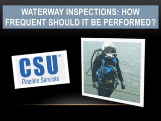
WATERWAY INSPECTIONS: HOW FREQUENT SHOULD IT BE PERFORMED?
- 1. WATERWAY INSPECTIONS: HOW FREQUENT SHOULD IT BE PERFORMED?
- 3. INTRODUCTION U.S Government regulations call for waterways to be 100-ft wider to maintain a minimal cover of 48”. And, this is so because pipeline crossings need to be inspected at least once in every 5 years. In most cases, the operating agencies perform surveys in 3 years or at a greater regularity rate for crossings and fast flowing rivers where erosion is suspected, or where flooded conditions are experienced.
- 4. This is an obligation by PHMSA Regulations that pipeline water crossings need to be monitored frequently and protected. Pipeline operators must hire a top-grade, well-seasoned waterway inspections Mississippi team to ensure the safety and well-being of their water crossings.
- 5. Here’s how the conventional survey is: Earlier, it required extensive diver labor to probe pipelines that are believed to have traversed the rivers. This process is carried out using a diver boat followed by a couple of divers and a single tender (if it is a large river). Smaller crossing inspections are performed with substandard equipment and less field recruits to maneuver out of a smaller vessel. A diver, with a marinized pipeline detector, interjects the water-equipped using a bar, so he could keep probing until he hits the line. The diver, then, assesses the cover-depth with the help of familiarized anatomy measurements of the bar or his arm or leg. Following this, he transmits data to the surface team, who then take imprecise position with the help of Differential Global Positioning System (DGPS). There’s been many such instances where cover extent is found enough to feed the inspection conditions.
- 6. How often pipeline episodes occur in water crossings? Flood, washing away a segment of riverbed causing pipelines’ exposure and susceptibility to breakage, is a rare incident. This occurrence is also called scouring. According to a recent study by PHMSA, 0.3% of pipeline occurrences had a cover loss at water crossings over the last 20 years and as a contributing factor.
- 7. Since there’s an industry-wide demand for frequent and effective water crossing inspections, Central States Underwater (CSU) implements highly expedient and affordable inspection programs for water crossings. How can CSU be helpful here?
- 8. • They inspect crossings and determine the cover-depth. Identify the areas that are prone to erosions and also detect water channel changes. • They put their best team forward to create metrics and identify priority crossings based on: scour potential, channel migration, cover-depth, impending debris and consequences. • Opt for perpetual mitigation action and implement as per priority ranking: HDDs, freshly trenched crossings beneath the scour depth, extra fill, rock drops, bank stabilization. • Continued real-time screening program for flooded conditions utilizing USGS Water Alert System. Besides, they also perform preemptive snow level monitoring before running off using pre-determined flow rate triggers. • Continued leak detection for alterations in the flow rates of pressure of the pipeline.
- 9. CONCLUSION What we deduce now is that CSU makes the wisest choice as a waterway inspection Louisiana-based company. They are comprehensive, approachable and affordable.
- 10. CONTACT INFORMATION Website : https://www.csugulfcoast.com/ https://www.facebook.com/CentralStatesUnderwater https://twitter.com/CSUDiving https://www.linkedin.com/company/central-states-gulf-coast- csu-inc.-?trk=prof-0-ovw-curr_pos