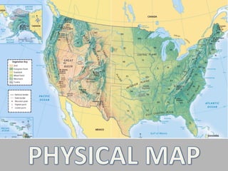
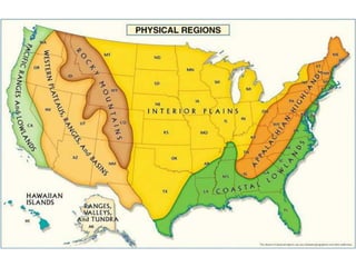
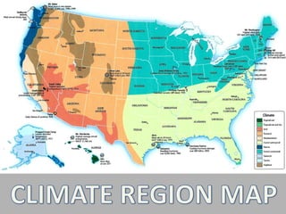
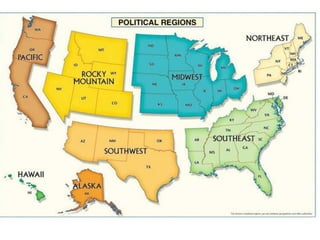
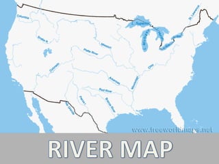
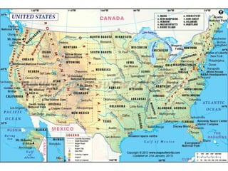
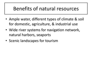
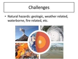
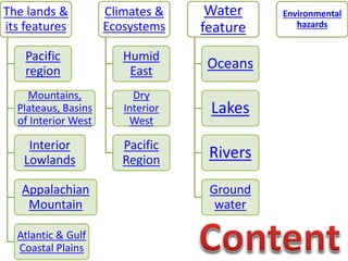
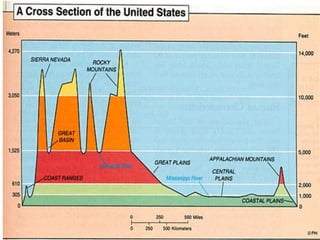
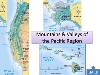
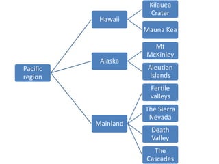
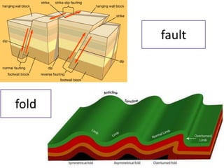
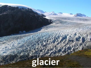
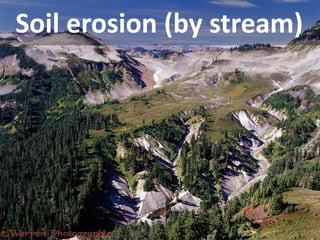
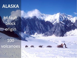
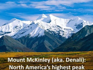
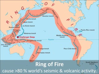
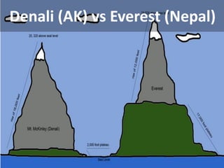
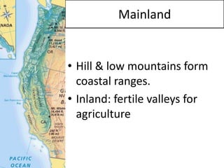
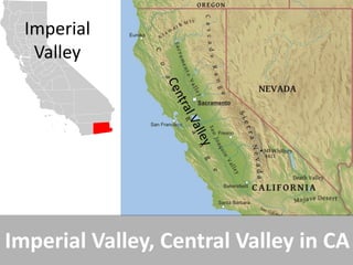
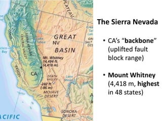
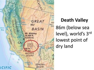
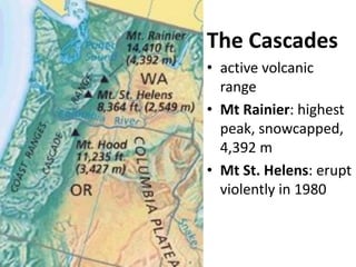
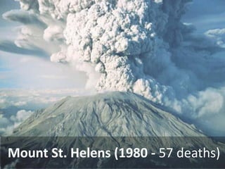
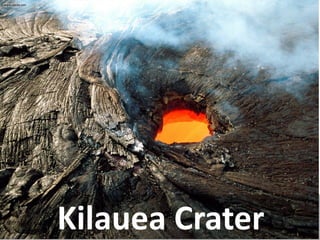
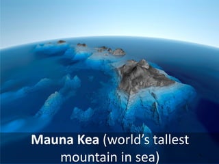
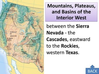
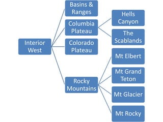
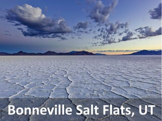
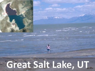
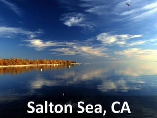
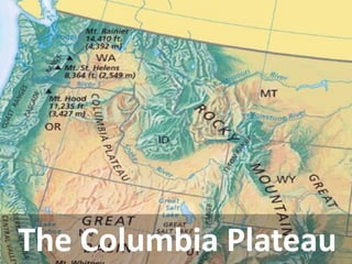
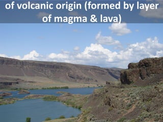
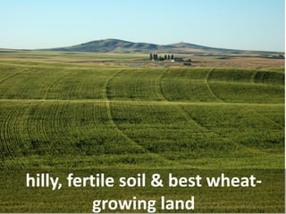
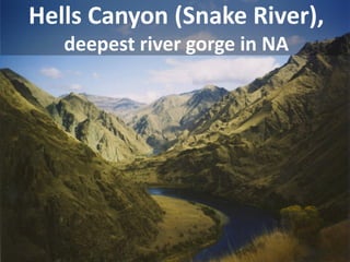
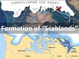
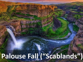
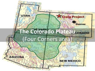
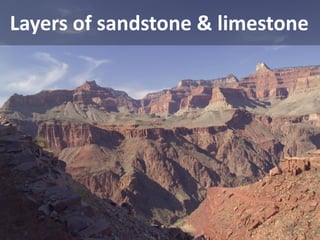
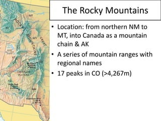
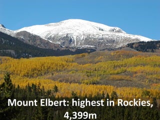
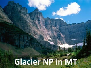
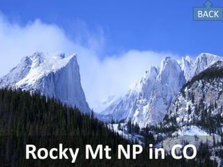
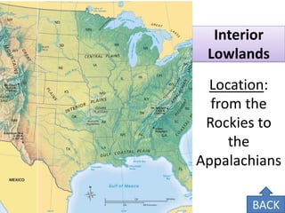
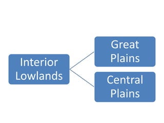
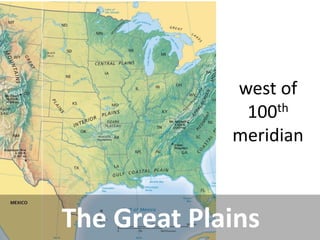
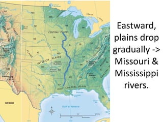
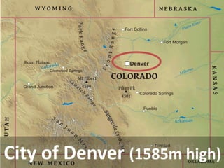
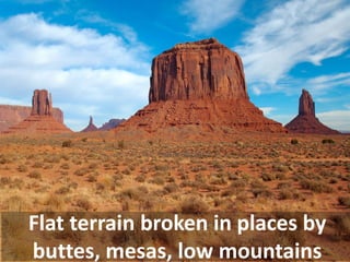
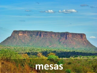
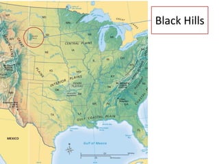
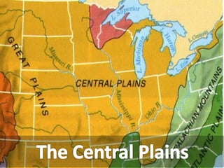
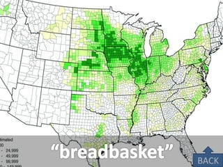
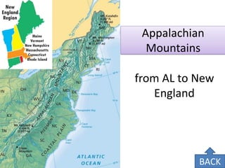
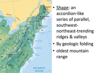
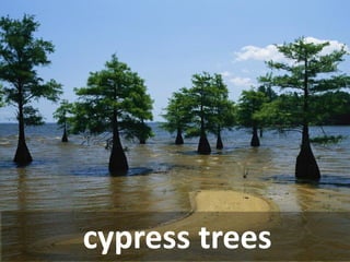
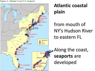
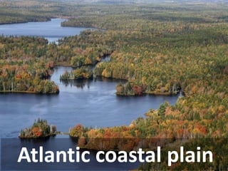
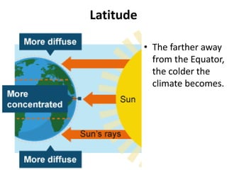
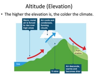
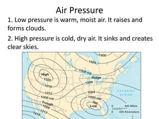
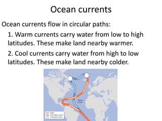
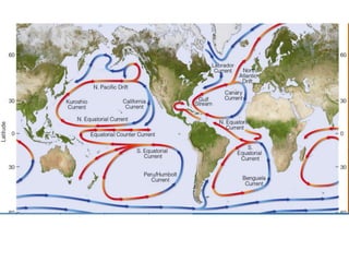
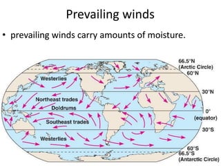
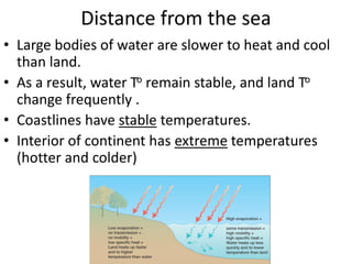
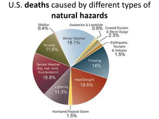
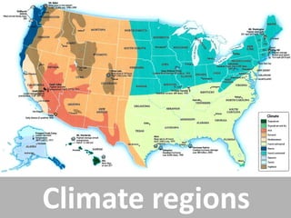
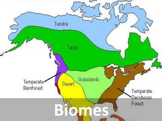
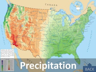
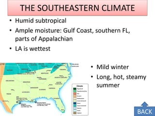
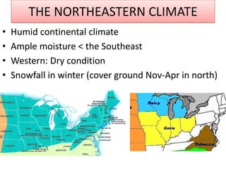
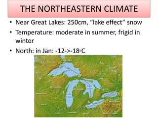
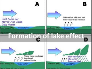
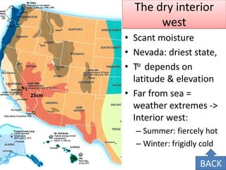
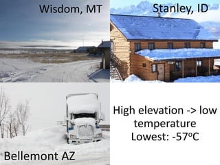
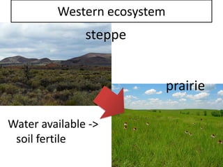
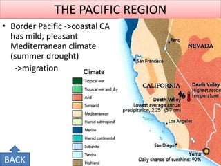
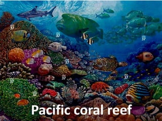
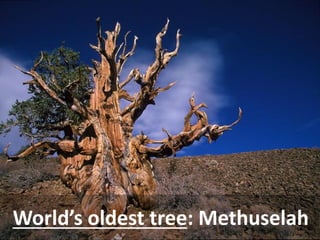
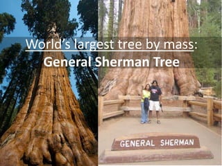
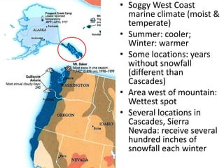
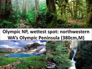
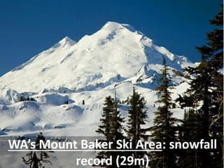
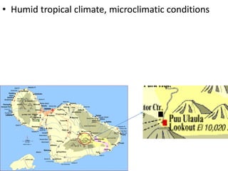
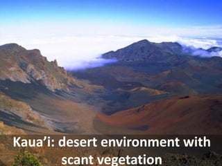
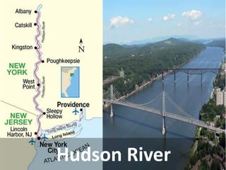
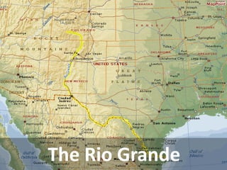
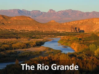
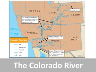
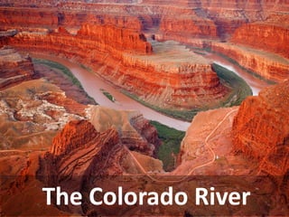
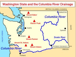
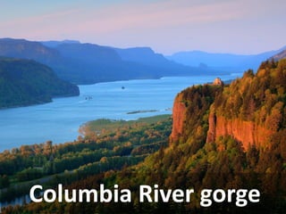
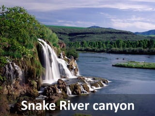
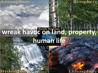
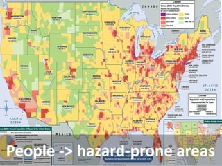
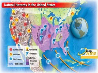
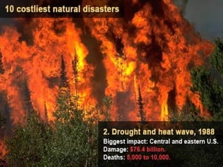
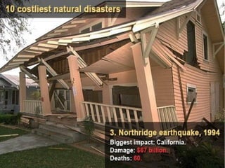
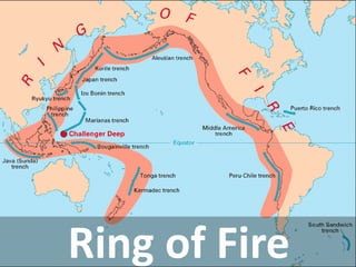
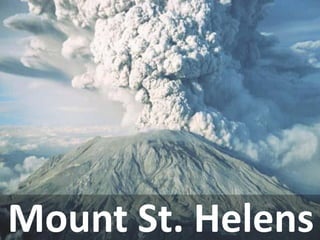
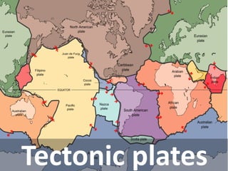
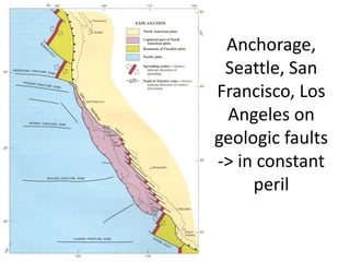
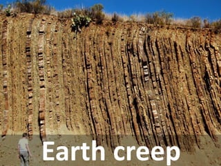
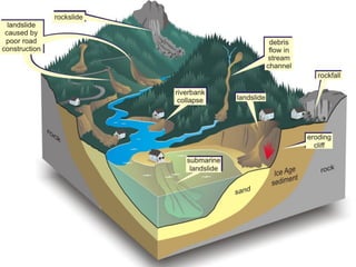
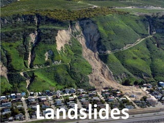
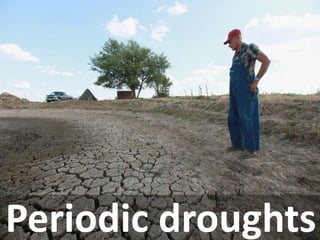
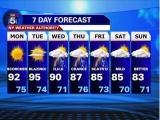
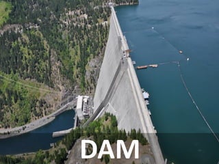
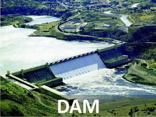
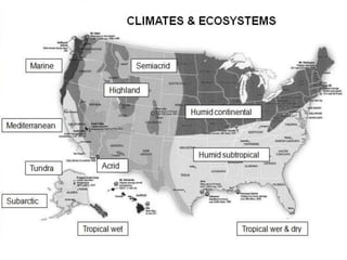
Benefits of natural resources 
•Ample water, different types of climate & soil for domestic, agriculture, & industrial use 
•Wide river systems for navigation network, natural harbors, seaports 
•Scenic landscapes for tourism
Challenges 
•Natural hazards: geologic, weather related, waterborne, fire related, etc.
Three questions of geographers 
1.How do people adapt to the environments in which they live? 
2.What natural elements are important to a people? How are natural resources used? 
3.How have humans changed the environments in which they live? 
BACK
The lands & its features 
Pacific region 
Mountains, Plateaus, Basins of Interior West 
Interior Lowlands 
Appalachian Mountain 
Atlantic & Gulf Coastal Plains 
Climates & Ecosystems 
Humid East 
Dry Interior West 
Pacific Region 
Water feature 
Oceans 
Lakes 
Rivers 
Groundwater 
Environmental hazards
BACK
Mountains & Valleys of the Pacific Region 
BACK
Pacific region 
Hawaii 
Kilauea Crater 
Mauna Kea 
Alaska 
Mt McKinley 
Aleutian Islands 
Mainland 
Fertile valleys 
The Sierra Nevada 
Death Valley 
The Cascades
General characteristics 
•Greatest mountain ranges, highest/tallest mountains, stunning scenery 
•Nature’s land-building process: volcanism, faulting, folding. 
•Erosion: glacier, swift-flowing streams
fault 
fold
San Andreas Fault
Fold
glacier
Soil erosion (by stream)
ALASKA 
of fault block origin 
100 volcanoes
Mount McKinley (aka. Denali): North America’s highest peak
Aleutian Islands: volcanoes
Aleutian Islands
Ring of Fire 
cause >80 % world’s seismic & volcanic activity.
Denali (AK) vs Everest (Nepal)
List of peaks by prominence 
Rank 
PEAK 
HEIGHT (m) 
COUNTRY 
1 
Mount Everest 
8,848 
Nepal/China 
2 
Aconcagua 
6,962 
Argentina (Mendoza) 
3 
Mount McKinley (Denali) 
6,194 
US (Alaska) 
15 
Mauna Kea 
4,205 
US (Hawaii) 
21 
Mount Rainier 
4,393 
US (Washington)
List of peaks by base-to-peak height 
Rank 
PEAK 
HEIGHT (km) 
COUNTRY 
ORIGIN 
1 
Mauna Kea & Mauna Loa 
10.2 (4.2 SL) 
US (Hawaii) 
Volcanic 
2 
Pico del Teide 
7.5 (3.7 SL) 
Spain (Canary Islands) 
Volcanic 
3 
Mount McKinley (Denali) 
5.3 - 5.9 
(tallest on land) 
US (Alaska) 
tectonic 
4 
Mount Everest 
3.6 - 4.6 
Nepal/China 
tectonic
Mainland 
•Hill & low mountains form coastal ranges. 
•Inland: fertile valleys for agriculture
Imperial Valley 
Imperial Valley, Central Valley in CA
Willamette Valley in OR
Willamette Valley dam
lowlands bordering Puget Sound in WA
The Sierra Nevada 
•CA’s “backbone” (uplifted fault block range) 
•Mount Whitney (4,418 m, highest in 48 states)
Death Valley 
86m (below sea level), world’s 3rd lowest point of dry land
The Cascades 
•active volcanic range 
•Mt Rainier: highest peak, snowcapped, 4,392 m 
•Mt St. Helens: erupt violently in 1980
Mount St. Helens (1980 - 57 deaths)
HAWAII
Kilauea Crater
Mauna Kea (world’s tallest mountain in sea)
Milky way from Mauna Kea
Mountains, Plateaus, and Basins of the Interior West 
between the Sierra Nevada - the Cascades, eastward to the Rockies, western Texas. 
TX 
BACK
Interior West 
Basins & Ranges 
Columbia Plateau 
Hells Canyon 
The Scablands 
Colorado Plateau 
Rocky Mountains 
Mt Elbert 
Mt Grand Teton 
Mt Glacier 
Mt Rocky
Basins & Ranges 
Basins’ Feature: 
–low & scattered mountain ranges separate broad & flat basins. 
–With/without interior drainage
Bonneville Salt Flats, UT
Great Salt Lake, UT
Salton Sea, CA
The Columbia Plateau
of volcanic origin (formed by layer of magma & lava)
loess or powder-like material
hilly, fertile soil & best wheat- growing land
Hells Canyon (Snake River), deepest river gorge in NA
Formation of “Scablands”
Palouse Fall (“Scablands”)
The Colorado Plateau (Four Corners area)
Layers of sandstone & limestone
Water erosion -> towering cliff
Water erosion -> natural bridges
Water erosion -> arches
Water erosion -> deep gorges
•Location: from northern NM to MT, into Canada as a mountain chain & AK 
•A series of mountain ranges with regional names 
•17 peaks in CO (>4,267m) 
The Rocky Mountains
. 
Mount Elbert: highest in Rockies, 4,399m
Mountain glaciers scour the jagged terrain (Grand Teton NP in WY)
Glacier NP in MT
BACK 
Rocky Mt NP in CO
Interior Lowlands 
Location: from the Rockies to the Appalachians 
BACK
Interior Lowlands 
Great Plains 
Central Plains
west of 100th meridian 
The Great Plains
Eastward, plains drop gradually -> Missouri & Mississippi rivers.
City of Denver (1585m high)
Flat terrain broken in places by buttes, mesas, low mountains
mesas
Black Hills
BACK
Appalachian Mountains 
from AL to New England 
BACK
•Shape: an accordion-like series of parallel, southwest- northeast-trending ridges & valleys 
•By geologic folding 
•oldest mountain range
worn down by ice and water to produce a landscape of rolling hills and broad valleys.
Mount Mitchell (2,037m)
Gaps (Past)
BACK 
Gaps (Now)
Piedmont & Atlantic & Gulf Coastal Plains 
BACK
“fall zone/line”. -> early settlement 30 cities founded
Gulf coastal plain: an arc from western FL to southern TX
cypress trees
Atlantic coastal plain from mouth of NY’s Hudson River to eastern FL Along the coast, seaports are developed
Atlantic coastal plain
Factors that control our climate
Latitude 
•The farther away from the Equator, the colder the climate becomes.
Altitude (Elevation) 
•The higher the elevation is, the colder the climate.
Air Pressure 
1. Low pressure is warm, moist air. It raises and forms clouds. 
2. High pressure is cold, dry air. It sinks and creates clear skies.
Ocean currents 
Ocean currents flow in circular paths: 
1. Warm currents carry water from low to high latitudes. These make land nearby warmer. 
2. Cool currents carry water from high to low latitudes. These make land nearby colder.
Prevailing winds 
•prevailing winds carry amounts of moisture.
Distance from the sea 
•Large bodies of water are slower to heat and cool than land. 
•As a result, water To remain stable, and land To change frequently . 
•Coastlines have stable temperatures. 
•Interior of continent has extreme temperatures (hotter and colder)
Maritime 
•generally features warm (but not hot) summers and cool (but not cold) winters
•Within temperate mid-latitudes, moderate conditions of weather & climate (-AK, HI) 
•Extremes are seasonal (- aridity) 
•Settlers found ways to adapt to challenges: water storage, diversion, irrigation, air- conditioning, insulation, artificial heating 
•Varied climates offer diversity of natural vegetation, soil conditions, water features 
BACK
U.S. deaths caused by different types of natural hazards
Climate regions
Biomes
BACK 
Precipitation
THE SOUTHEASTERN CLIMATE 
•Humid subtropical 
•Ample moisture: Gulf Coast, southern FL, parts of Appalachian 
•LA is wettest 
•Mild winter 
•Long, hot, steamy summer 
BACK
Southeast longleaf pine forest
THE NORTHEASTERN CLIMATE 
•Humid continental climate 
•Ample moisture < the Southeast 
•Western: Dry condition 
•Snowfall in winter (cover ground Nov-Apr in north)
THE NORTHEASTERN CLIMATE 
•Near Great Lakes: 250cm, “lake effect” snow 
•Temperature: moderate in summer, frigid in winter 
•North: in Jan: -12->-18oC
Formation of lake effect
Northeast deciduous forest
Mixed forest of the Appalachian Plateau
coniferous forest
BACK
The dry interior west 
•Scant moisture 
•Nevada: driest state, 
•To depends on latitude & elevation 
•Far from sea = weather extremes -> Interior west: 
–Summer: fiercely hot 
–Winter: frigidly cold 
25cm 
BACK
Las Vegas: driest city
Death Valley, CA: 57oC
Tucson, AZ: 1% humidity
Summer: wettest, torrential thunderstorm
Aridity near the Sierra Nevada & Cascades
Semi-permanent high pressure maintains aridity in desert Southwest
Mojave Desert 
Sonora Desert 
Afternoon to: >40oC
Wisdom, MT 
Stanley, ID 
Bellemont AZ 
High elevation -> low temperature 
Lowest: -57oC
Western ecosystem 
steppe 
prairie 
Water available -> soil fertile
bison 
deer 
elk 
antelope 
BACK
THE PACIFIC REGION 
•Border Pacific ->coastal CA has mild, pleasant Mediterranean climate (summer drought) 
->migration 
BACK
Chaparral scrub 
Grassland with eucalyptus (from AUS mid-1800s)
Pacific coral reef
World’s tallest tree: Hyperion (115.5m)
World’s oldest tree: Methuselah
World’s largest tree by mass: General Sherman Tree
•Soggy West Coast marine climate (moist & temperate) 
•Summer: cooler; Winter: warmer 
•Some locations: years without snowfall (different than Cascades) 
•Area west of mountain: Wettest spot 
•Several locations in Cascades, Sierra Nevada: receive several hundred inches of snowfall each winter
Seattle, WA: weeks without sunshine
WA’s Mount Baker Ski Area: snowfall record (29m)
•Humid tropical climate, microclimatic conditions
Kaua’i: desert environment with scant vegetation
Mount Waialeale 
wettest spot rain, rain shadow
•Summer: short, cool 
•Winter: long, severe 
•Southern coast: temperatures moderate 
•Juneau (capital), Anchorage (largest city): warmer in winter (> “Lower 48”) 
•Inland: to -61oC -> 40oC 
•Adequate moisture
Ecosystem 
•Animal: bears (black, brown), deer, whales, seafood (fish, crab) 
Kodiak 
Grizzly bear 
Polar bear
moose 
caribou 
seals 
walrus
Taiga (or boreal) forest: larch, pine, spruce aspen
Tundra (far north)
Tundra (far north)
Arctic Tundra
moss 
Clump grasses 
Hardy flowering plants 
lichen
WATER FEATURE 
•Importance for: 
–agriculture, 
–industry (maritime transportation, hydroelectricity- producing dams), 
–commerce, recreational activity (fishing) 
=>largest cities grow around a river mouth or natural harbor, oasis sites 
•Problematic: water pollution & depletion 
BACK
Oceans 
•Bordered by 3: Pacific, Atlantic, Arctic 
Safe from potentially hostile neighbors, 
countless marine resources, 
scenic beauty, 
shipping access to the world, 
atmospheric moisture (melting Arctic Ocean ->global navigation to Europe, Asia) 
BACK
Lakes 
•90% world’s natural lakes formed by glacial action 
•In Pleistocene (ice age), glaciers reached into US (Ohio, Missouri rivers) & formed in many of higher mountain ranges 
=>Most lakes in the northeastern & north of Ohio, Missouri rivers; reservoirs, water bodies formed behind dams in Southeast & West. 
•Great Lakes: world’s largest system of freshwater (esp. Lake Superior); -> Canada’s St. Lawrence River -> Atlantic (water route) 
BACK
Rivers 
BACK
Mississippi river basin
Hudson River
The Rio Grande
The Rio Grande
The Colorado River
The Colorado River
Columbia River gorge
Snake River canyon
Dam on Snake River
Groundwater 
BACK
Ground water is water deposits stored in an aquifer, its upper limit is the water table.
Groundwater: tapped by wells, reach surface through springs
Environmental Hazards 
BACK
wreak havoc on land, property, human life
People -> hazard-prone areas
Hurricane
Hurricane Katrina (2005)
tornadoes
flood-causing rain
blizzards
hail
sleet
lightning
Ring of Fire
Mount St. Helens
Tectonic plates
Anchorage, Seattle, San Francisco, Los Angeles on geologic faults -> in constant peril
Earth creep
Landslides
Raging wildfires
Periodic droughts
How they avoid it
DAM
DAM
LEVEE
LEVEE
Preservation of wetlands
Reforestation
Cellars (from tornadoes)
Firefighting strategies & technology
QUIZ
1 
2 
3 
4 
5 
6 
7 
8 
9 
10 
11 
12 
13 
14 
15
1 
2 
3 
4 
5 
6 
7 
8 
9 
Desert 
Tropical Rainforest 
Tundra 
Freshwater 
Saltwater 
Grassland 
Coniferous Forest (Boreal, Taiga) 
Temperate Rainforest 
Temperate Deciduous Forest

Us geography