Downloaded 18 times

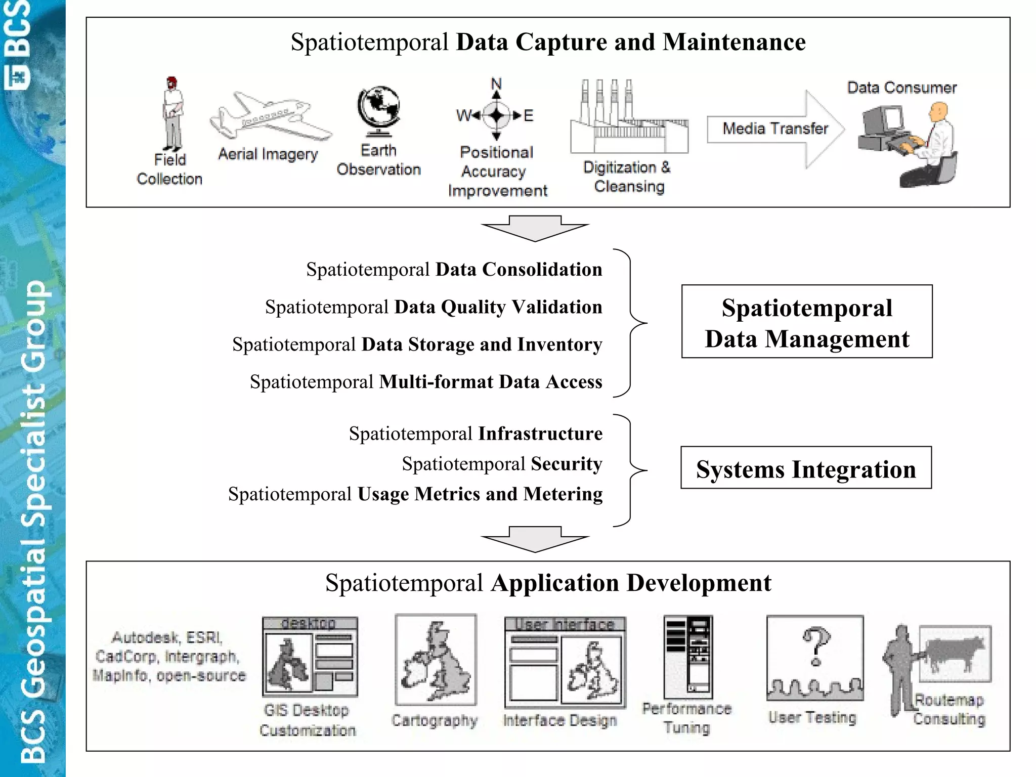
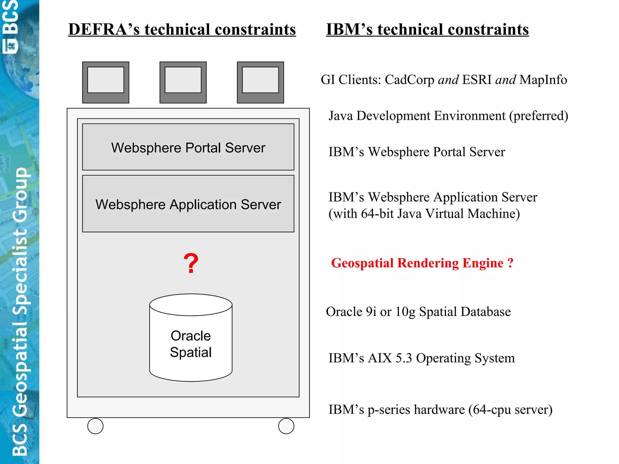


![Possible technical solutions for Disease Zone polygon extension scenario Land boundaries via (A) remote spatial database connection, or (B) “throttled” Web Feature Services connection Local Client Local Client Local Client Database & Web Server Database & Citrix Server Database & Web Server 1 2 3 Users’ mouse clicks are sent to a remote web application that is built for a single functional purpose. Desktop Tools CadCorp/ESRI/MapInfo Client Spatial Layers Disease Zones Desktop Tools Citrix Client simulates CacCorp/ ESRI/MapInfo Client Spatial Layers [None] Desktop Tools Web Browser Client Spatial Layers [None] Users’ mouse clicks are sent to Citrix server which simulates a local GIS desktop on the local client. Local GI Client & Remote Spatial Data : Use a local GI client to snap locally stored Disease Zone polygons to remote land boundary geometry via (A) network access to a remote spatial database holding PBL data (e.g. a “mart”), or, (B) a “throttled” PBL Web Feature Service. Remote Solution-specific GI Application & Remote Spatial Data : Use a web browser and online custom application to add or remove land boundary polygons from the Disease Zone polygon by clicking desired land boundary polygons. Remote ArcGIS & Remote Spatial Data : Use a remote GI client, provided via Citrix, to snap (remotely stored) Disease Zone polygons to underlying (remotely stored) land boundary polygons. The GI client accesses the remote spatial data via spatial database connections or “throttled” Web Feature Service connections. Connection Connection Connection Pros : Power users can apply full suite of desktop GI capabilities. Access to features enables local analysis and copy/snap. Cons : Performance limited by network bandwidth. New data must go back through QC system. Desktop GI client training time and software/licence costs. Pros : Same pros as (1) above, plus good performance and manageable deployment, licencing, and version control of GI Client tools. Cons : Citrix licence is an extra expense. Cost of spatial database software & licence. Cost of GI client tool training. Pros : Same pros as (1) above, plus ease of deployment, no licencing, minimal training, good performance and wide accessibility. Cons : Time/cost of capturing requirements and building custom solution. Heavy CPU load Server Spatial Layers Land boundaries Aerial Photos Server Spatial Layers Land boundaries Disease Zones Aerial Photos Server Spatial Layers Land boundaries Disease Zones Aerial Photos Heavy Network traffic Heavy CPU load Light CPU load Moderate Network traffic Heavy CPU load Light CPU load Light Network traffic Heavy CPU load](https://image.slidesharecdn.com/bcsgsggisatdefra4circulation-100327184623-phpapp01/75/Uniting-traditional-GIS-and-mainstream-IT-38-2048.jpg)
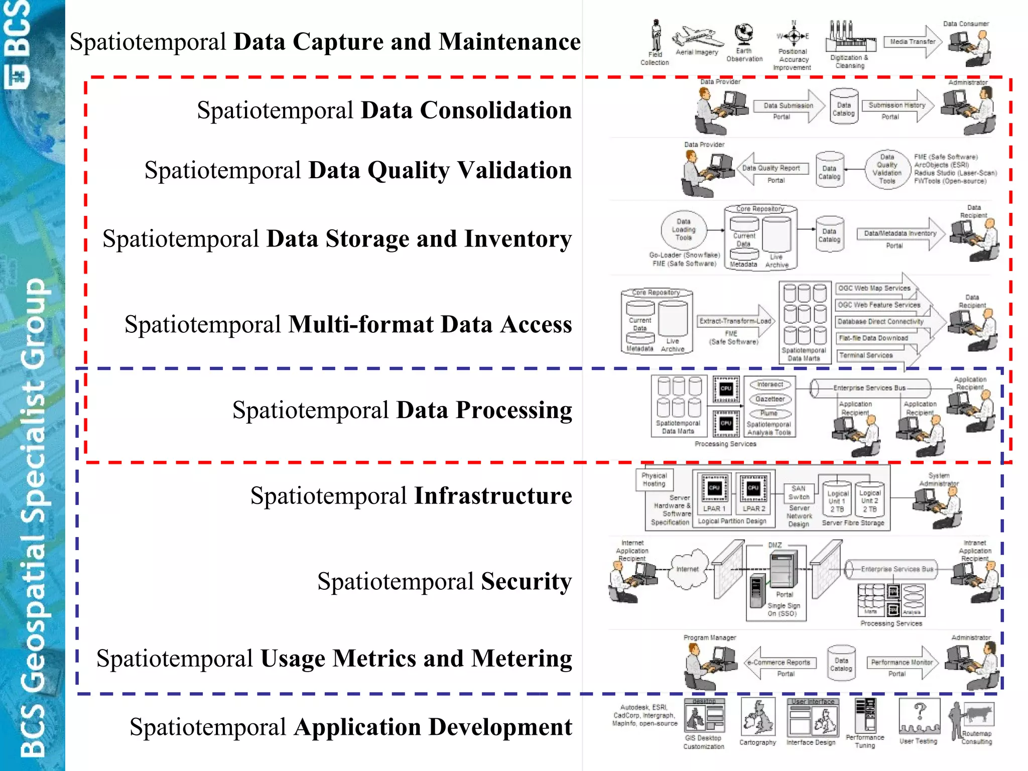


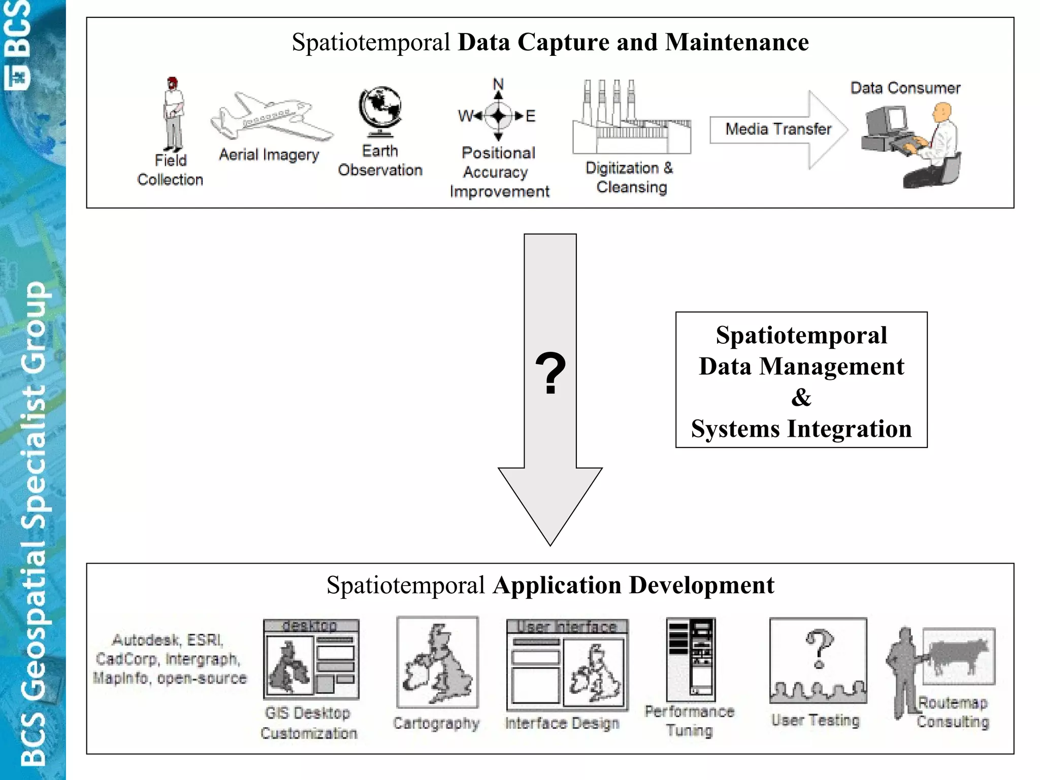
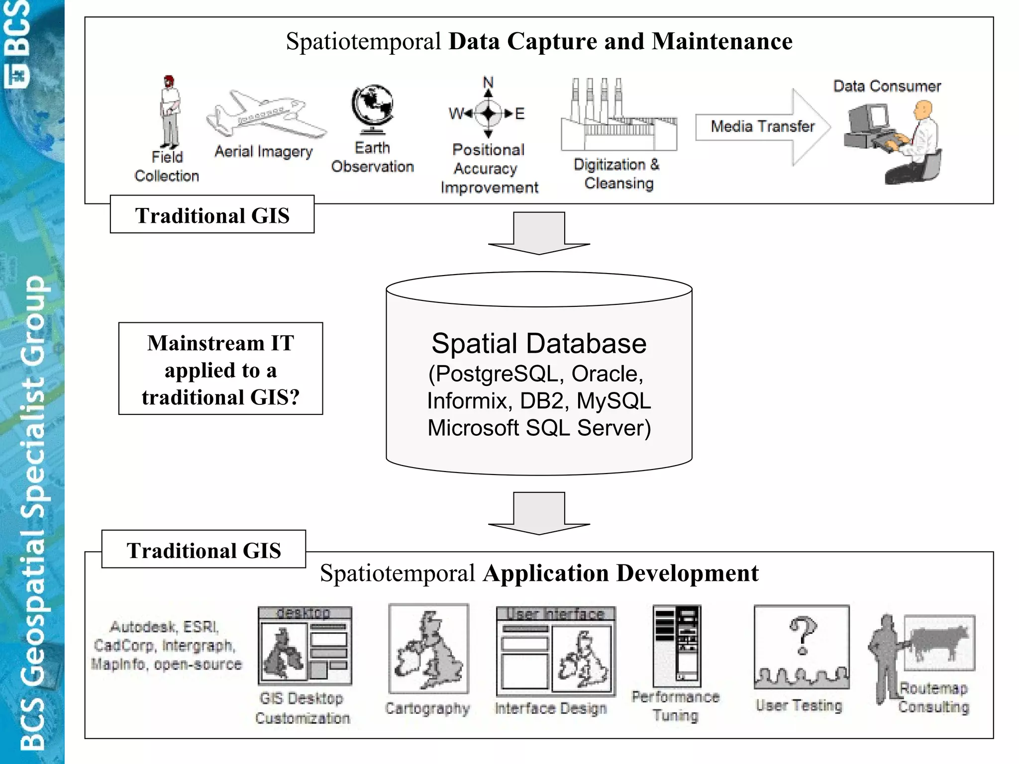
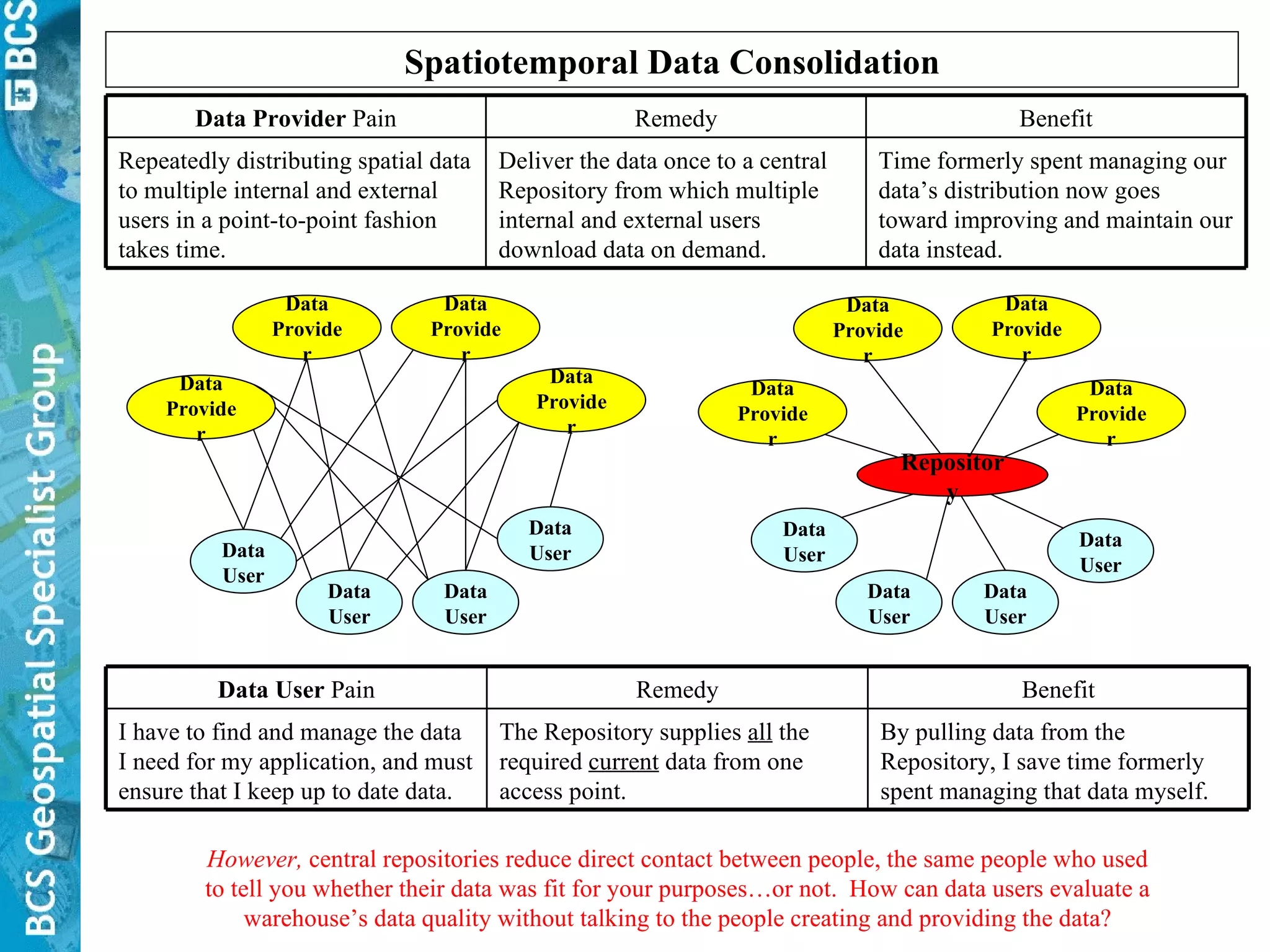
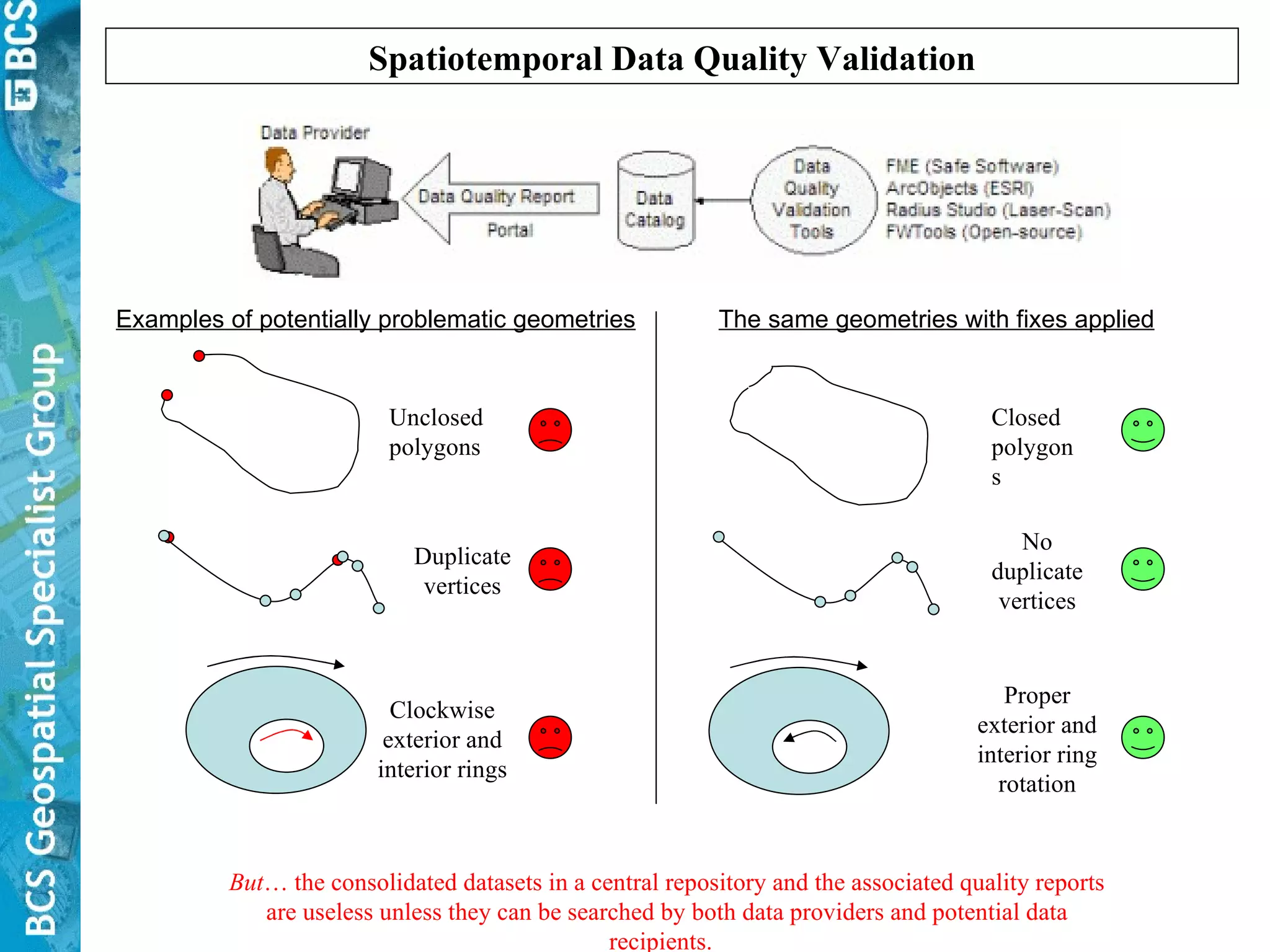
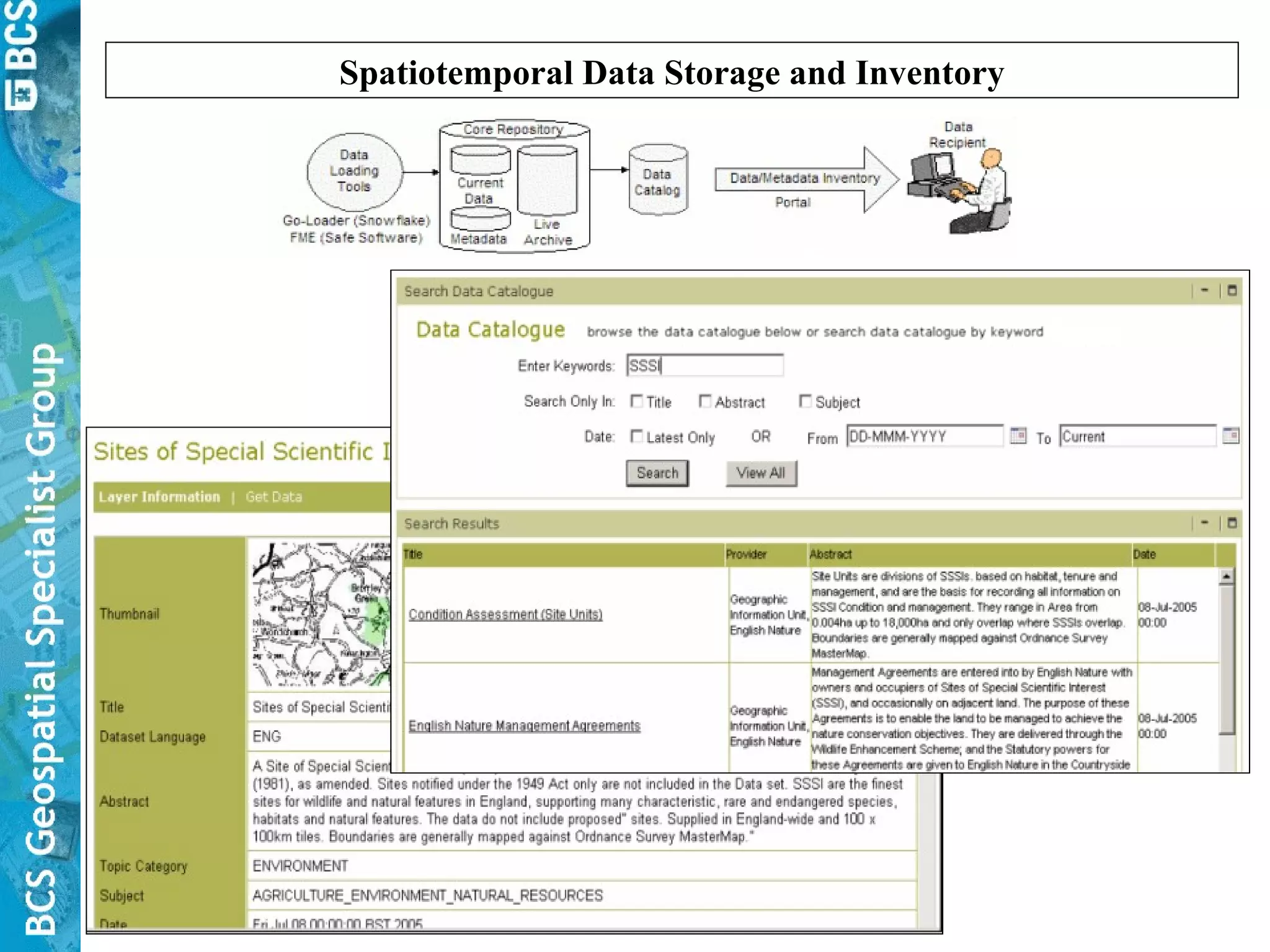
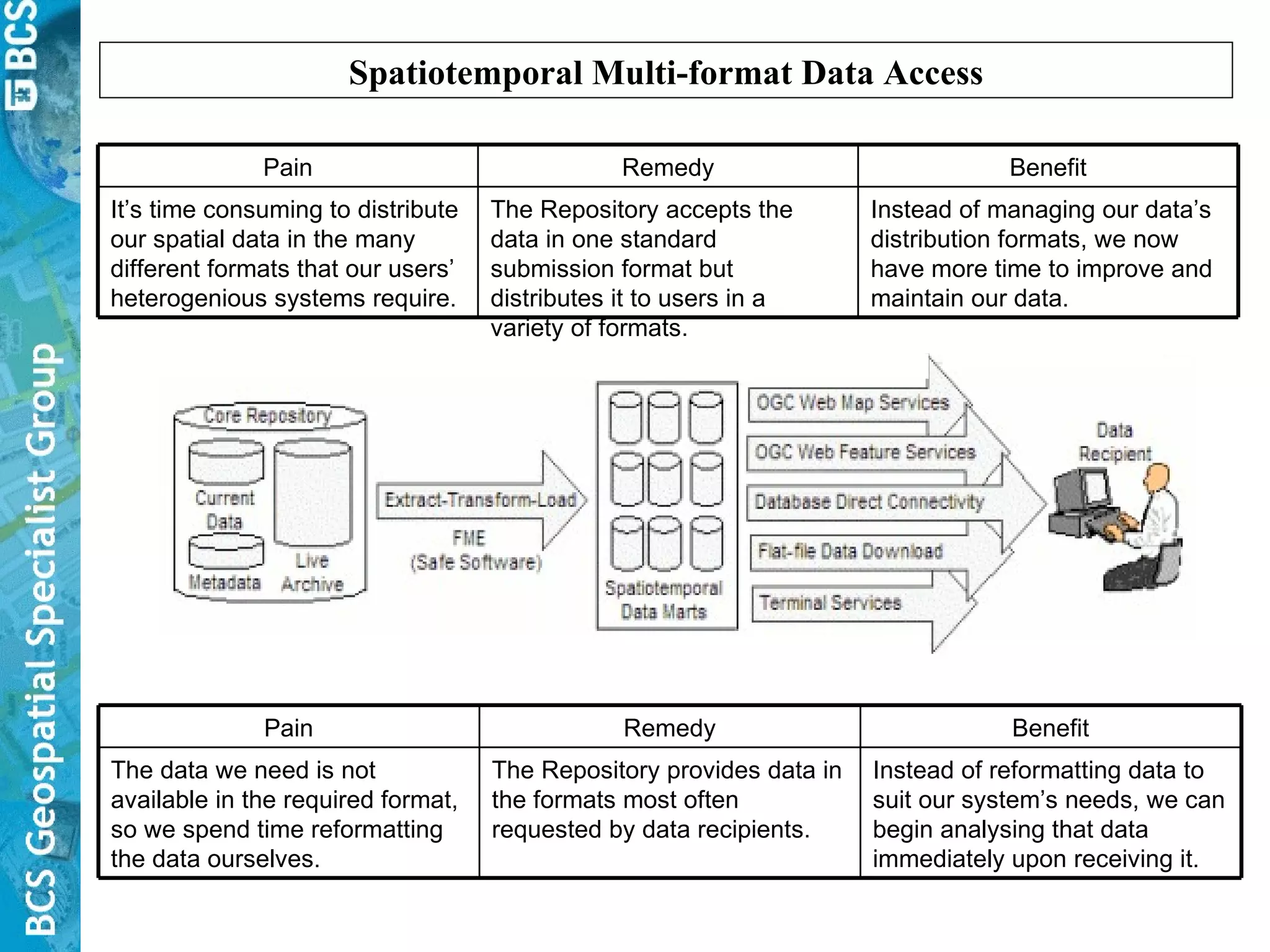
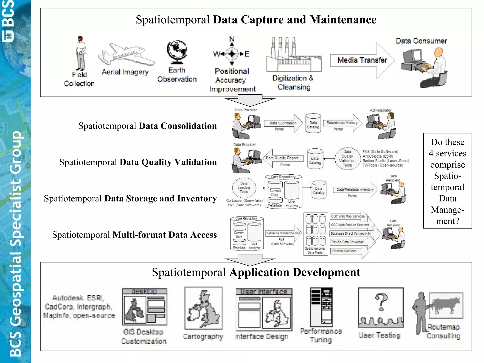
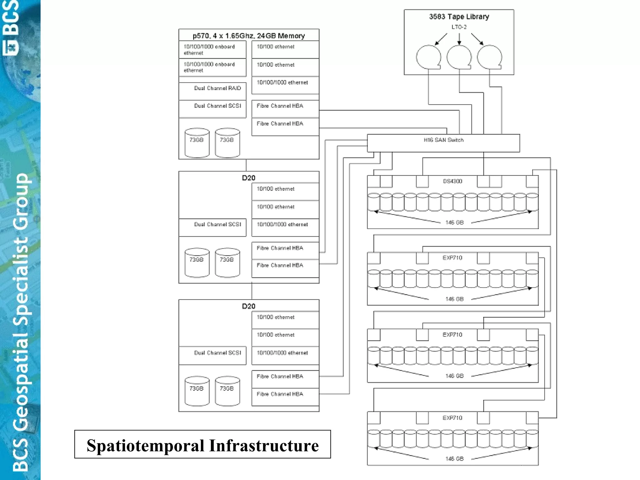
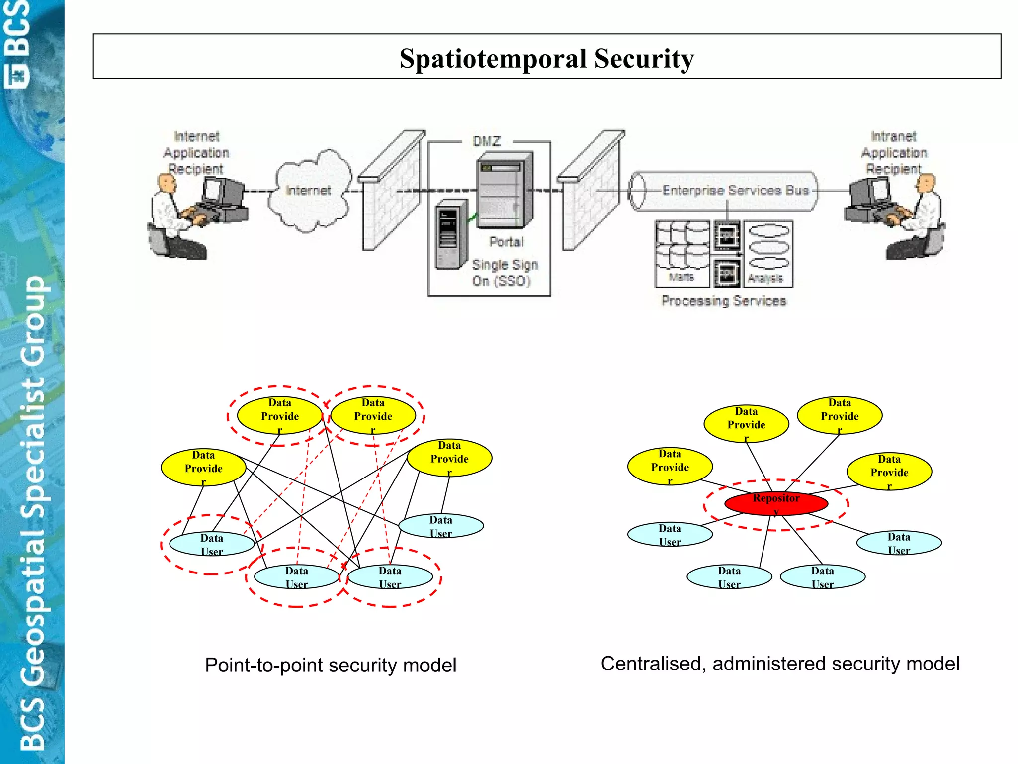
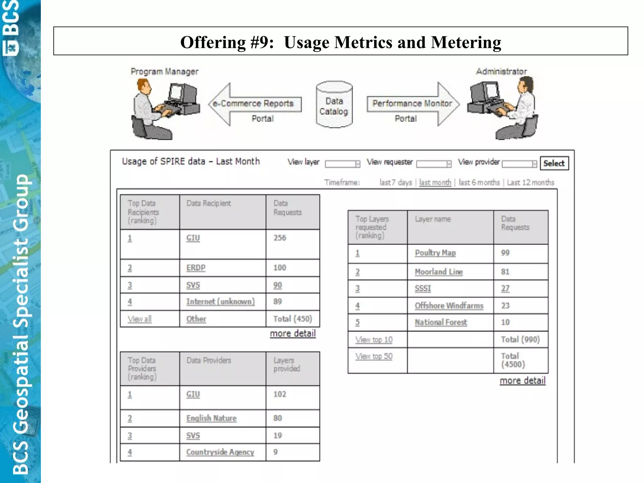
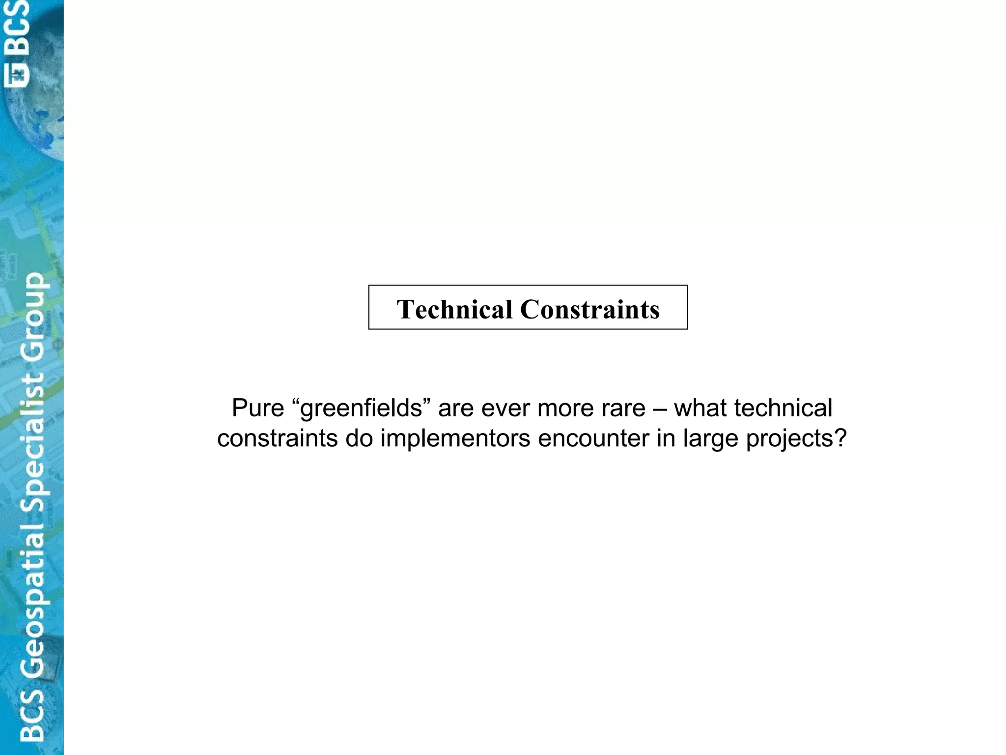
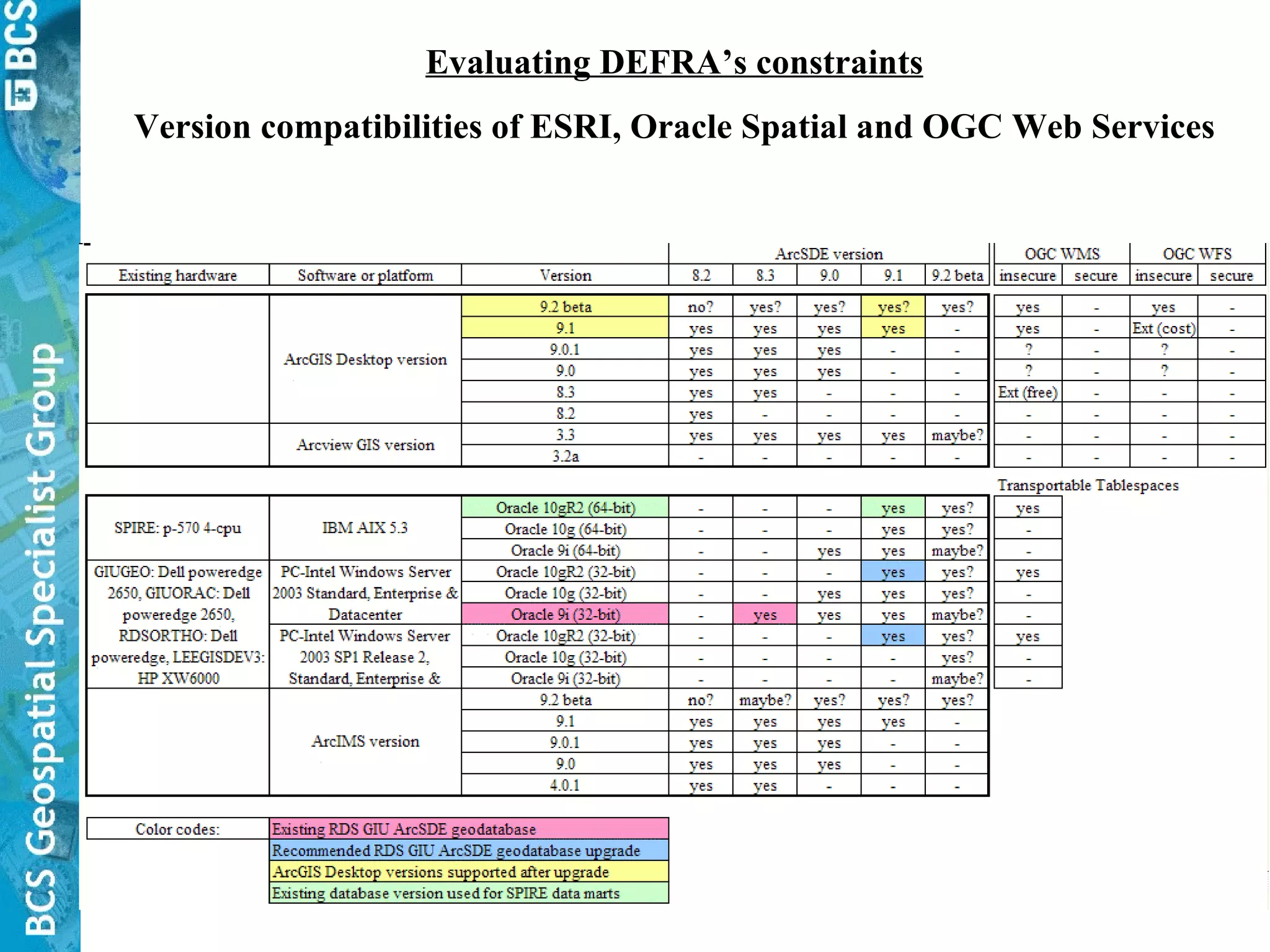
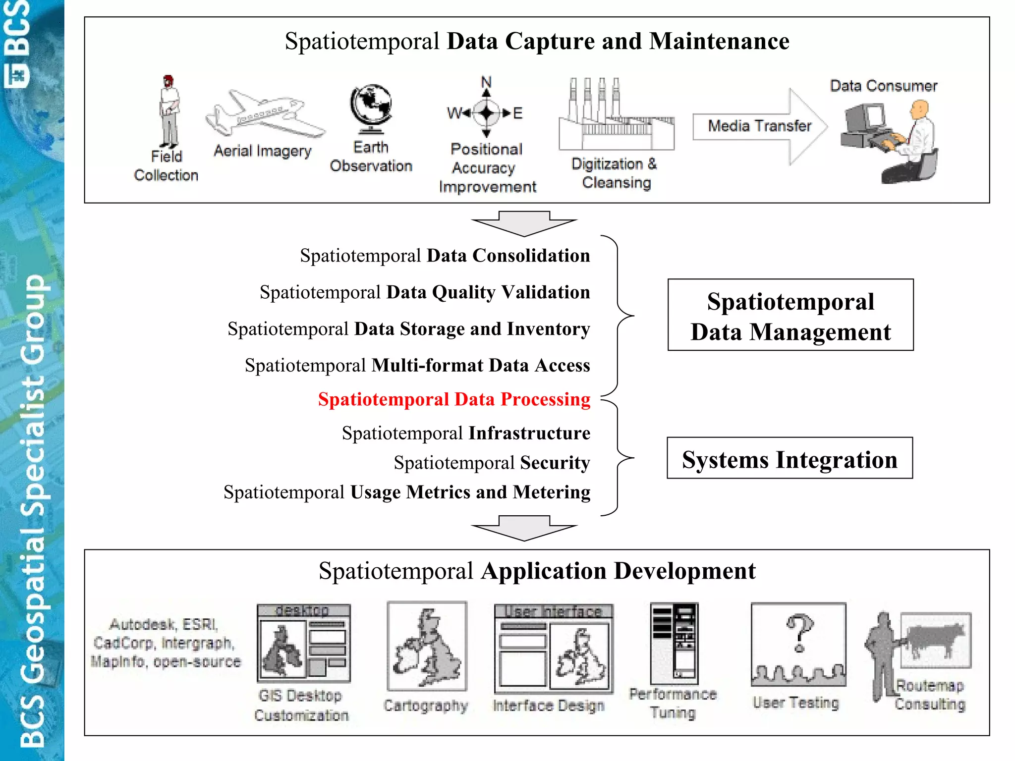
The document discusses spatiotemporal data management challenges faced by organizations like DEFRA and IBM's architectural approach. Specifically, it addresses the need for consolidated, high quality spatiotemporal data access across stakeholders. It also examines technical constraints encountered in large projects and potential next steps for integrated spatiotemporal enterprises.


