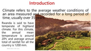
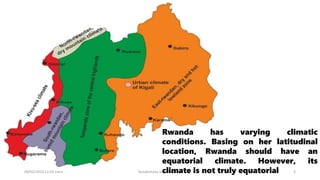
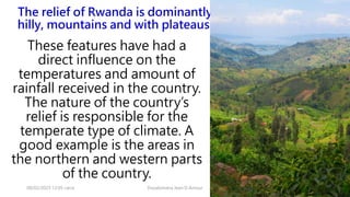
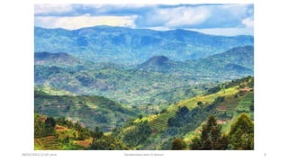
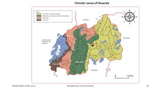
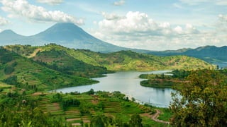
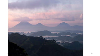
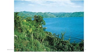
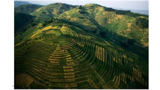
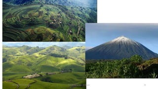
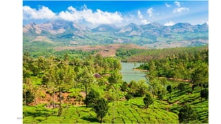
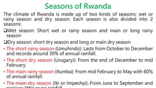
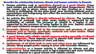
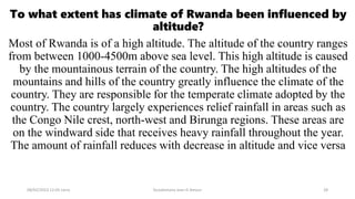
Climate refers to the average weather conditions of an area measured and recorded for a long period of time, usually over 35 years.
Rwanda is said to have temperate of highland climate. For this climate, the annual mean temperature is around 20⁰c and average annual total of rainfall for all the country is 1200 mm.
Factors that influence the climate of Rwanda
Describe the relationship between climate and human activities in Rwanda
Rwanda is a few miles away from the equator, yet her climate is not truly equatorial. Why?
Physical feature of india by ayush dewangan 😘.pptxayushDewangan19
India has a wide variety of physical features including mountains, plains, deserts, plateaus, and islands that were formed through geological processes over millions of years. The document divides India's physical features into several major physiographic divisions: the Himalayan mountains, northern plains, peninsular plateau, Indian desert, coastal plains, and islands. It provides details on the characteristics and sub-regions of each of these physiographic divisions. In conclusion, the document states that India's diverse physical geography has created various resources and opportunities for development across the country.
Jaisalmer is located in the Thar Desert region of Rajasthan, India. It was founded in 1156 AD by Maharwal Jaisal Singh as a more secure capital than the previous location 15km away. There are three main types of houses in Jaisalmer based on socioeconomic status: the simplest consists of a single room and courtyard, larger houses have additional rooms and verandahs, and the most elaborate are two to three stories with enclosed terraces and balconies. Traditional houses were made of mud in simple structures like bhunga houses with conical roofs supported by central wooden poles, and roopsi houses made of sun-dried clay blocks.
This document provides an overview of vernacular architecture in Kerala, India. It discusses the concepts of vastu shastra and types of traditional houses like nalukettu and ettukettu. Common building materials used include laterite stone, timber, tiles, and thatch. The nalukettu house design incorporates structures for different functions arranged around a central courtyard. Vernacular architecture in Kerala effectively uses local materials and responds to the climate and needs of the region.
vernacular architecture of north east indiaHriday Das
The document provides information on the vernacular architecture of Northeast India, specifically focusing on the states of Arunachal Pradesh and Meghalaya. It describes the traditional building materials and construction techniques used by tribes in the region, which include bamboo, wood, thatch, and locally available plants. Houses are designed to be elevated on stilts for protection from floods and have sloped roofs to shed heavy monsoon rains. Interior spaces are organized based on family structure and social activities. The simple designs demonstrate an adaption to the cold, hilly environment with minimal insulation and openings.
The document discusses key aspects of Buddhist architecture in India, including pillars (lats), stupas, and cave temples. It describes two main types of lats and provides details on important stupas like the Sanchi Stupa and Stupa at Amaravati. Monasteries (viharas) and worship halls (chaityas) are also summarized, with the chaitya at Karli given as an example. Finally, some of India's major cave temple sites reflecting Buddhist, Hindu, and Jain traditions are highlighted briefly, including Ajanta, Ellora, and Elephanta Caves.
Sarais were rest stops built along trade routes in the Mughal Empire. They provided shelter, food, and protection for merchants and travelers. Sarais were uniformly designed with small rooms in the outer walls, a central courtyard, a mosque, and a garrison for protection. They showcased the rich architectural style of the Mughal period, with features like arched entrances, vaulted ceilings, and ornate decorations. This particular Sarai located in Haridwar, India, dating back to 1903, still retains many of its original architectural elements and serves as a Dharamshala or rest house.
Lecture 05: Islamic Architecture in India_Slave DynastyKowshik Roy
This is a class lecture on Islamic Architecture in India. Architecture of Slave Dynasty has covered in this lecture.
Course Title: Architectural Heritage-IV
Architecture Discipline,
Khulna University, Khulna
The Resort is located in a short drive from the Holy lakes as well as the famous Brahma Temple which dates back to the 14th Century.
Experience uplifting downtime in a picturesque setting , with driving distance from jaipur. Indulge in a rejuvenating break surrounded by Frangipani trees, water features and sprawling gardens.
The Chalukyan dynasty ruled northern Karnataka during the 6th century and made significant contributions to temple architecture, known as Chalukyan architecture. This style blended elements of Dravidian and Nagara architecture. Chalukyan temples were constructed between 450-650 AD at sites like Aihole, Badami, Pattadakal, and Mahakuta. Notable temples include the cave temples of Badami featuring carvings of Hindu gods, and the Virupaksha Temple at Pattadakal which represents both northern and southern architectural styles. Chalukyan architecture had a lasting influence on temple building in the region.
The document discusses climate and building design in cold, dry regions like Ladakh. It provides details on:
1) Ladakh's climate which is extreme, with hot summers over 20°C and very cold winters below freezing.
2) Essential building design features for the cold climate like sloping roofs, thick walls, and optimizing room placement.
3) A sample layout of a traditional Ladakhi house, showing compact planning and orientation of rooms.
Himachal Pradesh - Vernacular architecture
by 4th year students of bachelor of architecture, indo global college of architecture affiliated with I.K. GUJRAL Punjab technical university
Kath-kuni is a traditional vernacular architecture used in Himachal Pradesh, India. It utilizes locally available materials like wood, stone and slate and techniques suited for the region's mountainous terrain and climate. A typical kath-kuni building has a stone foundation and alternating layers of wood and stone walls. The multi-level structure has rooms and balconies organized around an open courtyard. Roofs are sloped to shed snow and use slate or wood shingles. The style demonstrates an adaptive response using indigenous materials and knowledge to create stable, insulating structures.
The Modhera Sun Temple in Gujarat, India follows the Maru-Gurjara style of architecture. It has three main components aligned on an axis: a shrine hall (gudhamandapa) housing the sanctuary (garbhagriha), an outer assembly hall (sabhamandapa), and a sacred reservoir (kunda). The temple complex uses an earthquake resistant locking system and is decorated with religious imagery including figures of Surya, Shiva, Vishnu, and scenes from the Ramayana.
The document summarizes key architectural features of several South Indian temples from different periods. It describes:
1. The Srinivasanalur temple built during the reign of Parantaka I in the 10th century, which simplified Pallava elements and introduced changes like neck mouldings and kalasas.
2. Features adopted by later Dravidian style temples like the disappearance of lion motifs and inclusion of rakshasa heads.
3. Major temples like Brihadeeswarar at Tanjore and Gangaikondacholapuram that displayed the mature Chola style through their grand scale, intricate carvings, and tall pyramidal towers.
Generally, the northern part of India experiences this type of climate. Most cold and cloudy regions are situated at high altitudes. Shimla, Shillong, Srinagar and Mahabaleshwar are examples of places belonging to this climatic zone.
SKY CONDITIONS – Overcast for most part of the year, axcept during the brief summer period.
MISCELLANEOUS - Conditions in summer are usually clear and pleasant, but owing to cold winters.
The main criteria for design in the cold and cloudy region aim at resisting heat loss by insulation and infiltration, and promoting heat gain by directly admitting and trapping solar radiation within the living space. And protection from dampness is also very important.
The document summarizes traditional South Indian architecture and culture. It describes the Mysore Palace, built in 1897, as the prime example. It combines elements of Hindu, Islamic, Rajput, and Gothic styles. The palace's three stories are made of stone and marble, surrounded by gardens. South Indian classical music, Carnatic music, and elaborate dance forms like Bharatanatyam are highlighted as integral parts of the region's culture. Sculptures at temples exemplify the expression and preservation of dance.
1) Gujarat lies on India's western coast and has a diverse geography and climate, with regions facing earthquakes, cyclones, and floods.
2) The Indus Valley civilization influenced early architecture in Gujarat, seen in structures like stepwells built from local materials.
3) Rural architecture varies by region, with the northern Kutch region featuring circular Bhonga houses made of mud that are well-suited to the dry, hot climate.
This document summarizes the landscaping plan for the Castro Café landscape located on the Jamia campus near the M.F. Hussain art gallery. The landscaping includes both hard elements like benches, lamps, and sculptures, as well as soft landscaping elements like trees, shrubs, and herbs. Materials used include precast concrete, bricks, stone, and red sandstone pavers. The landscape provides an aesthetic outdoor space and utilizes plants and trees to create shade and define boundaries.
This document summarizes architectural styles in medieval India. It discusses the Northern or Nagara style characterized by beehive domes. The Southern or Dravidian style used pyramid temples with intricate carvings. The hybrid Vesara style blended these. Mughal architecture produced grand buildings using domes, arches, and decorative elements. The merchants also built large havelis and dargah shrines during this period of great construction.
The Sun Temple at Modhera was built in 1026-27 AD under the Solanki dynasty. It is dedicated to the sun god Surya and was designed so that sunlight would illuminate the deity's image at the equinoxes. The temple complex includes a large sacred pool and the main temple, divided into a pillared hall and inner sanctuary. Though now in ruins, the temple was renowned for its intricate carvings covering every surface both inside and out.
This document provides information on North Indian temple architecture from the Gupta period. It discusses key features of temples constructed during this era, including the use of stone construction instead of bricks, relief artwork, and structural elements like shikhara towers and mandapas. Specific temples from the Gupta period are highlighted like the ones at Tigwa, Udaygiri, and Deogarh. The architecture of the famous Sun Temple at Modhera is described in detail, including its main shrine hall, assembly hall with carved pillars, and surrounding kunda reservoir. Overall, the document outlines the defining characteristics of Nagara style temple architecture that developed and flourished during the golden age of the Guptas in North India
VERNACULAR ARCHITECTURE - ASSAM - NORTH EAST INDIAAleenBharati
ARCHITECTURE IN NORTH-EAST INDIA has a vast sense of sustainable architecture.
The notion of the ideas towards the structures on the land of those seven states is connected to nature.
Materials, climate, altitudes, people, light, ventilation, sun, wind, etc are connected to each other.
THIS is the case study of Assam so grab the ground knowledge of beautiful North- East India.
Vernacular architecture in Kerala is influenced by the region's climate and availability of materials. Traditional houses have sloped roofs, verandas, and courtyards to deal with heavy rainfall. The Nalukettu house type, centered around a courtyard, was common for wealthy families. Temple architecture also uses local wood, tiles, and granite, with steeply pitched copper roofs resembling Himalayan styles. Materials like timber, thatch, laterite, and lime mortar are suited to the humid climate. Temple plans vary from circular to square, often containing a central shrine surrounded by cloisters and subsidiary structures.
Monsoon Rainforest is a type of seasonal tropical forest that experiences a long dry season followed by a wet season with heavy rainfall. Key points:
- Located between 10-25 degrees latitude, areas include India, Sri Lanka, Africa, South America.
- Hot and humid all year with high rainfall during wet season that can exceed 2000mm. Soil is poor and leached of nutrients.
- Supports diverse wildlife like birds, deer, elephants, snakes. Tall trees produce large amounts of oxygen through photosynthesis.
- Heavily impacted by human activities like deforestation, pollution, and climate change which disrupt rainfall patterns. Proper precautions needed during monsoon seasons.
Sri Lanka has three main geographic areas based on elevation - highlands, uplands, and lowlands. It also has six climatic zones - Arid, Dry, Intermediate, Lowland Wet, Sub-Montane Wet, and Wet Highlands. These zones vary in rainfall, temperature, humidity, and vegetation types. The Wet Highlands in the central highlands have extensive forests and receive the highest rainfall, while the Arid zones in the northwest and southeast are very dry with inadequate rainfall to support abundant vegetation. Sri Lanka's geography and climate zones contribute greatly to its high biodiversity.
This document summarizes the key impacts of climate change that are already occurring and projected to occur in Uganda based on climate modeling. It notes that Uganda is experiencing more erratic rainfall patterns, with heavier rainfall events and longer dry periods, undermining agricultural production. It projects that future climate changes will have the biggest impact on the later, short rains in Uganda, bringing significantly wetter conditions. Higher temperatures are also expected, increasing risks of flooding and changing crop growing conditions. The impacts undermine livelihoods and food security in Uganda.
This document summarizes the key impacts of climate change that are already occurring and projected to occur in Uganda based on climate modeling. It notes that Uganda is experiencing more erratic rainfall patterns, with more intense rainfall events and longer dry periods, undermining agricultural production. Projections for Uganda include increased frequency of heavy rainfall events during the later rainy season from October to December, which could exacerbate flooding. Temperatures are also projected to continue increasing. The impacts on agriculture are threatening yields and varieties of staple crops in Uganda. Farmers are reporting difficulties adapting to these changes in weather patterns.
This document summarizes the impacts of climate change on poverty in Uganda. It discusses how climate changes like more erratic rainfall and intense downpours are negatively impacting agriculture, pastoralism, health, and access to water. These climate shocks undermine development and exacerbate food insecurity, hitting the poor hardest. While Uganda's contribution to global warming is minimal, it is highly vulnerable to current and future climate impacts. Adaptation efforts are needed to build resilience.
Weather and Climate
Class Presentation
IGCSE 1
Teacher :
RIMSHA JANJUA
Students:
Mahnoor
husnain
taha
zurdat
zeesham
Topics to be discussed :
What is weather?
What is Climate?
What are climatic zones? (In Pakistan)
What are highland zones and their climate?
What are lowland zones and their climate?
What are arid zones and their climate?
What are coastal zones and their climate?
What is river flood and what destruction can it possibly cause?
What are storms and there causes?
Drought & Desertification measures of mitigation ,Types of drought SANDEEP PATRE
Drought & Desertification measures of mitigation ,Types of drought ,Drought Causes, Effects of Drought .
Types of deserts and the global distribution of deserts, Factors for desert formation, Mitigation:
Malawian agriculture is highly dependent on rainfall and vulnerable to climate change impacts like increased droughts and floods. The government and farmers have responded by promoting more drought-tolerant crops, conservation agriculture, irrigation, and adaptation strategies. However, changing rainfall patterns are making livelihoods more difficult as the rainy season becomes less predictable and more extreme. This threatens food security in Malawi where the majority of people rely on rain-fed smallholder farming.
Drought is defined as a continuous period of dry weather that can vary in length between countries. It can be caused by seasonal changes in weather patterns like the Hadley cell and Inter-Tropical Convergence Zone, leading to wet and dry seasons in some regions. Long term droughts over multiple years can have disastrous consequences, affecting both human and natural systems. The consequences of drought include food shortages and the need for food aid when rains fail. Various groups like nomadic pastoralists have adapted to seasonal droughts, while long term management strategies are needed to address extended drought crises.
This document discusses drought, including its definition, causes, classification, effects, and government policies to combat it. Drought is defined as an extended period of deficient precipitation that causes water shortage for people and crops. Common causes of drought include low rainfall, high air pressure, lack of monsoon winds, depletion of forests and groundwater, and global warming. Droughts are classified as meteorological, agricultural, or hydrological based on their physical aspects and impacts. Effects of drought include economic losses, food shortages, environmental damage, and social impacts like conflicts and migration. The document provides a case study of the severe 2002 drought in Rajasthan, India and outlines various government programs to address drought like rural employment schemes and waters
Sri Lanka; Importance of Rain Water Harvesting in Sri Lankan AgricultureV9X
Sri Lanka receives most of its water from rainfall, but much of this runs off without being collected and stored. Rainwater harvesting through small tanks and ponds could help boost agriculture in dry areas and improve livelihoods. A study found that collecting rainwater in small tanks increased farmers' incomes by 180%. Storing runoff water on farms through techniques like "pathahas" could enable crop growth during dry seasons. Rehabilitating Sri Lanka's network of small tanks across the dry zone could promote food security through increased irrigation.
Landforms of bangladesh and their relation to natural hazardsJahangir Alam
Landforms of Bangladesh and their Relation to natural hazards:
Bangladesh is situated between 23 34’ and 26 38’ North latitude and 88 01’ and 92 41’East longitude.
The topography is flat with elevation not exceeding 10 meters above mean sea level.
Floodplain and piedmont plains occupy almost 80 percent of the land area.
It is a low-lying, riverine country located in South Asia with a largely marshy jungle coastline of 580 km (360 mi) on the northern littoral of the Bay of Bengal.
Bangladesh has a tropical monsoon climate characterized by heavy seasonal rainfall, high temperatures, and high humidity.
To know about the land forms of Bangladesh.
To know about the hazards of Bangladesh.
To find out the relationship between landforms and Hazards.
Topography is a configuration of a land surface including it’s relief and contours, the distribution of mountains and valleys , the patterns of rivers and other natural features that produce the landscape .
There are three distinctive natural features in Bangladesh.
A broad alluvial plain subject to frequent flooding.
A slightly elevated relatively older plain
A small hill region drained by fant flowing rivers.
Hailstorms and its effect on agriculture.pptxUAS, Dharwad
This document provides information about hailstorms and their impacts. It defines a hailstorm and describes the formation process of hailstones within thunderstorms. Key factors that favor hail formation include strong updrafts, high liquid water content, and portions of the cloud below freezing. The largest recorded hailstone in the US fell in South Dakota and measured 7.9 inches wide. Hail causes damage to crops, plants, and property and is most common at mid-latitudes, especially along mountainous regions. A 2010 hailstorm in Eastern India and Bangladesh destroyed crops and caused over 140 deaths.
Workshop on Alignment & implementation of National Action programmes with the UNCCD 10-year Strategy in the Arab Region
League of Arab States (18- 20 June 2014), Dubai - UAE
Sudan: Mrs. Alawia yousif MOHAMED
Drought is an extended period of deficient water supply that can last for months or years. It occurs when a region receives consistently below average precipitation and can substantially impact local ecosystems and agriculture. Prolonged droughts have caused mass migrations and humanitarian crises in affected areas.
Most drought-prone areas in India are located in arid, semi-arid, and sub-humid regions experiencing less than average annual rainfall. Over half of Rajasthan and over 30% of Gujarat experience arid conditions. Nearly 60% of Maharashtra and over 45% of Gujarat experience semi-arid conditions, demonstrating the importance of proper water usage in these states.
Recurring drought is a
The document discusses floods in India, including definitions, causes, impacts, management strategies, and case studies. It provides an overview of flood types, forecasting methods, zoning, and benefits. Major factors that cause floods are described. Impacts include loss of life, property damage, health issues, and economic disruption. Management involves mitigation, preparedness, response, and recovery. Case studies of specific flood events in India are also presented.
1) The document discusses various climate types including cold, temperate, desert/arid, semi-arid, warm humid tropical, and the climatic factors that define them such as temperature, solar radiation, humidity, wind, and precipitation.
2) It also provides examples of locations that exemplify each climate type, such as Antarctica for cold climate and savannah regions in eastern Indonesia for a climate with little rain.
3) Additionally, it describes some of Indonesia's regional climates in more detail, including coastal and lowland, highland, mountainous, and savannah regions, noting how factors like temperature and rainfall vary in each.
NATURAL REGIONS OF THE WORLD
CLIMATE AND NATURAL REGIONS
World Climatic Types and Their Characteristics.
The world climatic types on the basis of temperature are classified into four basic types;
i. HOT CLIMATES
Is the climatic type of the world characterized by mean annual temperature which is over 21ºC and have the following natural vegetation; Equatorial Forests, Monsoon Forest and Tropical Grassland scrub e.g Equatorial, Tropical Desert, Monsoon and Marine areas.
ii.WARM CLIMATES
Is the world’s climatic type whereby no month has the temperature of less than 7ºC and have the following natural vegetation, Evergreen Woodland and Grassland Temperate Forest e.g West Margine and China Type.iii. COOL CLIMATES
Is the world’s climatic type whereby one to five month have temperature below 7ºC and have the following natural vegetation; Temperate Forest, Grasslan
South Sudan faces significant climate change impacts like increased temperatures, rainfall, droughts and floods. This has affected agriculture and caused food insecurity for most South Sudanese who depend on farming. The effects of climate change have also led to physical destruction of ecosystems by encouraging encroachment on forests and wetlands. IDA can help South Sudan by establishing climate monitoring, supporting climate-smart agriculture, restoring forests, funding renewable energy and education programs, and population control initiatives to address the vulnerabilities and drivers of climate change in the country. Financing solutions need to consider the different environmental impacts of farmers and industrialists and promote best practices for sustainable resource use across sectors.
Rwanda's power sector is dominated by hydropower, which accounts for over 90% of the country's electricity generation. The country also has a small thermal power plant and a number of solar and mini-hydropower plant. On the other hand, Rwanda's energy sector is also dominated by biomass, which accounts for over 80% of the country's energy consumption. The country also uses some electricity, imported petroleum products and solar energy. Rwanda's power and energy sector is still under development, but it is making significant progress. The government is committed to improving the sector, and it is playing an increasingly important role in the country's economic development.
Transport: Rwanda has a well-developed road network, with over 12,000 kilometers of paved roads. Rwanda has two international airports, Kigali International Airport and Kamembe International Airport.
Communication: Rwanda has a modern telecommunications system, with over 80% mobile phone penetration. The country also has a fiber optic network, which provides high-speed internet access.
Trade: Rwanda is a member of the East African Community (EAC), which allows for free trade between member countries. The country also has trade agreements with other countries, including the United States, China and the European Union.
Rwanda's transport, communication and trade systems are essential for the country's economic development. They provide the infrastructure that businesses need to operate and grow, and they help to connect Rwanda to the global economy.
Agriculture refers to the growing of crops and rearing of animals for either subsistence or for commercial purposes.
Agriculture in Rwanda is divided into two main parts.
Crop cultivation (crop husbandry
Livestock farming (animal husbandry
Rural and urban settlement in Rwanda is discussed. There are four main types of rural settlements: clustered, dispersed, linear, and planned. Planned rural settlements (imidugudu) were established by the government to improve living standards. However, they also have disadvantages like improper waste disposal and lack of space. Urban centers have characteristics like higher population, employment, and infrastructure but also issues like traffic, high costs, and slum settlements. The document provides details on rural and urban settlements in Rwanda.
The vegetation is a set of plants that cover the earth’s surface.
Types of vegetation of Rwanda
There are two main types of vegetation:
Natural vegetation and
Artificial vegetation.
Drainage refers to the distribution of water on the surface of the Earth. Surface water in Rwanda is distributed in rivers, lakes and wetlands such as swamps.
Drainage systems are patterns formed by the streams, rivers and lakes in a particular drainage basin
Drainage basin is an area of land drained by a river and its tributaries
River system: A river and its tributaries
Water shed: an imaginary lines separating drainage basins
River reversal refers to the change of a river’s direction of flow due to an obstacle
The major lakes and their mode of formation
Population is the total number of people living in a given area (country, province, continent, etc.) at a specified period of time.
Population distribution refers to the spread of people in an area where they live over a period of time.
Population density: It is the population per unit of area expressed in inhabitants per square kilometer of land area.
Population density of an area can be:
Low: with 1-10 inhabitant/km²,
Moderate: with 10-50 inhabitant/km² and
High: with more than 50 inhabitant/km².
Factors of population distribution in Rwanda
Identify the different types of minerals and rocks in Rwanda
Locate the major minerals and rocks in Rwanda
Recall the economic importance of rocks and minerals.
1. Fieldwork involves learning activities conducted outside the classroom to gather new information. Various methods are used to collect primary and secondary data, including observation, questionnaires, interviews, records analysis, sampling, and measurement.
2. The key steps in fieldwork include pre-field preparation, pilot study, data collection, and follow-up. Data collection methods have advantages and disadvantages that researchers must consider for their specific studies.
3. Presenting findings involves organizing, analyzing, and communicating the data through written reports, displays, presentations and other methods. Careful planning is needed to address challenges that may arise during fieldwork.
By the end of this unit, a learner should be able to:
State the different types of soil in Rwanda
Identify the causes and effects of soil erosion in Rwanda
Identify the importance of soils in Rwanda.
Identify different components of the universe.
Describe the Earth and the solar system.
State the Earth’s movements and their consequences.
Show the relationship between longitude and time.
Define latitude and longitude
The document discusses elements of maps, including:
1. Maps contain specific elements like a title, key, compass, and scale to help readers understand the information represented.
2. Contours are lines on maps that connect points of equal elevation and show the shape and steepness of landscapes.
3. Relief on maps can be shown through methods like layer tinting, contours, spot heights, and hachures that represent elevation changes through color shading and line spacing.
This document defines key concepts related to landforms and relief features. It discusses different types of slopes like concave, convex, gentle and steep slopes. It also defines concepts like altitude, contours, and different types of continental relief features such as mountains, hills, plateaus, ridges and valleys. Marine relief features of the ocean floor are also explained, including continental shelves, slopes, rises, trenches and abyssal plains. Examples are given for many relief features. The document concludes by discussing the relationship between different relief features and human activities.
The document defines soil and outlines the key processes involved in soil formation, including weathering, leaching, eluviation, and illuviation. It also discusses the major components that make up soil, such as minerals, organic matter, water, and air. Additionally, the document examines important soil properties like texture, structure, color, depth, density, permeability, consistency, pH levels, and nutrient status. Soil profiles, catenas, and the major types of soils are also defined. The roles soils play in supporting agriculture, construction, and other human activities are highlighted.
This document provides an overview of rocks, including their definition, types, characteristics, and importance. It discusses the three main types of rocks: igneous, sedimentary, and metamorphic. Igneous rocks form from the cooling of magma, sedimentary rocks form through the compaction and cementation of sediments, and metamorphic rocks form from changes to pre-existing rocks through heat and pressure. The document also outlines key characteristics and formation processes for each rock type, and describes their economic and other importance, as well as some disadvantages.
The document provides an introduction to geography, defining it as the study of the Earth and its features. It discusses the origin of the word geography from Greek roots meaning "Earth" and "to write." The Greek philosopher Eratosthenes published the first book about the Earth and is considered the father of geography. The document also outlines key branches of geography like physical, human/economic geography and practical geography. It provides definitions and examples of the tools and techniques used by geographers to study and describe the Earth's surface.
The document describes the structure of the Earth, including its external and internal components. Externally, the Earth is made up of the atmosphere, hydrosphere, lithosphere, and biosphere. Internally, it consists of the crust, mantle, and core. The crust is the outermost layer and is divided into continental and oceanic crust. Below the crust lies the mantle, which makes up most of the Earth's volume and is divided into upper and lower sections. The innermost layer is the core, with a solid inner core and liquid outer core.
How to Setup Warehouse & Location in Odoo 17 InventoryCeline George
In this slide, we'll explore how to set up warehouses and locations in Odoo 17 Inventory. This will help us manage our stock effectively, track inventory levels, and streamline warehouse operations.
How to Make a Field Mandatory in Odoo 17Celine George
In Odoo, making a field required can be done through both Python code and XML views. When you set the required attribute to True in Python code, it makes the field required across all views where it's used. Conversely, when you set the required attribute in XML views, it makes the field required only in the context of that particular view.
Philippine Edukasyong Pantahanan at Pangkabuhayan (EPP) CurriculumMJDuyan
(𝐓𝐋𝐄 𝟏𝟎𝟎) (𝐋𝐞𝐬𝐬𝐨𝐧 𝟏)-𝐏𝐫𝐞𝐥𝐢𝐦𝐬
𝐃𝐢𝐬𝐜𝐮𝐬𝐬 𝐭𝐡𝐞 𝐄𝐏𝐏 𝐂𝐮𝐫𝐫𝐢𝐜𝐮𝐥𝐮𝐦 𝐢𝐧 𝐭𝐡𝐞 𝐏𝐡𝐢𝐥𝐢𝐩𝐩𝐢𝐧𝐞𝐬:
- Understand the goals and objectives of the Edukasyong Pantahanan at Pangkabuhayan (EPP) curriculum, recognizing its importance in fostering practical life skills and values among students. Students will also be able to identify the key components and subjects covered, such as agriculture, home economics, industrial arts, and information and communication technology.
𝐄𝐱𝐩𝐥𝐚𝐢𝐧 𝐭𝐡𝐞 𝐍𝐚𝐭𝐮𝐫𝐞 𝐚𝐧𝐝 𝐒𝐜𝐨𝐩𝐞 𝐨𝐟 𝐚𝐧 𝐄𝐧𝐭𝐫𝐞𝐩𝐫𝐞𝐧𝐞𝐮𝐫:
-Define entrepreneurship, distinguishing it from general business activities by emphasizing its focus on innovation, risk-taking, and value creation. Students will describe the characteristics and traits of successful entrepreneurs, including their roles and responsibilities, and discuss the broader economic and social impacts of entrepreneurial activities on both local and global scales.
Main Java[All of the Base Concepts}.docxadhitya5119
This is part 1 of my Java Learning Journey. This Contains Custom methods, classes, constructors, packages, multithreading , try- catch block, finally block and more.
Temple of Asclepius in Thrace. Excavation resultsKrassimira Luka
The temple and the sanctuary around were dedicated to Asklepios Zmidrenus. This name has been known since 1875 when an inscription dedicated to him was discovered in Rome. The inscription is dated in 227 AD and was left by soldiers originating from the city of Philippopolis (modern Plovdiv).
ISO/IEC 27001, ISO/IEC 42001, and GDPR: Best Practices for Implementation and...PECB
Denis is a dynamic and results-driven Chief Information Officer (CIO) with a distinguished career spanning information systems analysis and technical project management. With a proven track record of spearheading the design and delivery of cutting-edge Information Management solutions, he has consistently elevated business operations, streamlined reporting functions, and maximized process efficiency.
Certified as an ISO/IEC 27001: Information Security Management Systems (ISMS) Lead Implementer, Data Protection Officer, and Cyber Risks Analyst, Denis brings a heightened focus on data security, privacy, and cyber resilience to every endeavor.
His expertise extends across a diverse spectrum of reporting, database, and web development applications, underpinned by an exceptional grasp of data storage and virtualization technologies. His proficiency in application testing, database administration, and data cleansing ensures seamless execution of complex projects.
What sets Denis apart is his comprehensive understanding of Business and Systems Analysis technologies, honed through involvement in all phases of the Software Development Lifecycle (SDLC). From meticulous requirements gathering to precise analysis, innovative design, rigorous development, thorough testing, and successful implementation, he has consistently delivered exceptional results.
Throughout his career, he has taken on multifaceted roles, from leading technical project management teams to owning solutions that drive operational excellence. His conscientious and proactive approach is unwavering, whether he is working independently or collaboratively within a team. His ability to connect with colleagues on a personal level underscores his commitment to fostering a harmonious and productive workplace environment.
Date: May 29, 2024
Tags: Information Security, ISO/IEC 27001, ISO/IEC 42001, Artificial Intelligence, GDPR
-------------------------------------------------------------------------------
Find out more about ISO training and certification services
Training: ISO/IEC 27001 Information Security Management System - EN | PECB
ISO/IEC 42001 Artificial Intelligence Management System - EN | PECB
General Data Protection Regulation (GDPR) - Training Courses - EN | PECB
Webinars: https://pecb.com/webinars
Article: https://pecb.com/article
-------------------------------------------------------------------------------
For more information about PECB:
Website: https://pecb.com/
LinkedIn: https://www.linkedin.com/company/pecb/
Facebook: https://www.facebook.com/PECBInternational/
Slideshare: http://www.slideshare.net/PECBCERTIFICATION
हिंदी वर्णमाला पीपीटी, hindi alphabet PPT presentation, hindi varnamala PPT, Hindi Varnamala pdf, हिंदी स्वर, हिंदी व्यंजन, sikhiye hindi varnmala, dr. mulla adam ali, hindi language and literature, hindi alphabet with drawing, hindi alphabet pdf, hindi varnamala for childrens, hindi language, hindi varnamala practice for kids, https://www.drmullaadamali.com
2. Introduction
08/02/2023 12:05 carra Dusabimana Jean D Amour 2
Climate refers to the average weather conditions of
an area measured and recorded for a long period of
time, usually over 35 years.
Rwanda is said to have
temperate of highland
climate. For this climate,
the annual mean
temperature is around
20⁰c and average annual
total of rainfall for all the
country is 1200 mm.
3. 08/02/2023 12:05 carra Dusabimana Jean D Amour 3
Rwanda has varying climatic
conditions. Basing on her latitudinal
location, Rwanda should have an
equatorial climate. However, its
climate is not truly equatorial
4. 08/02/2023 12:05 carra Dusabimana Jean D Amour 4
Rwanda is a few miles away
from the equator, yet her
climate is not truly equatorial.
Why?
5. The relief of Rwanda is dominantly
hilly, mountains and with plateaus.
These features have had a
direct influence on the
temperatures and amount of
rainfall received in the country.
The nature of the country’s
relief is responsible for the
temperate type of climate. A
good example is the areas in
the northern and western parts
of the country.
08/02/2023 12:05 carra Dusabimana Jean D Amour 5
7. The prevailing winds that blow towards the country carry
little or no moisture
This mostly affects parts of
the Eastern Province. The
south-east trade winds carry
a lot of moisture from the
Indian Ocean. The moisture
is then dropped in the
southern highland areas of
Tanzania. By the time the
winds reach the Eastern
region of Rwanda, they are
completely dry hence the
semi-arid conditions in the
area.
08/02/2023 12:05 carra Dusabimana Jean D Amour 7
8. Rwanda has inadequate forests
The absence of dense
vegetation in some areas
such as in Bugesera has
disrupted the hydrological
cycle leading to the
creation of semi-arid
climatic conditions in the
area thus receiving
unreliable rainfall.
However, the
government’s intervention
of preserving and planting
more trees has assisted in
reversing this trend. The
efforts are still work in
progress.
08/02/2023 12:05 carra Dusabimana Jean D Amour 8
9. Human activities are also directly responsible for the
absence of a true equatorial type of climate in Rwanda.
• These activities
include poor farming
methods,
deforestation, mining
and construction and
the establishment of
settlements due to
the increasing
population. This has
caused great pressure
on the land leading to
the destruction of
vegetation.
08/02/2023 12:05 carra Dusabimana Jean D Amour 9
10. Rwanda has few wetlands and large water bodies which
would be supportive to the occurrence of an equatorial
type of climate through the hydrological cycle.
The absence of such
water bodies has
limited the humid
conditions that are
associated with the
equatorial climate.
08/02/2023 12:05 carra 10
Dusabimana Jean D Amour
11. Climate regions of Rwanda
Due to the differences in altitude, the country
can be divided into various climatic regions.
They are as follows;
1. Lowlands of Eastern Province
2. Central plateau
3. Highlands of Gicumbi
4. Congo Nile crest and Virunga regions
5. The plains of Bugarama
6. The Lake Kivu surroundings
08/02/2023 12:05 carra Dusabimana Jean D Amour 11
13. Lowlands of the Eastern
plateau
08/02/2023 12:05 carra Dusabimana Jean D Amour 13
• The Eastern lowland area is
one of the hottest areas in
Rwanda.
• It has a mean annual
temperature that ranges
between 22 - 24°C.
• The precipitation received in
this area ranges between 800-
1000mm
The high temperatures are
mainly due to the absence of
dense vegetation due to
unreliable rainfall and dry winds
14. Central plateau
• This climatic region
receives rainfall that
ranges between 1000
and 1400mm.
• The mean annual
temperature is
between 19°C and
20°C.
This region receives
steady and moderate
rainfall which has
supported the human
activities that take
place within the area
08/02/2023 12:05 carra Dusabimana Jean D Amour 14
15. Plains of Bugarama
08/02/2023 12:05 carra Dusabimana Jean D Amour 15
• This climatic region
receives rainfall
amounts that are below
900mm. However, the
region averagely has an
annual rainfall of about
1079mm.
• In this region, the
average annual
temperature is about
24°C
16. The Congo Nile crest and the volcanoes
08/02/2023 12:05 carra Dusabimana Jean D Amour 16
• The Congo Nile crest, the
volcanoes and highland
areas of Gicumbi, are the
coldest areas in Rwanda.
• The mean annual
temperatures here range
between 15°C and 18°C.
• The rainfall received here
is mainly orographic
rainfall (1200 - 1600 mm).
It is in this area where the
highest rainfall is received
- 2200mm mostly around
the volcanic areas.
23. Factors that influence the climate of
Rwanda
1. Altitude: Most of Rwanda is of a high altitude. The altitude of the
country ranges from between 1000-4500m above sea level and
this influence greatly the climate of Rwanda.
2. Latitude: The apparent movement of the sun over the equator
comes along with heavy rainfall in favour of Rwanda. When the
sun’s position is overhead the Tropic of Cancer, Rwanda gets little
or no rainfall.
3. Vegetation: In areas where there are dense forests such as
Nyungwe, Gishwati and Birunga, more rainfall is experienced than
in the savanna grassland areas of the Eastern plateau.
4. Presence of water bodies: Rwanda has very few water bodies that
have very little influence on the climate of the country because of
their sizes and nature. This scenario limits the supply of humidity
into the atmosphere.
08/02/2023 12:05 carra Dusabimana Jean D Amour 23
24. 5. Influence of global winds: The global winds (dry south- east
trade winds) reach the eastern parts of the country when they
dry winds and have played a great role in the creation of dry
conditions in areas such as Bugesera, Kirehe, Ngoma, and
Gisagara.
6. Influence of local winds: Local winds that blow in Rwanda are
Breezes. There are land and lake breezes, mountain or hill and
valley breezes. They contribute to modify temperature and
increase rainfall in Rwanda.
7. Human activities: Activities such as afforestation, reforestation
and agroforestry that aim at conserving and protecting forests,
the environment and wetlands influence the climate of the
country. On the other hand, reclamation of wetlands and other
marshy areas in favour of rice growing and a wide range of
agricultural projects, has affected the climate of the country
leading to dry conditions.
08/02/2023 12:05 carra Dusabimana Jean D Amour 24
25. Seasons of Rwanda
The climate of Rwanda is made up of two kinds of seasons: wet or
rainy season and dry season. Each season is also divided into 2
seasons:
Wet season: Short wet or rainy season and main or long rainy
season
Dry season: short dry season and long or main dry season
• The short rainy season (Umuhindo): Lasts from October to December
and records around 30% of annual rainfall.
• The short dry season (Urugaryi): From the end of December to mid
February.
• The main rainy season (Itumba): From mid February to May with 60%
of annual rainfall.
• The main dry season (Iki or Impeshyi): From June to September and
08/02/2023 12:05 carra Dusabimana Jean D Amour 25
26. 1. Human activities such as agriculture depend on a good climate. Crops
need reliable and well distributed rainfall and ideal temperatures. This is
the reason why in places where rainfall is low, farming as a human
activity is challenging. On the other hand, poor farming methods such as
monoculture and overgrazing that affect the environment also affect the
climate of an area.
2. An activity like fishing is directly influenced by climate. The continued
existence of wetlands and other water bodies is supported by the
availability of rainfall. The presence of rainfall in a region is also
supported by the presence of water bodies in the area. Aquatic animals
also need conducive temperatures for their existence.
3. Favorable climates have led to the occurrence and presence of many
features such as forests, grasslands, wetlands and water bodies. These
features form tourist attraction sites.
4. A good climate with reliable rainfall supports mining especially of alluvial
mineral deposits. These deposits occur in alluvial soils which come into
existence due to the presence of rivers and lakes.
5. Settlements of all kinds both in rural and urban areas are influenced by
climate. Many people prefer staying in areas with favorable climates.
6. Industrialisation as a human activity is affected by climate and also
influences it. Some industries such as Agro-industries and water bottling
industries depend on a good climate with reliable rainfall.
Describe the relationship between climate and human activities in Rwanda
27. 1. To what extent has climate of Rwanda been influenced by
altitude?
2. Explain the differences existing between the climatic
characteristics of the Congo Nile crest and the low plateau
regions of Rwanda.
3. Describe the impact of climatic characteristics of the Northern
Province of Rwanda on the people that live there.
4. Rwanda is a few miles away from the equator, yet her climate
is not truly equatorial. Discuss.
5. Giving specific examples, examine the causes of the semi-arid
conditions in some parts of Rwanda.
6. Imagine you are appointed to be the Minister for Environment
in Rwanda. Explain what you would do to make the climate and
environment of Rwanda better than they are today.
08/02/2023 12:05 carra Dusabimana Jean D Amour 27
Revision questions
28. To what extent has climate of Rwanda been influenced by
altitude?
Most of Rwanda is of a high altitude. The altitude of the country ranges
from between 1000-4500m above sea level. This high altitude is caused
by the mountainous terrain of the country. The high altitudes of the
mountains and hills of the country greatly influence the climate of the
country. They are responsible for the temperate climate adopted by the
country. The country largely experiences relief rainfall in areas such as
the Congo Nile crest, north-west and Birunga regions. These areas are
on the windward side that receives heavy rainfall throughout the year.
The amount of rainfall reduces with decrease in altitude and vice versa
08/02/2023 12:05 carra Dusabimana Jean D Amour 28
29. Explain the differences existing between the climatic
characteristics of the Congo Nile crest and the low
plateau regions of Rwanda
• The Congo-Nile Crest, the volcanoes and highland areas of Gicumbi, are the
coldest areas in Rwanda. The mean annual temperatures here range between
15°C and 18°C. In the north-west areas where the Birunga Mountains are found,
the mean annual temperature falls to 12°C.
• The Eastern lowland area is one of the hottest areas in Rwanda. It has a mean
annual temperature that ranges between 21°C and 24°C. The precipitation
received in this area ranges between 800-1000mm. However, in some seasons,
some parts of this region receive rainfall that is below 800 mm. The high
temperatures are mainly due to the absence of dense vegetation due to unreliable
rainfall and dry winds.
08/02/2023 12:05 carra Dusabimana Jean D Amour 29
30. Describe the impact of climatic
characteristics of the Northern Province
of Rwanda on the people that live there
The climate has influenced farming activities due to the
adequate and reliable rainfall as well as the good fertile
soils. This encourages the growth of vegetation such as
forests that encourage tourism in the area.
08/02/2023 12:05 carra Dusabimana Jean D Amour 30
Influence of Human activities
Rainfall decreases in some regions of Rwanda
Temperature increases due to green house gases
Some times heavy rainfall occurs
The disruption of seasons in Rwanda
The occurrence of floods in valleys
The afforestation and re-afforestation are one of some methods used in Rwanda to solve the problems caused by the modification of climate in Rwanda.
The different climatic regions of Rwanda and explain the relationship between the relief and the micro-climates of the specific regions.