The document discusses how public participatory GIS can empower communities by allowing them to create maps using technologies like the Google Maps API. It provides examples of how environmental groups have used interactive mapping applications with Google Maps to involve the public, collect and share local data, and raise awareness of issues. The use of these technologies lowers the cost and technical barriers to using GIS for community organizations.
Coding for Community - Team DashabilityRicky Trent
Coding for Community - Team Dashability
Town: Haddonfield Borough
Links to Demo App:
GitHub: https://github.com/indraneel/sustainability-dashboard
Web App: http://dashability.com/landing/
Coding for Community - Team DashabilityRicky Trent
Coding for Community - Team Dashability
Town: Haddonfield Borough
Links to Demo App:
GitHub: https://github.com/indraneel/sustainability-dashboard
Web App: http://dashability.com/landing/
2009 AAG presentation for the "Is Google Good for Geography?" session.
Can the GeoWeb Get the Public to Care about Geography? The Positive Externalities of a Web Enabled Ecosystem
The Mapping Revolution: Incorporating Geographic Information Systems in Gover...GovLoop
Since the beginning of civilization, humans have used images as a means to tell stories. We have used images to educate, entertain or to build a just and moral society. Our ancient ancestors would use images to remember stories and archive information for future generations. Similar to our ancient ancestors, we use images today to convey meaning, understand complex relationships and improve communication.
The use of mapping and geospatial technology is at the heart of story telling and improved communications. As the challenges of the public sector continue to grow in complexity, efficient and effective communication tools are essential. Today, government is more interconnected than ever before, and the complexity has led to increased integration between state, local and federal officials. At all levels of government, agencies are looking for solutions to find value and improve public sector decision-making through data. http://www.govloop.com/profiles/blogs/govloop-guide-the-mapping-revolution-incorporating-geographic-inf
All predictions are wrong; some are useful. This presentation offers a slate of "ripe issues" that were developed in discussion with the OGC Board of Directors and expanded in a blog series. The issues were developed by reviewing over 200 articles from geospatial industry publications as well as from information technology journals (IEEE, ACM, etc.).
These Ripe Issues of geospatial technology identify areas where further development of open standards can lead to great benefit. The OGC is an international consortium where members participate in a consensus process to develop publicly available geospatial standards.
The ripe issues of geospatial technology identified in March 2013 are:
• The Power of Location
• Internet of Things
• Mobile Development
• Indoor Frontier
• Cartographers of the future
• Big Processing of Geospatial Data
• Smart Cities Depend on Smart Location
• Policy implementation
Local GIS/GPS specialist Lisa Arnold will introduce you to geographic information systems and demonstrate how to translate geographic information onto the web:
* Why geographic location — "where" — matters
* Options available for delivering maps on the web
* Focus on ESRI's ArcGIS mapping software utilizing the ArcGIS API for Flex.
This is the presentation of a program made by me and my friend Shoaib Khan, This program is written in C Language. If you want the copy of this program write me...
This is the report of a program made by me and my friend Shoaib Khan, This program is written in C Language. If you want the copy of this program write me...
You are instructed by Lands Department to review their web-based GeoInfo Map applications. Please critically review the strength and limitations of the technologies employed, and suggest improvements.
React’s suitability to develop Geospatial solutions.pdfMindfire LLC
Application development is a critical necessity for many firms that seek to create unique user experiences. This can range from a simple interface that provides relatively specialized access to data, such as data monetization, to a more comprehensive solution that supports complicated business decisions, such as site selection. According to 182 Pages Report, the worldwide geospatial solutions market is expected to reach USD 502.6 billion by 2024, up from USD 239.1 billion in 2019, at a CAGR of 13.2 percent over the forecast period. In this article, we will discuss the significance of react in geospatial solutions.
GIS KNOWLEDGE SHARING: USING THE WEB FOR OPEN BUSINESS TO PROMOTE REGIONAL GI...Greg Babinski
Successful GIS operation requires access to detailed technical knowledge in a wide variety of subjects. Many small and medium sized GIS operations struggle, and some fail, because of a lack of appropriate technical knowledge. This presentation outlines how and why King County GIS utilizes a web based GIS knowledge sharing system to conduct its business openly. Open business and structured knowledge sharing can be useful to improve internal operations, enhance GIS staff knowledge and level of professionalism, and promote the success of regional GIS.
Delivered at 2002 URISA Annual Conference
David Coleman presentation at SDI Summit 2014, Calgary, Canada, 17-19 Sept 2014GSDI Association
Keynote presentation at Pan-Canadian SDI Summit 2014 by GSDI Association President David Coleman entitled "International SDI Initiatives: Thinking Globally, Acting Locally”. After providing context on the role Canadians played in early land information networking and SDI developments through the 1980s and early 1990s, he described the importance of such transnational and international SDI initiatives as Digital Earth, GEO, OGC & ISO, UN GGIM and — with special emphasis on the GSDI Cookbook and Small Grants Program — the GSDI Association itself.
Leveraging ArcGIS Platform & CityEngine for GIS based Master PlansEsri India
Sustainable, scalable and future ready urban development is one the key priorities in India as well globally. Major government programs i.e. Smart Cities and Atal Mission for Rejuvenation and Urban Transformation (AMRUT) aim to build foundations to achieve this.
For any planned development, master plan is a starting point. A master plan provides a long term blueprint that guides the sustainable planned development of the city. Use of GIS for master planning is not new. GIS-based Master Plans will help in different types of urban planning exercises, e.g. preparation of development plan, zonal plan, utility plan, infrastructure plan, etc. Even Smart City program and AMRUT programs mandate use of GIS for master plan creation.
ArcGIS is a complete platform for end-to-end city planning, design and management. The webinar illustrates how ArcGIS Platform and 3D capabilities of CityEngine provides a complete set of tools for end-to-end GIS based master plan creation and updation.
QGIS for Landuse Planning in Peninsular MalaysiaAbbas Wahab
This slideshow I presented was base on my paper "QGIS as an alternative to proprietary GIS" which also won the Grand Prize Award aka MAMPU Open Source Award 2009 (Public Sector) at the MYGOSSON 2009, Putrajaya. Together, they were the founding material I used to expose and introduce to the National Open Source Software Interest Group, the general audience from both the Public and Private Sector as well the general public about a little known but powerful GIS software known as Quantum GIS (QGIS). The rest is history.
A Framework for Geospatial Web Services for Public Health by Dr. Leslie LenertWansoo Im
A Framework for Geospatial Web Services for Public Health
by Leslie Lenert, MD, MS, FACMI, Director
National Center for Public Health Informatics, CCHIS, CDC
June 8 2009 URISA Public Health Conference
uploaded by Wansoo Im, Ph.D.
URISA Membership Committee Chair
http://www.gisinpublichealth.org
Students, digital devices and success - Andreas Schleicher - 27 May 2024..pptxEduSkills OECD
Andreas Schleicher presents at the OECD webinar ‘Digital devices in schools: detrimental distraction or secret to success?’ on 27 May 2024. The presentation was based on findings from PISA 2022 results and the webinar helped launch the PISA in Focus ‘Managing screen time: How to protect and equip students against distraction’ https://www.oecd-ilibrary.org/education/managing-screen-time_7c225af4-en and the OECD Education Policy Perspective ‘Students, digital devices and success’ can be found here - https://oe.cd/il/5yV
How to Split Bills in the Odoo 17 POS ModuleCeline George
Bills have a main role in point of sale procedure. It will help to track sales, handling payments and giving receipts to customers. Bill splitting also has an important role in POS. For example, If some friends come together for dinner and if they want to divide the bill then it is possible by POS bill splitting. This slide will show how to split bills in odoo 17 POS.
Palestine last event orientationfvgnh .pptxRaedMohamed3
An EFL lesson about the current events in Palestine. It is intended to be for intermediate students who wish to increase their listening skills through a short lesson in power point.
The Roman Empire A Historical Colossus.pdfkaushalkr1407
The Roman Empire, a vast and enduring power, stands as one of history's most remarkable civilizations, leaving an indelible imprint on the world. It emerged from the Roman Republic, transitioning into an imperial powerhouse under the leadership of Augustus Caesar in 27 BCE. This transformation marked the beginning of an era defined by unprecedented territorial expansion, architectural marvels, and profound cultural influence.
The empire's roots lie in the city of Rome, founded, according to legend, by Romulus in 753 BCE. Over centuries, Rome evolved from a small settlement to a formidable republic, characterized by a complex political system with elected officials and checks on power. However, internal strife, class conflicts, and military ambitions paved the way for the end of the Republic. Julius Caesar’s dictatorship and subsequent assassination in 44 BCE created a power vacuum, leading to a civil war. Octavian, later Augustus, emerged victorious, heralding the Roman Empire’s birth.
Under Augustus, the empire experienced the Pax Romana, a 200-year period of relative peace and stability. Augustus reformed the military, established efficient administrative systems, and initiated grand construction projects. The empire's borders expanded, encompassing territories from Britain to Egypt and from Spain to the Euphrates. Roman legions, renowned for their discipline and engineering prowess, secured and maintained these vast territories, building roads, fortifications, and cities that facilitated control and integration.
The Roman Empire’s society was hierarchical, with a rigid class system. At the top were the patricians, wealthy elites who held significant political power. Below them were the plebeians, free citizens with limited political influence, and the vast numbers of slaves who formed the backbone of the economy. The family unit was central, governed by the paterfamilias, the male head who held absolute authority.
Culturally, the Romans were eclectic, absorbing and adapting elements from the civilizations they encountered, particularly the Greeks. Roman art, literature, and philosophy reflected this synthesis, creating a rich cultural tapestry. Latin, the Roman language, became the lingua franca of the Western world, influencing numerous modern languages.
Roman architecture and engineering achievements were monumental. They perfected the arch, vault, and dome, constructing enduring structures like the Colosseum, Pantheon, and aqueducts. These engineering marvels not only showcased Roman ingenuity but also served practical purposes, from public entertainment to water supply.
Operation “Blue Star” is the only event in the history of Independent India where the state went into war with its own people. Even after about 40 years it is not clear if it was culmination of states anger over people of the region, a political game of power or start of dictatorial chapter in the democratic setup.
The people of Punjab felt alienated from main stream due to denial of their just demands during a long democratic struggle since independence. As it happen all over the word, it led to militant struggle with great loss of lives of military, police and civilian personnel. Killing of Indira Gandhi and massacre of innocent Sikhs in Delhi and other India cities was also associated with this movement.
This is a presentation by Dada Robert in a Your Skill Boost masterclass organised by the Excellence Foundation for South Sudan (EFSS) on Saturday, the 25th and Sunday, the 26th of May 2024.
He discussed the concept of quality improvement, emphasizing its applicability to various aspects of life, including personal, project, and program improvements. He defined quality as doing the right thing at the right time in the right way to achieve the best possible results and discussed the concept of the "gap" between what we know and what we do, and how this gap represents the areas we need to improve. He explained the scientific approach to quality improvement, which involves systematic performance analysis, testing and learning, and implementing change ideas. He also highlighted the importance of client focus and a team approach to quality improvement.
How to Create Map Views in the Odoo 17 ERPCeline George
The map views are useful for providing a geographical representation of data. They allow users to visualize and analyze the data in a more intuitive manner.
The Art Pastor's Guide to Sabbath | Steve ThomasonSteve Thomason
What is the purpose of the Sabbath Law in the Torah. It is interesting to compare how the context of the law shifts from Exodus to Deuteronomy. Who gets to rest, and why?
Welcome to TechSoup New Member Orientation and Q&A (May 2024).pdfTechSoup
In this webinar you will learn how your organization can access TechSoup's wide variety of product discount and donation programs. From hardware to software, we'll give you a tour of the tools available to help your nonprofit with productivity, collaboration, financial management, donor tracking, security, and more.
Ethnobotany and Ethnopharmacology:
Ethnobotany in herbal drug evaluation,
Impact of Ethnobotany in traditional medicine,
New development in herbals,
Bio-prospecting tools for drug discovery,
Role of Ethnopharmacology in drug evaluation,
Reverse Pharmacology.
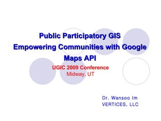
1. Public Participatory GIS Empowering Communities with Google Maps API Dr. Wansoo Im VERTICES, LLC UGIC 2009 Conference Midway, UT
2.
3.
4. Five Components of GIS Source: http://ioc.unesco.org/oceanteacher/OceanTeacher2/02_InfTchSciCmm/01_CmpTch/03_GIS&SDI/01_Fundamentals/Components.html
5. Five Components of GIS Source: http://ioc.unesco.org/oceanteacher/OceanTeacher2/02_InfTchSciCmm/01_CmpTch/03_GIS&SDI/01_Fundamentals/Components.html
6.
7. Interoperability “ capability to communicate, execute programs, or transfer data among various functional units in a manner that requires the user to have little or no knowledge of the unique characteristics of those units” Source: OGC Abstract Specification Topic 12: Services. Derived from ISO 2382-1.