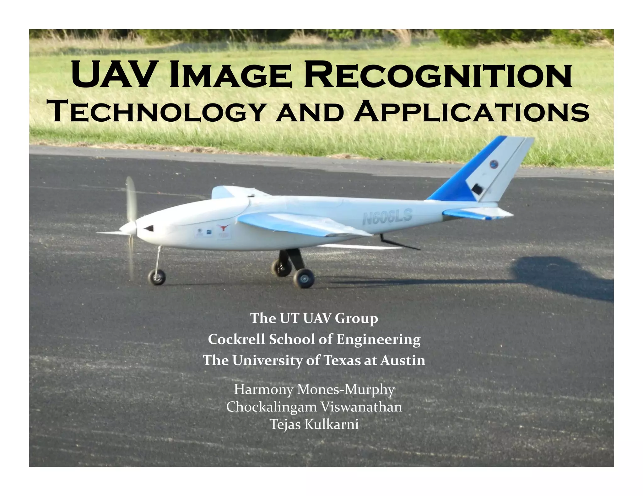
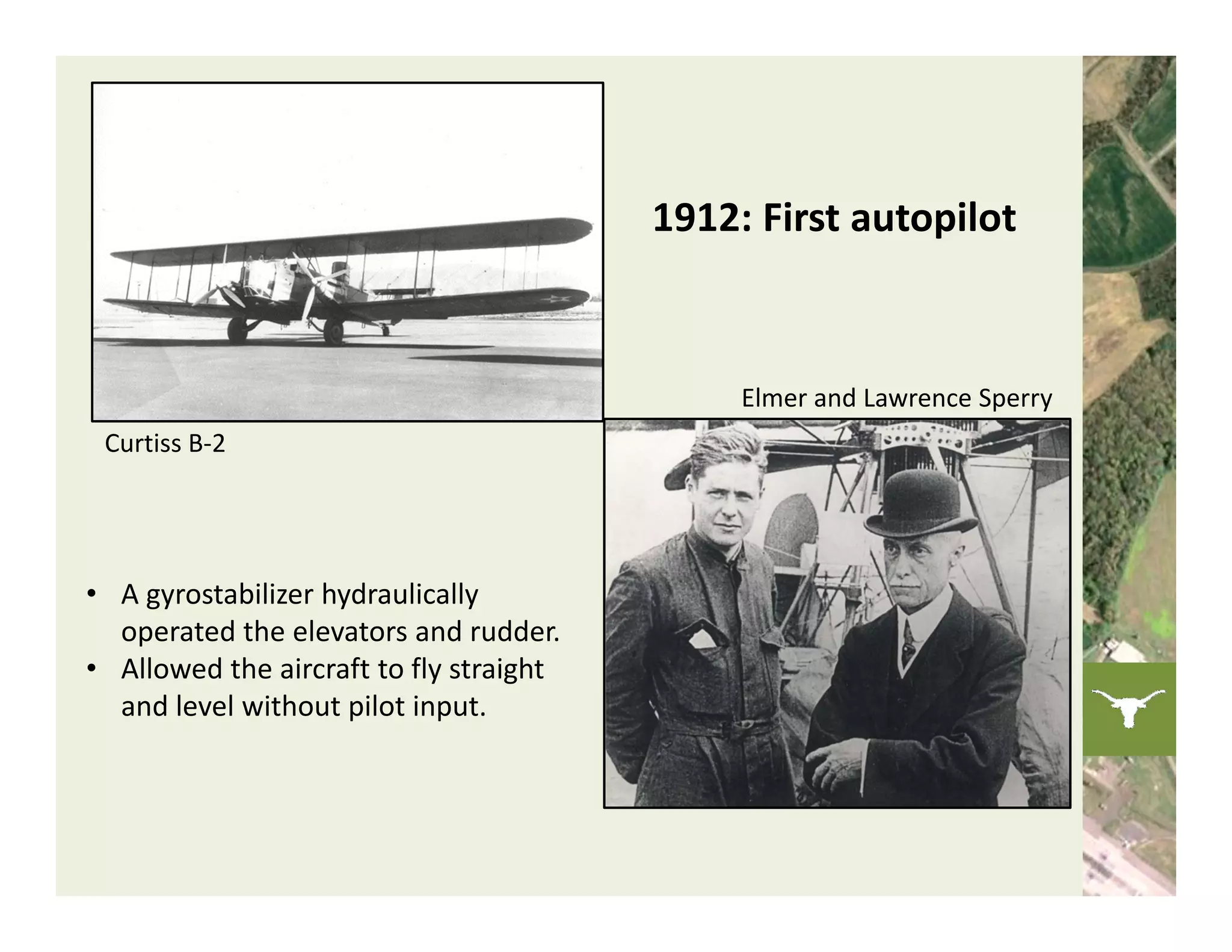
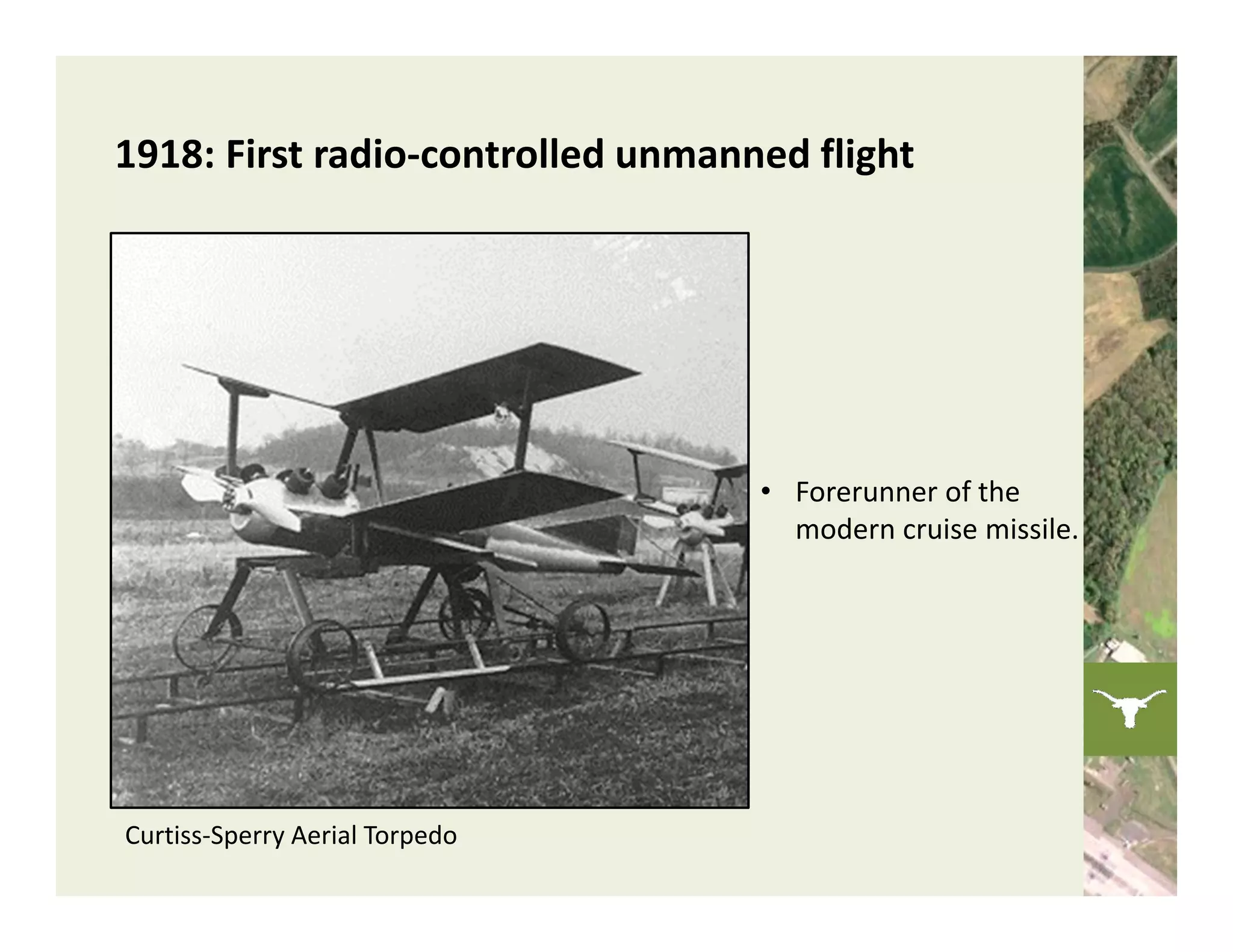
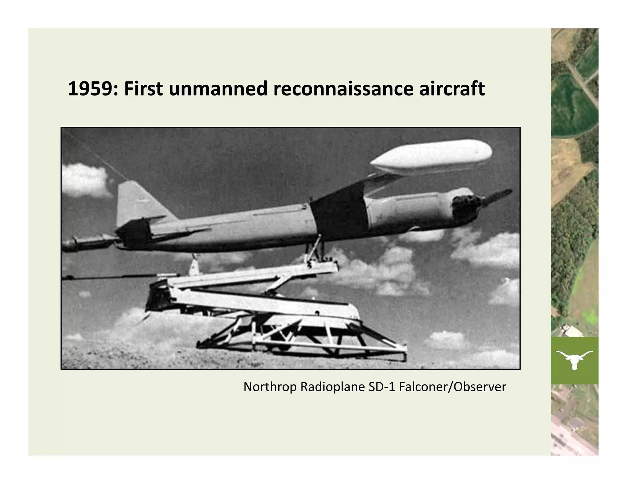
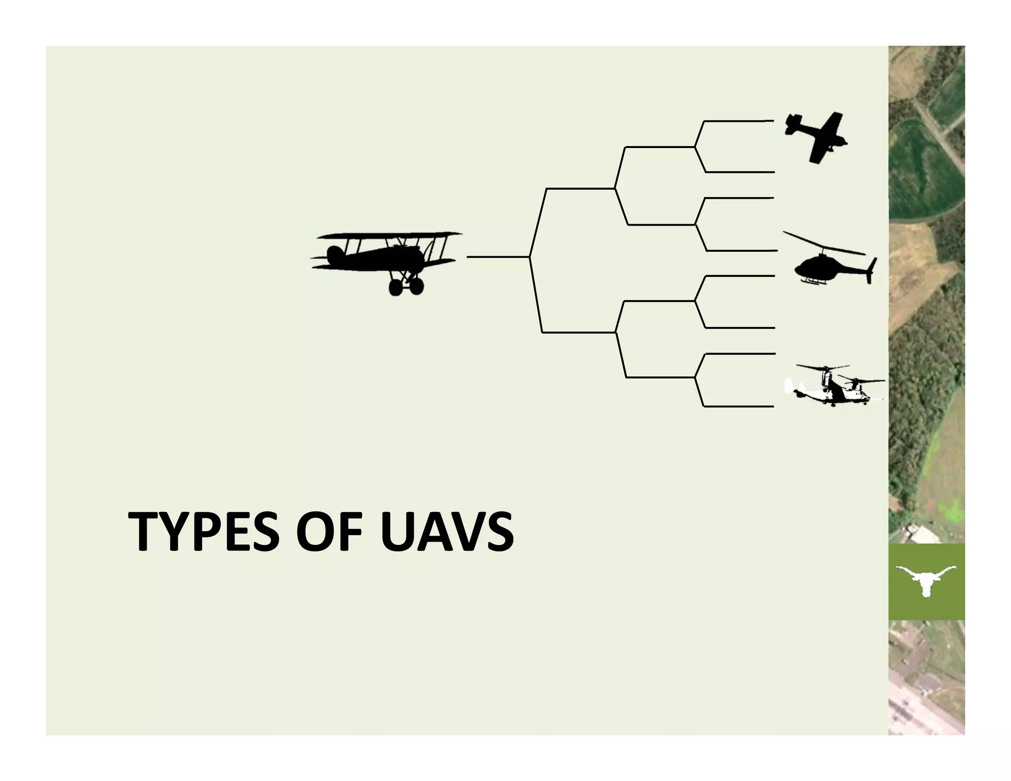
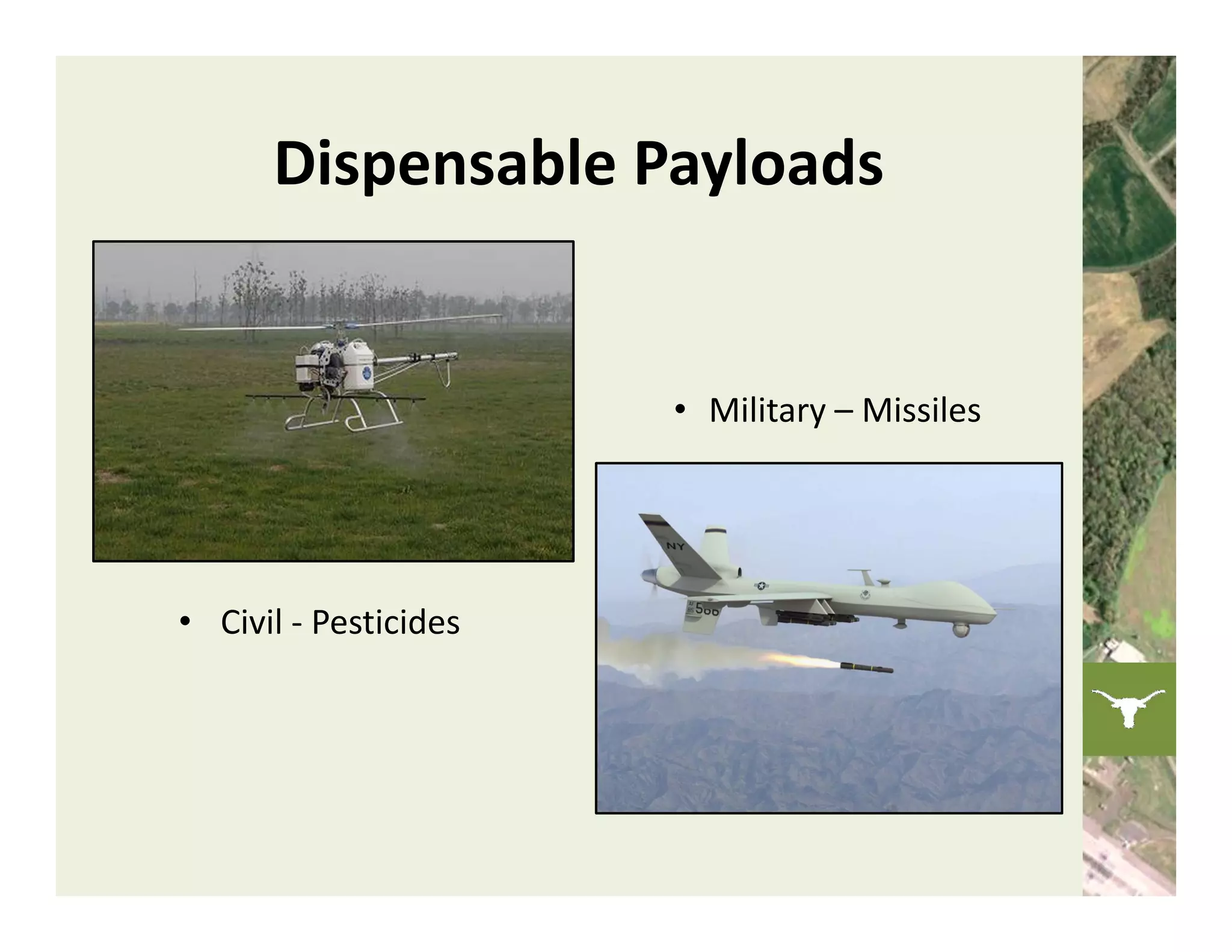
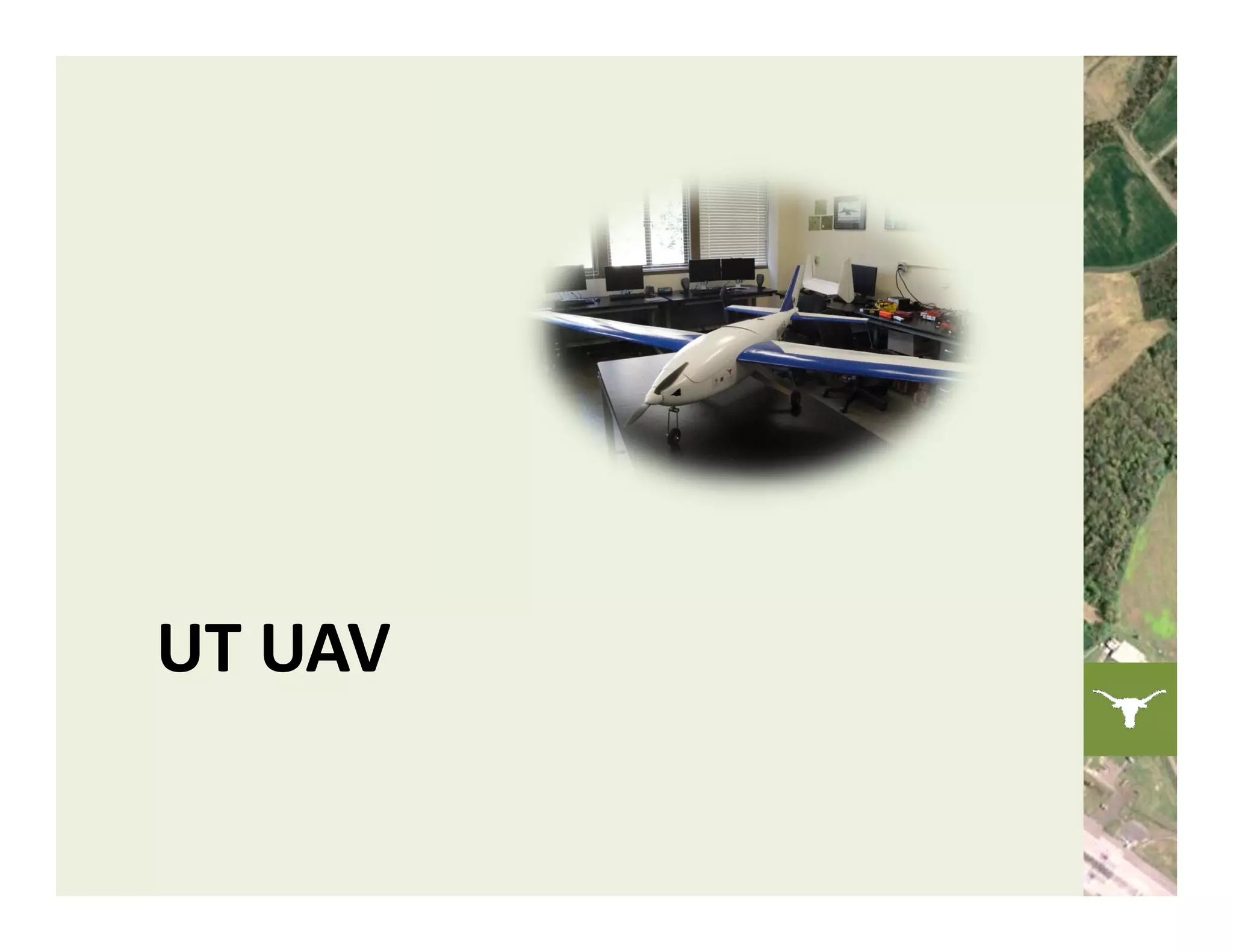
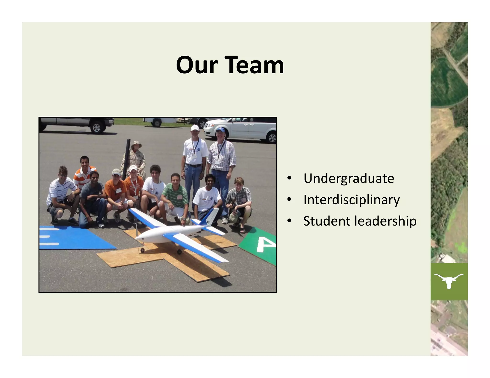
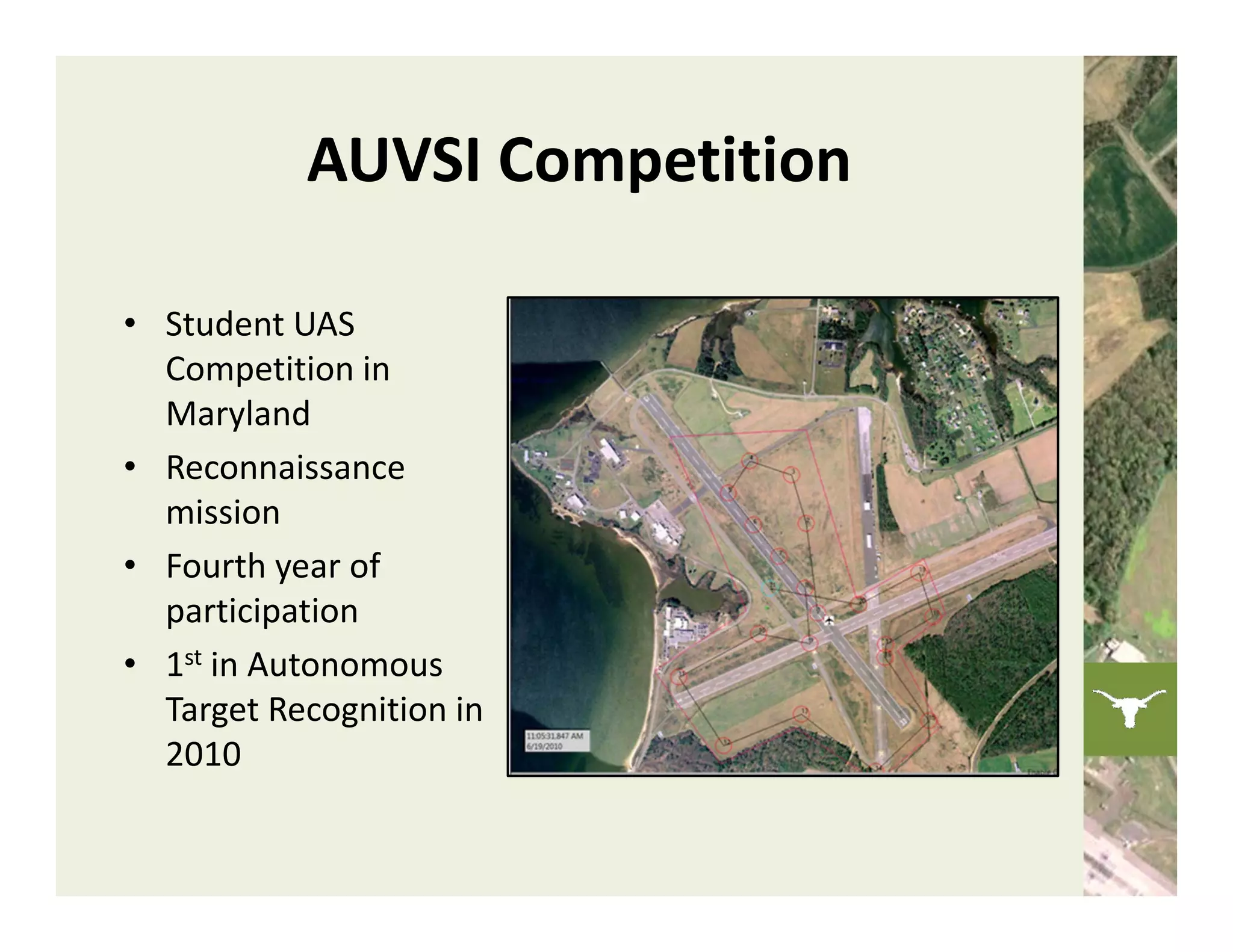
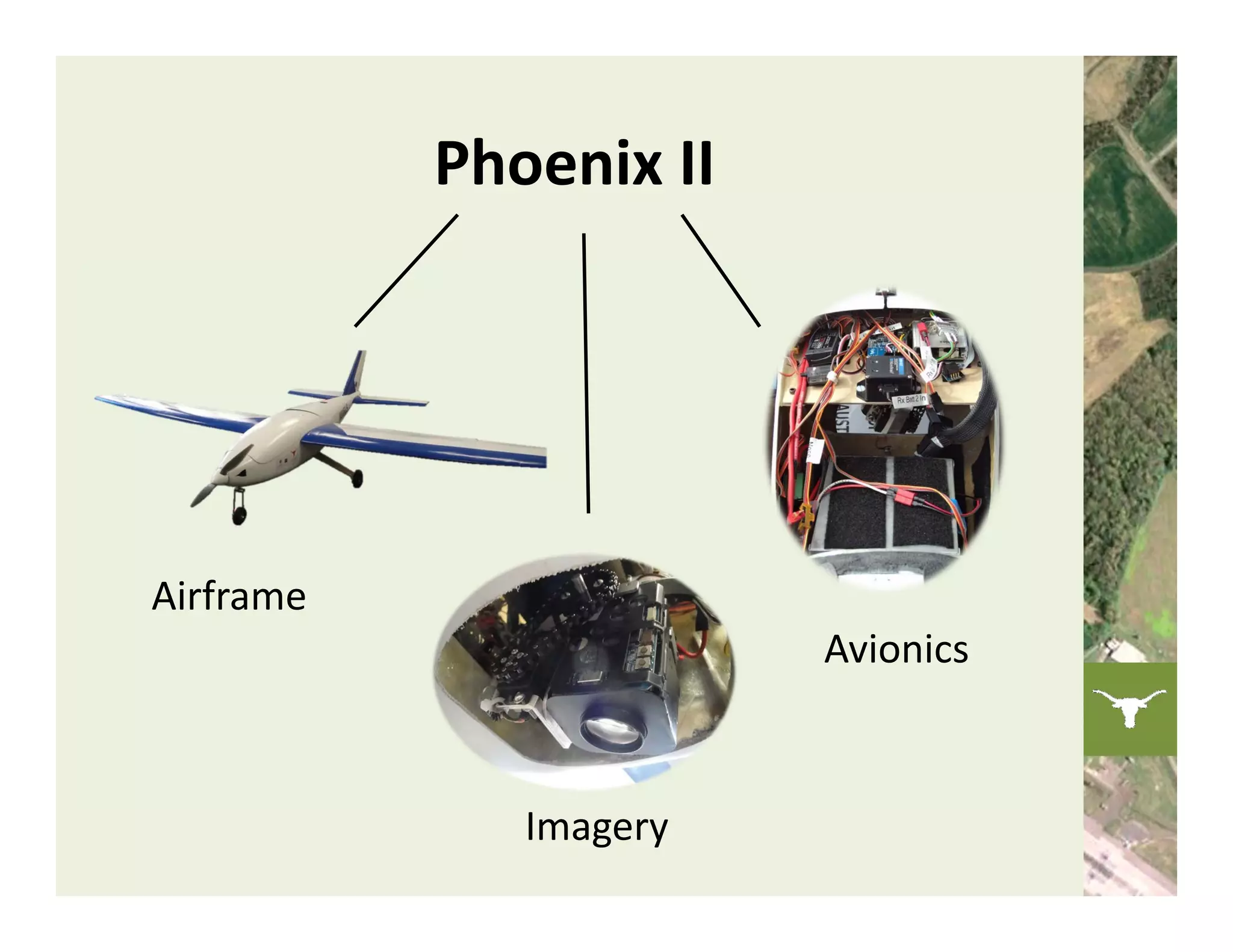
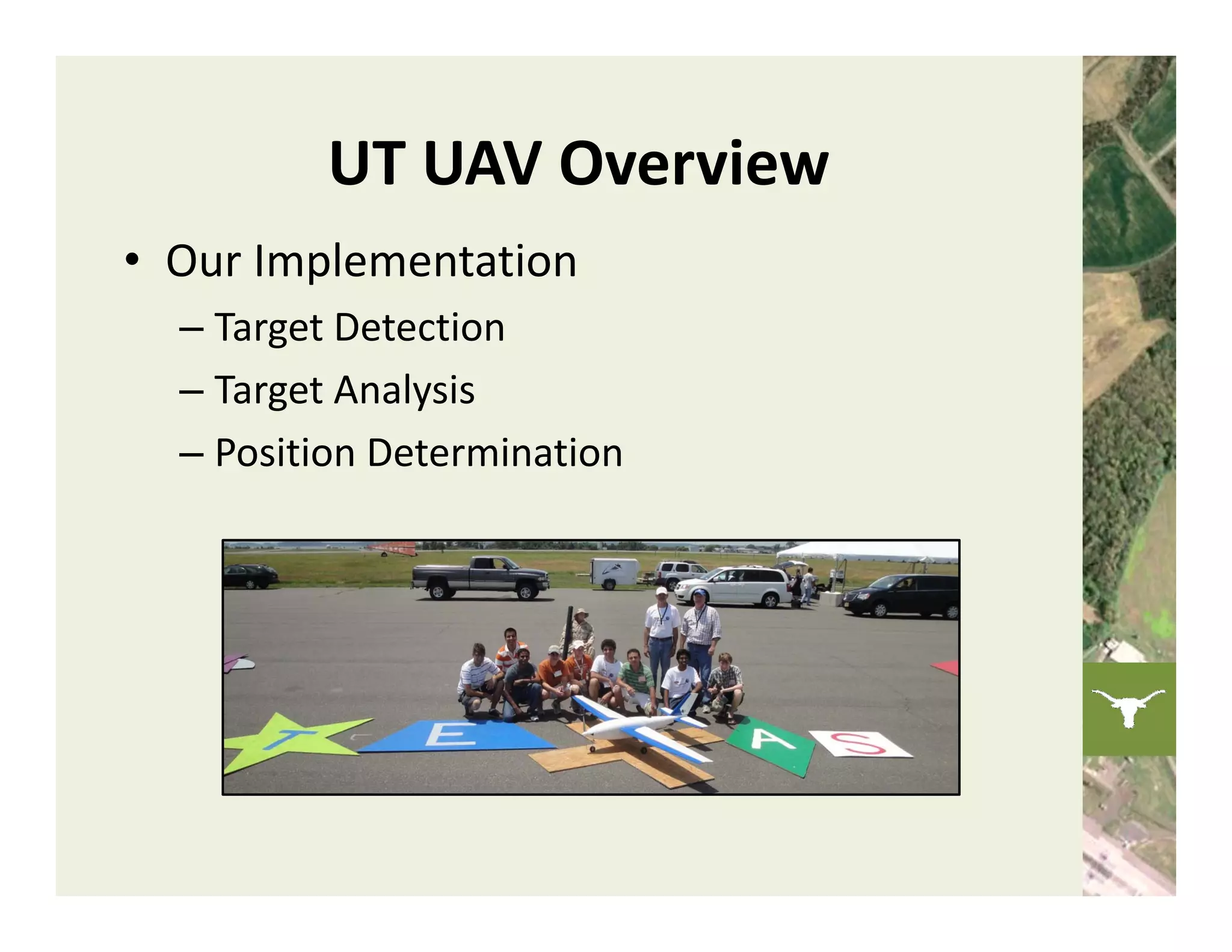
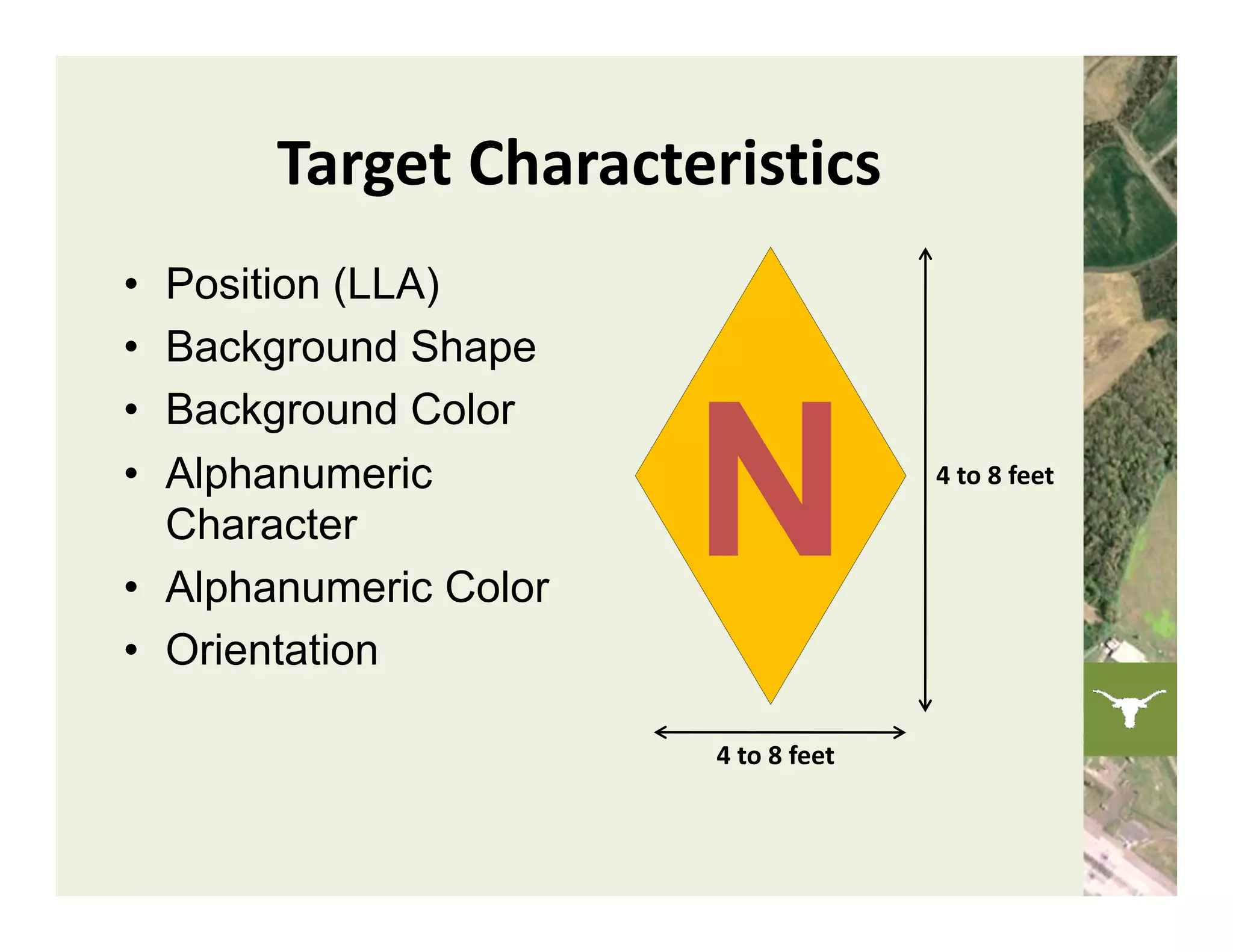
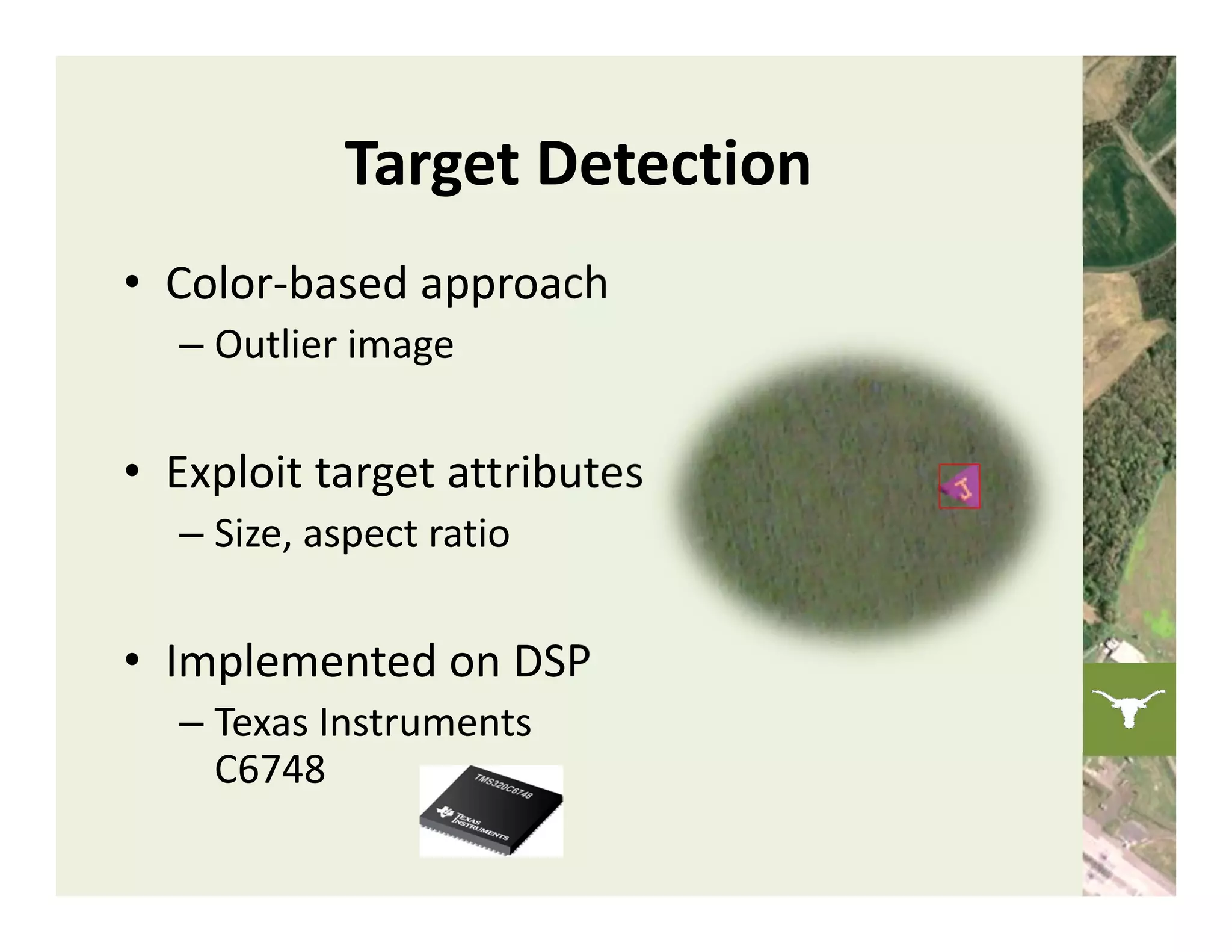
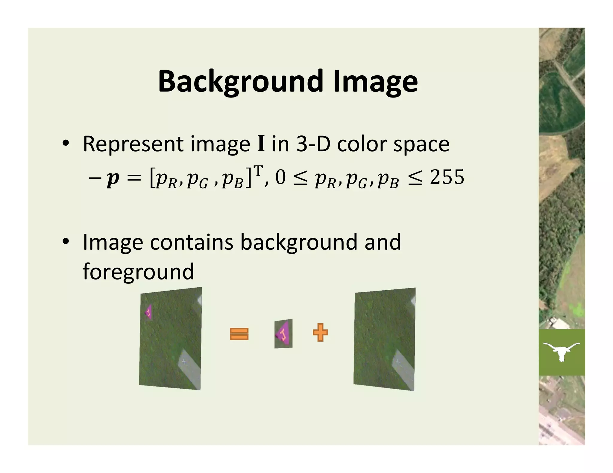
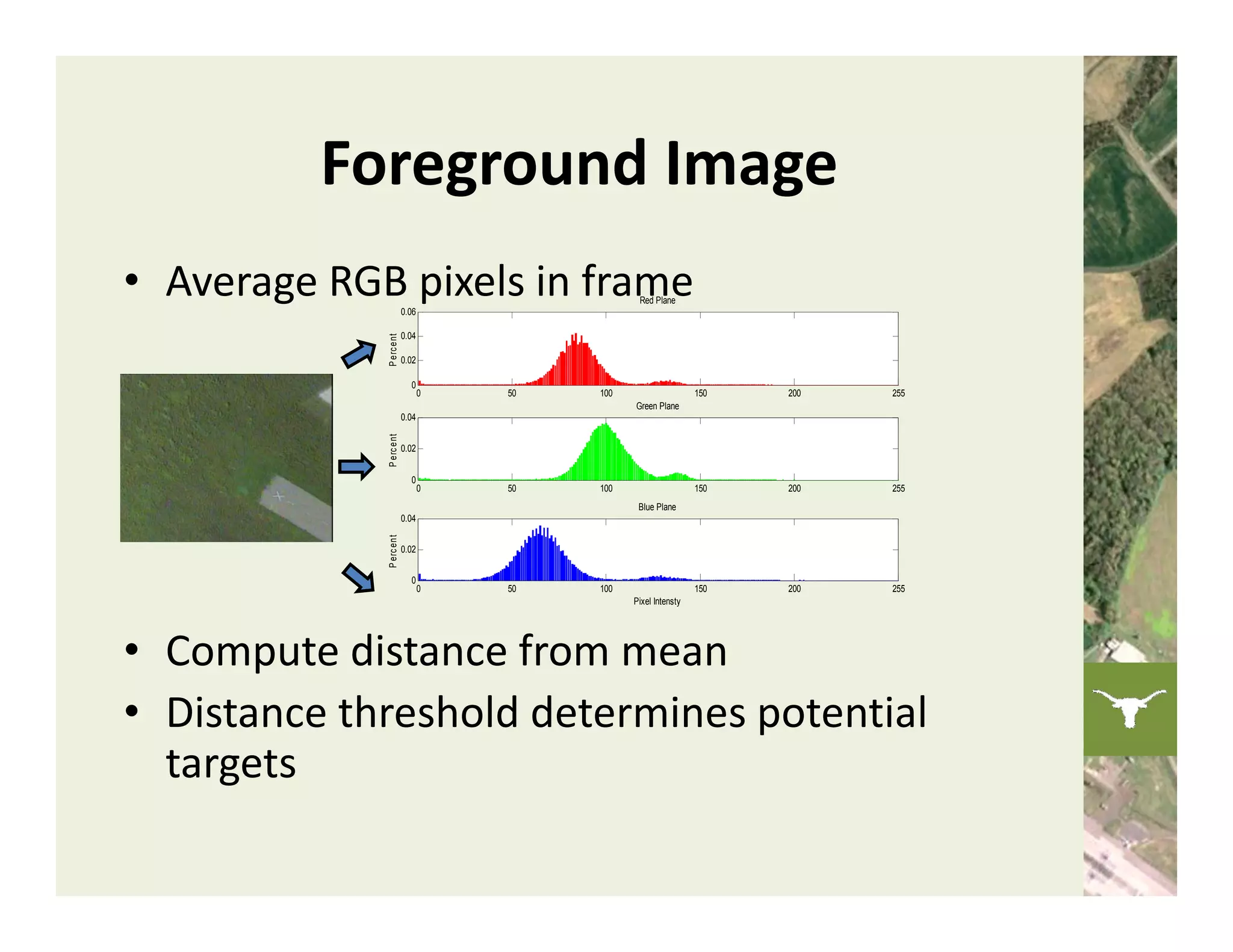
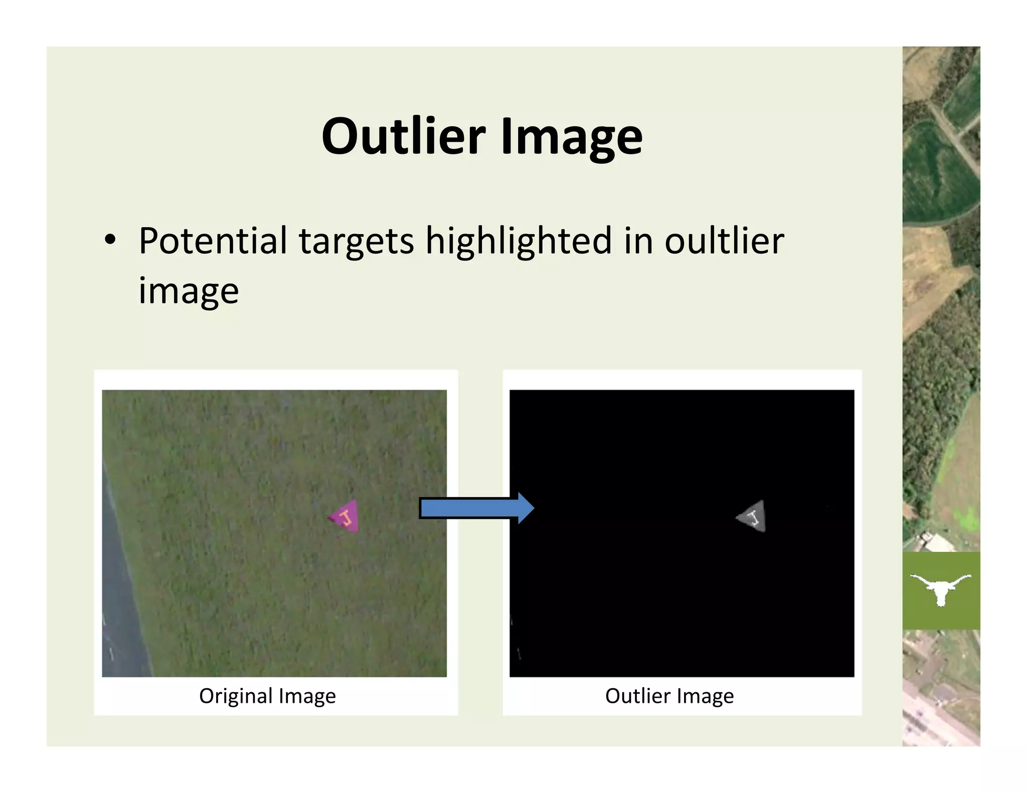
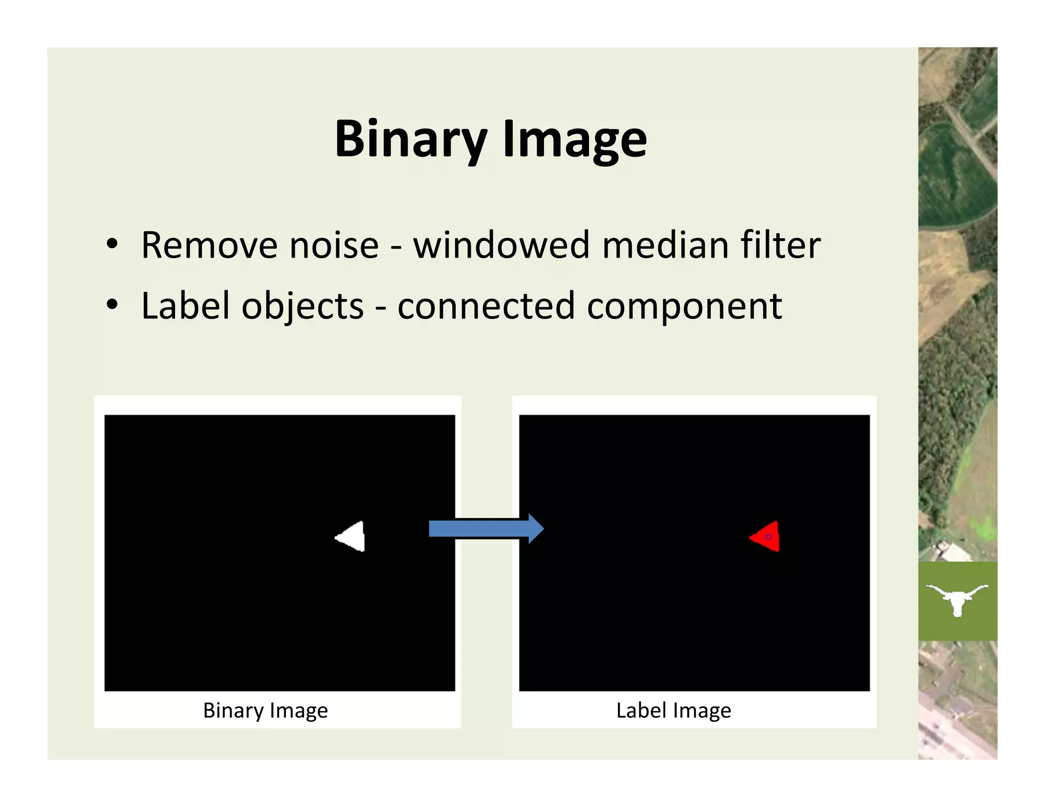
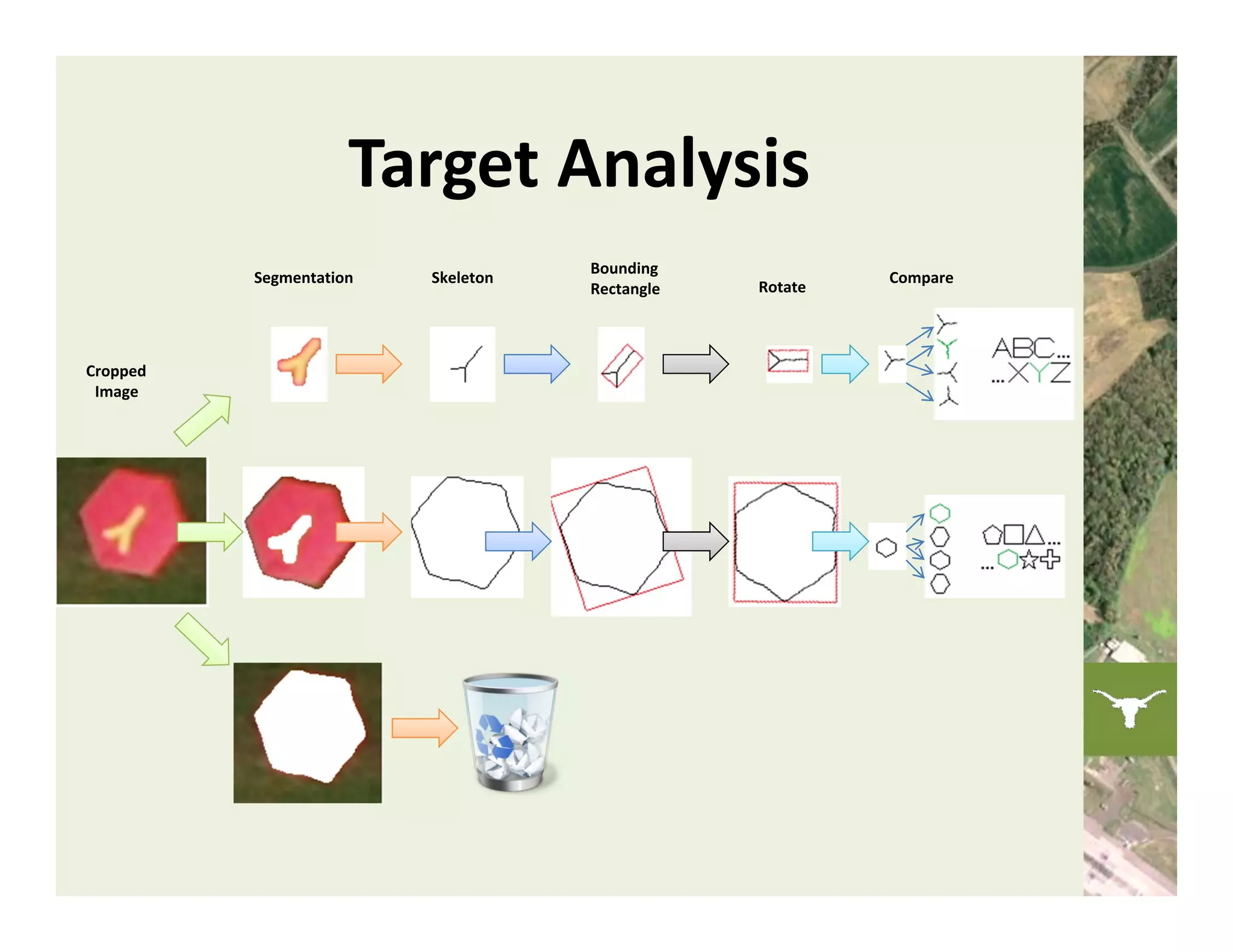
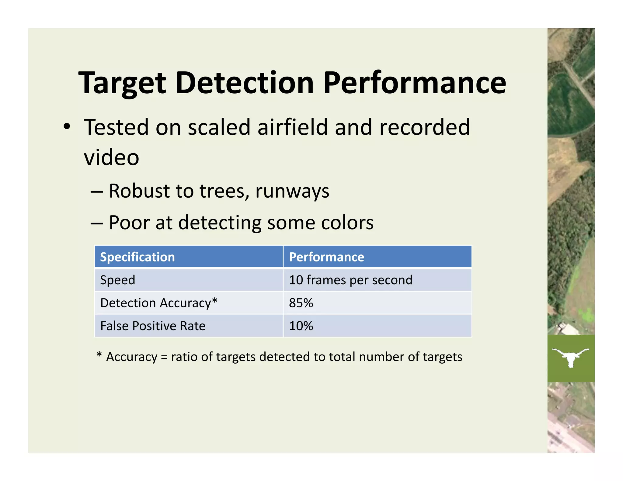
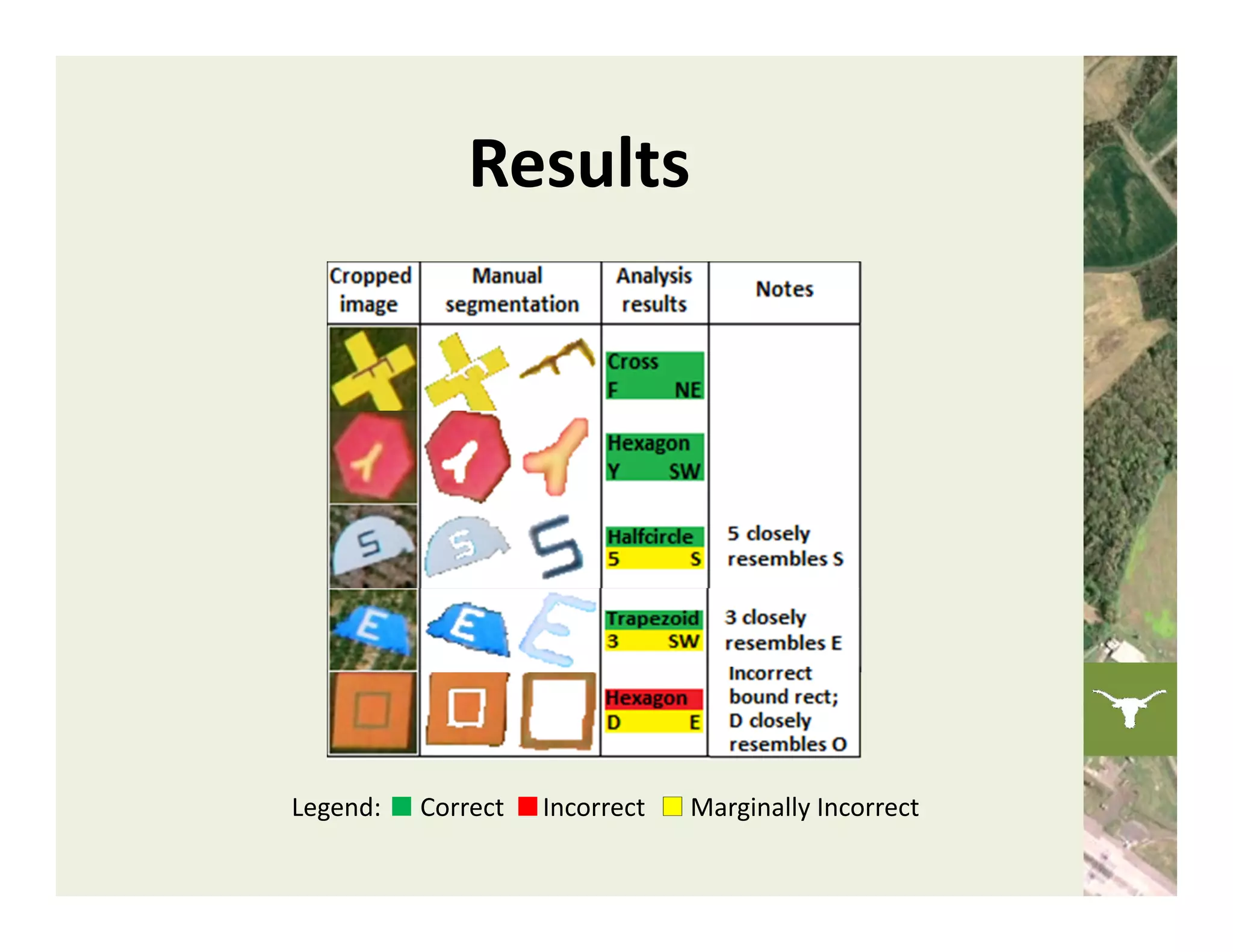
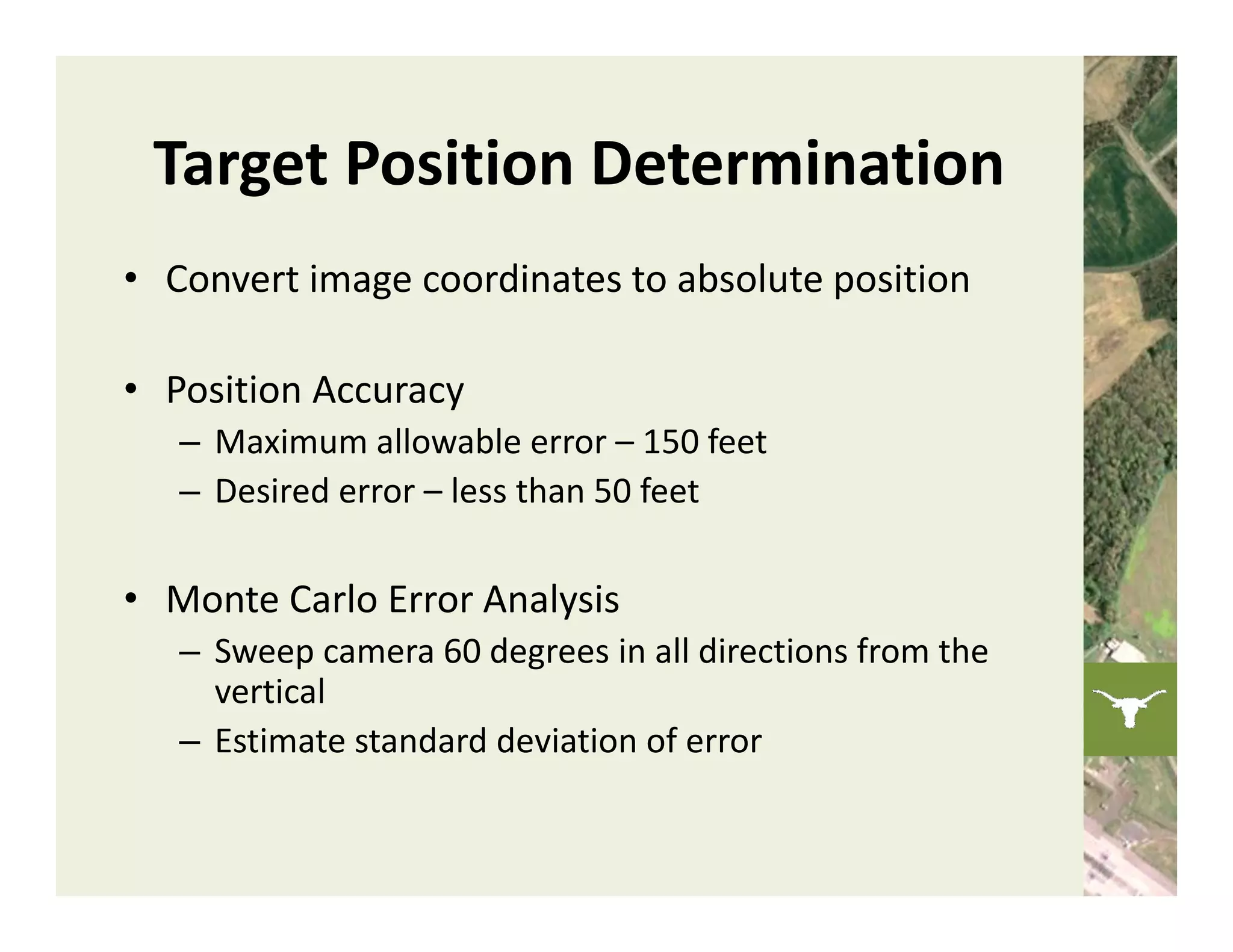
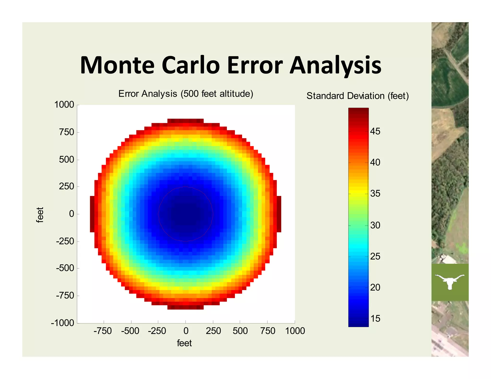
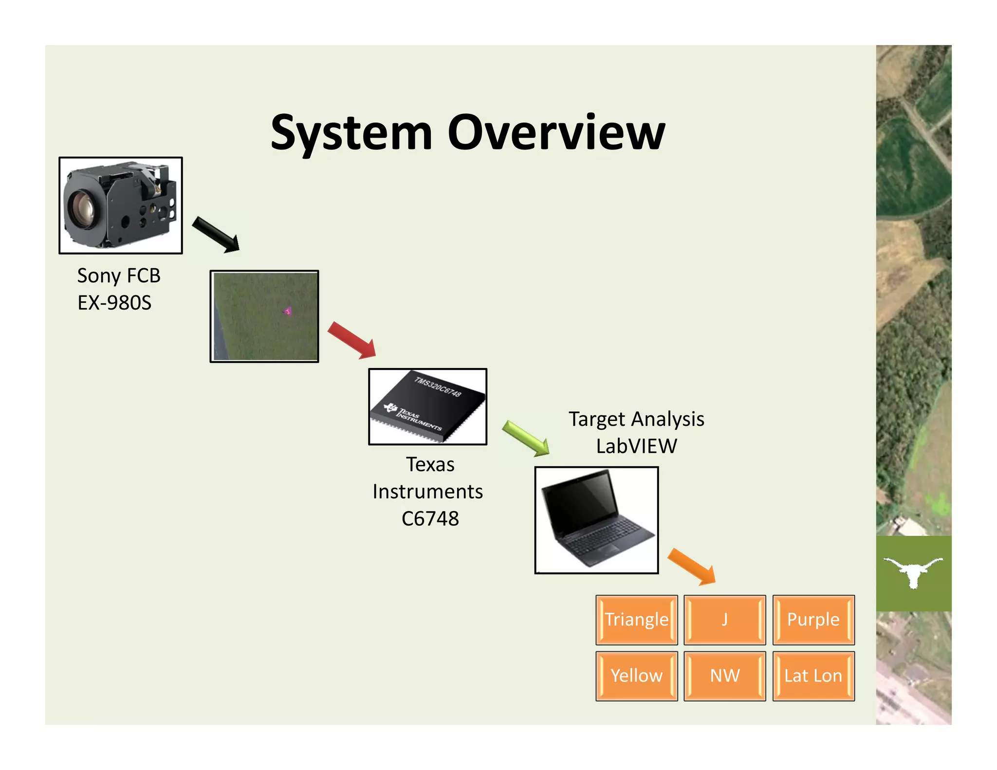
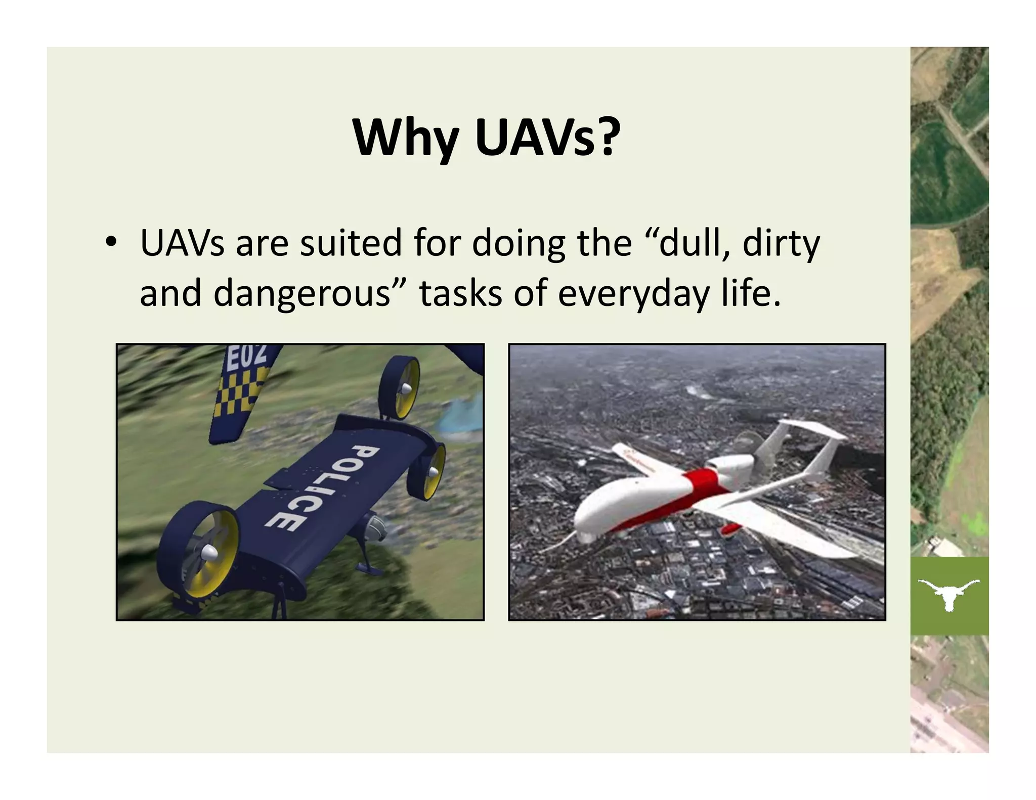
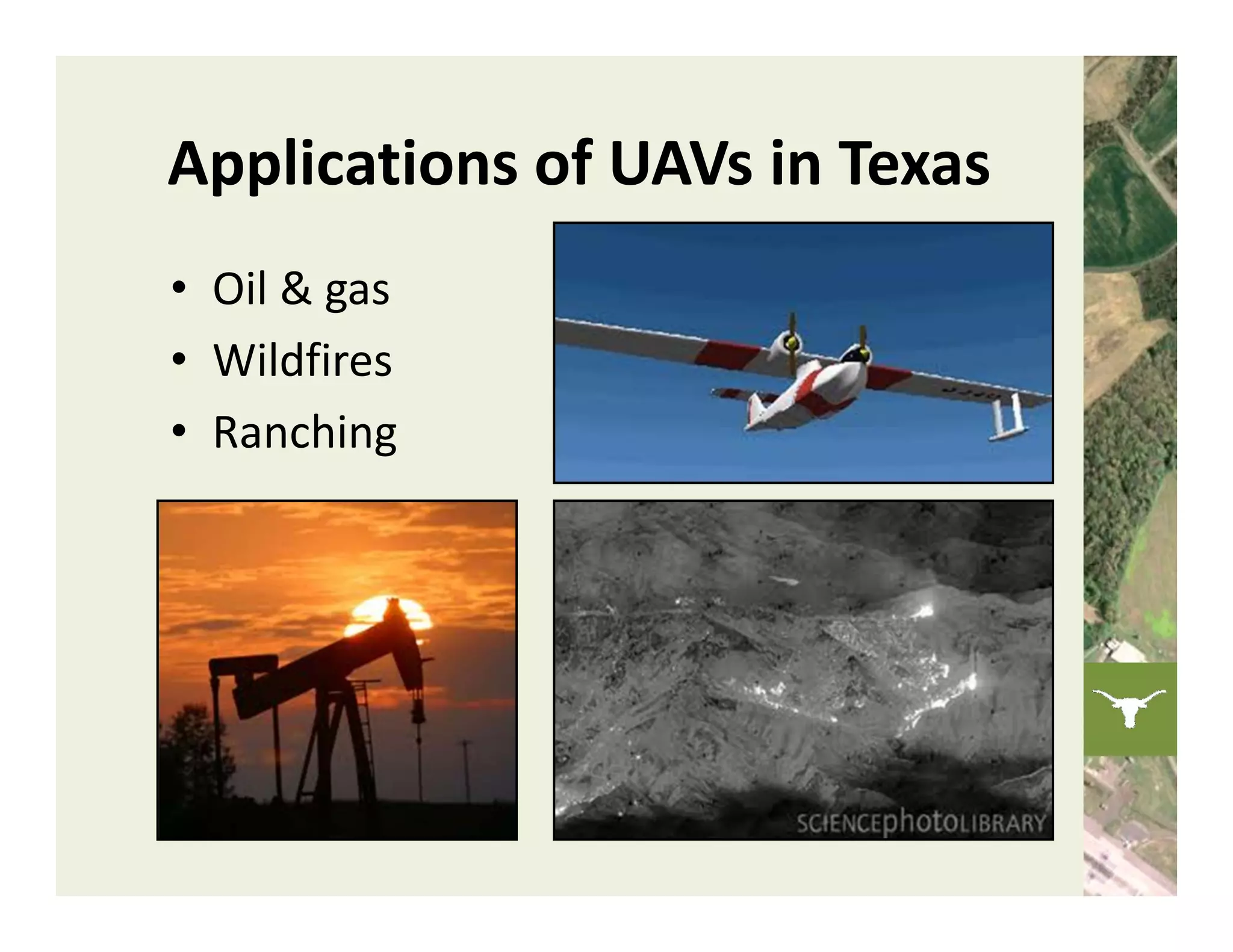
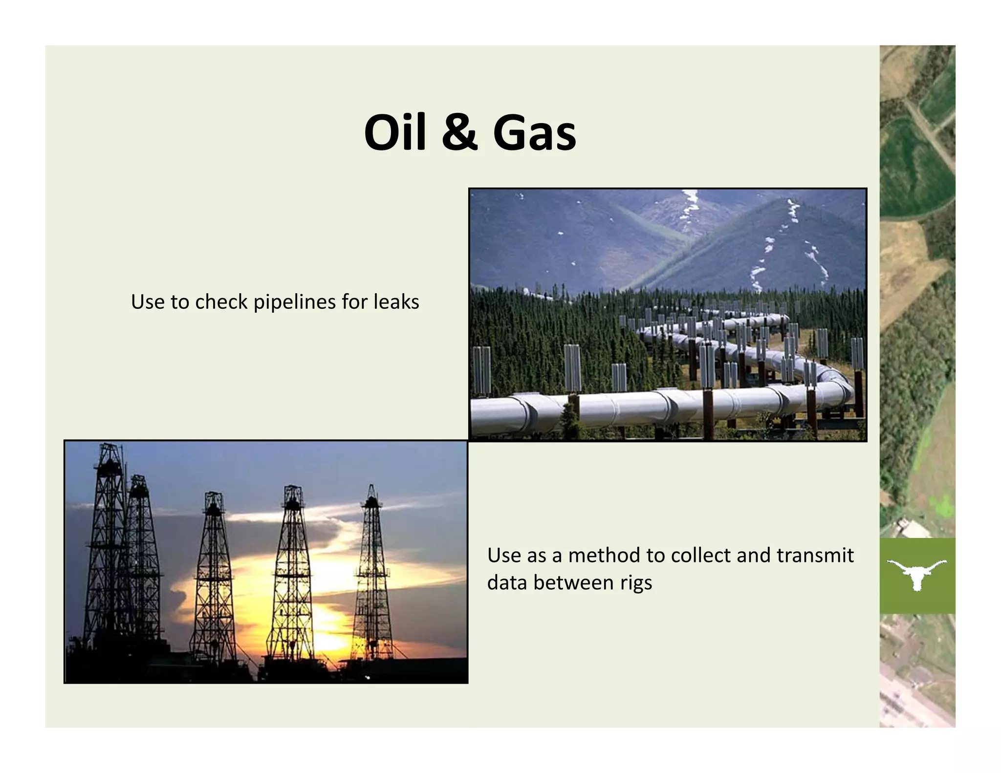
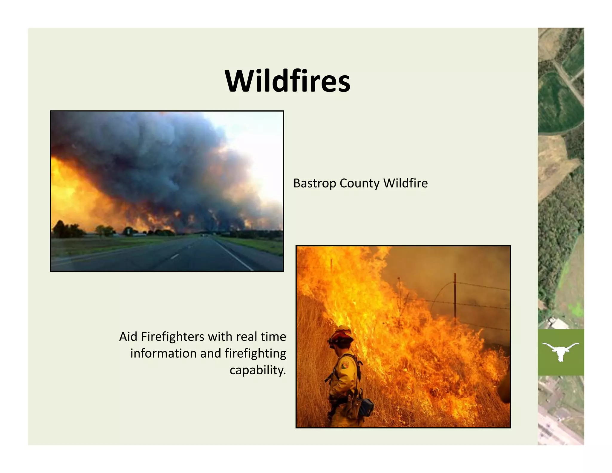
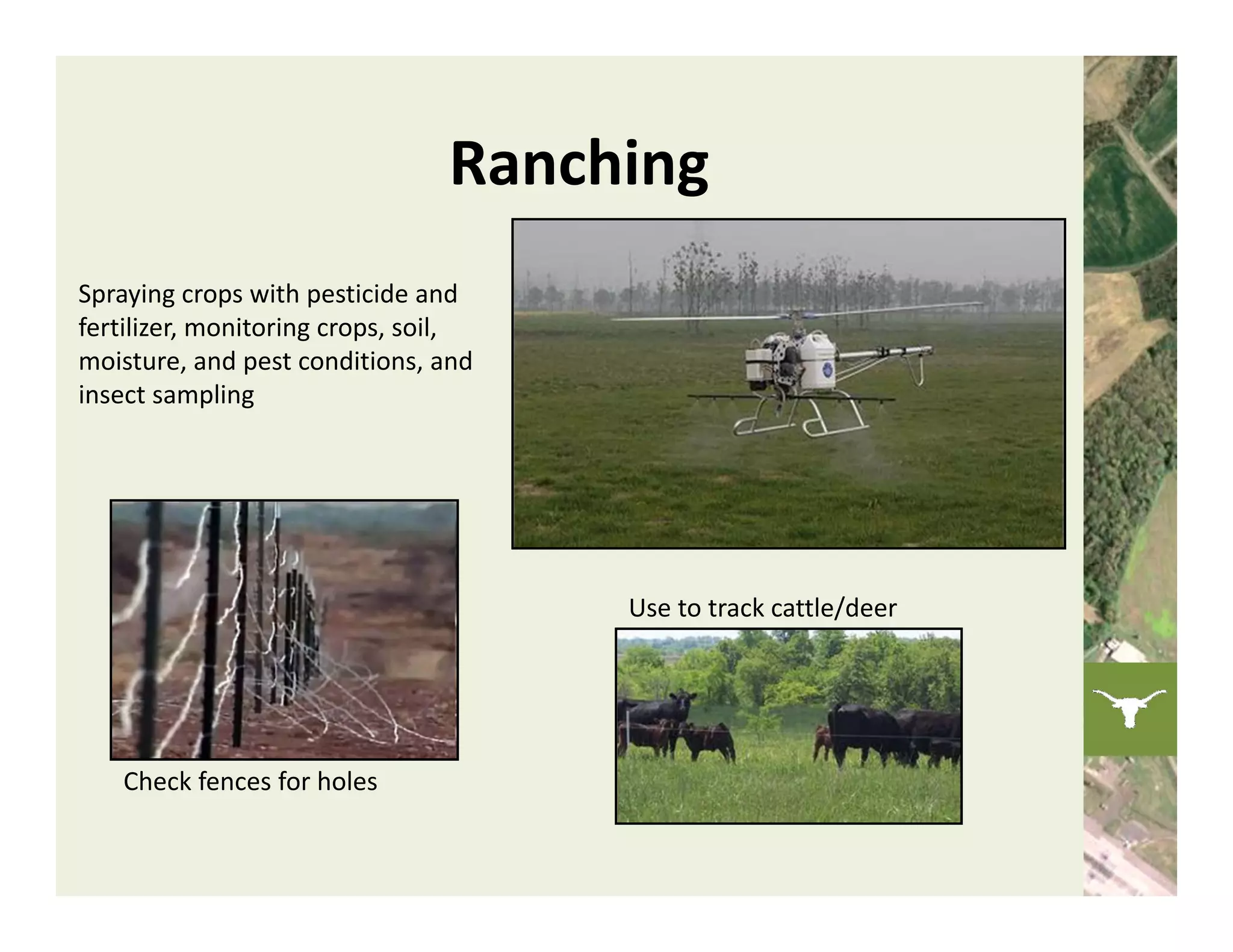
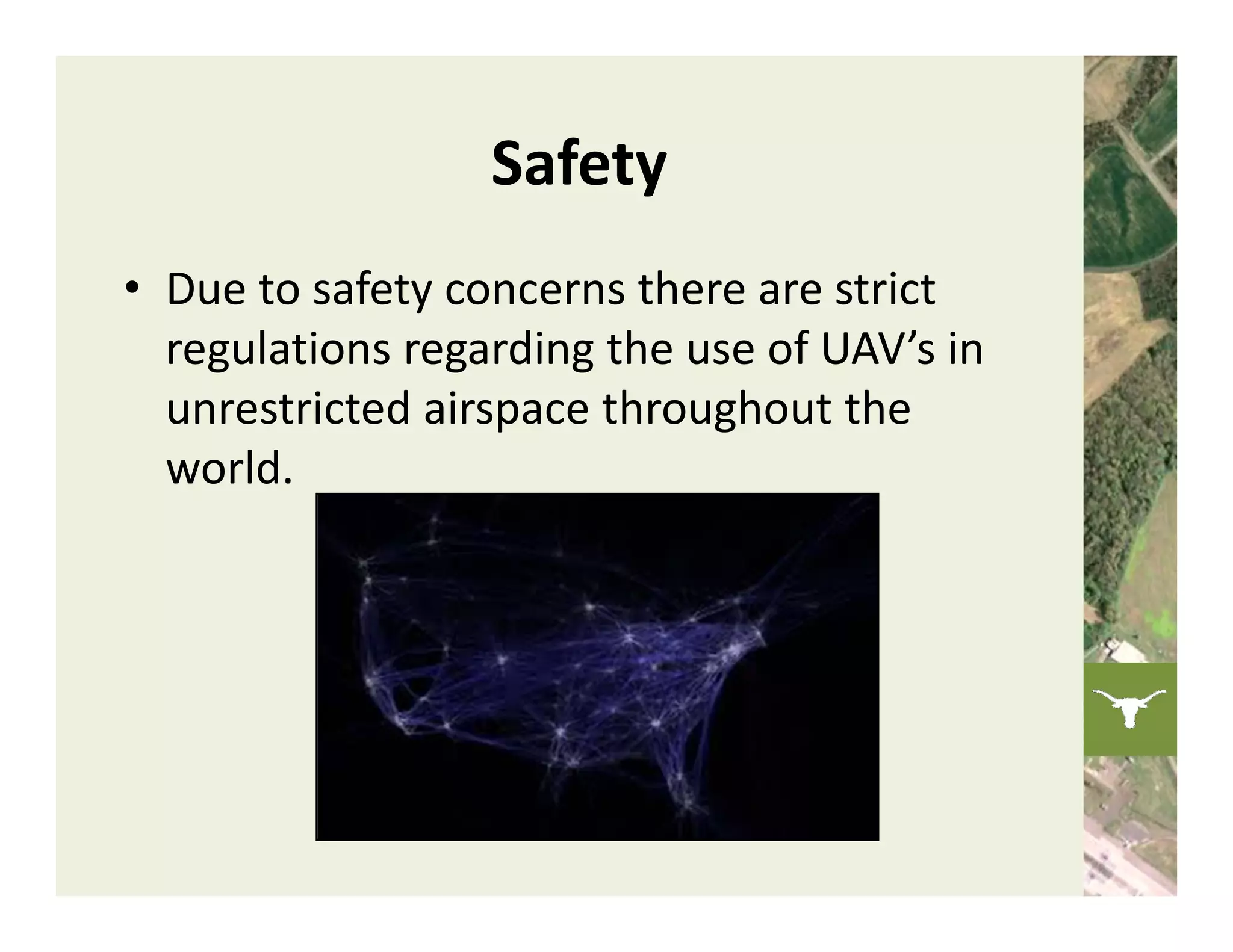
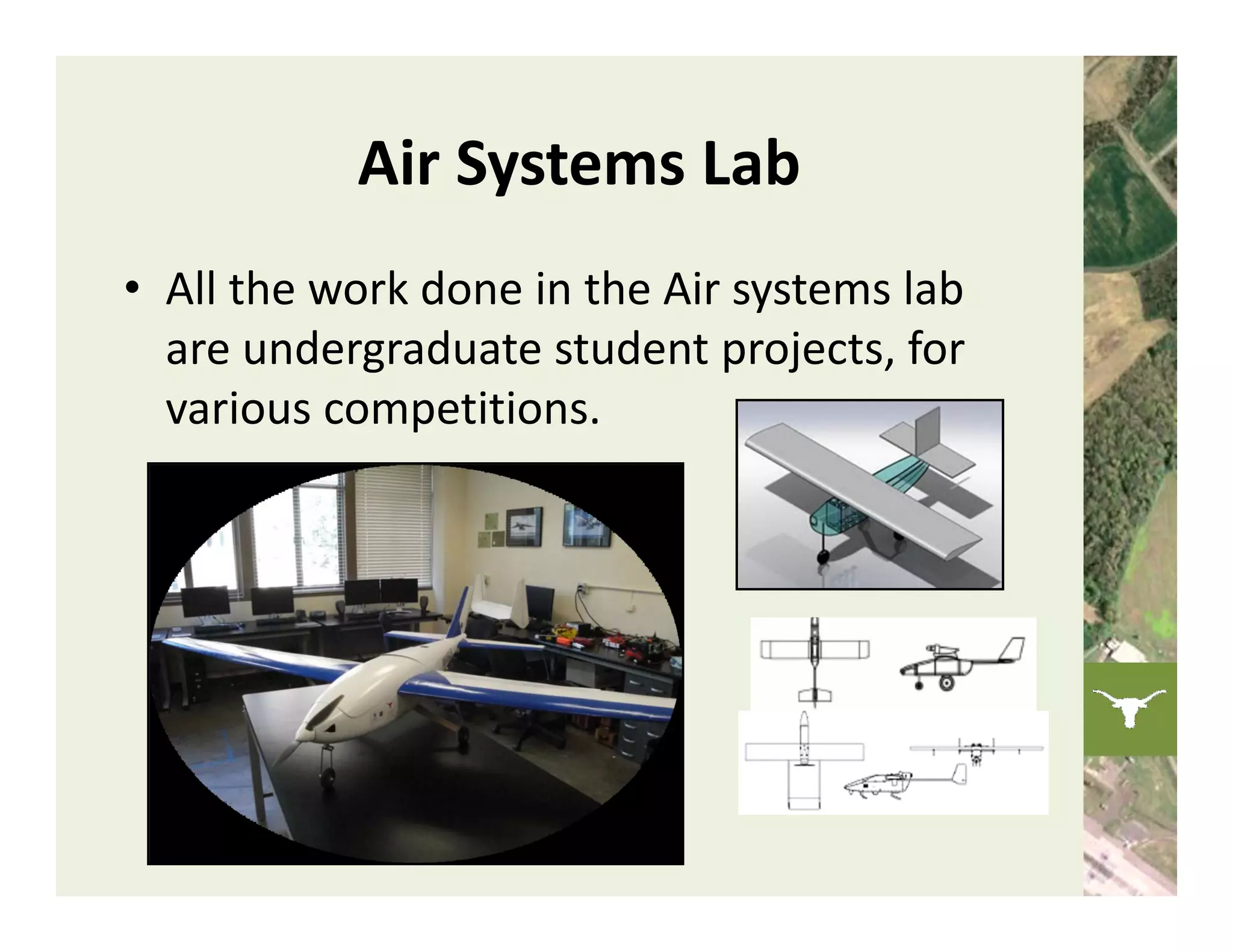
UAV Image Recognition
Technology and Applications


             The UT UAV Group
        Cockrell School of Engineering
       The University of Texas at Austin
           Harmony Mones‐Murphy
          Chockalingam Viswanathan
               Tejas Kulkarni
What is a UAV?
• The Department of Defense Dictionary
  defines a UAV as:
  A powered, aerial vehicle that does not carry a 
  human operator, uses aerodynamic forces to 
  provide vehicle lift, can fly autonomously or be 
  piloted remotely, can be expendable or 
  recoverable, and can carry a lethal or nonlethal 
  payload. 
Driving Technology
•   Powered heavier than air flight
•   Radio control (R/C)
•   Autopilots
•   GPS
•   Imagery systems
•   High density power batteries
•   Long range and low‐power micro radio devices
•   Miniaturized parts
•   Wireless networks
•   Powerful micro‐processors
1898          1912          1933          1960


                  1903          1918          1959


HISTORICAL FIRSTS
1898: First demonstration 
        of radio‐control 


 Nikola Tesla’s “Teleautomaton,” a radio‐
control boat 
                                            Electrical Exposition at Madison 
                                            Square Garden
1912: First autopilot


                                               Elmer and Lawrence Sperry
 Curtiss B‐2


• A gyrostabilizer hydraulically 
  operated the elevators and rudder.
• Allowed the aircraft to fly straight 
  and level without pilot input.
1918: First radio‐controlled unmanned flight


                                   • Forerunner of the 
                                     modern cruise missile. 


Curtiss‐Sperry Aerial Torpedo
1959: First unmanned reconnaissance aircraft


                  Northrop Radioplane SD‐1 Falconer/Observer
TYPES OF UAVS
Fixed‐Wing


Northrop Grumman RQ‐4 Global Hawk
Rotorcraft

              Helicopter: Northrop Grumman MQ‐8 Fire 
                          Scout


 Quadcopter            Tiltrotor: Bell Eagle Eye
PAYLOADS
Electro‐optic Payload Systems

• Optical Cameras
• Low‐light‐level 
  (LLL) Cameras
• Thermal Imagers
Radar Imaging Payloads


• Synthetic 
  Aperture 
  Radar(SAR)
Dispensable Payloads


                       • Military – Missiles


• Civil ‐ Pesticides
UT UAV
Our Team


           • Undergraduate
           • Interdisciplinary
           • Student leadership
AUVSI Competition

• Student UAS 
  Competition in 
  Maryland
• Reconnaissance 
  mission
• Fourth year of 
  participation
• 1st in Autonomous 
  Target Recognition in 
  2010 
Phoenix II


Airframe
                        Avionics


              Imagery
UT UAV Overview
• Our Implementation
  – Target Detection
  – Target Analysis
  – Position Determination
Target Characteristics
• Position (LLA)
• Background Shape
• Background Color
• Alphanumeric                       4 to 8 feet
  Character
• Alphanumeric Color
• Orientation

                       4 to 8 feet
Target Detection
• Color‐based approach
  – Outlier image

• Exploit target attributes
  – Size, aspect ratio

• Implemented on DSP
  – Texas Instruments 
    C6748
Background Image
• Represent image  in 3‐D color space
  –                , 


• Image contains background and 
  foreground
Foreground Image
• Average RGB pixels in frame
                           0.06
                                                  Red Plane


                           0.04


             P e rc en t
                           0.02

                             0
                                  0   50   100                    150   200   255
                                                 Green Plane
                           0.04
             P erc e nt


                           0.02


                             0
                                  0   50   100                    150   200   255
                                                  Blue Plane
                           0.04
             P erc e nt


                           0.02


                             0
                                  0   50   100                    150   200   255
                                                 Pixel Intensty


• Compute distance from mean
• Distance threshold determines potential 
  targets
Outlier Image
• Potential targets highlighted in oultlier
  image


      Original Image           Outlier Image
Binary Image
• Remove noise ‐ windowed median filter
• Label objects ‐ connected component


     Binary Image             Label Image
Target Analysis
                                    Bounding
          Segmentation   Skeleton                        Compare
                                    Rectangle   Rotate


Cropped
 Image
Target Detection Performance
• Tested on scaled airfield and recorded 
  video
  – Robust to trees, runways
  – Poor at detecting some colors
   Specification                     Performance
   Speed                             10 frames per second
   Detection Accuracy*               85%
   False Positive Rate               10%

   * Accuracy = ratio of targets detected to total number of targets
Results


Legend:      Correct      Incorrect       Marginally Incorrect 
Target Position Determination
• Convert image coordinates to absolute position

• Position Accuracy
   – Maximum allowable error – 150 feet
   – Desired error – less than 50 feet

• Monte Carlo Error Analysis
   – Sweep camera 60 degrees in all directions from the 
     vertical
   – Estimate standard deviation of error
Monte Carlo Error Analysis
                    Error Analysis (500 feet altitude)              Standard Deviation (feet)
       1000

        750                                                                        45

        500                                                                        40

        250
                                                                                   35
feet


          0
                                                                                   30
        -250
                                                                                   25
        -500

                                                                                   20
        -750

       -1000                                                                       15
                -750 -500 -250      0     250   500      750 1000
                                  feet
System Overview

Sony FCB 
EX‐980S 


                              Target Analysis
                                 LabVIEW
                   Texas
               Instruments 
                  C6748


                                 Triangle       J    Purple

                                  Yellow        NW   Lat Lon
Plans for 2012
• Communication
  – Switch to Wifi (802.11N)

• Digital camera (DSLR)

• Weight reduction
Why UAVs?
• UAVs are suited for doing the “dull, dirty 
  and dangerous” tasks of everyday life.
Applications of UAVs in Texas
• Oil & gas
• Wildfires
• Ranching
Oil & Gas

Use to check pipelines for leaks 


                                    Use as a method to collect and transmit 
                                    data between rigs
Wildfires

                                    Bastrop County Wildfire


Aid Firefighters with real time 
  information and firefighting 
                     capability. 
Ranching
Spraying crops with pesticide and 
fertilizer, monitoring crops, soil, 
moisture, and pest conditions, and 
insect sampling


                                       Use to track cattle/deer


    Check fences for holes
Safety
• Due to safety concerns there are strict 
  regulations regarding the use of UAV’s in 
  unrestricted airspace throughout the 
  world. 
Air Systems Lab
• All the work done in the Air systems lab 
  are undergraduate student projects, for 
  various competitions. 
Q&A
Uav image recognition technology and applications

Uav image recognition technology and applications