call girls in Kamla Market (DELHI) 🔝 >༒9953330565🔝 genuine Escort Service 🔝✔️✔️
Lyle tamucc 2
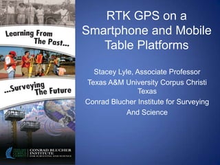
1. RTK GPS on a
Smartphone and Mobile
Table Platforms
Stacey Lyle, Associate Professor
Texas A&M University Corpus Christi
Texas
Conrad Blucher Institute for Surveying
And Science
2. Dd
D
Office ofBlucher Institute
Conrad Research and Texas A&M University
Texas A&M University
Corpus Christi
Corpus Christi
D Graduate Studies
for Surveying and The Island University
The Island University
Science
Operations
N
Collecting real-time and long term ocean coastal
observations
Managing coastal observing systems for navigation
and transportation
3. Dd
D
Office ofBlucher Institute
Conrad Research and Texas A&M University
Texas A&M University
Corpus Christi
Corpus Christi
D Graduate Studies
for Surveying and The Island University
The Island University
Science
Physical Oceanographic Real-Time System
N
(PORTS®)
• Houston/Galveston
• Sabine-Neches
• Gulfport
• Pascagoula
• Mobile Bay
• Lake Charles
4. Office of Research and Texas A&M University
Corpus Christi
Graduate Studies The Island University
Research N
• NASA
– Columbia Recovery (Lyle
and Smith, 2003)
– Geospatial Authentication
(NASA, 2009)
– Aerial Vediography Direct
Georeference Rocket
Payloads (NASA, 2009)
• NOAA/NGS
– Spacebased RTK (Lyle and
Mulcare, 2005)
– Airborne Gravity (Prouty
and Lyle, et al., 2007)
– GPS Quality (Lyle and
Wood, 2002)
6/29/2012 DRAFT 4
5. Dd
D
Office ofBlucher Institute
Conrad Research and Texas A&M University
Texas A&M University
Corpus Christi
Corpus Christi
D Graduate Studies
for Surveying and The Island University
The Island University
Science
NPS and TxGLO UAS
N
• RS 16
• 16’ wing spread
• 13,000’ ceiling
• 16 hour flight time
• 25 pound load
• Photogrammetry Payload
• Direct GeoReferencing
6. Office of Research and Texas A&M University
Corpus Christi
Graduate Studies The Island University
Smartphone RTK
N
RTN
GPS:
VRS or
RTCM
Server
Local Wi-Fi
Network
Real Time Map 2G/3G/4G
6/29/2012 DRAFT 6
7. Dd
D
Office ofBlucher Institute
Conrad Research and Texas A&M University
Texas A&M University
Corpus Christi
Corpus Christi
D Graduate Studies
for Surveying and The Island University
The Island University
Science
USDA: Low Cost Machine
N
Control
• Low Cost RTK GPS
• Space-based RTK
• CORS Connection
8. Office of Research and Texas A&M University
Corpus Christi
Graduate Studies The Island University
L1 RTK Horizontal
N
0.03
0.02
0.01
0
-0.03 -0.02 -0.01 0 0.01 0.02 0.03
-0.01
-0.02
-0.03
-0.04
6/29/2012 DRAFT 8
9. Office of Research and Texas A&M University
Corpus Christi
Graduate Studies The Island University
L1 RTK Vertical
N
0.1
0.08
0.06
0.04
0.02
0
0 500 1000 1500 2000 2500 3000 3500 4000
-0.02
-0.04
-0.06
-0.08
6/29/2012 DRAFT 9
10. Office of Research and Texas A&M University
Corpus Christi
Graduate Studies The Island University
Considerations
N
• QWERTY keyboard
• Kick-out keyboards
• Touch screen
• Smaller data collectors
in existence
• User adaptations
11. Office of Research and Texas A&M University
Corpus Christi
Graduate Studies The Island University
Phone
N
Considerations
• iPhone 4:
– 3G – 6 hours
– Wi-Fi – 10 hours
– Standby – 300 hours
– Bluetooth – worse
• Android and Windows –
similar
12. Office of Research and Texas A&M University
Corpus Christi
Graduate Studies The Island University
Application Steps
N
1. App starts- Settings
2. Post Processing vs. RTK
3. Start Job
4. Smart phone gets corrections
5. Surveying started with selected
accuracy
6. GNSS configured to output
7. Real Time Mapping and/or
Control
8. App closed
13. Office of Research and Texas A&M University
Graduate Studies Product Corpus Christi
The Island University
Availability
N
• Open Source
• Work in progress
• Will be found in:
– Markets
– Websites
– Software application management software
14. Office of Research and Texas A&M University
Corpus Christi
Graduate Studies The Island University
Thank YouN
Conrad Blucher Institute for
Surveying and Science
6300 Ocean Drive
Corpus Christi, Texas 78412
Stacey.lyle@tamucc.edu
361-548-8852
Editor's Notes
The downside to this is that in today’s world Land Surveyors are accustomed to harsh environments, however, the mobile phones and tablets are not. The mobile phone has many options that we can evaluate though. There is a Full QWERTY keyboard for quick data entry, but they are often small and difficult to use. Then there are the kick-out style keyboards that offer larger buttons, but they are still considered too tedious. We have then brought out the touch screen keyboards which are popular; however, they lack tactile feedback. The current touch screen data collectors have only 320x320 pixels, while the newer smart phones have the 960x640 pixels screens. Small displays and limited interaction capabilities make it difficult to design and frustrating to use. Users are now more adapted to the newest screens and keyboard interfaces so the frustrations have lessened.
We then have to take into consideration the batter power of the smart phone. The iPhone 4 can sustain a 3G internet connect of up to 6 hours, a Wi-Fi of up to 10 hours, and a standby moment up to 300 hours. The Bluetooth drains the battery even faster. The Android and Windows phones have similar battery power configuration. The phones can be operated while being charge, but that takes away from the USB connection method for the GNSS receiver.
The steps to the application will be as follows. Step 1: The application starts. Step 2: The user will choose either Post Processing or Real Time. Step 3: After selecting Real time the user will start a Job with the Real Time configuration file for the GNSS. The options that are settings are used. Step 4: While the GNSS is started the Smart Phone logs on to the Real Time provider to obtain a VRS or RTCM correction using the available location to the NTRIP type server. Step 5: Surveying can be started with the current or minimum accuracy that can be configured in settings. Step 6: The GNSS will be configured to output a NEMA string on TCPIP or other communication as selected in the settings. Step 7: The Real Time mapping data is pushed or pulled as selected in the settings. None is also an option. Step 8: When the application is closed the files are closed.
A software factory configuration is being established to continue the product development. The product will be provided in markets, websites, and software application management software such as iTunes or Amazon.