Ham radio operators provide essential communications support for various events through the use of mobile communications trailers with generators and antennas. This includes providing backup communications, monitoring medical situations, tracking locations, and reuniting families. The organization aims to have more robust and redundant mobile communications assets statewide to support agencies and response efforts. Strategies include networking trailers, using mesh networking and video capabilities, and training volunteers to work with agencies.
This document discusses a case study using combined BIM and GIS modeling for building energy conservation. It introduces the Department of Land Surveying and Geo-Informatics at PolyU, which provides training in geomatics including BIM. A 3D model was constructed of Block Z and surrounding areas using floor plans, existing survey data, and a landscape scan. Daylight and solar radiation simulations were performed on the combined model. Seasonal differences in sunlight and shadows cast by neighboring buildings were analyzed. An intelligent lighting management system was designed for the 6th floor based on daylight factor maps and lighting locations. The study demonstrated the benefits of integrating BIM and GIS for optimizing building lighting and energy conservation.
Presentation prepared for Ikatan Ahli Perencana, Jakata (Planner Association). A lesson learn from Australia's and Indonesia's city. It shows case different implementation in Australia and Indonesia.
This document discusses bridging the gap between geographic information systems (GIS) and building information modeling (BIM) to build a sustainable railway network using consistent digital information. It proposes collecting data once at the source and sharing it throughout the asset lifecycle. Current GIS and BIM standards like InfraGML, IFC, and LandXML are examined for integrating railway design data with 3D reality models from lidar scans. The document demonstrates a proof of concept for extracting rail information from point clouds, reading 3D LandXML designs, and comparing plans to reality. It concludes that BIM-GIS integration is relevant for infrastructure and that software like FME can help fill interoperability gaps.
ESRI Mapping & Charting Solution: ArcGIS 10 Production Mappingmmarques_esri
This document describes mapping and charting solutions for efficiently producing standardized geospatial data and maps. It discusses workflows for capturing, managing, validating, and disseminating geospatial data and maps. Key components of the solutions include rules-based geodatabases, product libraries for managing map specifications and documents, validation tools like ArcGIS Data Reviewer, and workflow management tools like ArcGIS Workflow Manager. The solutions are designed to streamline production processes and improve data quality for organizations that produce high volumes of maps and geospatial datasets.
The document summarizes the history and key details of the Olympic Games. It describes the ancient Olympic Games in Greece, the revival of the modern Olympics in Athens in 1896, and the addition of the Winter Olympics and Paralympics over time. It provides details on the first Olympics hosted in South America in Rio de Janeiro in 2016, including the athlete count, sports featured, and mascot.
Integrating BIM & GIS - Closing the Data Loop, September 2019Esri Ireland
The integration of BIM and GIS enables users to unlock the value in diverse data sets to enable applications including citizen engagement, sustainability analysis, disaster preparedness and much more operational and management uses. Esri Ireland and Pentagon Solutions are partnering to showcase the power of the BIM and GIS integration at a series of events, the first ones which took place in Dublin and Belfast from September 24th - 25th 2019.
This first of a kind collaboration demonstrated the workflows between ArcGIS and BIM technology for planning, design and asset ownership of digital projects. Both Esri Ireland and Pentagon Solutions believe that the integration of these game changing technologies, will prove beneficial for many.
If this is an area that is of interest to you or your organisation, you can get in touch with us via mapsmakesense@esri-ireland.ie.
This document provides an overview of geographic information systems (GIS). It discusses the history of GIS, defines what GIS is, describes what types of geographical data are used in GIS, and outlines the key GIS processes of capture, manage, analyze and present. It also provides some examples of GIS applications such as crime mapping, hydrology and health services. The overall document provides a high-level introduction to what GIS is and how it works.
Digitizing in GIS is the process of converting geographic data either from a hardcopy or a scanned image into vector data by tracing the features. During the digitzing process, features from the traced map or image are captured as coordinates in either point, line, or polygon format.
This presentation introduces Google Earth, an interactive mapping application that allows users to visually explore the globe. It summarizes that Google Earth displays roads, buildings and geographic features, and that users can search locations by address, name or coordinates to fly to new places. The document also outlines that Google Earth is used by teachers, scientists, students and others to easily show locations, and describes some of its key features like Street View, historical imagery of places and the ability to add one's own placemarks.
GIS provides an integrated platform to support special forces operations by facilitating information sharing, synthesizing multi-source intelligence, and enabling decision making. It normalizes different types of data like maps, imagery, and social media to be accessible on mobile and desktop apps. GIS serves various functions for special forces like planning, operations, intelligence analysis, and situational awareness. Case studies show how GIS supports NATO by enabling "fighting off the same map" and the US Army through its geospatial enterprise which uses GIS for planning, command posts, sensors, and mobile users.
Winter resorts, features strategies to attract visitorsAMALDASKH
Winter resorts are towns and villages that offer facilities and amenities to support skiing and snowboarding activities. They provide lodging, equipment rental, ski schools, ski lifts, and marked ski trails. Some are located within existing towns while others are destination resorts located in ski areas away from towns. Resorts aim to attract visitors during off-season months with strategies like more flexible booking policies, competitive pricing, and providing equipment and information about local winter activities.
Bridging Between CAD & GIS: 8 Ways to Automate Data IntegrationSafe Software
Converting between CAD and GIS is a common requirement for projects involving infrastructure, buildings, city plans, and more. Unfortunately, the workflow presents many challenges, like translating geometry, attributes, annotations, symbology, geolocation, and other elements.
So how do you allow data to flow freely between these disparate data types, without losing the precision offered by CAD and the spatial context offered by GIS?
This webinar will explore the power of automated data integration workflows for CAD and GIS.
First, we’ll discuss challenges and scenarios for CAD-to-GIS translations, and demo how to use FME to power a digital plan submission portal that validates CAD data and integrates it into the central GIS repository. Next, we’ll discuss challenges and scenarios for GIS-to-CAD conversions, and demo how to build an automated FME workflow for requesting CAD data from GIS.
At the end of the webinar, you'll know how to achieve harmony between CAD & GIS by automating its integration.
GIS is a system for managing and analyzing geographic data. It uses two main data models: vector, representing points, lines and polygons; and raster, representing data as a grid of cells. Common file formats include shapefiles for vector data and GeoTIFF and MrSID for raster. GIS data is referenced using coordinate systems like WGS84 for global latitude/longitude or HK80Grid for Hong Kong. ESRI's ArcGIS software allows viewing, editing, and publishing this geospatial data for mapping and analysis.
Building Information Modelling is changing the way the engineering, architecture and construction industry is operating.
The availability of BIM models provide a very rich source of data but due to the use of specific data models and standards integrating this data with GIS introduces challenges.
In this presentation we introduce BIM and the major differences with GIS, we give an overview of the standards in the BIM end Geo domain, introduce the major open source BIM tools and demonstrate the integration of BIM models in a GIS environment.
How to Easily Read and Write CityGML Data Using FME Safe Software
CityGML has the potential to broaden the amount and quality of spatial data that is available for use in 3D modelling software. Across the globe, an increasing number of cities and companies are building virtual 3D city models for use in various areas including urban planning, disaster management, navigation and environmental simulations. Learn how FME can help you easily convert, restructure, integrate and distribute this CityGML data to use and share in more than 300 different formats.
This document provides an overview of enterprise GIS system architecture design. It discusses the system design process, GIS technology, data administration, network communications, and Esri architecture. Key aspects of system performance including software, hardware, and virtualization are also covered. The document concludes with an example of using Esri's Capacity Planning Tool to help with system design.
ICESat-2 is a NASA satellite mission scheduled to launch in December 2017 that will use photon counting laser altimetry to measure ice sheet and sea ice elevations. It will carry an advanced laser altimeter that splits each laser pulse into 6 beams in a cross-track pattern to provide dense sampling. This will allow for improved elevation estimates over rough terrain. The document discusses ICESat-2's science objectives, measurement concept, data products, processing workflow, and approach to managing metadata across different levels of data products.
Mobile GIS combines maps with mobile technology, allowing users to access geographic information systems (GIS) on mobile devices. GIS links location data to information in databases to answer questions about places. Mobile GIS is moving from desktop to distributed systems through open standards, increasing interoperability. Location-based services (LBS) use mobile GIS and location data to provide services tailored to a user's location through their mobile device. JVNMobileGIS is a cross-platform mobile map viewer developed in Java ME to demonstrate mobile GIS capabilities.
This document provides an overview of ESRI and ArcGIS. It discusses that ESRI was founded in 1969 and began developing GIS tools in the 1980s, releasing their first commercial software ARC/INFO in 1982. It then summarizes the history of ArcGIS, including the releases of ArcView in the 1990s, ArcGIS 8.X in 1999, and ArcGIS 9.X in 2004. The document also outlines the different ArcGIS Desktop components and levels, as well as the industries where ArcGIS is applicable, such as agriculture, utilities, government, and more.
Web Mapping 101: What Is It and Making It Work For YouSafe Software
Web mapping is the process of using the internet to visualize, analyze, and share your geospatial data through a map. Web maps are an important tool for many organizations as they provide the ability to distribute critical information to anyone, anywhere, and at any time.
Web maps provide endless potential for visualizing valuable data that may otherwise go unused. But, not everyone knows how to get started with creating one. In this webinar, we’ll cover:
- An overview of web mapping and how it works
- How OpenLayers and Leaflet work with web mapping
- How to use web mapping tools, including Esri Leaflet and Mapbox with the HTMLReportGenerator
- How to create vector tilesets in FME to make web mapping easier than ever
Join our team of Support Specialists to learn how to get started using FME to create a web map of your own to visualize and share your data.
Stop wasting the value of your geospatial data by letting it sit unused. You’ll leave this webinar with the tools to get you started with creating a web map of your own so you can present your data in a way thats easy to understand and share with others.
This study includes a comprehensive and detailed urban study done in Indre By, Copenhagen, Denmark. Team: Abishek Narayan R S, Afrin Banu, Akshaya Ravi & Dhanush P. Guided By, Prof. Senthil Mani & Prof. Akhila Rajamurthi MARG INSTITUTE OF DESIGN AND ARCHITECTURE, SWARNABHOOMI (MIDAS), CHENNAI.
Orthorectification transforms the central projection of the photograph into an orthogonal view of the ground, thereby removing the distorting effects of tilt and terrain relief. The by-product of orthorectification process is orthoimage or orthophotos.
NDGeospatialSummit2019 - Drone Based Lidar and the Future of Survey/GISNorth Dakota GIS Hub
This document discusses drone-based LiDAR technology and its benefits over traditional survey methods. HEI has 12 certified drone pilots and uses drones equipped with high-quality sensors to capture LiDAR point clouds for transportation, environmental, and land surveying projects. Drone-based LiDAR allows large areas to be surveyed quickly, safely, and accurately, with point densities over 30 points per square foot. HEI and its partner SkySkopes process the raw LiDAR data to create deliverables like topographic maps, digital terrain models, and 3D models for engineering design in a fraction of the time of traditional ground-based surveying.
Gis Day Presentation 2010 - ACCC - Expanded Versionpdcaris
GIS Day powerpoint slides from presentation at Atlantic Cape May Community College. This version contains additional slides that were not included in original presentation.
GIS is a system for storing, mapping, and analyzing spatial data. ArcGIS is a GIS software created by ESRI. It includes ArcCatalog for data management, ArcMap for visualization and analysis, and ArcToolbox for geoprocessing tools. ArcGIS uses both vector and raster data models to represent geographic features and imagery. It can store data in shapefiles, geodatabases, coverages, and other formats. ArcCatalog allows users to organize, search, and document their spatial data with metadata. ArcMap allows users to visualize, query, and analyze spatial data in layers.
The document describes the amateur radio communications assets and network used to support large running events in the Twin Cities area. It details the mobile mesh network of tower trailers that provide WiFi, voice, and data capabilities along the race courses. The network uses commercial and open-source software to track injured runners, coordinate medical response, and facilitate family reunification. The summary also outlines the roles and responsibilities of amateur radio operators in supporting medical, communications, and logistical needs for the events.
The document describes how amateur radio operators provide emergency communications support for the annual Medtronic Twin Cities Marathon. It discusses:
- How 120 radio amateurs showcase their technology leadership by supporting communications for the marathon.
- The principles of amateur radio service including providing emergency communications, advancing the radio art, and encouraging skills.
- The communications structure and technology used at the marathon, including digital repeaters, packet radio, databases for runner tracking, and IP phones.
- Examples of projects like mesh networking and IP phone systems that could support disaster response.
- A hypothetical case study of how their resources could be used to set up vaccination tracking for 20,000 people within 2 hours in a pandemic situation.
TECHIMP provides a full portfolio of partial discharge, gas analysis, and thermal imaging monitoring solutions for a variety of electrical system components including transformers, cables, switchgear, motors, and generators.
IRJET- AOT Based Escalator in Public Transport for Physically Disabled Pe...IRJET Journal
This document summarizes a research paper that designed an escalator system for public transportation to assist physically disabled persons. The system uses technologies like AOT (Assistive Orientation and Tracking), GPS, fingerprint recognition, and an Android app for communication. It allows disabled passengers to easily access transportation and also provides safety features like accident detection and alerting nearby hospitals in emergencies. The designed escalator prototype was tested in real-time and showed promising results for improving accessibility and safety in public transportation systems.
IRJET- AOT Based Escalator in Public Transport for Physically Disabled PersonIRJET Journal
This document summarizes a research paper that designed an escalator system for public transportation to assist physically disabled persons. The system uses technologies like AOT (Assistive Orientation and Tracking), GPS, fingerprint recognition, and an Android app for communication. It allows disabled passengers to easily access transportation and also provides safety features like accident detection and alerting nearby hospitals in emergencies. The designed escalator prototype was tested in real-time and showed promising results for improving accessibility and safety in public transportation systems.
REACT International Inc.
New Technology Integration
About REACT.
New Technology
HAM/Amateur Radio
DMR, D-STAR, Raspberri Pi, MotoTrbo, HSMM-Mesh / Broadband Hamnet
Energy hub disaster tech innovation programMilan Sadhwani
The document describes an "Energy Hub" that provides power, clean water, and communication access for disaster relief. The Energy Hub is a portable generator that converts kinetic energy from pedaling into electricity to charge devices and power essentials like lights and water pumps. It also has WiFi and data collection capabilities. The Energy Hub is being developed to provide immediate and long-term energy support for disaster-impacted communities by serving as an independent power source and communication hub. It aims to empower communities and streamline relief efforts. The document provides details on the Energy Hub's design, components, data collection features, and the organization's plans to finalize the prototype and increase impact.
This document summarizes a presentation by Bruce Beegle of Vanner about idle reduction technologies. It discusses Vanner's history providing power conversion solutions for vehicles since 1977. It presents Vanner's technology including inverters, chargers, and DC to DC converters. It also describes Vanner's IdleWatch and IdleGuard idle reduction systems for work trucks, their components, programming, and data collection capabilities. Finally, it introduces Vanner's S.M.A.R.T. electrical systems using model-based battery monitoring technology to reduce maintenance costs and fuel consumption.
This document summarizes a presentation about advancing electric vehicle charging stations. It discusses planning and permitting issues related to electric vehicle infrastructure, including allowing charging stations, streamlining permitting processes, addressing parking and accessibility, payment methods, and educating various stakeholders. The presentation also provides an overview of electric vehicle technology, including different types of charging stations and an example of current charging station deployment in New England.
IRJET- Bus Identification and Obstacle Detection for Blind using RF Communica...IRJET Journal
This document describes a system to help blind people safely use public buses. The system uses radio frequency communication between a unit on the bus and a unit carried by the blind person. The bus unit sends information like bus identification to the blind unit. An ultrasonic sensor in the blind unit detects obstacles. When the bus is detected, the blind unit provides voice output of the bus information and activates a vibration motor. This helps blind people safely catch the correct bus and detect obstacles in their path, improving accessibility of public transportation. The system aims to address transportation difficulties that are a major challenge for the visually impaired.
(a)What do you mean by smart substation, smart feeders & Transmission system?
(b)What is need of smart substation, smart feeders & Transmission system?
(c) What are various merits and benefits of smart substation, smart feeders & Transmission system?
(d) Various technologies to make adjusting system into smart substation, smart distribution & Transmission system?
This document discusses improving substation reliability and availability. It describes electrical events that occurred after an expansion at a refinery, highlighting issues with microprocessor relays, control power supplies, and time synchronization. The importance of substation documentation, automation, data retrieval, monitoring, and critical auxiliaries is discussed. Reliability calculations are shown to not fully account for hidden failures and varying operating conditions. Overall recommendations are made to establish best practices for documentation, configuration, monitoring, and addressing reliability more holistically.
Engage with...nexperia | Driving the Electric Revolution WebinarKTN
nexperia is a global semiconductor manufacturer with a factory in Manchester. Their product range includes bipolar transistors, diodes, ESD protection, TVS diodes, MOSFETs and Logic devices.
Find out more here: https://ktn-uk.co.uk/news/just-launched-driving-the-electric-revolution-webinar-series
The document discusses Chattanooga, Tennessee's implementation of adjustable low-energy street lights combined with automated metering infrastructure. This allows the city to measure and manage energy savings from the lights. Some key points made:
- Chattanooga is the first city to deploy this system city-wide, allowing individual light energy use to be monitored.
- Lights can be dimmed or brightened on a schedule or on demand, reducing energy use by 50-75% without compromising safety.
- The system has provided economic, sustainability, technology and job creation benefits for Chattanooga.
- Being able to measure energy use through the automated metering allows the city to effectively manage
This document describes a firefighting robotic vehicle that can detect and extinguish fires autonomously. The robotic vehicle is equipped with sensors like a temperature sensor and smoke detector to detect fires. It also has a water tank and pump to extinguish fires. An Android application allows for remote control of the robot to move forward, backward, left, right and activate the water pump. The robot is designed to help fight fires in dangerous situations where human firefighters may be at risk.
At the 2013 Healthcare IT (HIT) Institute Conference held last month our customer, Bruce A. Rainey, Corporate Vice President, Construction and Facilities at Scripps, shared his insights into the future of wireless in healthcare. He highlighted the capability of his locations across California and the wireless challenges facing them with new and emerging healthcare technologies and the benefits of a comprehensive wireless strategy. See Bruce’s presentation below.
Similar to Tower Trailers, Ski Events and VOADs (20)
Causes Supporting Charity for Elderly PeopleSERUDS INDIA
Around 52% of the elder populations in India are living in poverty and poor health problems. In this technological world, they became very backward without having any knowledge about technology. So they’re dependent on working hard for their daily earnings, they’re physically very weak. Thus charity organizations are made to help and raise them and also to give them hope to live.
Donate Us:
https://serudsindia.org/supporting-charity-for-elderly-people-india/
#oldagehome, #donateforeldersinkurnool, #donateforelders, #donationforelders, #donateforoldpeople, #donationforoldpeople, #sponsorforelders, #sponsorforoldpeople, #donationforcharity, #charity, #seruds, #kurnool, #donateforoldagehome, #oldagehomedonation
Sponsor a Child for Education & Food.pptxSERUDS INDIA
Every year there are many generous people across the world who wanna help needy children with everything they need. The statistics say that donations worth education and food for more than 500 million children get every year
Donate Us:
https://serudsindia.org/sponsor-a-child-india-2021-kurnool/
#donatefororphan, #donateforhomelesschildren, #childeducation, #ngochildeducation, #donateforeducation, #donatefoodforchildren, #foodforchildren, #donationforchildeducation, #sponsorforpoorchild, #sponsororphanage #sponsororphanchild, #donation, #education, #charity, #educationforchild, #seruds, #kurnool
The cost of poor health: What does rising health-related benefit spending mea...
Tower Trailers, Ski Events and VOADs
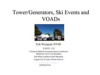
1. Tower/Generators, Ski Events and
VOADs
Erik Westgard, NY9D
2/10/22 1.31
Volunteer Medical Communications Coordinator,
Medtronic Twin Cites Marathon
Red White and Boom Half Marathon
Loppet City of Lakes Winter Festival
http://www.14567.org
ny9d@arrl.net
2. Amateur Radio Public Service in 2022
• Is standing around for government/cellular radio systems to fail
boring?
• Embedded in agencies- EMS, hospitals, counties, NGOs
• Pivot from written message traffic to databases and dashboards
• Capabilities + direct service
– Missing persons/ family reunification
– Aid stations /medical support/ medical command centers (medical
resource shortages)
– Weather spotting
– IP Video
– Duties as assigned (food distribution, IT support etc.)
– Disaster clean up (Crisis Cleanup, VOAD, etc.)
• Assets*- repeaters, networks, generators and tower trailers
• A Ham Radio license is a valid credential
• “Unwanted Volunteers” are prized, trusted and recruited
*(Go-kits are not welcome at large
sporting events )
3. Aid
Stations
Amateur
Radio
Assets
Net1
Data
+
22 Water
Stops/
100 Yellow
Shirts
5 + 4 voice
repeaters
911 service
300 Rented
UHF Radios
5G Mesh backbone
Net Controls- distributed
Mesh data entry/query
On-Course Med Director
RaceSafe
Finish Line EMS Dispatch
Database
Net 4 (course inter-tie)
Medical Ch.1 Control
Medical Director
Family Medical
Info Tent
Bus Drop-off
iPads
IP phones
Medtronic Twin Cities Marathon Medical Communications
Yellow shirts (hams) backstop 911 /EMS medical communications and dispatch volunteer resources and track injured runners
Injured /dropped out runner location data flows to the local server and status dashboard
Course tactical operations are autonomous (ICS)
“Runner Down” protocol is always 911
Finish Line
802.11a/n protocol
802.11a/OLSR Part 15 mesh link
Net2 Net3 Medical Tent Family Medical
Race
Operations
Center
Internet
RaceSafe
Finish Data (chip mats)
Net 1: (Miles 1-18) Minneapolis (Maple Grove/TCFMC)
Net 2: (Miles 18-22) Hennepin County ICC Truck (ARMER)
Net 3: (Miles 23-26) St. Paul Dispatch Center (911)
Net 4: Finish / Medical Command Center
Type 3 Incident
Unified Command
Ham in Medical Seat in ROC
4. RaceSafe Medical Dashboard Software
irunsafe.com
trivnetdb in
the TCM
data trailer
API
Amateur Family Medical
Information Tent agents (6-8)
Either a single
integrated
view or windows to both/all apps
TCM Race
Timing Web
MDs
Medical
admissions
Command centers
Query + updates
Events +
Timestamps
Part 97 Requirements:
Non HIPAA event view,
API feed to trivnetdb
EMR
PHR
data
Mobile
devices
5. Ham Radio Open SourceTracking Software: Trivnetdb
Missing /dropped out/ill runner
web runner lookup and update
Runner location only- non
HIPAA
Can be used for family
reunification, vaccine stations
Owner: KD8GBL
6. Other Amateur Duties/Roles 2022
• Medical Command Center, staffed 100% by radio amateurs. All non-911 volunteer resources are in our scope. We also
monitor 911 radio traffic using authorized volunteers to ensure our reports are accurate; e.g., the right bib number and
runner cross street location.
• Provision of a fully redundant "lights out" backup radio system. This is a specific, requested function.
• Assignments on Command trucks, which house some of our net controls who provide liaison to government radio systems
and are under our direction.
• At our events and others, 350 rented trunked radios are the backbone of event communications (a best practice). We
provide net controls for the medical channels - the Incident Commander checks in and is on our rented radio nets all race.
• Transport tracking and hospital capacity management -- using secure systems and authorized officials we ensure families
know where runners are transported. We do not share medical condition information.
• Family reunification -- if runners drop off the course or are injured, we reunite runners with their families.
• Wheel chair and medical electric cart dispatching.
• Aid station support on the course.
• Hams every mile for dropped out runner reporting and situational awareness.
• Shadows for key officials as requested.
• Medical tent runner check-in and check out.
• Support and provide student EMTs, Medical Reserve Corps and volunteer resources, such as mutual aid at the sprawling
finish line area.
• Support published disaster and evacuation plans.
• Support bike medics
• Track SAG (Supplies and Gear) bus location and passengers.
• Train users on medical applications.
• Provide input to the development of ICS 205/206 frequency lists and Incident Action Plan (IAP).
7. The Database and Dashboard Gap
Winston Churchill’s WWII
War Room.
Message traffic
Phones
Dashboard /Map
What Amateur Radio /ARES
software supports real time
data and or dashboarding?
https://medicalxpress.com/news/2020-10-covid-dashboard-highlights-gaps-pandemic.html
https://en.wikipedia.org/wiki/Churchill_War_Rooms
8. Ham and Provider Strike Teams
• At our events, we are operational assets not support (i.e.
not in Service Branch)
• The Service Branch under logistics is not “customer
facing” – the Medical Unit is internal
9. As a Strike Team what skills are needed?
• Yes
– First aid (as directed) i.e. EMT courses
– Traige (as directed)
– Ground truth (25 homes destroyed vs a ruined shed
from a fallen tree)
– WebEoc etc.
– Video
– In EMS lingo, volunteers only handle “Green” cases*
• No
– Land mobile programming
– Winlink
*One of our EMS partners brought this up with Astroworld- 2021
10. Why Mesh?
• Served agency leadership is increasingly using real time
dashboards, databases and video - “Better data better
decisions” is a common request/theme
• The Red Cross has moved to a cloud database called RC
Care
• Mesh, based on standard, low cost, outdoor rated WiFi
hardware, offers high data rates and allows peer-peer
connectivity
• Very short tactical range except dish to dish (line of sight)
• MN ARES has adopted AREDN software and Channels -2
and 180, 10m bandwidth:
https://www.arednmesh.org/content/current-software
11. Twin Cities Mesh Network 7/19
5Ghz Mesh High Speed Part 15* “TWINSLAN Medical Command Network”
In production since 2011 for live video, dashboard apps, voice and family reunification
Encryption is supported for medical records, law enforcement as needed
* Caused the “Revolt of the COMLs”
14. 2/20 City of Lakes Loppet Winter Festival
Urban ski race- five distributed aid stations
Super volunteer friendly
42 KM course
HQ located in a valley
Needed a tower trailer – none was available
15. 2/2020 Broken “Light Tower” Trailer found online* - $700
30’ tower (crank up)
Group 27 deep cycle
50w solar panel
TWINSLAN mesh
2.4 Wifi
GP95 2m/440/1.2
Spare antenna mounts
6KW diesel (soon)
Bent axle
Consultant: N0NAS
*A popular wholesale/surplus/auction market for light towers is on www.ironplanet.com
1.0 Vision
16. Decisions -$500 Broken or $1200 Running?
Injection pumps ($$)
Governor 1800 rpm (missing)
Glow plugs
6kw Generator –
Semi interchangeable
This diesel is a Lister-Petter LPW4 (also military)
Cylinder/piston wear?
Tires, bearings, lift cables and jacks
Diesel Creek- https://www.youtube.com/watch?v=2phV49_o6S4
17. Field Day, June 2020
6M beam, propane generator, dipoles, mesh Ta33jr, dipole support
G5RV
“A broken generator is good ballast”
19. Little White #11 ($425*) 12/2020 Auction Pickup
Lombardini FOCS 27 hp
30+ gallons diesel
6kw generator
30’ tower
….
Assessment:
Cement dust !
Needs tires
Replace pintle hitch
Trailer wiring
Rusted jacks
Low coolant
No key (!)
Missing exhaust pipe
Bad main windings (2) **
Stuck rotation screw
Missing light nuts
2/13/21: Running diesel, 45A@12V alternator, (HF rig + repeater), mesh antennas,
Group 24 marine battery, room for a repeater- pondering a main generator swap-
*Does $425 + tax require formal grant funding- no. Insurance is $32/year.
**Hint- check main windings for opens
20. Bumblebee #13 – Wisconsin scrap line -$140
Missing trailer coupler
No generator output
5’ wide vs 4.5’ or 4’
Electric hoist
Generator run capacitor replaced
$12 universal coupler part
6KW 120V/240V output
Light(s) still inop- not sure why
(300V vs 600V AC)
21. No-Touch Concierge Delivery, Ritchie
Brothers, Medford, MN 3/21 Trailer #12
30’ Tower, 6KW 30A 240VAC, Lombardini FOCS
diesel, 60 hours run time with onboard fuel @.45gph
22. Was Orange Now Black #1 (L) Jolly Green Generator #8 (R)
5G Part 15
Mesh
5G AREDN*
PTZ Camera
2x100K Lumens
3kw propane
Pipe mount
Repeater
2G AREDN*
6KW Diesel
https://hamradiosigns.co.uk/product/reflective-tower-yagi-logo-call-sign-sticker
7/20
* Solved the “Revolt of the COMLs”- power only air-gapped
23. Mesh Video Uplink - Basic
Video capture- tripod, battery, Ubiquiti radio,
$49 ONVIF IP camera, $99 ice fishing tent
Video edit/uplink – Open Broadcast Studio
Mesh* backbone, PTZ camera as required
*We did learn OLSR/mesh likes to reconverge randomly if it sees multiple paths
24. Live Mesh to YouTube Video at the Wirth Park Pre-
Loppet + Loppet Winter Festival 1/17, 30, 31/21
25. Field Day 6/2021
MN VOAD Simulation
Comms Trailer 2-3 Operators
Tower /Repeater trailer with TT-30
Outlet, dual fuel generator, Mesh/Wi-Fi
Diesel power backup- N+1 6KW
120 hours total fuel + third unit
240V to 120V load balancing
transformer
- 50A RVs with dual A/C
put 30A diesel gensets at risk
- Excellent reliability
- Focus on critical workloads
- 15KW or 20KW tower- nice to have
26. Dawg House + Vin (Diesel)
All weather
Sturdy, towable by Sno-Cat
No winterizing
Easy to store, tested
15KW @240+120+ 3 phase @208
Good for 50A RVs
$750
27. Video Uplink- Advanced
Medtronic Twin Cities Marathon 10/2021
Tower trailer PTZ IP video via mesh relay to
Command truck, up to YouTube.
Downlink in Race Ops Center, then to HSIN for first responders
28. MNVOAD- Downdraft- I
SET Exercise in Long Lake
Park, 10/2021. The Red Cross
and Salvation Army
participated. We sent a disaster
declaration message and
simulated sheltering and feeding
for 200 people and 30 animals
under lights out and
communications failure after a
weather event
29. 2021/2022 Events
• Pre-Loppet – Video https://www.arrl.org/ares-el?issue=2021-01-20
• Loppet Winter Festival – Mesh Video
https://minnesota.cbslocal.com/2021/01/30/city-of-lakes-loppet-winter-
festival/
• Junior Regional Championships- 3/5-7 Loppet- Video
https://www.loppet.org/events/juniorchampionships/
• Chisago Lakes Triathalon 8/18 - Repeater Trailer
https://www.hometownsource.com/the_post_review/sports/chisago-lakes-
triathlon-local-finishers/article_a79c712c-a30e-11e8-87df-3bf55750f390.html
• Downdraft I- MNVOAD Exercise - https://www.arrl.org/ares-el?issue=2021-
11-17
• Medtronic Twin Cities Marathon- Medical Command Center + Mesh Video
10/21 https://www.tcmevents.org/events/medtronic-twin-cities-marathon-
weekend-2021
• Klondike Dog Derby 2/5/22
• Loppet Winter Festival 2/5-6/22
30. Proposed Silly* Trailer Rules
• Trailers get cute tactical names/colors (ask your wife)- consult your kids on the paint job
• Trailers are tested with our Strategic Technology Reserve assets and local mesh standards. We hand
out radios and antennas for this. If everyone sets them up their own way they cannot work together or
add value.
• The ownership should be widely distributed to prevent any one person from taking them over.
• Ideally we have a three hour response time state wide. Seven here are on 20 minute warm standby.
Four hours to find which box in the basement has the antennas and which bin has the feedlines is not
good.
• Trailers should travel in convoy for the best visual effect. I can see these in parades, county fairs, etc.
• Citizen Science is the idea here- creative technology is encouraged- this is a
technology/service/hobby project. Remember "State of the Radio Art" from someplace?
• If more than one trailer is needed at once - ask- "Barn Raising" is the model
• These are intended to be cheap, abundant and deployable- more like cattle vs a prized race horse. If
you have $10,000 in it or it is powering your house it can't be out helping others.
• The idea is we are volunteer Ham Radio operators - think bass boat armada for water rescues.
• Hams in a given county should have at least as much rolling tower/generator capacity as the County
EM
Thanks to N0NAS and KD8GBL for advice and support
*Every effort is being made to not take this effort too seriously. A beverage cooler was a suggested add-on.
31. Our Future- From the CISA
Communications Section Task Force: Defining the Future State of the Communications Section (cisa.gov) Accessed 1/20/22
We do this today at our events and for MNVOAD
32. Some Strategy Advice
Volunteer Emergency Services Maturity Model (K8JK)
1. Integrated volunteer emergency management
(MNVOAD-ground truth and CAN-P reporting)
2. Family reunification /Medical management
3. Interoperable communications /backup EOC staffing
4. Amateur Radio traffic handling /shadows
5. Backup communications
Vision for ARES® 3.0
Mission: To provide state of the art volunteer emergency communications and IT Service Management to government agencies, events,
NGOs and the general public.
Divisions:
1. Government. Trained, vetted individuals to meet demanding government volunteer requirements
2. Events. The largest outdoor events depend on dedicated, trusted volunteers to enhance participant and spectator safety
3. VOAD and NGO support. Volunteers helping volunteers partnering to deliver critical support to those in need
4. Innovation Lab. Uniting builders and makers to develop technical solutions to meet current and emerging challenges