Wetlands in Bangladesh encompass a wide verity of dynamic ecosystems ranging from mangrove forest (about 577, 100 ha), natural lakes, man-made reservoir (Kaptai lake), freshwater marshes (about 400 haors), oxbow lakes (about 54488 ha, locally known as baors), freshwater depressions (about 1,000 beels), fish ponds and tanks (about 147, 000 ha), estuaries and seasonal inundated extensive floodplains (Akonda, 1989; cited in Akbar Ali Khan 1993 and DoF 1985).
Maritime states and UT's of the India and updated districts, major ports and important fishes landed along coastal states. Few crafts and gears used in fishery.
USE & MISUSE OFWATER RESOURCES& LAND RESOURCESSushanta Gupta
Land and Land Resources refer to a delineable area of the earth's terrestrial surface, encompassing all attributes of the biosphere immediately above or below this surface, including those of the near-surface, climate, the soil and terrain forms, the surface hydrology (including shallow lakes, rivers, marshes and swamps), the near-surface sedimentary layers and associated groundwater and geo-hydrological reserve, the plant and animal populations, the human settlement pattern and physical results of past and present human activity
he management of water resources has become a critical need in Bangladesh because of growing demand for water and increasing conflict over its alternative uses. As populations expand and make various uses of water, its growing scarcity becomes a serious issue in developing countries such as Bangladesh.
Biodiversity and conservation status of mangrove forest, Sundarbans
Wetland resources management in BangladeshTanvirHridoy1
Wetland resources management in Bangladesh
A patch of land that develops pools of water after a rainstorm would not necessarily be considered a "wetland", even though the land is wet. Wetlands have unique characteristics: they are generally distinguished from other water bodies or landforms based on their water level and on the types of plants that live within them. Specifically, wetlands are characterized as having a water table that stands at or near the land surface for a long enough period each year to support aquatic plants.
Wetlands are those areas that are inundated or saturated by surface or groundwater at a frequency and duration sufficient to support, and that under normal circumstances do support, a prevalence of vegetation typically adapted for life in saturated soil conditions. Wetlands generally include swamps, marshes, bogs, and similar areas.
Natural calamities and diseases of sundarbans mangrove forestihn FreeStyle Corp.
Bangladesh with an area of 147,570 square km is bordered by India to the northeast and west, Myanmar to the southeast, and the Bay of Bengal to the south. Bangladesh is one of the most densely populated countries in the world and its population is still growing by over 2 million people per year. The Sundarbans mangrove forest has a history of scientific management since 1879. The Sundarbans are the world's largest halophytic mangrove forests and one of the most biologically productive of all natural ecosystems. The forest is an essential buffer for inland areas against the ravages of frequent cyclones from the Bay of Bengal. For outstanding natural value, the World Heritage committee of UNESCO inscribed the Sundarban of Bangladesh in the 798th World Heritage list in 1997 and accordingly the Government of the People’s Republic of Bangladesh declared the Sundarban as World Heritage Site in 1999. The Sundarbans is the largest remaining habitat in the world for the Royal-Bengal Tiger. According to Ramsar convention, the wetland of Sundarban area in very complex and it is recognized as one of the most organic productive area in the world. The livelihood survival of the Sundarban community is linked with the forest resources of the Sundarbans, aquatic resources of the saline and fresh water wetlands.
Fisheries and aquaculture sectors in Bangladesh: an overview of the present s...Premier Publishers
Fisheries sector in Bangladesh represents as one of the most productive and dynamic sectors in the country. This sector plays a significant role in food security, employment, and foreign exchange earnings in the economy. At present agricultural transformation is taking place in Bangladesh. With the changes of farming system, farmers have started to shift their crop land to aquaculture as they considered it more profitable compared to rice production. The production of inland fisheries represents an increasing trend since 1989-90 with a growth rate of around 5-7%. Similarly, marine fisheries have also shown an increasing trend while a fluctuated growth rate has emerged in this sub sector. The fisheries sector in the 21st century is facing the challenges of food security for the increasing population, habitat degradation, urbanization, and industrial development. Development of responsible fisheries management and optimal use of water bodies can address those challenges. Since fishery is a productive growth sector in Bangladesh, it has high potential to contribute in the socioeconomic development of the country.
Mangrove forest and Sustainability of Sundarban deltaAbhilashaGanguly2
Sundarban is a mangrove area and formed by the confluence of the Ganges, Brahmaputra and Meghna Rivers in Bay of Bengal. The Sundarbans mangrove forest is one of the largest such forests in the world, occupying about 40,000km area in India. India. While this mangrove forest supports biodiversity, ecosystems services and sustainable development, the Sundarban delta is an ecologically fragile and climatically vulnerable regions. The most abundant tree species of this forest are Sundri, Gewa, Byne, Garjan, Goran. The soil stratum of the delta is in dynamic construction by the characteristic root systems of mangroves. The main cable root system of the mangrove trees, comprising of aerial pneumatophores and underground anchoring roots ,slow down the movement of tidal waters that results in the sediments to settle and build up the muddy bottom. Mangroves are known as natural carbon sinks as it takes carbon dioxide out of the atmosphere and store as blue carbon. Thus, it contributes heavily to reduce the warming of the earth and other ill effects of climate change. Sunderbans forest is one of the richest biodiversity hotspots in India containing about 453 faunal wildlife, including 290 bird, 120 fish, 42 mammal, 35 reptile,8 amphibian species and home for many rare and globally threatened wildlife species like the Royal Bengal tiger, Gangetic dolphin, Olive ridley turtle etc. The lives and livelihood of over 4.5 million people at Sundarban delta depend on the mangrove forest ranging from collection of honey, timber, leaves and herbs as food, fuel, hut/boat and ayurvedic medicines. Mangrove forest provide coastal protection through surge and wind suppression during tropical cyclones and often recover with time and continue to provide numerous societal benefits in the wake of storm events. The mangrove forest is very sensitive to pollution and declining at the rate of 1 percent per year due to climate change . Therefore, the sustainability of Sundarban delta requires a long-term vision that integrate climate adaptation and strategies for conservation of mangrove forest and its biodiversity.
Diversity and Ecological Status of Serpent Fauna of degraded forest habitats ...inventionjournals
International Journal of Engineering and Science Invention (IJESI) is an international journal intended for professionals and researchers in all fields of computer science and electronics. IJESI publishes research articles and reviews within the whole field Engineering Science and Technology, new teaching methods, assessment, validation and the impact of new technologies and it will continue to provide information on the latest trends and developments in this ever-expanding subject. The publications of papers are selected through double peer reviewed to ensure originality, relevance, and readability. The articles published in our journal can be accessed online.
Sundarbans-an introduction by Dibash debDibash Deb
The Sundarbans mangrove forest, one of the largest such forests in the world (140,000 ha), lies on the delta of the Ganges, Brahmaputra and Meghna rivers on the Bay of Bengal. The area is known for its wide range of fauna, including 260 bird species, the Bengal tiger and other threatened species such as the estuarine crocodile and the Indian python.
This powerpoint presentation is created by Gyanbikash.com for the students of class nine to ten from their English first part NCTB textbook for multimedia class.
Contents:
Importance of wetlands of Pakistan in the national and international context.
Types of wetlands in Pakistan with respect to area.
Most significant wetlands of Pakistan,
Four major wetland complexes /demonstration sites of Pakistan categorized under WWF-Pakistan Wetland Program (PWP).
Nineteen Internationally recognized Ramsar sites of Pakistan
Present status of biodiversity and forest coverage of Madhupur and Nijhum DwipMd. Ashikur Rahman Khan
This slide describes the ecological concerns of Madhupur and Nijhum Dwip Reserved Forest. It also includes the issues of biodiversity and forest coverage of those areas as well.
A field study was carried out to decipher the root cause of conflict between Indian Sloth Bear (Melursus ursinus) and men at Kadekolla cluster villages in Ballari district of Karnataka state. It was observed that there were no reports of man-bear conflict in this region till 1990 AD, however drastically increased in the last 15 years. Data was collected through interviews with the 46 of 47 victims living in six villages who survived serious injuries during 2000 to 2015. It was found that the local farmers of surrounding villages on the other side of bear habitat adopted modern horticultural practices to grow orchard plants. Attracted by the new delicious crop the bears began passing through the study area to reach the orchards about 4-7 KMs away from their dens. While returning from orchards in the morning hours, bears encounter people going to their farmlands, thus conflict occurs. 66 % of the bear attacks occurred in farmlands. 58 % of the victims of attack were in the age group of 31-50 years. Most of the attacks happened between 6 A.M and 4 P.M. 47 % of attacks were made by solitary bears and 40% of attacks by mother bear and cubs. 41 % of the victims received serious head injuries. 2 % of the victims succumb to the fatal injuries. 82% of the attacks occurred within 1 kilometer distance from the villages. 51 % of the victims felt that the change of crop pattern was the root cause of man-animal conflict in this area. It is also realized that the excessive human activities, deforestation and non-availability of water were the causes for the conflict. It is recommended to consolidate fragmented bear habitat, in order to support natural regeneration of flora in the forest, taking up soil and moisture conservation (S.M.C) activities in the bear habitat in order to reduce and avoid the above said conflict.
In this presentation, I discuss Location, Tourist spot, Eco-system, Trees, Seasons, Contribution in economy, Diversity of the bird's species, and Overall brief idea about Sundarban.
Pritam Bhattacharjee, Dr. Pralay Ganguly
Sundarban is world famous for its mangrove vegetation and is approximately of 10,000 sq km in area in the northern Bay of Bengal, which is also designated as world heritage site by UNESCO in the year 1987. It is the home of several animals and plant species, specially the mangrove trees (Sundari) and Royal Bengal tiger of this forest is world famous. Mangroves functions as a buffer against frequently occurring cyclones and helps to protect South Bengal specially Kolkata and southern part of Bangladesh. But now a day due to the climate change and repetitive cyclone occurring every year, Sundarban faces lots of challenges, with rising sea level- island are disappearing, salinity of water increasing day by day in addition of that there have been a major disturbances to hydrological parameters, changing fishing patterns are resulting disastrous consequences for the fisher man. Frequent cyclones and erratic monsoon damaging ecology, humidity, livelihood as well as ecotourism. The objective of this research is to focus the area of Sundarban and its potentials, challenges and probable solution to overcome the situation as well as the impact of mangrove degradation on local people and tourism. Here we use some data and statistics to understand the situation better. In this process researcher collected data from 130 respondents in the study area and further analysis has been taken through percentage method, statistical tools like t test with the help of software like SPSS, MS excel etc to conclude. Study findings suggest that significance difference exists on profile base of residents due to environmental degradation and minimize the negative impacts on same could bring a prosperous livelihood for residents
Willie Nelson Net Worth: A Journey Through Music, Movies, and Business Venturesgreendigital
Willie Nelson is a name that resonates within the world of music and entertainment. Known for his unique voice, and masterful guitar skills. and an extraordinary career spanning several decades. Nelson has become a legend in the country music scene. But, his influence extends far beyond the realm of music. with ventures in acting, writing, activism, and business. This comprehensive article delves into Willie Nelson net worth. exploring the various facets of his career that have contributed to his large fortune.
Follow us on: Pinterest
Introduction
Willie Nelson net worth is a testament to his enduring influence and success in many fields. Born on April 29, 1933, in Abbott, Texas. Nelson's journey from a humble beginning to becoming one of the most iconic figures in American music is nothing short of inspirational. His net worth, which estimated to be around $25 million as of 2024. reflects a career that is as diverse as it is prolific.
Early Life and Musical Beginnings
Humble Origins
Willie Hugh Nelson was born during the Great Depression. a time of significant economic hardship in the United States. Raised by his grandparents. Nelson found solace and inspiration in music from an early age. His grandmother taught him to play the guitar. setting the stage for what would become an illustrious career.
First Steps in Music
Nelson's initial foray into the music industry was fraught with challenges. He moved to Nashville, Tennessee, to pursue his dreams, but success did not come . Working as a songwriter, Nelson penned hits for other artists. which helped him gain a foothold in the competitive music scene. His songwriting skills contributed to his early earnings. laying the foundation for his net worth.
Rise to Stardom
Breakthrough Albums
The 1970s marked a turning point in Willie Nelson's career. His albums "Shotgun Willie" (1973), "Red Headed Stranger" (1975). and "Stardust" (1978) received critical acclaim and commercial success. These albums not only solidified his position in the country music genre. but also introduced his music to a broader audience. The success of these albums played a crucial role in boosting Willie Nelson net worth.
Iconic Songs
Willie Nelson net worth is also attributed to his extensive catalog of hit songs. Tracks like "Blue Eyes Crying in the Rain," "On the Road Again," and "Always on My Mind" have become timeless classics. These songs have not only earned Nelson large royalties but have also ensured his continued relevance in the music industry.
Acting and Film Career
Hollywood Ventures
In addition to his music career, Willie Nelson has also made a mark in Hollywood. His distinctive personality and on-screen presence have landed him roles in several films and television shows. Notable appearances include roles in "The Electric Horseman" (1979), "Honeysuckle Rose" (1980), and "Barbarosa" (1982). These acting gigs have added a significant amount to Willie Nelson net worth.
Television Appearances
Nelson's char
Artificial Reefs by Kuddle Life Foundation - May 2024punit537210
Situated in Pondicherry, India, Kuddle Life Foundation is a charitable, non-profit and non-governmental organization (NGO) dedicated to improving the living standards of coastal communities and simultaneously placing a strong emphasis on the protection of marine ecosystems.
One of the key areas we work in is Artificial Reefs. This presentation captures our journey so far and our learnings. We hope you get as excited about marine conservation and artificial reefs as we are.
Please visit our website: https://kuddlelife.org
Our Instagram channel:
@kuddlelifefoundation
Our Linkedin Page:
https://www.linkedin.com/company/kuddlelifefoundation/
and write to us if you have any questions:
info@kuddlelife.org
Natural farming @ Dr. Siddhartha S. Jena.pptxsidjena70
A brief about organic farming/ Natural farming/ Zero budget natural farming/ Subash Palekar Natural farming which keeps us and environment safe and healthy. Next gen Agricultural practices of chemical free farming.
UNDERSTANDING WHAT GREEN WASHING IS!.pdfJulietMogola
Many companies today use green washing to lure the public into thinking they are conserving the environment but in real sense they are doing more harm. There have been such several cases from very big companies here in Kenya and also globally. This ranges from various sectors from manufacturing and goes to consumer products. Educating people on greenwashing will enable people to make better choices based on their analysis and not on what they see on marketing sites.
WRI’s brand new “Food Service Playbook for Promoting Sustainable Food Choices” gives food service operators the very latest strategies for creating dining environments that empower consumers to choose sustainable, plant-rich dishes. This research builds off our first guide for food service, now with industry experience and insights from nearly 350 academic trials.
DRAFT NRW Recreation Strategy - People and Nature thriving together
Tour report 8th emon
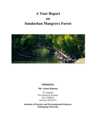
1. A Tour Report
on
Sundarban Mangrove Forest
Submitted by:
Md. Anisur Rahman
8th
semester
B.sc (hons) in Forestry
Id: 11208013
Session: 2010-2011
Institute of Forestry and Environmental Sciencess,
Chittagong University
2. Introduction:
As a student of B.Sc (hons) in Forestry, we have to attend several field trips in each semester. In 8th
semester, recently we visited the largest mangrove forest of the world. A field trip always triggers our
boundary of theoretical knowledge with practical situations. We learned about the unique features of
Sundarban Mangrove Forest.
A detailed map of Sundarban mangrove forest:
:
3. Date 8th
January, 2017
Place Sundarbans Mangrove Forest, Khulna
Organizer
1. Dr. Mohammad Shafiul Alam
Professor
2. Dr. Mohammed Kamal Hossain
Professor
3. Mohammad Main Uddin
Associate Professor
4. Dr. Md. Aktar Hossain
Professor
Participants
Students,
6th
and 8th
Semester,
Institute of Forestry and Environmental Sciences,
Chittagong University
Resource person
1. Mahmudul Hasan Polash
Forester
2. F. M. Hemayet Uddin
Acting Officer
3. Sheikh Kaiyum
Forest Guard
4. Md. Hamidul Hoque
Accounts Officer
5. Mr. Khalil
Tour Guide
Visited places
1. Supoti Forest Station
2. Kochikhali Wildlife Sanctuary
3. Jamtola
4. Kotka Wildlife Sanctuary
5. Heron point
6. Alorkul
7. Harbaria Ecotourism Centre
8. Koromjol
Tour Duration 8 January, 2017 to 13 January, 2017
(5 days)
4. Sundarban: An overview
The Sundarban is a unique and largest contiguous natural mangrove forest in the
world. The Sundarban lies between latitudes 21'39 and 22'30N and longitudes 89'01 and 89'52
in the southern most parts. It is situated in the southern part of Satkhira, Khulna and
Bagerhat districts, the south-western region of Bangladesh. It has an area about
10000 km2
, of which Bangladesh possessed 6017 km2
and the rest belongs to
neighboring country India. Sundarbans is 4.2% of the country’s land area and 44% of
the state forest land. It forms southern most of the Ganges and Brahamaputra river
deltas and is shaped by the complex drainage structure. Topographic variation within
this delta is very low. The forest floor lies between 0.9 m to 2.1 m above sea level.
The drainage system of Sundarban has three sub systems to the east, centre and west,
which formed the estuaries of Bangra, Kunga and Raimangal. The whole area is
dissected by large tidal river, notably the Baleswar, Passur, Kobadak-Sibsha,
Arpangasia and Raimangal with innumerable small channels and creeks.
Approximately 450 rivers are flown through this mangrove forest and the length of
these rivers are 12,500 km. The proportion of salinity and the distribution of tree
species composition define the zonation of Sundarban. These are the freshwater zone,
moderately saltwater zone and saltwater zone. Sundri (Heritiera fomes) is the
characteristic species of the freshwater zone. The forest of the moderately saltwater
zone is mixture of gewa (Excoecaria agallocha) and sundri with varying amounts of
goran (Ceriops decandra) and other species. The forest in the saltwater zone is
dominated by goran with anover storey of gewa, passur (Xylocarpus mekongensis)
and dhandal (Xylocarpus granatum).
Management overview of Sundarban Mangrove Forest:
Sundarban Mangrove Forest is solely managed under the direct supervision of
Bangladesh Forest Division. Administratively it is divided into two divisions and four
ranges.
Divisions are:
1. Sundarban East Division
2. Sundarban West Division
5. Ranges are:
1. Soronkhola Range
2. Chandpai Range
3. Burigualini Range
4. Khulna Range
This forest have 3 wildlife sanctuaries. These are-
1. Sundarban East Wildlife Sanctuary
2. Sundarban West Wildlife Sanctuary
3. Sundarban South Wildlife Sanctuary
Apart from these, Sundarbans have two exclusive dolphin sanctuary.
Working circles of Sundarban:
1. Sundari working circle
2. Gewa working circle
3. Keora working circle
4. Goolpata working circle
5. Firewood working circle
6. Wildlife and ecotourism working circle
7. Fisheries resources working circle
8. Mixed working circle
6. Biodiversity of Sundarbans:
Name Species number
Plants 334
Mammal 49
Reptile 87
Fish 300
Bird 355
Amphibian 14
Name Approximate number
Tiger 106
Deer 1-1.5 millions
Monkey 40-50 thousands
Wild boar 20-25 thousands
Crocodile 150-200
Dolphin 20-265 thousands
Key information recorded from the tour diary:
2nd
Day Of Sundarban:
Dhangmari Gate—Entry of Sundarban
Mangrove silviculture –BFRI (Mangrove Division)
Rivers—450
Length of all rivers—12500km
Rupsha (Khulna)
Poshur (Mongla)
World Mangrove position—6th
Total area—10000 sq km
Bangladesh—6017 sqkm (62%)
India—3083 sqkm (38%)
Age—Sundarban mangrove (7000 years), Chakaria sundarban (10,000 years, 8510 ha
area, declared 1903)
7. Mangrove species characteristics:
1. Pneumetaphore
2. Root penetration
3. Salt gland
4. Muddy sediment
5. Viviparous germination
6. Leaf succulent
7. Selective ion transport
Mangrove species :
Scientific Name Family Local name Type of plant
Avicennia officinalis Avicenniaceae Baen Tree
Bruguiera gymnorrhiza Rhizophoraceae Kankra Tree
Cynometra ramiflora Leguminosae Shingra Shrub
Excoecaria agallocha Euphorbiaceae Gewa Tree
Heritiera fomes Sterculiaceae Sundri Tree
Nypa fruticans Palmae Golpatta Palm with underground stem
Phoenix paludosa Palmae Hantal Thorny palm
Red mangrove: Rhizophorus
Black mangrove: Sundari, Baen
White mangrove: Gewa
World 31% Forest (4 billion hector)
World 114 mangrove species ( 66 genus, 43 families)
Bangladesh – (68-69) mangrove species
Royal Bengal Tiger—
2004—UNDP—440 tigers
2006—200 tigers (not published camera trial)
2010—(400-450) tigers (FD and wildlife trust of BD)
2015—106 tigers (peg mark camera trial)
Others animals—
Mammals—49 species
Reptile – 87 species
Fish – 300 sp
Bird – 350 sp
Amphibian—14 sp
Total—505 species overall
8. People dependent: 30-35 lakh
Annual value of sundarban: 7115.20 M/USD or 56921 crore taka (1 year)
Ecological critical area: around 10 km of sundarban
13 no ECA – Sylhet (Jaflong)—Dahuk river
14 no ECA—Halda river
Per hector Sundari tree:
1959 year—296 ha trees—Sundari 211 pieces per ha
1983 year—180 ha trees—Sundari 125 pieces per ha
1996 year—144 ha trees—Sundari 106 pieces per ha
2020 year—109 ha trees—Sundari 80 pieces per ha
Area of Sundarban by FAO in Bangladesh:
1777—11,256 sq km
1841—9279 sq km
2015—5467 sq km (FAO)
Succession- 2 types
In the south-west (SW) region, along the upper catchment area of the rivers in the
Sundarban, more than 41 polders have been constructed, mainly to control salinity and
high tide intrusion into the agricultural fields
NCC: Non cover crop area
Salinity types:
Strong saline –more than 4 ppt
Moderate saline—2-4 ppt
Fresh saline—less than 2 ppt
1991 Cyclone—4 billion taka loss
15 November, 2007 (Sidr)—
Affected families 2,064,026
Affected persons 8,923,259
Dead people 3,363
Injured people 55,282
Missing people 871
Damaged houses 1,518,942
Damage to crops in hectare 1,512,878
Damage to trees 4,065,316
Total livestock dead 2,634,069
9. Damage to educational Institutions (full & partial) 16,954
Damage to road (complete & partial) in km 8,075
Damaged embankment (km) 1,875
Damage to bridges and culverts 1,687
Elevation area are depending on sea level rise:
Elevation area Sea level rise
.2% Less than 50cm
2.83% .5m-1m
10.49% 1m-1.5m
20.53% 1.5m-2.5m
28.79% 2m-2.5m
22.88% 2.5m-3m
10.44% 3m-3.5m
2.94% 3.5m-4m
.8% More than 4m
3rd
Day of Sundarban(Kachikhali,Kotka jamtola beach,Kotka wildlife sanctuary):
Gewa- slow growing species, Eat- wild bore
Two island: Pokkhir chor, Dimer chor
Forest department tried to establish agricultural crops but failed for inundation.
Some pictures of Kachikhali wildlife sanctuary:
10. Kotka jamtola Beach area:
Dominant species: Goran
Other species: Nunia, Jhau, Keora, Gewa, Tiger farns, Hetal, Sundari
3 portions
40-50% velocity loss—around 50 km belt
Sundarban N-S approx. 80 km
Plot Sample Data:
For regeneration: 5m*5m
Regeneration: 15
Pneumatophore: Sundari (550), Gewa (50)
Plot size: 20m*20m
Total number of species :96
Gewa: 52
Keora: 1
Sundari: 43
Inundation: 96cm
55 compartment (Bangladesh), 20 compartment (India)
3 wildlife sanctuary:
Sundarban East (Kotka, Kachikhali, Sumoti) , 31227 ha
11. Sundarban west (Nilkamal,Duberki), 36971 ha
Sundarban west (Lotabeki, Mundorbari, Pushpokhali), 71502 ha
Animals: Tiger, deer, bore, monkey
CWD: Coarse woody debris
FWD: Fine woody debris
Alur pol: famous for dry fish
Bay of Bengal: 1 lakh 18,000 km square, Bangladesh rights 664km
Fish caught in bay of Bengal: Bangladesh, Thailand, Srilanka, India
Total fish: 80 lakh tons, Bangladesh caught 1 lakh ton only
Blue economy: based on sea resources
Proposed park: N-E of coxsbazar
Dolphin sanctuary: 2
Collection of Hetal per year: 1000 m. ton
Collection of Grass per year: 4700 mton
Collection of Honey per year: 130 ton
Shoronkhola range:Therabaka, Panir Ghat, Bhola, Tasher vabani,
Morabhola, Charua, Chorkhali, Supathi, Shapla, Dudhmukhi, Kochikhali
etc.
Chadpai range:Chadpai Station, Choraputia, Amurpunia, Gulishkhali,
Koromjal,Moraposhur, Harbaria, Bighamari etc
Dubra jela Palli: Choto ambaria, Boro ambaria, Malikkhali, Narikelbaria,
Meherali, Majherkilla, Kokilmuni, Ziarchor etc
BLC: Boat licenses certificate
10000 tk per seasons (3-4 months)
200 tk per day/launch
20 tk per student
50tk (Bangladesh), 350 tk (Foreigner) –with camera
10tk (Bangladesh, --with no camera
400 per day guard (2 persons)
Bangladesh researchers (30tk)
Foreign researchers (100tk)
Child (10tk)
Problems: Manpower, Budget, Communication, Safety, image crisis etc
Economic valuation:
1. Provisioning (Honey ,food)
2. Regulatory ( cyclone, water cycle)
12. 3. Supporting ( wildlife, breeding site)
4. Cultural ( rashmela)
4th
Day of Sundarban (Hiron point, Dublar char):
Heron point (80 km area)
Ecotourism and tourist
Animals: tiger, deer, monkey, monitor, crocodile, birds
Plants: sundari, gewa, posur, Baen, kakra, keora, shingra, goran, golpata
Visitor: (October to February)
Drinking water—filtration—rain water harvest
Solid waste: incineration
Honey: Khalshi(white), Goran(Deep)
No pharmacy at Alorkul
No help – Rab, police, coastguard
Rashmela—karthik season
Vegetation type in Sundarban: (17)
I. Sundari—gewa
II. Sundari—passur
III. Sundari—passur—kakra
IV. Only gewa
V. Gewa—goran
VI. Gewa—sundari
VII. Only goran
VIII. Garan—gewa
IX. Passur—keora
X. Possur—kakra—baen
XI. Only baen
XII. Kewra
Ramsar Site: 560, land area: 411230 ha, water area: 189156 ha
Language: kolla, kalabon, Ghugu( small boat), Boro mistry (Tiger), Machi (robbers),
Barani (crossing between canal and river)
13 char land at Dublarchar
2 Dolphin sanctuary
13. 5th
Day of Sundarban ( Harbaria ecotourism center, Karamjal ecotourism center)
Foot trail : 2km
Tiger : 3
Plant: Sundari, keora, baen, Possur, Kakra
Animals: Deer, wild cock, monkey, tiger
Sundari—Top dying
Deer, Monkey, Crocodile breeding (Karamjal)
Romio-juliet (karamjal )
Water collection—pond
Limitation:
Lack of man power
Budget scarcity
Communication problem
Sedimentation
Lack of logistic support
Planning
Lack of co-ordination of different department
Image crisis
Conclusion:
Study tour or field trip or practical classes always make a clear sense about theoretical
knowledge. Sundarban covers almost half of Bangladesh’s total forest area. So, if we didn’t
have the opportunity of this tour we would be in dark about the magnificent features of
mangrove forests. As a student of forestry, I am really grateful to my honorable teachers and also
to my beloved institute for letting us enjoy and learn about one of the most unique ecosystems of
the earth. Having visited Sundarban, now our forestry knowledge level has been upgraded to a
new height. Importance of Sundarban Mangrove Forest is something that can’t be understands
without understanding the complex ecosystem of Sundarbans. Our most awaited tour gave us
that opportunity. Now we are done with visiting major forest types of Bangladsh. As, it was our
last academic tour, I think it’s time to implement the gathered knowledge in developing our
country’s forestry sector.