The FiRe CTO Design Challenge: Wildfire Technology
•Download as PPT, PDF•
1 like•670 views

08.05.23 CTO Challenge Team presentation FiRe Conference Title: The FiRe CTO Design Challenge: Wildfire Technology San Diego, CA
![Problem Statement ,[object Object],[object Object],[object Object],[object Object],[object Object],[object Object],[object Object],[object Object],[object Object],[object Object],[object Object],[object Object],[object Object],[object Object],[object Object],Situational Awareness Early Detection Rapid Response](data:image/gif;base64,R0lGODlhAQABAIAAAAAAAP///yH5BAEAAAAALAAAAAABAAEAAAIBRAA7)
Recommended
Recommended
More Related Content
What's hot
What's hot (20)
Similar to The FiRe CTO Design Challenge: Wildfire Technology
Similar to The FiRe CTO Design Challenge: Wildfire Technology (20)
More from Larry Smarr
More from Larry Smarr (20)
Recently uploaded
Recently uploaded (20)
The FiRe CTO Design Challenge: Wildfire Technology
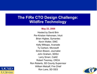
- 1. The FiRe CTO Design Challenge: Wildfire Technology May 23, 2008 Hosted by David Brin Per-Kristian Halvorsen, Intuit Brian Higbee, Symantec Kevin Walter, EMC Kelly Millsaps, Avanade Ty Carlson, Microsoft Simon Bisson, Journalist John Graham, SDSU Larry Smarr, Calit2 Robert Twomey, CRCA Ron Roberts, SD County Supervisor William Metcalf, Fire Chief Ron Lane, SD OES
- 3. Recommendation Overview System Architecture
- 6. MODIS Images Provide Targeting Information to NASA's EO-1 Satellite Which Cuts Through Smoke EO-1’s Hyperion Spectrometer Observes 220 Contiguous Wavelengths From Visible Light To Shortwave Infrared October 23, 2007 Witch Wildfire south of Escondido, California Composite of the Red, Blue, and Green Channels Three of the Shortwave Infrared Channels NASA/EO-1 Team www.nasa.gov/vision/earth/lookingatearth/socal_wildfires_oct07.html
- 9. NASA’s Aqua Satellite’s MODIS Instrument Provided “Situational Awareness” of the 14 SoCal Fires NASA/MODIS Rapid Response www.nasa.gov/vision/earth/lookingatearth/socal_wildfires_oct07.html October 22, 2007 Moderate Resolution Imaging Spectroradiometer (MODIS) Calit2, SDSU, and NASA Goddard Used NASA Prioritization and OptIPuter Links to Cut time to Receive Images from 24 to 3 Hours
- 10. SDSU’s San Diego GIS Force Group of Volunteers Geo-Referenced MODIS Data and Distributed Over Web http://map.sdsu.edu/ “ We apologize for the slow server performance in the first two days of the wildfires (Oct. 21 & 22) due to overloaded requests from Web users. Tuesday we were given access to major Intel computers at Calit2 at UCSD and special connectivity between SDSU and UCSD (OptIPuter) from which this page is now being served (special thanks to John Graham, Eric Frost, Larry Smarr, John DeNune, and Cristiano). It is super fast now.” -- SDSU Department of Geography, Oct. 25, 11:00am. Site organized by Dr. Ming-Hsiang Tsou, SDSU October 23, 2007
- 12. Calit2 Added Live Feeds From HPWREN Cameras to KPBS Google Map www.calit2.net/newsroom/release.php?id=1194
- 14. Upgraded Command Center Integrating Early Detection, Rapid Response, Situational Awareness Pilot Flies Predator B from NASA Dryden in Edwards AF Base NASA Ikhana Carrying Autonomous Modular Scanner on 8 Hour Flight, Coordinated with the FAA, Downlinks to NASA Ames NASA Ames Overlaid Thermal-Infrared Images on Google Earth Maps, Transmitted in Near-Real Time to the Interagency Fire Center in Boise, Idaho Flight Plan and Ikhana Data Displayed in San Diego Emergency Operations Center's Situation Room www.nasa.gov/centers/dryden/news/Features/2007/wildfire_socal_10_07.html