This document summarizes a lecture given at Tianjin University on the Chinese way of building cities. It discusses research done at McGill University comparing urban structure in Beijing and Montreal at the scale of one square kilometer. The research looks at density, land use, street networks, and block sizes. In Beijing, land is divided into large mixed-use residential compounds, while Montreal has lower densities and more separation of uses. The lecture explores how these differences shape urban form and community life.
The document provides background information on Beijing, China. It discusses Beijing's history and evolution as a capital city meant to link heaven and earth. It describes some planning issues facing the city, including size, density, block size, orientation, balancing old and new developments, and sustainability. It also presents examples of past and current urban planning and architectural projects in and around Beijing.
URBAN BASICS
Urbanization and development: Historical Perspective
An Academic Presentation to BdevS, Center for Development Studies
Kathmamndu University
2014
Rajendra P Sharma
rpsharma@mailcity.com
Neighborhood planning in capital city of chandigarh an appraisal JIT KUMAR GUPTA
1. The document discusses the neighborhood planning concepts used in the development of Chandigarh, India. It describes the initial plans created by Albert Mayer and Matthew Nowicki, which divided the city into large superblocks.
2. The plan was later revised by Le Corbusier, who changed the basic unit to sectors and organized the city into residential, commercial, industrial and educational areas connected by a road network.
3. The document analyzes the principles of neighborhood planning that influenced Le Corbusier's sector-based design for Chandigarh, including defining boundaries, excluding vehicular traffic, and allocating open spaces.
The document discusses Amaravathi, the proposed capital city of Andhra Pradesh, as a potential smart city. It outlines some key components that make Amaravathi suitable for a smart city, such as connectivity, available resources, and industrial corridors. Some proposed smart city features for Amaravathi include smart ticketing for public transportation, electronic display boards, smart buildings, underground drainage, and flood prevention infrastructure like canals. Potential downsides mentioned include Amaravathi being located in an earthquake and flood-prone region and the risk of congestion. The document concludes by inviting any questions about developing Amaravathi as a smart capital city.
The document discusses the relationship between urban planning and public health. It begins by providing a brief history of how the two fields developed separately in response to 19th century crises but are now interconnected. Rapid urbanization is putting pressure on infrastructure and leading to increased poverty and health issues. The document calls for urban planners and public health experts to work together by applying health trends knowledge to policy and design decisions to promote healthier living environments and lifestyles.
The document discusses different types of towns classified by their main functions, including industrial towns (focused on mining, textiles, or steel), holiday towns (focused on tourism), port towns (focused on port services), and satellite towns (planned, self-sustaining communities outside major cities). It also discusses green belts used to restrict urban sprawl and preserve land, as well as factors influencing population growth and distribution within cities.
This document discusses the vision and benefits of integrated townships. Integrated townships are self-sustaining developments located on the outskirts of cities that include residential, commercial, retail, educational, and sometimes industrial areas. They aim to reduce pressure on city infrastructure by providing modern amenities and a balance of residential and commercial spaces, along with recreational areas and open spaces. Integrated townships offer walkability, mixed uses, housing options, and sustainability to support wholesome living without pollution. They have amenities like schools, hospitals, parks and retail to provide a high quality of life under one roof. The document argues integrated townships will be in demand in the future as cities expand boundaries and need horizontal growth solutions.
Crime in urban areas and thier spatial planning implicationsAjayPatel389
Crime ratio is higher in urban area compare to rural area. And crime is higher in urban due to increased population, unchecked migration, gives rise to unorganized settlements. And also lack of opportunities, uneven distribution of incomes etc.. And types of crime, what are the effects on urban due to crime, and how to reduce crime that are described here.
Rural-urban Partnerships and Quality of Life. OECD OECD Governance
Urban and rural areas are deeply interconnected and, if well-managed, these connections can benefit both places. For more information see http://www.oecd.org/gov/rural-urban-linkages.htm
This document provides an overview of the evolution of town planning in India from ancient to modern times. It describes the key features of towns during different historical periods, including the Indus Valley civilization, Vedic period, Buddhist period, medieval period under the Mughals, pre-independence period under British rule, and post-independence period. Important towns that emerged during each period are highlighted, along with the influences of rulers and planning approaches during that time.
1.6 Town planning India pre & post independenceSachin PatiL
Necessity scope principles of Town Planning,
Present status of town planning in India,
Contribution of town planners in modern era,
Sir Patrick Geddes,
Sir Ebenezer Howard,
Clarence stein,
Sir Patrick Abercrombie,
Le Corbusier,
Early Chinese civilizations developed along rivers like the Wei River Valley and Yellow River, which provided fertile soil, stable food supply, and water. Cities in China served as centers for agriculture, housing, trade, manufacturing, politics, culture, and administration. Chinese cities were carefully designed based on principles of feng shui, ying guo, and feng li to integrate architecture with nature, morality, and social harmony.
This document provides an overview of urban economics. It defines urban economics as the study of the geographical arrangement of households and firms in urban areas and the locational choices they make. It examines where economic activity occurs as households choose where to live and work, and firms choose where to locate factories, offices, or stores. The document outlines the objectives of studying urban economics and the scope of topics covered, including location choices, urbanization, sprawl, poverty, unemployment, crime, traffic, pollution, housing, land, education, and public finance issues in urban areas.
Urban design can significantly impact the economic, environmental, social, and cultural outcomes of a place. It influences factors like local business success, housing costs, transportation access, and how people interact. Key elements of urban design include buildings, public spaces, streets, transportation systems, and landscape features. Buildings define the streetscape while public spaces are where people come together. Streets connect places and their design impacts walkability. Transportation networks enable movement throughout the city. Landscape provides green spaces that enhance character and beauty.
Jane Jacobs was an influential writer and activist in urban planning in the mid-20th century. She opposed the widespread replacement of urban communities with high-rise buildings and advocated for mixed-use neighborhoods with a focus on walkability. Along with Lewis Mumford, she is considered a founder of the New Urbanist movement. New Urbanism aims to reduce car dependence and create livable, walkable neighborhoods with a mix of housing, jobs, and commercial areas. Some examples of New Urbanist developments include Seaside, Florida, the first fully New Urbanist town, and Stapleton in Denver, Colorado. However, New Urbanism has also faced some criticisms around issues like lack of privacy and questions about how well it achieves
Site Planning Studio 1st Semester M.Plan SPADLakshman R
The document discusses a proposed site plan layout for a new development. It includes plans for a pedestrian walkway to provide connectivity to nature, a lotus pond to provide aesthetic and microclimate benefits, a multi-use zone near housing and a playground area, segregation of the utility zone from plotted housing areas, and aerial views of a planned central green belt area.
Sir Patrick Geddes was a pioneering Scottish town planner in the late 19th/early 20th century. Some of his key contributions included:
- Introducing the concepts of "region" and "conurbation" to urban planning.
- Arguing that rural development, urban planning, and city design require different approaches and shouldn't follow a single process.
- Developing the concept of the "valley section" to illustrate how a region influences and is influenced by its cities.
- Coining the term "conurbation" to describe the merging of cities, towns, and urban areas through population growth and expansion.
- Advocating a sequential approach to planning of regional survey, rural development
Growth pattern of towns Natural and Planned,
Types of zoning and importance,
various road networks(Grid iron pattern, shoe string development,
Surveys for data collection, physical survey, social survey, economic survey, civic survey,
Town aesthetics, landscape architecture,
Rehabilitation of slum and urban renewal,
Urban culture refers to the behavioral patterns and expressions of thought, feelings, and talents that are characteristic of cities and urban areas. Urban culture is represented through various art forms like music, dance, fashion, and can vary significantly depending on geographic location. Over time, urban cultures have modernized and certain types of street culture like skateboarding, hip hop, tattoo art, graffiti, and spray painting have become globally widespread forms of cultural expression, especially among youth, as urbanization increases connections between population centers while still allowing for local cultural evolution.
The document discusses satellite towns, which are smaller metropolitan areas located near but independent from larger cities. Satellite towns help decentralize populations and activities to reduce overcrowding in major cities. They have local governance and facilities, but rely on parent cities for some employment and education. The document outlines the need for satellite towns due to urban growth issues, and describes their characteristics, objectives in developing infrastructure, and the process of city and regional planning to integrate satellite towns with parent cities.
Appreciation of an Urban Neighbourhood at Dehradun UttarakahndAnoushka Tyagi
This document summarizes a study of an urban neighborhood in Dehradun, Uttarakhand, India. The neighborhood was selected due to its mixed land use and role as a witness to the city's historical development. A land use analysis found commercial, residential, public, and recreational areas. Issues included lack of green space, traffic, and waste. Urban development policies like JNNURM, PMAY, and Smart Cities have helped but more decentralization is needed. Remedial measures proposed include green spaces, historic preservation, and sustainable development.
Concentric Zone Model Theory and Its Limitations. Concentric Zone Model Theory was created by sociologist EW Burgess in 1925. Based on a study of land use patterns and social group in Chicago. City grows outward beginning with the CBD. Similar & functionally related activities will locate at the same distance from CBD.
concentric zone theory paper
concentric zone theory articles
chicago's concentric zone theory
concentric zone model definition
concentric zone theory of crime
concentric zone model example
concentric zone model strengths
concentric zone theory and statistics
This document outlines an ethics training presentation for planners. It begins with an introduction that explains the importance of discussing ethics for planners and fulfilling continuing education requirements. It then covers key topics like defining ethics, reviewing various ethics codes including the AICP Code of Ethics, and discussing hypothetical scenarios that planners may face in their work to demonstrate how to approach ethical issues and dilemmas. The presentation aims to help planners develop skills for navigating ethical situations in their everyday practice through discussion and reflection rather than just memorizing codes.
Smart and sustainable city case of urban transformation of seoul myounggu kangsimrc
The document discusses the transformation of Seoul, South Korea from a non-urban area to a smart and sustainable city through proactive urban planning and land management. It provides background on the rapid urbanization of Seoul in the 1960s-1980s, and how the city addressed challenges of housing shortages, congestion, and environmental issues through master plans, new towns like Gangnam and Bundang, and redevelopment projects like Cheonggyecheon. The restoration of Cheonggyecheon creek in central Seoul improved safety, environment, culture and the local economy by removing an elevated highway and creating a public green space.
Gentrification refers to the process of renovating deteriorated neighborhoods through investments by wealthier residents, often leading to increased property values and the displacement of long-time, usually lower-income, residents. It transforms working-class areas into more affluent, middle-class communities and changes the social character of neighborhoods. Gentrification is a complex issue with both positive and negative impacts.
This document is a guidebook for urban planning published by the United Nations Human Settlements Programme (UN-Habitat) to provide guidance to city leaders on urban planning. It covers a range of topics related to urban planning challenges facing growing cities such as transportation, infrastructure, informal settlements, resilience, safety, financing, partnerships and measuring impact. The guidebook is intended to help leaders better communicate with planning departments and ask the right questions to address pressing urban development needs in their cities. It promotes a new approach to urban planning where local leaders play a principal role in shaping future city growth.
City Structure and the Shape of Community 2018 12 08Joe Carter
An exploration of East-West urban spatial order and the transition in China from an extended family compound (the courtyard house) to a multi-family self-administered compound (modern housing estate); from an extended family community to an urban residential community.:
The courtyard is a deep-seated Eastern pattern, that is persisting and re-appearing - at a larger scale and higher density - in the residential compounds that are the basic building blocks of China’s recent urban explosion. The social scale has also expanded. The courtyard house was originally designed for the extended family; the new residential compound courtyards are for a neighbourhood, an emerging and increasingly self-managed urban territory and social unit.
Beijing China Courtyard House 2017 02 22Joe Carter
The Chinese Courtyard House
Joe Carter, a graduate of the School of Architecture, McGill (1972) lived in China (mostly in Beijing) for thirty years (1985-2015). This presentation is in five parts, and discusses the Chinese courtyard house primarily in the context of Beijing.
Part 1 is a brief introduction at the typology and construction of the courtyard house.
Part 2 introduces some of the cultural, cosmological underpinnings of the Chinese courtyard house and its city setting.
Part 3 looks at the above patterns as an urban spatial order.
Part 4 describes some of the efforts at preservation and regeneration in old Beijing.
Part 5 proposes that the courtyard is a deep-seated Eastern pattern, that is persisting and re-appearing - at a larger scale and higher density - in the residential compounds that are the basic building blocks of China’s recent urban explosion. The courtyard house was originally designed for the extended family; the new residential compound courtyards are for the neighbourhood, an emerging and increasingly self-managed urban territory and social unit.
Theories of Architecture and Urbanism Comparative Analysis Essaydouglasloon
Taylor's University Lakeside Campus
School of Architecture, Building & Design
Bachelor of Science (Hons) in Architecture
Theories of Architecture & Urbanism (ARC 61303)
This document is an architecture portfolio for Yang Yundong Patrick from 2012-2016. It summarizes several of his architectural projects focused on human-centered design including housing for youth, libraries designed around children, and occupying residual urban spaces. The portfolio highlights his conceptual diagrams, physical models, and technical drawings for each project. It also includes his contact information, experiences, languages, education history and computer skills. In 3 sentences or less, it provides an overview of Yang's architectural work and qualifications.
The document proposes a schema for conserving tube-houses in the ancient quarter of Hanoi, Vietnam. The schema involves a layered approach with participation from families, the local authority, technical consultants, and businessmen. At the core is empowering families to conserve and maintain their tube-houses according to agreed upon guidelines. The local authority would support families and mediate policies. Technical consultants would assist communities and design infrastructure to support conservation efforts. Businessmen could help traditional trades and support socially responsible investments. The goal is to enhance community participation while stabilizing the unique tube-house typology.
The document discusses an "emergent neighborhood model" for urban design that focuses on designing urban nuclei, main streets, pedestrian sheds, and sanctuary areas rather than predefined neighborhoods. It argues that neighborhoods emerge organically based on the spatial structure of a city, including transportation networks and administrative boundaries. The model proposes placing urban nuclei in optimal locations and allowing neighborhoods to form around multiple nuclei. It also discusses designing for a 400-meter rule between main streets and sanctuary areas to generate a gradual urbanization process. Examples from Tel Aviv and London are provided to illustrate how this model can integrate green space and transportation networks.
This document summarizes Mohammed Burhan Patel's urban design thesis from the College of Architecture. The thesis examines activating passive urban spaces through supporting activities. It discusses parameters that cause absence of social activity, including identifying the type of social activities needed to create a sense of belonging. Case studies of spaces in San Francisco, Kansas City, Manchester, and India are presented that activated spaces through activities, linkages, and flexibility. The thesis aims to devise mechanisms to activate spaces undergoing gentrification by studying what causes passivity and how to induce social connectivity through anchor activities.
The document provides a comparative analysis of Nam Cheong Street in Sham Shui Po, Hong Kong and Jalan Mendaling in Kajang, Malaysia. It analyzes four contact points: 1) Street and building typology, noting differences in parking and pedestrian flow. 2) Sidewalks and bus stops, and their influence on pedestrian routes. 3) Food stalls, with one open long hours in Hong Kong and one only in mornings in Malaysia. 4) Pocket parks and public spaces, with one park preferred for its shade and greenery over a hot public space. The analysis concludes human behavior is shaped by the built environment's promotion of social activities and street culture.
The document discusses trends in urban planning from the early 20th century to recent times. It describes concepts like the linear city, satellite towns, neighborhood units, garden cities, and modernist planning principles promoted by figures like Le Corbusier. Recent trends focus on creating more sustainable, age-friendly, child-friendly and 15-minute cities through approaches like urban agriculture, green infrastructure and car-free design. Big data is now also being used for disaster management in smart cities.
Theories of architecture and urbanism comparative essay of Union Square and P...Leong Vuiyung
This is a comparative essay based on the theories of life between building space by using public space. I have analysis both Union Square and Petaling Street based on the contact points and public nodes and campared both street and find out some solution to increase walkability in petaling street.
1. The document outlines the concepts and inspiration behind the architect's mixed-use public project called "From Kat-Oikia to Syn-Oikia".
2. The project draws inspiration from stories of Salvador Dali and his wife Gala expanding their home, as well as the works and philosophies of architect Dimitrios Pikionis.
3. The project consists of 2+1 volumes representing the neighborhood's history from village to urban area to modern residences. It aims to reconcile users with their neighborhood through visual and physical connections between interior and exterior spaces.
This document presents a research proposal to study the sense of place in Shanghai's Lilong public spaces. The research will focus on Bugaoli Lilong and use spatial, qualitative, and quantitative methods to analyze the relationship between public and private spaces. It will seek to understand how privacy is diffused in Lilong neighborhoods through the morphology of spaces and perceptions of residents. Expected outputs include data visualizations, cognitive maps of place perceptions, and contributions to theories of sense of place in Chinese culture. Findings will be disseminated academically and to the public.
This document summarizes Andrea Mantecon Guillen's 2018 portfolio from the Master of Architecture in Collective Housing program. It presents a variety of individual and group projects covering topics such as re-purposing abandoned factories, rural living, and the relationship between architecture and nature. The portfolio demonstrates the program's intensive workshop format led by guest architects, focusing on housing at various scales. It explores collective housing as a way to study and support current and future societies through architectural problem solving.
This document compares the urban morphology of Manhattan's 6th Avenue and Petaling Street in Kuala Lumpur, Malaysia. 6th Avenue has a consistent distribution of contact points like bus stops and parks, while Petaling Street's contact points are highly concentrated in its upper section as a crowded market. Social activities along 6th Avenue mainly occur in parks and involve a variety of events, while Petaling Street's activities center around shopping in its market. The urban form of 6th Avenue features uniformly tall skyscrapers maintaining a lower density, whereas Petaling Street has a denser area with compact shops but lower activity in its wider lower section due to its narrow, disorganized layout.
This document is a resume and portfolio for Alicia A Nardo, an architecture graduate from Philadelphia University. It includes her education history, skills, work experience, and selected educational projects. Her portfolio highlights six educational studio projects from her time in school, including "BioStudio", "A Quilted Community", and "Opening the Closed Community". She is currently working as an architect intern at Stokes Architecture in Philadelphia.
The document outlines an interior design project for a 40-floor, five-star hotel in Hong Kong conceptualized around the theme of different types of tea. Floors would represent different teas through color palettes and programming. The goal was to blend eastern and western cultures into a cosmopolitan space for the city's diverse population passing through daily.
Bill Hillier report.pdfgfhgfhgfhgfhfyhruSamaKhalid5
Bill Hillier was a British architect and urban theorist known for developing space syntax theory. He served as a professor at University College London where he helped establish the Space Syntax Laboratory. Space syntax theory analyzes how the spatial configuration and layout of urban and architectural spaces influences human movement and behavior. It represents spaces and their relationships using measures like integration and choice. Hillier applied this theory to projects like the renovation of Trafalgar Square in London, where space syntax analysis was used to improve pedestrian connectivity and accessibility within the space.
Fleet Street Rediscovered: Analytical Exploration of the Built EnvironmentJordan Jones
University: The Bartlett School of Architecture, UCL
Degree: Spatial Design: Architecture & Cities MSc
As part of the Space Syntax Methodology and Analytical Design module, students were tasked with applying the techniques learnt throughout term one on a practical project. This year’s project required reviewing a City of London Area Enhancement Strategy and examining the built environment from a macro to a micro scale.
This document provides an analysis of the Three Courtyard Community Centre in China, which reinterprets elements of traditional Chinese courtyard houses in its spatial layout. It discusses how the architect drew from characteristics of courtyard houses like their clustered form organized around internal courtyards. While maintaining aspects like this courtyard concept, the community centre adapted the design for modern public use, arranging spaces to accommodate different levels of social interaction. The analysis examines how this design struck a balance between traditional Chinese characteristics and contemporary needs.
Similar to The Chinese Way of Building Cities: City Structure and the Shape of Community (20)
Chinese & islamic contributions to global civilization enJoe Carter
The document discusses the contributions of Chinese and Islamic civilizations to global development. It notes that China was a leader in many fields, including agriculture, astronomy, engineering, and medicine, until around 1200 AD. Many key inventions originated in China and spread to other parts of the world through trade and the translation of knowledge, facilitated by Islam. The document discusses several important figures, including Saʿd ibn Abī Waqqās, one of the earliest converts to Islam who led an envoy to China in 651 AD and is buried there. It outlines the transmission of knowledge from China to Europe over centuries and the role of the Islamic Golden Age from 750-1258 AD in advancing knowledge in many fields.
China Resources and Potentialities:
An Exploration of a statement attributed to Abdul-Baha, the son of Baha'u'llah, the Founder of the Baha'i Faith:
“China has the most great capability. The Chinese people are most simple-hearted and truth-seeking…Truly, I say, the Chinese are free from any deceit and hypocrisies and are prompted with ideal motives. China is the country of the future."
And another statement by Shoghi Effendi, the grandson of Abdu'l-Baha:
“China, a land which has its own world and civilization, whose people (in 1923) constitute one-fourth of the population of the globe, which ranks foremost among all nations
in material, cultural, and spiritual resources and potentialities, and whose future is assuredly bright."
Some Social Aspects of Sustainability 2015 01 16Joe Carter
This document discusses some social aspects of sustainability. It begins by noting that while sustainability is often discussed in terms of architecture, planning, construction, and tourism, it also has important social dimensions that are sometimes overlooked. These include socio-economic and equity considerations.
It then discusses criteria for sustainable development in both outer and inner cities, including mixed-use development, public transportation, green infrastructure, net zero energy/water communities, and agriculture integrated into outer city communities. For inner cities, it lists ongoing capacity building, empowered individuals and communities working together, and institutions that enable meaningful participation.
[DOCUMENT]:
Some Social Aspects of Sustainability
16 January 2015
The Baha’i Mashriqu’l-Adhkar, Precedents, and Urban Planning ImplicationsJoe Carter
An introduction to the Baha’i Mashriqu’l-Adhkar, an institution designed by Baha'u'llah, the Founder of the Baha'i Faith, as a collective center of society. It is composed of educational, scientific, cultural and humanitarian centers, as well as administrative offices, clustered around a central temple. The design sets up symbiotic relationships between its component parts and allows spiritual energy to be translated into acts of service. Some historical precedents are presented, followed by a tentative exploration of the implications of this institution for future urban planning.
A collection of mixed media work on paper including some collage.
He Hongyu is an artist based in Beijing, China and Montreal, Canada.
Email: he.hongyu@hotmail.com
A collection of mixed media work on paper including some collage.
He Hongyu is an artist based in Beijing, China and Montreal, Canada.
Email: he.hongyu@hotmail.com
The Regeneration of Old Residential Districts in Beijing (in Chinese)Joe Carter
A Ph.D. thesis written in 1992, in Chinese, by He Hong Yu about the regeneration of hutong residential areas of the old city of Beijing. Although she was trained as an architect, the author's treatment of the topic is comprehensive, and spans not only planning and design issues, but social, economic and administrative factors as well.
The document discusses the benefits of meditation for reducing stress and anxiety. Regular meditation practice can help calm the mind and body by lowering blood pressure, reducing muscle tension, and decreasing levels of stress hormones. Meditation has also been shown to improve focus and concentration while boosting mood.
The next logical step in our social evolution from family, to tribe, to city, to nation, is a world commonwealth of nations. Consciously or unconsciously, humanity has been engaged in an endeavour to create this world community.
Globalization is a sign that we are entering our long-awaited
stage of maturity. We are arriving at what has been variously called the New World Order, the Omega Point, the Global Village, Tian Xia Yi Jia (All Under Heaven One Family), the Grand Synthesis, the Kingdom of God on Earth, and so on;
It is no longer just a dream; the survival of the human race, in
fact, depends on constructing this New World Order.
If China is rich in material, cultural, and spiritual resources and potentialities; then it is important to understand China's maturation process and potential contributions as we face the challenges of the adult stage of our collective life. This book contains my thoughts, and references to those of others, collected so far, exploring this theme.
A picture emerges; the more the definition of modernization
and prosperity includes spiritual development - as well as material - the more the collective endeavour humanity faces seems feasible, and the more apparent will China's potential contributions be.
This paper (in Chinese) focuses on the spiritual challenges threatening China’s social sustainability and the need for a modern belief system. These challenges have come to light through the recent decades of emphasis on material development, and from China’s integration into a rapidly globalizing world.
Religion and Sustainable Development in ChinaJoe Carter
This paper focuses on the spiritual challenges threatening China’s social sustainability and the need for a modern belief system. These challenges have come to light through the recent decades of emphasis on material development, and from China’s integration into a rapidly globalizing world.
A collection of mixed media work on paper including some collage.
He Hongyu is an artist based in Beijing, China and Montreal, Canada.
Email: he.hongyu@hotmail.com
This small book is the result of a two week exercise to introduce students to the richness and depth of thought contained in the Dao De Jing, the primary text of Daoism. This small volume is said to contain, by some scholars, the cultural genes of China. The students were invited to a select a few passages that interested them and then express their understandings in a non-verbal form. The understanding thus gained were applied to the assignment for the remainder of the term, the design of a Daoist Learning Center in the hills north of Beijing, near the Great Wall. See Daoist Learning Center (2)
ONE SQ. KM. / SUSTAINABILITY AND SOCIAL INFRASTRUCTUREJoe Carter
ONE SQ. KM. / SUSTAINABILITY AND SOCIAL INFRASTRUCTURE
This book records the exploration by our seminar group at McGill University School of Architecture: Course Arch 540, Selected Topics, Winter Term, 2015.
We studied aspects of social sustainability and how they might impact physical planning and design. In particular, we looked at the question of civic and community centers as nodes and support for community life.
This book is a loose collection of parts: a compilation, research papers, preliminary efforts at a Transit Oriented Development (TOD) design, and notes of discussions. It’s a record that students, and others, could use in future research. We recommend reading it in conjunction with last term’s book, “One Sq. KM: A comparative Study Using Sustainability Criteria”. Joe Carter
Twelve proposals for a Daoist Learning Center for a site just north of the Great Wall were designed by students in a design class at the McGill University School of Architecture in the Winter Term of 2015. This slide show contains selections from their work. The class was led by Joe Carter and He Hong Yu, architects from Beijing, China. The results of an exercise to immerse ourselves in the Daoist text, the Dao De Jing, can be seen in "Daoist Learning Center (1)".
The Needs of Our Age: Chinese and Baha'i Viewpoints Joe Carter
This presentation explores and compares the Chinese and Baha'i viewpoints on the needs of our age: in particular the need to enlarge our consciousness and our allegiance to include the whole planet; and the need to build a global community that is both materially and spiritually advanced, and that draws on all of our collective heritage.
One Sq.Km.: A Beijing - Montreal ComparisonJoe Carter
This book, made by students at the McGill School of Architecture in the fall of 2014, compares the urban form of Beijing and Montreal. The comparison is on the basis of sustainability criteria: population and building density, street network, land-use mix, streetscape, walkability, development pattern, and community. The work was guided by Joe Carter and He Hong Yu, visiting Sheff professors.
Sheff Lecture presented by Joe Carter at McGill University, School of Architecture, on November 24, 2014. Most of the presentation concerns Joe's almost thirty years of experience as an architect in China. It also includes some of his Canadian experience before going to China, in Montreal and Newfoundland.
China's sacred literature provides guidance for social development and achieving the Great Unity.
The literature describes the goal of the Great Unity as a world of universal harmony, fairness, and shared prosperity. It advocates cultivating virtue and selecting leaders based on talent and ability.
The Great Learning outlines the path to achieve social transformation through individual self-cultivation and investigation of reality starting from the self and expanding to family, society, and the world. It emphasizes developing one's character through education and participating in positive social change.
China's traditional vision sees development as a reciprocal process between bettering oneself and helping others, with individual cultivation necessary to transform society for the benefit of all.
Architectural and constructions management experience since 2003 including 18 years located in UAE.
Coordinate and oversee all technical activities relating to architectural and construction projects,
including directing the design team, reviewing drafts and computer models, and approving design
changes.
Organize and typically develop, and review building plans, ensuring that a project meets all safety and
environmental standards.
Prepare feasibility studies, construction contracts, and tender documents with specifications and
tender analyses.
Consulting with clients, work on formulating equipment and labor cost estimates, ensuring a project
meets environmental, safety, structural, zoning, and aesthetic standards.
Monitoring the progress of a project to assess whether or not it is in compliance with building plans
and project deadlines.
Attention to detail, exceptional time management, and strong problem-solving and communication
skills are required for this role.
International Upcycling Research Network advisory board meeting 4Kyungeun Sung
Slides used for the International Upcycling Research Network advisory board 4 (last one). The project is based at De Montfort University in Leicester, UK, and funded by the Arts and Humanities Research Council.
Fonts play a crucial role in both User Interface (UI) and User Experience (UX) design. They affect readability, accessibility, aesthetics, and overall user perception.
EASY TUTORIAL OF HOW TO USE CAPCUT BY: FEBLESS HERNANEFebless Hernane
CapCut is an easy-to-use video editing app perfect for beginners. To start, download and open CapCut on your phone. Tap "New Project" and select the videos or photos you want to edit. You can trim clips by dragging the edges, add text by tapping "Text," and include music by selecting "Audio." Enhance your video with filters and effects from the "Effects" menu. When you're happy with your video, tap the export button to save and share it. CapCut makes video editing simple and fun for everyone!
The Chinese Way of Building Cities: City Structure and the Shape of Community
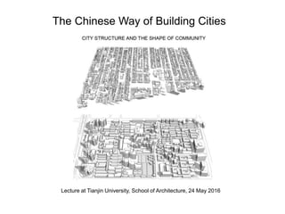
1. Lecture at Tianjin University, School of Architecture, 24 May 2016
The Chinese Way of Building Cities
2. ARCH521: Structure of Cities, Fall Term 2014
One Sq.Km.: A BEIJING – MONTREAL COMPARISON
http://www.slideshare.net/qiaokate/one-sqkm-a-beijing-montreal-comparison
OR
http://issuu.com/mcgillarchitecture/docs/one_sq.km._beijing___montreal_compa
ARCH 540: Selected Topics, Winter Term, 2015
ONE SQ. KM. / SUSTAINABILITY AND SOCIAL INFRASTRUCTURE
http://www.slideshare.net/qiaokate/onesqkm-civic-centres-20150427
OR
http://issuu.com/mcgillarchitecture/docs/onesqkm_civic_centres_20150427
This presentation summarizes research done at McGill University, Fall Term 2014, called:
One Sq.Km.: A BEIJING – MONTREAL COMPARISON
6. The average Plot Ratio (FAR) of the whole large urban block shown above is 2.1, about
double the equivalent area in the Plateau Areas of Montreal (1.1) and about 6 times the
density of a Montreal suburb.
7. The Plot Ratio (FAR) of the area inside the red boundary (about 1.0 sq.km.)
is about 1.1
Montreal Study Area, The Plateau:
Downtown Residential
8. The Plot Ratio (FAR) of the area inside the yellow boundary (about 1.0 sq.km.)
is about 0.35
Montreal Study Area: Brossard Suburbs
9. City Structure and the Shape of Community
1. Density
2. Land Use
3. Street Network and Spatial Order
4. Block Size
10. City Structure and the Shape of Community
1. Density
2. Land Use
3. Street Network and Spatial Order
4. Block Size
17. Sample Population Densities: Red is Asia, Blue is Europe, Green is North America
Gross FAR of one sq. km. around 1.0 is the threshold of walkability.
Below that the city is increasingly car-dependent.
18. City Structure and the Shape of Community
1. Density
2. Land Use
3. Street Network and Spatial Order
4. Block Size
19. Transition from an extended family compound (the coutyard house)
to a multi-family compond (modern housing estate):
The courtyard is a deep-seated Eastern pattern, that is persisting and
re-appearing - at a larger scale and higher density - in the residential
compounds that are the basic building blocks of China’s recent urban
explosion. The social scale has also expanded. The courtyard house
was originally designed for the extended family; the new residential
compound courtyards are for a neighbourhood, an emerging and
increasingly self-managed urban territory and social unit.
22. CHINA
Contemporary Land Use Pattern
reminiscent of the Socialist Work Unit (Danwei)
Highly Mixed Use, very Walkable
23. An Example of a Work Unit: Tianjin University Campus, 1985, Mixed Use, Very Walkable
24. No Gated Communities
in this study area.
In the west, “Gated Community”
suggests privilege and elitism.
In China all social classes live
In the same residential
compound type.
Montreal (Plateau Area)
Relativey High Density
Mixed Use, Walkable
25. Ironically, the retail on this site
is actually
car sales showrooms.
Montreal Suburb
Very Low Mix of Land Use
Not Walkable
26. City Structure and the Shape of Community
1. Density
2. Land Use
3. Street Network and Spatial Order
4. Block Size
27. Chinese Spatial Order
The semi-private or semi-public space courtyard space,
belonging to an extended family or a group of residential buildings,
allows family activities and social interaction to occur in that space.
Residential
28. Western Spatial Order
The semi-private or semi-public space courtyard space,
belonging to an extended family or a group of residential buildings,
usually does not exist. The transition from the dwelling to the
public street is more direct.
32. 1 sq.km. Area, Street Network Hierarchy,
Small Dead/Loop Roads, bicycle/pedestrian paths (green) traverse and
link each block
33. Western Spatial Order
The semi-private or semi-public space courtyard space,
belonging to an extended family or a group of residential buildings,
usually does not exist. The transition from the dwelling to the
public street is more direct.
38. Chinese Spatial Order
The semi-private or semi-public space courtyard space,
belonging to an extended family or a group of residential buildings,
allows family activities and social interaction to occur in that space.
Residential
55. Communal Neighbourhood Activity
Location of
residents
shown in the
previous four
images
Location of
residents
shown in the
next four
images. (Five
storey walk-up
apartments)
62. Location of a Residential Courtyard Compound called Sun City
in Beijing (East of East Second Ring Road)
with four towers, 24 floors each.
My home since 2003.
63. Beijing, Yang Guang Du Shi (Sun City) Residential District (2.4 h. inside the red line)
Big enough for Communal Neighbourhood Activity
64. Beijing, Sun City (Yang Guang Du Shi) Residential District Garden/Yard
65. Beijing, Sun City (Yang Guang Du Shi) Residential District Garden/Yard
66. Beijing, Sun City (Yang Guang Du Shi) Residential District Garden/Yard
67. Beijing, Sun City (Yang Guang Du Shi) Residential District Garden/Yard
68. Beijing, Sun City (Yang Guang Du Shi) Residential District Garden/Yard
69. Beijing, Yang Guang Du Shi Residential District Garden/Yard – English Corner
70. Streets: Hierarchy, Arterial Road
The location of the Sun City
Residential Compound activity
is on the other side,
at the base of, this building.
71. Beijing, Sun City (Yang Guang Du Shi) Residential District. Summer, 2016
Preparation for the formation of a Residents Committee, the beginning of self-management
72. Beijing, Sun City (Yang Guang Du Shi) Residential District,
first, newly-formed Residents Committee. Population of the district is about 300 people.
The beginnings of neighbourhood self-management.
The residents can now hire or fire the property management company.
73. Beijing, Sun City (Yang Guang Du Shi) Residential District,
first, newly-formed Residents Committee
Vote to chose a new property management company.
October 2017
74. Beijing, Sun City (Yang Guang Du Shi) Residential District,
first, newly-formed Residents Committee
Vote to chose a new property management company.
October 2017
77. Western Spatial Order
The semi-private or semi-public space courtyard space,
belonging to an extended family or a group of residential buildings,
usually does not exist. The transition from the dwelling to the
public street is more direct.
100. Location of
residents
shown in the
previous four
images
Large-Scale Courtyard for the Urban Neighbourhood
Polouation, about 2000 people living on 2.4 h. of land = 830 people/hectare
101. The western city normally does not have common outdoor space assigned to a group of households.
Population density about 300 to 400 people/hectare.
102. City Structure and the Shape of Community
1. Density
2. Land Use
3. Street Network and Spatial Order
4. Block Size
110. Construction Area: 222,000 sq.m.
Plot Ratio: 2.16
Population Density: 777 people/hectare
Beijing, Nan Xin Yuan
Residential District 1993
Pin-wheel Street pattern
designed to slow down
through traffic.
However,
property management
closed
all perimeter
street intersections
except at the north
where gates and guards
were installed.
Beijing’s First Social Housing Project
112. Nan Xin Yuan is in the southeast (bottom right) corner. The pin-wheel interior street
pattern divides the 15 hectare block into a central 1 hectare park, and four smaller blocks
of 3, 5, 3, and 2 hectares.
113. Beijing, Yang Guang Du Shi (Sun City) Residential District (2.4 h. inside red line)
Big enough for Communal Neighbourhood Activity
I lived here from 2003
114. Beijing, Ju Er Hu Tong Phase 2, Residential District (0.6 hectares inside red line)
I lived here from 1993-2002
117. Cliff Moughtin, Emeritus Professor of Planning at the University of Nottingham,
believes too large a block destroys city life.
"The larger and more homogenous the street block the greater will be its
power to destroy the social, economic, and physical networks of the city.
The large-scale single-use, single-ownership street block is the instrument
most influential in the decline of the city: its effect, together with that
of its partner the motorcar, are among the real causes of
the death of the great city."
[1] Cliff Moughtin, Urban Design: Green Dimensions, 1996, Architectural Press, P.138
The Chinese large block residential compounds are criticized by western planners
for creating traffic problems, and for reducing life in the streets.
118. The Chinese large block residential compounds are criticized by western planners
for creating traffic problems, and for reducing life in the streets.
119. The Chinese large block residential compounds are criticized by western planners
for creating traffic problems, and for reducing life in the streets.
120. Not all foreign planners are against the Chinese residential compound pattern. Below is a statement
by Jeff Johnson at the China Lab at Columbia that focuses on the Chinese super block
as a potentially positive force in urban planning and social order.
121. The Barcelona Friendly Superblock Experiment
Combine 9 original blocks to make one superblock.
The size of the Barcelona superblock (about 16 hectares)
is similar in size the Chinese residential neighbourhood superblock.
The main difference is the degree of porosity.
The Barcelona superblock is open to through-traffic for pedestrians and cyclists.
The Chinese urban superblock is closed to through-traffic pedestrians and cyclists.
122. The main difference is the degree of porosity.
The Barcelona superblock is open to through-traffic for pedestrians and cyclists.
The Chinese urban superblock is closed to through-traffic pedestrians and cyclists.
The Barcelona Friendly Superblock Experiment
123. The Barcelona Friendly Super-Block, a 400m x 400m block divided into 9 smaller blocks (Total: 16 hectares)
Before, all traffic went everywhere.
124. The Barcelona Friendly Super-Block, a 400m x 400m block divided into 9 smaller blocks (Total: 16 hectares)
Now, through car traffic is diverted to the perimeter and only local traffic goes inside the 400x400m block.
125. The Barcelona Friendly Super-Block, a 400m x 400m block divided into 9 smaller blocks (Total: 16 hectares)
If we add a shared garden/yard in the middle it starts to look like a Chinese urban super-block.
126. The Barcelona Friendly Super-Block, a 400m x 400m block divided into 9 smaller blocks (Total: 16 hectares)
A 16 hectare block is similar to a Chinese urban super-block. Each of the smaller 1.8 hectare
blocks is large enough for an internal semi-private shared social space.
127. The Barcelona Friendly Super-Block, a 400m x 400m block divided into 9 smaller blocks
If we add common facilities such as kindergarten, infirmary, senior’s center, residents committee office,
(Chinese “pei tao”) at the center we get an even stronger resemblance to a Chinese Residential Compound.