This document provides a summary of an operational safety review of 14th Avenue between Markham Road and Ninth Line in Markham, Ontario. The review found that a number of single vehicle collisions occurred due to high operating speeds on the curvy road sections that did not meet drivers' expectations. Potential contributing factors identified included sightline restrictions from multiple curves, inadequate pavement markings and signage, and a reverse cross slope causing water to flow across lanes. Recommendations focused on improving delineation of curves, conducting a drainage study, and implementing traffic calming measures to encourage safer speeds.
SmartTrack Presentation- Toronto Transit Network Planning
Do not include any personal information as all posted material on this site is considered to be part of a public record as defined by section 27 of the Municipal Freedom of Information and Protection of Privacy Act.
We reserve the right to remove inappropriate comments. Please see Terms of Use for City of Toronto Social Media Sites at http://www.toronto.ca/e-updates/termsofuse.htm.
International Journal of Engineering Research and Applications (IJERA) is an open access online peer reviewed international journal that publishes research and review articles in the fields of Computer Science, Neural Networks, Electrical Engineering, Software Engineering, Information Technology, Mechanical Engineering, Chemical Engineering, Plastic Engineering, Food Technology, Textile Engineering, Nano Technology & science, Power Electronics, Electronics & Communication Engineering, Computational mathematics, Image processing, Civil Engineering, Structural Engineering, Environmental Engineering, VLSI Testing & Low Power VLSI Design etc.
Leaping the Barriers to Perfect Cash ForecatingElena Oliveira
Corporate treasury teams continue to struggle with developing an accurate and reliable cash forecast, affecting their ability to optimize cash returns, meet hedging policies, and mobilize cash globally. In this webinar, Treasury Strategies and Kyriba will tackle the reasons why treasury teams have difficulty perfecting their cash forecasts and highlight new opportunities to achieve value through forecasting.
New language from Google, static safe compiler, with GC and as fast as C++ or Java, syntax simpler then Python - 2 hour-long tutorial and you can start code.
In this talk Serhii will talk about Go, also known as Golang – an open source language developed at Google and used in production by companies such as Docker, Dropbox, Facebook and Google itself. Go is now heavily used as a general-purpose programming language that’s a pleasure to use and maintain. This introductory talk contains many live demos of basic language concepts, concurrency model, simple HTTP-based endpoint implementation and, of course, tests using build-in framework. This presentation will be interesting for backend engineers and DevOps to understand why Go had become so popular and how it might help to build robust and maintanable services.
Agenda of the presentation:
1. Go is not C, not Java, not anything
2. Rob Pike argument
3. Main ideas and basics
4. Concurrency model
5. Tools
6. Issues
In October of 2016, the EPA signed the final Hazardous Waste Generator Improvements Rule to provide greater flexibility for hazardous waste generators and clarification around certain components of the hazardous generator program in an effort to improve compliance and environmental protection. The EPA has described the rule as “an overhaul of the hazardous waste generator regulatory program.” Some revisions appear to be more lenient than existing regulations, while others are more stringent, such as documenting hazardous waste determinations.
کودک از زمان تولد به دنبال جستجو وکشف جهان پیرامون خود است وهر چه که به دستش می رسد را تجزیه وتحلیل می کند وبه دنبال تغییر دادن شرایط است تا چیز جدیدی خلق کند وبه این شکل خلاقیت خود را بروز دهد .
the Community Access Project sings out the concerns of people with physical and sensory disabilities in these Public Comments to MassDOT. Three recommendations, with photos, are included.
21/08/2015 · Department of Civil Technology Written By: Ahmed Zakaria Page 11 Hosting Company: Fig 2: Al haramain Company headquarter Company address: Al Haramain Company for Commerce and Contracting Building Al Nahda Area Jeddah 2233 Saudi Arabia +966 2 694 2000 ahc@haramain.com.sa. 12.
www.slideshare.net › surveying-internship-reportSite Survey Report - SlideShare
12/08/2015 · Department of Civil Technology Written By: Ahmed Zakaria Page 15 Hosting Company: a) Report writing Reporting is a controlling / informative mechanism which will help in evaluating the status of a project. It also help decision makers to follow the status of the project without being present physically on the site.
People also ask
What is the purpose of a student intern survey?
What is an internship exit survey?
How to write an internship report?
How to evaluate the performance of interns of an internship program?
www.academia.edu › 4202293 › Internship_report(PDF) Internship report | Sajesh Maharjan - Academia.edu
Download Free PDF. 1 An Internship Report with regard to J.B. Rajbhandary & DiBins Submitted by Sajesh Maharjan Roll no: 10450124 PU Registration Number: 2009-2-45-0066 An Internship Report Submitted to Ace Institute of Management Faculty of Management Pokhara University Submitted for the degree of Bachelor of Business Administration in Banking ...
Authors: Sajesh Maharjan
www.academia.edu › 15735540 › A_SUMMER_INTERNSHIP_REPORT(DOC) A SUMMER INTERNSHIP REPORT - Academia.edu
It has been operational in Pakistan since 1989. Toyota is a one of a kind Japanese multinational automotive manufacturer. As of September 2018, it was the sixth largest company in the world in terms of revenue. The economic conditions however have not been very favorable for the automotive industry.
Authors: jhanavi gadhavi
www.jotform.com › form-templates › internship-surveyInternship Survey Form Template | Jotform
With Jotform’s free Employee Satisfaction Survey, you can collect survey responses online from any device! Just customize the form template, embed it in your employee website or share it with a link, and view responses in your secure Jotform account. You can then auto-generate detailed reports using Jotform Report Builder, or convert each ...
www.examples.com › business › internship-reportInternship Report - 12+ Examples, Format, Pdf | Examples
12+ Internship Report Examples & Samples in PDF. Students and trainees usually undergo an internship program to prepare themselves for the real world. Through this program, they are able to gain work experience for a specified requirement. This is especially common for medical report students, who spend almost half of their student lives as ...
www.template.net › business › survey-templates10+ Student Intern Survey Templates in PDF | DOC
Student Internship Satisfaction Survey Template. 8. Experience Student Internship Survey in PDF. 9. Psychology Student Internship Survey Template. 10. Basic Student Internship Survey. 11. S
Study to evaluate bicycle and pedestrian connectivity along the A1A/US 1 Corridor between SE 17th St. and Dania Beach Blvd., through the Fort Lauderdale/Hollywood International Airport and Port Everglades, an area notorious for being hazardous to bicycle travel.
Student information management system project report ii.pdfKamal Acharya
Our project explains about the student management. This project mainly explains the various actions related to student details. This project shows some ease in adding, editing and deleting the student details. It also provides a less time consuming process for viewing, adding, editing and deleting the marks of the students.
Final project report on grocery store management system..pdfKamal Acharya
In today’s fast-changing business environment, it’s extremely important to be able to respond to client needs in the most effective and timely manner. If your customers wish to see your business online and have instant access to your products or services.
Online Grocery Store is an e-commerce website, which retails various grocery products. This project allows viewing various products available enables registered users to purchase desired products instantly using Paytm, UPI payment processor (Instant Pay) and also can place order by using Cash on Delivery (Pay Later) option. This project provides an easy access to Administrators and Managers to view orders placed using Pay Later and Instant Pay options.
In order to develop an e-commerce website, a number of Technologies must be studied and understood. These include multi-tiered architecture, server and client-side scripting techniques, implementation technologies, programming language (such as PHP, HTML, CSS, JavaScript) and MySQL relational databases. This is a project with the objective to develop a basic website where a consumer is provided with a shopping cart website and also to know about the technologies used to develop such a website.
This document will discuss each of the underlying technologies to create and implement an e- commerce website.
TECHNICAL TRAINING MANUAL GENERAL FAMILIARIZATION COURSEDuvanRamosGarzon1
AIRCRAFT GENERAL
The Single Aisle is the most advanced family aircraft in service today, with fly-by-wire flight controls.
The A318, A319, A320 and A321 are twin-engine subsonic medium range aircraft.
The family offers a choice of engines
About
Indigenized remote control interface card suitable for MAFI system CCR equipment. Compatible for IDM8000 CCR. Backplane mounted serial and TCP/Ethernet communication module for CCR remote access. IDM 8000 CCR remote control on serial and TCP protocol.
• Remote control: Parallel or serial interface.
• Compatible with MAFI CCR system.
• Compatible with IDM8000 CCR.
• Compatible with Backplane mount serial communication.
• Compatible with commercial and Defence aviation CCR system.
• Remote control system for accessing CCR and allied system over serial or TCP.
• Indigenized local Support/presence in India.
• Easy in configuration using DIP switches.
Technical Specifications
Indigenized remote control interface card suitable for MAFI system CCR equipment. Compatible for IDM8000 CCR. Backplane mounted serial and TCP/Ethernet communication module for CCR remote access. IDM 8000 CCR remote control on serial and TCP protocol.
Key Features
Indigenized remote control interface card suitable for MAFI system CCR equipment. Compatible for IDM8000 CCR. Backplane mounted serial and TCP/Ethernet communication module for CCR remote access. IDM 8000 CCR remote control on serial and TCP protocol.
• Remote control: Parallel or serial interface
• Compatible with MAFI CCR system
• Copatiable with IDM8000 CCR
• Compatible with Backplane mount serial communication.
• Compatible with commercial and Defence aviation CCR system.
• Remote control system for accessing CCR and allied system over serial or TCP.
• Indigenized local Support/presence in India.
Application
• Remote control: Parallel or serial interface.
• Compatible with MAFI CCR system.
• Compatible with IDM8000 CCR.
• Compatible with Backplane mount serial communication.
• Compatible with commercial and Defence aviation CCR system.
• Remote control system for accessing CCR and allied system over serial or TCP.
• Indigenized local Support/presence in India.
• Easy in configuration using DIP switches.
NO1 Uk best vashikaran specialist in delhi vashikaran baba near me online vas...Amil Baba Dawood bangali
Contact with Dawood Bhai Just call on +92322-6382012 and we'll help you. We'll solve all your problems within 12 to 24 hours and with 101% guarantee and with astrology systematic. If you want to take any personal or professional advice then also you can call us on +92322-6382012 , ONLINE LOVE PROBLEM & Other all types of Daily Life Problem's.Then CALL or WHATSAPP us on +92322-6382012 and Get all these problems solutions here by Amil Baba DAWOOD BANGALI
#vashikaranspecialist #astrologer #palmistry #amliyaat #taweez #manpasandshadi #horoscope #spiritual #lovelife #lovespell #marriagespell#aamilbabainpakistan #amilbabainkarachi #powerfullblackmagicspell #kalajadumantarspecialist #realamilbaba #AmilbabainPakistan #astrologerincanada #astrologerindubai #lovespellsmaster #kalajaduspecialist #lovespellsthatwork #aamilbabainlahore#blackmagicformarriage #aamilbaba #kalajadu #kalailam #taweez #wazifaexpert #jadumantar #vashikaranspecialist #astrologer #palmistry #amliyaat #taweez #manpasandshadi #horoscope #spiritual #lovelife #lovespell #marriagespell#aamilbabainpakistan #amilbabainkarachi #powerfullblackmagicspell #kalajadumantarspecialist #realamilbaba #AmilbabainPakistan #astrologerincanada #astrologerindubai #lovespellsmaster #kalajaduspecialist #lovespellsthatwork #aamilbabainlahore #blackmagicforlove #blackmagicformarriage #aamilbaba #kalajadu #kalailam #taweez #wazifaexpert #jadumantar #vashikaranspecialist #astrologer #palmistry #amliyaat #taweez #manpasandshadi #horoscope #spiritual #lovelife #lovespell #marriagespell#aamilbabainpakistan #amilbabainkarachi #powerfullblackmagicspell #kalajadumantarspecialist #realamilbaba #AmilbabainPakistan #astrologerincanada #astrologerindubai #lovespellsmaster #kalajaduspecialist #lovespellsthatwork #aamilbabainlahore #Amilbabainuk #amilbabainspain #amilbabaindubai #Amilbabainnorway #amilbabainkrachi #amilbabainlahore #amilbabaingujranwalan #amilbabainislamabad
Explore the innovative world of trenchless pipe repair with our comprehensive guide, "The Benefits and Techniques of Trenchless Pipe Repair." This document delves into the modern methods of repairing underground pipes without the need for extensive excavation, highlighting the numerous advantages and the latest techniques used in the industry.
Learn about the cost savings, reduced environmental impact, and minimal disruption associated with trenchless technology. Discover detailed explanations of popular techniques such as pipe bursting, cured-in-place pipe (CIPP) lining, and directional drilling. Understand how these methods can be applied to various types of infrastructure, from residential plumbing to large-scale municipal systems.
Ideal for homeowners, contractors, engineers, and anyone interested in modern plumbing solutions, this guide provides valuable insights into why trenchless pipe repair is becoming the preferred choice for pipe rehabilitation. Stay informed about the latest advancements and best practices in the field.
Vaccine management system project report documentation..pdfKamal Acharya
The Division of Vaccine and Immunization is facing increasing difficulty monitoring vaccines and other commodities distribution once they have been distributed from the national stores. With the introduction of new vaccines, more challenges have been anticipated with this additions posing serious threat to the already over strained vaccine supply chain system in Kenya.
Welcome to WIPAC Monthly the magazine brought to you by the LinkedIn Group Water Industry Process Automation & Control.
In this month's edition, along with this month's industry news to celebrate the 13 years since the group was created we have articles including
A case study of the used of Advanced Process Control at the Wastewater Treatment works at Lleida in Spain
A look back on an article on smart wastewater networks in order to see how the industry has measured up in the interim around the adoption of Digital Transformation in the Water Industry.
Water scarcity is the lack of fresh water resources to meet the standard water demand. There are two type of water scarcity. One is physical. The other is economic water scarcity.
Event Management System Vb Net Project Report.pdfKamal Acharya
In present era, the scopes of information technology growing with a very fast .We do not see any are untouched from this industry. The scope of information technology has become wider includes: Business and industry. Household Business, Communication, Education, Entertainment, Science, Medicine, Engineering, Distance Learning, Weather Forecasting. Carrier Searching and so on.
My project named “Event Management System” is software that store and maintained all events coordinated in college. It also helpful to print related reports. My project will help to record the events coordinated by faculties with their Name, Event subject, date & details in an efficient & effective ways.
In my system we have to make a system by which a user can record all events coordinated by a particular faculty. In our proposed system some more featured are added which differs it from the existing system such as security.
Industrial Training at Shahjalal Fertilizer Company Limited (SFCL)MdTanvirMahtab2
This presentation is about the working procedure of Shahjalal Fertilizer Company Limited (SFCL). A Govt. owned Company of Bangladesh Chemical Industries Corporation under Ministry of Industries.
1. i
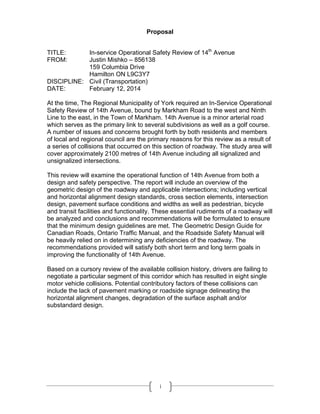
Proposal
TITLE: In-service Operational Safety Review of 14th
Avenue
FROM: Justin Mishko – 856138
159 Columbia Drive
Hamilton ON L9C3Y7
DISCIPLINE: Civil (Transportation)
DATE: February 12, 2014
At the time, The Regional Municipality of York required an In-Service Operational
Safety Review of 14th Avenue, bound by Markham Road to the west and Ninth
Line to the east, in the Town of Markham. 14th Avenue is a minor arterial road
which serves as the primary link to several subdivisions as well as a golf course.
A number of issues and concerns brought forth by both residents and members
of local and regional council are the primary reasons for this review as a result of
a series of collisions that occurred on this section of roadway. The study area will
cover approximately 2100 metres of 14th Avenue including all signalized and
unsignalized intersections.
This review will examine the operational function of 14th Avenue from both a
design and safety perspective. The report will include an overview of the
geometric design of the roadway and applicable intersections; including vertical
and horizontal alignment design standards, cross section elements, intersection
design, pavement surface conditions and widths as well as pedestrian, bicycle
and transit facilities and functionality. These essential rudiments of a roadway will
be analyzed and conclusions and recommendations will be formulated to ensure
that the minimum design guidelines are met. The Geometric Design Guide for
Canadian Roads, Ontario Traffic Manual, and the Roadside Safety Manual will
be heavily relied on in determining any deficiencies of the roadway. The
recommendations provided will satisfy both short term and long term goals in
improving the functionality of 14th Avenue.
Based on a cursory review of the available collision history, drivers are failing to
negotiate a particular segment of this corridor which has resulted in eight single
motor vehicle collisions. Potential contributory factors of these collisions can
include the lack of pavement marking or roadside signage delineating the
horizontal alignment changes, degradation of the surface asphalt and/or
substandard design.
2. ii
Executive Summary
The residents of the Boxgrove community are primarily serviced by the east/west
arterial highway of 14th
Avenue. This 2100 meter road section consists of 7
intersections, 2 of which are controlled by traffic signals; and boarders the
Markham Green Golf Course where it crosses the Rouge River. With the opening
of a newly constructed north/south ‘by-pass’ route east of the study area, 14th
Avenue is experiencing higher than anticipated volumes.
Over the last five years, collision statistics, as well as political and public concern,
have highlighted potential deficiencies. These alleged problematic areas as well
as part of ongoing initiatives for corridor improvements, served as a catalyst for
an in-service operational safety review.
Available collision data provided by the Regional Municipality of York in
cooperation with York Region Police was analyzed to determine occurring trends
and patterns. Site investigations confirmed horizontal alignment issues as well as
other design and engineering shortages. These elements were addressed
satisfying a range of time length solutions.
It was identified that a portion of 14th
Avenue was initially constructed so that
there were several ‘kinks’ in the horizontal alignment. This design feature can
cause a driver’s expectations to not be met yielding an unsafe and hazardous
situation. The combination of vertical and horizontal curves approaching the
bridge spanning the Rouge River promotes a precarious situation in relation to
pedestrian safety as there is no barrier between the walkway across the bridge
and the travel portion of the roadway.
Several key aspects have been identified as being a potential contributing factor
to the cause of this review. To immediately satisfy a portion of the listed remedial
countermeasures, additional steps are to be completed to highlight the
characteristics of the roadway. To ensure a motorist’s expectations are met,
additional signage and delineation are required in the interim.
As a candidate for a bike way and multi-use pathway; capital works should be
scheduled accordingly to ensure that the Pedestrian and Cycling Master Plan’s
initiatives are included. Rehabilitation and reconstruction of 14th
Avenue can
complement initiatives to provide a multi-user friend roadway.
3. iii
Acknowledgements
Special thanks to the Regional Municipality of York, Transportation Services
Department for supplying the necessary data and services for this in-service
operational safety review. Also, thank you to Yvonne Kaczor P Eng., Traffic
Engineering and Road Safety, York Region and Zoran Postic, Manager, Traffic
Engineering and Road Safety, York Region for their continuing support and
guidance throughout the preparation of this report.
4. iv
Table of Contents
Proposal i
Executive Summary ii
Acknowledgments iii
Table of Contents iv
List of Figures vi
1.0 Introduction
1.1 Background 1
1.2 Purpose 1
1.3 Study Scope 1
1.4 Study Area 2
2.0 Data Collection
2.1 Collision History 3
2.2 Traffic Volumes 3
2.3 Speed Study 3
2.4 Field Investigation 4
3.0 Analysis
3.1 Existing Roadway 4
3.2 Traffic Volumes 7
3.3 Collisions 7
3.4 Potential Contributory Factors 9
3.5 Potential Countermeasures & Remedial Action 17
4.0 Conclusion 18
5.0 Recommendations 20
References 22
Appendix A
A1 Collision Diagram – Havelock Gate to Roxbury Street
A2 Collision Diagram – Roxbury Street to Boxwood Crescent West
A3 Collision Diagram – Boxwood Crescent West to Ninth Line
Appendix B
5. v
B1 TMC – 14th
Avenue @ Boxwood Crescent East
B3 TMC – 14th
Avenue @ Legacy Drive
B5 TMC – 14th
Avenue @ Roxbury Street
B7 ATR – Horstman Street to Markham Road
B7 ATR – Legacy Drive to Ninth Line
Appendix C
C1 York Region Proposed Cycling Network
Appendix D
D1 Speed Study: 60 km/h Posted Speed Limit
D2 Speed Study: 50 km/h Posted Speed Limit
6. vi
LIST OF FIGURES
Figure 1-1 Map of study area 2
Figure 2-1 Collected traffic data 3
Figure 2-2 Results of speed survey (Apr 25, 2007) 4
Figure 3-1 Typical view of a signalized intersection 6
Figure 3-2 Typical view of an unsignalized intersection 6
Figure 3-3 Typical midblock view 7
Figure 3-4 Annual average traffic volume on 14th
Avenue 7
Figure 3-5 Eastbound sight distance 11
Figure 3-6 Vehicle tire trace mark 12
Figure 3-7 Intersection warning sign 13
Figure 3-8 Uncontrolled access point – Roxbury Park 14
Figure 3-9 Westbound tire traces 15
Figure 3-10 One catch basin through curved portion of roadway 16
Figure 3-11 Potential remedial treatments 17
Figure 4-1 Wooden Post 21
7. 1
1.0 INTRODUCTION
1.1 Background
As part of ongoing initiatives for corridor improvement, 14th
Avenue was identified
as a candidate for an In-Service Operational Safety Review. Concerns have
been brought forth by both members of Regional and Local Council, as well as
local area residents. A growing statistical trend specific to collision history is an
indicator that certain elements of the roadway could be insufficient or
substandard.
1.2 Purpose
This report will see that minimum design, operational and safety standards are
met or exceeded where necessary so that all road users are able to utilize 14th
Avenue in a safe and efficient manner. Problematic areas and identified
deficiencies of 14th
Avenue will be reviewed and the recommended
countermeasures will satisfy the needs of the short term and long term solutions.
1.3 Study Scope
This report will include an analysis of the geometric design of the roadway and
applicable intersections; including vertical and horizontal alignment design
standards, cross section elements, intersection design, pavement surface
conditions and widths all where applicable. Pedestrian, bicycle and transit
facilities will be examined to determine their functionality and relationship as they
relate to the Pedestrian and Cycling Master Plan.
8. 2
1.4 Study Area
The study area consists of the 14th
Avenue corridor bound by Markham Road in
the west and Ninth Line in the east, in the Town of Markham. All signalized and
non-signalized intersections are within the scope of this study with the exception
of 14th
Avenue at Markham Road and 14th
Avenue at Ninth Line. The study area
is depicted below in Figure 1-1.
Figure 1-1: Map of Study Area
This report will examine the key engineering, design and operational
fundamentals of a safe and efficient roadway. Highlighted there within will include
9. 3
actions to provide a multi-user friendly roadway through future design and
rehabilitation works.
2.0 DATA COLLECTION
2.1 Collision History
The collision analysis for the subject study area was based on motor vehicle
collision reports from January 1, 2003 to December 31, 2007 inclusive. Collision
diagrams were generated based on the available statistics. (Appendix A)
2.2 Traffic Volumes
The available turning movement counts and automatic traffic recorder counts
were used in the analysis. A summary of the data used is shown in Figure 2-1.
Figure 2-1: Collected Traffic Data
LOCATION STUDY DATE
14th
Avenue @ Boxwood Crescent East TMC February 24, 2005
14th
Avenue @ Legacy Drive TMC June 26, 2007
14th
Ave @ Roxbury Street TMC February 24, 2005
14th
Ave east of Markham Road ATR November 2007
14th
Ave west of Ninth Line ATR December 2006
Traffic data is attached in Appendix B.
2.3 Speed Study
A speed survey targeting westbound vehicles approaching the intersection of 14th
Avenue west of Boxwood Crescent was conducted on April 25, 2007. The results
of the speed survey are shown in Figure 2-2.
10. 4
Figure 2-2: Results of Speed Survey (April 25, 2007)
Posted Speed Limit 50 km/h
Sample Size 106
85th
Percentile 69.6 km/h
Maximum Speed 81 km/h
Minimum Speed 51 km/h
% Compliance 0.0 %
2.4 Field Investigation
Site investigations were completed during the morning and afternoon peak hours
as well as during the off-peak hours. Morning and afternoon peak field
investigations were completed on Wednesday July 23, 2008. The aim of these
investigations was to observe traffic in higher volume conditions when road user
frustration and conflicts between vehicles are more likely to occur. In order to
obtain more information about the environment, surrounding development and to
determine lower volume traffic characteristics, an off-peak field investigation was
completed on Thursday, July 24, 2008.
3.0 ANALYSIS
3.1 Existing Roadway
14th
Avenue is an arterial roadway that carries approximately 16,000 vehicles per
day, 3% of which are heavy trucks.
Between Markham Road and Havelock Gate, 14th
Avenue has a four lane cross
section. Between Havelock Gate and Ninth Line, 14th
Avenue has a two lane
cross section. Throughout the entire study area, there is no direct property
11. 5
access onto 14th
Avenue with the exception of a rarely used Hydro One access
point.
The horizontal alignment of 14th
Avenue between a point approximately 500
meters west of Markham Road and Ninth Line is very curvilinear. There are
sidewalks on both sides of 14th
Avenue from Markham Road to Ninth Line. The
distance between the sidewalk and the roadway edge varies along the entire
section. At the bridge across the Rouge River there is no separation between the
pedestrian walkway and the edge of the road. Currently, there are no bike lanes
along this stretch of the roadway; however, York Region’s Pedestrian and
Cycling Master Plan does identify 14th
Avenue as a potential candidate for the
implementation of bike lanes and multi-use trails (Appendix C).
The intersection of 14th Avenue at Havelock Gate consists of an exclusive left
turn lane, a through lane and a shared through/right turn lane. Figure 3-1
illustrates a typical roadway cross-section at a signalized intersection in the study
area.
12. 6
Figure 3-1: Typical View of a Signalized Intersection
The intersection of 14th
Avenue at Boxwood Crescent is unsignalized and
consists of one through lane and no auxiliary turn lanes as shown in Figure 3-2.
Figure 3-2: Typical View of an Unsignalized Intersection
13. 7
A typical cross-section of 14th
Avenue between Havelock Gate and Ninth Line is
illustrated in Figure 3-3
Figure 3-3: Typical Midblock View
3.2 Traffic Volumes
The most recent traffic count for 14th
Avenue was completed on June 5, 2007,
between Legacy Drive and Ninth Line. (Figure 3-4)
Figure 3-4: Annual Average Traffic Volume on 14th
Avenue
As per the above data, the annual average daily traffic for 14th
Avenue is 13,420
vehicles per day in both eastbound and westbound directions combined.
14. 8
3.3 Collisions
3.3.1 Overview
Between 2003 and 2007 a total of 15 reported collisions occurred within the
study area. All these collisions were classified as property damage only; none of
the collisions resulting in fatalities or injuries.
Of the 15 collisions that occurred, 7 were single vehicle collisions that took place
during wet weather conditions (rain or snow) as a result of the vehicle traveling
too fast for the conditions in relation to the horizontal curvature of the roadway.
These collisions occurred mostly in the off-peak periods when travel speeds are
generally higher.
A reduction in travel speeds on the study section of 14th
Avenue will decrease the
risk of “run-off the road” and “head-on” collisions as well as the risk of these
vehicles colliding with pedestrians using the pedestrian walkways.
Two collisions involved a vehicle colliding with a cyclist.
3.3.2 Collision Diagrams
The collision diagrams attached in Appendix A were prepared after investigating
copies of collision reporting forms as completed by York Region Police.
15. 9
3.4 Development of Potential Contributory Factors
The following observations identify potential contributory factors for the
overrepresented single motor vehicle collisions along 14th
Avenue between Ninth
Line and Markham Road.
3.4.1 Operating Speed
The subject section of 14th
Avenue is located in the transition zone between
areas of urban and rural development, which typically has considerably different
operating speeds. The area east of Ninth Line is considered as open space and
is currently undeveloped; therefore drivers traveling eastbound east of Markham
Road might be prematurely changing into a ‘rural driving mode’. This false
perception is even more exaggerated due to the presence of a mature woodland
area located on the north side of 14th
Avenue. A similar situation has been noted
for westbound vehicles where drivers coming from a rural environment may not
have adjusted their speed for the urban area they are about to enter. Eastbound
and westbound speed studies show approaching speeds between 51 km/h and
81 km/h with an 85th
percentile speed approximately 70 km/h in the 50 km/h
residential zone.
The results of the speed study completed in December 2005 revealed 58% of
drivers complying with the posted speed limit of 60 km/h. In March 2006,
Regional Council recommended lowering the speed limit of 60 km/h to 50 km/h
throughout the subject portion of 14th
Avenue.
16. 10
Based on the results of a speed study it is evident that the lowering of the speed
limit had no discernible impact on operating speeds. It is apparent that vehicles
do not conform to the posted speed limit of 50 km/h. Where it is desirable to have
at least 85% of drivers comply with the posted speed limit, the compliance with
the speed limit is 0%. The observed speeds could be considered significantly
high for a 2 lane urban arterial especially with the existing geometric
characteristics of the roadway.
Comparing the results of both speed studies, the speed compliance has dropped
from 58% to 0% after the speed limit reduction from 60 km/h to 50 km/h.
Therefore, an additional speed limit reduction is not recommended. The results of
the study are attached in Appendix D.
3.4.2 Sightline Restrictions
There is a potential sightline conflict for eastbound and westbound traffic due to
the presence of a combination of vertical and multiple horizontal curves as
illustrated in the Figure 3-5.
17. 11
Figure 3-5: Eastbound Sight Distance
3.4.3 Geometry
Several field investigations revealed that the section of 14th
Avenue between
Markham Road and Ninth Line along the curved portions of the roadway have a
reverse cross fall that can cause vehicles to errant from the roadway while
negotiating the curve.
Additionally, on 14th
Avenue within the study section there are several horizontal
curves. These curves are short and have small deflection angles thereby creating
“kinks” in the roadway that could be a challenge to negotiate at high speeds,
especially in adverse weather conditions.
Approximately 280 meters west of Ninth Line on 14th
Avenue, there is a bridge
over the Rouge River. This bridge is situated on a horizontal curve and both
approaches to the bridge are on a downgrade. On the outside of the curve (i.e. of
18. 12
the south side of 14th
Avenue), over the bridge, the pedestrian walkway is directly
adjacent to the roadway and is not protected by any form of barrier. The
combination of the horizontal and vertical alignment in this area increases the
risk that vehicles, driving at excessive speeds, could leave the traveled portion of
the roadway entering into the pedestrian walkway area. Figure 3-6 illustrates a
tire mark from an errant vehicle striking a tree.
Figure 3-6: Vehicle Tire Trace Mark
3.4.4 Signage
As shown in Figure 3-7, the limited visibility of a warning sign due to extensive
vegetation combined with its location could also be a contributing factor in single
motor vehicle collisions. The improper notification to the driver about the
presence of an intersection and possible vehicles violates driver’s expectancy.
Furthermore, this sign is alerting drivers to the presence of an approaching
intersection but not of the approaching horizontal curve.
19. 13
Figure 3-7: Intersection Warning Sign
3.4.5 Uncontrolled Access Point
Roxbury Park is located on the north side of 14th
Avenue between Havelock Gate
and Ninth Line parallel to a residential development on the south side. During the
field investigation, two uncontrolled access points leading to the park were
noticed (Figure 3-8 shows one location). The unexpected presence of
pedestrians or cyclists crossing the road can increase the likelihood of a collision
with a motor vehicle and another road user.
20. 14
Figure 3-8: Uncontrolled Access Point – Roxbury Park
3.4.6 Road Surface Friction
Of all the collisions which were reported from 2003 to 2007 respectively, 47% of
the collisions were classified as single motor vehicle and occurred during wet
weather conditions. Low skid resistance of the roadway could be one of the
reasons for vehicles losing control during wet weather conditions. During the field
investigation, skid marks were found on 14th
Avenue approximately 250 meters
beyond Roxbury Street. The placement of this skid mark indicated the vehicle
was traveling westbound at a speed which exceeded the maximum able to
negotiate the curve. Figure 3-9 illustrates the vehicle’s tire traces (skid marks)
thorough this curved portion of 14th
Avenue.
21. 15
Figure 3-9: Westbound Tire Traces
3.4.7 Other Road Users: Cyclists
Currently there is no available data on cyclist volumes; however, the field
investigations found several cyclists (more than 5 within one hour period)
travelling along 14th
Avenue between Markham Road and Ninth Line. The
collision history revealed that within the last five years, 2 collisions occurred that
involved cyclists.
York Region’s Pedestrian and Cycling Master Plan identifies a bike lane on 14th
Avenue between Markham Road and Roxbury Street and a multi-use trail on 14th
Avenue between Roxbury Street and Ninth Line.
A multi-use trail is a facility that is entirely separated from the travelled portion of
the roadway and a bike lane is a facility located in the travelled portion of the
22. 16
roadway and is designed for one way bicycle traffic. Additional details can be
found in Appendix C.
The existing width of a one-direction lane on 14th
Avenue is 3.75 meters
respectively. Based on the Pedestrian and Cycling Master Plan, the minimum
lane width to accommodate bike lanes is 5.0 meters; therefore, the current width
of the lane is insufficient to accommodate both vehicular and cyclist traffic.
3.4.8 Drainage
An insufficient number of catch basins were noticed on the south side of 14th
Avenue within the subject area, especially through the curved portions of the
roadway (figure 3-10). This can cause rain water to remain on the road surface
and pond in low lying horizontal and vertical portions of the road. A combination
of a reversed cross fall, excessive speed and water over the road surface could
be a possible cause of many of the collisions that occurred between 2003 and
2007.
Figure 3-10: One Catch Basin Through Curved Portion of Roadway
23. 17
3.5 Potential Countermeasures and Remedial Action
Figure 3-11 presents several potential remedial treatments listing advantages
and disadvantages related to single motor vehicle collisions.
Figure 3-11: Potential Remedial Treatments
Countermeasure Benefits Disadvantages
Expected
Effectiveness
Increase number
of catch basins
along 14th
Avenue
§Improves drainage
of the road’s
surface
Eliminates vehicle
skidding and loss of
control
§Equipment and
installation cost
Medium
Pavement
micro-surfacing
§Prevent vehicles
from leaving the
travel portion of the
road by increasing
the friction of the
roadway
§Moderate
rehabilitation
cost
§Moderate traffic
disruption
High
Road
Reconstruction:
Widen and
eliminate reversed
cross fall
§Prevent vehicles
from losing control
and leaving the
travel portion of the
road
§Reduced single
motor vehicle
collisions
§Accommodate other
road users (cyclists)
and comply with the
Pedestrian and
Cycling Master Plan
§Significant
reconstruction
cost
§Environmental
concerns
specific to the
Rouge River
§Major disruption
to traffic flows
High
Refresh pavement
markings
§Improved road
delineation
§Highlight ‘winding
road’ characteristics
§Minor cost
§Minor traffic
disruption
Low
Trim vegetation &
tree branches
§Improved warning
sign visibility
§Maintenance
cost Low
Additional curve
warning signs and
§Improved roadway
delineation
§Signs and
installation
Low
24. 18
chevrons along
curved portions of
the roadway
§Increased driver’s
expectancy
costs
§Minor traffic
disruption
Installation of
wooden pylons or
trees on the
boulevard along
the curved section
of the roadway
§Protects
pedestrians from
errant vehicles
§Enhanced
streetscaping
§Decreased
operating speed as
the road seems
visibly narrower
§Potential
roadside hazard
if unbreakable
Low
Road
Reconstruction &
Realignment:
Removing kinks
and providing
larger curves
§Prevent errant
vehicles from
leaving the travel
portion of the
roadway
§Reduced single
motor vehicle
collisions
§Allow vehicles to
travel at a more
appropriate speed
relating to the
nature of the
subject section of
14th
Avenue
§Significant
reconstruction
cost
§Environmental
concerns
specific to the
Rouge River
§Major disruption
to traffic flows
High
§Streetscaping
§Reduced operating
speed
§Implementation
and
maintenance
cost
Medium
4.0 CONCLUSION
Based on the conducted analysis, several key aspects have been identified as
being a potential contributing factor to the cause of this review. Prior to the
commencement of this review, it had been identified that collision trends
25. 19
indicated a possible deficiency in the geometric design of a portion of 14th
Avenue, specific to the road section between Roxbury Street and Ninth Line.
To immediately satisfy a portion of the listed remedial countermeasures,
additional steps are to be completed to highlight the characteristics of the
roadway. To ensure a motorist’s expectations are met, additional signage and
delineation are required in the interim.
As earlier noted, this section of 14th
Avenue is a candidate for a bike way and
multi-use pathway; capital works should be scheduled accordingly to ensure that
the Pedestrian and Cycling Master Plan’s initiatives are included. At such time,
the rehabilitation and reconstruction of 14th
Avenue can complement York
Region’s initiatives to provide a multi-user friend roadway. Such initiatives can
include the addition and upgrading of pedestrian, bicycle and transit facilities, as
well as streetscaping and gateway treatments.
The introduction or enhancement of streetscaping features and gateway
treatments have proven to be effective to the voluntary compliance of posted
speed limits. Such roadside treatments also provide a barrier between the travel
portion of the roadway and pedestrian facilities (sidewalks and pathways).
As on overall assessment of the completed analysis, the application of several of
the listed remedial actions will serve to enhance this safe and multi-user friendly
roadway. These enhancements will help bring an integral part of York Region’s
Master Plan and Pedestrian and Cycling Master Plan to fruition by implementing
26. 20
their key fundamentals; thus being that a Regional road will be able to serve a
multitude of users whilst promoting alternate modes of transportation.
5.0 RECOMMENDATIONS
Based on the above detailed assessment, the following remedial treatments are
recommended to address the collision issues for 14th
Avenue between Markham
Road and Ninth Line:
Short Term
§ Install additional curve warning signs with a flashing beacon as well as
chevrons through the curved portion of the roadway – specifically the road
sections immediately west of Roxbury Street and in the area of the bridge
crossing the Rough River.
§ Refresh all existing pavement markings and install 10cm thick edge lines
along 14th
Avenue between Roxbury Street and Ninth Line.
§ Trim any roadside vegetation that impairs a driver’s ability to see an
approaching warning sign or obstructs sightlines.
Mid Term
§ Pavement micro surfacing or the application of a high friction top coat.
§ Tree planting or the installation of wooden pylons. Figure 4-1 shows an
example of wooden pylons spaced six meters apart.
27. 21
Figure 4-1: Wooden Post
Long Term
§ Roadway reconstruction: widening the travel portion and overall right-of-way;
allowance for and installation of bike ways, removing ‘kinked’ horizontal
curves and providing larger curves; eliminate reverse cross falls; install
additional catch basins.
§ Streetscaping to promote voluntary compliance with the speed limit.
28. 22
REFERENCES
Transportation Association of Canada, Geometric Design Guide for Canadian
Roads, September 1999, Part 1, 1999 Edition
Transportation Association of Canada, Geometric Design Guide for Canadian
Roads, September 1999, Part 2, 1999 Edition
Ontario Ministry of Transportation, Ontario Traffic Manual – Book 6, July 2001
Regional Municipality of York, Pedestrian and Cycling Master Plan, April 2008
Regional Municipality of York, Transportation Master Plan, June 2002