Downloaded 43 times
![Beniamino Murgante Spatial Information Systems yesterday, today and tomorrow e-mail: [email_address] url: http://www.unibas.it/utenti/murgante/Benny.html Skype: beniamino.murgante Linkedin: http://www.linkedin.com/pub/beniamino-murgante/7/960/9aa](https://image.slidesharecdn.com/cuenca-110602123924-phpapp02/75/Spatial-Information-Systems-yesterday-today-and-tomorrow-1-2048.jpg)
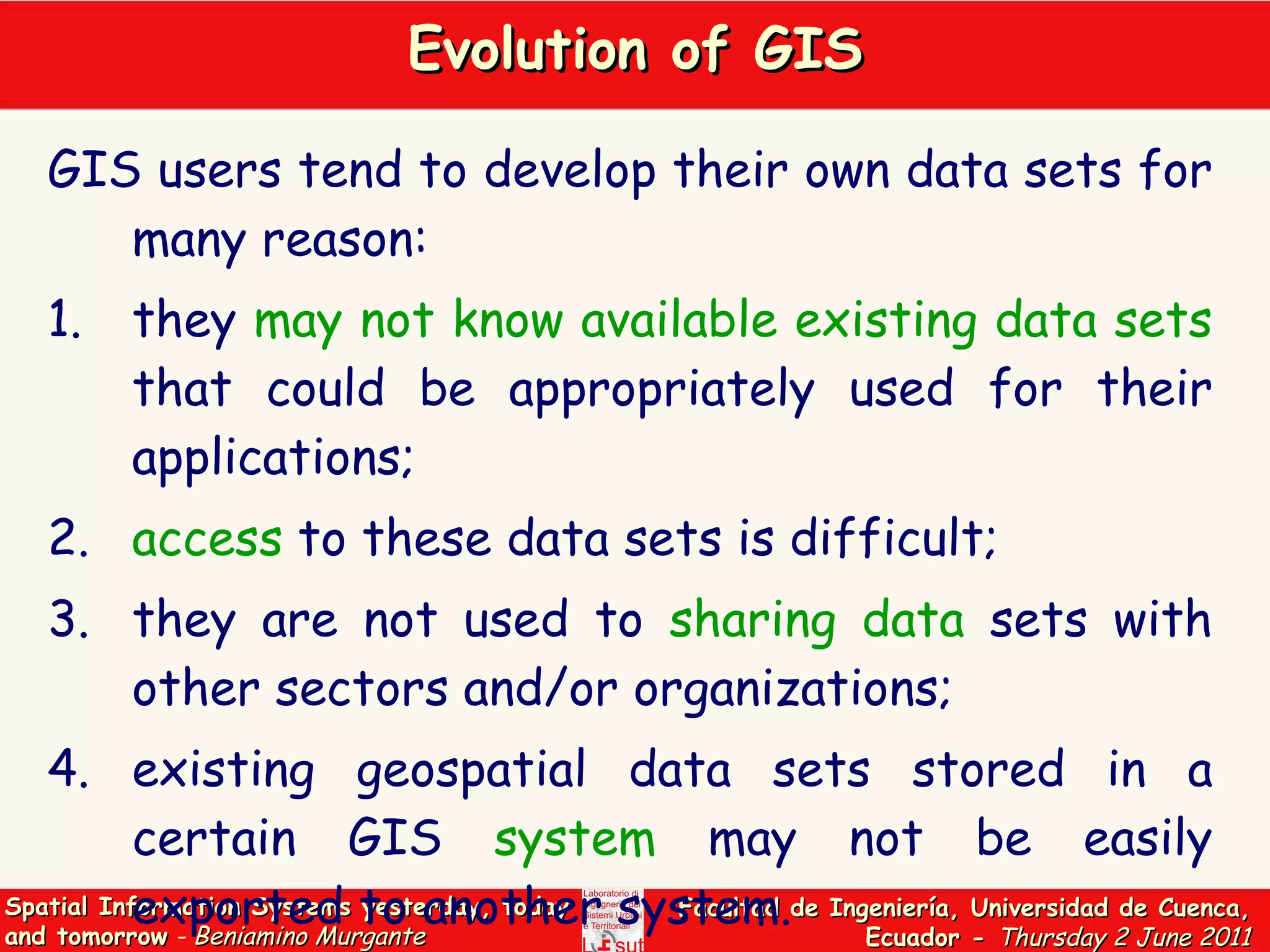
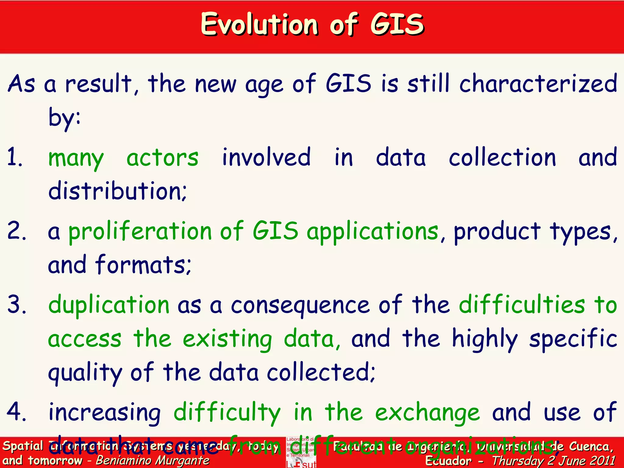
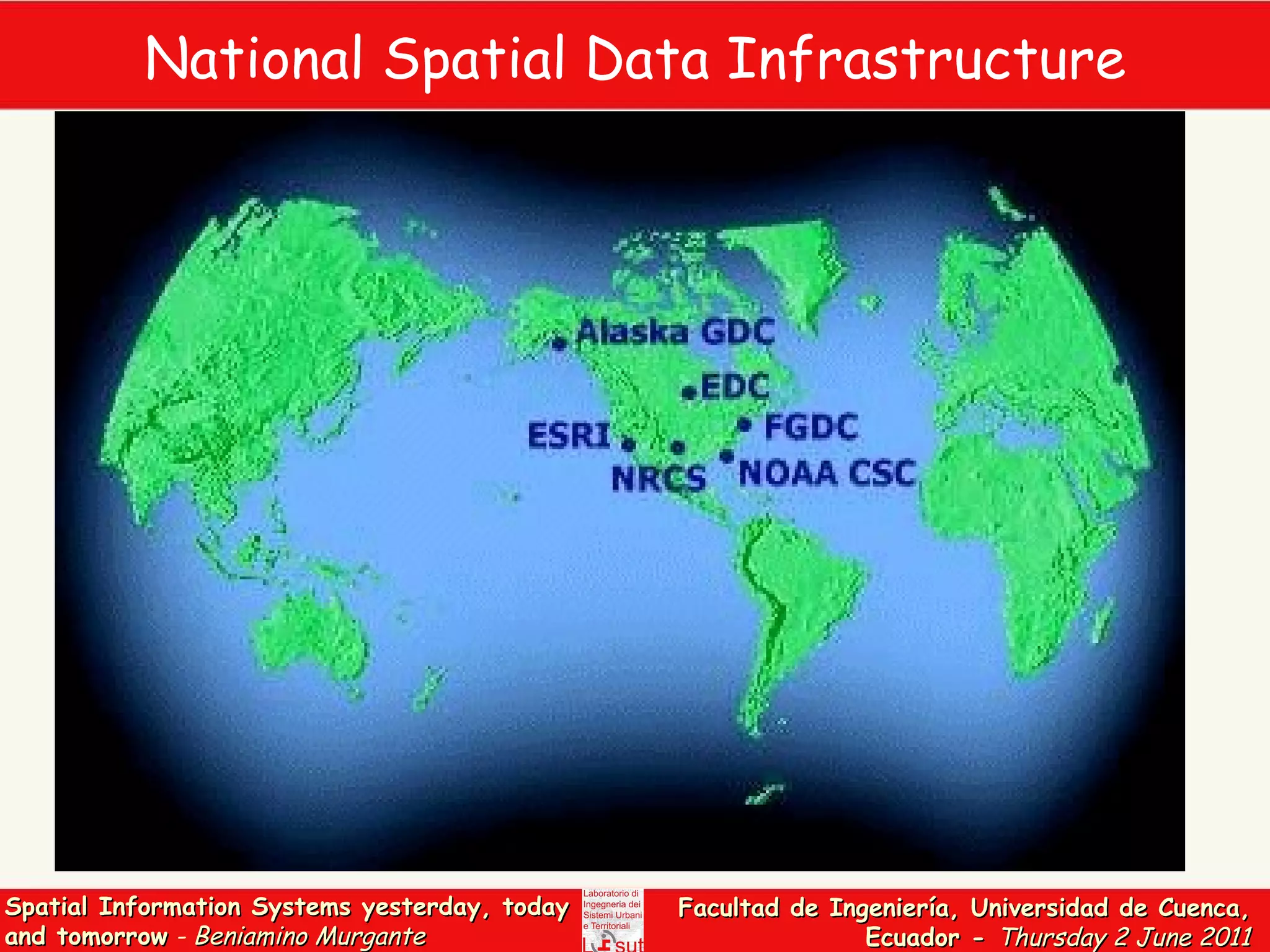
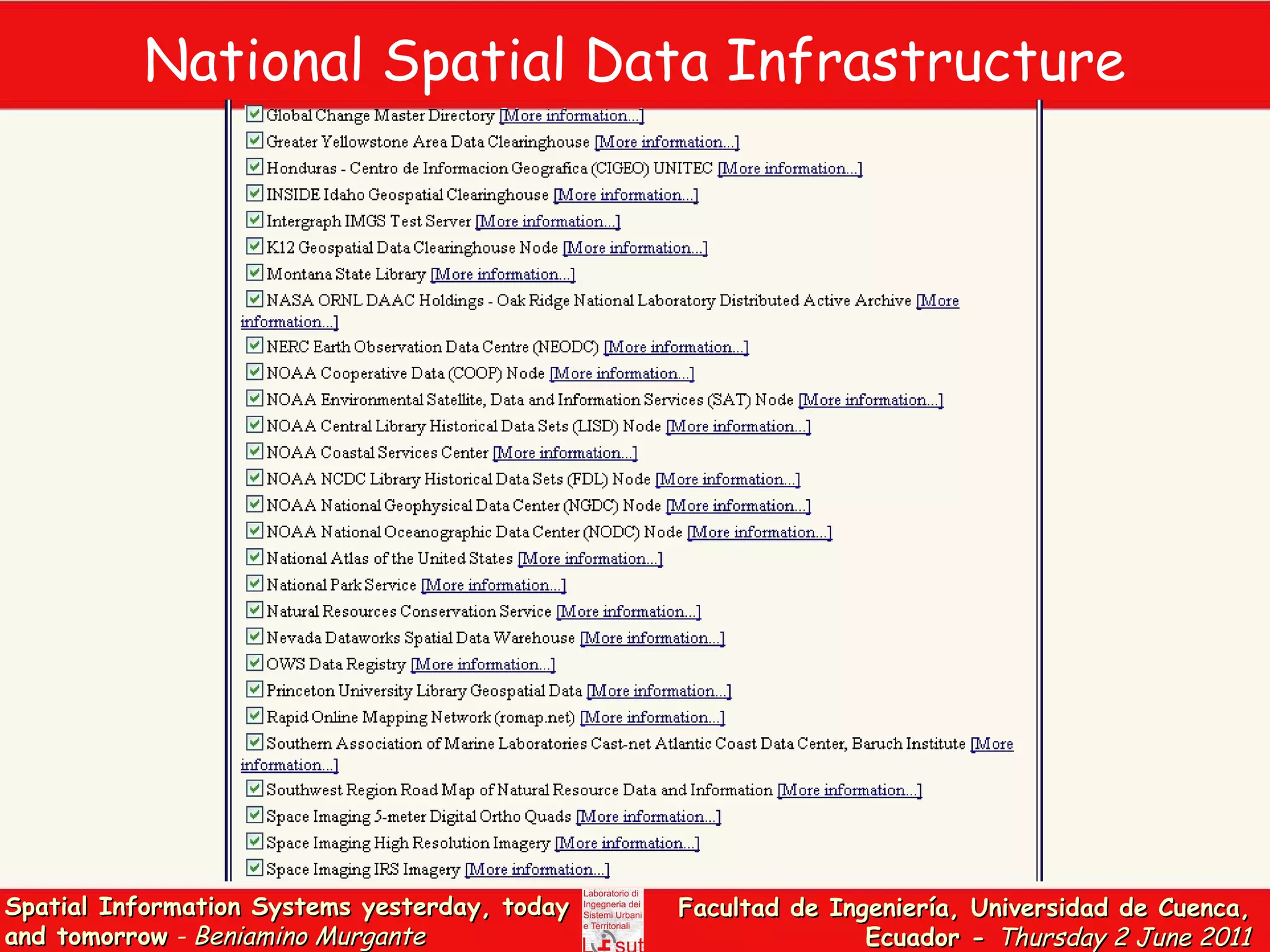
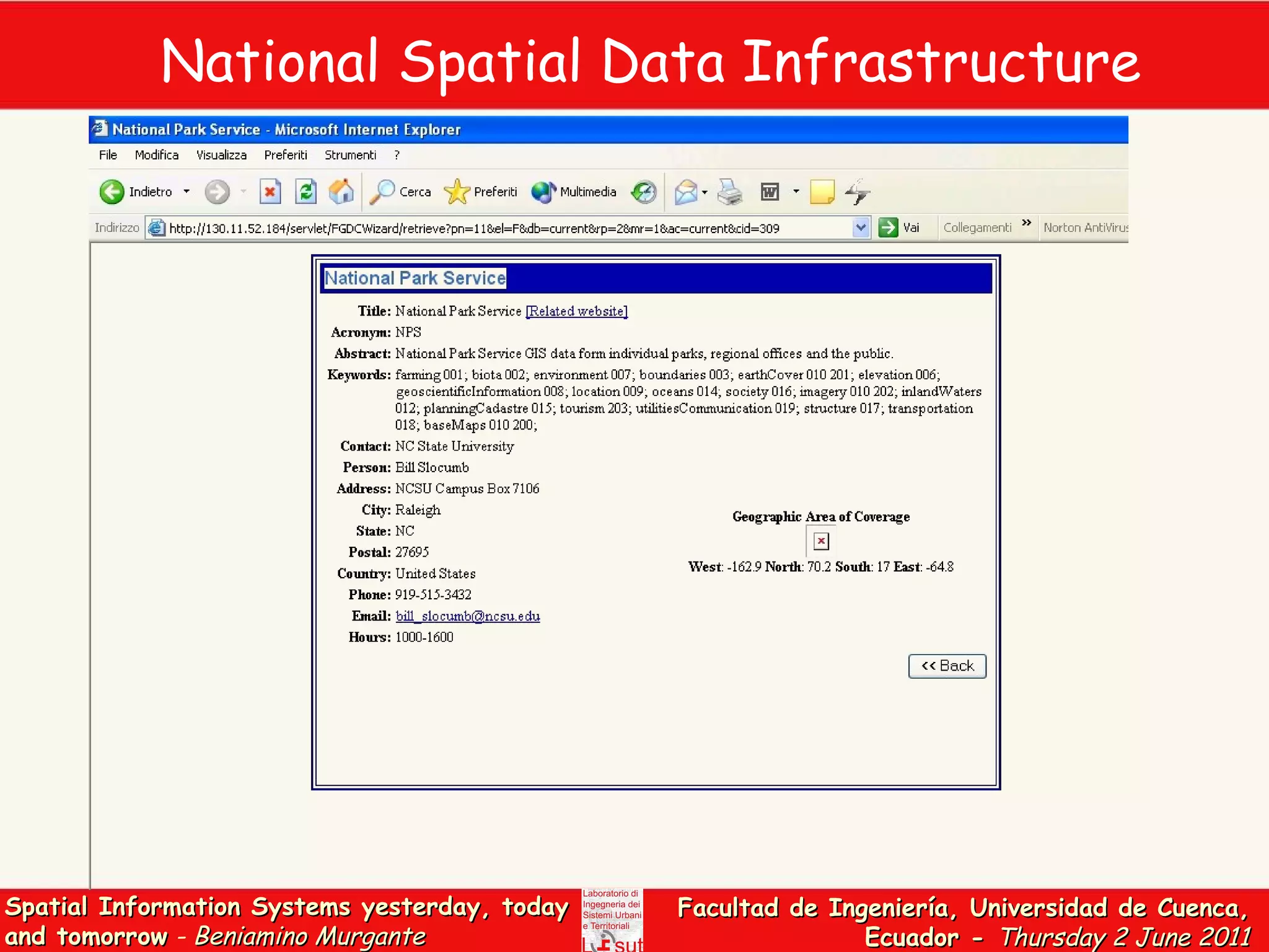
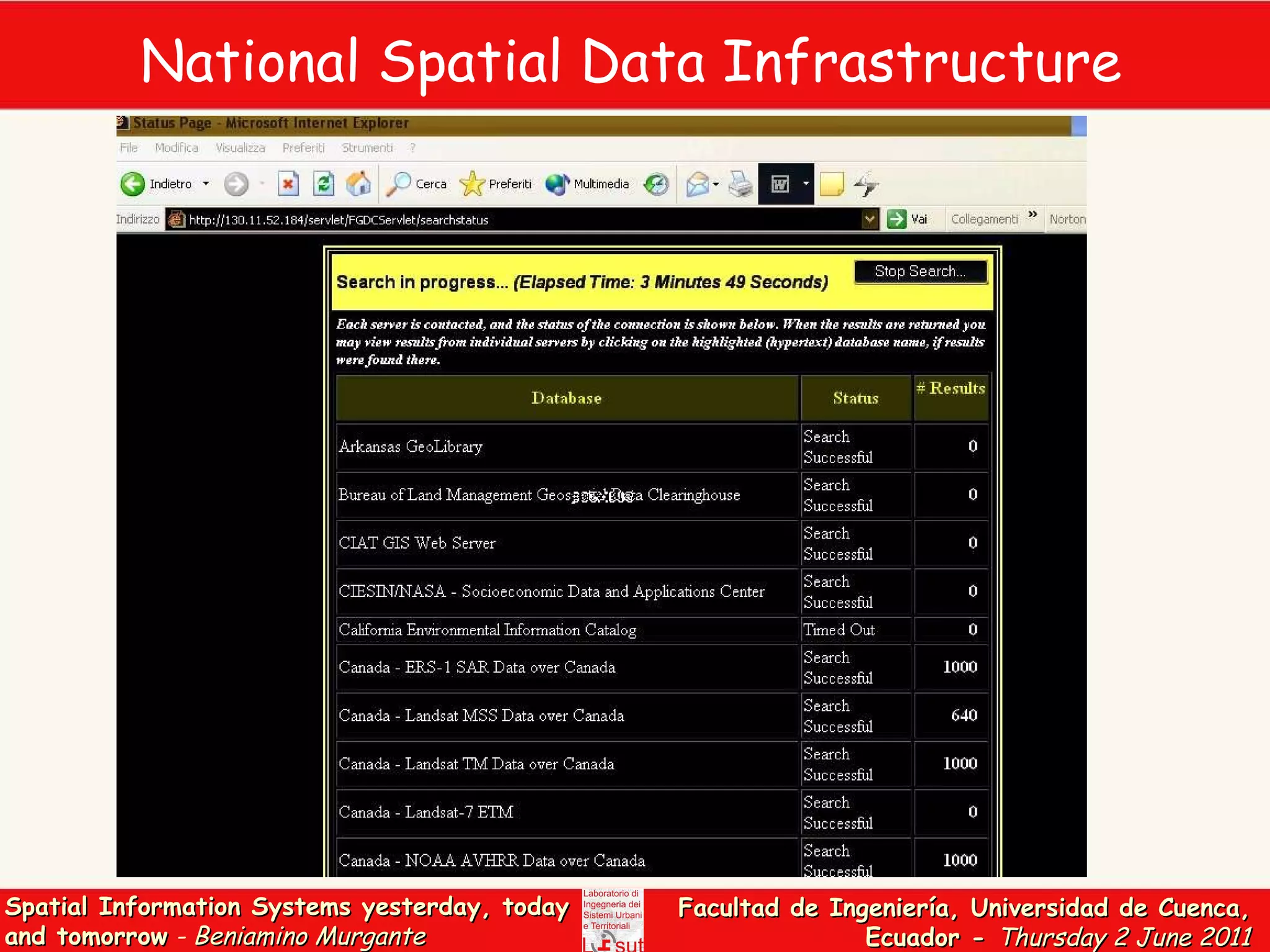
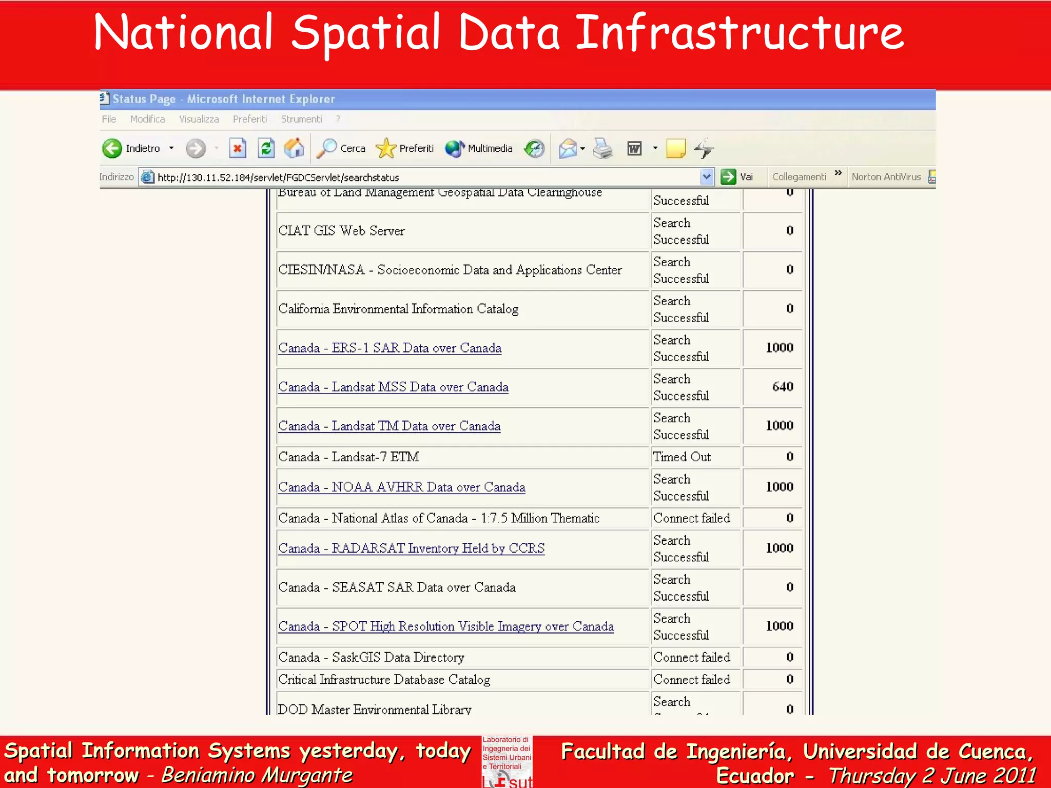
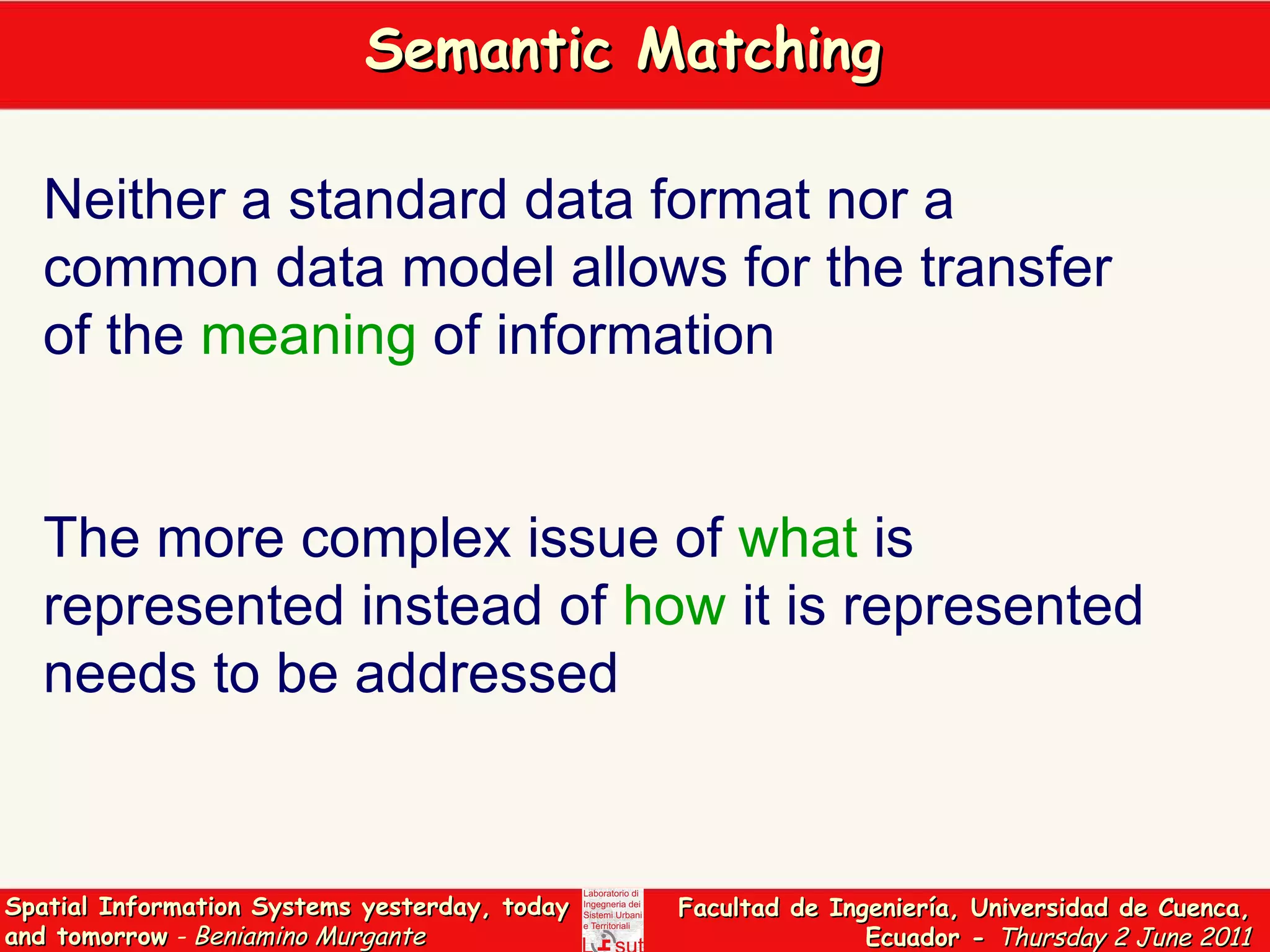
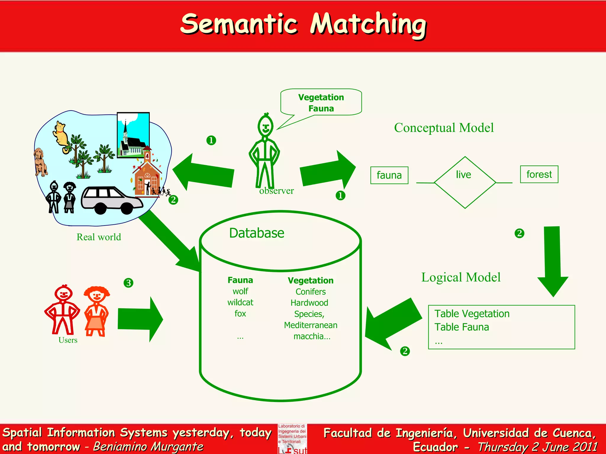
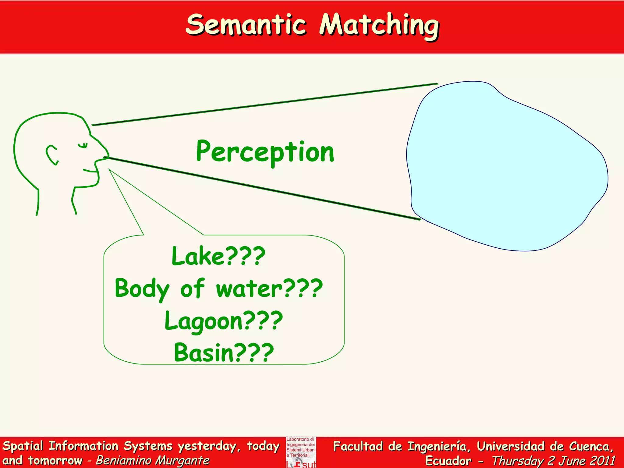
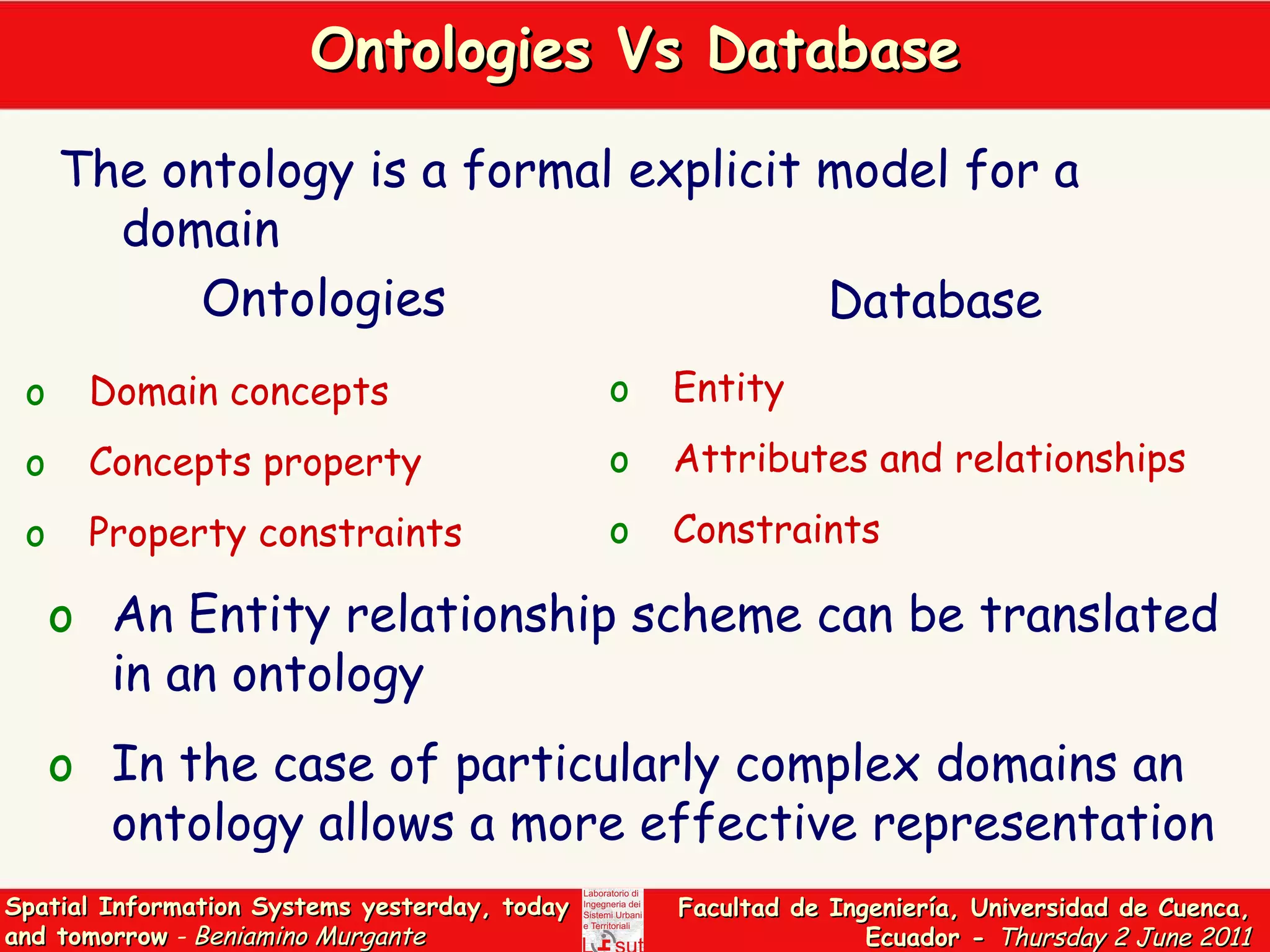
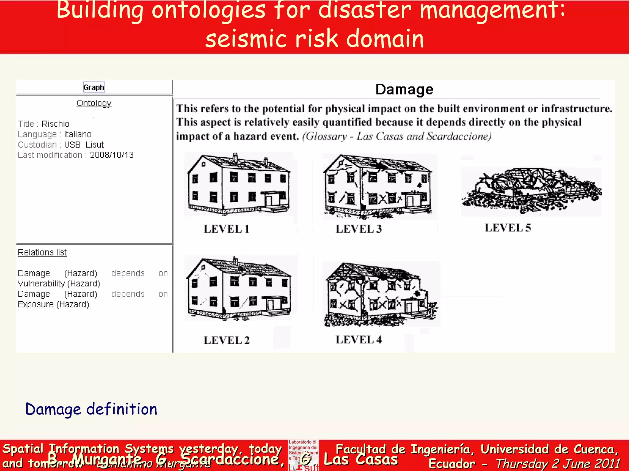
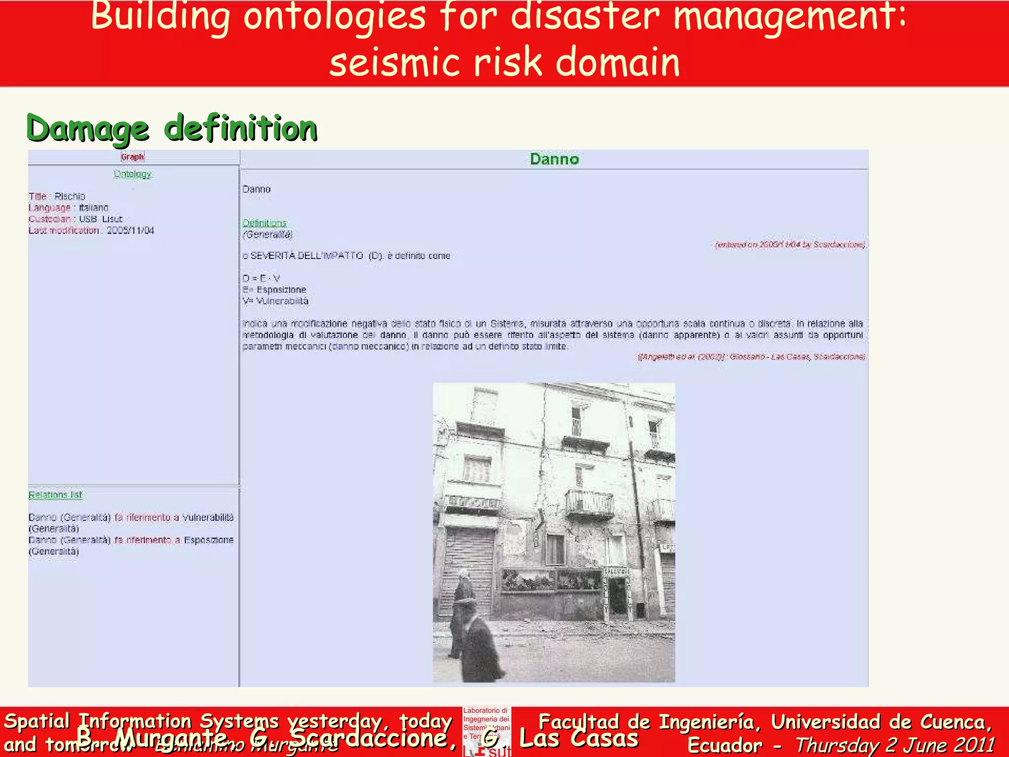
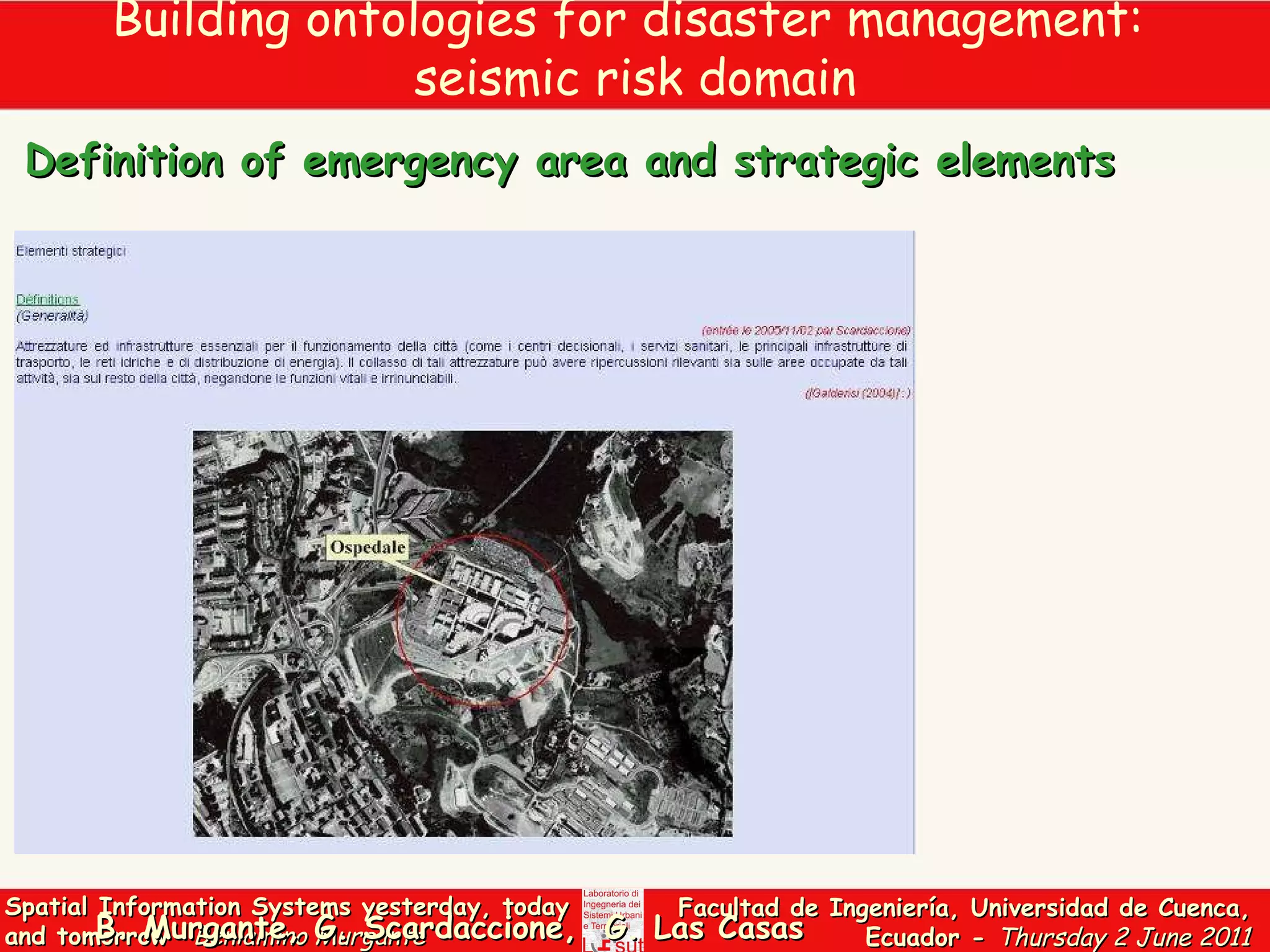
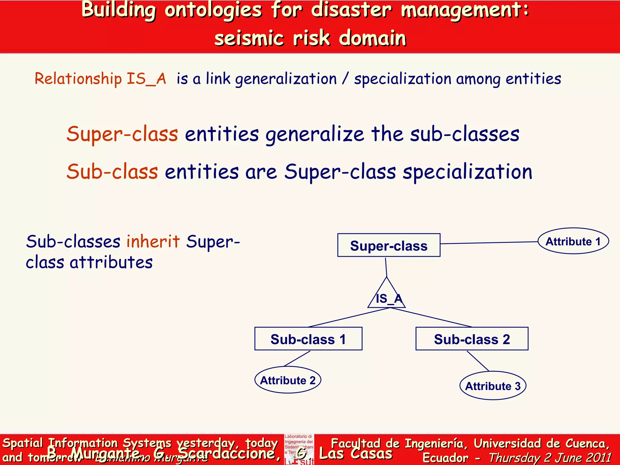
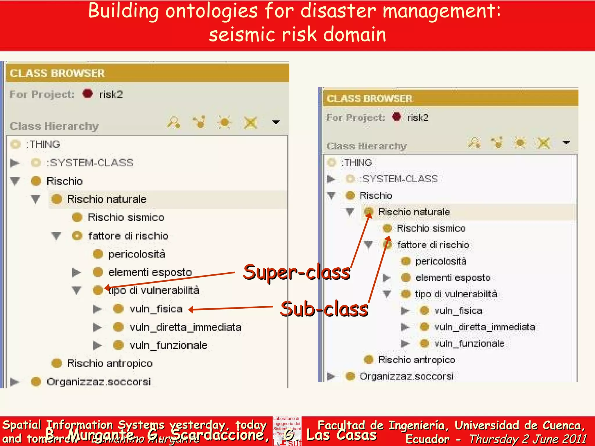
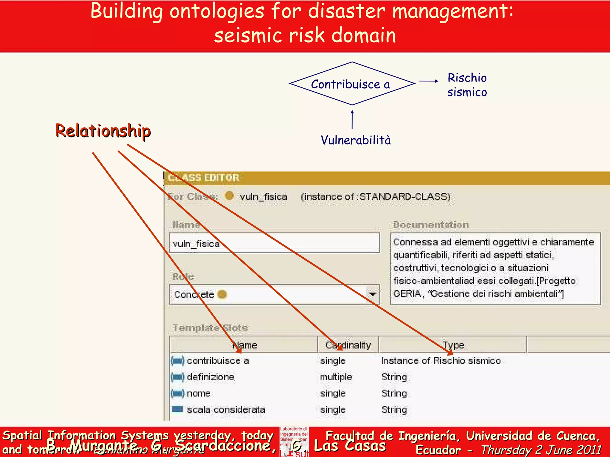
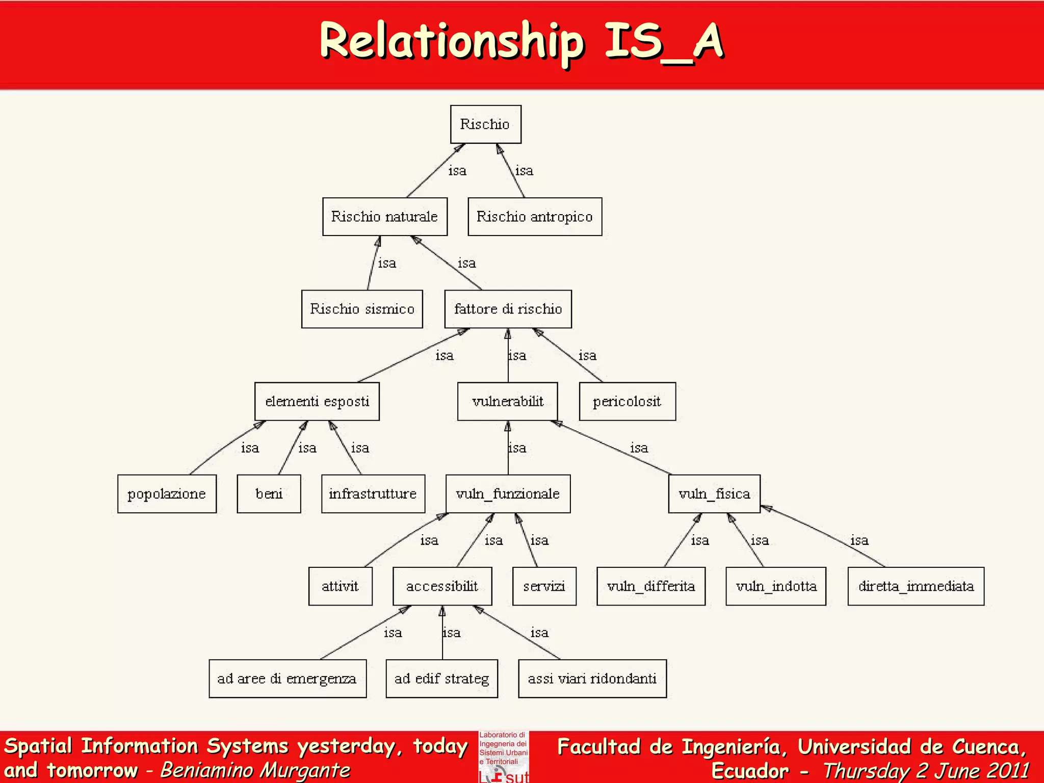
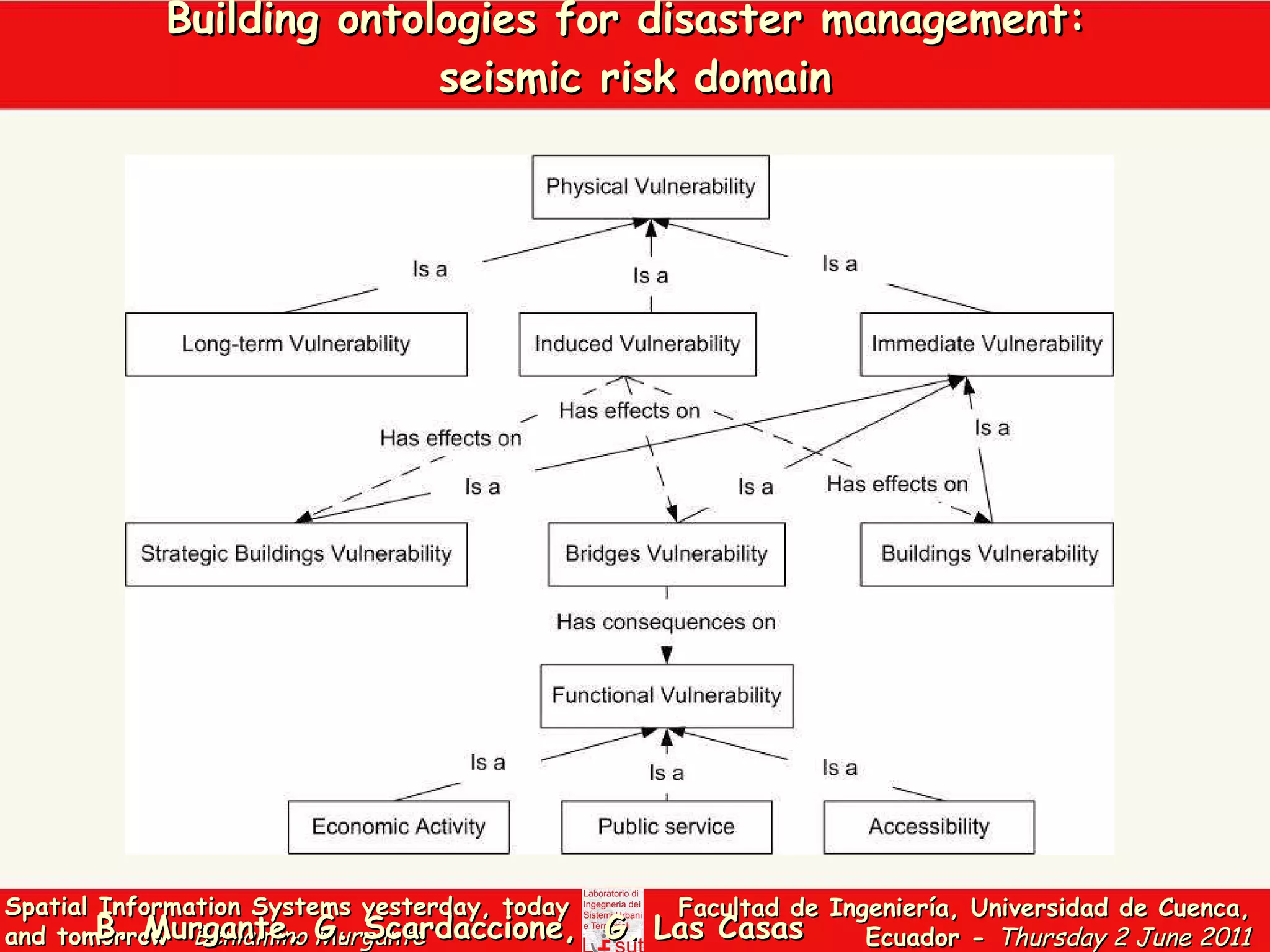
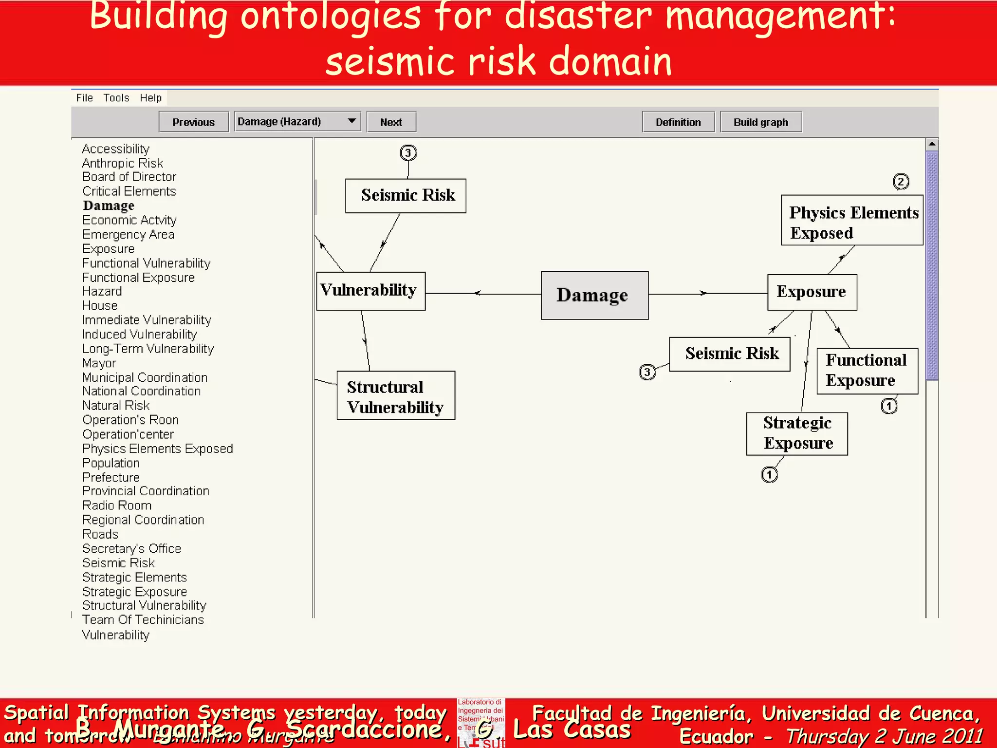
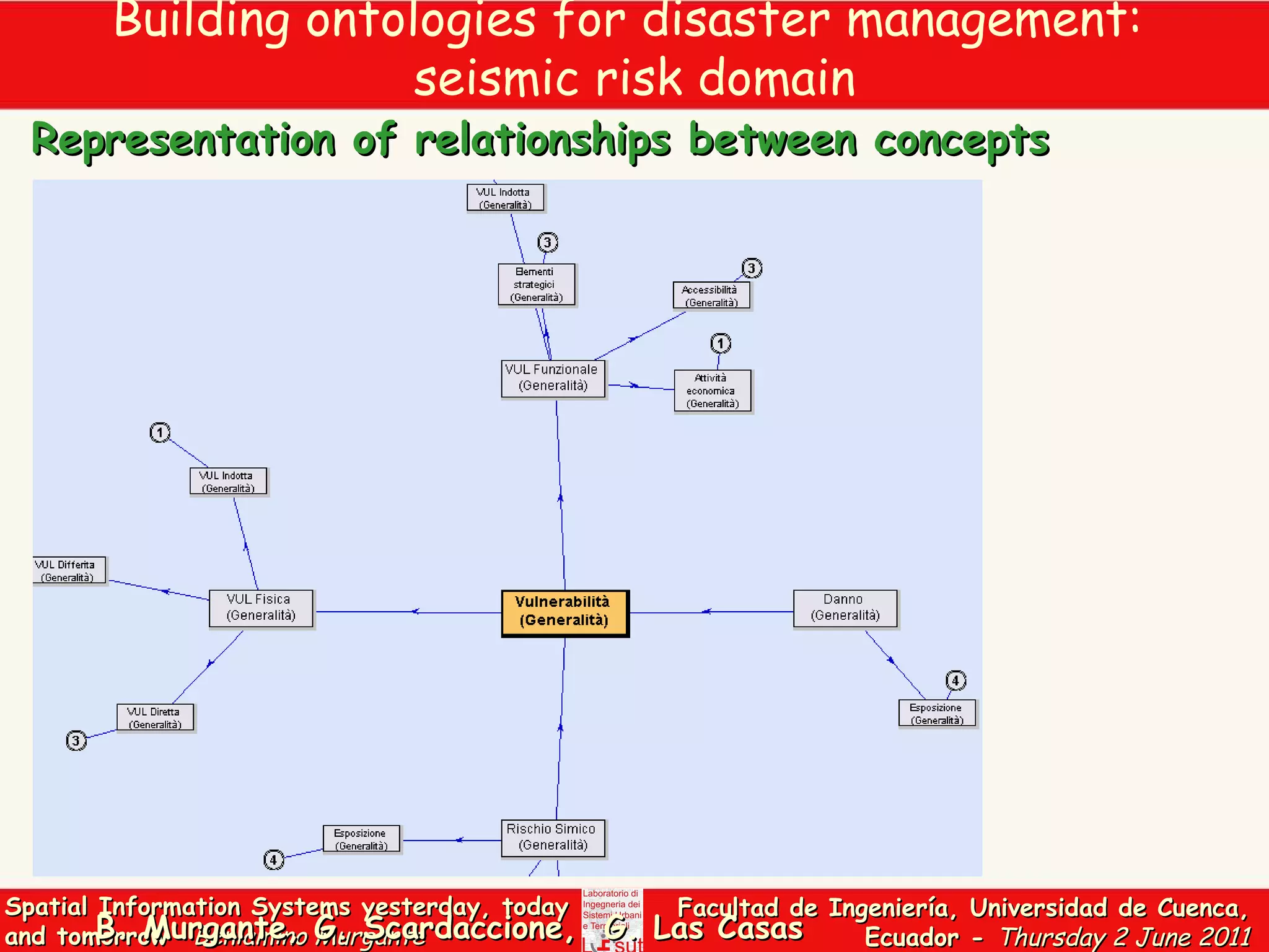
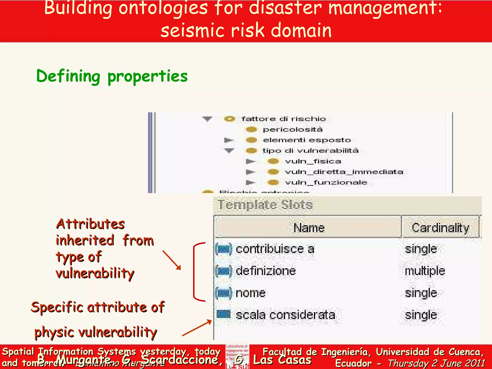

The document discusses the evolution of Geographic Information Systems (GIS) from historical perspectives to modern challenges, emphasizing the issues surrounding data accessibility and interoperability. It highlights the importance of the National Spatial Data Infrastructure and the role of ontologies in improving data exchange and semantic matching in GIS. Additionally, the document touches on collaborative data production methods such as volunteered geographic information and crowdsourcing.


