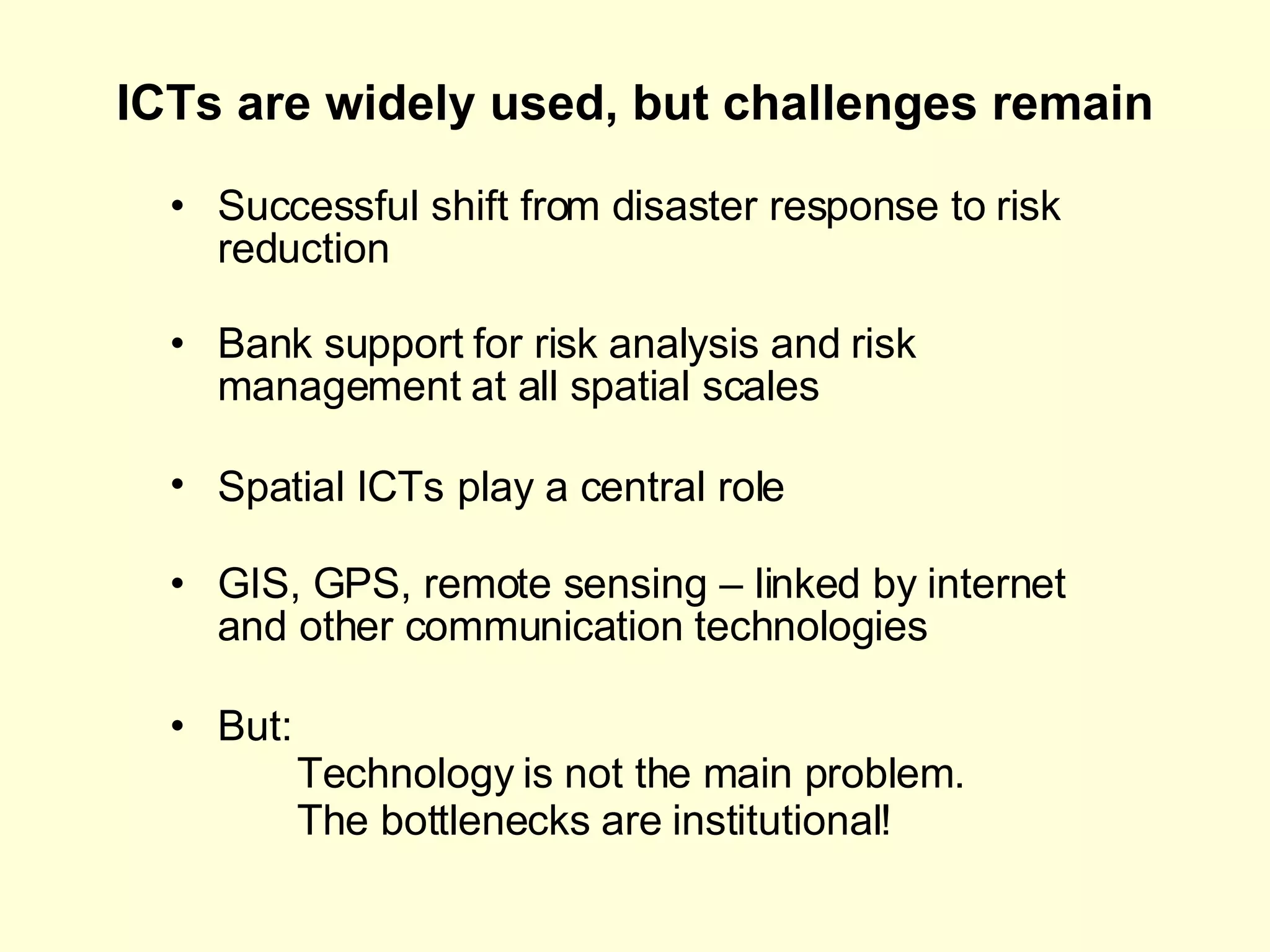
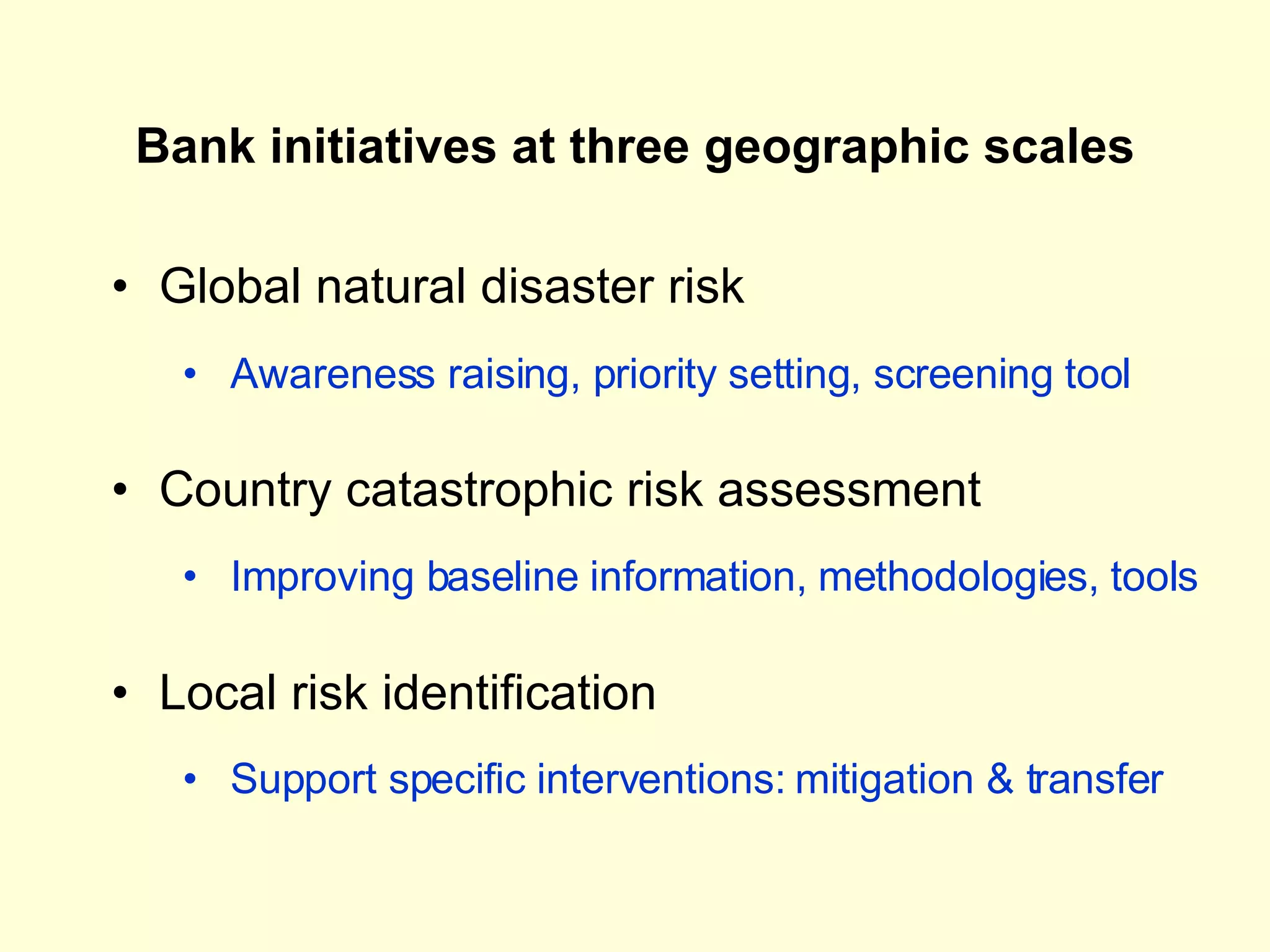
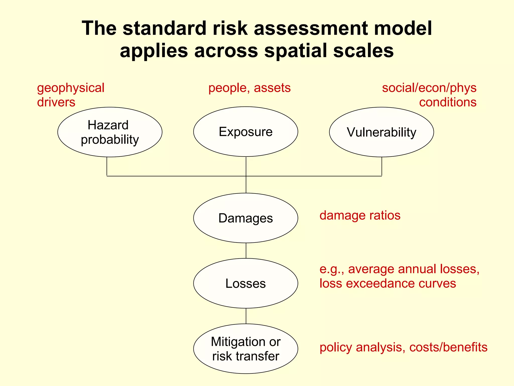
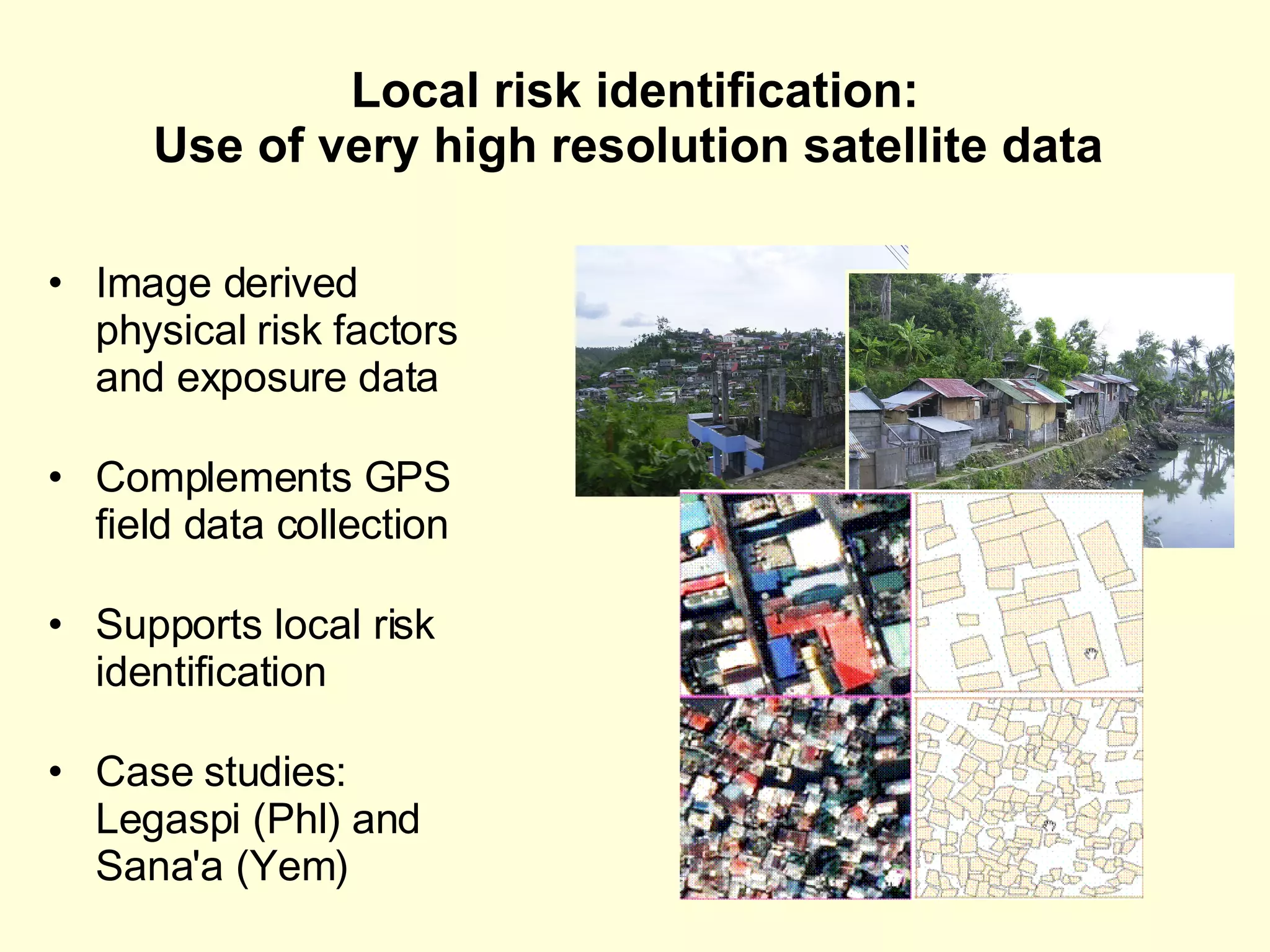
Spatial  ICTs for risk identification and risk reduction: Three geographic scales and three challenges Uwe Deichmann Development Research Group World Bank, Washington DC <udeichmann@worldbank.org> International Day on Disaster Risk Reduction at the World Bank Disaster Risk Management in the Information Age October 8-9, 2008
ICTs are widely used, but challenges remain Successful shift from disaster response to risk reduction Bank support for risk analysis and risk management at all spatial scales Spatial ICTs   play a central role GIS, GPS, remote sensing – linked by internet and other communication technologies But:  Technology is not the main problem.  The bottlenecks are institutional!
Bank initiatives at three geographic scales Global natural disaster risk Country catastrophic risk assessment Local risk identification Awareness raising, priority setting, screening tool Improving baseline information, methodologies, tools Support specific interventions: mitigation & transfer
The standard risk assessment model applies across spatial scales Damages Losses Mitigation or risk transfer policy analysis, costs/benefits e.g., average annual losses, loss exceedance curves damage ratios Hazard  probability Exposure Vulnerability people, assets social/econ/phys conditions geophysical drivers
Combining information on hazards … Severe Storms, 1981 - 2000 World Bank/Columbia University: Natural Disaster Hotspots Study 2005 based on storm track data compiled by UNEP-GRID Geneva Cyclone Frequency Global Analysis: Natural Disaster Risk Hotspots
…  and exposure … Population distribution
…  to generate risk profiles Multi-hazard mortality risk hotspots  Updated global analysis forthcoming in the  UN/WB Global Assessment Report on Disaster Risk Reduction 2009
Country catastrophic risk assessment Operational risk assessments E.g., Central America Probabilistic Risk Assessment National level assessments in hotspot countries Knowledge management: tools and guidance MIRISK  open source tool for risk assessment and guidelines on what to do about it “ Guidance Note for Common Country Catastrophic Risk Assessment Methodology (C3RAM)”, GFDRR Post disaster information sharing: “Using Data for Disaster Response” (PREM/GFDRR)
Local risk identification: Use of very high resolution satellite data  Image derived physical risk factors and exposure data Complements GPS field data collection Supports local risk identification Case studies: Legaspi (Phl) and Sana'a (Yem)
Challenges Capacity  Insufficient at local levels Leading to highly centralized disaster management Coordination  Inter-agency coordination within countries Internationally (UN/national/NGOs) during  disaster response Content Data and tools: limited access and black box models Data readiness
What to do Capacity Learn from decentralization of other government functions Invest in learning at the local level Coordination Use mix of incentives and enforcement while minimizing coordination costs (e.g., spatial data infrastructure) High level agreements on binding protocols for IT use during disaster response  Content Invest in data and analytical tools as public goods  Ensure data readiness well before disaster strikes

Spatial ICTs for risk identification and risk reduction: Three geographic scales and three challenges

  • 1.
    Spatial ICTsfor risk identification and risk reduction: Three geographic scales and three challenges Uwe Deichmann Development Research Group World Bank, Washington DC <udeichmann@worldbank.org> International Day on Disaster Risk Reduction at the World Bank Disaster Risk Management in the Information Age October 8-9, 2008
  • 2.
    ICTs are widelyused, but challenges remain Successful shift from disaster response to risk reduction Bank support for risk analysis and risk management at all spatial scales Spatial ICTs play a central role GIS, GPS, remote sensing – linked by internet and other communication technologies But: Technology is not the main problem. The bottlenecks are institutional!
  • 3.
    Bank initiatives atthree geographic scales Global natural disaster risk Country catastrophic risk assessment Local risk identification Awareness raising, priority setting, screening tool Improving baseline information, methodologies, tools Support specific interventions: mitigation & transfer
  • 4.
    The standard riskassessment model applies across spatial scales Damages Losses Mitigation or risk transfer policy analysis, costs/benefits e.g., average annual losses, loss exceedance curves damage ratios Hazard probability Exposure Vulnerability people, assets social/econ/phys conditions geophysical drivers
  • 5.
    Combining information onhazards … Severe Storms, 1981 - 2000 World Bank/Columbia University: Natural Disaster Hotspots Study 2005 based on storm track data compiled by UNEP-GRID Geneva Cyclone Frequency Global Analysis: Natural Disaster Risk Hotspots
  • 6.
    … andexposure … Population distribution
  • 7.
    … togenerate risk profiles Multi-hazard mortality risk hotspots Updated global analysis forthcoming in the UN/WB Global Assessment Report on Disaster Risk Reduction 2009
  • 8.
    Country catastrophic riskassessment Operational risk assessments E.g., Central America Probabilistic Risk Assessment National level assessments in hotspot countries Knowledge management: tools and guidance MIRISK open source tool for risk assessment and guidelines on what to do about it “ Guidance Note for Common Country Catastrophic Risk Assessment Methodology (C3RAM)”, GFDRR Post disaster information sharing: “Using Data for Disaster Response” (PREM/GFDRR)
  • 9.
    Local risk identification:Use of very high resolution satellite data Image derived physical risk factors and exposure data Complements GPS field data collection Supports local risk identification Case studies: Legaspi (Phl) and Sana'a (Yem)
  • 10.
    Challenges Capacity Insufficient at local levels Leading to highly centralized disaster management Coordination Inter-agency coordination within countries Internationally (UN/national/NGOs) during disaster response Content Data and tools: limited access and black box models Data readiness
  • 11.
    What to doCapacity Learn from decentralization of other government functions Invest in learning at the local level Coordination Use mix of incentives and enforcement while minimizing coordination costs (e.g., spatial data infrastructure) High level agreements on binding protocols for IT use during disaster response Content Invest in data and analytical tools as public goods Ensure data readiness well before disaster strikes