Download as KEY, PPTX


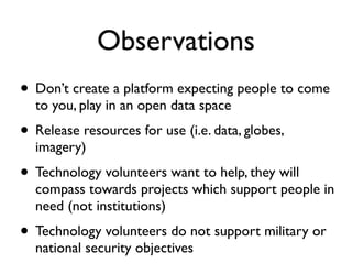
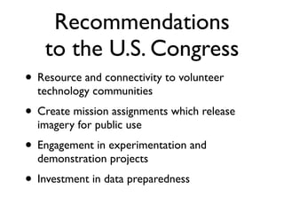


The document discusses the use of geospatial technologies in crisis response, emphasizing the importance of community involvement and innovative approaches during disasters. It highlights key lessons learned, such as the need for data preparedness and the effective harnessing of local resources and technology volunteers. The author makes recommendations to enhance collaboration and resource access among volunteer technology communities and government agencies.


![Participatory [Citizen] Science](https://cdn.slidesharecdn.com/ss_thumbnails/haklay-ecsa2016-160519212623-thumbnail.jpg?width=640&height=640&fit=bounds)


