Downloaded 139 times


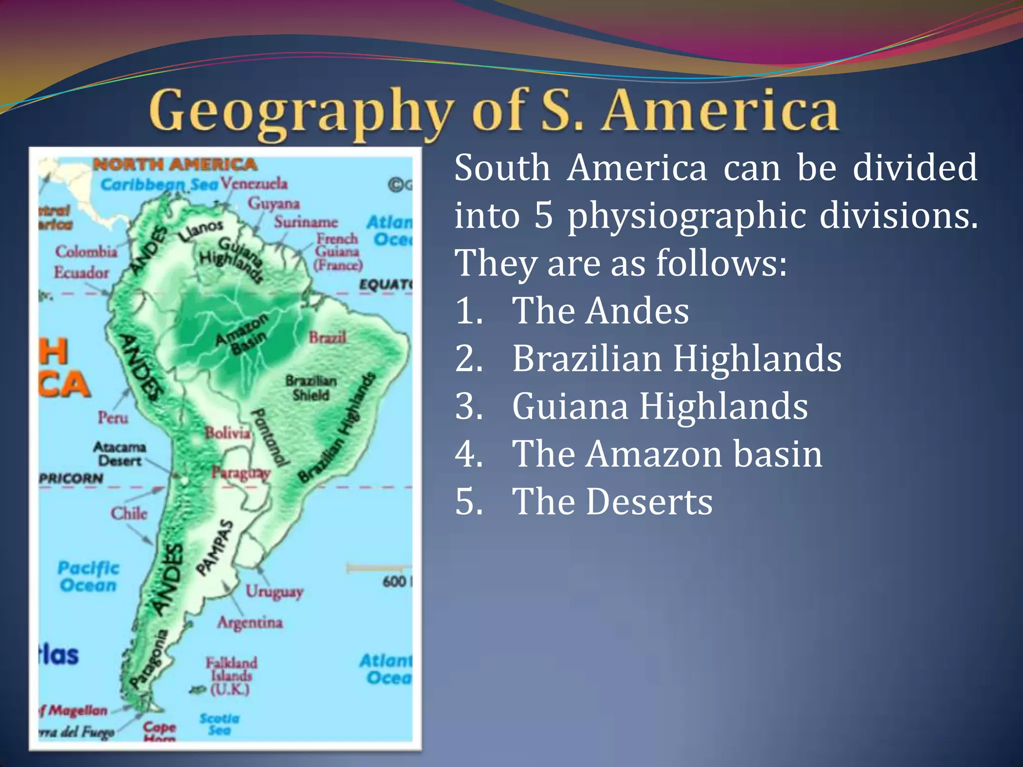


South America consists of 13 independent countries and 6 dependencies. It ranks 4th in area and 5th in population. The continent can be divided into 5 physiographic divisions - the Andes mountains, Brazilian Highlands, Guiana Highlands, Amazon basin, and the deserts. The Andes are the longest continental mountain range in the world, running along the western edge of South America. They contain the highest point in both South America and the southern hemisphere, Mount Aconcagua.


