Download as PDF, PPTX
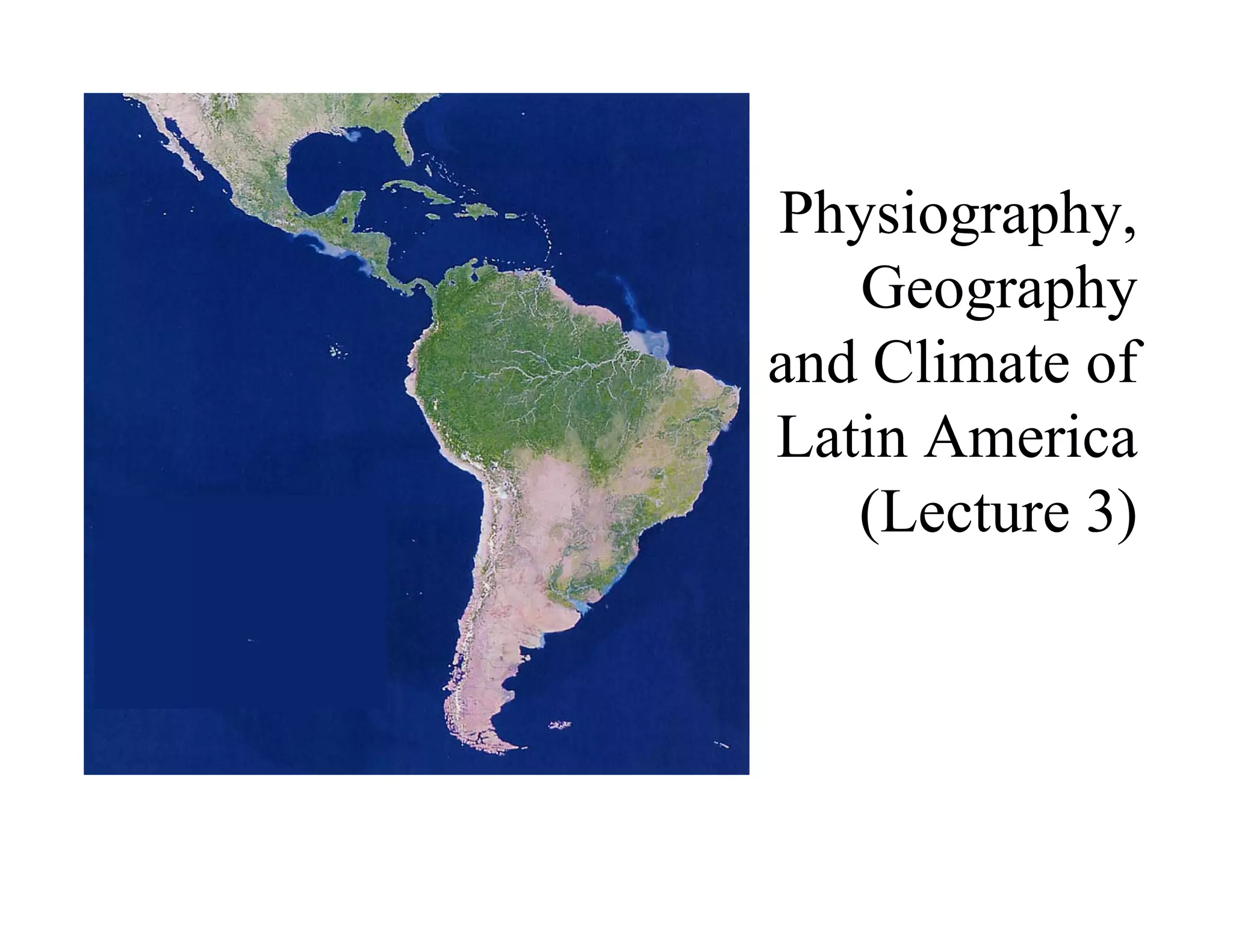
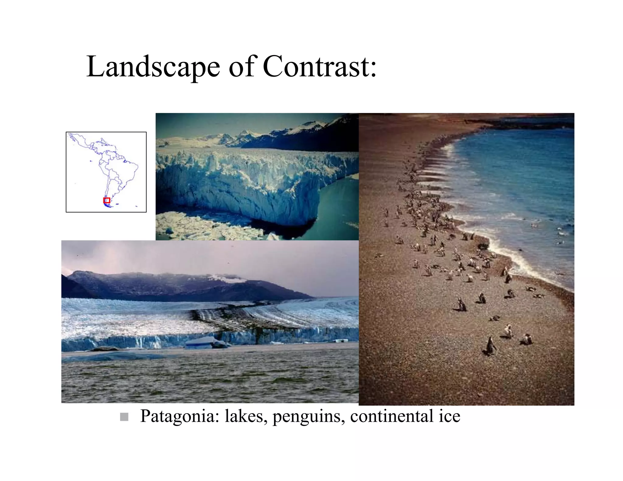


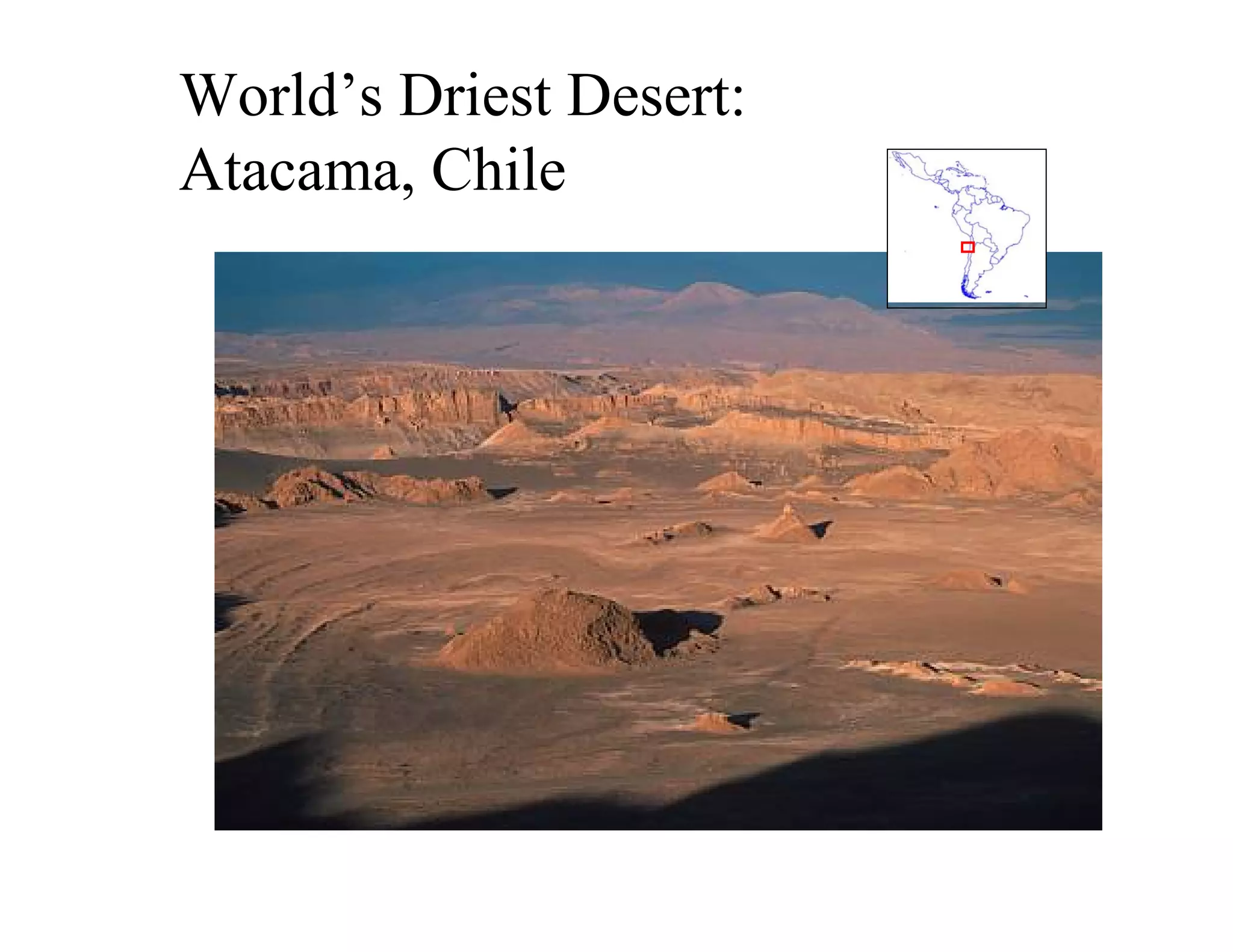
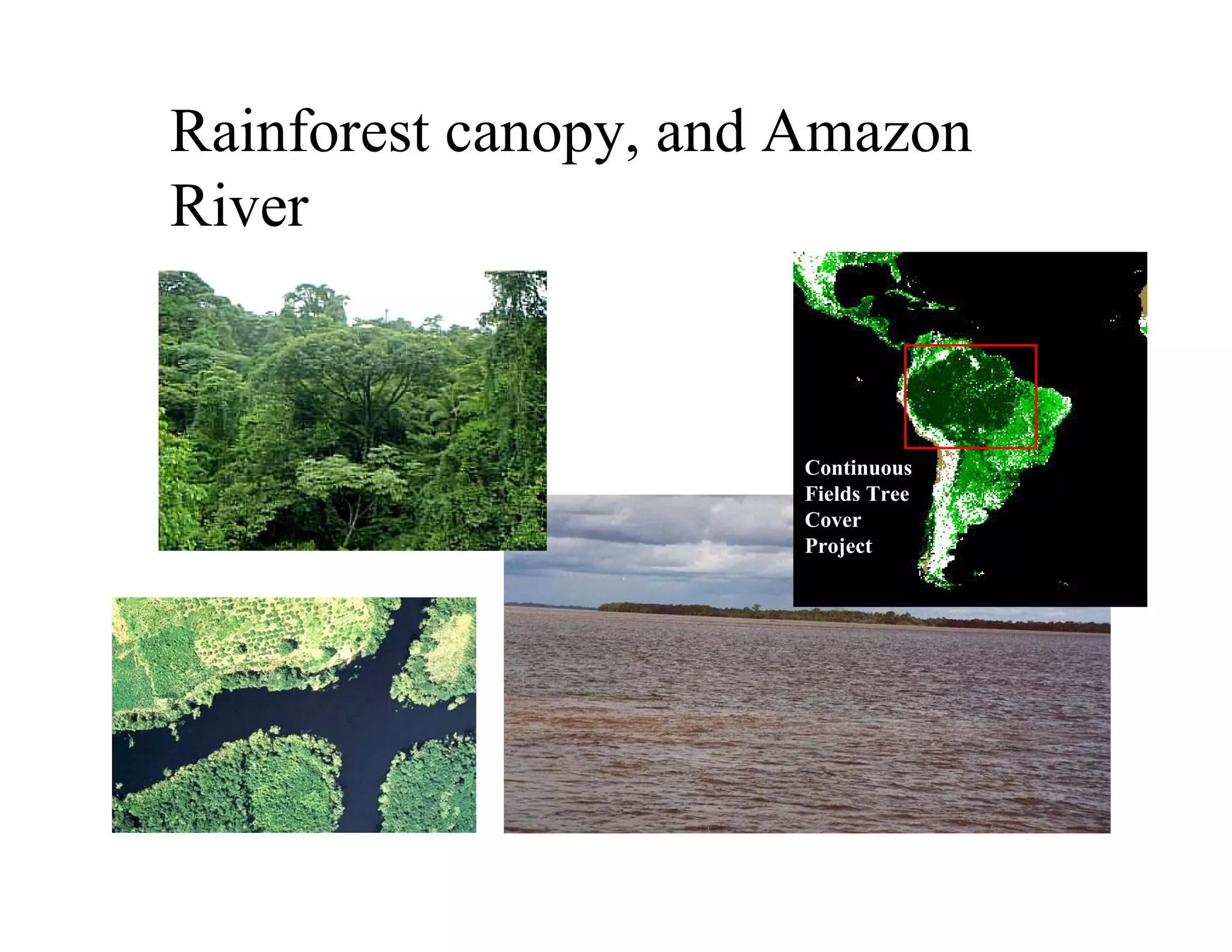
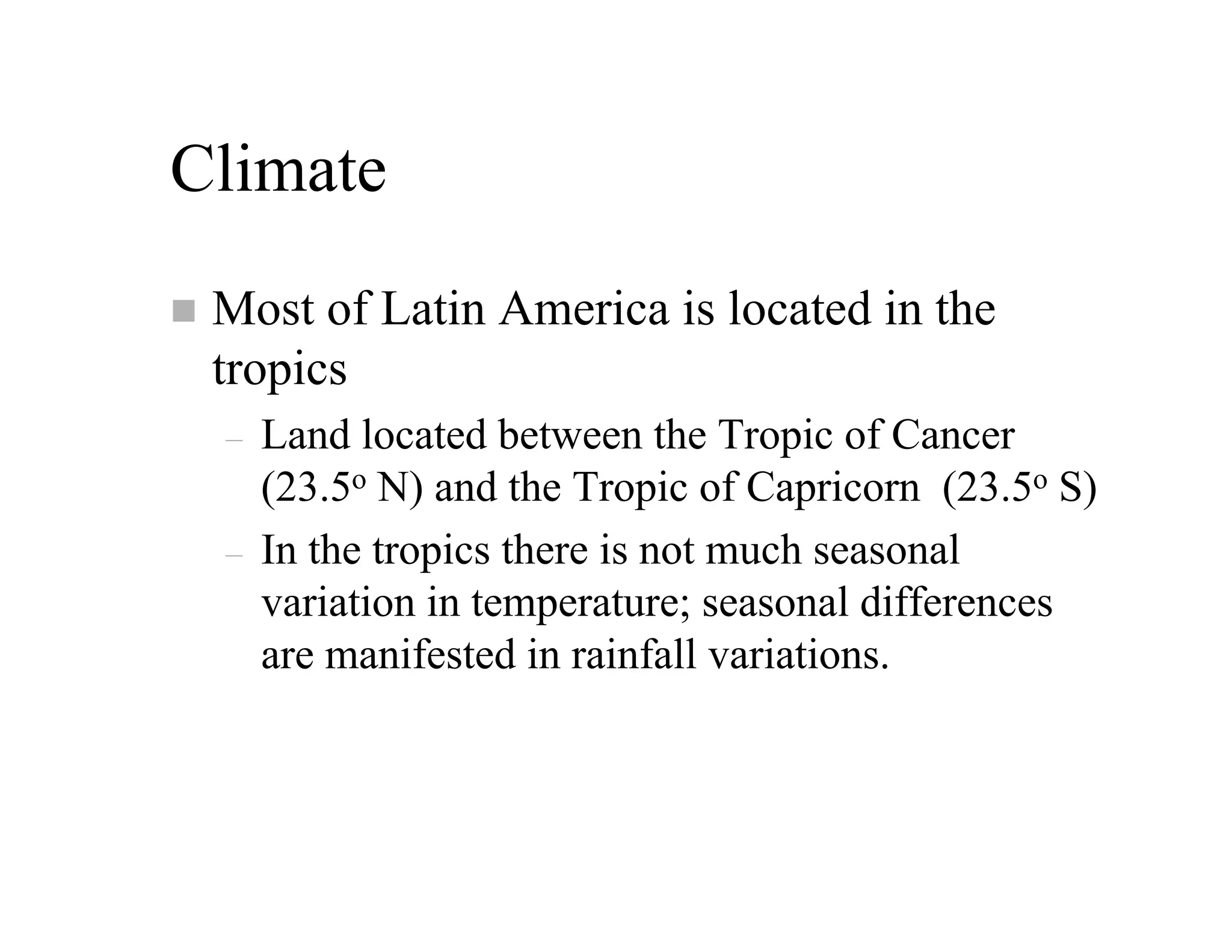
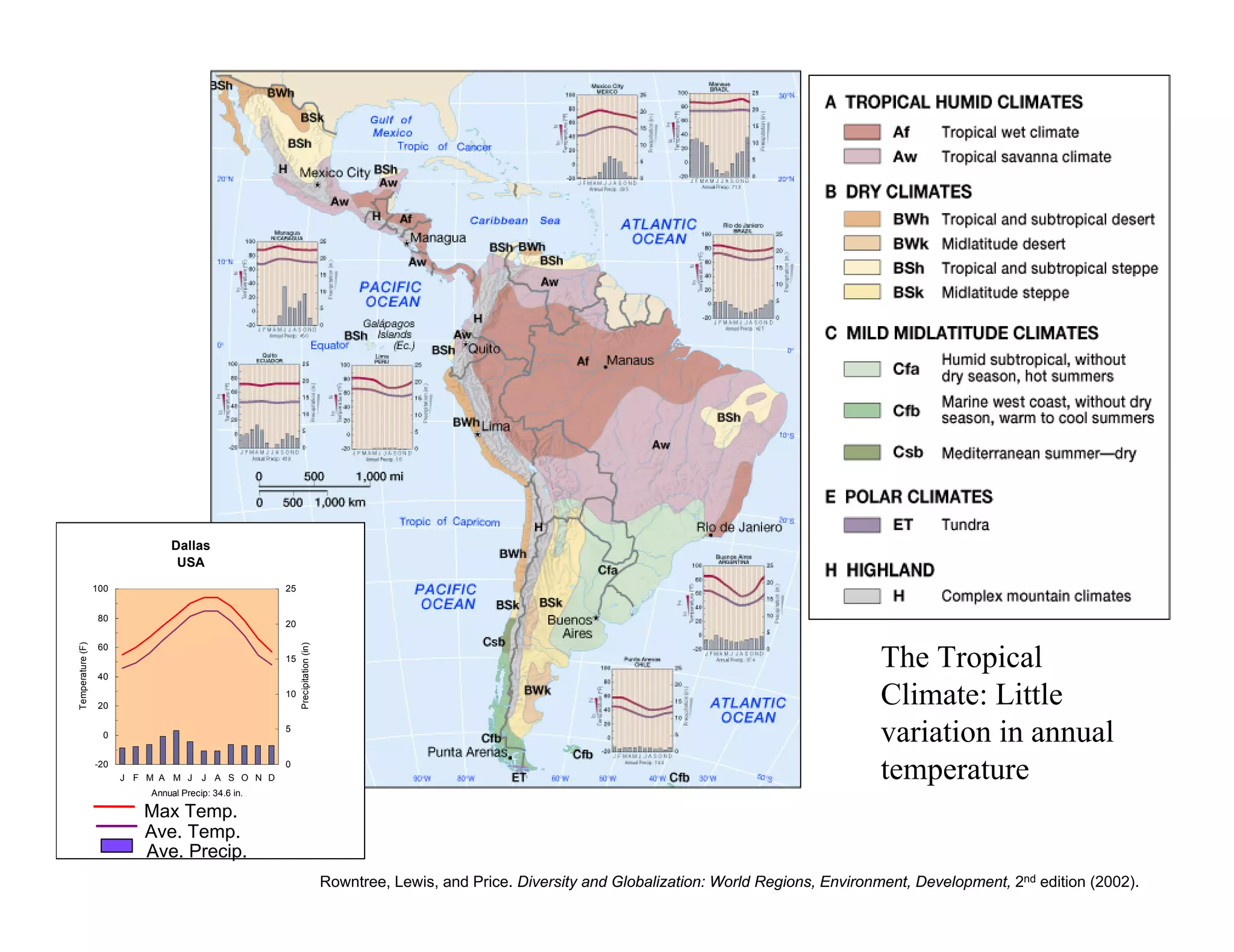
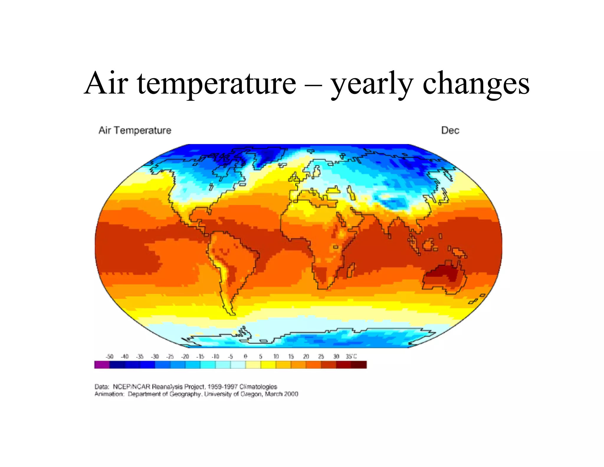
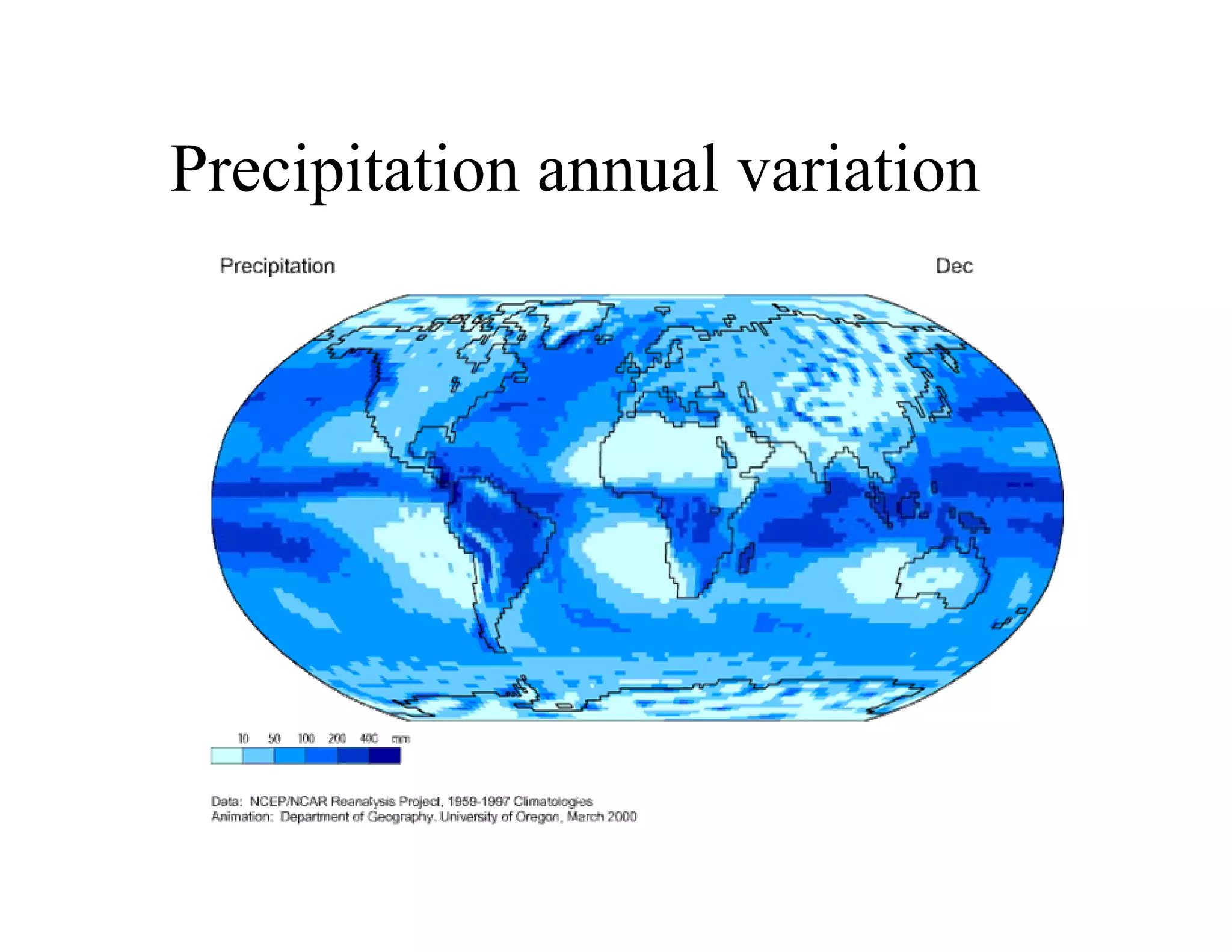
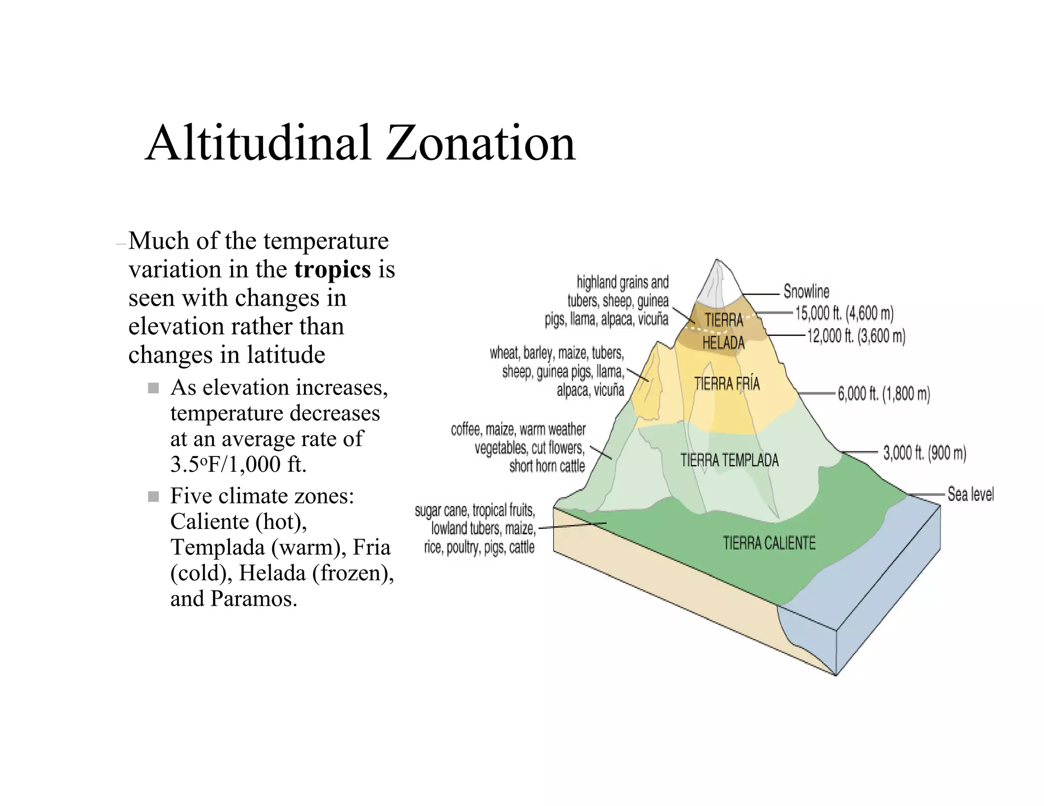
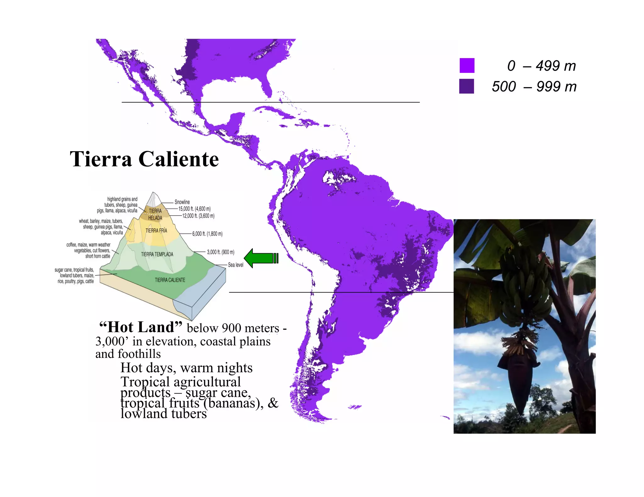
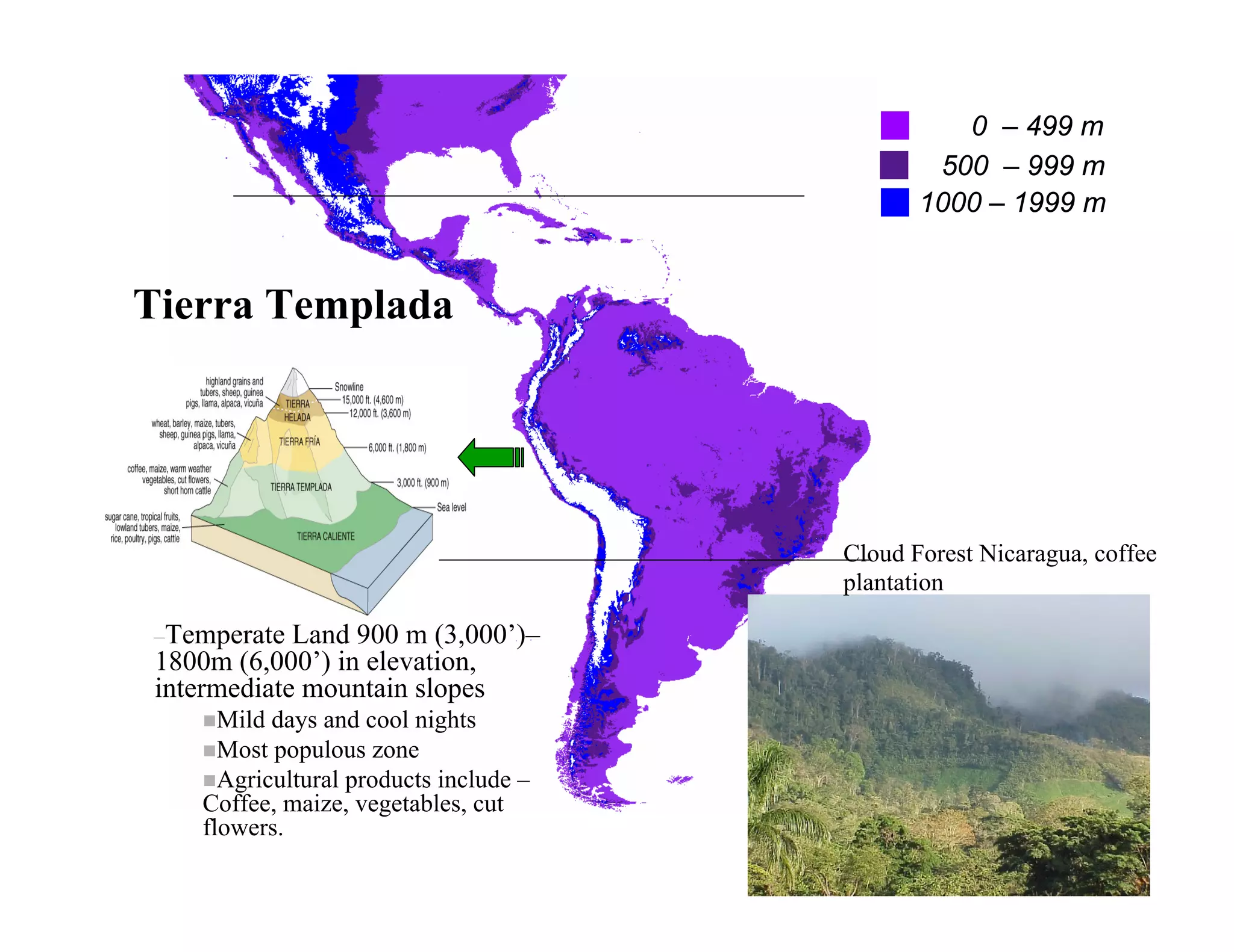
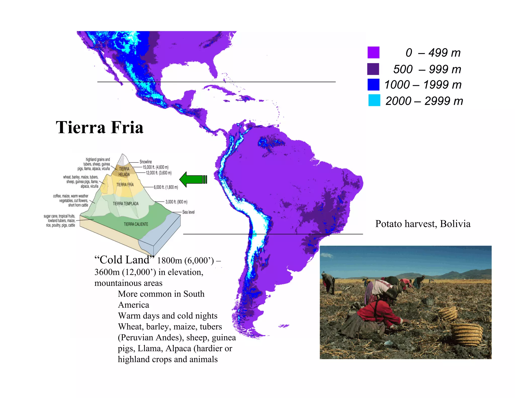
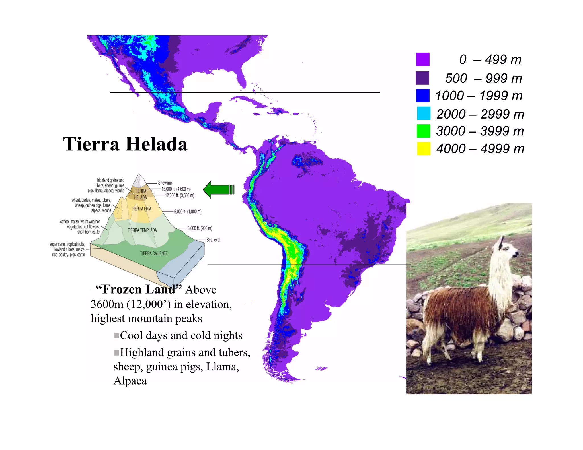
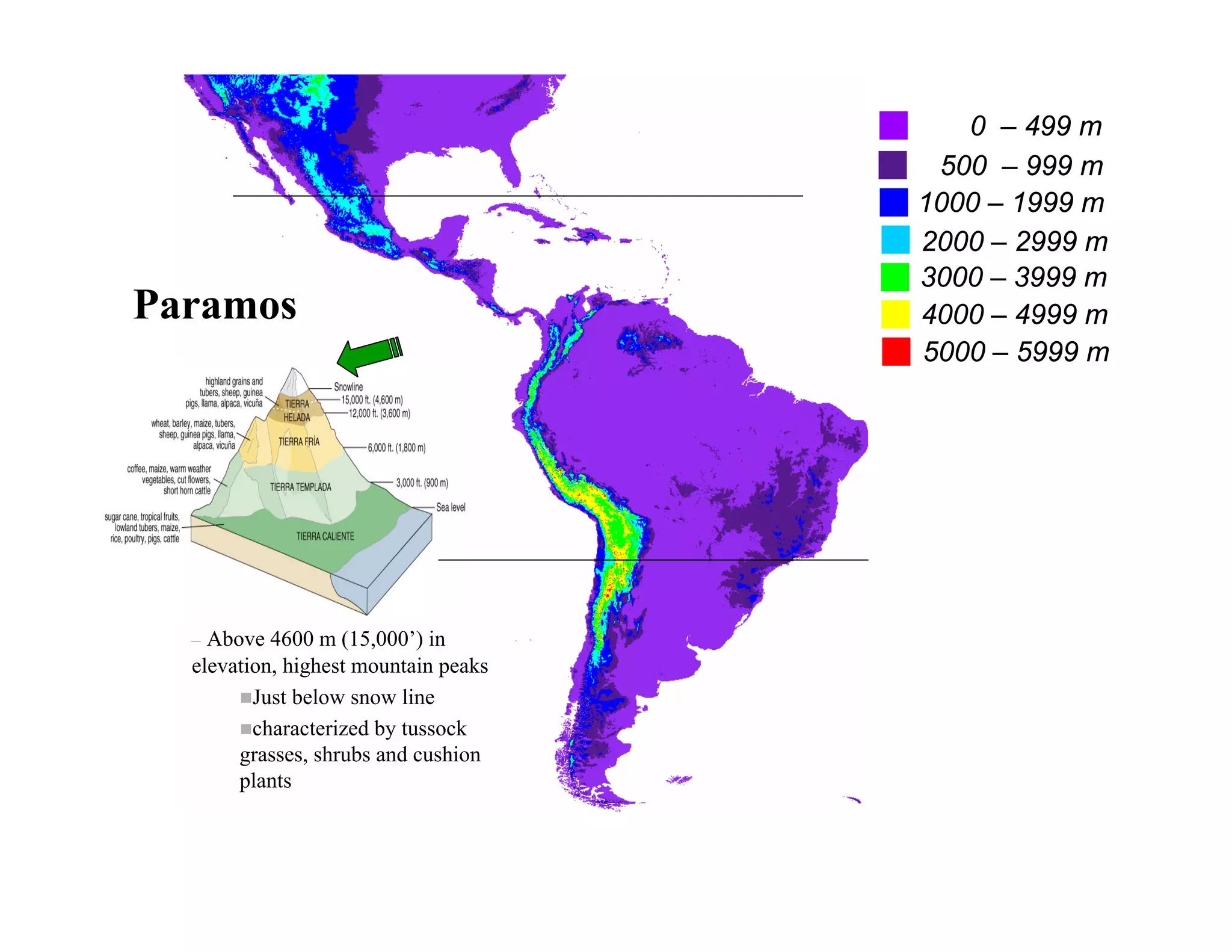
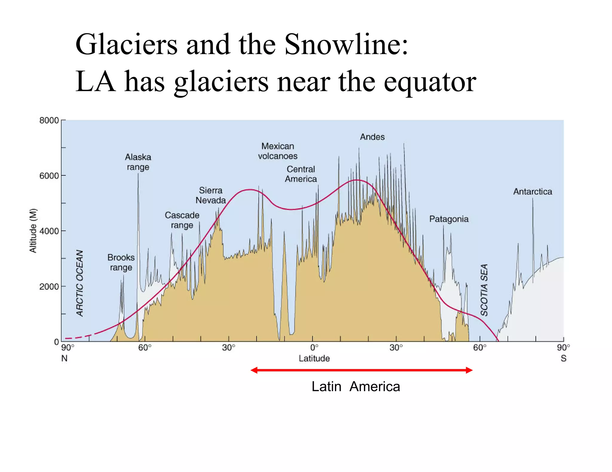
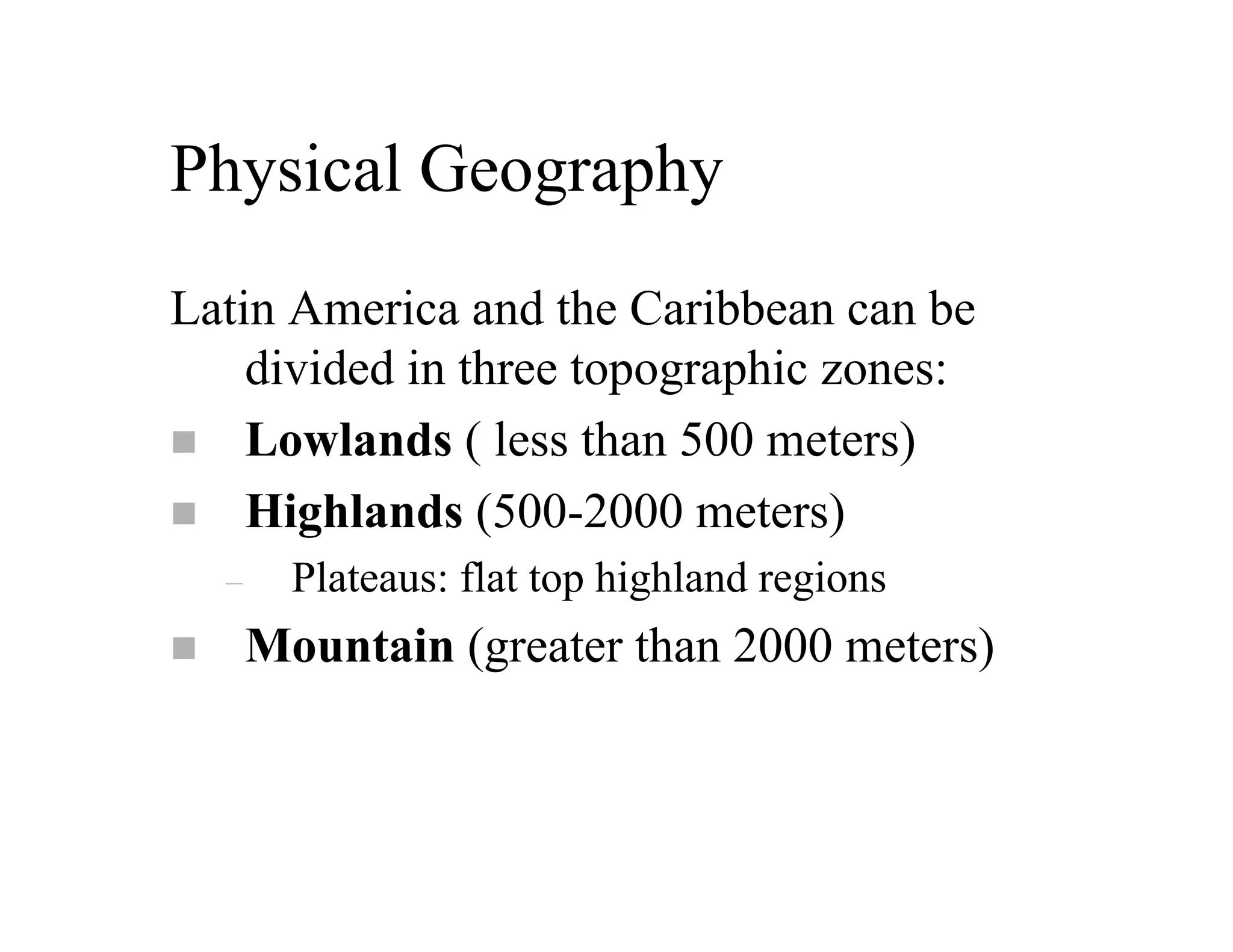
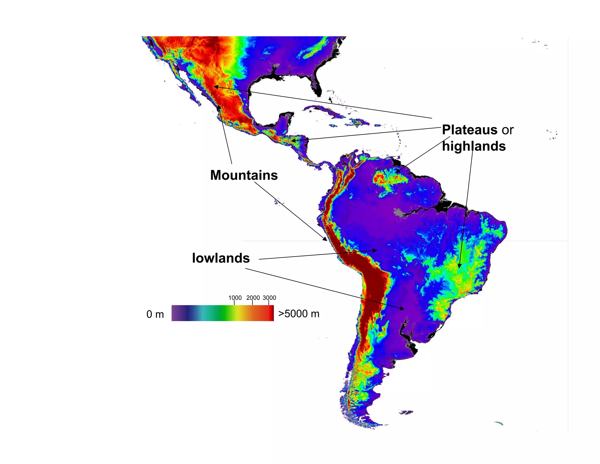
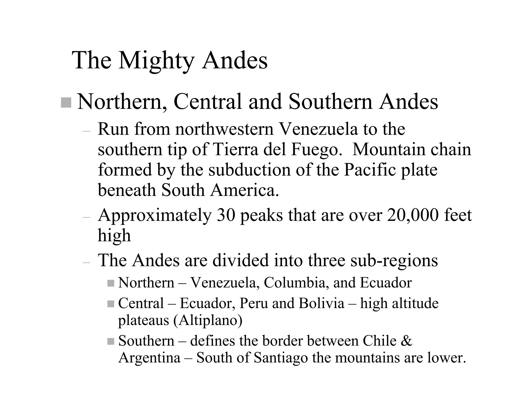
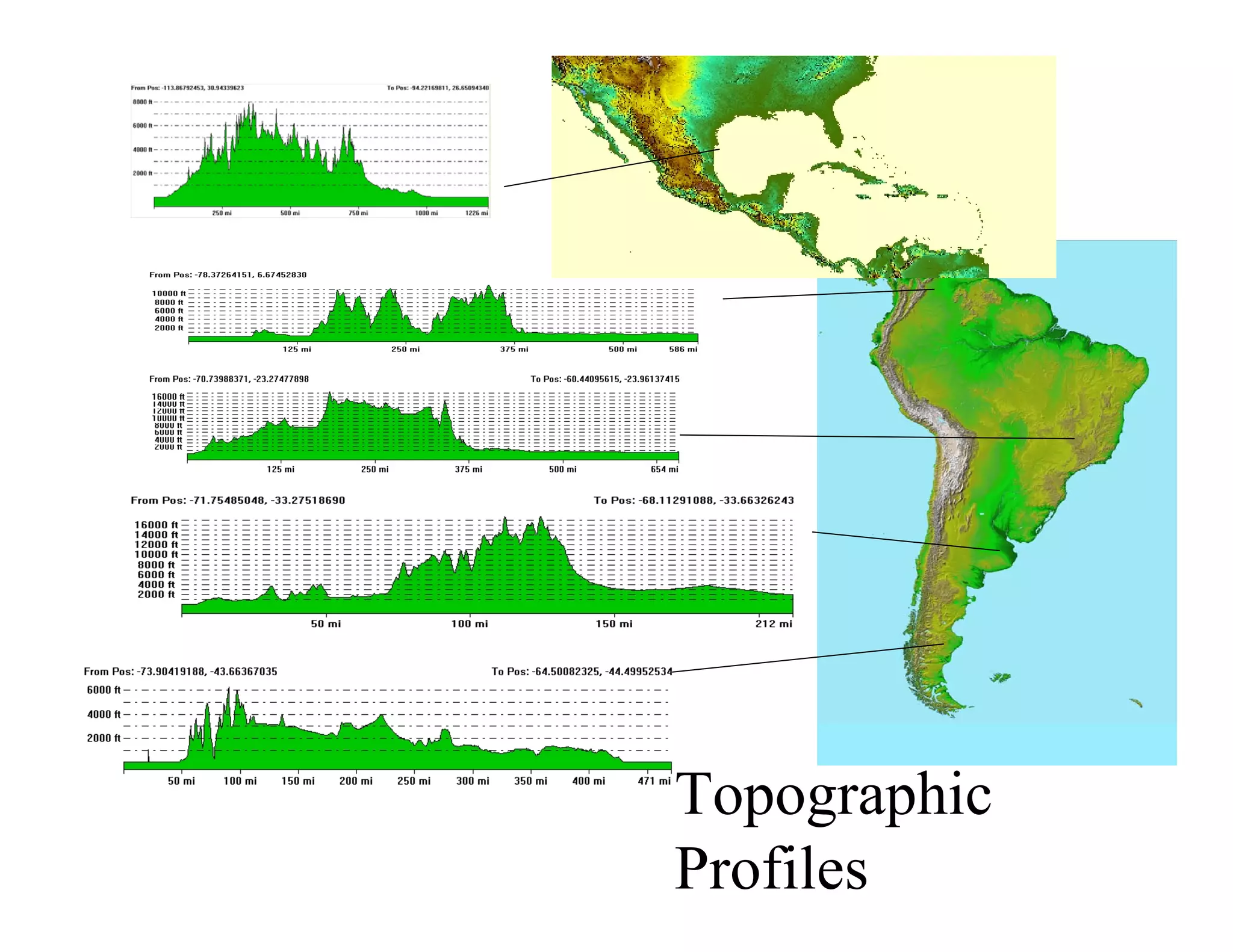
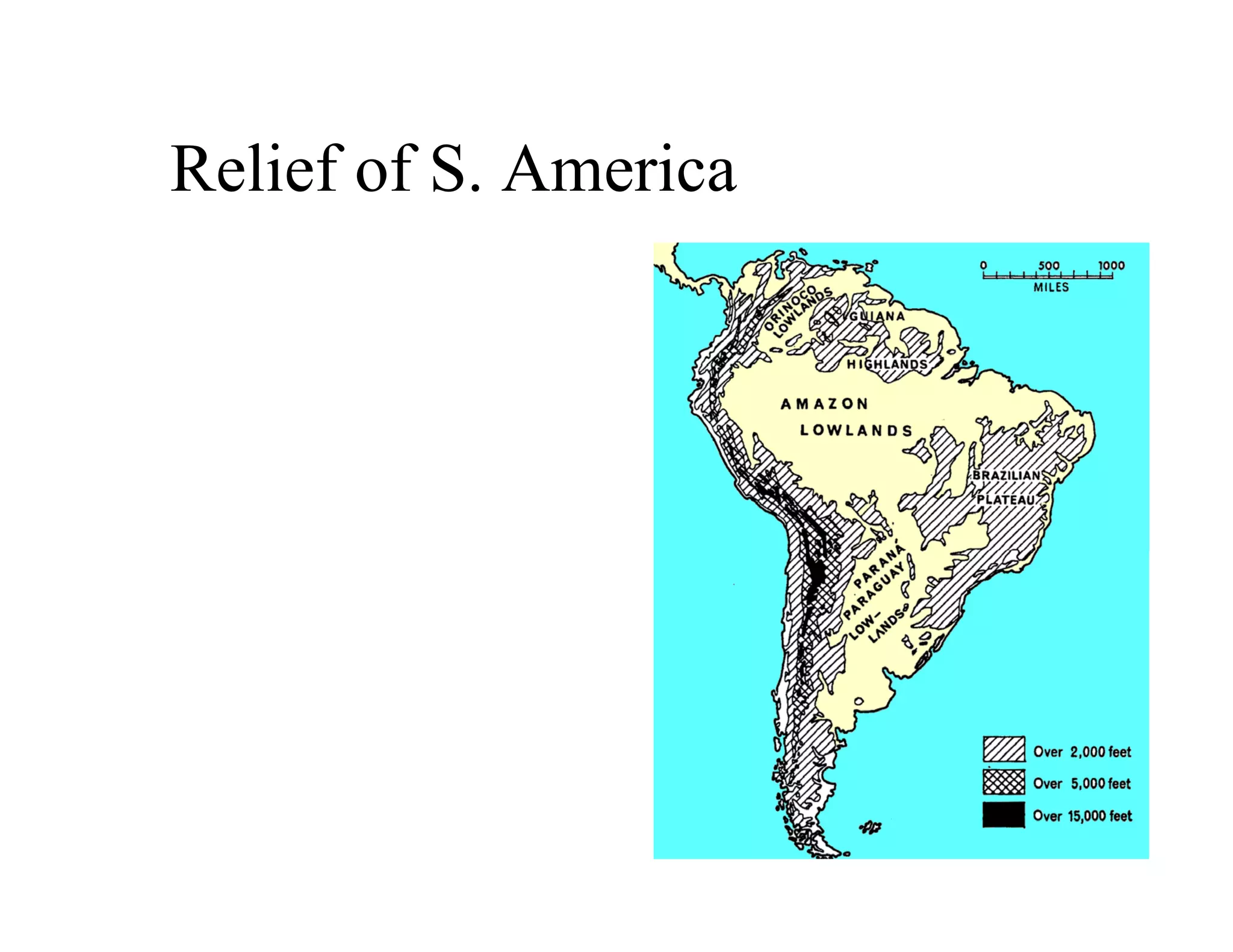
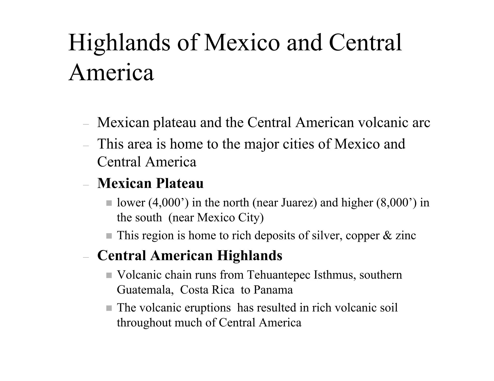
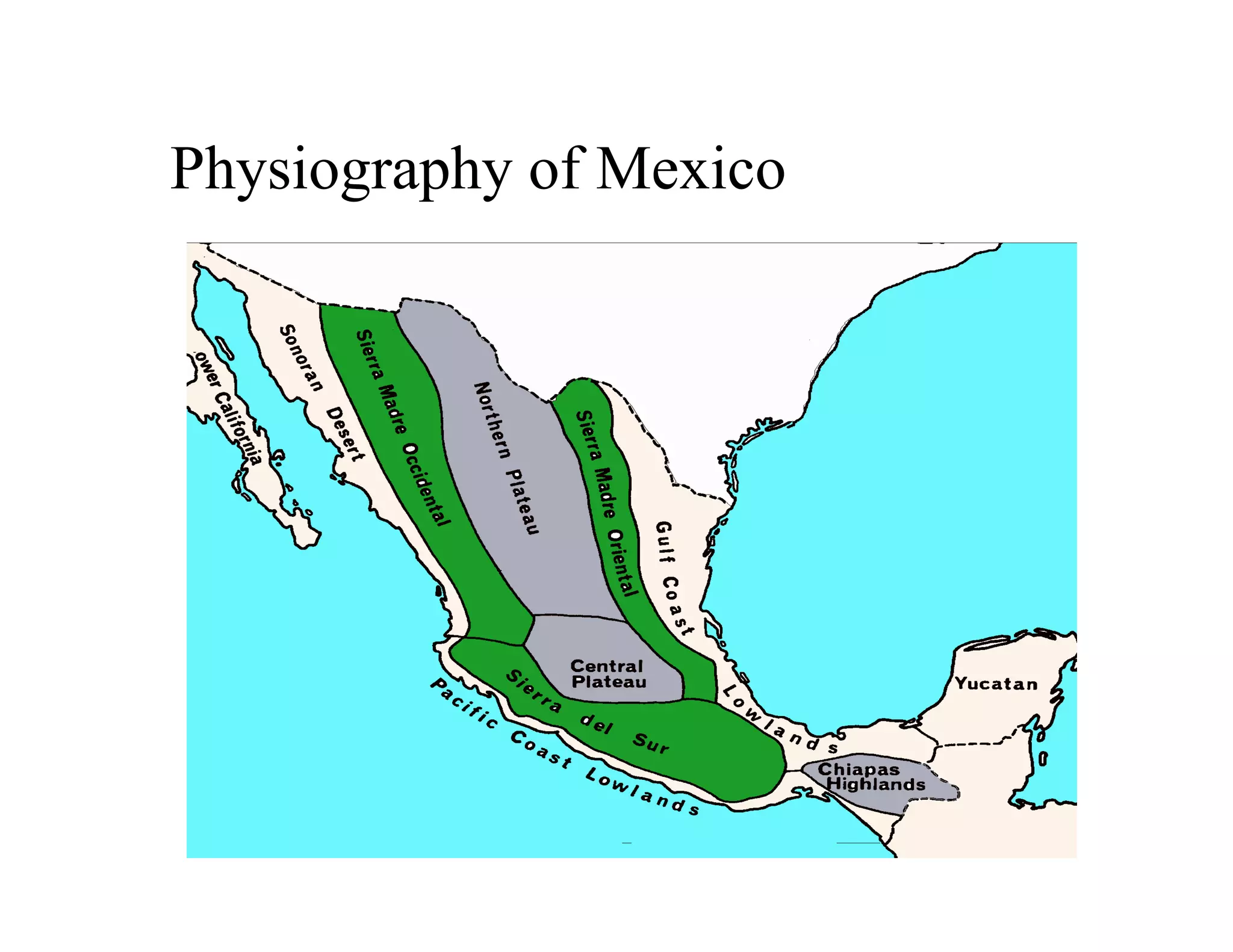
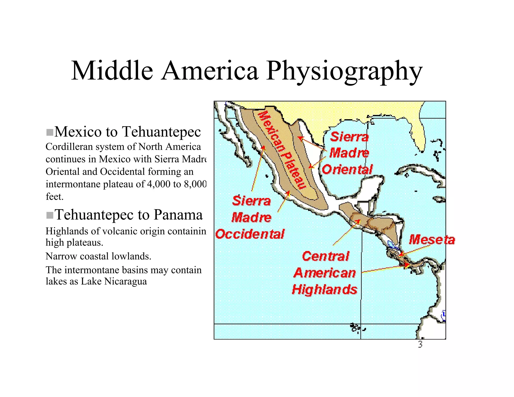


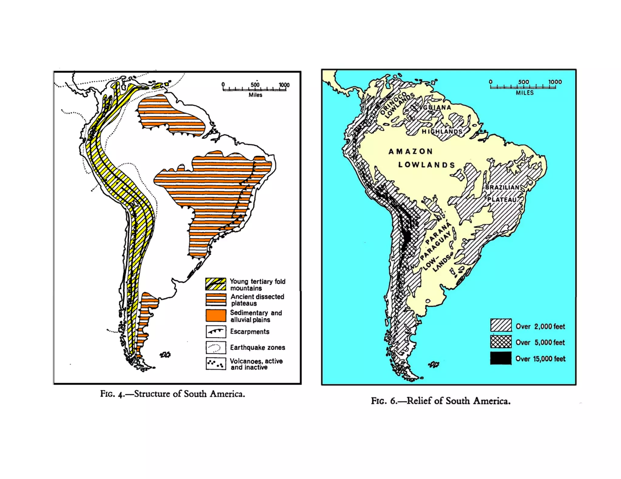
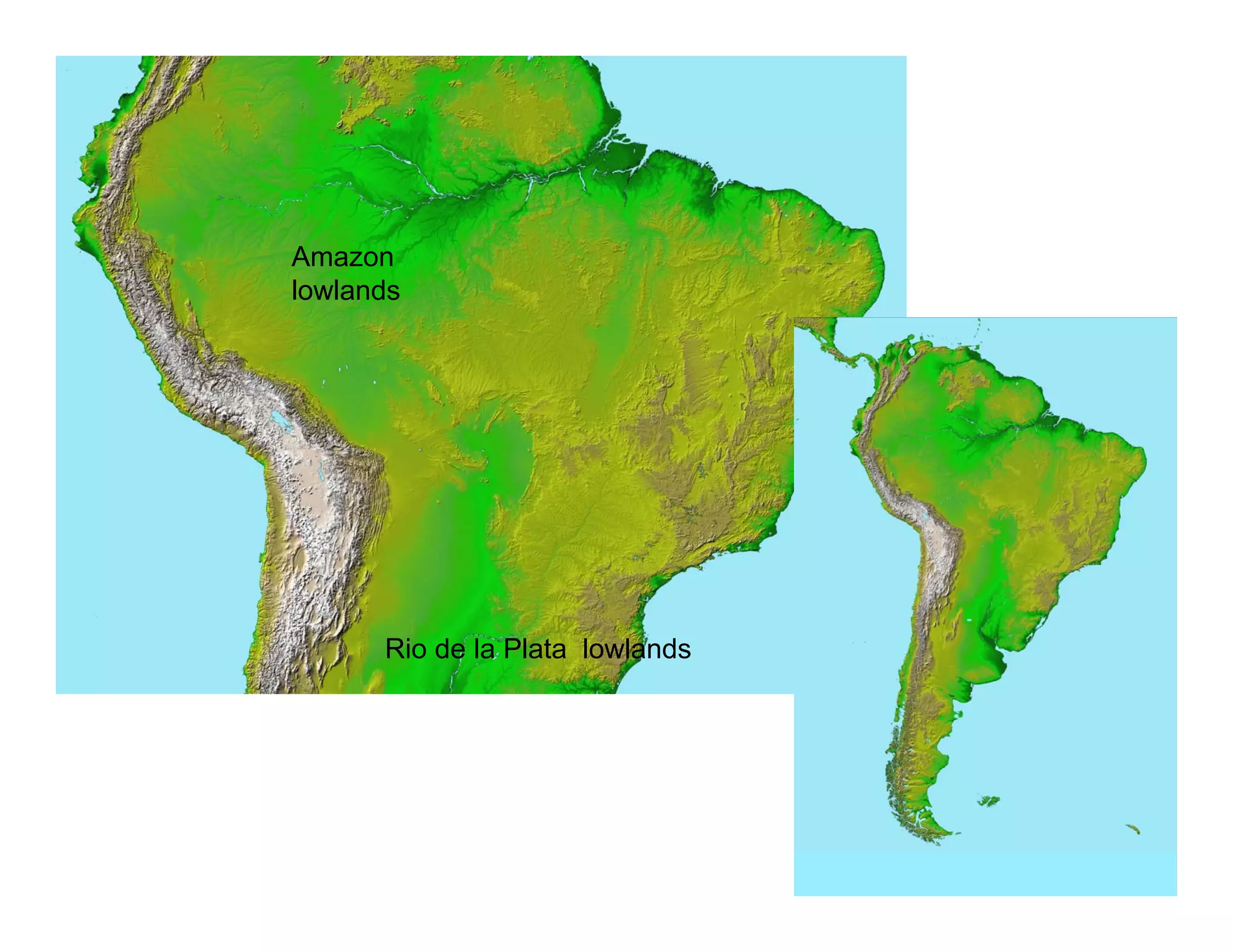
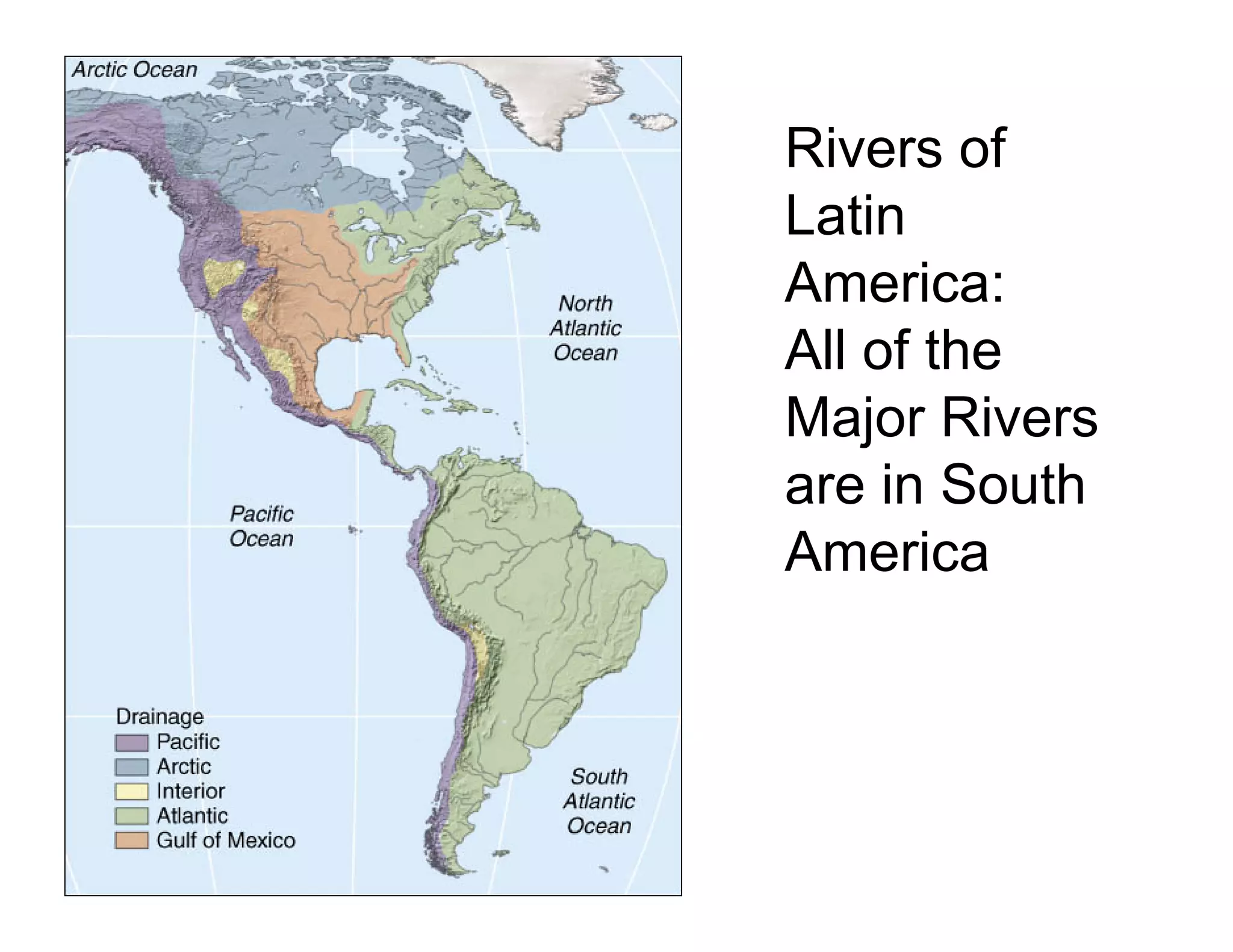
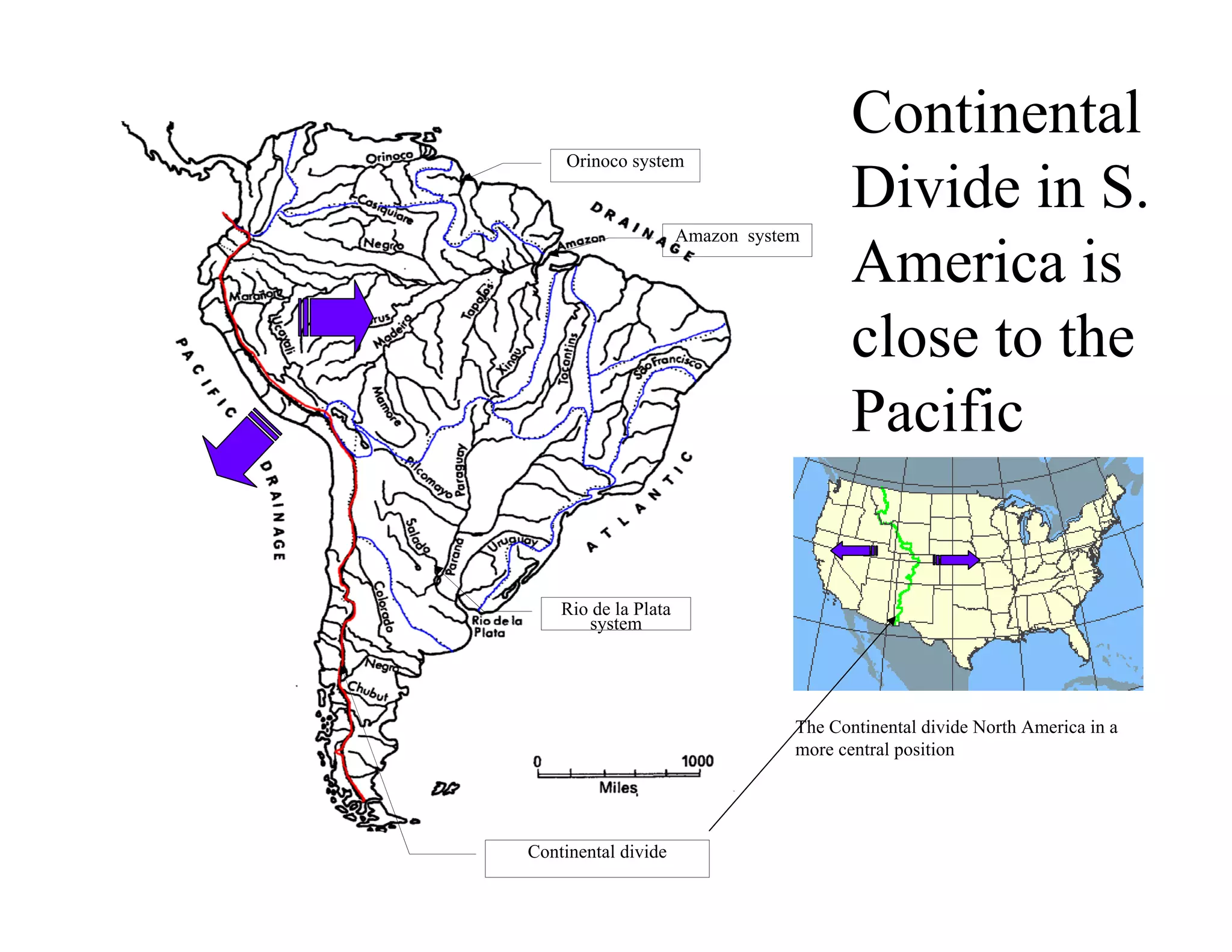
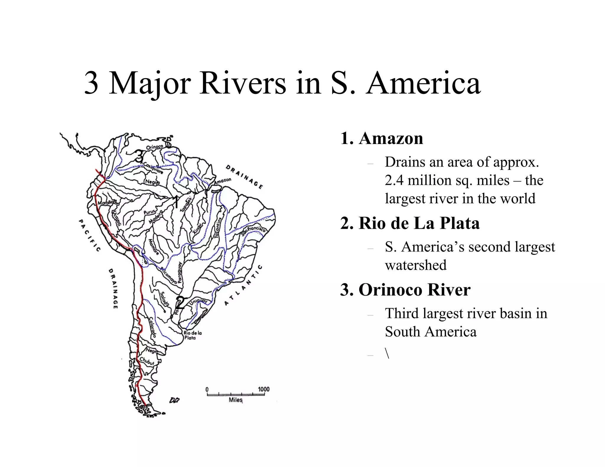

Latin America contains many notable physical landmarks including the longest mountain range in the world (the Andes), the world's highest volcanoes, largest rainforest (Amazon), and driest desert (Atacama). The climate of most of Latin America is tropical, with little seasonal temperature variation but distinct wet and dry seasons. Elevation strongly influences climate, with five altitudinal zones ranging from hot lowlands to cold mountain peaks. Major physical features include the Andes Mountains, Mexican plateau, Central American volcanic arc, and lowland river basins of the Amazon, Orinoco, and Rio de la Plata.


