Satellite Imagery: Acquisition and Presentation
•
2 likes•1,898 views
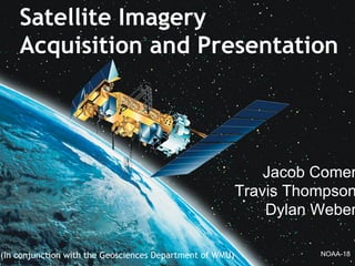
Scientist use remote sensing stations to acquire real time imagery and data from various orbiting satellites to help them better understand global warming and climate change. Terascan, a satellite imagery receiving and processing program, is used to download and then take images and add post capture meta data such as borders and tags. These images are then cataloged and put into an ArcGIS database for later review and research. A combination of automation, streamlining, and back-end optimizations will allow research to continue with the best available data which will help us better understand the effects of climate change.
Report
Share
Report
Share
Download to read offline

Recommended
Arc gis introduction-ppt
This document provides an overview of ArcGIS and its components. It discusses how data are stored in ArcGIS using different data models over time, including coverages, shapefiles, and geodatabases. It describes the main ArcGIS applications - ArcMap for viewing and editing data, ArcCatalog for data management, and ArcToolbox for geoprocessing tools. It also outlines some key ArcGIS extensions for spatial, geostatistical, and 3D analysis.
Geo Stationary Earth Orbit imaging satellite
A GEO satellite’s distance from earth gives it a large coverage area, almost a fourth of the earth’s surface and also have 24 hour view of a particular area.This will be very helpful to army,navy etc.,These factors make it ideal for satellite broadcast and other multipoint applications.Continuous monitoring is done and also cost effective in long term, risk-less.
Introduction to ArcGIS
An introductory tutorial for Esri's ArcGIS version 10.1. This tutorial covers some basic concepts and tasks.
UAV: sensors and Remote sensing techniques for the small platform
UAV: sensors and Remote sensing techniques for the small platformHawaii Geographic Information Coordinating Council
This document discusses using drones for aerial imagery collection as a more cost-effective alternative to airplanes and helicopters. It notes that while large aircraft can image large areas at high resolution and accuracy, they are expensive for remote areas. Small drones can image smaller areas at lower resolutions but with average accuracy. The document then outlines the solution developed using a medium-sized fixed-wing drone carrying a small Sony camera to match the capabilities of plane-based imagery collection for remote areas at a lower cost.GIS
Geographic Information System (GIS) is a set of computer tools for collecting, storing, retrieving, transforming, and displaying spatial data. GIS integrates spatial information within a single system and allows users to manipulate and display geographic knowledge in new ways. GIS brings together technology from fields like geography, cartography, remote sensing, and computer science to analyze and solve real world problems with geographic components.
Open street map final ppt
OpenStreetMap (OSM) is a collaborative project to create a free editable map of the world. It was founded in 2004 and now has over 500,000 registered users. Data is collected through GPS, local knowledge, and correcting existing maps. The map can be edited online or through applications like JOSM and uploaded. OSM data includes nodes, ways, closed ways, and relations. Rendering transforms the vector data into a more artistic map. OSM has benefits like aiding disaster relief and is compatible with platforms like Ushahidi.
Interpolation 2013
The document discusses various interpolation techniques used in GIS, including inverse distance weighted (IDW), spline, and kriging. IDW, spline, and kriging were analyzed in more depth. The study area includes states in the western US and weather station data was used, including station names, coordinates, elevation, and rain percentage. Different interpolation techniques were tested in ArcGIS and ArcScene to compare the results.
Digital image classification22oct
Digital image classification is the process of sorting pixels into categories based on their spectral values. There are supervised and unsupervised classification methods. Supervised classification involves using training sites of known categories to define statistical signatures for each class. Unsupervised classification groups pixels into clusters without prior class definitions. Validation is needed to assess classification accuracy by comparing results to ground truth data. Factors like training site selection and signature separability impact classification performance.
Orthorectification and triangulation
The document discusses orthorectification and triangulation. It defines orthorectification as the process of removing geometric errors from aerial photographs to produce orthophotos that have consistent scale and orthographic projection like a map but also have photographic detail. Triangulation is defined as determining the location of a point by measuring angles to it from other known points, rather than direct measurements. It can be used to orient aerial photographs and produce 3D point measurements. The document provides details on producing orthophotos using DEM data and forward or backward projection methods. It also gives an example of using triangulation to align a block of aerial images.
Collinearity Equations
Collinearity Equations
Kinds of product that can be derived by the collinearity equation
- Space Resection By Collinearity
- Space Intersection By Collinearity
- Interior Orientation
- Relative Orientation
- Absolute Orientation
- Self-Calibration
Digital photogrammetry
This document discusses digital photogrammetry. It begins by explaining that digital photogrammetry uses digital images that are stored and processed on a computer, rather than hard copy photos. These digital images can come from satellites, airplanes, or cameras. The document then discusses some applications of digital photogrammetry like topographic mapping and creating orthophotos, digital elevation models (DEMs), and virtual landscapes. It also notes that nadir imagery and image overlap are needed to provide 3D information. Finally, the document lists some common products of digital photogrammetry such as maps, DEMs, and virtual landscapes.
DTM DEM Generation
DTM/DEM generation involves creating digital models of terrain elevation from various data sources. A DTM provides height values referenced to positions and can include other terrain features, while a DEM only provides regular elevation values. Photogrammetry and remote sensing are common methods to acquire elevation data and generate DTMs/DEMs. The data often needs editing and filtering to remove errors and refine the models. Raster and TIN representations are common formats, with rasters using a grid and TINs using irregular triangles. Accuracy depends on factors like the data source and grid size for rasters. DSMs include above-ground features and require processing to derive bare earth DTMs below the features.
Introduction to WebGIS- Esri norsk BK 2014
The document summarizes a technical workshop on the ArcGIS platform and web GIS. It outlines the evolution of GIS technology towards more integrated software and services. It then reviews the key components of the ArcGIS platform, including ArcGIS Desktop, ArcGIS Online, Portal for ArcGIS, and ArcGIS Server. It demonstrates how GIS data and resources can be centralized in a portal and accessed through web apps by users on desktops, web, and mobile devices. The workshop concludes with advice on implementing web GIS within an organization.
Optical remote sensing
Optical remote sensing uses visible, near infrared, and shortwave infrared sensors to form images of the Earth's surface by detecting solar radiation reflected from targets. Different materials reflect and absorb light differently at different wavelengths, allowing targets to be differentiated by their spectral signatures. Optical remote sensing systems are classified as panchromatic, multispectral, hyperspectral, or superspectral depending on the number of spectral bands measured.
Global Positioning System
The Global Positioning System (GPS) is a satellite-based navigation system consisting of 24 satellites in medium Earth orbit controlled by the US Air Force. A GPS receiver can determine its position by measuring the time delay of signals received from at least 3 satellites to calculate distance via trilateration. The system consists of space, control, and user segments, with the control segment monitoring satellite health and transmitting updates. GPS is mainly used for navigation, mapping, and has military applications.
Web GIS
This document discusses web-based GIS and virtual globes. It begins by defining web-based GIS as using the web to disseminate and process geographic information and present results. Virtual globes are 3D software models of the earth that allow users to freely navigate. The history of web-based GIS is then outlined, along with examples like Google Earth. The document notes that web-based GIS and virtual globes can advance science by allowing overlay of data and custom applications. Examples of how these tools may impact daily life are finding hotels and viewing real-time weather. The document concludes by speculating on further potential benefits in areas like home shopping, data exploration, and comparing human behavior patterns.
Principal component analysis
This document discusses principal component analysis (PCA) and its applications in image processing and facial recognition. PCA is a technique used to reduce the dimensionality of data while retaining as much information as possible. It works by transforming a set of correlated variables into a set of linearly uncorrelated variables called principal components. The first principal component accounts for as much of the variability in the data as possible, and each succeeding component accounts for as much of the remaining variability as possible. The document provides an example of applying PCA to a set of facial images to reduce them to their principal components for analysis and recognition.
Satellite image processing
Satellite Image Processing technique to enhance raw images received from cameras or sensors placed on satellites, space probes and aircrafts or pictures taken in normal day to day life in various applications.
GIS & Raster
This document provides an overview of GIS, raster data formats, and spatial analysis tools. It defines GIS as an automated system for capturing, storing, analyzing and displaying spatial data linked to tabular data on maps. Raster data represents real-world phenomena through a matrix of cells, with each cell storing a value like elevation or satellite imagery. Spatial analysis tools in GIS like Euclidean distance and point density perform cell-based raster analyses, calculating distances from raster cells to points or densities of points within neighborhoods.
Remote Sensing: Image Classification
The objective of image classification is to classify each pixel into only one class (crisp or hard classification) or to associate the pixel with many classes (fuzzy or soft classification). The classification techniques may be categorized either on the basis of training process (supervised and unsupervised) or on the basis of theoretical model (parametric and non-parametric).
Unsupervised classification is where the groupings of pixels with common characteristics are based on the software analysis of an image without the user providing sample classes. The computer uses techniques to determine which pixels are related and groups them into classes. The user can specify which algorism the software will use and the desired number of output classes but otherwise does not aid in the classification process. However, the user must have knowledge of the area being classified when the groupings of pixels with common characteristics produced by the computer have to be related to actual features on the ground (such as waterbodies, developed areas, forests, etc.).
Supervised classification is based on the idea that a user can select sample pixels in an image that are representative of specific classes and then direct the image processing software to use these training sites as references for the classification of all other pixels in the image. Input classes are selected based on the knowledge of the user. The user also sets the bounds for how similar other pixels must be to group them together. These bounds are often set based on the spectral characteristics of the input classes (AOI), plus or minus a certain increment (often based on “brightness” or strength of reflection in specific spectral bands). The user also designates the number of classes that the image is classified into.
THIS PRESENTATION IS TO HELP YOU PERFORM THE TASK STEP BY STEP.
Introduction to OpenStreetMap
This document provides an agenda and introduction to OpenStreetMap (OSM). It outlines OSM as a collaborative project to create a free map of the world. The agenda covers introductions to OSM, editing tools, data collection tools, and hands-on mapping. It discusses OSM's history, statistics, the Humanitarian OSM Team, and examples of OSM's use in crisis response and developing countries. It also outlines how to download data, edit maps, and use OSM data in various applications.
GIS Based Project Planning and Management
This document describes a GIS-based project management system called ProGIS. It allows users to track multiple construction or infrastructure projects on an interactive map. Project managers can view tasks, timelines, images and reports for each project location without traveling to sites. Data from on-site mobile devices is synced to the backend server and displayed on maps. The system was designed with flexibility, security, and support for remote access in mind. It uses open-source LAMP stack technologies and integrates mapping capabilities from GeoServer. Screenshots demonstrate the web and mobile interfaces.
Mobile gis
This study has done to identify the applicability of Mobile GIS as a method of data collection for mobility mapping.
Digital Elevation Models - WUR - Grontmij
This is the presentation given to a delegation of students from Wageningen University (WUR) on Digital Elevation Models
International Terrestrial Reference Frame
The document discusses the International Terrestrial Reference Frame (ITRF) and its fundamental role in geosciences. It explains that ITRF is crucial for monitoring Earth's motions and positions relative to space, and provides a realization of the International Terrestrial Reference System (ITRS) through 3D coordinates of points on Earth's surface. It then outlines the space geodetic techniques that provide input data to define ITRF, applications of ITRF in geosciences, current inconsistencies and limitations, and improvements and alternative reference frames being developed.
Remote sensing by jitendra thakor
remote sensing-1. Basic Concept
2. Principles of radiation
3. Types of system
4. Spectral signatures
5. Resolution
7. Applications
8.Adavantage
GLOBAL POSITIONING SYSTEM
This document provides an overview of the Global Positioning System (GPS). It discusses the three main aspects of GPS which are determining position, speed, and time anywhere on Earth. It explains the basic principles of how GPS works by measuring the signal transit time between satellites and a receiver to calculate the receiver's location. It describes the three segments that make up the full GPS system - the space segment consisting of satellites, the control segment of ground stations, and the user segment of GPS receivers. It also provides a brief overview of differential GPS which improves location accuracy.
Unit 2 Elements of a map.pdf
The document discusses elements of maps, including:
1. Maps contain specific elements like a title, key, compass, and scale to help readers understand the information represented.
2. Contours are lines on maps that connect points of equal elevation and show the shape and steepness of landscapes.
3. Relief on maps can be shown through methods like layer tinting, contours, spot heights, and hachures that represent elevation changes through color shading and line spacing.
Application of satellite imagery
Presented in “China – Thailand Geo-Informatics Workshop Series I: Agricultural Applications” 30 June - 2 July 2010 at Pattaya, Thailand
Aerial photography vs RS satellite
This document compares aerial photography and satellite remote sensing. [1] Aerial photography uses cameras mounted on aircraft to capture overlapping photos at fixed altitudes, while satellites capture continuous image strips from orbit. [2] Aerial photography provides higher resolution images but is limited by weather and environment, while satellites can image any location but provide lower resolution. [3] Both techniques image the electromagnetic spectrum, but satellites can capture non-visible data like infrared and radar not restricted by time of day.
More Related Content
What's hot
Orthorectification and triangulation
The document discusses orthorectification and triangulation. It defines orthorectification as the process of removing geometric errors from aerial photographs to produce orthophotos that have consistent scale and orthographic projection like a map but also have photographic detail. Triangulation is defined as determining the location of a point by measuring angles to it from other known points, rather than direct measurements. It can be used to orient aerial photographs and produce 3D point measurements. The document provides details on producing orthophotos using DEM data and forward or backward projection methods. It also gives an example of using triangulation to align a block of aerial images.
Collinearity Equations
Collinearity Equations
Kinds of product that can be derived by the collinearity equation
- Space Resection By Collinearity
- Space Intersection By Collinearity
- Interior Orientation
- Relative Orientation
- Absolute Orientation
- Self-Calibration
Digital photogrammetry
This document discusses digital photogrammetry. It begins by explaining that digital photogrammetry uses digital images that are stored and processed on a computer, rather than hard copy photos. These digital images can come from satellites, airplanes, or cameras. The document then discusses some applications of digital photogrammetry like topographic mapping and creating orthophotos, digital elevation models (DEMs), and virtual landscapes. It also notes that nadir imagery and image overlap are needed to provide 3D information. Finally, the document lists some common products of digital photogrammetry such as maps, DEMs, and virtual landscapes.
DTM DEM Generation
DTM/DEM generation involves creating digital models of terrain elevation from various data sources. A DTM provides height values referenced to positions and can include other terrain features, while a DEM only provides regular elevation values. Photogrammetry and remote sensing are common methods to acquire elevation data and generate DTMs/DEMs. The data often needs editing and filtering to remove errors and refine the models. Raster and TIN representations are common formats, with rasters using a grid and TINs using irregular triangles. Accuracy depends on factors like the data source and grid size for rasters. DSMs include above-ground features and require processing to derive bare earth DTMs below the features.
Introduction to WebGIS- Esri norsk BK 2014
The document summarizes a technical workshop on the ArcGIS platform and web GIS. It outlines the evolution of GIS technology towards more integrated software and services. It then reviews the key components of the ArcGIS platform, including ArcGIS Desktop, ArcGIS Online, Portal for ArcGIS, and ArcGIS Server. It demonstrates how GIS data and resources can be centralized in a portal and accessed through web apps by users on desktops, web, and mobile devices. The workshop concludes with advice on implementing web GIS within an organization.
Optical remote sensing
Optical remote sensing uses visible, near infrared, and shortwave infrared sensors to form images of the Earth's surface by detecting solar radiation reflected from targets. Different materials reflect and absorb light differently at different wavelengths, allowing targets to be differentiated by their spectral signatures. Optical remote sensing systems are classified as panchromatic, multispectral, hyperspectral, or superspectral depending on the number of spectral bands measured.
Global Positioning System
The Global Positioning System (GPS) is a satellite-based navigation system consisting of 24 satellites in medium Earth orbit controlled by the US Air Force. A GPS receiver can determine its position by measuring the time delay of signals received from at least 3 satellites to calculate distance via trilateration. The system consists of space, control, and user segments, with the control segment monitoring satellite health and transmitting updates. GPS is mainly used for navigation, mapping, and has military applications.
Web GIS
This document discusses web-based GIS and virtual globes. It begins by defining web-based GIS as using the web to disseminate and process geographic information and present results. Virtual globes are 3D software models of the earth that allow users to freely navigate. The history of web-based GIS is then outlined, along with examples like Google Earth. The document notes that web-based GIS and virtual globes can advance science by allowing overlay of data and custom applications. Examples of how these tools may impact daily life are finding hotels and viewing real-time weather. The document concludes by speculating on further potential benefits in areas like home shopping, data exploration, and comparing human behavior patterns.
Principal component analysis
This document discusses principal component analysis (PCA) and its applications in image processing and facial recognition. PCA is a technique used to reduce the dimensionality of data while retaining as much information as possible. It works by transforming a set of correlated variables into a set of linearly uncorrelated variables called principal components. The first principal component accounts for as much of the variability in the data as possible, and each succeeding component accounts for as much of the remaining variability as possible. The document provides an example of applying PCA to a set of facial images to reduce them to their principal components for analysis and recognition.
Satellite image processing
Satellite Image Processing technique to enhance raw images received from cameras or sensors placed on satellites, space probes and aircrafts or pictures taken in normal day to day life in various applications.
GIS & Raster
This document provides an overview of GIS, raster data formats, and spatial analysis tools. It defines GIS as an automated system for capturing, storing, analyzing and displaying spatial data linked to tabular data on maps. Raster data represents real-world phenomena through a matrix of cells, with each cell storing a value like elevation or satellite imagery. Spatial analysis tools in GIS like Euclidean distance and point density perform cell-based raster analyses, calculating distances from raster cells to points or densities of points within neighborhoods.
Remote Sensing: Image Classification
The objective of image classification is to classify each pixel into only one class (crisp or hard classification) or to associate the pixel with many classes (fuzzy or soft classification). The classification techniques may be categorized either on the basis of training process (supervised and unsupervised) or on the basis of theoretical model (parametric and non-parametric).
Unsupervised classification is where the groupings of pixels with common characteristics are based on the software analysis of an image without the user providing sample classes. The computer uses techniques to determine which pixels are related and groups them into classes. The user can specify which algorism the software will use and the desired number of output classes but otherwise does not aid in the classification process. However, the user must have knowledge of the area being classified when the groupings of pixels with common characteristics produced by the computer have to be related to actual features on the ground (such as waterbodies, developed areas, forests, etc.).
Supervised classification is based on the idea that a user can select sample pixels in an image that are representative of specific classes and then direct the image processing software to use these training sites as references for the classification of all other pixels in the image. Input classes are selected based on the knowledge of the user. The user also sets the bounds for how similar other pixels must be to group them together. These bounds are often set based on the spectral characteristics of the input classes (AOI), plus or minus a certain increment (often based on “brightness” or strength of reflection in specific spectral bands). The user also designates the number of classes that the image is classified into.
THIS PRESENTATION IS TO HELP YOU PERFORM THE TASK STEP BY STEP.
Introduction to OpenStreetMap
This document provides an agenda and introduction to OpenStreetMap (OSM). It outlines OSM as a collaborative project to create a free map of the world. The agenda covers introductions to OSM, editing tools, data collection tools, and hands-on mapping. It discusses OSM's history, statistics, the Humanitarian OSM Team, and examples of OSM's use in crisis response and developing countries. It also outlines how to download data, edit maps, and use OSM data in various applications.
GIS Based Project Planning and Management
This document describes a GIS-based project management system called ProGIS. It allows users to track multiple construction or infrastructure projects on an interactive map. Project managers can view tasks, timelines, images and reports for each project location without traveling to sites. Data from on-site mobile devices is synced to the backend server and displayed on maps. The system was designed with flexibility, security, and support for remote access in mind. It uses open-source LAMP stack technologies and integrates mapping capabilities from GeoServer. Screenshots demonstrate the web and mobile interfaces.
Mobile gis
This study has done to identify the applicability of Mobile GIS as a method of data collection for mobility mapping.
Digital Elevation Models - WUR - Grontmij
This is the presentation given to a delegation of students from Wageningen University (WUR) on Digital Elevation Models
International Terrestrial Reference Frame
The document discusses the International Terrestrial Reference Frame (ITRF) and its fundamental role in geosciences. It explains that ITRF is crucial for monitoring Earth's motions and positions relative to space, and provides a realization of the International Terrestrial Reference System (ITRS) through 3D coordinates of points on Earth's surface. It then outlines the space geodetic techniques that provide input data to define ITRF, applications of ITRF in geosciences, current inconsistencies and limitations, and improvements and alternative reference frames being developed.
Remote sensing by jitendra thakor
remote sensing-1. Basic Concept
2. Principles of radiation
3. Types of system
4. Spectral signatures
5. Resolution
7. Applications
8.Adavantage
GLOBAL POSITIONING SYSTEM
This document provides an overview of the Global Positioning System (GPS). It discusses the three main aspects of GPS which are determining position, speed, and time anywhere on Earth. It explains the basic principles of how GPS works by measuring the signal transit time between satellites and a receiver to calculate the receiver's location. It describes the three segments that make up the full GPS system - the space segment consisting of satellites, the control segment of ground stations, and the user segment of GPS receivers. It also provides a brief overview of differential GPS which improves location accuracy.
Unit 2 Elements of a map.pdf
The document discusses elements of maps, including:
1. Maps contain specific elements like a title, key, compass, and scale to help readers understand the information represented.
2. Contours are lines on maps that connect points of equal elevation and show the shape and steepness of landscapes.
3. Relief on maps can be shown through methods like layer tinting, contours, spot heights, and hachures that represent elevation changes through color shading and line spacing.
What's hot (20)
Viewers also liked
Application of satellite imagery
Presented in “China – Thailand Geo-Informatics Workshop Series I: Agricultural Applications” 30 June - 2 July 2010 at Pattaya, Thailand
Aerial photography vs RS satellite
This document compares aerial photography and satellite remote sensing. [1] Aerial photography uses cameras mounted on aircraft to capture overlapping photos at fixed altitudes, while satellites capture continuous image strips from orbit. [2] Aerial photography provides higher resolution images but is limited by weather and environment, while satellites can image any location but provide lower resolution. [3] Both techniques image the electromagnetic spectrum, but satellites can capture non-visible data like infrared and radar not restricted by time of day.
satellite image processing
This document discusses digital image processing of satellite images. It describes how satellite images are represented digitally as pixels with brightness values. It outlines three main categories of image processing: image rectification and restoration to correct distortions; enhancement to improve visual interpretation; and information extraction to automate feature identification. Specific techniques discussed include image rectification, contrast enhancement, spatial filtering, edge enhancement, and band ratioing. The overall aim is to analyze satellite images both visually and quantitatively.
Remote Sensing PPT
This document provides an overview of remote sensing through a seminar presented by Ashwathy Babu Paul. It defines remote sensing as obtaining information about an object without physical contact through electromagnetic radiation. It describes the basic components and process of remote sensing systems including energy sources, sensor recording, transmission and processing. Various sensors and platforms are discussed along with advantages and applications in fields like agriculture, natural resource management, national security, geology, meteorology, and more. Challenges are addressed but advantages of remote sensing are said to far outweigh these.
Review for Photo Camera
The document discusses various photography concepts including focal point, juxtaposition, and the three basic steps of framing a shot, focusing the camera, and setting the correct exposure by adjusting the shutter speed and aperture. It also covers topics such as film speed, depth of field, shutter priority, and bracketing exposures to ensure the proper shot is captured. The document serves as a helpful primer on fundamental photography techniques.
Remote sensing
Remote sensing involves observing the Earth from a distance using aerial photographs or satellite imagery. Aerial photographs provide detailed views from low altitudes but limited coverage, while satellite images offer global coverage but less detail. Remote sensing data can be used to map features, monitor changes over time, and classify land cover by analyzing spectral signatures from multi-spectral imagery. Digital tools allow remote sensing data to be manipulated for 3D modeling and analysis in geographic information systems.
Monograph
This document provides an overview of the author's research into what makes a rock climbing community. The author conducted ethnographic research through observations, surveys, interviews, and content analysis of climbing media. The research focused on the bouldering community. Key findings included common reasons that draw climbers to the sport, such as the mental and physical challenge. It also found that a shared passion for climbing immediately forms deep bonds between community members.
PM Digital: Getting E-Commerce Team Buy-In for Local Optimization Efforts #LS...
Presentation by: Joe Pawlikowski, PM Digital
E-commerce Optimization
Local Organic Search Results
E-Commerce Benefits of Local Optimization
Organic Search Traffic Revenue
Map Packs
Unique Content
Structured Data
Location Pages
#LSS2016
Terzian, m. monograph climbing community
This document provides an overview of the author's ethnographic research into what makes a rock climbing community. The author conducted passive observation of climbers, participated in climbing activities, distributed surveys, and interviewed climbers. The research found that tight social bonds in the climbing community are based on deep trust that arises from shared values and passions for the sport. The community provides influences and support that help climbers overcome mental blocks and improve their skills.
Trabajo informatica
La usabilidad web es un documento sobre la usabilidad web escrito por Natalia Fernanda Reniz López para su profesora Analida Carvajal Monterrosa como parte de un curso en la Escuela Normal Superior del Distrito de Barranquilla.
Webinar- The Mobile Opportunity for Local and Multi-Location Businesses
Stop struggling with desktop optimization—the real action now and in future is in mobile. According to Google, consumers overwhelmingly turn to their mobile devices (94 % of the time) when the information they seek is local. Seventy-eight percent of these mobile local searches result in an offline purchase within a few hours.
Don’t be left behind! Mobile local isn’t a ‘flavor of the day’ marketing trend; it’s the present-day reality for enterprise marketers trying to connect with highly motivated mobile consumers. Those lacking a focus on mobile are losing market share to their mobile local-savvy competitors. In this webinar Tyler Ludwig and Kent Lewis will take us through the key strategies for mobile success.
Join us for this webinar and learn:
• The mobile local playbook to make sure you’re mobile-ready
• What a mobile-friendly site looks and feels like for consumers
• How paid search can attract qualified leads
• The importance of storytelling for the mobile users to maximize visibility and conversions
Monograph
This document provides an overview of a monograph examining the rock climbing community. The author conducted ethnographic research on boulderers, specifically, through participant observation, surveys, interviews, and content analysis.
The results showed common threads that link climbers, like an appreciation for nature and awareness of one's body. Acceptance in the community is earned through accomplishments and dedication. Community is expressed differently in gym climbing, outdoor trips, and competitions, but generally involves support that improves attitudes and skills. Competitions bring out more individualism while gym climbing fosters cooperation. The climbing community provides benefits but also involves passages of giving back through mentorship and promoting safety.
Annotated bibliography 2
This cover letter summarizes the author's areas of interest in anthropological research. The author focuses on cultural studies, gender theory, and development practices. They have conducted ethnographic research on rock climbing communities and studied Voodoo practices in Haiti. The author's annotated bibliography covers topics including ethnographic research methods, development theory, gender and queer studies, and the region of Haiti. The research has helped the author narrow their interests to include analyzing gender roles and stigmas in developing countries.
Satellite and aerial surveys
GPS and remote sensing techniques capture geospatial data. GPS uses satellites to calculate user positions on Earth within 5 meters typically. Remote sensing includes aerial photography from planes and satellite imagery from space to observe large areas. Together these provide location data and images that can be analyzed in GIS systems.
Wiideman Consulting: Success Stories for Driving Local Value for Your Brand #...
This document summarizes Steve Wiideman's presentation on driving local value for brands through SEO and usability. The presentation outlines critical and helpful attributes for maximizing organic rankings at the city level, including local images, ratings, offers, calls-to-action and maps. It also discusses streamlining conversion tracking by deciding what to track, creating categories and labels, and measuring results. Additionally, the presentation explores researching local consumer problems to create content that attracts links, shares and referral traffic.
Application of Remote Sensing
The document discusses the benefits of exercise for mental health. Regular physical activity can help reduce anxiety and depression and improve mood and cognitive functioning. Exercise causes chemical changes in the brain that may help protect against mental illness and improve symptoms.
Rio SEO Webinar: Local SEO Strategies to Capitalize on Voice Search
In this webinar Sophia Elson of MindMeld, Steve Beatty of iProspect and Tyler Ludwig of Rio SEO explore the growth of voice search and provide marketers with local SEO best practices to capitalize on the voice search opportunity. Learn the nuances of voice search keywords and phrases, on-page content strategies to optimize for voice search and more.
[Webinar] Hallmark & Local Search Association: How to Use Online Seasonal Mar...
#LSAwebinars
#localseo
Digitally Influenced Offline Spending
Cross Platform Consumers
Verticals Benefiting from Local Search
Digital Media Driving Foot Traffic and Sales
Brand Management Across Multiple Channels
Marketing Budget Extension
Seasonal Marketing Tips
Personalizing Online Brand Experiences
Local Store Marketing
Retailer Customized Marketing
Crown Rewards Consumer Database
Customer Acquisition
Seasonal Marketing Campaigns
Scalable Solutions to Execute Campaigns
Brand Value and National Strategies
Local Search Association, Greg Sterling - VP of Strategy & Insights
Rio SEO, Tyler Ludwig - Director of Product & Strategy
Hallmark, Carlos Corredor - Marketing Manager
56. seni budaya smp m ts
Dokumen tersebut membahas standar kompetensi dan kompetensi dasar mata pelajaran Seni Budaya untuk siswa SMP/MTs. Mata pelajaran ini bertujuan agar siswa dapat mengapresiasi dan mengekspresikan diri melalui berbagai seni seperti seni rupa, musik, tari, dan teater dengan mengeksplorasi budaya lokal maupun nasional. Kompetensi dasar mencakup kemampuan mengidentifikasi, menampilkan
76. seni budaya sma
Ringkasan dokumen tersebut adalah sebagai berikut:
Mata pelajaran Seni Budaya diajarkan di SMA/MA untuk memberikan pengalaman estetika kepada siswa melalui aktivitas berkreasi dan berapresiasi seni. Mata pelajaran ini mencakup empat bidang seni yaitu seni rupa, musik, tari, dan teater. Dokumen ini menjelaskan kompetensi dasar dan standar kompetensi pelajaran Seni Budaya untuk setiap kelas
Viewers also liked (20)
PM Digital: Getting E-Commerce Team Buy-In for Local Optimization Efforts #LS...
PM Digital: Getting E-Commerce Team Buy-In for Local Optimization Efforts #LS...
Webinar- The Mobile Opportunity for Local and Multi-Location Businesses
Webinar- The Mobile Opportunity for Local and Multi-Location Businesses
Wiideman Consulting: Success Stories for Driving Local Value for Your Brand #...
Wiideman Consulting: Success Stories for Driving Local Value for Your Brand #...
Rio SEO Webinar: Local SEO Strategies to Capitalize on Voice Search
Rio SEO Webinar: Local SEO Strategies to Capitalize on Voice Search
[Webinar] Hallmark & Local Search Association: How to Use Online Seasonal Mar...
[Webinar] Hallmark & Local Search Association: How to Use Online Seasonal Mar...
Similar to Satellite Imagery: Acquisition and Presentation
Edward King SPEDDEXES 2014
The document discusses using OPeNDAP as a means to provide access to gridded remote sensing data from various sources. It describes setting up an OPeNDAP server to serve various data formats and implementing a system using a PostGIS database to add spatial and temporal metadata to help discover and access the data more easily. Key lessons learned include that while OPeNDAP performs well, significant infrastructure is needed to handle the variety of data formats and projections, and it is tempting to add too many features to the system.
NPOESS Program Overview
This document provides an overview of the NPOESS Program. NPOESS is a tri-agency program between NOAA, NASA, and the Department of Defense to develop the next generation of US polar-orbiting environmental satellites. The goal is to converge the DoD and NOAA satellite programs to achieve cost savings while incorporating new technologies. NPOESS will provide global environmental data for weather forecasting, climate monitoring, and other applications. The first NPOESS satellite is scheduled for launch in 2013 and the system is expected to operate through 2026. The NPP satellite launching in 2011 will help reduce risks for NPOESS.
GEO Analytics Canada Overview April 2020
The document provides an overview of the Geo Analytics Canada demonstration platform. It describes how the platform addresses the challenge of analyzing large satellite datasets using traditional desktop tools by bringing algorithms to scalable cloud data and computing resources. Key features highlighted include on-demand compute and storage, tools for querying, discovering and analyzing satellite data, pre-processing pipelines, and personal analytic environments for interactive exploration and scaling of analyses. The platform aims to enable big data analytics of satellite datasets through open-source technologies and partnerships between IT and Earth observation experts.
Phased-Array Radar Systems Engineering Bootcamp : Tonex
Phased-Array Radar Systems Engineering Bootcamp is a 3-day preparing program covering phased array radar standards, most recent innovative advancements, programming, framework investigation, prerequisites, engineering, plan and activity. Analyze significant subsystems and related advancements with masters in those territories.
Who Should Attend:
System Engineers and Designers
Software, Hardware and Testing Engineers
Technical Managers
Technicians
Logistics and Support
Operations
Procurement and Specifications Writing Practitioners
Course Agenda and Topics:
Introduction to Radar Systems
Phased Array Radar Fundamentals
Phased-array Radar Design: Application of Radar Fundamentals
Radar Antenna Architectures
Target Detection
Search and Acquisition Functions
Estimation, Tracking, and Data Association
Target Classification, Discrimination, and Identification
Interference Suppression Techniques
Phased-array Radar Architectures
Fundamental Radar Design Trade-offs
Performance-driven Radar Requirements
Missile Defense Radar Design Considerations
Early Warning Radar Design Considerations
Air Defense Radar Design Considerations
Predicted Performance of Phased-array Radars
Learn more about training objectives, pricing, outline etc.
#PhasedArray #Radar #SystemsEngineering Bootcamp
https://www.tonex.com/training-courses/phased-array-radar-systems-engineering-bootcamp/
Multibeam Advisory Committee - 2016 UNOLS FIC Meeting
This document provides an overview of the Multibeam Advisory Committee (MAC) and its goals to improve the collection and quality of multibeam sonar data across the UNOLS fleet. The MAC conducts ship visits to perform system tests and assessments, develops best practice documentation, and facilitates communication between stakeholders to coordinate multibeam data quality efforts across different programs. Recent MAC activities include ship visits and system tests on several vessels to help optimize configurations and ensure consistent high quality data collection.
Space Communications and Navigation (SCaN) Testbed
Richard Reinhart, NASA Glenn Research Center: "Space Communications and Navigation (SCaN) Testbed." Presented at the 2013 International Space Station Research and Development Conference, http://www.astronautical.org/issrdc/2013.
Sunsight Antenna Alignment intro
This document summarizes Sunsight's antenna alignment tool (AAT). It discusses Sunsight's philosophy of accurate antenna installation. The AAT allows accurate measurement of antenna azimuth, tilt, roll, height and location. Using the AAT leads to more accurate antenna deployment, faster network builds, improved network performance, and reduced costs. Case studies show antennas are often misaligned without proper tools. The AAT pays for itself by reducing re-works. Customers require its use due to improved quality of service.
MeetUp Monitoring with Prometheus and Grafana (September 2018)
This presentation introduces the concept of monitoring - focusing on why and how and finally on the tools to use. It introduces Prometheus (metrics gathering, processing, alerting), application instrumentation and Prometheus exporters and finally it introduces Grafana as a common companion for dashboarding, alerting and notifications. This presentations also introduces the handson workshop - for which materials are available from https://github.com/lucasjellema/monitoring-workshop-prometheus-grafana
VMworld 2013: Architecting VMware Horizon Workspace for Scale and Performance
This document discusses the architecture of VMware Horizon Workspace and how to configure it for scale and performance. It describes the different virtual appliance components that make up a Horizon Workspace deployment including the configurator, service, data, connector, and gateway VAs. It provides hardware sizing recommendations for each VA based on the number of supported users. It also discusses vSphere configuration considerations and best practices for backup and high availability when deploying Horizon Workspace.
Collecting and Analysing Spaceborn Data
Communicating with space and analysing satellite data
Azure reached beyond the clouds and bring space-born satellite data to your subscription for analysis and discovering insights.
Satellite as a service, Azure Orbital and a whole new ecosystem signal the ambition to push the limits and explore new opportunities.
In this session we are talking about geospatial AI-based analysis and a comprehensive flow that will allow you touch a vector of increasing importance for extending the cloud and helping businesses make tactical decisions.
Ian Grant_Adoption of AusCover data standards and systems to improve access t...
This document discusses the adoption of AusCover data standards and systems by the Bureau of Meteorology to improve access to national climate data. Specifically, it summarizes how the Bureau has adopted AusCover's use of netCDF format and metadata standards to deliver daily meteorological grid data and established an ongoing process to convert historical data and updates to this format. This benefits climate modeling by streamlining data delivery and bringing standardized metadata to Bureau products.
Big Data LDN 2018: DEUTSCHE BANK: THE PATH TO AUTOMATION IN A HIGHLY REGULATE...
Date: 13th November 2018
Location: Data-Driven Ldn Theatre
Time: 12:30 - 13:00
Speaker: Paul Wilkinson, Naveen Gupta
Organisation: Cloudera
About: Investment banks are faced with some of the toughest regulatory requirements in the world. In a market where data is increasing and changing at extraordinary rates the journey with data governance never ends.
In this session, Deutsche Bank will share their journey with big data and explain some of the processes and techniques they have employed to prepare the bank for today’s challenges and tomorrow’s opportunities.
Brought to you by Naveen Gupta, VP Software Engineering, Deutsche Bank and Paul Wilkinson, Principal Solutions Architect, Cloudera.
Tonex's Phased array radar systems engineering bootcamp
Invented a phased array for military radar systems, so that a beam of radio waves can quickly travel across the sky to detect aircraft and missiles.
Nowadays, phased array radar systems have been developed, so the technology is also used in the civilian field.
A phased array is a group of antennas whose strong (additional) radiation pattern can be changed by phasing the signal of each element.
By changing the phase of different elements, the radiation pattern can be modified to enhance/enhance in a given direction.
Advantages of Phased array radar system over single antenna radar system, such as:
The highly movable and flexible beam is under computer control.
Multi-function operation by emitting multiple beams at the same time.
Even if errors and failures occur in certain areas, the system can still operate normally.
Phased array radar technology has made such tremendous progress, therefore, the latest training to stay ahead is more important than ever, such as Tonex's Phased Array Radar System Engineering Training Bootcamp course.
Tonex’s Phased Array Radar System Engineering Bootcamp training program includes:
Phased array radar principles
Latest technological developments
Software
System analysis
Requirements
Architecture, design and operation
Become Skilled At:
Principles and the technology of the phased array antenna and radar system engineering
Analysis
Design
Performance and Implementation
Verification and validation
Operation and Maintenance
Learning Objectives:
List terms, principles, concepts, subsystems and components related to system engineering and design
Examine and Converse the applications and technologies behind the multifunctional phased array radar system
Evaluate the latest technological development, design, engineering and operation process and principle of phased array radar system
Identify principles, procedures, design, engineering techniques and evolution of phased-array radar technology
Evaluate how modern phased array radars work
Talk about Radar Concept of Operation (ConOps), useful engineering, system requirement, system design, architecture, execution, activity and support, and troubleshooting
And many more..
Course Outline:
Radar System Introduction
Basic Knowledge of Phased Array Radar
Phased Array Radar Design
Architecture of Radar Antenna
Detection Target
Explore and Get Functions
Estimate, Track and Correlate Data
Target Classification, Differentiation and Recognition
Interference Suppression Techniques
Architectures of Phased-array Radar
Basic Radar Design Trade-offs
Performance-driven Radar Requirements
Design Considerations for Missile Defense Radar
Precautions For Early Warning Radar Design
Air Defense Radar Design Considerations
Predicted Performance of Phased-array Radars
Learn More:
Phased-Array Radar Systems Engineering Bootcamp
https://www.tonex.com/training-courses/phased-array-radar-systems-engineering-bootcamp/
Monitoring Akka with Kamon 1.0
Kamon is an open-source tool for monitoring JVM applications like those using Akka. It provides metrics collection and distributed tracing capabilities. The document discusses how Kamon 1.0 can be used to monitor Akka applications by collecting automatic and custom metrics. It also describes how to set up Kamon with Prometheus and Grafana for metrics storage and visualization. The experience of instrumenting an application at EMnify with Kamon is presented as an example.
[Year 2014-15 ] Internet Radio
This document discusses internet radio software components. It describes an Android application called VLIVE that allows users to listen to internet radio stations and rate live programming. It also discusses a graph feature that could track listener numbers over time. The document proposes implementing an internet radio station using a virtual machine with allocated resources at a local college to broadcast events and entertainment.
Geo Analytics Canada Overview - May 2020
This document summarizes a new cloud-based platform for analyzing large satellite Earth observation (EO) data. Key points:
- Traditional desktop tools cannot handle the growing size of EO data, requiring a shift to cloud-native analytics using big data tools.
- The demonstrated platform brings algorithms to distributed data using open-source tools like Kubernetes, Docker, and Jupyter notebooks running on Google Cloud.
- It provides scalable infrastructure for processing and analyzing petabytes of EO data through pipelines, supports open data standards, and ensures data sovereignty with Canadian storage.
Collecting and Analysing Satellite Data with Azure Orbital
Azure reached beyond the clouds and bring space-born satellite data to your subscription for analysis and discovering insights.
Satellite as a service, Azure Orbital and a whole new ecosystem signal the ambition to push the limits and explore new opportunities.
In this session we are talking about geospatial AI-based analysis and a comprehensive flow that will allow you touch a vector of increasing importance for extending the cloud and helping businesses make tactical decisions.
Azure Orbital - a fully managed cloud-based ground station as a service that enables you to communicate with your spacecrafts or satellites and generate products for customers.
AZ orbital handles machine-machine communication for the user based on the schedule and TLE location of satellites.
Azure software modules decrypt satellite data and prepare for usage.
Ibm cloud nativenetflixossfinal
1. The document discusses running NetflixOSS microservices on Docker locally and in the cloud. It demonstrates Docker local setup with Eureka for service discovery and Microscaler for auto scaling and recovery.
2. Key lessons from running SkyDNS and Eureka together for service discovery in Docker include that both work well but Eureka provides more application awareness while SkyDNS has looser coupling.
3. Microscaler is an open source auto scaling system developed to handle auto scaling, recovery, and version rolling for Docker local deployments, providing functionality similar to Amazon Auto Scaling and RightScale for Docker environments.
Netflix0SS Services on Docker
1. The document describes a Docker implementation of NetflixOSS microservices on IBM SoftLayer.
2. Key aspects discussed include networking Docker containers across multiple SoftLayer datacenters, managing the Docker API across multiple hosts, and integrating Docker images with SoftLayer image management.
3. Lessons learned include the need for a proxy for the Docker remote API across multiple hosts, and approaches for keeping Docker advantages like image portability when integrating with an IaaS platform.
Running Non-MapReduce Big Data Applications on Apache Hadoop
Apache Hadoop has become popular from its specialization in the execution of MapReduce programs. However, it has been hard to leverage existing Hadoop infrastructure for various other processing paradigms such as real-time streaming, graph processing and message-passing. That was true until the introduction of Apache Hadoop YARN in Apache Hadoop 2.0. YARN supports running arbitrary processing paradigms on the same Hadoop cluster. This allows for development of newer frameworks as well as more efficient implementations of existing frameworks that can all run on and share the resources of a single multi-tenant YARN cluster. This talk gives a brief introduction to YARN. We will illustrate how to create applications and how to best make use of YARN. We will show examples of different applications such as Apache Tez and Apache Samza that can leverage YARN and present best practices/guidelines on building applications on top of Apache Hadoop YARN.
Similar to Satellite Imagery: Acquisition and Presentation (20)
Phased-Array Radar Systems Engineering Bootcamp : Tonex
Phased-Array Radar Systems Engineering Bootcamp : Tonex
Multibeam Advisory Committee - 2016 UNOLS FIC Meeting
Multibeam Advisory Committee - 2016 UNOLS FIC Meeting
Space Communications and Navigation (SCaN) Testbed
Space Communications and Navigation (SCaN) Testbed
MeetUp Monitoring with Prometheus and Grafana (September 2018)
MeetUp Monitoring with Prometheus and Grafana (September 2018)
VMworld 2013: Architecting VMware Horizon Workspace for Scale and Performance
VMworld 2013: Architecting VMware Horizon Workspace for Scale and Performance
Ian Grant_Adoption of AusCover data standards and systems to improve access t...
Ian Grant_Adoption of AusCover data standards and systems to improve access t...
Big Data LDN 2018: DEUTSCHE BANK: THE PATH TO AUTOMATION IN A HIGHLY REGULATE...
Big Data LDN 2018: DEUTSCHE BANK: THE PATH TO AUTOMATION IN A HIGHLY REGULATE...
Tonex's Phased array radar systems engineering bootcamp
Tonex's Phased array radar systems engineering bootcamp
Collecting and Analysing Satellite Data with Azure Orbital
Collecting and Analysing Satellite Data with Azure Orbital
Running Non-MapReduce Big Data Applications on Apache Hadoop
Running Non-MapReduce Big Data Applications on Apache Hadoop
Recently uploaded
Introduction of Cybersecurity with OSS at Code Europe 2024
I develop the Ruby programming language, RubyGems, and Bundler, which are package managers for Ruby. Today, I will introduce how to enhance the security of your application using open-source software (OSS) examples from Ruby and RubyGems.
The first topic is CVE (Common Vulnerabilities and Exposures). I have published CVEs many times. But what exactly is a CVE? I'll provide a basic understanding of CVEs and explain how to detect and handle vulnerabilities in OSS.
Next, let's discuss package managers. Package managers play a critical role in the OSS ecosystem. I'll explain how to manage library dependencies in your application.
I'll share insights into how the Ruby and RubyGems core team works to keep our ecosystem safe. By the end of this talk, you'll have a better understanding of how to safeguard your code.
HCL Notes and Domino License Cost Reduction in the World of DLAU
Webinar Recording: https://www.panagenda.com/webinars/hcl-notes-and-domino-license-cost-reduction-in-the-world-of-dlau/
The introduction of DLAU and the CCB & CCX licensing model caused quite a stir in the HCL community. As a Notes and Domino customer, you may have faced challenges with unexpected user counts and license costs. You probably have questions on how this new licensing approach works and how to benefit from it. Most importantly, you likely have budget constraints and want to save money where possible. Don’t worry, we can help with all of this!
We’ll show you how to fix common misconfigurations that cause higher-than-expected user counts, and how to identify accounts which you can deactivate to save money. There are also frequent patterns that can cause unnecessary cost, like using a person document instead of a mail-in for shared mailboxes. We’ll provide examples and solutions for those as well. And naturally we’ll explain the new licensing model.
Join HCL Ambassador Marc Thomas in this webinar with a special guest appearance from Franz Walder. It will give you the tools and know-how to stay on top of what is going on with Domino licensing. You will be able lower your cost through an optimized configuration and keep it low going forward.
These topics will be covered
- Reducing license cost by finding and fixing misconfigurations and superfluous accounts
- How do CCB and CCX licenses really work?
- Understanding the DLAU tool and how to best utilize it
- Tips for common problem areas, like team mailboxes, functional/test users, etc
- Practical examples and best practices to implement right away
"Frontline Battles with DDoS: Best practices and Lessons Learned", Igor Ivaniuk
At this talk we will discuss DDoS protection tools and best practices, discuss network architectures and what AWS has to offer. Also, we will look into one of the largest DDoS attacks on Ukrainian infrastructure that happened in February 2022. We'll see, what techniques helped to keep the web resources available for Ukrainians and how AWS improved DDoS protection for all customers based on Ukraine experience
"Choosing proper type of scaling", Olena Syrota
Imagine an IoT processing system that is already quite mature and production-ready and for which client coverage is growing and scaling and performance aspects are life and death questions. The system has Redis, MongoDB, and stream processing based on ksqldb. In this talk, firstly, we will analyze scaling approaches and then select the proper ones for our system.
Columbus Data & Analytics Wednesdays - June 2024
Columbus Data & Analytics Wednesdays, June 2024 with Maria Copot 20
[OReilly Superstream] Occupy the Space: A grassroots guide to engineering (an...
The typical problem in product engineering is not bad strategy, so much as “no strategy”. This leads to confusion, lack of motivation, and incoherent action. The next time you look for a strategy and find an empty space, instead of waiting for it to be filled, I will show you how to fill it in yourself. If you’re wrong, it forces a correction. If you’re right, it helps create focus. I’ll share how I’ve approached this in the past, both what works and lessons for what didn’t work so well.
zkStudyClub - LatticeFold: A Lattice-based Folding Scheme and its Application...
Folding is a recent technique for building efficient recursive SNARKs. Several elegant folding protocols have been proposed, such as Nova, Supernova, Hypernova, Protostar, and others. However, all of them rely on an additively homomorphic commitment scheme based on discrete log, and are therefore not post-quantum secure. In this work we present LatticeFold, the first lattice-based folding protocol based on the Module SIS problem. This folding protocol naturally leads to an efficient recursive lattice-based SNARK and an efficient PCD scheme. LatticeFold supports folding low-degree relations, such as R1CS, as well as high-degree relations, such as CCS. The key challenge is to construct a secure folding protocol that works with the Ajtai commitment scheme. The difficulty, is ensuring that extracted witnesses are low norm through many rounds of folding. We present a novel technique using the sumcheck protocol to ensure that extracted witnesses are always low norm no matter how many rounds of folding are used. Our evaluation of the final proof system suggests that it is as performant as Hypernova, while providing post-quantum security.
Paper Link: https://eprint.iacr.org/2024/257
Astute Business Solutions | Oracle Cloud Partner |
Your goto partner for Oracle Cloud, PeopleSoft, E-Business Suite, and Ellucian Banner. We are a firm specialized in managed services and consulting.
Harnessing the Power of NLP and Knowledge Graphs for Opioid Research
Gursev Pirge, PhD
Senior Data Scientist - JohnSnowLabs
Essentials of Automations: Exploring Attributes & Automation Parameters
Building automations in FME Flow can save time, money, and help businesses scale by eliminating data silos and providing data to stakeholders in real-time. One essential component to orchestrating complex automations is the use of attributes & automation parameters (both formerly known as “keys”). In fact, it’s unlikely you’ll ever build an Automation without using these components, but what exactly are they?
Attributes & automation parameters enable the automation author to pass data values from one automation component to the next. During this webinar, our FME Flow Specialists will cover leveraging the three types of these output attributes & parameters in FME Flow: Event, Custom, and Automation. As a bonus, they’ll also be making use of the Split-Merge Block functionality.
You’ll leave this webinar with a better understanding of how to maximize the potential of automations by making use of attributes & automation parameters, with the ultimate goal of setting your enterprise integration workflows up on autopilot.
Digital Banking in the Cloud: How Citizens Bank Unlocked Their Mainframe
Inconsistent user experience and siloed data, high costs, and changing customer expectations – Citizens Bank was experiencing these challenges while it was attempting to deliver a superior digital banking experience for its clients. Its core banking applications run on the mainframe and Citizens was using legacy utilities to get the critical mainframe data to feed customer-facing channels, like call centers, web, and mobile. Ultimately, this led to higher operating costs (MIPS), delayed response times, and longer time to market.
Ever-changing customer expectations demand more modern digital experiences, and the bank needed to find a solution that could provide real-time data to its customer channels with low latency and operating costs. Join this session to learn how Citizens is leveraging Precisely to replicate mainframe data to its customer channels and deliver on their “modern digital bank” experiences.
“How Axelera AI Uses Digital Compute-in-memory to Deliver Fast and Energy-eff...
“How Axelera AI Uses Digital Compute-in-memory to Deliver Fast and Energy-eff...Edge AI and Vision Alliance
For the full video of this presentation, please visit: https://www.edge-ai-vision.com/2024/06/how-axelera-ai-uses-digital-compute-in-memory-to-deliver-fast-and-energy-efficient-computer-vision-a-presentation-from-axelera-ai/
Bram Verhoef, Head of Machine Learning at Axelera AI, presents the “How Axelera AI Uses Digital Compute-in-memory to Deliver Fast and Energy-efficient Computer Vision” tutorial at the May 2024 Embedded Vision Summit.
As artificial intelligence inference transitions from cloud environments to edge locations, computer vision applications achieve heightened responsiveness, reliability and privacy. This migration, however, introduces the challenge of operating within the stringent confines of resource constraints typical at the edge, including small form factors, low energy budgets and diminished memory and computational capacities. Axelera AI addresses these challenges through an innovative approach of performing digital computations within memory itself. This technique facilitates the realization of high-performance, energy-efficient and cost-effective computer vision capabilities at the thin and thick edge, extending the frontier of what is achievable with current technologies.
In this presentation, Verhoef unveils his company’s pioneering chip technology and demonstrates its capacity to deliver exceptional frames-per-second performance across a range of standard computer vision networks typical of applications in security, surveillance and the industrial sector. This shows that advanced computer vision can be accessible and efficient, even at the very edge of our technological ecosystem.Mutation Testing for Task-Oriented Chatbots
Conversational agents, or chatbots, are increasingly used to access all sorts of services using natural language. While open-domain chatbots - like ChatGPT - can converse on any topic, task-oriented chatbots - the focus of this paper - are designed for specific tasks, like booking a flight, obtaining customer support, or setting an appointment. Like any other software, task-oriented chatbots need to be properly tested, usually by defining and executing test scenarios (i.e., sequences of user-chatbot interactions). However, there is currently a lack of methods to quantify the completeness and strength of such test scenarios, which can lead to low-quality tests, and hence to buggy chatbots.
To fill this gap, we propose adapting mutation testing (MuT) for task-oriented chatbots. To this end, we introduce a set of mutation operators that emulate faults in chatbot designs, an architecture that enables MuT on chatbots built using heterogeneous technologies, and a practical realisation as an Eclipse plugin. Moreover, we evaluate the applicability, effectiveness and efficiency of our approach on open-source chatbots, with promising results.
June Patch Tuesday
Ivanti’s Patch Tuesday breakdown goes beyond patching your applications and brings you the intelligence and guidance needed to prioritize where to focus your attention first. Catch early analysis on our Ivanti blog, then join industry expert Chris Goettl for the Patch Tuesday Webinar Event. There we’ll do a deep dive into each of the bulletins and give guidance on the risks associated with the newly-identified vulnerabilities.
5th LF Energy Power Grid Model Meet-up Slides
5th Power Grid Model Meet-up
It is with great pleasure that we extend to you an invitation to the 5th Power Grid Model Meet-up, scheduled for 6th June 2024. This event will adopt a hybrid format, allowing participants to join us either through an online Mircosoft Teams session or in person at TU/e located at Den Dolech 2, Eindhoven, Netherlands. The meet-up will be hosted by Eindhoven University of Technology (TU/e), a research university specializing in engineering science & technology.
Power Grid Model
The global energy transition is placing new and unprecedented demands on Distribution System Operators (DSOs). Alongside upgrades to grid capacity, processes such as digitization, capacity optimization, and congestion management are becoming vital for delivering reliable services.
Power Grid Model is an open source project from Linux Foundation Energy and provides a calculation engine that is increasingly essential for DSOs. It offers a standards-based foundation enabling real-time power systems analysis, simulations of electrical power grids, and sophisticated what-if analysis. In addition, it enables in-depth studies and analysis of the electrical power grid’s behavior and performance. This comprehensive model incorporates essential factors such as power generation capacity, electrical losses, voltage levels, power flows, and system stability.
Power Grid Model is currently being applied in a wide variety of use cases, including grid planning, expansion, reliability, and congestion studies. It can also help in analyzing the impact of renewable energy integration, assessing the effects of disturbances or faults, and developing strategies for grid control and optimization.
What to expect
For the upcoming meetup we are organizing, we have an exciting lineup of activities planned:
-Insightful presentations covering two practical applications of the Power Grid Model.
-An update on the latest advancements in Power Grid -Model technology during the first and second quarters of 2024.
-An interactive brainstorming session to discuss and propose new feature requests.
-An opportunity to connect with fellow Power Grid Model enthusiasts and users.
Biomedical Knowledge Graphs for Data Scientists and Bioinformaticians
Dmitrii Kamaev, PhD
Senior Product Owner - QIAGEN
Recently uploaded (20)
Introduction of Cybersecurity with OSS at Code Europe 2024
Introduction of Cybersecurity with OSS at Code Europe 2024
HCL Notes and Domino License Cost Reduction in the World of DLAU
HCL Notes and Domino License Cost Reduction in the World of DLAU
Nordic Marketo Engage User Group_June 13_ 2024.pptx
Nordic Marketo Engage User Group_June 13_ 2024.pptx
"Frontline Battles with DDoS: Best practices and Lessons Learned", Igor Ivaniuk
"Frontline Battles with DDoS: Best practices and Lessons Learned", Igor Ivaniuk
Overcoming the PLG Trap: Lessons from Canva's Head of Sales & Head of EMEA Da...
Overcoming the PLG Trap: Lessons from Canva's Head of Sales & Head of EMEA Da...
[OReilly Superstream] Occupy the Space: A grassroots guide to engineering (an...
[OReilly Superstream] Occupy the Space: A grassroots guide to engineering (an...
Deep Dive: AI-Powered Marketing to Get More Leads and Customers with HyperGro...
Deep Dive: AI-Powered Marketing to Get More Leads and Customers with HyperGro...
zkStudyClub - LatticeFold: A Lattice-based Folding Scheme and its Application...
zkStudyClub - LatticeFold: A Lattice-based Folding Scheme and its Application...
Astute Business Solutions | Oracle Cloud Partner |
Astute Business Solutions | Oracle Cloud Partner |
Harnessing the Power of NLP and Knowledge Graphs for Opioid Research
Harnessing the Power of NLP and Knowledge Graphs for Opioid Research
Essentials of Automations: Exploring Attributes & Automation Parameters
Essentials of Automations: Exploring Attributes & Automation Parameters
Digital Banking in the Cloud: How Citizens Bank Unlocked Their Mainframe
Digital Banking in the Cloud: How Citizens Bank Unlocked Their Mainframe
“How Axelera AI Uses Digital Compute-in-memory to Deliver Fast and Energy-eff...
“How Axelera AI Uses Digital Compute-in-memory to Deliver Fast and Energy-eff...
Biomedical Knowledge Graphs for Data Scientists and Bioinformaticians
Biomedical Knowledge Graphs for Data Scientists and Bioinformaticians
Satellite Imagery: Acquisition and Presentation
- 1. (In conjunction with the Geosciences Department of WMU) Satellite Imagery Acquisition and Presentation Jacob Comer Travis Thompson Dylan Weber NOAA-18
- 2. Introduction and Background Dylan Design and Implementation Travis Frontend, Testing, and Summary Jake Introduction
- 3. Background • Client • History of satellite receiver • Problems • Solutions
- 4. Design and Implementation • NOAA Satellites • Recieving Station • Application and Database Server
- 5. Testing and Summary • Frontend Design • Testing Image Accuracy & Aquisition • Testing Image Database Insertion • Testing Web Frontend • Testing Robustness of Backend • Summary
- 7. Client • Primary Stakeholder Dr. Mohamed Sultan - Chair, Dept. Of Geosciences Western Michigan University • Primary Contact Kyle Chouinard - Systems Administrator, Dept. Of Geosciences Western Michigan University
- 8. Satellite Receiver • Installed on Everett Tower 2004. • Uses Terascan Software on Receiver in Rood Hall • Provides information for hydrolic, oceanographic, and meteorological studies • Inoperational since 2008.
- 9. Satellites • Noaa 15 - 19 • Advanced Very High Resolution Radiometer (AVHRR) • Advanced Microwave Sounding Unit-A (AMSU-A) • Microwave Humidity Sounder (MHS)
- 10. Terascan • Proprietary Seaspace Software • Used for downloading raw data from polar orbiting satellites. • Converts raw data to various image formats.
- 11. Problems • Reciever wasn't communicating with satellites • Outdated software and hardware • Poor documentation • Licensing Problems
- 12. Outdated Hardware and Software • Updated to Terascan 4.0 • Upgraded hardware • Installed CentOS
- 13. Poor Documentation/Licensing • Contacted Seaspace • Renewed License
- 14. Design & Implementation Travis Thompson
- 17. NOAA Satellites • Polar Orbiting • High Resolution Picture Transmission (HRPT) • Transmition on L-Band (1670 - 1720 MHz) • Advanced Very High Resolution Radiometer (AVHRR) Satellite Frequency NOAA-15 1702.5 MHz NOAA-16 1702.5 MHz NOAA-17 1698.0 MHz NOAA-18 1707.0 MHz NOAA-19 1698.0 MHz
- 18. NOAA Satellites Cont. Name Launch date Period (min) NOAA 19 February 6, 2009 102 NOAA 18 May 20, 2005 102 NOAA 17 June 24, 2002 101.1 NOAA 16 September 21, 2000 101.9 NOAA 15 May 13, 1998 101.1
- 20. NOAA-15 Passes
- 22. Antenna • 1.5m Dish inside a 1.8m Radome • Integrated Tracking System • L-Band (1670 - 1720 MHz) • 3 Axis Positioner
- 23. Receiving Station • CentOS 5.7 x64 • TeraScan 4.0.1 • Image Reception Scheduler
- 27. Application & Database Server Overview HRPT NOAA-[15-19] Coax Receiving Station Samba Database Server Application Server Socket Client HTTP Antenna
- 28. Application & Database Server • Windows Server 2008 R2 • ArcGIS 10 • PostgreSQL 8.3 • Apache / Tomcat
- 29. Image Insertion Automation Scan Watch Directory Find Raster Dataset Insert into Catalog Move into Processed Directory
- 30. • ArcPy Python Library • Connection to ArcGIS SDE Database Server • Insert Raster Dataset into the Database import arcpy from arcpy import env Image Insertion Automation Cont. sdeDB = "E:/TeraScan/automation/Localhost.sde" env.workspace = sdeDB arcpy.RasterToGeodatabase_conversion(filename, sdeDB)
- 31. ArcCatalog
- 32. Frontend, Testing, & Summary Jacob Comer
- 34. Frontend Technologies Flow Application Server Database Server Client Side Socket
- 35. Frontend Design
- 37. Turning on a Layer
- 38. Multiple Layers
- 41. Graphs
- 42. Graphs Cont.
- 43. Testing Image Accuracy & Aquisition • View images as they are aquired • Verify images against images that are known to be accurate • Set up a log that logs when images are being downloaded
- 44. Testing Image Database Insertion • Automate encoding into GEOTIFF format • Verify images visually • Log automated transfer of encoded images to database drive • Log automated insertion into database • Log removal of images on original box to keep clutter down
- 45. Automated Transfer of Files
- 46. Automated Insertion Into Database
- 47. Testing Web Frontend • Group testing of features o Attempt to break Everything we have implemented • Client testing of features o Make sure they don't break anything accidentally • Ensuring security of database connection
- 48. Testing Robustness of Backend • Multiple connections • Query for non-existing image • Attempt to access restricted information on the server
- 49. Summary • Automates image aquisition, processing, and insertion into database • The backend will automatically make database images accessible from the web frontend • The web frontend will overlay the images on a (google) map and allow meta-data to be viewed