"Climate Change, Sea Level Rise and Sustainable Communities: Defining the Challenge and the Opportunities" presentation by Sacha Spector, Scenic Hudson from the 4/13/12 Columbia-Greene Revitalizing Hudson Riverfronts forum.
The document discusses climate change impacts in the Great Lakes region based on a conference presentation. It finds that (1) the climate is already changing, with temperatures rising especially in winter and other impacts like shorter ice cover, (2) these changes will exacerbate existing problems like worsening water resources and human health issues, and (3) common sense solutions exist now but it is unclear if governments, industries and citizens are adequately preparing for these challenges.
The document discusses climate classification systems. It describes how climate is determined based on temperature, moisture, vegetation/soil conditions, and atmospheric conditions. It then summarizes the Köppen climate classification system which categorizes climates into five main groups (A, B, C, D, E) based on these factors. Each group has additional subclassifications, resulting in over two dozen total climate classifications. Examples of different climate types are provided and explained.
Mark Mulligan: Water availability and Productivity in the Andes Regiontasstie
This document discusses water availability and productivity in the Andes region. It provides context on the challenges of water resources in the mountainous, transnational Andes. It then presents various methods and results of analyzing water availability and productivity at different spatial scales. Key findings include high water availability in the northern and eastern Andes, areas of current water deficit, the influence of dams on water storage and use, impacts of climate variability and change on hydrology, and relationships between water availability/climate factors and agricultural productivity. Uncertainties in data and models are also discussed. The document advocates for more hydrological data and modeling to better understand the complex water systems in the Andes under a changing climate and increasing human impacts.
Water Availability and Productivity in the Andes RegionAndesBFP
This document discusses water availability and productivity in the Andes region. It provides context on the heterogeneous nature of the Andes in terms of climate, land use, and competing demands on water resources. It then presents various methods and results from analyzing water availability and productivity at different spatial scales. Key findings include areas of current and potential future water deficit, the influence of dams on water storage and use, impacts of climate and land use change on hydrology, and relationships between water availability/climate factors and agricultural productivity. Complexities and uncertainties in the analyses are also acknowledged.
The document discusses climate classification systems, focusing on the Koeppen system which categorizes climates based on temperature and precipitation patterns. It examines the major climate types like tropical wet/dry, dry, mesothermal, microthermal, and polar climates. The document also covers topics like the hydrologic cycle, soil moisture, groundwater resources, water usage, and potential impacts of climate change.
This document provides information about factors that affect climate and how scientists study past climates. It discusses how latitude, altitude, distance from large bodies of water, ocean currents, prevailing winds, mountains, and seasonal winds influence temperature and precipitation patterns. Scientists can learn about ancient climates by examining pollen, tree rings, and ice cores to see what plants lived in different areas over time and identify patterns that indicate climate conditions. Natural factors that can cause climate change include variations in Earth's orbit, solar activity, volcanic eruptions, and ocean currents.
Climate change is evidenced by rising global temperatures and atmospheric concentrations of greenhouse gases over the last century. Several causes contribute to climate change, with greenhouse gases, chiefly carbon dioxide and methane from human activities like burning fossil fuels and agriculture, accounting for over 90% of current warming. General climate models predict further global temperature increases of 1.4-5.8°C by 2100 depending on emissions scenarios, with effects including more severe droughts that endanger food supply.
This document discusses three main climatic zones: tropical, equatorial, and temperate. It provides characteristics of each zone. The tropical zone extends from 0-23.5 degrees latitude and has very warm temperatures due to high solar radiation. The subtropics from 23.5-40 degrees receive less moisture and have deserts. The temperate zone from 40-60 degrees has cooler average temperatures and distinct seasons compared to the other zones.
Martin Labadz_Influence of land use change on the catchment water balance and...TERN Australia
The document discusses a study examining the influence of land use change on water quality in the Samford Valley catchment in Southeast Queensland, Australia. The study aims to determine baseline water quality conditions and compare them between a more disturbed and undisturbed site. Methods included monitoring physico-chemical parameters, nutrients, and hydrology over time to understand the impacts of urbanization on water balance and nutrient cycling in subtropical ecosystems.
The Köppen Climate Classification System categorizes climates into five main groups - A, B, C, D, and E - based on annual and monthly patterns of temperature and precipitation. Group A refers to tropical climates with high temperatures year-round. Group B includes dry climates with low precipitation. Group C covers mild and humid mid-latitude climates. Group D comprises climates with cold winters. Group E represents polar climates with extremely cold temperatures. Each group has several minor subtypes defined by specific characteristics of temperature and rainfall.
Physical GEOG: Chapter 6 - Elements of WeatherSofian Muhd
The document discusses factors that affect temperature such as latitude, altitude, distance from the sea, cloud cover, and ocean currents. It then provides examples of how these factors influence the climate in different locations. The document also describes the formation processes of different types of rain including convectional rain, relief/orographic rain, and the southwest and northeast monsoons in Asia.
This document provides an overview of key concepts in climate science. It discusses how climate science aims to observe, interpret, and explain the interconnected climate system, which includes the atmosphere, hydrosphere, cryosphere, lithosphere, and biosphere. It also notes that climate science requires an integrative and interdisciplinary approach. The document then summarizes several important aspects of the climate system, including definitions of climate and weather; components and complexity of the climate system; natural climate variability mechanisms like ENSO, NAO, PDO, and AMO; climate forcings and feedbacks; and factors that influence climate like solar activity, volcanoes, and plate tectonics.
The document discusses algal blooms in the Gippsland Lakes in southeastern Victoria. It describes the formation of the lakes and increasing algal blooms that have impacted water quality. The Gippsland Lakes & Catchment Taskforce was created to address this issue through programs that reduce nutrient runoff from farms and improve waste management. Research has provided insight into what drives algal blooms in the lakes and the need for ongoing management to limit nutrient inputs.
The document discusses climate types and classification systems. It defines climate as weather averaged over a long period, usually 30 years. It describes the major climate classification systems, particularly the widely used Köppen climate classification system. The Köppen system divides climates into five main groups (tropical, dry, temperate, continental, polar) based on precipitation and temperature patterns. Within each group are subcategories that provide more detailed climate descriptions. Factors like temperature, precipitation, wind and solar radiation that characterize climates are also outlined.
The Chinese Academy of Agricultural Sciences (CAAS) and the International Food Policy Research Institute (IFPRI) jointly hosted the International Conference on Climate Change and Food Security (ICCCFS) November 6-8, 2011 in Beijing, China. This conference provided a forum for leading international scientists and young researchers to present their latest research findings, exchange their research ideas, and share their experiences in the field of climate change and food security. The event included technical sessions, poster sessions, and social events. The conference results and recommendations were presented at the global climate talks in Durban, South Africa during an official side event on December 1.
This chapter discusses weather and climate. It defines weather as short-term atmospheric conditions, while climate refers to longer-term patterns over 30-35 years. Weather is described by temperature, humidity, precipitation, pressure and winds. Temperature is influenced by factors like latitude, altitude, distance from the sea, and cloud cover. Humidity refers to water vapor in the air. Precipitation forms as rain or snow depending on temperature. Air pressure decreases with altitude as air molecules are farther apart. Winds blow from high to low pressure areas. Sea and land breezes are influenced by differences in how land and sea absorb heat.
The document discusses the goal set by the UNFCCC to limit global warming to 2°C above pre-industrial levels in order to prevent dangerous anthropogenic interference with the climate system. It explains that keeping warming below 2°C requires near-zero global greenhouse gas emissions by the end of the century through coordinated international efforts. While 2°C of warming may not cause major issues everywhere, it risks triggering significant impacts such as more frequent heat waves, impacts on water supplies, and coral bleaching. Failure to limit warming to 2°C could lead to even greater consequences for ecosystems, agriculture, coastlines and public health.
The document discusses six key factors that affect climate: latitude, altitude, distance from the sea, relief, pressure and wind systems, and ocean currents. Latitude affects temperature, with tropical regions being hot, polar regions being cold, and temperate regions having moderate temperatures. Altitude also influences temperature, with temperatures decreasing as elevation increases. Proximity to the sea moderates climate, while inland areas experience more extreme temperatures. Relief such as mountains can act as barriers or influence rainfall distribution. Pressure and wind systems determine rainfall amounts and patterns. Ocean currents also impact local climate, with warm currents raising and cold currents lowering temperatures.
The document discusses different types of atmospheric disturbances including air masses, fronts, midlatitude cyclones, and hurricanes. It provides definitions and key characteristics of each type of disturbance. Air masses are large bodies of air that have uniform properties and are classified based on their source region and temperature/humidity. Fronts are zones where air mass properties change rapidly and include warm, cold, stationary, and occluded fronts. Midlatitude cyclones are large low pressure systems that move with westerly winds and bring precipitation to populated regions. Hurricanes are intense tropical cyclones that form over warm ocean waters and have damaging winds and heavy rain.
1. The document discusses seasonal climate forecasts and natural cycles of drought and how they relate to food security.
2. It provides examples of how El Niño/Southern Oscillation patterns impact winter precipitation and rice yields in certain regions.
3. Global warming may further impact agriculture and climate through changing temperature and precipitation patterns globally in the coming decades and centuries according to climate models.
Future of water and agriculture in Sri Lanka in the face of climate change, N...Global Water Partnership
This document discusses the future of water and agriculture in Sri Lanka in the face of climate change. It outlines observed changes like increasing temperatures and variable rainfall patterns. Projected changes include continued warming and uncertain rainfall projections. Impacts could include reduced water resources and agricultural yields. Climate change vulnerability hotspots are typical farming areas with high exposure, sensitivity, and low adaptive capacity. Responding will require mitigation, adaptation, and addressing knowledge gaps.
Extreme weather is becoming more common in our region. Flood events can impact human health and safety, and result in substantial costs to property and infrastructure. Geared toward municipal decision makers and concerned citizens, this forum provides on-the-ground examples of flood resilience strategies that can help Hudson Valley communities minimize risks while conserving financial resources.
Presentation by Climatologist for the Northeast Regional Climate Center Jessica Rennells for a flood management forum hosted by the Cary Institute of Ecosystem Studies in Millbrook, NY on May 4, 2013.
This document discusses climate change and its political and scientific aspects. It provides background on key climate concepts like the 2 degree Celsius target and 350 ppm threshold. It outlines the history of the modern environmental movement from Rachel Carson's Silent Spring in 1962 to the Rio Earth Summit in 1992. The science section details direct observations of climate change through increasing temperatures, changes in precipitation patterns, and extreme weather events. It also examines greenhouse gases like carbon dioxide and methane and their rising levels in the atmosphere. The politics section notes vulnerable areas like coastal zones in India and impacts on agriculture and health from climate change.
This document summarizes how climate change is expected to impact ecosystems. It notes that temperatures have already increased 1.3-1.9°F in the US since 1895, precipitation patterns have changed, and sea levels have risen about 1 foot. Future projections include further temperature increases of over 3°F, more extreme precipitation events, multi-foot sea level rise, and longer growing seasons. These changes may stress ecosystems through increased moisture deficits, habitat shifts, more severe disturbances from fires and pests, and expansion of invasive species. However, increased carbon dioxide and longer growing seasons may boost some plant productivity if other factors don't limit it. The impacts will vary locally.
Climate change refers to significant and lasting changes in weather patterns over long periods of time. It is caused by both natural factors and human activities like burning fossil fuels which release greenhouse gases. Evidence of climate change includes rising global temperatures, shrinking glaciers, earlier flowering times, more extreme weather events, rising sea levels, and warming oceans. If emissions continue, the IPCC predicts increases in global temperatures between 1-3 degrees Celsius which will have both beneficial and harmful effects worldwide.
Climate Smart & Climate Ready Conference Opening Plenary on April 20, 2013 at Cinempolis in Ithaca, NY. Art Degaetano, Dept. Earth and Atmospheric Sciences, Cornell University. Global Climate Change in Our Backyard: Vulnerabilities, Risks, and Opportunities.
The Bidani House project demonstrates how to design a climate-responsive building on a constrained urban site. Located in Faridabad's composite climate zone, the house has large temperature swings throughout the year. Key sustainable features include developing the house form around a central courtyard to act as a heat sink, using buffer spaces on the overheated southwestern exposure, allowing solar penetration according to seasonal changes through the building form, and using local stone for thermal mass to moderate temperature swings. The project shows how responsive design is possible even on a fixed small urban site.
The document discusses the hydrologic cycle and water resources on Earth. It describes how water circulates between the oceans, atmosphere, and land through processes like evaporation, precipitation, runoff, infiltration, and transpiration. Energy from the sun drives evaporation of ocean water into vapor which forms clouds and falls as rain or snow, some of which is intercepted by plants and soils. Precipitation that reaches the ground either infiltrates into soils and groundwater, runs off into streams and rivers, or is taken up and released by plants through transpiration, completing the cycle as vapor returns to the oceans.
The document discusses how climate change is expected to impact ecosystems through warmer temperatures, changes in precipitation patterns, and sea level rise over the next century. This will present both challenges like increased risk of drought, changes in suitable habitat for some species, and greater disturbance from extreme weather events and opportunities such as longer growing seasons. The impacts on ecosystems will vary locally depending on site-specific factors like soil conditions, topography, and land use.
The hydrologic cycle describes the continuous movement of water on, above, and below the surface of the Earth. Water is evaporated from oceans and land surfaces, rises into the atmosphere, cools and condenses to form clouds, and falls again as precipitation. Some precipitation runs off surfaces and becomes surface water in oceans, seas, rivers, lakes, and groundwater; other precipitation is intercepted by trees and vegetation; and some infiltrates and recharges groundwater stores. Water is also transpired into the atmosphere from plants and other surfaces. The hydrologic cycle involves the balanced circulation of water in the hydrosphere, atmosphere, geosphere, and biosphere.
The document discusses deforestation in the Amazon and its impacts. It notes that expansion of agriculture has increased deforestation rates and could eliminate 40% of Amazon forests by 2050. Models show that large-scale deforestation reduces evapotranspiration and increases surface air temperatures and changes rainfall patterns. However, the impacts of small-scale, complex mosaics of land cover are less clear. Deforestation has increased river discharge in some watersheds due to reduced evapotranspiration and increased runoff, but has not significantly changed precipitation totals or the timing of the rainy season. The impacts on extreme weather events are still being studied using advanced modeling techniques.
Lecture power point of Climate change Adaptation and Mitigation for Department of Natural Resource Management. This short lecture power point is prepared by Mengistu Tilahun
Thanks!!!
The document discusses how oceans and mountains affect weather and climate. It states that oceans moderate temperatures worldwide by absorbing heat more slowly than land. Cities near oceans, like San Francisco, tend to have milder temperatures than inland cities at the same latitude, like Nashville. Mountains also influence climate by causing rising air to cool and produce rain on their windward sides, while their leeward sides receive less rain and are warmer.
The document provides an overview of key concepts in oceanography, meteorology, and climatology that may be covered on an Earth Science test, including topics like tides, ocean currents, weather systems, climate factors, and alternative energy sources. It describes various oceanic and atmospheric phenomena like upwelling, estuaries, cloud formation, wind patterns, and weather instruments. Examples are given of different types of clouds, storms, fronts shown on weather maps, and advantages and disadvantages of energy resources.
Global wind patterns are caused by differences in air pressure between warm air at the equator and cold air at the poles. This causes precipitation to be greatest near the equator and decrease with increasing latitude. Land heats and cools faster than water, contributing to precipitation patterns and winds. Climate is also influenced by El Niño/La Niña cycles in the Pacific Ocean and features like rain shadows caused by mountain ranges. Climate change has numerous causes, both natural factors like plate tectonics and volcanic activity, as well as human activities that increase greenhouse gas emissions.
The document summarizes regional climate trends and projections for the future in the Midwest region. It finds that temperatures have increased across the US by 1.2-1.8°F since 1986, with the greatest warming occurring in winter. Precipitation trends vary by region but the Midwest has seen increases. Extreme precipitation events are also becoming more frequent and intense. Climate models project continued warming of 2.0-3.7°F by late century under higher emissions scenarios, with more hot days and fewer cold days. This will impact agriculture, water resources, and increase flood risks. Adaptation strategies will be needed to prepare communities.
Climate change is caused by an increase in greenhouse gases like carbon dioxide that trap heat in the atmosphere. The planet is warming due to human activities like burning fossil fuels. Evidence of climate change includes rising global temperatures, sea level rise, shrinking ice sheets, and more extreme weather. Continued climate change will severely impact regions through increased flooding, drought, wildfires, and effects on agriculture, ecosystems, and infrastructure. Reducing greenhouse gas emissions through individual actions and policy changes can help mitigate further climate change impacts.
Presentation given by Chris Swanston to the the Hudson to Housatonic (H2H) Conservation Initiative for the H2H Conservation in a Changing Climate workshop on December 11, 2014.
Similar to "Climate Change, Sea Level Rise and Sustainable Communities: Defining the Challenge and the Opportunities" by Sacha Spector (20)
"Green Infrastructure to Manage Combined Sewer Overflows and Flooding" by Emi...scenichudson
"Green Infrastructure to Manage Combined Sewer Overflows and Flooding" presentation by Emily Vail of NYSDEC Hudson River Estuary Program from the 4/13/12 Columbia-Greene Revitalizing Hudson Riverfronts forum.
"Hudson River School Art Trail" by Elizabeth Jacksscenichudson
"Hudson River School Art Trail" by Elizabeth Jacks of the Thomas Cole National Historic Site, presented at the 4/13/12 Columbia-Greene Revitalizing Hudson Riverfronts forum.
"Policy Options for Managing Waterfront Vulnerability to Flooding" by Betsy B...scenichudson
"Policy Options for Managing Waterfront Vulnerability to Flooding" presentation by Betsy Blair, NYSDEC Hudson River National Estuarine Research Reserve, from the 4/13/12 Columbia-Greene Revitalizing Hudson Riverfronts forum .
Connecting People to the River by Jeff Anzevinoscenichudson
"Connecting People to the River" presentation by Jeff Anzevino, AICP, Scenic Hudson, delivered at the 4/13/12 Columbia-Greene Revitalizing Hudson Riverfronts Forum
Discover top-tier mobile app development services, offering innovative solutions for iOS and Android. Enhance your business with custom, user-friendly mobile applications.
[OReilly Superstream] Occupy the Space: A grassroots guide to engineering (an...Jason Yip
The typical problem in product engineering is not bad strategy, so much as “no strategy”. This leads to confusion, lack of motivation, and incoherent action. The next time you look for a strategy and find an empty space, instead of waiting for it to be filled, I will show you how to fill it in yourself. If you’re wrong, it forces a correction. If you’re right, it helps create focus. I’ll share how I’ve approached this in the past, both what works and lessons for what didn’t work so well.
Have you ever been confused by the myriad of choices offered by AWS for hosting a website or an API?
Lambda, Elastic Beanstalk, Lightsail, Amplify, S3 (and more!) can each host websites + APIs. But which one should we choose?
Which one is cheapest? Which one is fastest? Which one will scale to meet our needs?
Join me in this session as we dive into each AWS hosting service to determine which one is best for your scenario and explain why!
How information systems are built or acquired puts information, which is what they should be about, in a secondary place. Our language adapted accordingly, and we no longer talk about information systems but applications. Applications evolved in a way to break data into diverse fragments, tightly coupled with applications and expensive to integrate. The result is technical debt, which is re-paid by taking even bigger "loans", resulting in an ever-increasing technical debt. Software engineering and procurement practices work in sync with market forces to maintain this trend. This talk demonstrates how natural this situation is. The question is: can something be done to reverse the trend?
AppSec PNW: Android and iOS Application Security with MobSFAjin Abraham
Mobile Security Framework - MobSF is a free and open source automated mobile application security testing environment designed to help security engineers, researchers, developers, and penetration testers to identify security vulnerabilities, malicious behaviours and privacy concerns in mobile applications using static and dynamic analysis. It supports all the popular mobile application binaries and source code formats built for Android and iOS devices. In addition to automated security assessment, it also offers an interactive testing environment to build and execute scenario based test/fuzz cases against the application.
This talk covers:
Using MobSF for static analysis of mobile applications.
Interactive dynamic security assessment of Android and iOS applications.
Solving Mobile app CTF challenges.
Reverse engineering and runtime analysis of Mobile malware.
How to shift left and integrate MobSF/mobsfscan SAST and DAST in your build pipeline.
Skybuffer SAM4U tool for SAP license adoptionTatiana Kojar
Manage and optimize your license adoption and consumption with SAM4U, an SAP free customer software asset management tool.
SAM4U, an SAP complimentary software asset management tool for customers, delivers a detailed and well-structured overview of license inventory and usage with a user-friendly interface. We offer a hosted, cost-effective, and performance-optimized SAM4U setup in the Skybuffer Cloud environment. You retain ownership of the system and data, while we manage the ABAP 7.58 infrastructure, ensuring fixed Total Cost of Ownership (TCO) and exceptional services through the SAP Fiori interface.
HCL Notes and Domino License Cost Reduction in the World of DLAUpanagenda
Webinar Recording: https://www.panagenda.com/webinars/hcl-notes-and-domino-license-cost-reduction-in-the-world-of-dlau/
The introduction of DLAU and the CCB & CCX licensing model caused quite a stir in the HCL community. As a Notes and Domino customer, you may have faced challenges with unexpected user counts and license costs. You probably have questions on how this new licensing approach works and how to benefit from it. Most importantly, you likely have budget constraints and want to save money where possible. Don’t worry, we can help with all of this!
We’ll show you how to fix common misconfigurations that cause higher-than-expected user counts, and how to identify accounts which you can deactivate to save money. There are also frequent patterns that can cause unnecessary cost, like using a person document instead of a mail-in for shared mailboxes. We’ll provide examples and solutions for those as well. And naturally we’ll explain the new licensing model.
Join HCL Ambassador Marc Thomas in this webinar with a special guest appearance from Franz Walder. It will give you the tools and know-how to stay on top of what is going on with Domino licensing. You will be able lower your cost through an optimized configuration and keep it low going forward.
These topics will be covered
- Reducing license cost by finding and fixing misconfigurations and superfluous accounts
- How do CCB and CCX licenses really work?
- Understanding the DLAU tool and how to best utilize it
- Tips for common problem areas, like team mailboxes, functional/test users, etc
- Practical examples and best practices to implement right away
Monitoring and Managing Anomaly Detection on OpenShift.pdfTosin Akinosho
Monitoring and Managing Anomaly Detection on OpenShift
Overview
Dive into the world of anomaly detection on edge devices with our comprehensive hands-on tutorial. This SlideShare presentation will guide you through the entire process, from data collection and model training to edge deployment and real-time monitoring. Perfect for those looking to implement robust anomaly detection systems on resource-constrained IoT/edge devices.
Key Topics Covered
1. Introduction to Anomaly Detection
- Understand the fundamentals of anomaly detection and its importance in identifying unusual behavior or failures in systems.
2. Understanding Edge (IoT)
- Learn about edge computing and IoT, and how they enable real-time data processing and decision-making at the source.
3. What is ArgoCD?
- Discover ArgoCD, a declarative, GitOps continuous delivery tool for Kubernetes, and its role in deploying applications on edge devices.
4. Deployment Using ArgoCD for Edge Devices
- Step-by-step guide on deploying anomaly detection models on edge devices using ArgoCD.
5. Introduction to Apache Kafka and S3
- Explore Apache Kafka for real-time data streaming and Amazon S3 for scalable storage solutions.
6. Viewing Kafka Messages in the Data Lake
- Learn how to view and analyze Kafka messages stored in a data lake for better insights.
7. What is Prometheus?
- Get to know Prometheus, an open-source monitoring and alerting toolkit, and its application in monitoring edge devices.
8. Monitoring Application Metrics with Prometheus
- Detailed instructions on setting up Prometheus to monitor the performance and health of your anomaly detection system.
9. What is Camel K?
- Introduction to Camel K, a lightweight integration framework built on Apache Camel, designed for Kubernetes.
10. Configuring Camel K Integrations for Data Pipelines
- Learn how to configure Camel K for seamless data pipeline integrations in your anomaly detection workflow.
11. What is a Jupyter Notebook?
- Overview of Jupyter Notebooks, an open-source web application for creating and sharing documents with live code, equations, visualizations, and narrative text.
12. Jupyter Notebooks with Code Examples
- Hands-on examples and code snippets in Jupyter Notebooks to help you implement and test anomaly detection models.
In the realm of cybersecurity, offensive security practices act as a critical shield. By simulating real-world attacks in a controlled environment, these techniques expose vulnerabilities before malicious actors can exploit them. This proactive approach allows manufacturers to identify and fix weaknesses, significantly enhancing system security.
This presentation delves into the development of a system designed to mimic Galileo's Open Service signal using software-defined radio (SDR) technology. We'll begin with a foundational overview of both Global Navigation Satellite Systems (GNSS) and the intricacies of digital signal processing.
The presentation culminates in a live demonstration. We'll showcase the manipulation of Galileo's Open Service pilot signal, simulating an attack on various software and hardware systems. This practical demonstration serves to highlight the potential consequences of unaddressed vulnerabilities, emphasizing the importance of offensive security practices in safeguarding critical infrastructure.
"Frontline Battles with DDoS: Best practices and Lessons Learned", Igor IvaniukFwdays
At this talk we will discuss DDoS protection tools and best practices, discuss network architectures and what AWS has to offer. Also, we will look into one of the largest DDoS attacks on Ukrainian infrastructure that happened in February 2022. We'll see, what techniques helped to keep the web resources available for Ukrainians and how AWS improved DDoS protection for all customers based on Ukraine experience
Introduction of Cybersecurity with OSS at Code Europe 2024Hiroshi SHIBATA
I develop the Ruby programming language, RubyGems, and Bundler, which are package managers for Ruby. Today, I will introduce how to enhance the security of your application using open-source software (OSS) examples from Ruby and RubyGems.
The first topic is CVE (Common Vulnerabilities and Exposures). I have published CVEs many times. But what exactly is a CVE? I'll provide a basic understanding of CVEs and explain how to detect and handle vulnerabilities in OSS.
Next, let's discuss package managers. Package managers play a critical role in the OSS ecosystem. I'll explain how to manage library dependencies in your application.
I'll share insights into how the Ruby and RubyGems core team works to keep our ecosystem safe. By the end of this talk, you'll have a better understanding of how to safeguard your code.
Introduction of Cybersecurity with OSS at Code Europe 2024
"Climate Change, Sea Level Rise and Sustainable Communities: Defining the Challenge and the Opportunities" by Sacha Spector
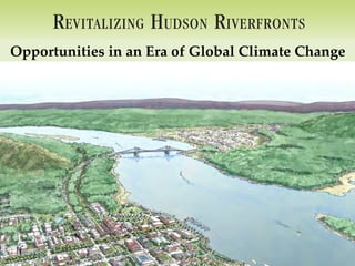
1. R EVITALIZING H UDSON R IVERFRONTS
Illustrated Conservation & Development Strategies for Creating Healthy, Prosperous Communities
Opportunities in an Era of Global Climate Change
3. what’s happening now
3-strategy roadmap
co-benefits of action
The Opportunity of a
Lifetime
4. Indicators of a Warming World
Glaciers Humidity
Temperature Over Land
Snow Cover
Air Temperature Near Surface (troposphere)
Temperature Over Oceans
Tree-lines shifting poleward and upward
Sea Surface Temperature
Sea Level
Spring coming earlier
Ice Sheets
Ocean Heat Content
Species migrating poleward and upward
Sea Ice
5. Indicators of a
Warming World source: National Center for Atmospheric Research
http://www2.ucar.edu/news/1036/record-high-temperatures-far-outpace-record-lows-across-us
6. Northeast annual
avg. temp up 1.4°F
since 1970
New York winter
temperatures
almost 5oF warmer
than 30 years ago.
Observed Changes in New York
7. 1990 USDA Hardiness Zones vs.
2006 Arborday.org Hardiness Zones
differences reflect warmer climate
Later frost in fall
Earlier plant germination
and blooms
Earlier arrival of
zone change
migratory birds
+2
+1
no change Timing of lake ice
-1
-2 formation and melting
1990 2006
Changes in species
ranges
Changes in precipitation
Observed Changes in New York
8. Return Period (Years)
Return (Years)
Years) Rainfall (in.)
110 5.55
105 5.50 • More precipitation
100 5.45 (slightly)
95 5.40
• More rain in winter
90 5.35
85 5.30 • Increasing extreme
80 5.25 storms (heavy rain
75
1961 1981 2001 2021 2041 2061
5.20 in a short period of
time)
Return
Return Period in. per Y Equivalent to 1961-1990 100-year storm
Number Events > 1 of Stormear
Year
Amount of 100-year storm
10
Observed
• Summers warmer,
8
HADCM3 with drier soils and
periodic drought
6
• Summer low
4 streamflow period
2
will be longer
1961 1981 2001 2021 2041 2061 2081
Year
Year
Observed Changes in New York
9. the imperative to facilitate the persistence of the
tinue to provide ecological services that sustain
optimal balance will require locally-specific tactics
edge, and regional strategies that coordinate efforts
mework.
Hudson River Sea Level 1856-2009
Sea level is 1’ higher
Sea Level
a (in mm, observed at Manhattan) than 100 years ago
Rise
500 Rate of sea level
average = 2.79mm/yr by 2080
rise is accelerating
400
Lower emissions:
300
8-23 inches
200
Higher emissions:
100
source: NOAA
37-50 inches
0
1856 1881 1906 1931 1956 1981 2006
Figure 2. Sea level change since 1856, observed
by tidal gauge at the Battery, Manhattan, NYC.
er
Sea Level Rise on the Hudson
we can expect water levels on the Hudson River –
ral Dam at Troy - to rise by up to five feet by the end
10. SAVING THE LAND THAT MATTERS MOST 2020 2050 2080
Hudson River Sea Level Rise Projections 1155 additional acres 2641 additional acres 4647 additional acres
inundation zone
> 5000 acres by
Sea Level Rise on the Hudson 2080
16. Save taxpayer dollars
Spur local economies and
create millions of green jobs
Improve public health
Reduce risks to people and
property
Enhance national security
Create a legacy of
leadership and conservation
...and avert catastrophe.
Opportunity
17. How Do We Plan
Toward the Best of
Both Worlds?
18. Restored Tributary
SAV
Preserved Ecologically
Sensitive Area
Diverse Housing Types,
Sizes and Affordability
4
Wetland
4
Parking Garage and
On-Street Parking
Alley and Parking
Behind Buildings
4
Local Street Along
Greenways and Parks
4
4
Renovated Existing
4
4
Buildings
4 4 4
70-FOOT SETBACK
In Built Riverfront Areas
4
4
4 Special Public Spaces
Viewing Piers, Marinas
4
Tour Boat Facilities
4
4
4
4 4
Bioretention Areas
Parking Lot Screening
Restored Historic Building
100-YEAR FLOODPLAIN
100-FOOT SETBACK
In Parks, Greenways, and
Natural Areas
4
4
Plan by Raymond Curran
100” 200” 300” 400” 500”
Mixed-Use Buildings Public Buildings Residential Buildings
Resilient Soften and Protect
Riverfront Restore Tidal Wetlands
Communities Shorelines and Floodplains
19. R EVITALIZING H UDSON R IVERFRONTS
Illustrated Conservation & Development Strategies for Creating Healthy, Prosperous Communities
www.revitalizinghudonsriverfronts.org
20. Restored Tributary
SAV
Preserved Ecologically
Sensitive Area
Diverse Housing Types,
• Identify built and natural assets
Sizes and Affordability
4
Wetland
4
Parking Garage and
On-Street Parking
Alley and Parking
at risk
Behind Buildings
• Steer development away from
4
Local Street Along
Greenways and Parks
4
4
Renovated Existing shorelines and floodplains
4
4
Buildings
4 4 4
• Site new infrastructure out of
70-FOOT SETBACK
In Built Riverfront Areas
4
the 500+ year floodplain
4 4 Special Public Spaces
Viewing Piers, Marinas
4
Tour Boat Facilities
4
4
• New structures elevated or
4
resilient
4 4
Bioretention Areas
• Employ softer, greener
Parking Lot Screening shoreline treatments where
Restored Historic Building
100-YEAR FLOODPLAIN
appropriate
100-FOOT SETBACK
In Parks, Greenways, and
Natural Areas
4
4
Plan by Raymond Curran
100” 200” 300” 400” 500”
Mixed-Use Buildings Public Buildings Residential Buildings
21. Four Basic Typologies
Natural Area
The Riverfront Greenway
Community Park
RFRONT
100 / 100 rule
OR
This mostly vegetated
-looking steps waterfront
ish a riverfront greenway corridor corridor should extend inland
reenway corridor serves as continuous,
hat provides public access, recreation, Built Riverfront
to the 100-year floodplain
conditions allow, this mostly vegetated
he 100-year floodplain boundary OR
boundary OR 100 feet from
ter line, whichever is GREATER. the mean high-water line,
s can be thought of as falling into four
whichever is GREATER.
ost urban form of the riverfront
ctions as a direct extension of the Linear
Riverfront
r municipal center. It provides public Park
should include lively, mixed-use,
estinations drawing upon local cultural,
tal assets.
Long, narrow public areas within the
23. d
T
k
3
Identify Resources,
Risks, and
Vulnerability: v y
Cornwall’s Waterfront r
on Sea Level Rise
Sea-Level Habitats Ramshorn Marsh
photo: Jeffery Anzevino
31. Dead stout stake to secure geotextile fabric * Not to scale
Eroded streambank
Install additional vegetation like live stakes,
rooted seedlings, etc.
Compacted soil about 1-foot thick
Live cuttings
Geotextile fabric
Height varies: 8-feet max.
High tide
Low tide
Streambed
Rock fill
2 to 3 ft.
NOTE: Rooted/leafed condition Esopus Meadows Watertrail Preserve, Esopus
of living plant material does not 3 to 4 f
represent time of installation. eet
Geotextile fabric
recommended
High tide
Low tide
Streambed
Dead stout stake used to
secure geotextile fabric
Riprap Live stakes Foundry Dock Park, Cold Spring
32. Existing vegetation, plantings or
soil bioengineering systems
Live branch cuttings
(1/2 to 1 inch diameter)
Erosion
control
High tide fabric
Low tide Compacted fill
material
Streambed
2 to 3 feet Geotextile fabric
Gabion baskets
NOTE: Rooted/leafed condition
of living plant material does not
represent time of installation. * Not to scale