Download to read offline

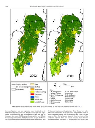
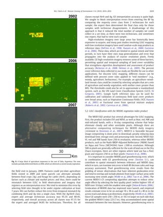

This document describes a study that developed a method for mapping annual land cover and land use (LULC) in the Dry Chaco ecoregion of South America using MODIS satellite imagery. Reference data was collected by visually interpreting high-resolution QuickBird imagery in Google Earth at random sample points. LULC was classified into 8 classes using predictor variables derived from MODIS time series data and a Random Forests classifier. Annual LULC maps from 2001 to 2007 were produced at 250m resolution and assessed for accuracy. The maps showed rapid deforestation related to expansion of soybean and pasture agriculture.

![[International agrophysics] ground penetrating radar for underground sensing ...](https://cdn.slidesharecdn.com/ss_thumbnails/internationalagrophysicsgroundpenetratingradarforundergroundsensinginagricultureareview-180310152824-thumbnail.jpg?width=640&height=640&fit=bounds)


