Download to read offline
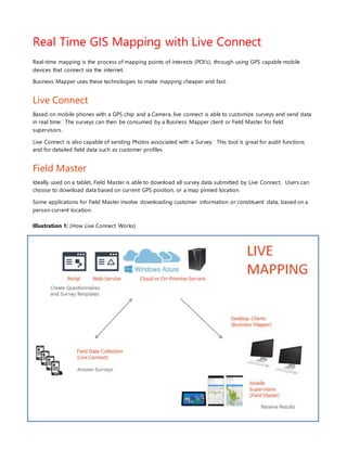

Real-time GIS mapping utilizes GPS-enabled mobile devices to map points of interest and streamline data collection through tools like Live Connect and Field Master. Live Connect allows for customizable surveys and immediate data submissions, including photographs, while Field Master enables easy access to survey data based on GPS location. This technology enhances auditing processes and enables detailed field data management, making mapping more efficient and cost-effective.


