
Download as PDF, PPTX


![European Union Water Initiative plus
for Eastern Partnership
© iStockphoto.com/ansonsaw
EXAMPLE 2
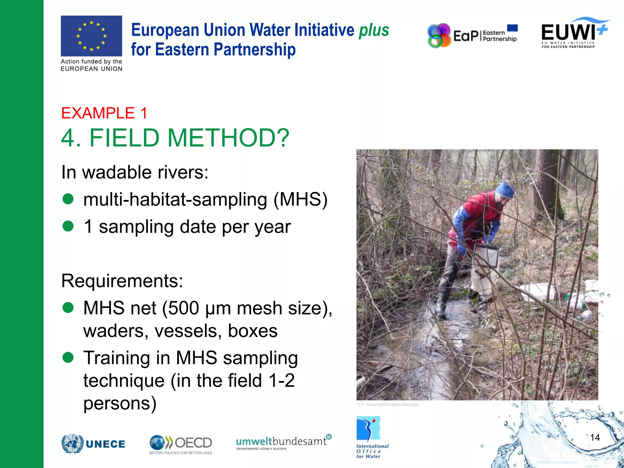
4. FIELD METHOD
30
0 2 4 6 8 10 12 14 16 18 20 22 24
Water temperature [°C]
25
20
15
10
5
0
Waterdepth[m]
epilimnion
metalimnion
hypolimnion
thermocline
8,9
7,8
6,9
20,9
20,1
17,7
0 2 4 6 8 10 12 14 16 18 20 22 24
Water temperature [°C]
25
20
15
10
5
0
Waterdepth[m]
Secchi depth
euphotic zone
14,1
aphotic zone
= Secchi depth x 2.5
compensation level
= max T](https://image.slidesharecdn.com/03principlesofclassification-180702134333/75/Principles-of-biological-classification-30-2048.jpg)


This document discusses methods for assessing water quality in rivers and lakes according to the Water Framework Directive (WFD). It provides examples of determining the appropriate method for different water body types based on key factors like category, type, expected pressures, and most sensitive biological quality element. For rivers, it suggests diatoms are often the most sensitive element and the multi-habitat sampling method for sample collection and sorting in the field or lab for analysis. For lakes, it indicates phytoplankton such as chlorophyll-a concentration is often most sensitive and involves various field sampling techniques and lab analysis of chemicals and phytoplankton. It stresses the importance of standardization, documentation, training and quality control for WFD compliant assessment


