Download as PDF, PPTX


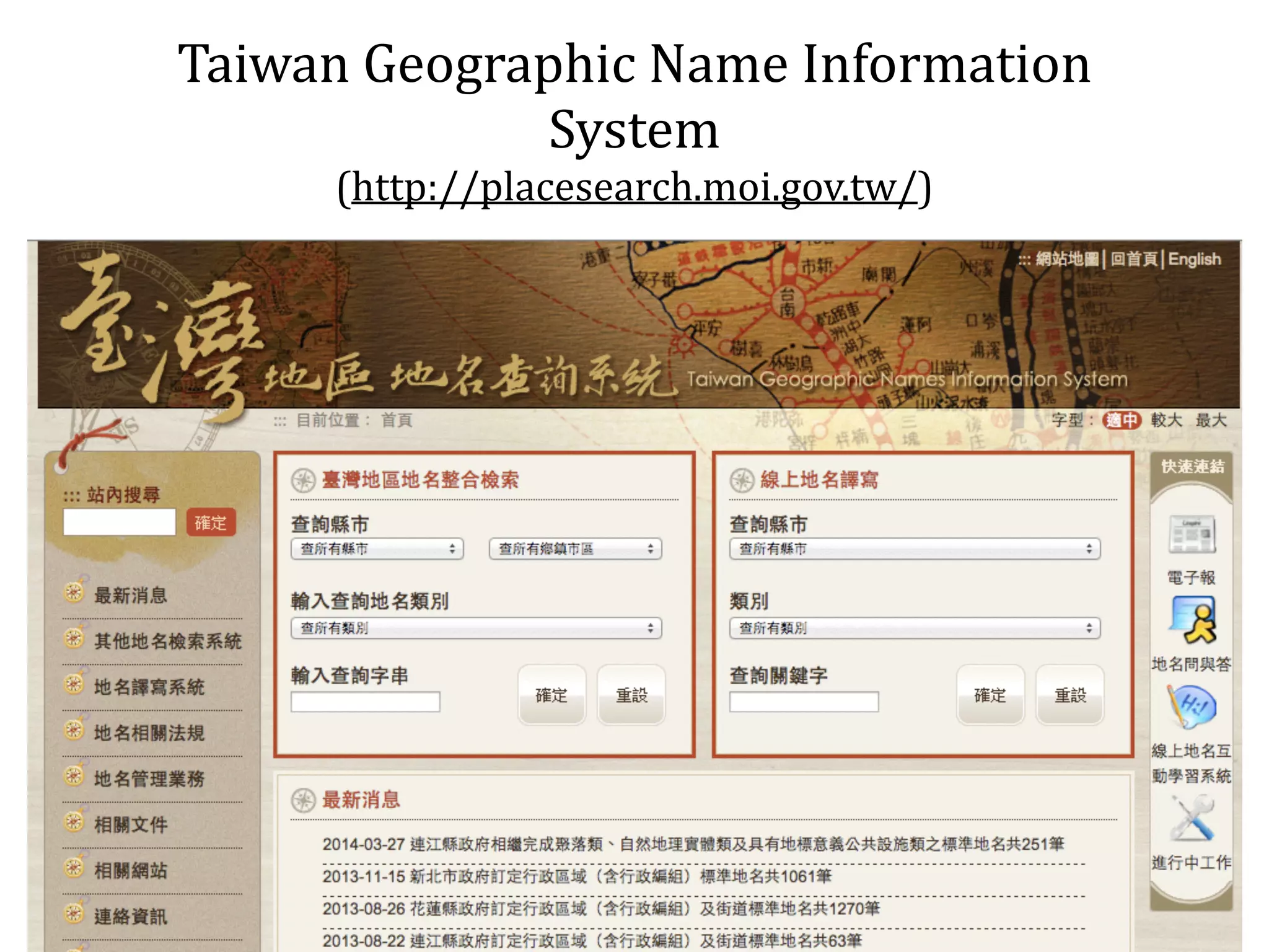
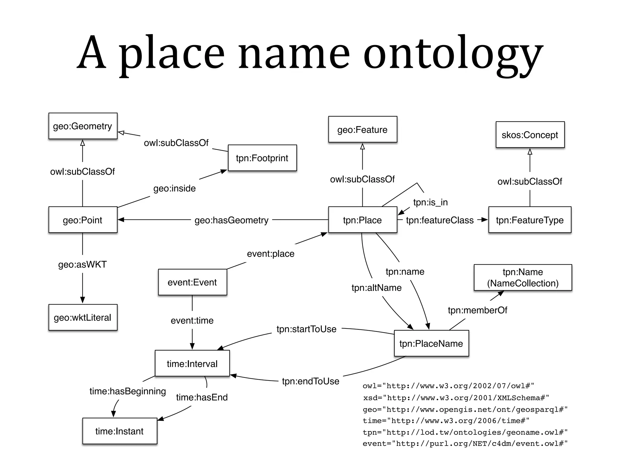
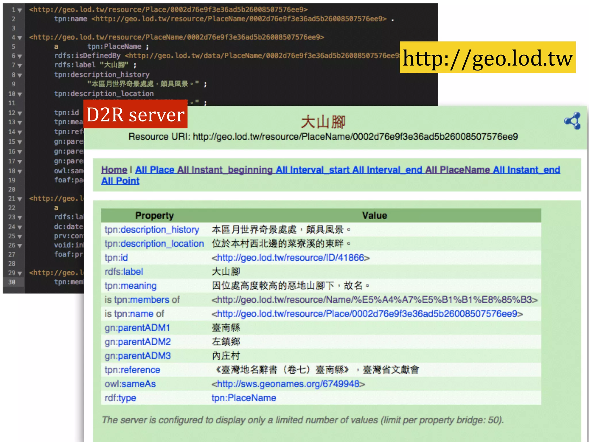


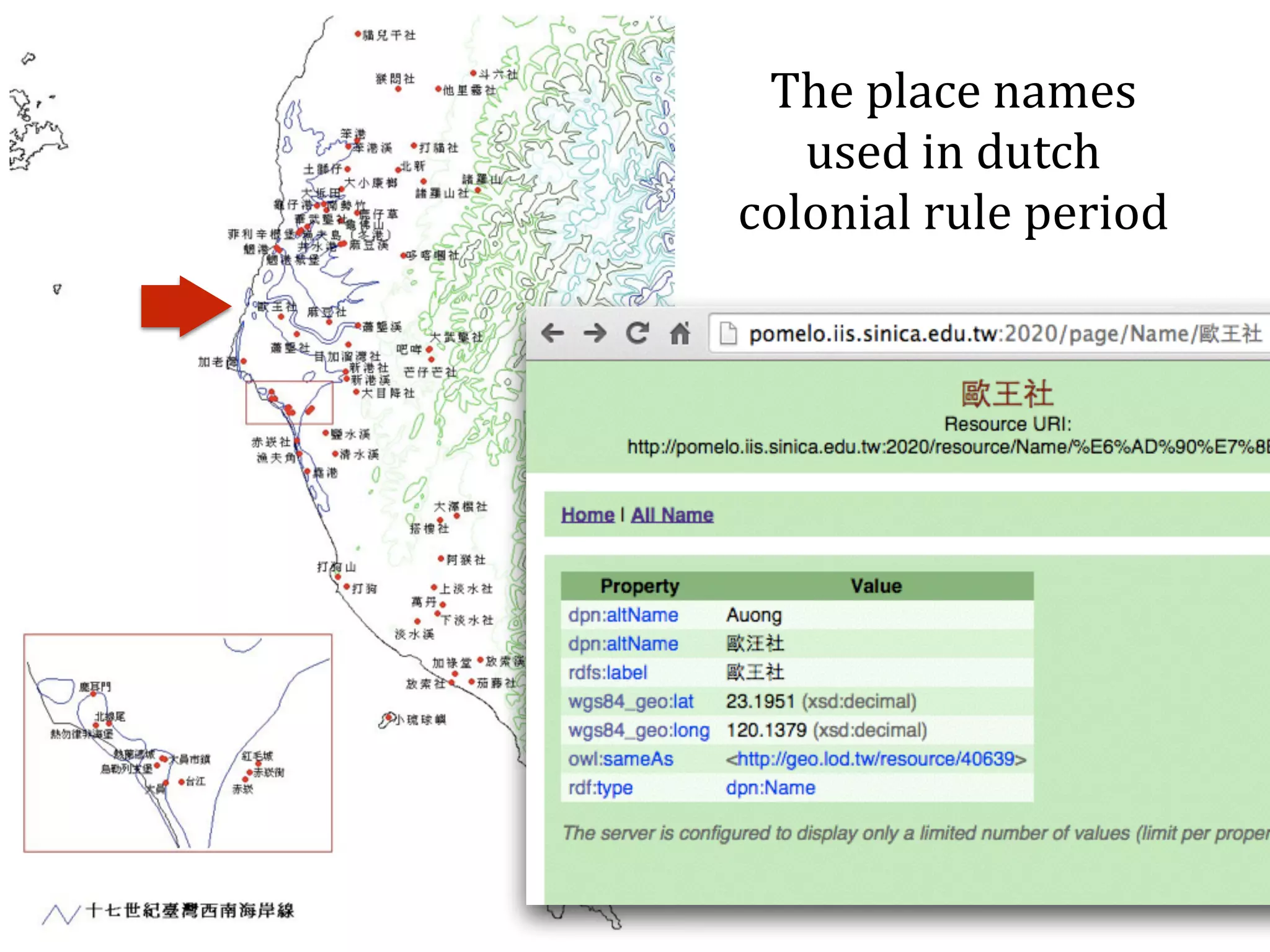
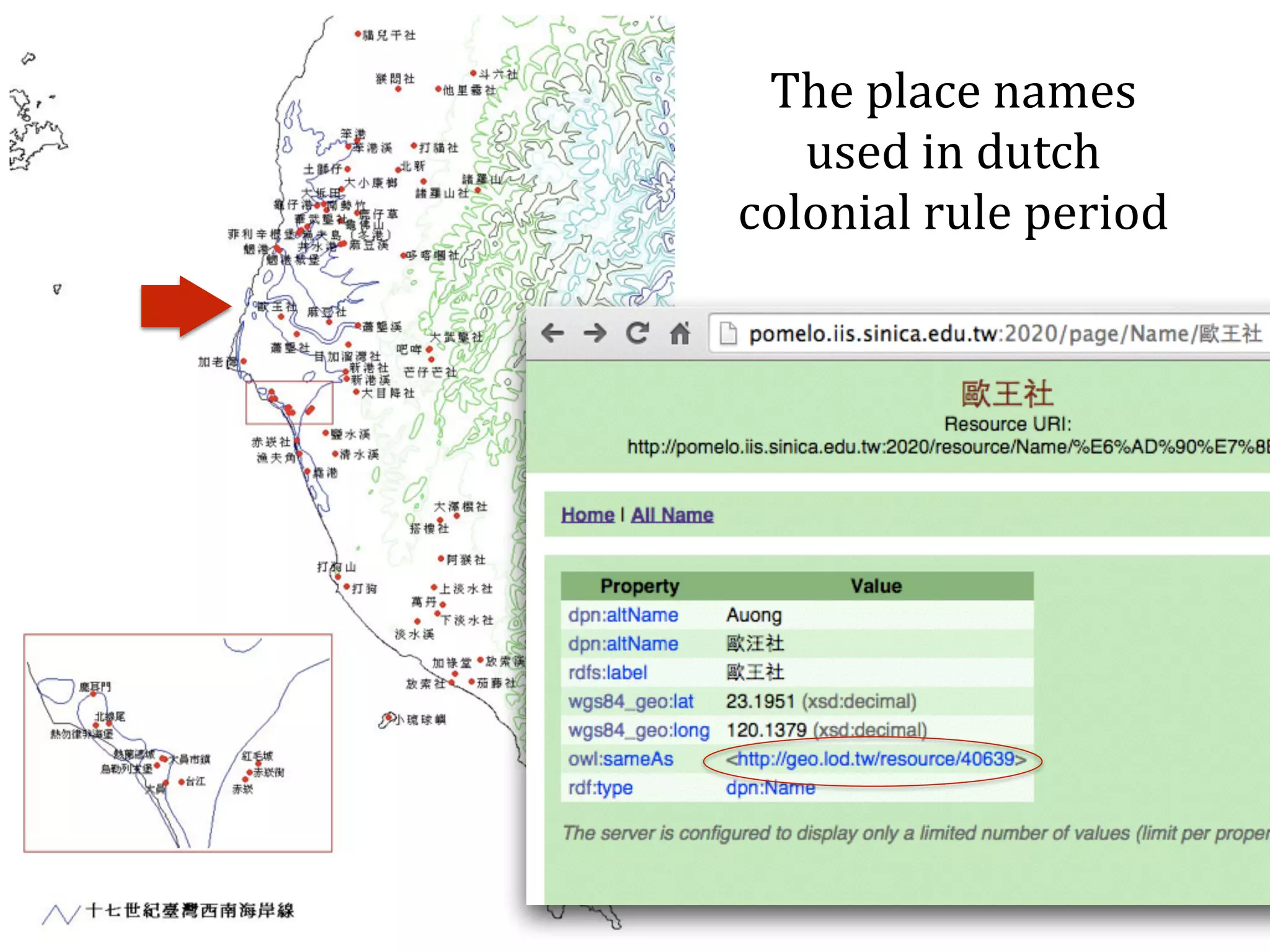
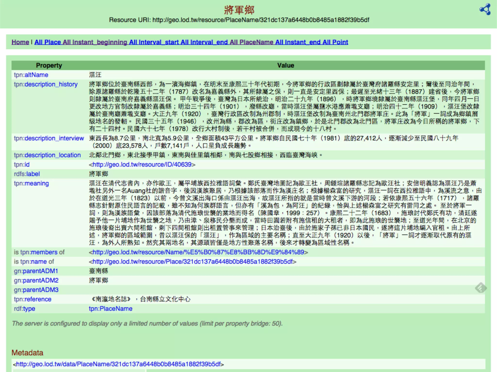

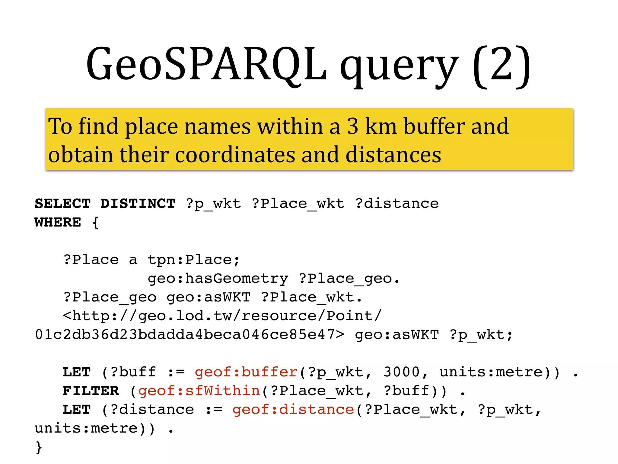

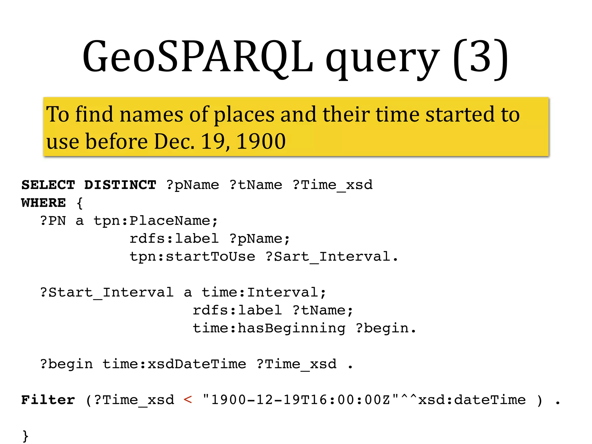
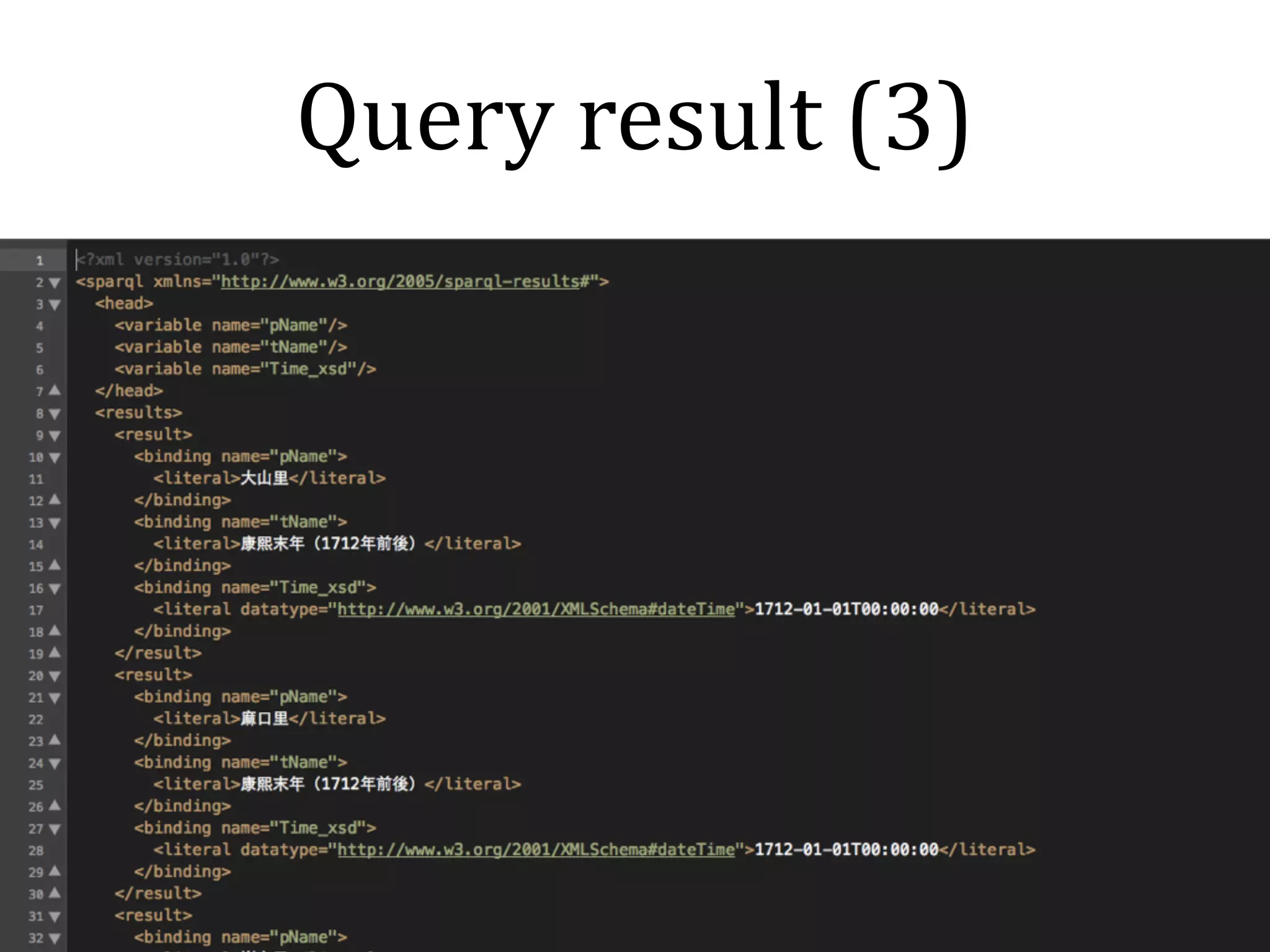


This document summarizes Dongpo Deng's presentation on developing linked geoname data using GeoSPARQL. It discusses transforming a Taiwanese place name dataset into RDF triples using a place name ontology. A linked data server and GeoSPARQL endpoint were created to serve and query the linked place name data. Spatial and temporal SPARQL queries over the data were demonstrated. The linked place names can be used as controlled vocabularies and are connected to other datasets like Geonames.org.


![Coded Agents – with UiPath SDK + LangGraph [Virtual Hands-on Workshop]](https://cdn.slidesharecdn.com/ss_thumbnails/codedagentsdeck-251215155422-5497c599-thumbnail.jpg?width=640&height=640&fit=bounds)


