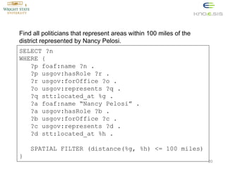
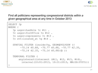
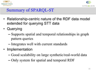
Download to read offline

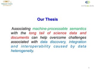
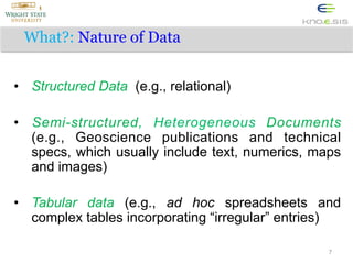
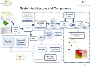

The document discusses the importance of semantics-enhanced interoperability in geoscience, highlighting the challenges and potential benefits of utilizing semantic technologies for data discovery and integration. It emphasizes the need for lightweight semantic strategies to support both large organizations and individual scientists, aimed at improving data accessibility and reducing redundancy. Additionally, it outlines the architectural framework and applications of advanced query languages like SPARQL for effective data retrieval and machine perception in geospatial contexts.