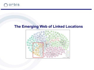
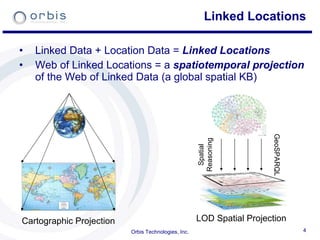
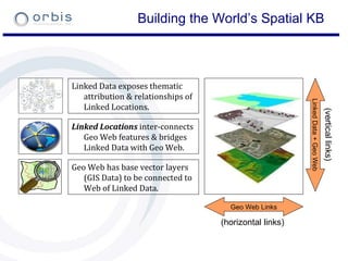
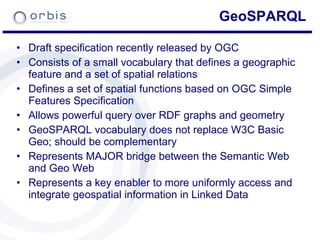
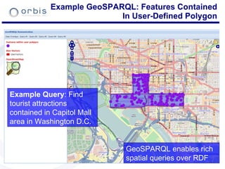
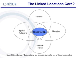
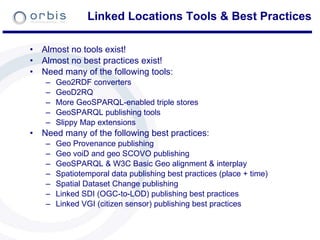
The document discusses the role of geographic information in government linked data. It describes how spatial data infrastructure (SDI) can be published as linked data to create a linked spatial data infrastructure. This would allow government geospatial data to be integrated into the linked open data cloud. Publishing lightweight location data from reports and using citizen sensor data are also discussed. Standards like GeoSPARQL could help bridge the semantic web and geo web by enabling spatial queries over RDF graphs. Tools and best practices are still needed for tasks like converting and publishing geospatial data as linked data.


![Example GeoSPARQL Query SELECT ?airport WHERE { ?airport rdf:type :Airport . ?airport :hasPointGeometry [ ogc:asWKT ?aPointGeom ] FILTER(ogcf:distance(?aPointGeom, “ POINT(-122.4192 37.7793)”^^ogc:WKTLiteral, ogc:km) <= 100) } Example Query: Find airports within 100 KM of San Francisco :SemTech2011 :locatedIn :SanFrancisco . :SanFrancisco :hasPointGeometry [ ogc:asWKT “POINT(-122.4192 37.7793)”^^ogc:WKTLiteral ] . Example Data: SemTech 2011 is located in San Francisco](https://image.slidesharecdn.com/geographicinformationingovtlinkeddata-110628173845-phpapp02/85/Geographic-information-in-govt-linked-data-19-320.jpg)


![[Metropolia Student Project Seminar 24.5.] Innovative Building Materials](https://cdn.slidesharecdn.com/ss_thumbnails/innovativebuildingmaterials-120529021636-phpapp02-thumbnail.jpg?width=640&height=640&fit=bounds)