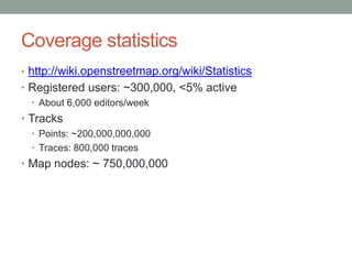
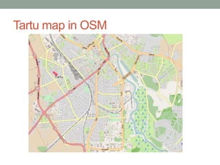
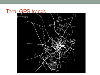
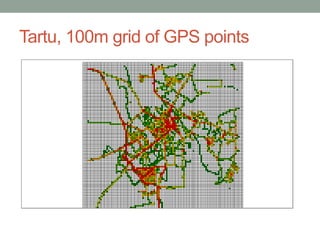
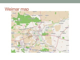
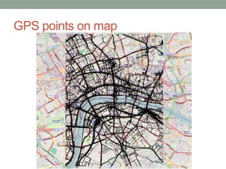
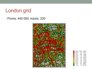
OpenStreetMap and positioningJaakLainesteOpenStreetMap EstoniaNutiteq.com
OpenStreetMapWikipedia of mapsGlobal databaseFocused to current street mapsNo elevation, history etcCommunity300.000+ registered usersVery strong in GermanyFree and open to useCC-BY-SA license
How OSM is createdField mappingGPS tracesWalking Papers – paper notesOn-screen mappingYahoo! ImageryRegional sources: e.g. Estonian National Land BoardImportsUSA: TIGER dataEurope: Corine Land Cover etc
Mapping parties
Data in OSM DatabasesMap dataNodes, ways, relationsTagged openlyHistory: who, when, changesetsGPS tracesBase for map
GPS Trace dataHTTP REST-based APIBased on BBOXTracks and trackpoints (lat/long)No timestamp, user IDGPX format (simple XML) Someone has been in point XTrack details from databaseTimestamp, user ID
Map dataWays and nodes:User IDEditing timeInformation about locations:Probably editor has been in the point around editing time (+ maybe few weeks)Density of different editorsQuite ambiguous
London – different editorsITOWorld extract
Using OSM dataGPS trackHigh precision – time and locationLess usersMap locationsLow precisionMore usersMovement distributionPlaces what and when users have visited
OSM advantagesCoverage is:GlobalQuick, get the data nowFreeReal usability?Real coverage is variable
Coverage statisticshttp://wiki.openstreetmap.org/wiki/StatisticsRegistered users: ~300,000, <5% activeAbout 6,000 editors/weekTracksPoints: ~200,000,000,000 Traces: 800,000 tracesMap nodes: ~ 750,000,000
Key issuesUser is in „mapping mode“. May be special tripMost mappers do not upload/share GPS tracesUser can trace aerials, without being thereRegional differencesVery good in e.g. Germany, UKLimited in e.g. US (TIGER imports)
Other uses of OSMUse OpenStreetMap as a base mapPositioning accuracy improvement GPS trace shows where people are more probablyShare your GPS traces in OSMContribute to OSMfix map of your neighbourhoods!
Study: distribution of GPS tracesTwo random cities pickedTartu, Estonia – well-known townWeimar, Germany – unknown townGPS traces downloaded for town areaTartu – 9x9 km, 160.000 points, 42 tracksWeimar – 7x7 km, 100.000 points, 33 tracksSpatial distribution of tracesVisualized in 50 or 100-m grid
Tartu map in OSM
Tartu GPS traces
Tartu, 100m grid of GPS points
Weimar map
Weimar, GPS trackpoints
Weimar, 50m grid
Map of central London
GPS traces
GPS points on map
London gridPoints: 440 000, tracks: 220

Openstreetmap, GPS traces and positioning

Editor's Notes

  • #4 ... And you can create it too?
  • #23 You can see some roads which stand out