Download as PDF, PPTX


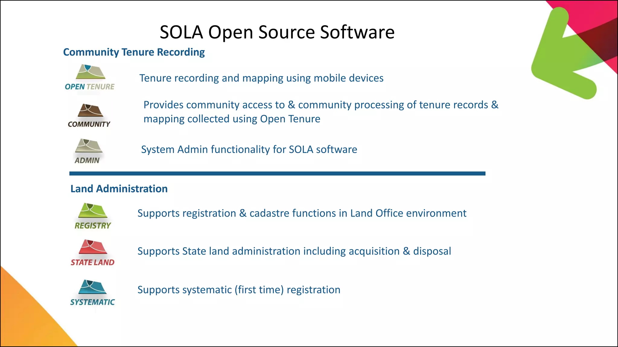
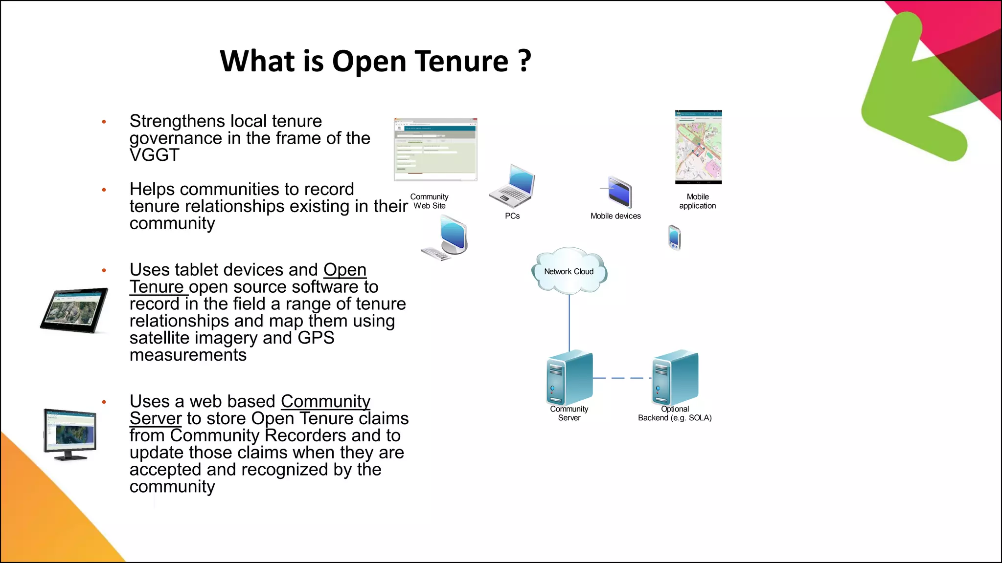
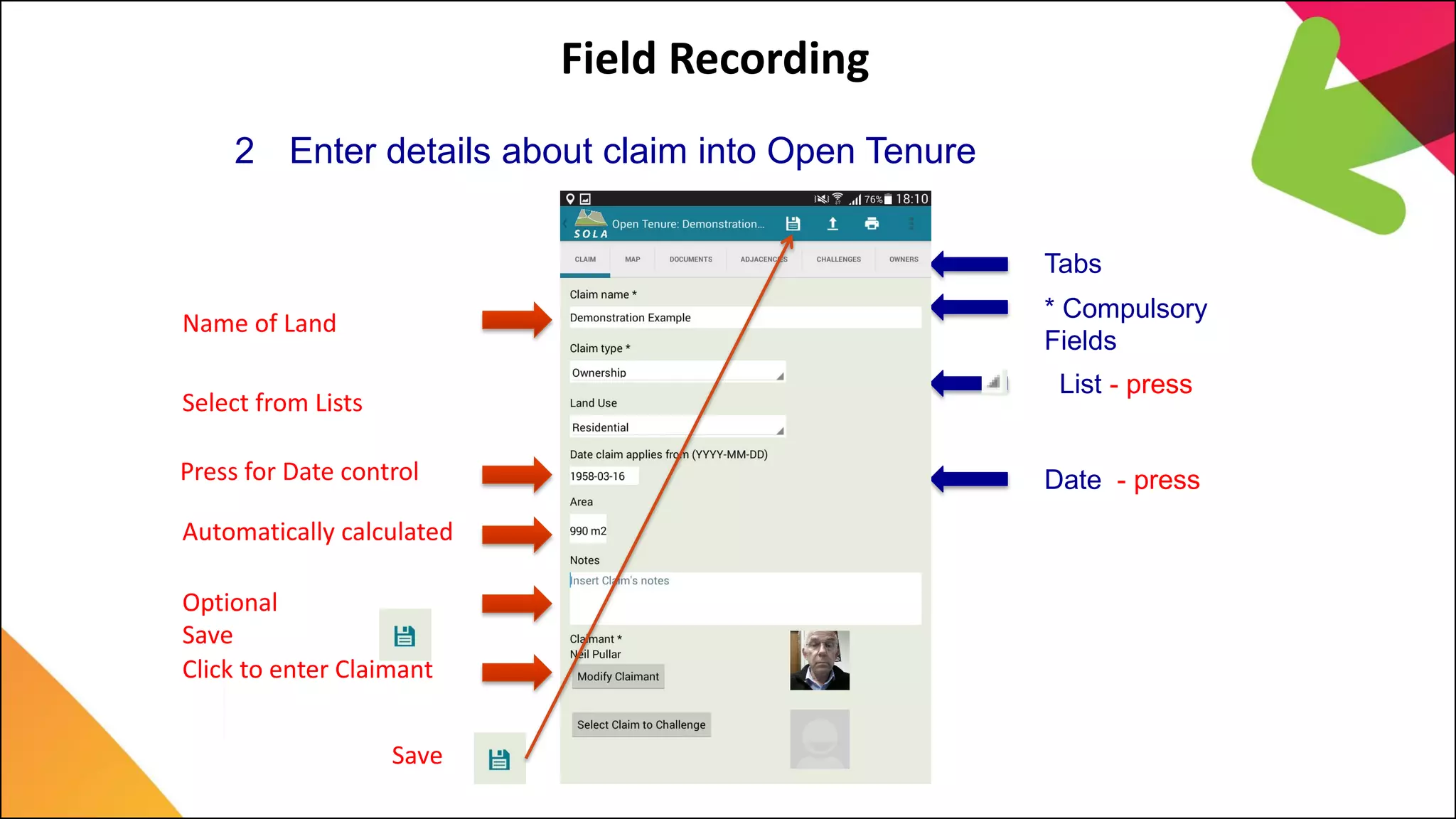
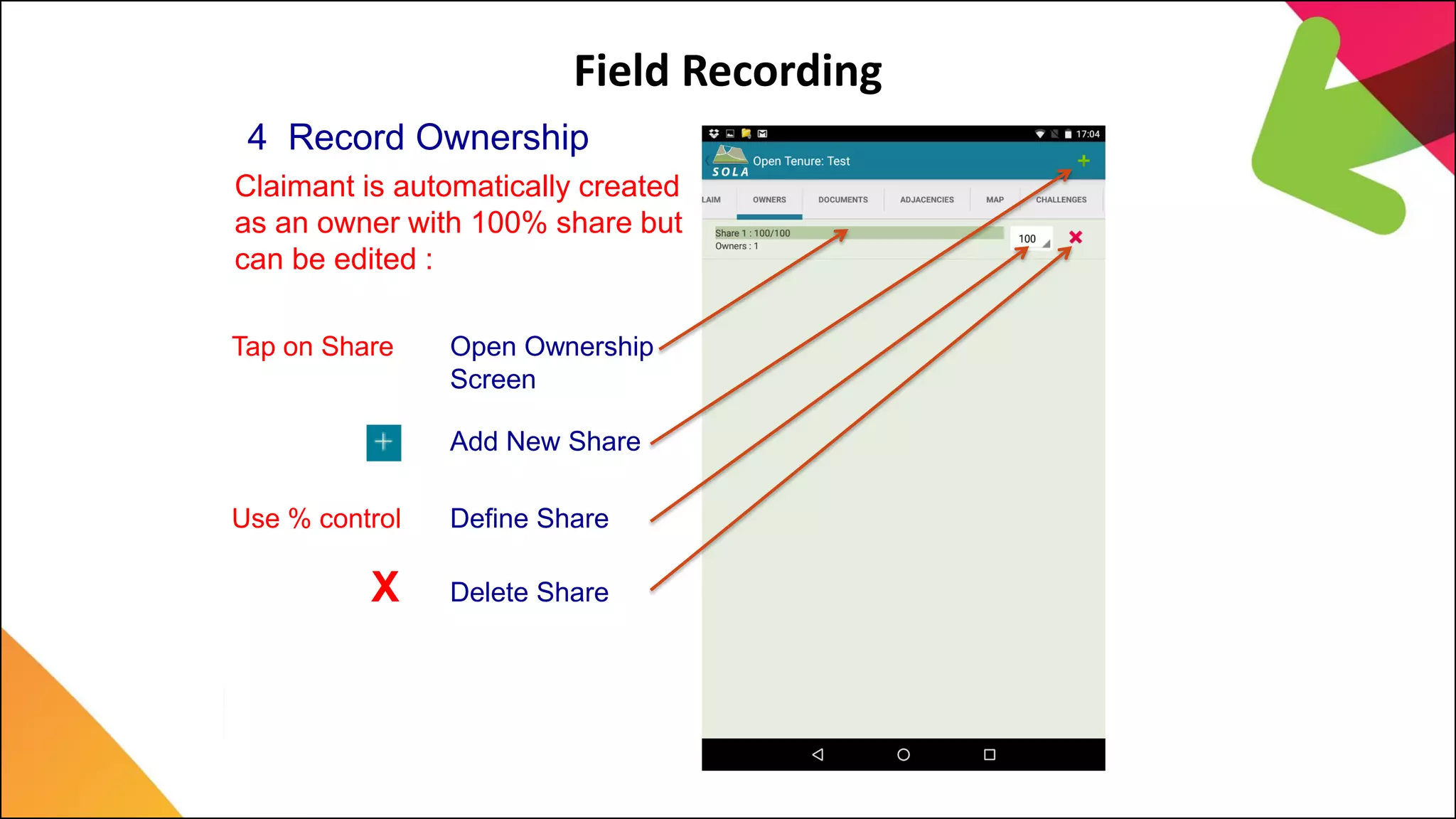
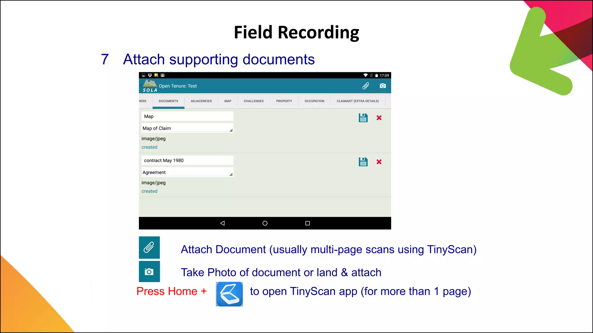
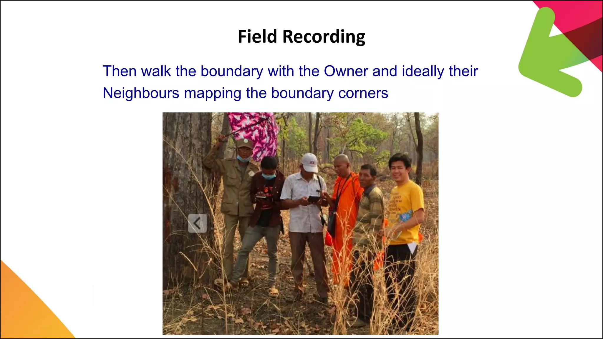
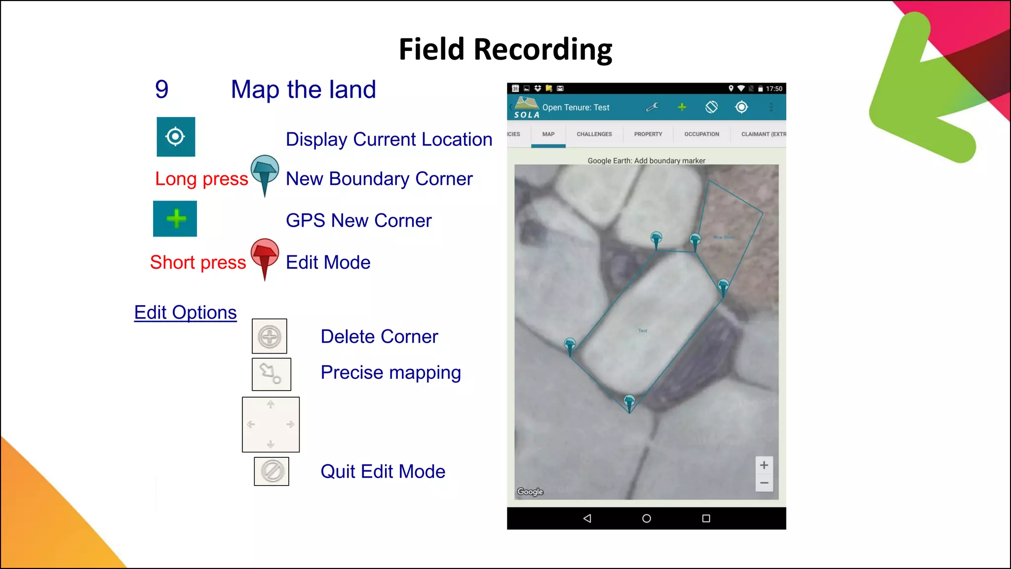
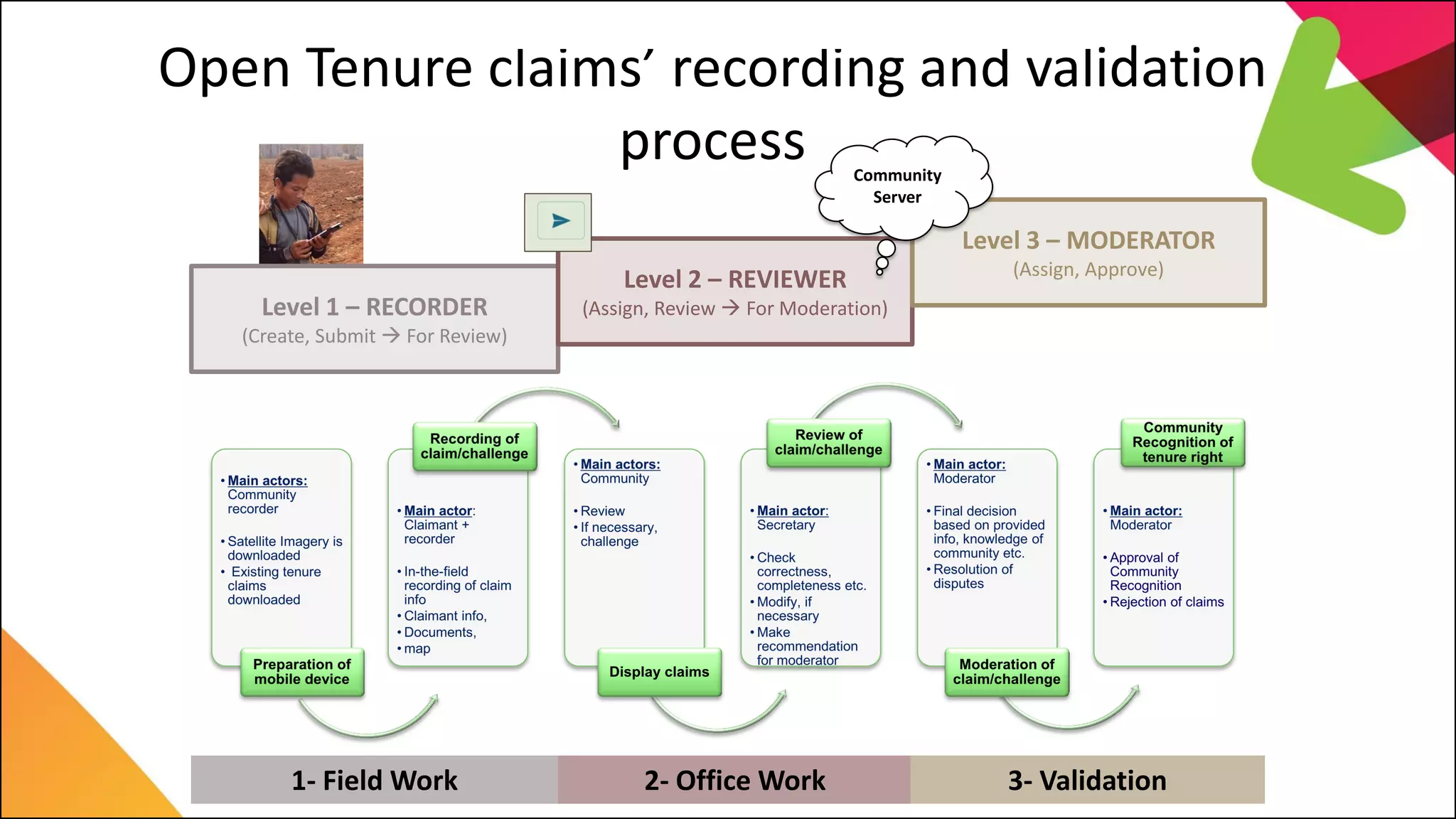
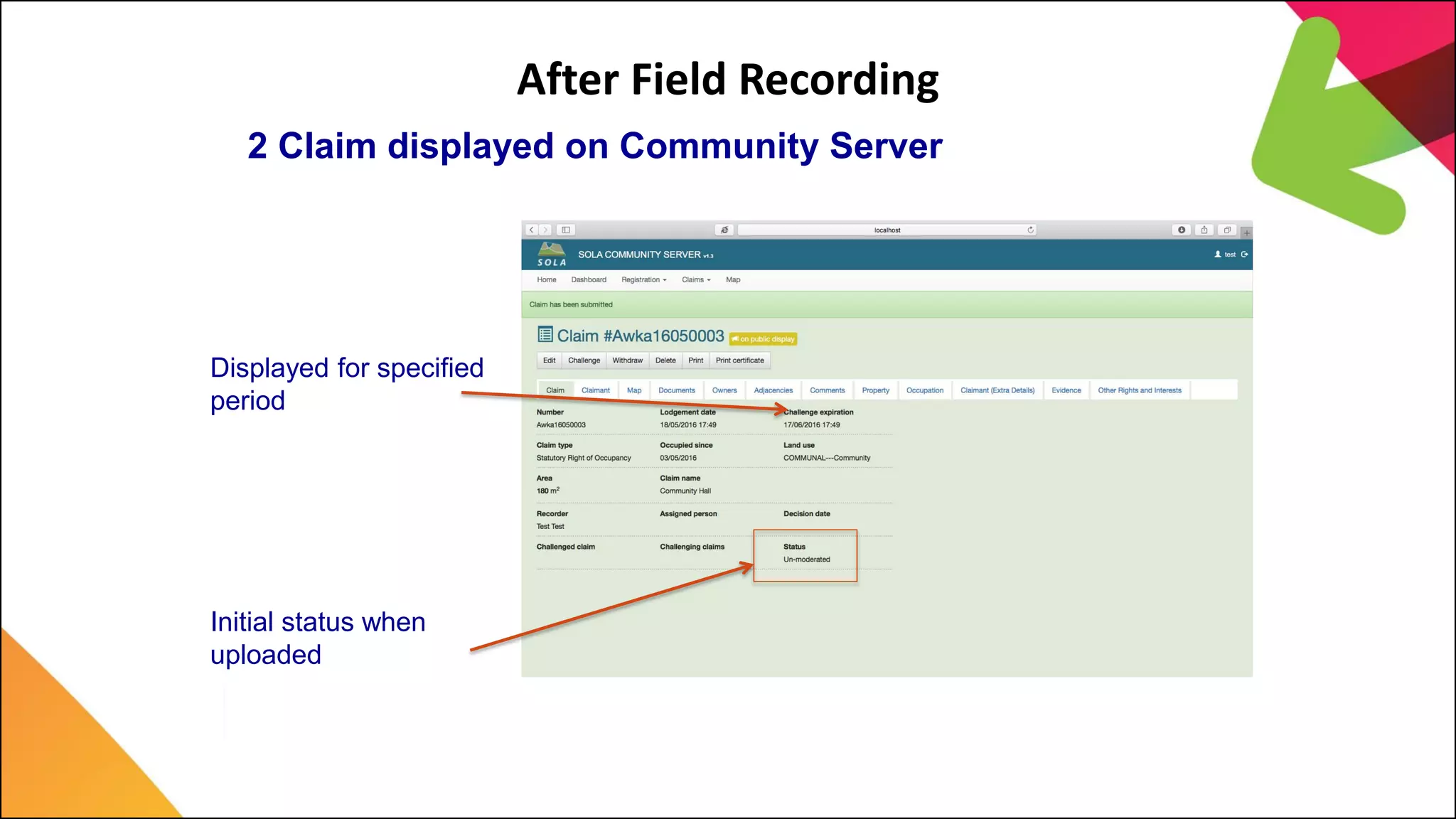
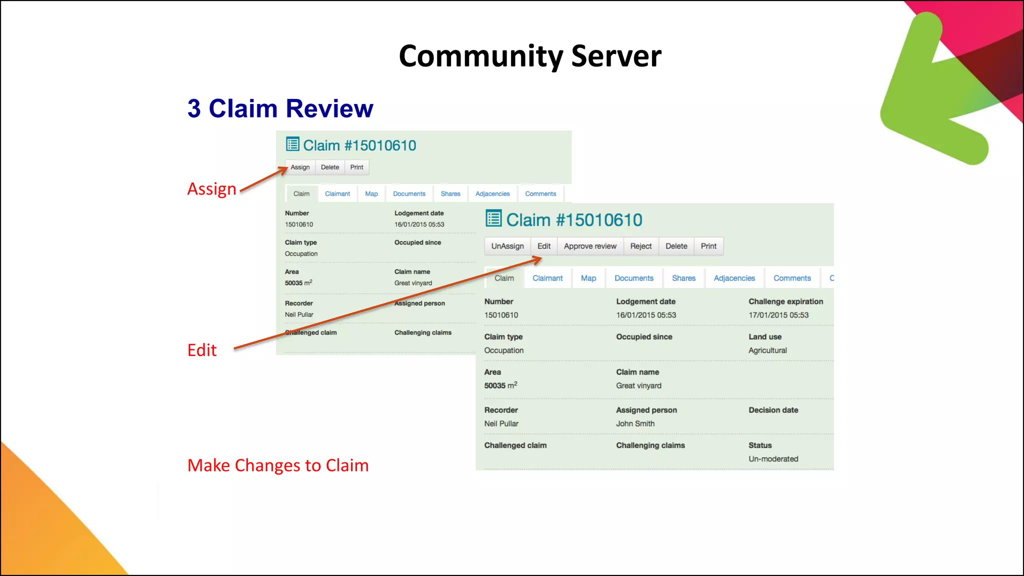
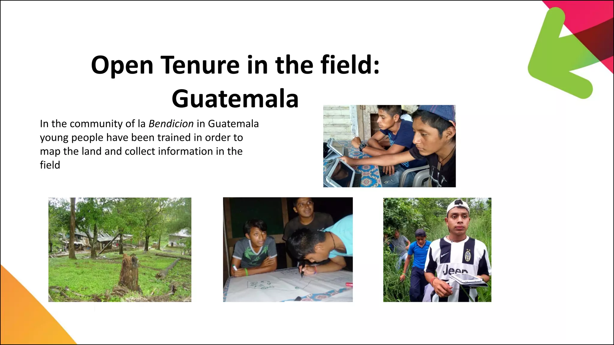
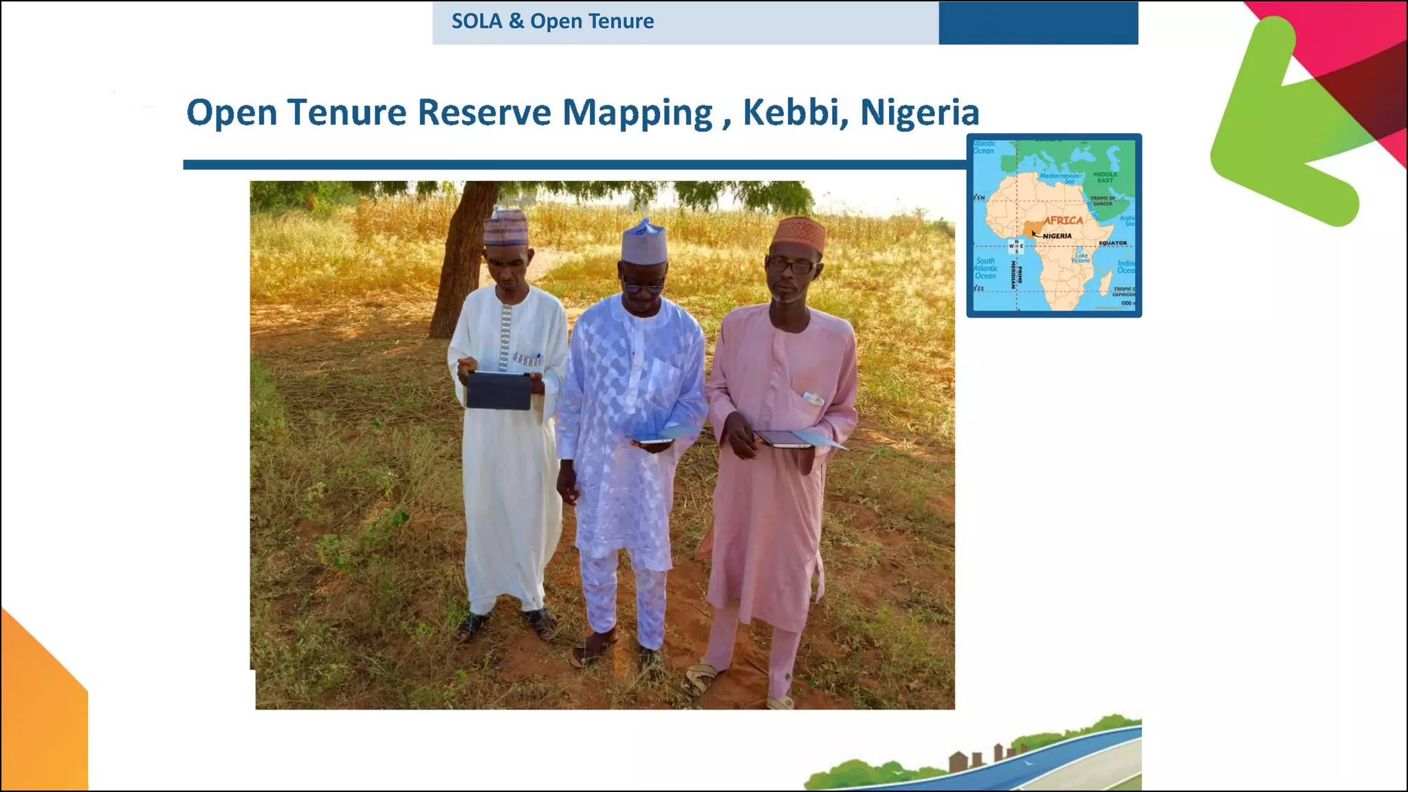
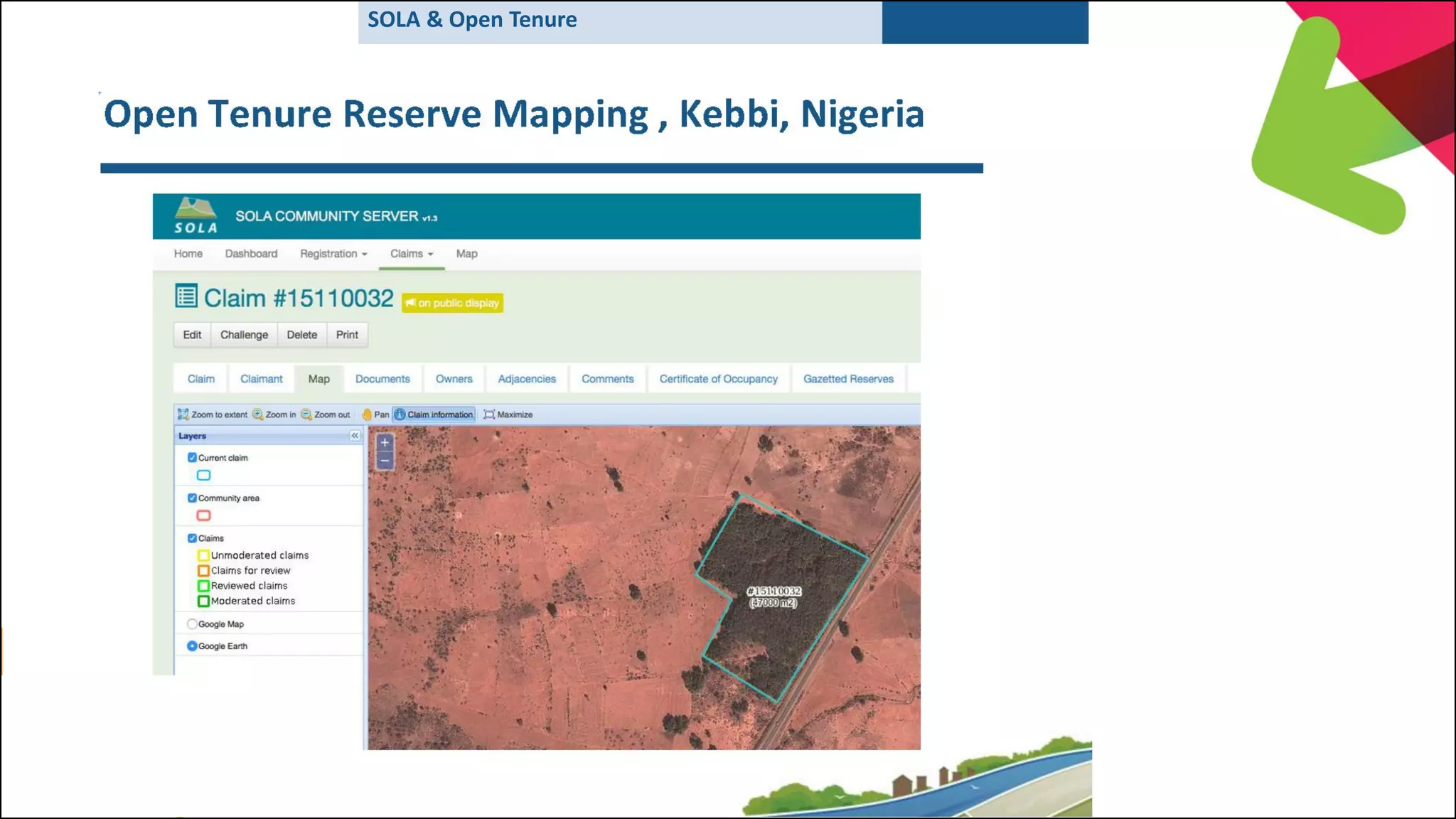
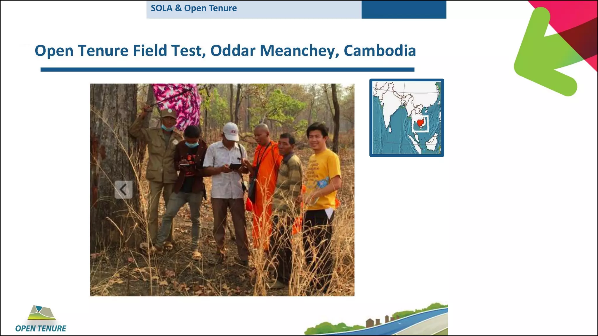
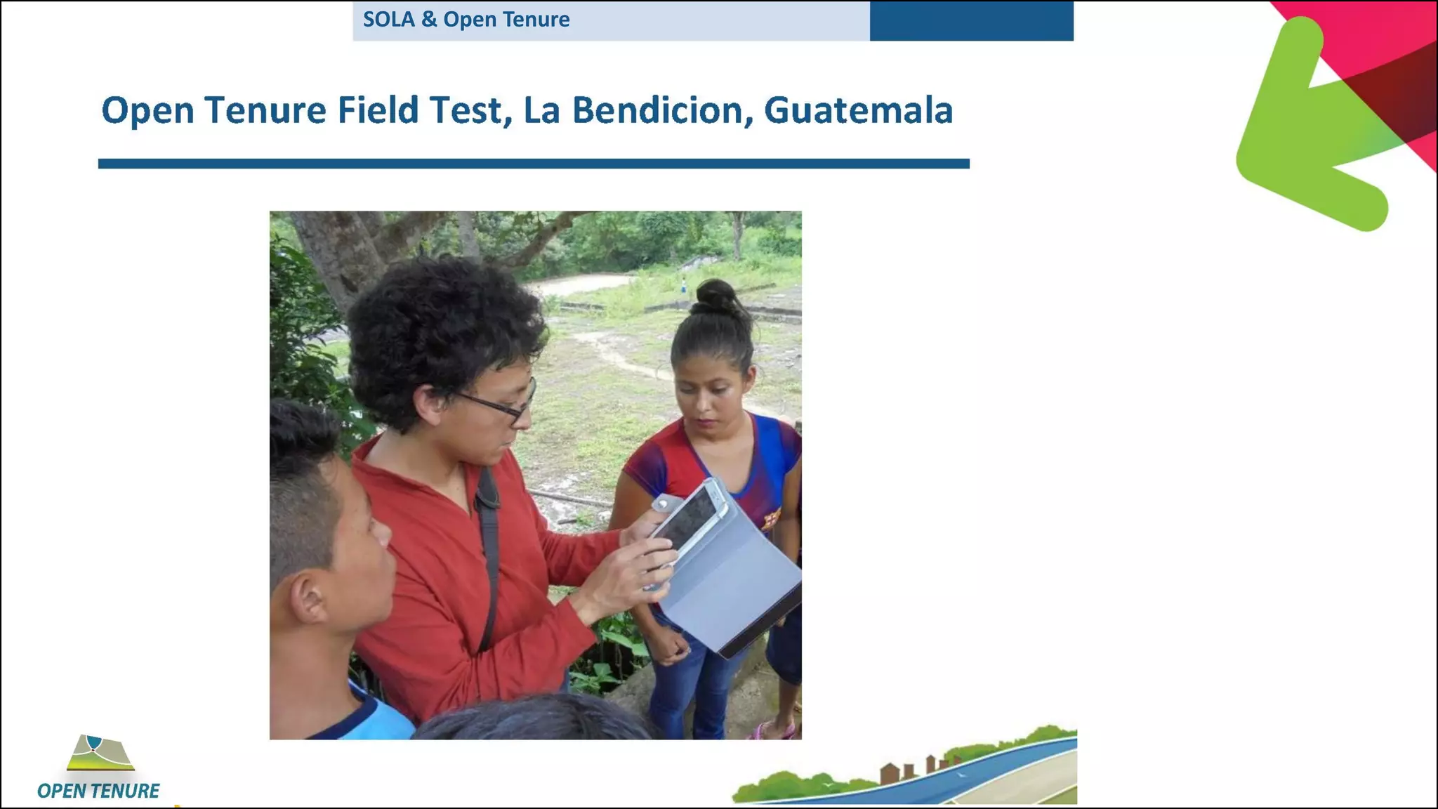
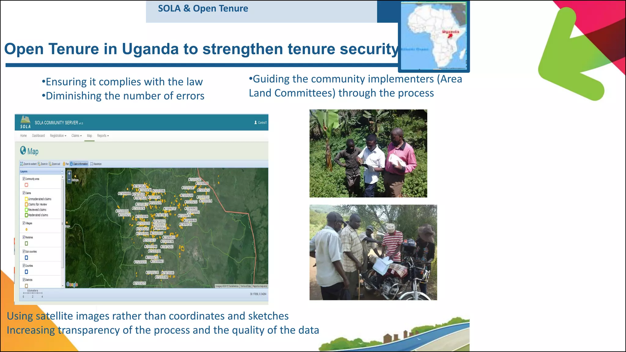
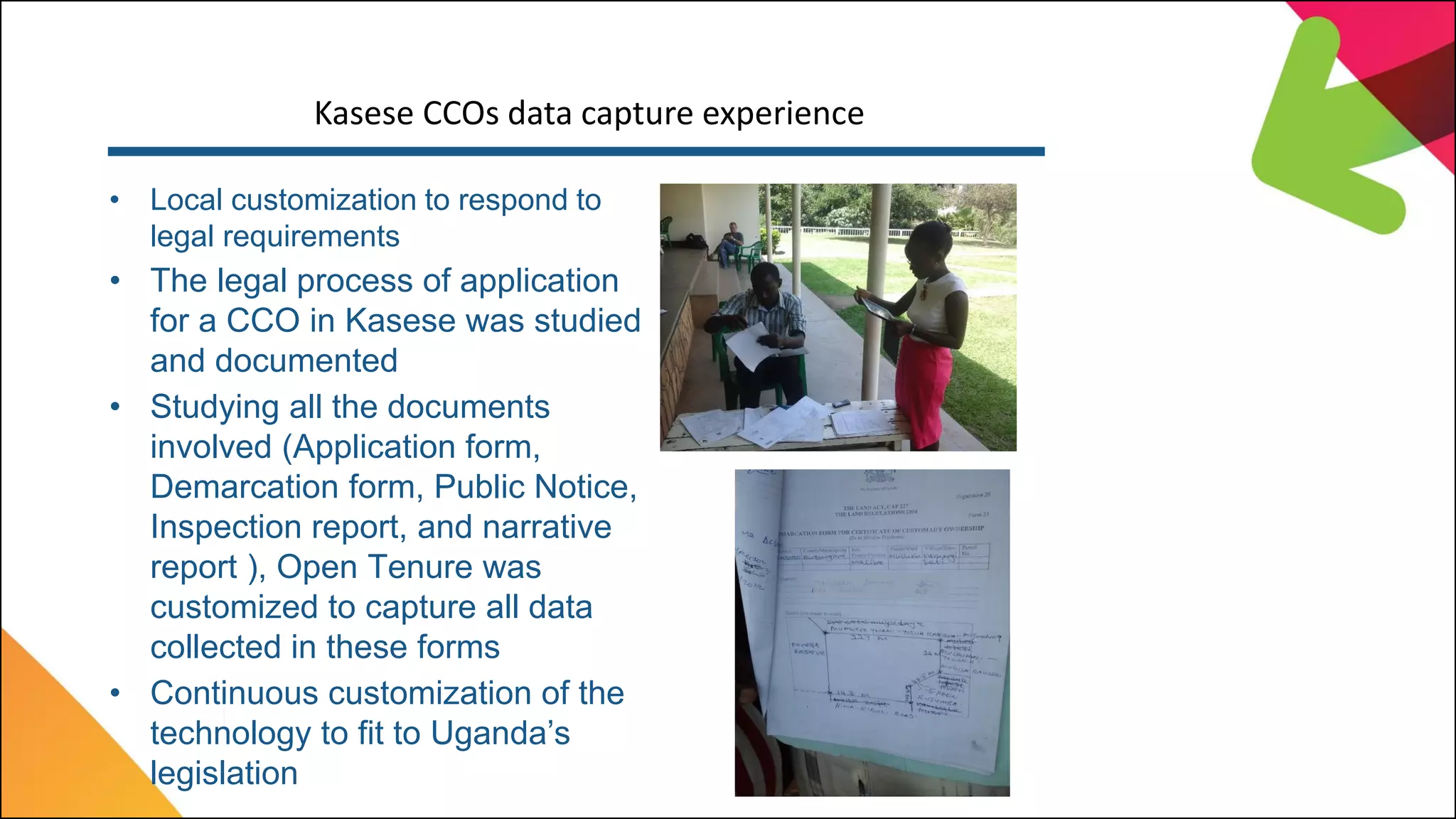
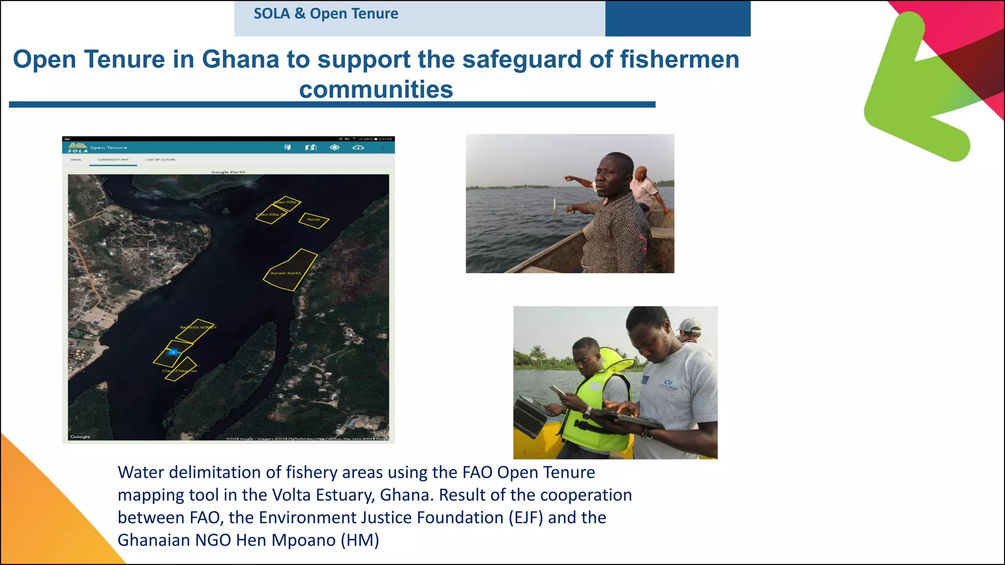
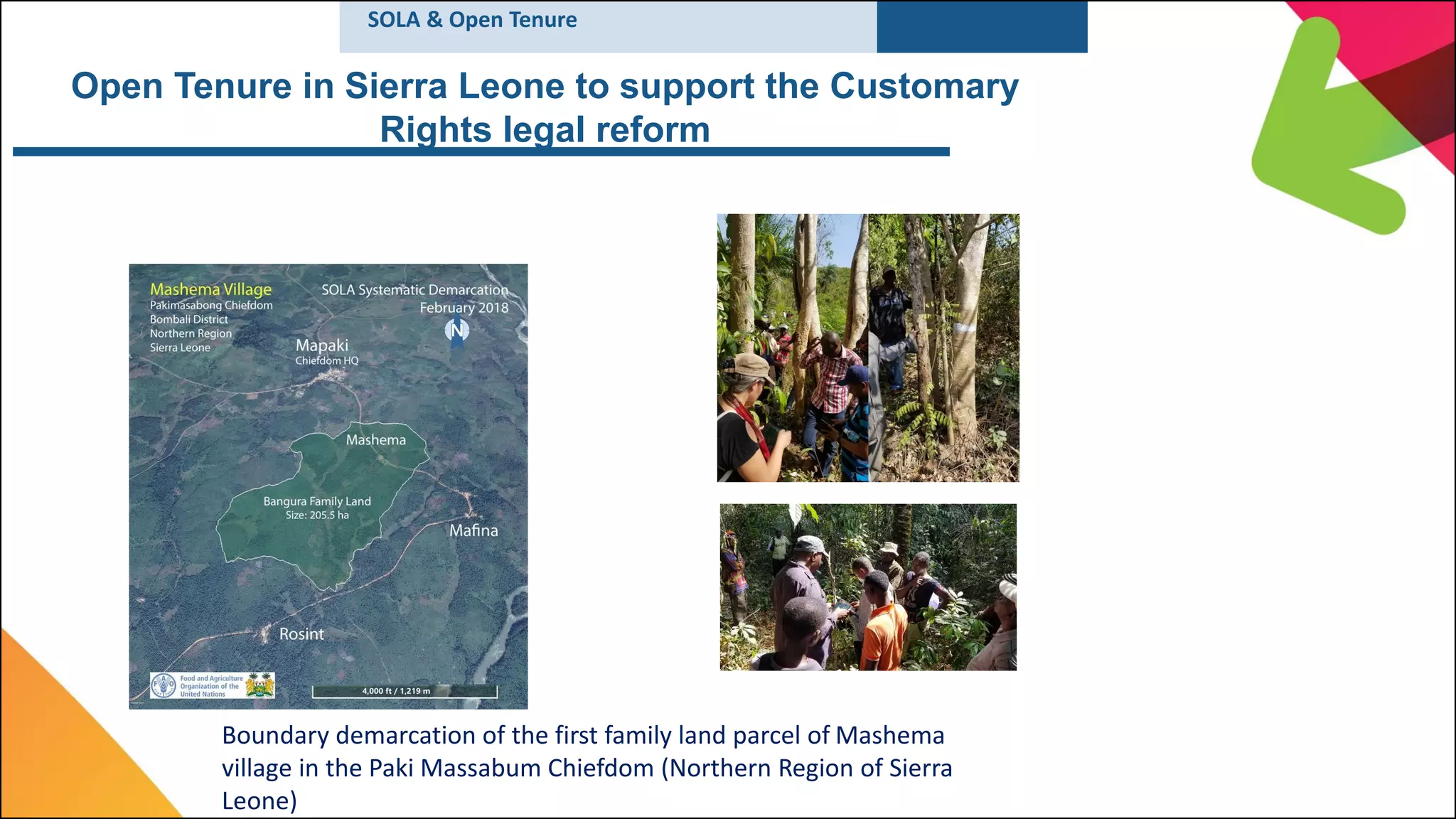

This document summarizes a meeting about land governance. It discusses the Voluntary Guidelines on Responsible Governance of Tenure of Land, Fisheries and Forests (VGGT) and how open source software like SOLA and Open Tenure can help implement the VGGT. Open Tenure is a mobile application that allows communities to record their own tenure rights to strengthen local governance. It has been implemented in several countries. SOLA works with Open Tenure to store and manage community tenure claims recorded in the field. The document outlines the benefits of these tools, such as increasing transparency, engagement, and protecting community rights.


