A global open source platform enabling any organization (public or private) to upload, update, validate the quality, store and share open transport data
Big data Europe the transport pilot in Thessaloniki - Josep Maria SalanovaBigData_Europe
The document discusses mobile sensor data collection in Thessaloniki, Greece for transportation analysis. It describes using stationary Bluetooth sensors to track device IDs for travel time estimation and origin-destination analysis. It also uses floating car data from taxis and buses for traffic status and mobility pattern analysis. The data is processed using map matching and time series forecasting algorithms to classify current traffic states and predict future conditions. Websites and data portals for accessing the collected transportation data are also listed.
SC4 Workshop 1: Evangelos Mitsakis: Big data Sources for/from Intelligent Roa...BigData_Europe
This document discusses big data sources for intelligent road transport. It explains that even small datasets from individual vehicles can grow very large in aggregate when many vehicles are transmitting GPS data. Transportation agencies are now collecting petabytes of data on traffic patterns, public transit use, and vehicle locations using sensors, vehicle fleets, and smartphones. This big data is helping to optimize traffic management, asset maintenance, and traveler information services. Researchers are also able to conduct more accurate studies without relying on samples by analyzing vast amounts of real-world transportation data. The document provides examples of big data collection and use for traffic, public transit, and smart cities in Greece.
Encuentro Aporta 2016 - Mesa 2 - Miguel AriasDatos.gob.es
This document discusses Carto's open source and open data approach to business decision making. It highlights that by 2020, 25 billion devices will generate location data, and that location unlocks insights from big data. Carto uses open source code and open data to democratize location intelligence and build communities. This allows for faster development at lower costs. The future is in services rather than code lines. Carto has over 250,000 users creating over 5,000 visualizations per month, and offers tools like Builder, Engine, and location data services to help organizations leverage location data.
SC4 Workshop 1: Simon Scerri (Fraunhofer) - What can big data do for transport?BigData_Europe
The document describes a series of workshops on empowering communities with data technologies for transport. It provides context on big data, including the large volume of data being created and its dimensions of volume, velocity, variety and veracity. It outlines the motivation and objectives of the Big Data Europe project, including establishing data value chains across domains and lowering barriers to using big data. Current activities for Year 1 include a series of societal workshops and setting up interest groups in health, food, energy, transport, climate, societies and security.
Big data and transport - where can it take us? Paul KompfnerBigData_Europe
Big data has the potential to provide surprising insights into mobility if used purposefully to answer specific questions. Sources of big transport data include vehicle sensors, infrastructure sensors, mobile devices, social media, and associated transaction systems. In the future, mobility-as-a-service platforms will depend heavily on big data handling to broker demand, understand customer journey plans, and efficiently fulfill transport services through extensive data processing and analysis. Key open questions include who will be the customers and owners of these big data systems and what their long-term business models will be.
Innovations in London's Transport: Big Data for a Better Customer ServiceGovnet Events
Presentation on Innovations in London's Transport: Big Data for a Better Customer Service by Andrew Hyman, TFL at HPC and Big Data 2016 in Central London
A presentation by Neil Frost (Chief Executive Officer: iSAHA), at the Transport Forum SIG: "Cost Effective Public Transport Management Systems" on 12 May 2016 hosted by University of Johannesburg. The theme of the presentation was: "Big Data and Public Transport."
SC4 Workshop 1: Nick Cohn: Traffic managementBigData_Europe
This document discusses how big data from real-time traffic sources can be used for active traffic management to reduce delays and improve safety. Data is merged from fixed detectors and used to monitor traffic networks, manage incidents, inform the public, prevent accidents, and trigger management scenarios. Archived traffic data can also be used to improve individual route planning, measure bottlenecks and delays, analyze system reliability, and determine infrastructure improvement priorities. Next steps include developing cooperative traffic management systems, improving real-time data timeliness and precision, and incorporating multi-modal transportation data.
The document provides information about the SmartLab research group at the University of Genoa in Italy. It discusses SmartLab's work in areas like real-time analytics for fuel prediction and skid prediction in racing cars. It also mentions past projects involving traffic forecasting and bus arrival time prediction. The document outlines SmartLab's computing resources and plans to expand its IBM cluster. It discusses potential future work in areas like process mining, condition-based maintenance using NoSQL databases, and advanced data analytics.
Tips For Implementing Smart City TechnologyAlan Oviatt
The concept of smart cities was premised on integrating information, communications and Internet of Things (IoT) technologies like sensors and cameras in a secure fashion to manage a city's assets. One goal was more effective and cost-efficient management of city infrastructures and property, but equally important was responsiveness to emerging infrastructure events to help cities and their occupants. By Alan Oviatt
SC4 Workshop 1: Roberto Baldessari: The use of big data for public transport ...BigData_Europe
This document discusses how public transportation agencies can use big data to improve performance. It provides examples of how transportation agencies can use automated vehicle location (AVL) data from buses to identify excess waiting times, busy routes, and bottlenecks. This data can then be used to optimize schedules and reduce excess waiting times. The document also discusses how AVL data combined with automatic passenger counter (APC) data can be used to analyze bus load profiles and driving patterns to find opportunities for fuel savings and safety improvements. Finally, the document presents a vision of integrating various data sources like video, sensors and customer apps to further optimize public transportation systems.
An overview of the ICARUS project provided during the European Big Data Value Forum, Parallel Session 1.3 “Transforming Transport”, on November 12th, 2018, in Vienna.
ICARUS @EASN 2019 - Industry 4.0 in Aeronautics Session (September 2019, Athens)ICARUS2020.aero
A glimpse at the ICARUS aviation data and intelligent marketplace provided during the 9th EASN International Conference on Innovation in Aviation & Space, "Industry 4.0 in Aeronautics" Session, on September 3rd, 2019, in Athens
CITY DATA EXCHANGE – A MARKETPLACE FOR PUBLIC AND PRIVATE DATA - PETER BJØRN ...Big Data Week
Peter joined Hitachi Consulting in August 2015 as the leader of the City data Exchange in Copenhagen. Peter is no stranger to the initiative as he was leading the tender process from the client side where he was the Smart City Manager at the triple helix organisation CLEAN.
He is a well know smart city expert and has presented at several large international events including the Barcelona Smart City Expo, Smart to Future Cities in London and at the EU-China Smart City collaboration event in Beijing where he represented the City of Copenhagen. Peter also have more than 10 years of international consultant experience from the EU Commission, EU Parliament, OECD, Nordic Innovation Center and Danish government institutions. His expertise is in regional innovation systems, sector competitiveness studies and smart cities.
Big data has the potential to significantly impact freight transport. The document discusses three "mountaintops" of big data in freight transport: (1) collecting data in real-time from vehicles, drivers, cargo and more, (2) processing this large and complex data in real-time, and (3) exploiting the data in real-time for applications like optimized routing, forecasting, and human resource management. Big data applications could improve operational efficiency, enhance the customer experience, and enable new business models in freight transport. However, big data also presents challenges that are cross-disciplinary, cross-industrial and cross-border in nature.
Karmic Currency and the Future of Government Operations - Varun Adibhatla and...refactorcamp
This document discusses using a "karmic currency" system to incentivize citizens to help improve outdated and fragmented municipal record keeping systems. It argues that reframing mundane government tasks as games could help automate data collection and analysis. This would transform planning processes from developing vague strategies to taking an experimental approach driven by measurable outcomes. The authors believe this could help governments take on big challenges again by leveraging common problems that affect many communities. They invite readers to join a discussion on modernizing government operations.
A glimpse at the ICARUS policy perspectives provided during the European Big Data Value Forum 2018, BDVA Workshop 2.3 "Policy issues, opportunities and barriers in big data-driven transport", on November 14th, 2018, in Vienna
Next Generation Intelligent Transportation: Solutions for Smart CitiesUGPTI
This March 1 seminar presentation provided an overview of key technology trends that are steadily transforming our transportation system. Bridgelall provided a sample of research needs that exposed the complexities and interdependencies between transportation supply, transportation demand, performance measures, and policy making.
How can FIWARE and Standardised Context Data Management create synergies between Robotic Systems and other Smart Solutions. How to integrate Real-Time Operating System (ROS) with FIWARE Orion Context Broker.
● What is a Robotic System?
● How to get/put context data out from/into robotic systems?
The document discusses open data and its impacts. It notes that open data must be freely accessible, in reusable formats, and under an open license. Open data can impact politics, society, and the economy by enabling open innovation and business opportunities. Implementing an open data policy faces challenges regarding policy, regulation, capacity, and technology. The Open Data Charter provides principles for open data policies. OpenDataSoft is a company that helps make data scale and create value through visualizations, APIs, and enabling data reuse. It discusses using open data in areas like transportation, smart cities, and performance management.
Big Data : nouvelle donne et opportunités - par JM Lazard, EDHEC 95, CEO de O...Christelle EDHEC
Jean-Marc Lazard, EDHEC GE 1995, fondateur d'Open Data Soft, intervenait le 6 novembre 2014 à l'EDHEC à l'invitation du Club Marketing sur le thème "Data-driven Marketing, comment réussir la mutation ?"
This document discusses how real-time traffic information is not sufficient to manage traffic congestion. While modern transportation infrastructure provides real-time data on traffic conditions, it cannot anticipate and prevent congestion from occurring. Predictive analytics that integrate historical data with real-time information can forecast traffic issues well in advance, allowing decisions to be made ahead of developing problems and enabling proactive mitigation of congestion. IBM's Traffic Prediction Tool piloted in Singapore uses this approach to provide accurate predictions and recommendations to optimize traffic flow across all modes of transportation.
The document outlines different companies in the data sharing and network optimization ecosystem. It lists firms that provide multi-variant testing, data exchanges, ad networks, demand side platforms, algorithm companies, publisher platforms, and analytics or measurement networks. Some of the companies mentioned include Adchemy, Tumri, Omniture, BlueKai, Axciom, Quantcast, Web Trends, DART, DataXu, Targus, AppNexus, Pubmatic, Rubicon, Triggit, Akamai, Adobe, and Red Aril.
Location analytics by Marc Planaguma at Big Data Spain 2014Big Data Spain
http://www.bigdataspain.org/2014/conference/location-analytics
While the implementation of analytic operations on distributed computing frameworks has been widely describing, enabling the computational core of a Big Data system with capabilities for supporting geospatial querying on data is yet a challenging issue.
This session aims to target that specific aspect by reviewing how researchers at BDigital Technology Centre have designed and implemented a stack for advanced Machine Learning on Urban Data by providing a way to geoquery massive amounts of HDFS data from Spark processes without hindering the overall system performance.
This document discusses how big data analytics on cellular networks can provide real-time transportation and traffic data through anonymously tracking active cell phones. It works by assigning GPS coordinates to each phone's signaling messages, achieving more accurate positioning than standard location technologies. The data can show where people live and travel, routes, modes of transportation, delays, and more. Using data from 30% of the population across networks provides the richest data source for planning and insights into travel times, shopping habits, and traffic flows. Cellint has major customers and partners validating its capabilities.
Grands groupes: 8 manières de collaborer avec une start-up, jusqu’au coup de foudre?
Read more at http://www.frenchweb.fr/grands-groupes-8-manieres-de-collaborer-avec-une-start-up-jusquau-coup-de-foudre/225966#EbLo8TpXaoc7K42W.99
The document discusses GENIVI Alliance's efforts to accelerate connected car development through open source software and standards. Specifically, it summarizes GENIVI's mission to allow vehicles and occupants to participate fully in the connected world. It then describes GENIVI's open source community and tools like the GENIVI Development Platform. A key initiative discussed is Remote Vehicle Interaction (RVI), an open connectivity platform to enable remote control and data transfer capabilities. The document outlines RVI proofs-of-concept and integration into GENIVI tools. It also highlights how GENIVI is accelerating innovation through start-up programs, internships, and pilots.
Cityzen Mobility est un service de voiture avec chauffeur personnalisé et optimisé :Cityzen Mobility connaît les besoins des passagers et leur contexte de vie personnel, et les Chauffeurs-Compagnons partenaires sont formés aux besoins spécifiques physiques et cognitifs des aînés, par exemple pour un accompagnement de son appartement à sa place assise dans le train, ou son accueil de jour Alzheimer. Le système d’information optimise les demandes de trajets et regroupe les passagers dans les véhicules pour proposer des
Open data France accompagne les collectivités territoriales dans l’ouverture de leurs données, désormais obligatoire pour toutes les entités de plus de 3500 habitants. Données prioritaires, formats, licences, interopérabilité, portails et accès aux data, passage en revue des chantiers de l’association.
When corporate meet startups, 3 key MistakesFabMob
This document outlines 3 key mistakes that corporates often make when meeting with startups.
The first mistake is thinking it is about buying technology, when in reality market adoption is more important. The second mistake is that the life cycles of corporates and startups are incompatible - startups progress much more rapidly. The third mistake is that corporates fail to undergo a true digital transformation, and see startups only as a technology project rather than a cultural shift.
The document provides information about the IAA International Motor Show in Frankfurt, Germany and the New Mobility World startup zone being organized as part of the event. Some key details include:
- The IAA is the most important automotive show worldwide, organized by the VDA with over 1,000 exhibitors and 900,000 visitors annually.
- New Mobility World aims to create an ecosystem bringing together key players from industries like automotive, transportation and technology to address mobility challenges.
- The startup zone will provide networking, pitching, and matchmaking opportunities for startups to engage with automotive leaders, investors, and customers. Two participation options are outlined for startups to engage over B2B days
This document discusses the Open Source Vehicle Aquitaine (O.S.V.Aquitaine) project. The project aims to create a viable ecosystem centered around open source and connected vehicles, with a focus on industrialization. Four main use cases are identified for these vehicles: urban mobility, tourism, agriculture, and last mile logistics. Some impediments to the project include European regulations, vehicle design limitations, autonomy limitations, and price competitiveness. The goal is to present a prototype of the open source vehicle at the 22nd ITS World Congress in October 2015.
The document discusses open source software in the field of mobility and transportation. It addresses why open source is important, how to manage open source communities, ways that individuals and organizations can contribute to open source development, and the role of open source in public sector projects, standards and normalization, and whether the scope of work should be more at a national, European, or international level.
Description of a Smart City Platform, what is the offering of FIWARE in terms of the Smart City Platform with general concepts about the standards used and a complete architecture of services. The relationship of Smart Cities and Cloud for deployment of solutions, with the specific case of the FIWARE Lab. This is our OpenStack environment free for use for the FIWARE Ecosystem to deploy Infrastructure as a Service (IaaS) to test the "Powered by FIWARE" solutions.
This document proposes the creation of CATALOGUE, a global open data platform for transportation data. CATALOGUE would allow anyone to upload, access, and share open transportation data. It aims to provide a single location for accurate, up-to-date open transportation data through features like data validation, error checking, categorization, and real-time updates. CATALOGUE would be run by a non-profit foundation and open community to ensure open governance and access to its aggregation of worldwide transportation data and tools.
Realtime Big Data Analytics for Event Detection in HighwaysYork University
This document introduces a real-time big data analytics platform for event detection and classification in highways. The platform consists of data, analytics, and management components. It leverages cloud computing for reliability, scalability, and adaptability. The platform can perform both real-time and retrospective analytics. It is demonstrated for detecting events on major highways in the Greater Toronto Area. The platform uses a cluster-based architecture and Spark for streaming analytics. Algorithms are developed to model event signatures and detect events from sensor data in real-time.
Discover how local government agencies around Australia are leveraging cloud services to revolutionize how associations operate and, ultimately, enhance services for citizens.
Presenter: Craig Lawton, Smart Cities and IoT Specialist, Solution Architect, AWS
IoT can be complex and confusing with many definitions often perceived by enterprises. But it's not a futuristic trend because it's already happening and we can start small with existing 'things'.
The Internet of Things powers a new era of innovation that opens new opportunities to re-imagine the future of our city, so city leaders can more proactively address city priorities such as reducing energy consumption, improving public safety, and nurturing innovation and growth.
Forrester Wave - Big data streaming analytics platformsIBM Software India
The document provides an overview of Forrester's evaluation of big data streaming analytics platforms. It defines streaming analytics and perishable insights that platforms can help companies detect. It also describes common streaming operators that are used to build streaming applications to filter, aggregate, correlate, and analyze streaming data. The evaluation assessed 7 platforms from vendors like IBM, Informatica, SAP, Software AG, SQLstream, Tibco, and Vitria based on their offerings, strategies, and market presence.
#FIWAREPamplona - Training day - Open and agile smart cities. A technical int...Miguel García González
This document discusses open and agile smart cities. It begins by outlining the principles of the Open & Agile Smart Cities (OASC) initiative, which are driven by implementation and focus on common APIs, data models, and open data platforms. It then provides details on existing open standards like NGSI and CKAN that OASC utilizes. Next, it describes how context and sensor data can be integrated using NGSI and visualized. Finally, it outlines OASC participation and technical steps going forward like defining shared data models and an open data marketplace.
WSO2Con EU 2015: Reference Architecture for EDAWSO2
WSO2Con EU 2015: Reference Architecture for EDA
With 100 billion API calls per minute in the cloud, event-driven architecture is more relevant today than when John started it back in the 1980s at TIBCO. This session will focus on the history of event-driven architecture and the new event-driven architecture that some are calling the 3.0 platform.
It will also talk about the suite of core EDA components that work with and are augmented by cloud, mobile, social, big data, and API management. Some sample case study architectures will be presented for cloud as well as an IOT service.
Presenter:
John Mathon
Vice President – Enterprise Evangelism,
WSO2
A Full End-to-End Platform as a Service for SmartCity ApplicationsCharalampos Doukas
Presentation at the 10th IEEE International Conference on Wireless and Mobile Computing, Networking and Communications - WiMob2014, about using COMPOSE project components for building Smart City application
1) NavInfo is a leading location big data company in China that collects real-time traffic and road conditions data from over 30 million vehicles and other sources daily.
2) NavInfo provides traffic data and analytic services to automakers, governments, and enterprises through products like real-time traffic maps, traffic predictions, and local hazard warnings.
3) NavInfo has built a location big data platform called MineData that integrates massive traffic and road data to provide tools for visualization, spatial analysis, and custom location services.
The document discusses cloud mashups, which are intelligent web-based services that combine APIs to deliver digital content across devices globally. It describes an aggressive environment dominated by major tech companies and the evolution toward ubiquitous cloud access. The cloud mashup is proposed as an enabler of on-demand real-time services across the internet and devices. Various target users, services, and strategies are outlined for a cloud mashup platform to aggregate third-party and branded services for consumers and developers across devices and platforms. High-level architectures and example application scenarios illustrate potential uses.
The document is a slide presentation about building the architecture for transportation digital business. It discusses how enterprise architecture, IoT, and various technology platforms can support digital business capabilities for the transportation sector. The key platforms include an IoT platform to connect physical assets, a customer experience platform, data and analytics platform, and information systems platform. It provides an example use case of a connected metro rail system and recommendations to prototype ecosystems, modernize platforms, and establish digital business capabilities with a focus on security.
The document discusses big data and Hadoop. It provides statistics on the growth of the big data market from IDC and Deloitte. It then discusses Hadoop in more detail, describing it as an open source software platform for distributed storage and processing of large datasets across clusters of commodity servers. The core components of Hadoop including HDFS for storage and MapReduce for processing are explained. Examples of companies using big data technologies like Hadoop are provided.
CarStream: An Industrial System of Big Data Processing for Internet of Vehiclesijtsrd
The document describes CarStream, an industrial system of big data processing for internet of vehicles (IoV) applications. It discusses the challenges of designing scalable IoV systems to process large volumes of data from fleet vehicles with low data quality. CarStream addresses these challenges through its architecture, which includes layers for data bus, online stream processing, online batch processing, and heterogeneous data management using both NoSQL and SQL databases to store data according to application requirements. The document also discusses issues with existing IoV systems and proposes solutions adopted in CarStream's design.
A Linked Data Dataset for Madrid Transport Authority's DatasetsOscar Corcho
This document discusses the creation of a linked data dataset for Madrid's public transport authority (CRTM) to make their transport data more accessible and reusable. It outlines the motivation and benefits of open transport data, reviews existing methods of publishing open data, and proposes publishing CRTM's data as linked open data using semantic web standards to enable new applications and value-added services by combining the transport data with other public datasets. The methodology describes transforming CRTM's static and real-time transport datasets into RDF and providing SPARQL and SPARQL-Stream endpoints to access the data. Examples demonstrate sample URIs, queries to retrieve stop points, and visualizations of the linked data.
Richard Baird, Vice President of IBM, presented on capabilities for digital transformation in government. He discussed systems of engagement that focus on citizen services through mobile apps, web apps, and social/location data. These systems need to be connected to systems of record for full transaction capabilities. IBM's systems of interaction portfolio bridges different systems and technologies like cloud, mobile, analytics and IoT. Case studies showed how systems of interaction improved emergency response times and patient care. The presentation promoted an integrated approach using IBM technologies to deliver digital government services.
Integration of Big Data Analytics with IoT and OT Systems to Turn Insights in...Alaa Mahjoub
Presentation Main Points:
A- The Role of OT & IoT Systems in Digital Business Transformation
1- What is digital business
2- Digital business platform reference architecture
3- How to use the enterprise architecture to plan and implement digital business transformation
4- Use case: transportation industry digital business platform
B- How to Integrate Big Data Analytics with IoT and OT Systems
1- Basic definitions related to big data analytics
2- Essentials of big data strategy
3- Use cases of integrating big data analytics with IoT and OT systems (in transportation and petroleum industries)
4- Big data platform integration options and their cost benefit trade-offs
More and more people in mega cities, more sensors, more apps, Smart is everywhere for smart living. but what's about security, what's about the people. How to deliver better living, happy living. HPE provides IoT solutions with connectivity management, processing at the edge and in the cloud, security, data management, etc to help industry verticals, telecom operators deliver secured trusted IoT solutions
Understanding Inductive Bias in Machine LearningSUTEJAS
This presentation explores the concept of inductive bias in machine learning. It explains how algorithms come with built-in assumptions and preferences that guide the learning process. You'll learn about the different types of inductive bias and how they can impact the performance and generalizability of machine learning models.
The presentation also covers the positive and negative aspects of inductive bias, along with strategies for mitigating potential drawbacks. We'll explore examples of how bias manifests in algorithms like neural networks and decision trees.
By understanding inductive bias, you can gain valuable insights into how machine learning models work and make informed decisions when building and deploying them.
Optimizing Gradle Builds - Gradle DPE Tour Berlin 2024Sinan KOZAK
Sinan from the Delivery Hero mobile infrastructure engineering team shares a deep dive into performance acceleration with Gradle build cache optimizations. Sinan shares their journey into solving complex build-cache problems that affect Gradle builds. By understanding the challenges and solutions found in our journey, we aim to demonstrate the possibilities for faster builds. The case study reveals how overlapping outputs and cache misconfigurations led to significant increases in build times, especially as the project scaled up with numerous modules using Paparazzi tests. The journey from diagnosing to defeating cache issues offers invaluable lessons on maintaining cache integrity without sacrificing functionality.
Using recycled concrete aggregates (RCA) for pavements is crucial to achieving sustainability. Implementing RCA for new pavement can minimize carbon footprint, conserve natural resources, reduce harmful emissions, and lower life cycle costs. Compared to natural aggregate (NA), RCA pavement has fewer comprehensive studies and sustainability assessments.
Literature Review Basics and Understanding Reference Management.pptxDr Ramhari Poudyal
Three-day training on academic research focuses on analytical tools at United Technical College, supported by the University Grant Commission, Nepal. 24-26 May 2024
Harnessing WebAssembly for Real-time Stateless Streaming PipelinesChristina Lin
Traditionally, dealing with real-time data pipelines has involved significant overhead, even for straightforward tasks like data transformation or masking. However, in this talk, we’ll venture into the dynamic realm of WebAssembly (WASM) and discover how it can revolutionize the creation of stateless streaming pipelines within a Kafka (Redpanda) broker. These pipelines are adept at managing low-latency, high-data-volume scenarios.
Embedded machine learning-based road conditions and driving behavior monitoringIJECEIAES
Car accident rates have increased in recent years, resulting in losses in human lives, properties, and other financial costs. An embedded machine learning-based system is developed to address this critical issue. The system can monitor road conditions, detect driving patterns, and identify aggressive driving behaviors. The system is based on neural networks trained on a comprehensive dataset of driving events, driving styles, and road conditions. The system effectively detects potential risks and helps mitigate the frequency and impact of accidents. The primary goal is to ensure the safety of drivers and vehicles. Collecting data involved gathering information on three key road events: normal street and normal drive, speed bumps, circular yellow speed bumps, and three aggressive driving actions: sudden start, sudden stop, and sudden entry. The gathered data is processed and analyzed using a machine learning system designed for limited power and memory devices. The developed system resulted in 91.9% accuracy, 93.6% precision, and 92% recall. The achieved inference time on an Arduino Nano 33 BLE Sense with a 32-bit CPU running at 64 MHz is 34 ms and requires 2.6 kB peak RAM and 139.9 kB program flash memory, making it suitable for resource-constrained embedded systems.
Presentation of IEEE Slovenia CIS (Computational Intelligence Society) Chapte...University of Maribor
Slides from talk presenting:
Aleš Zamuda: Presentation of IEEE Slovenia CIS (Computational Intelligence Society) Chapter and Networking.
Presentation at IcETRAN 2024 session:
"Inter-Society Networking Panel GRSS/MTT-S/CIS
Panel Session: Promoting Connection and Cooperation"
IEEE Slovenia GRSS
IEEE Serbia and Montenegro MTT-S
IEEE Slovenia CIS
11TH INTERNATIONAL CONFERENCE ON ELECTRICAL, ELECTRONIC AND COMPUTING ENGINEERING
3-6 June 2024, Niš, Serbia
A SYSTEMATIC RISK ASSESSMENT APPROACH FOR SECURING THE SMART IRRIGATION SYSTEMSIJNSA Journal
The smart irrigation system represents an innovative approach to optimize water usage in agricultural and landscaping practices. The integration of cutting-edge technologies, including sensors, actuators, and data analysis, empowers this system to provide accurate monitoring and control of irrigation processes by leveraging real-time environmental conditions. The main objective of a smart irrigation system is to optimize water efficiency, minimize expenses, and foster the adoption of sustainable water management methods. This paper conducts a systematic risk assessment by exploring the key components/assets and their functionalities in the smart irrigation system. The crucial role of sensors in gathering data on soil moisture, weather patterns, and plant well-being is emphasized in this system. These sensors enable intelligent decision-making in irrigation scheduling and water distribution, leading to enhanced water efficiency and sustainable water management practices. Actuators enable automated control of irrigation devices, ensuring precise and targeted water delivery to plants. Additionally, the paper addresses the potential threat and vulnerabilities associated with smart irrigation systems. It discusses limitations of the system, such as power constraints and computational capabilities, and calculates the potential security risks. The paper suggests possible risk treatment methods for effective secure system operation. In conclusion, the paper emphasizes the significant benefits of implementing smart irrigation systems, including improved water conservation, increased crop yield, and reduced environmental impact. Additionally, based on the security analysis conducted, the paper recommends the implementation of countermeasures and security approaches to address vulnerabilities and ensure the integrity and reliability of the system. By incorporating these measures, smart irrigation technology can revolutionize water management practices in agriculture, promoting sustainability, resource efficiency, and safeguarding against potential security threats.
A review on techniques and modelling methodologies used for checking electrom...nooriasukmaningtyas
The proper function of the integrated circuit (IC) in an inhibiting electromagnetic environment has always been a serious concern throughout the decades of revolution in the world of electronics, from disjunct devices to today’s integrated circuit technology, where billions of transistors are combined on a single chip. The automotive industry and smart vehicles in particular, are confronting design issues such as being prone to electromagnetic interference (EMI). Electronic control devices calculate incorrect outputs because of EMI and sensors give misleading values which can prove fatal in case of automotives. In this paper, the authors have non exhaustively tried to review research work concerned with the investigation of EMI in ICs and prediction of this EMI using various modelling methodologies and measurement setups.
Comparative analysis between traditional aquaponics and reconstructed aquapon...bijceesjournal
The aquaponic system of planting is a method that does not require soil usage. It is a method that only needs water, fish, lava rocks (a substitute for soil), and plants. Aquaponic systems are sustainable and environmentally friendly. Its use not only helps to plant in small spaces but also helps reduce artificial chemical use and minimizes excess water use, as aquaponics consumes 90% less water than soil-based gardening. The study applied a descriptive and experimental design to assess and compare conventional and reconstructed aquaponic methods for reproducing tomatoes. The researchers created an observation checklist to determine the significant factors of the study. The study aims to determine the significant difference between traditional aquaponics and reconstructed aquaponics systems propagating tomatoes in terms of height, weight, girth, and number of fruits. The reconstructed aquaponics system’s higher growth yield results in a much more nourished crop than the traditional aquaponics system. It is superior in its number of fruits, height, weight, and girth measurement. Moreover, the reconstructed aquaponics system is proven to eliminate all the hindrances present in the traditional aquaponics system, which are overcrowding of fish, algae growth, pest problems, contaminated water, and dead fish.
Comparative analysis between traditional aquaponics and reconstructed aquapon...
Open Data Hub
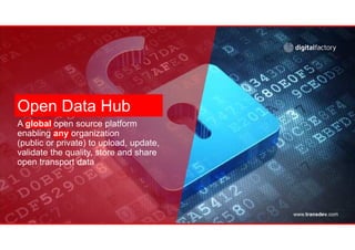
1. Open Data Hub
A global open source platform
enabling any organization
(public or private) to upload, update,
validate the quality, store and share
open transport data
www.transdev.com
2. www.transdev.com
Why do we need an open data solution?
Changing
regulations
and lawsMacron Loi: Pour la
Croissance, l’activité et l’égalité
des chances économiques ».
Lemaire: « Pour une République
Numérique »
Valter: governs specifically the
principle of free access to public
sector data.
NOTRe: “Nouvelle Organisation
Territoriale de la République”.
USA, Finland, Sweden,
Germany, Singapore data is
already open
Smart Cities
Need Data
Cities are investing in Open data
portals, and smart mobility
marketplaces needing transport
data, but also geographical data,
geocoded address, points of
interests, etc
Support from Policy
Makers
MaaS
3. www.transdev.com
What is the Hub
Aggregator of transport data
Community of data producers, data
consumers, developers
Tools to help create data, push data,
and pull real-time data.
Network & Product description data
Fare, names of operation, process description …
Mapping data
Geo localized data: bus stop hubs, stations …
Statistics data
Miles traveled, services offered
Real time data
Data delivered instantly or by stream
5. www.transdev.com
Information Tomorrow
External
Services
Management
Layer
Applications
Data
LayersExternal
Data
Sources
External
Applications
& Services
Smart City
Solutions
Software
Development Kit
API Library
Standardization
System
Management
Security &
Privacy
Data
Management
Data Organization Syncing Tools
Quality Control and Platform Organization
Amazon S3 Cloud Architecture
Analytics
Interface
Cleaning
Tools
3rd Party
Analytics
Solutions
TransdevOpenDataHub
Ticketing
Trip planning
Routing Algorithms
First/Last-mile Products
Artificial Intelligence
Fleet Management
Scheduled Transport Data Real-time Transport Data Customer Information Fare Information
Real-Time CRM
Driverless Cars
Smart City Products
6. www.transdev.com
Importance of an Open Community
Ecosystem exists across multiple products
Provides mechanisms for clearly defining and
enforcing the boundaries of acceptability
within the project
Designed to allow project leaders to avoid
unnecessary and wasteful diversions by rogue
elements within the community
Ensure that those with aligned strategies can
undertake complimentary work in a
collaborative and constructive way
Focus on consensus
Previous consensus
Seek a compromiseSuggest change
Further Changes? Do you agree with
The change?
New consensus
Implement
Yes
Disagree
Wait
No
Agree
7. www.transdev.com
Why is this Initiative Important to Transdev
A reference standard for
Europe must be developed
Data consumers need a
single place to go to get
open transport data
No fully global open source/open
data community exists