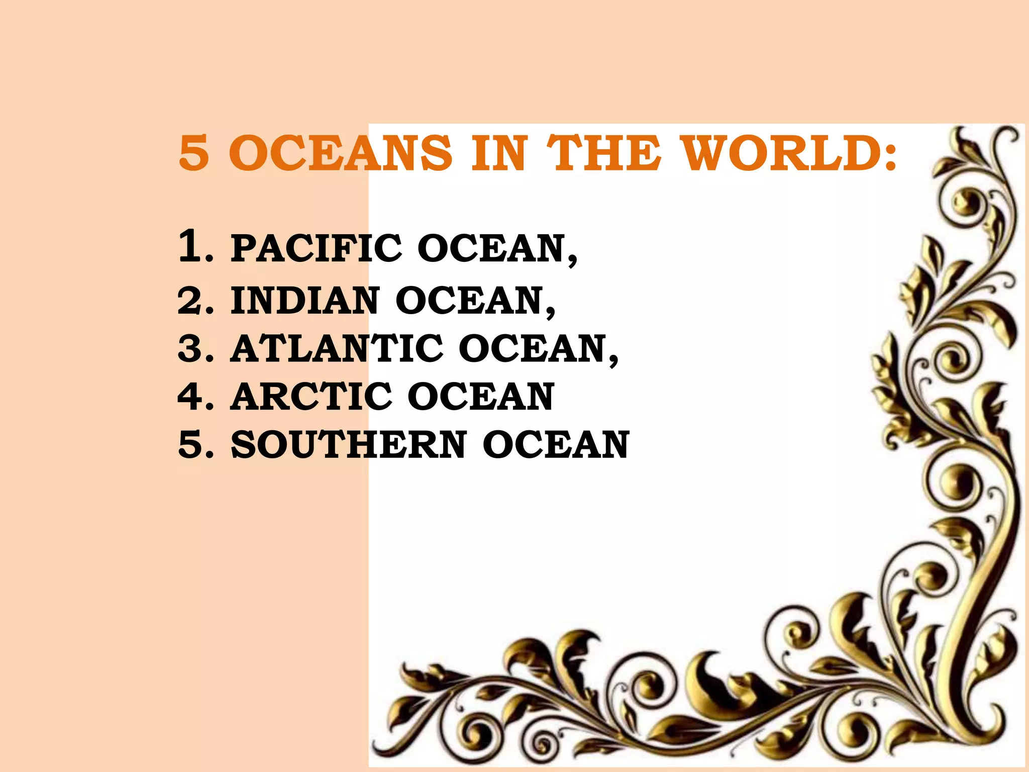
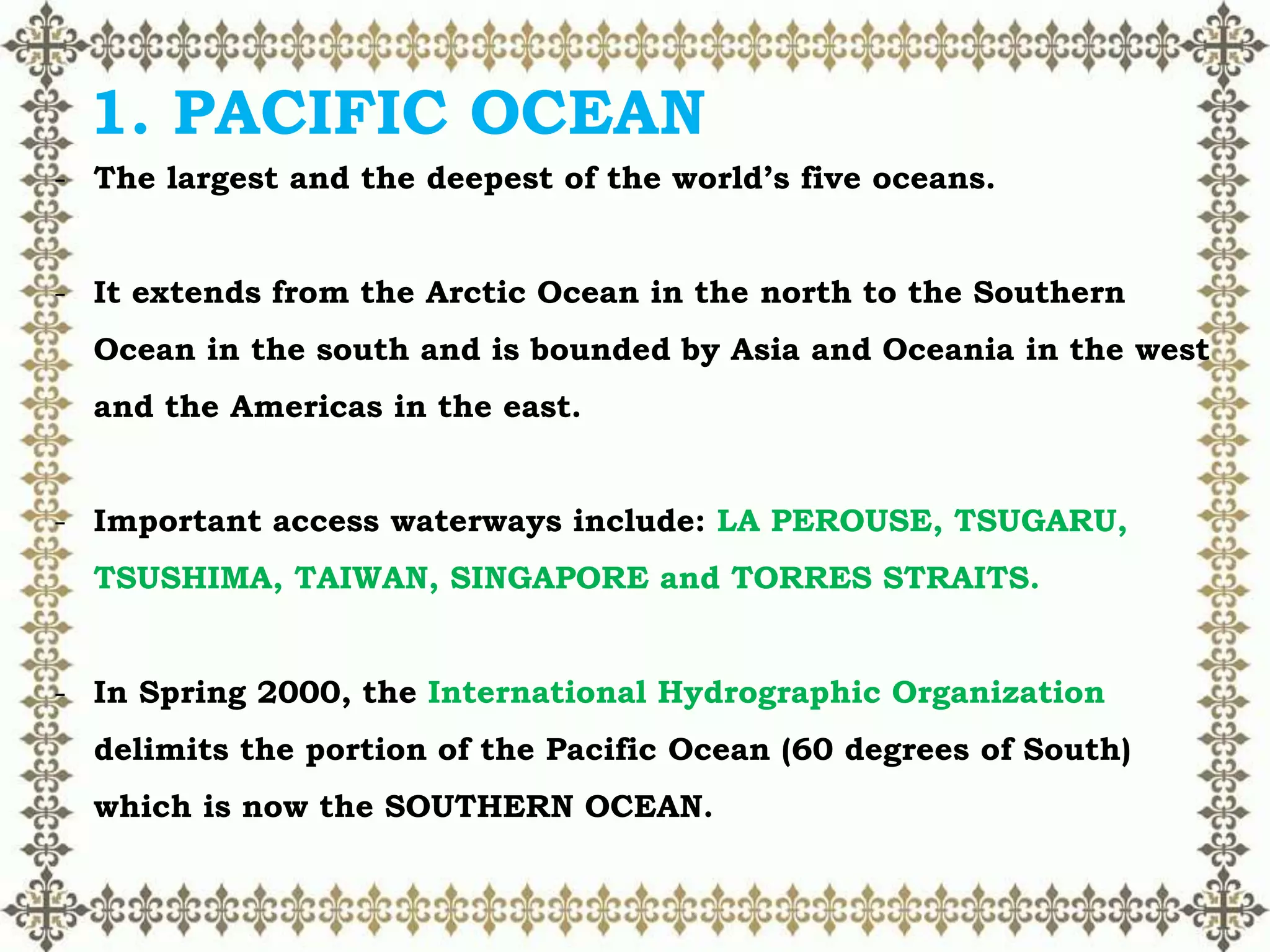
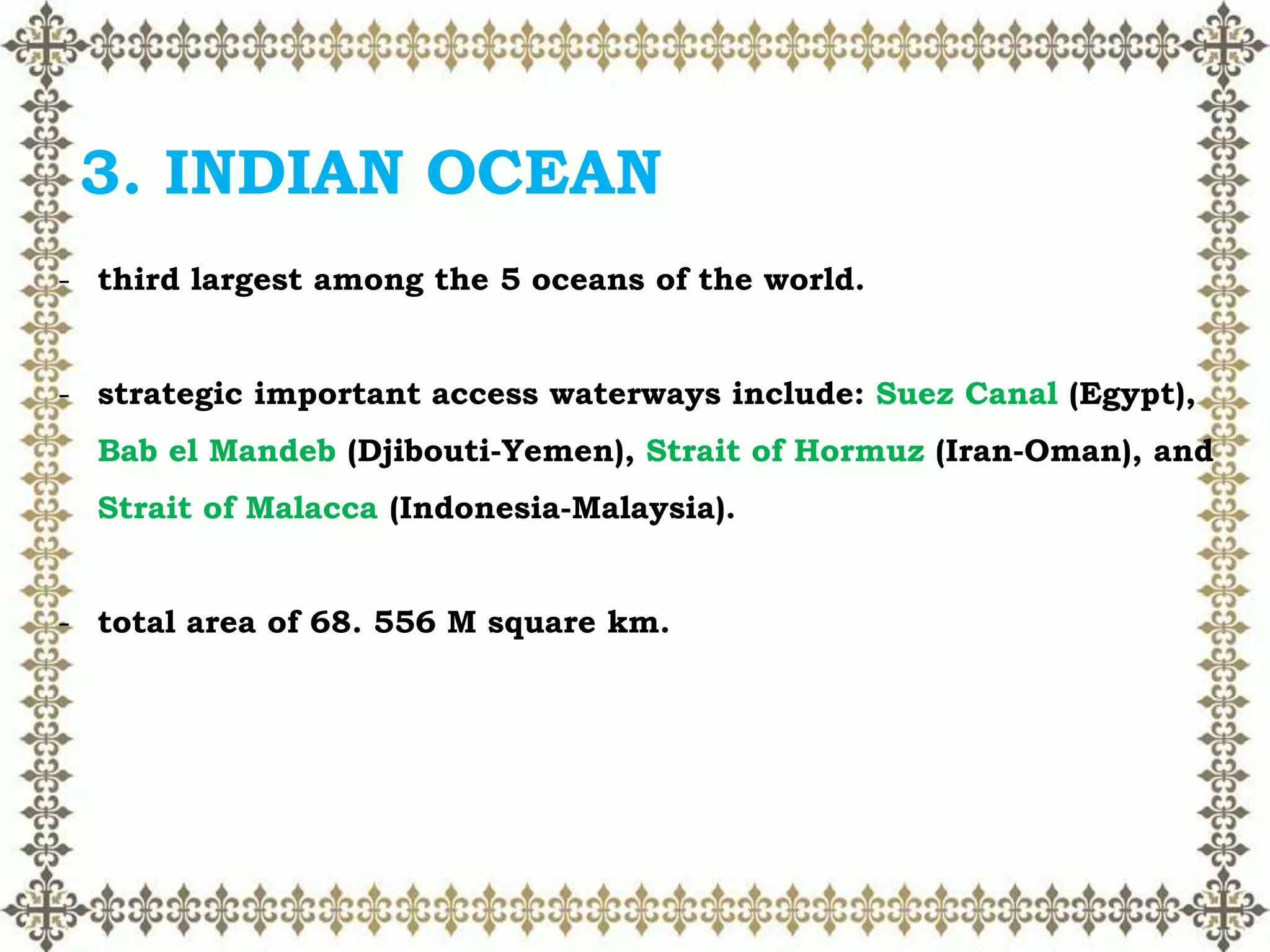
CHAPTER 10
OCEANS OF THE
WORLD
LEARNING OBJECTIVES:
At the end of this chapter, students must be able to;
a. identify the major oceans of the world,
c. locate the five oceans of the world.
Introduction
What is an OCEAN?
• An ocean is a vast and a continuous frame of salty water that
shelters almost 75 % of the total earth's surface.
• The planet Earth appears to be blue and white in the outer space
because almost ¾ of the Earth is occupied by the bodies of water
such as oceans and seas other bodies of water are lakes, lagoons,
rivers, streams and springs.
5 OCEANS IN THE WORLD:
1. PACIFIC OCEAN,
2. INDIAN OCEAN,
3. ATLANTIC OCEAN,
4. ARCTIC OCEAN
5. SOUTHERN OCEAN
DIFFERENCE BETWEEN AN OCEAN AND A SEA
• The difference between these two bodies of water are
summarized in terms of depth, area and marine life.
DEPTH
 The comparison by depth shows that oceans are much
deeper as compared to seas because land usually encloses
the seawaters.
Pacific Ocean (largest) -10, 924 meters
Arctic Ocean (smallest) - 5, 625 meters
Average depth of 5 oceans – 3, 688 meters
Carribean Sea – 6, 946 meters (deepest sea)
AREA
Thus, this variation in the area indicates that seas are
smaller than oceans.
Pacific Ocean – 60, 060, 700 square miles
Arctic Ocean – 5, 427, 000 square miles
Mediterranean Sea (largest sea) – 1, 144, 800 square
miles
Ocean’s average total area - 361, 900, 000 square
kilometers
MARINE LIFE
Seas support a large portion of marine life since sunlight
penetrates deep down allowing photosynthesis to take place.
Oceans rarely support marine life since they are deeper than seas
and thus sunlight does not penetrate deep enough to the surface to
let photosynthesis to take place.
5 OCEANS OF THE WORLD
ASIA
EUROPE
AFRICA
NORTH AMERICA
SOUTH AMERICA
AUSTRALIA
1. PACIFIC OCEAN
- The largest and the deepest of the world’s five oceans.
- It extends from the Arctic Ocean in the north to the Southern
Ocean in the south and is bounded by Asia and Oceania in the west
and the Americas in the east.
- Important access waterways include: LA PEROUSE, TSUGARU,
TSUSHIMA, TAIWAN, SINGAPORE and TORRES STRAITS.
- In Spring 2000, the International Hydrographic Organization
delimits the portion of the Pacific Ocean (60 degrees of South)
which is now the SOUTHERN OCEAN.
- The planetary air pressure systems and resultant wind patterns
exhibit remarkable uniformity in the south and east; trade winds
and westerly winds are well-developed patterns, modified by
seasonal fluctuations.
- From June – October, tropical cyclones may form south of Mexico
and affect the areas of Mexico and Central America.
- The Western Pacific is monsoonal.
- Tropical cyclones (typhoons) may strike Southeast and East of
Asia from May to December.
- Its terrain surface currents in the Northern Pacific are dominated by a
clockwise warm-water gyre and in the Southern pacific by a counter
clockwise, cool-water gyre.
- In the Northern Pacific, sea ice forms in the Bering Sea and Sea of
Okhotsk in winter. In the Southern pacific, sea ice from Antarctica
reaches its northernmost extent in October; the ocean floor in the
Eastern Pacific is dominated by the East Pacific Rise, while the
Western Pacific is dissected by the deep trenches including the
Marianas Trench which is the deepest point in the world’s ocean.
GYRE- circular pattern of ocean currents.
2. ATLANTIC OCEAN
-second largest ocean among the five major oceans of the world.
-Strategic important access waterways include; Kiel Canal
(Germany), Oresund (Denmark-Sweden), Bosporus (Turkey), Strait
of Gibraltar (Morocco-Spain), St Lawrence Seaway (Canada-US)
-total area of 76. 792 M square km.
 the climate tropical cyclones (hurricanes) develop off the coast
of Africa near Cape Verde and move Westward into the
Caribbean Sea; hurricanes can occur from May to December but
are most frequent from August to November.
 terrain consists of surface usually covered with sea ice in
Labrador Sea, Denmark Strait and coastal portions of the
Baltic Sea form October to June.
 clockwise warm-water gyre in the Northern Atlantic, counter
clockwise warm-water gyre in the Southern Atlantic. The ocean
floor is dominated by the Mid- Atlantic Ridge, a rugged North-
South Centerline for the entire Atlantic ocean.
3. INDIAN OCEAN
- third largest among the 5 oceans of the world.
- strategic important access waterways include: Suez Canal (Egypt),
Bab el Mandeb (Djibouti-Yemen), Strait of Hormuz (Iran-Oman), and
Strait of Malacca (Indonesia-Malaysia).
- total area of 68. 556 M square km.
 its terrain consist of surface dominated by counter clockwise
gyre in the southern Indian ocean; unique reversal currents in
the northern Indian Ocean; low atmospheric pressure over
southwest Asia from hot, rising, summer air results in the
southwest monsoon and southwest-to-northeast winds and
currents while high pressure over Northern Asia from cold,
falling, winter air results in the northeast monsoon and
northeast-to-southwest winds and currents, ocean floor is
dominated by the Mid-Indian ocean Ridge and subdivided by the
Southeast Indian Ocean Ridge, Southwest Indian Ocean Ridge,
and Northeast Ridge
4. ARCTIC OCEAN
-the smallest of the world’s five oceans.
-the two important seasonal waterways include: Northwest passage
(US and Canada) and Northern Sea Route (Norway and Russia)
-total area is 15.056 M square km.
 Its climate is characterized by persistent cold and relatively
narrow annual temperature ranges; winters characterized by
continuous darkness, cold and stable weather conditions, and
clear skies.
 Summer characterized by continuous daylight, damp and foggy
weather, and weak cyclones with rain or snow
 The terrain consists of central surface covered by a perennial
drifting polar icepack that, on average is about 3 m thick. The
icepack is surrounded by open seas during the summer, but
more than doubles in size during the winter and extends to the
encircling landmasses; the ocean floor is about 50% continental
shelf.
5. SOUTHERN OCEAN
 Southern Ocean, also called Antarctic Ocean, the southern
portions of the Pacific, Atlantic, and Indian oceans and their
tributary seas surrounding Antarctica. Unbroken by any other
continental landmass, the Southern Ocean’s narrowest
constriction is the Drake Passage, 600 miles (about 1,000 km)
wide, between South America and the tip of the Antarctic
Peninsula.
 The structure of the ocean floor includes a continental
shelf usually less than 160 miles (about 260 km) wide that
attains its maximum width of more than 1,600 miles (2,600
km) in the vicinity of the Weddell and Ross seas.
OCEANS OF THE WORLD

OCEANS OF THE WORLD

  • 1.
  • 2.
    LEARNING OBJECTIVES: At theend of this chapter, students must be able to; a. identify the major oceans of the world, c. locate the five oceans of the world.
  • 3.
    Introduction What is anOCEAN? • An ocean is a vast and a continuous frame of salty water that shelters almost 75 % of the total earth's surface. • The planet Earth appears to be blue and white in the outer space because almost ¾ of the Earth is occupied by the bodies of water such as oceans and seas other bodies of water are lakes, lagoons, rivers, streams and springs.
  • 4.
    5 OCEANS INTHE WORLD: 1. PACIFIC OCEAN, 2. INDIAN OCEAN, 3. ATLANTIC OCEAN, 4. ARCTIC OCEAN 5. SOUTHERN OCEAN
  • 6.
    DIFFERENCE BETWEEN ANOCEAN AND A SEA • The difference between these two bodies of water are summarized in terms of depth, area and marine life. DEPTH  The comparison by depth shows that oceans are much deeper as compared to seas because land usually encloses the seawaters. Pacific Ocean (largest) -10, 924 meters Arctic Ocean (smallest) - 5, 625 meters Average depth of 5 oceans – 3, 688 meters Carribean Sea – 6, 946 meters (deepest sea)
  • 7.
    AREA Thus, this variationin the area indicates that seas are smaller than oceans. Pacific Ocean – 60, 060, 700 square miles Arctic Ocean – 5, 427, 000 square miles Mediterranean Sea (largest sea) – 1, 144, 800 square miles Ocean’s average total area - 361, 900, 000 square kilometers
  • 8.
    MARINE LIFE Seas supporta large portion of marine life since sunlight penetrates deep down allowing photosynthesis to take place. Oceans rarely support marine life since they are deeper than seas and thus sunlight does not penetrate deep enough to the surface to let photosynthesis to take place.
  • 9.
    5 OCEANS OFTHE WORLD ASIA EUROPE AFRICA NORTH AMERICA SOUTH AMERICA AUSTRALIA
  • 10.
    1. PACIFIC OCEAN -The largest and the deepest of the world’s five oceans. - It extends from the Arctic Ocean in the north to the Southern Ocean in the south and is bounded by Asia and Oceania in the west and the Americas in the east. - Important access waterways include: LA PEROUSE, TSUGARU, TSUSHIMA, TAIWAN, SINGAPORE and TORRES STRAITS. - In Spring 2000, the International Hydrographic Organization delimits the portion of the Pacific Ocean (60 degrees of South) which is now the SOUTHERN OCEAN.
  • 11.
    - The planetaryair pressure systems and resultant wind patterns exhibit remarkable uniformity in the south and east; trade winds and westerly winds are well-developed patterns, modified by seasonal fluctuations. - From June – October, tropical cyclones may form south of Mexico and affect the areas of Mexico and Central America. - The Western Pacific is monsoonal. - Tropical cyclones (typhoons) may strike Southeast and East of Asia from May to December.
  • 12.
    - Its terrainsurface currents in the Northern Pacific are dominated by a clockwise warm-water gyre and in the Southern pacific by a counter clockwise, cool-water gyre. - In the Northern Pacific, sea ice forms in the Bering Sea and Sea of Okhotsk in winter. In the Southern pacific, sea ice from Antarctica reaches its northernmost extent in October; the ocean floor in the Eastern Pacific is dominated by the East Pacific Rise, while the Western Pacific is dissected by the deep trenches including the Marianas Trench which is the deepest point in the world’s ocean.
  • 13.
    GYRE- circular patternof ocean currents.
  • 16.
    2. ATLANTIC OCEAN -secondlargest ocean among the five major oceans of the world. -Strategic important access waterways include; Kiel Canal (Germany), Oresund (Denmark-Sweden), Bosporus (Turkey), Strait of Gibraltar (Morocco-Spain), St Lawrence Seaway (Canada-US) -total area of 76. 792 M square km.  the climate tropical cyclones (hurricanes) develop off the coast of Africa near Cape Verde and move Westward into the Caribbean Sea; hurricanes can occur from May to December but are most frequent from August to November.
  • 17.
     terrain consistsof surface usually covered with sea ice in Labrador Sea, Denmark Strait and coastal portions of the Baltic Sea form October to June.  clockwise warm-water gyre in the Northern Atlantic, counter clockwise warm-water gyre in the Southern Atlantic. The ocean floor is dominated by the Mid- Atlantic Ridge, a rugged North- South Centerline for the entire Atlantic ocean.
  • 18.
    3. INDIAN OCEAN -third largest among the 5 oceans of the world. - strategic important access waterways include: Suez Canal (Egypt), Bab el Mandeb (Djibouti-Yemen), Strait of Hormuz (Iran-Oman), and Strait of Malacca (Indonesia-Malaysia). - total area of 68. 556 M square km.
  • 19.
     its terrainconsist of surface dominated by counter clockwise gyre in the southern Indian ocean; unique reversal currents in the northern Indian Ocean; low atmospheric pressure over southwest Asia from hot, rising, summer air results in the southwest monsoon and southwest-to-northeast winds and currents while high pressure over Northern Asia from cold, falling, winter air results in the northeast monsoon and northeast-to-southwest winds and currents, ocean floor is dominated by the Mid-Indian ocean Ridge and subdivided by the Southeast Indian Ocean Ridge, Southwest Indian Ocean Ridge, and Northeast Ridge
  • 20.
    4. ARCTIC OCEAN -thesmallest of the world’s five oceans. -the two important seasonal waterways include: Northwest passage (US and Canada) and Northern Sea Route (Norway and Russia) -total area is 15.056 M square km.  Its climate is characterized by persistent cold and relatively narrow annual temperature ranges; winters characterized by continuous darkness, cold and stable weather conditions, and clear skies.  Summer characterized by continuous daylight, damp and foggy weather, and weak cyclones with rain or snow
  • 21.
     The terrainconsists of central surface covered by a perennial drifting polar icepack that, on average is about 3 m thick. The icepack is surrounded by open seas during the summer, but more than doubles in size during the winter and extends to the encircling landmasses; the ocean floor is about 50% continental shelf.
  • 22.
    5. SOUTHERN OCEAN Southern Ocean, also called Antarctic Ocean, the southern portions of the Pacific, Atlantic, and Indian oceans and their tributary seas surrounding Antarctica. Unbroken by any other continental landmass, the Southern Ocean’s narrowest constriction is the Drake Passage, 600 miles (about 1,000 km) wide, between South America and the tip of the Antarctic Peninsula.  The structure of the ocean floor includes a continental shelf usually less than 160 miles (about 260 km) wide that attains its maximum width of more than 1,600 miles (2,600 km) in the vicinity of the Weddell and Ross seas.