Download to read offline

![Slide 9: Official research effort 1: water column transport: 1970’s 7 80’s
• Long distant transport of soluble and insoluble rad wastes through water
column now widely attested (UK sea discharged Cs and Pu detected N.E Atlantic,Arctic, N.Pacific)
• MAFF : Re-concentration [Cs, Pu] observed in Irt/Esk estuary fine
sediments (10/12 km south of Sellafield pipe)
• MAFF : Sea to land transfer of nuclides observed (flooding: high tide and
storm surge events) : Pu in house dust at Ravenglas, sheepmeat, local produce
……………………………………………………………………………….
• AERE late 70s (published 80’s): Marine enrichments ( Pu, Am and Cs)
observed in microlayers, sea-spray, aerosol (Pu EFS= 26,000 algal blooms)
• Sea to land transfer (Pu’s, Am and Cs) in seaspray and aerosols across the surf
line observed (Am EFs = +812)
• BUT extent of inland penetration NOT measured,
• AND measuring devices not efficient & data NOT appropriate for any
quantification work](https://image.slidesharecdn.com/nuris2015final-151127144058-lva1-app6891/85/Nuris-2015-final-10-320.jpg)

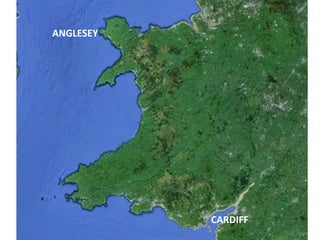

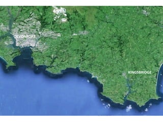
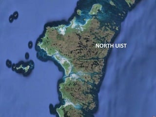
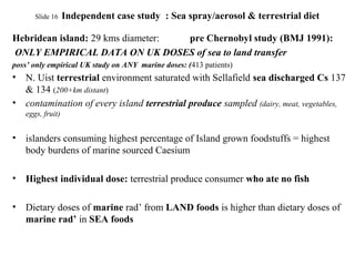
![slide 14 Independent Case Study: Sea spray/aerosol
Dyfed CC RADMID (1987/88):
* radioactivity monitoring in west Wales coastal zone
Sellafield derived (sea discharged) Cs 137 and Cs 134 found 10 miles inland on
pasture grass (proposed carried inland in sea spray during heavy onshore
winds/storms)……(first & only time 10 miles used) [lichens]
* demonstrated entry of sea derived rad to coastal zone meat stock and dairy
food chain
* Inevitable contamination of arable/horticultural crops/produce
* inevitable dietary dose (marine rad’) to humans via ingestion of terrestrial
produce
* Strongly implies dose to humans via inhalation of airborne Cs
Given presence of Cs :
presence of sea to land transferred Am and Pu likely
N.B.
Authorities won’t sample for sea to land transfer 10 miles inland](https://image.slidesharecdn.com/nuris2015final-151127144058-lva1-app6891/85/Nuris-2015-final-18-320.jpg)


The document discusses the flawed assumptions and research surrounding the discharge of radioactive waste into marine environments from the inception of the nuclear industry in the 1950s. It critiques the 'justifying hypothesis' that soluble and insoluble radionuclides would either dilute harmlessly or bond to seabed sediments, arguing that empirical evidence shows radionuclides travel extensively and impact terrestrial environments. The author calls for urgent reassessment of coastal monitoring and critical group identification based on new evidence, emphasizing the need for empirical research over flawed modeling.


