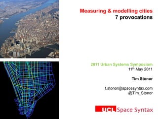
Modeling and Measuring Cities: Tim Stonor
•
6 likes•1,070 views
Presentation by Tim Stonor, Space Syntax. Given at the 2011 Urban Systems Symposium, as part of the Modeling and Measuring Cities panel.
Report
Share
Report
Share

Recommended
Firm dynamic productivity
The document discusses modeling economic growth and firm dynamics in urban areas. It analyzes firm data from the Klang Valley region of Malaysia from 1990 to 2007. The analysis finds that transportation infrastructure influences firm location choices, with many firms located near transportation features like roads. Manufacturing and wholesale/retail firms especially prefer areas close to transportation. The conclusion is that firm demography and location choices are important for modeling economic development and land use patterns from the bottom-up. However, more detailed firm data would be needed to fully model dynamics like firm migration and closure.
Future of Cities presentation
Presentation by Sir Mark Walport at the Foundation for Science and Technology discussion on 'Cities of the future – science, innovation and city management', June 2013
Future of Cities: Thinking for the long-term
This document discusses the future of cities and focuses on three main points. First, it notes that urban populations are growing rapidly worldwide and will continue to do so in the coming decades. Second, it argues that cities need to be considered and planned for in the long-term due to their complex, interdependent systems that impact each other over many years. Third, it suggests that future planning for sustainable cities will require diverse evidence, analytical methods, and involvement of local communities.
City as a Service: How to Design a New Urban Experience - Yegor Korobeynikov ...
City as a Service: How to Design a New Urban Experience - Yegor Korobeynikov ...Service Design Network
DAY TWO – OCT 3rd 2015 at Global Service Design Conference NYC
AFTERNOON SESSIONS / / SYSTEM CHANGE / CULTURE CHANGE
more info at: http://bit.ly/1PoNvbj
The Future of Cities: what will cities look like in 2065?
This document discusses the future of cities and provides context on how cities have developed over time. It notes that by 2065, most UK cities will have high levels of diversity similar to Birmingham today. An aging population will increase the number of over-75s significantly. Future cities will have more integrated infrastructure and new forms of sustainable transport and energy generation. High-speed rail will increase connectivity between cities and urban forms will become denser and greener.
Water in Future Cities
- The document discusses the future of cities and focuses on the need for long-term thinking when planning cities. It notes that cities are where many policy objectives succeed or fail.
- It also discusses how the UK has been gradually devolving more powers to cities and argues that future cities should be "liveable". Additionally, water issues need to be considered systematically in development decisions given the interdependencies between cities and water.
- There are challenges to planning due to cities having long impact cycles and highly interdependent systems. Research is needed to address knowledge gaps and help plan future cities. An integrated, long-term, and evidence-based approach is advocated.
Revolución tecnológica y cambio de época: smart cities
Sesión en el Master en Dirección de Políticas Públicas Locales (ayuntamiento de Barcelona). 29 de mayo de 2018
BLUE
Blue City Solutions is a non-profit organization that strives for sustainable smart city solutions globally. It operates in Europe, Asia, and the Americas, and helps cities learn from each other by sharing best practices. Blue also connects cities and businesses, facilitates independent testing of solutions, and helps accelerate the international rollout of new technologies to improve city services at a lower cost.
What exactly a smart city is?
AthensCoCreation Project
PANTEION UNIVERSITY OF SOCIAL AND POLITICAL SCIENCES
Department of Communication, Media and Culture
MA in Cultural Management
Urban Settlement and Urbanization
this 2 unit ppt lesson tells about urban settlements, their patterns functions, hierarchy, and types with cause and consequences of urbanization.
Smart cities, sustainable cities, city branding and lean start up methodology...
A theoretical approach on some basic concepts concerning smart cities, sustainable cities, lean start up methodology and city branding.
AthensCoCreation BrandingProject
Panteion University Of Social And Political Sciences
Department of Communication, Media and Culture
MA in Cultural Management
Course: Cultural Marketing and Communication
Course Instructor: Betty Tsakarestou, Assistant Professor and Head of Advertising and Public Relations Lab
NJ Complete Streets Summit Keynote - Charles Marohn
The document summarizes a New Jersey Complete Streets Summit that discussed building streets for all modes of transportation rather than just automobiles. It notes that Complete Streets is a rational approach and that streets should accommodate people first rather than being dominated by automobiles. Engineers are willing to build Complete Streets because it keeps their focus on traffic speed and volume rather than prioritizing safety and costs like the public prefers.
Booklet
The document discusses how a collaborative workspace could contribute to the identity of a site in Chow Kit, Kuala Lumpur. It provides background on the historical morphology and urban morphology of Chow Kit. It then analyzes several issues with the current site, including repetitive building types, a coarse urban grain, and an absence of variety in land uses. It explores how a collaborative workspace could address these issues by providing job opportunities, networking for different professions and societal classes, and acting as a multi-use space to bridge gaps in society. Finally, it examines the site's potential for permeability, accessibility, and acting as a protagonist for its surroundings.
Enrico Ferro, Brunella Caroleo, Maurizio Leo, Michele Osella, Elisa Pautasso:...
Enrico Ferro, Brunella Caroleo, Maurizio Leo, Michele Osella, Elisa Pautasso:...Danube University Krems, Centre for E-Governance
The document discusses the role of information and communication technologies (ICT) in smart city governance. It presents a "Smart City House" model that depicts the process of turning a city's technological infrastructure into value for society. The model shows that ICT alone does not create value; it is an input that when combined with other factors like public policy and stakeholder needs can produce outputs like economic growth and quality of life. For a city to be truly "smart" it must learn to balance individual and collective needs through participatory governance approaches supported by ICT.Matador
The document discusses key aspects of building future smart cities, including planning and managing infrastructure, transportation systems, public safety, and utilities like power, water and lighting. It emphasizes that smart cities require integrating technology into these systems to make them more efficient, sustainable and improve services for citizens. Data collection and analysis can help address challenges and anticipate problems in areas like transportation, security and resource management to create livable and prosperous urban environments.
The Future of Public Space III: Alderman Walker
This document discusses the future of public spaces and who owns them. It notes divisions along functions, ideals, and control as well as along race. It advocates standing up for shared spaces and adopting new perspectives. It also discusses moving from providing spaces to facilitating activity, rationalizing space use, prioritizing safety, accessibility, multi-functionality, and community needs. Key challenges discussed include lack of funding, vandalism, differing views on management, and how to provide spaces in informal settlements. Partnerships between the city, public, and activity groups are advocated to address these challenges.
Elmlund, P. - The importance of data innovation for analysis on cities
The importance of data innovation for analysis on cities - Peter Elmlund, Ax:son Jonson FoundatioWorkshop on Modernising Statistical Systems, OECD 2018.
Cities of tomorrow. URBACT thematic reports: Key messages 7
Cities of tomorrow. URBACT thematic reports: Key messages 7Ministerul Dezvoltării Regionale și Administrației Publice
This document provides a summary of key messages from a report on integrated sustainable urban development strategies in European cities. It discusses six thematic reports produced by URBACT workstreams that examined challenges facing cities like shrinking populations, lack of jobs, youth issues, segregation, mobility and energy efficiency. The document emphasizes that cities need to focus strategies on the areas they can most influence and complete bridges between policies and actions. It also stresses the importance of realigning resources to meet real needs, tackling barriers to change, investing in people, and creating "innovation brokers" to support integrated solutions for cities of tomorrow.Startupfest 2017: Micah Kotch (URBAN-X)
This document discusses challenges facing dense urban areas and potential solutions being developed by startups. As cities become more crowded, they require more resources and infrastructure puts pressure on quality of life. New technologies like electric vehicles, smart charging, vertical farms, and distributed energy could help address these issues by enhancing mobility, modernizing transit, encouraging mixed-use neighborhoods, and creating more sustainable food and energy systems. Startups are exploring how to leverage data and decentralized technologies to unlock unused urban potential and improve lives, but collaborations are needed between entrepreneurs, policymakers, and companies to realize these innovative solutions.
My vision of the city of the future
This document provides a vision for cities of the future that are smart, shareable, vertical, and green. It describes how smart cities will use sensors and digital technology to improve living standards. Shareable cities will utilize shared goods, services, and resources through peer-to-peer networks. Vertical cities will build up with multiple levels to accommodate more people in urban areas. Green cities will focus on sustainability, renewable energy, green space, and environmentally-friendly transportation.
Urbantech Unicorns And Where To Find Them
This document discusses urbanization trends, climate change challenges cities face, and opportunities for startups focused on improving cities. It introduces Urban.us, which invests in urban technology startups working in areas like transportation, infrastructure, energy, and public services. Urban.us' investment thesis is based on cities being at the forefront of solving global issues and some of the most valuable companies emerging from addressing city challenges. The document highlights several of Urban.us' portfolio companies developing technologies to help cities use energy more efficiently, enhance infrastructure and construction, and improve water management, transportation, and disaster response.
Brochure_SmartCity_A5_Final
The document describes various smart city initiatives undertaken by the Istituto Superiore Mario Boella's Smart City Strategic Program. It discusses (1) SIMUL@, a simulation-based decision support system for sustainable urban mobility that models electric vehicle adoption and impacts on traffic and energy infrastructure; (2) CS-VisualLab, a decision support system for car sharing providers that analyzes usage data to optimize services and business strategies; and (3) smart parking research using sensors and algorithms to guide drivers to available spaces in real-time.
Public transport international_magazine_2012_english
This document summarizes the key findings of a study by Arthur D. Little assessing urban mobility performance in 66 cities worldwide. The main points are:
1) Most cities scored below average on an urban mobility index, achieving only two-thirds of potential best practices, indicating significant room for improvement.
2) Top performing cities like Hong Kong and Amsterdam had strong public transport and policies promoting walking/cycling, with individual motorized transport at less than half.
3) To improve, cities need to establish collaborative platforms, develop integrated mobility visions and strategies, discover user needs, and introduce market mechanisms to spur innovation.
4) The document outlines strategic imperatives and business models that cities and mobility providers can
Town planning semester lec
This document discusses several theories of urban development and models of urban structure. It introduces central place theory, which explains how towns form around the distribution of goods and sharing of ideas. The concentric zone model depicts social groups arranged in concentric rings around the central business district. The sector model shows the influence of transportation corridors on growth. The multiple nuclei model describes cities growing from several independent centers that later merge into one urban area, with various nodes like ports and universities influencing land use.
Town planning theories concept and models
The document discusses several theories and models of urban and town planning from ancient to modern times. It describes the earliest river valley civilizations and oldest continuously inhabited cities. It then covers concepts in modern town planning like segregating industries, high-rise buildings, and master plans. Various approaches to town planning like rational, incremental, and communicative are mentioned. Models of urban structure and land use are summarized, including central place theory, Ebenezer Howard's three magnets diagram, the garden city movement, concentric zone model, linear city, Radburn superblock, neighborhood unit design, core frame model, sector model, and multiple nuclei model.
What's different between urban planning, urban design, architecture, AADI
A.Alliance Design International. What is the difference between urban planning, urban design, and architecture.
Urban Planning theories and models
Describes theories of how Urban towns came to be,how were they planned and what informs their planning design
Towards an effective transitioning of public transport system in Ghana
Towards an effective transitioning of public transport system in GhanaInstitute for Transport Studies (ITS)
Research presentation by visiting academic Dr Michael Poku-Boansi, Senior Lecturer at the Department of Planning, KNUST, Kumasi, Ghana and member of the Ghana Institute of Planners (GIP).
Abstract:
Research indicates that transport services in cities in developing countries are mostly informal and include the use of rickety and low occupancy vehicles such as minibuses, taxis, motorcycles and vans, operated by private groups or individuals. Due to this classification, two schools of thought have emerged. The first suggests that these informal transport service sector operators in most cases operate outside the officially sanctioned public transport sector and as a result should be regarded as nuisance due to its disorganised nature, calling for public intervention and occasional eradication. Given its disorganised nature, informal transport service operators are identified with urban problems including low level of services, high rates of collision and accidents, increased congestion in cities, erratic scheduling and services, inadequate and lack of capacity and evasion of taxes and fees. In contrast, the other school of thought supports and emphasises the critical role these private operators play in meeting the mobility demand of the urban population, as in some jurisdictions (e.g., Ghana, Kenya, and Senegal) provide over 50% of transport services. Public transport service provision in Ghana has undergone several transformations since pre-colonial times, both structured and disorganised development. However, to avoid the gradual decay of public transport service provision in Ghana, the government of Ghana since 2005 has initiated plans to introduce Bus Rapid Transit (BRT) services as a way of improving efficiency in public transport services. The Ghana UTP seeks to among other things to improve mobility within Ghana’s urban centres and to shift to more environmentally-sustainable transport modes and lower transport-related GHG emissions. Although the BRT project is yet to be fully roll out, its implementation is already facing some resistance from the informal public transport operators due to, a large extent, mistrust between the informal public transport operators and the government. The informal public transport operators consider this government intervention (BRT) as a strategy to make their operations inefficient and unpopular among Ghanaians. As a result, previous attempts to implement the project have failed, regardless of the potential benefits of the BRT. The purpose of my research is to explore ways of transition the uncoordinated informal public transport service operations in Ghana into a formal public transport service sector.
URBAN PLANNING_Essay 3
The document discusses new concepts in urban planning, specifically strategic planning versus master planning. It notes that strategic planning takes a more participatory approach that involves stakeholders and improves commitment levels compared to statutory master planning. However, strategic planning still requires a strong legal framework and institutional support to achieve its goals. The document also provides an example of strategic planning in Kumasi, Ghana, where it has prioritized infrastructure investment through budget allocation but still faces challenges of lack of integration among departments.
Urban Problems and Perspectives
This document discusses urban transport challenges and solutions. It notes that as urban populations and vehicles increase, cities face constraints on resources. This implies a huge challenge to build infrastructure while limiting environmental and public health impacts. The document evaluates two approaches: capital intensive solutions like expanding roads and rail; and changing paradigms by prioritizing non-motorized transport and bus systems. It argues that alternative solutions can transform cities in a low-cost, high impact way through compact development focused on pedestrians, bicycles, public transit and disincentives for car use. Examples from cities like Bogota demonstrate extraordinary results from integrated sustainable transport policies.
More Related Content
What's hot
What exactly a smart city is?
AthensCoCreation Project
PANTEION UNIVERSITY OF SOCIAL AND POLITICAL SCIENCES
Department of Communication, Media and Culture
MA in Cultural Management
Urban Settlement and Urbanization
this 2 unit ppt lesson tells about urban settlements, their patterns functions, hierarchy, and types with cause and consequences of urbanization.
Smart cities, sustainable cities, city branding and lean start up methodology...
A theoretical approach on some basic concepts concerning smart cities, sustainable cities, lean start up methodology and city branding.
AthensCoCreation BrandingProject
Panteion University Of Social And Political Sciences
Department of Communication, Media and Culture
MA in Cultural Management
Course: Cultural Marketing and Communication
Course Instructor: Betty Tsakarestou, Assistant Professor and Head of Advertising and Public Relations Lab
NJ Complete Streets Summit Keynote - Charles Marohn
The document summarizes a New Jersey Complete Streets Summit that discussed building streets for all modes of transportation rather than just automobiles. It notes that Complete Streets is a rational approach and that streets should accommodate people first rather than being dominated by automobiles. Engineers are willing to build Complete Streets because it keeps their focus on traffic speed and volume rather than prioritizing safety and costs like the public prefers.
Booklet
The document discusses how a collaborative workspace could contribute to the identity of a site in Chow Kit, Kuala Lumpur. It provides background on the historical morphology and urban morphology of Chow Kit. It then analyzes several issues with the current site, including repetitive building types, a coarse urban grain, and an absence of variety in land uses. It explores how a collaborative workspace could address these issues by providing job opportunities, networking for different professions and societal classes, and acting as a multi-use space to bridge gaps in society. Finally, it examines the site's potential for permeability, accessibility, and acting as a protagonist for its surroundings.
Enrico Ferro, Brunella Caroleo, Maurizio Leo, Michele Osella, Elisa Pautasso:...
Enrico Ferro, Brunella Caroleo, Maurizio Leo, Michele Osella, Elisa Pautasso:...Danube University Krems, Centre for E-Governance
The document discusses the role of information and communication technologies (ICT) in smart city governance. It presents a "Smart City House" model that depicts the process of turning a city's technological infrastructure into value for society. The model shows that ICT alone does not create value; it is an input that when combined with other factors like public policy and stakeholder needs can produce outputs like economic growth and quality of life. For a city to be truly "smart" it must learn to balance individual and collective needs through participatory governance approaches supported by ICT.Matador
The document discusses key aspects of building future smart cities, including planning and managing infrastructure, transportation systems, public safety, and utilities like power, water and lighting. It emphasizes that smart cities require integrating technology into these systems to make them more efficient, sustainable and improve services for citizens. Data collection and analysis can help address challenges and anticipate problems in areas like transportation, security and resource management to create livable and prosperous urban environments.
The Future of Public Space III: Alderman Walker
This document discusses the future of public spaces and who owns them. It notes divisions along functions, ideals, and control as well as along race. It advocates standing up for shared spaces and adopting new perspectives. It also discusses moving from providing spaces to facilitating activity, rationalizing space use, prioritizing safety, accessibility, multi-functionality, and community needs. Key challenges discussed include lack of funding, vandalism, differing views on management, and how to provide spaces in informal settlements. Partnerships between the city, public, and activity groups are advocated to address these challenges.
Elmlund, P. - The importance of data innovation for analysis on cities
The importance of data innovation for analysis on cities - Peter Elmlund, Ax:son Jonson FoundatioWorkshop on Modernising Statistical Systems, OECD 2018.
Cities of tomorrow. URBACT thematic reports: Key messages 7
Cities of tomorrow. URBACT thematic reports: Key messages 7Ministerul Dezvoltării Regionale și Administrației Publice
This document provides a summary of key messages from a report on integrated sustainable urban development strategies in European cities. It discusses six thematic reports produced by URBACT workstreams that examined challenges facing cities like shrinking populations, lack of jobs, youth issues, segregation, mobility and energy efficiency. The document emphasizes that cities need to focus strategies on the areas they can most influence and complete bridges between policies and actions. It also stresses the importance of realigning resources to meet real needs, tackling barriers to change, investing in people, and creating "innovation brokers" to support integrated solutions for cities of tomorrow.Startupfest 2017: Micah Kotch (URBAN-X)
This document discusses challenges facing dense urban areas and potential solutions being developed by startups. As cities become more crowded, they require more resources and infrastructure puts pressure on quality of life. New technologies like electric vehicles, smart charging, vertical farms, and distributed energy could help address these issues by enhancing mobility, modernizing transit, encouraging mixed-use neighborhoods, and creating more sustainable food and energy systems. Startups are exploring how to leverage data and decentralized technologies to unlock unused urban potential and improve lives, but collaborations are needed between entrepreneurs, policymakers, and companies to realize these innovative solutions.
My vision of the city of the future
This document provides a vision for cities of the future that are smart, shareable, vertical, and green. It describes how smart cities will use sensors and digital technology to improve living standards. Shareable cities will utilize shared goods, services, and resources through peer-to-peer networks. Vertical cities will build up with multiple levels to accommodate more people in urban areas. Green cities will focus on sustainability, renewable energy, green space, and environmentally-friendly transportation.
Urbantech Unicorns And Where To Find Them
This document discusses urbanization trends, climate change challenges cities face, and opportunities for startups focused on improving cities. It introduces Urban.us, which invests in urban technology startups working in areas like transportation, infrastructure, energy, and public services. Urban.us' investment thesis is based on cities being at the forefront of solving global issues and some of the most valuable companies emerging from addressing city challenges. The document highlights several of Urban.us' portfolio companies developing technologies to help cities use energy more efficiently, enhance infrastructure and construction, and improve water management, transportation, and disaster response.
Brochure_SmartCity_A5_Final
The document describes various smart city initiatives undertaken by the Istituto Superiore Mario Boella's Smart City Strategic Program. It discusses (1) SIMUL@, a simulation-based decision support system for sustainable urban mobility that models electric vehicle adoption and impacts on traffic and energy infrastructure; (2) CS-VisualLab, a decision support system for car sharing providers that analyzes usage data to optimize services and business strategies; and (3) smart parking research using sensors and algorithms to guide drivers to available spaces in real-time.
Public transport international_magazine_2012_english
This document summarizes the key findings of a study by Arthur D. Little assessing urban mobility performance in 66 cities worldwide. The main points are:
1) Most cities scored below average on an urban mobility index, achieving only two-thirds of potential best practices, indicating significant room for improvement.
2) Top performing cities like Hong Kong and Amsterdam had strong public transport and policies promoting walking/cycling, with individual motorized transport at less than half.
3) To improve, cities need to establish collaborative platforms, develop integrated mobility visions and strategies, discover user needs, and introduce market mechanisms to spur innovation.
4) The document outlines strategic imperatives and business models that cities and mobility providers can
What's hot (15)
Smart cities, sustainable cities, city branding and lean start up methodology...
Smart cities, sustainable cities, city branding and lean start up methodology...
NJ Complete Streets Summit Keynote - Charles Marohn
NJ Complete Streets Summit Keynote - Charles Marohn
Enrico Ferro, Brunella Caroleo, Maurizio Leo, Michele Osella, Elisa Pautasso:...
Enrico Ferro, Brunella Caroleo, Maurizio Leo, Michele Osella, Elisa Pautasso:...
Elmlund, P. - The importance of data innovation for analysis on cities
Elmlund, P. - The importance of data innovation for analysis on cities
Cities of tomorrow. URBACT thematic reports: Key messages 7
Cities of tomorrow. URBACT thematic reports: Key messages 7
Public transport international_magazine_2012_english
Public transport international_magazine_2012_english
Viewers also liked
Town planning semester lec
This document discusses several theories of urban development and models of urban structure. It introduces central place theory, which explains how towns form around the distribution of goods and sharing of ideas. The concentric zone model depicts social groups arranged in concentric rings around the central business district. The sector model shows the influence of transportation corridors on growth. The multiple nuclei model describes cities growing from several independent centers that later merge into one urban area, with various nodes like ports and universities influencing land use.
Town planning theories concept and models
The document discusses several theories and models of urban and town planning from ancient to modern times. It describes the earliest river valley civilizations and oldest continuously inhabited cities. It then covers concepts in modern town planning like segregating industries, high-rise buildings, and master plans. Various approaches to town planning like rational, incremental, and communicative are mentioned. Models of urban structure and land use are summarized, including central place theory, Ebenezer Howard's three magnets diagram, the garden city movement, concentric zone model, linear city, Radburn superblock, neighborhood unit design, core frame model, sector model, and multiple nuclei model.
What's different between urban planning, urban design, architecture, AADI
A.Alliance Design International. What is the difference between urban planning, urban design, and architecture.
Urban Planning theories and models
Describes theories of how Urban towns came to be,how were they planned and what informs their planning design
Towards an effective transitioning of public transport system in Ghana
Towards an effective transitioning of public transport system in GhanaInstitute for Transport Studies (ITS)
Research presentation by visiting academic Dr Michael Poku-Boansi, Senior Lecturer at the Department of Planning, KNUST, Kumasi, Ghana and member of the Ghana Institute of Planners (GIP).
Abstract:
Research indicates that transport services in cities in developing countries are mostly informal and include the use of rickety and low occupancy vehicles such as minibuses, taxis, motorcycles and vans, operated by private groups or individuals. Due to this classification, two schools of thought have emerged. The first suggests that these informal transport service sector operators in most cases operate outside the officially sanctioned public transport sector and as a result should be regarded as nuisance due to its disorganised nature, calling for public intervention and occasional eradication. Given its disorganised nature, informal transport service operators are identified with urban problems including low level of services, high rates of collision and accidents, increased congestion in cities, erratic scheduling and services, inadequate and lack of capacity and evasion of taxes and fees. In contrast, the other school of thought supports and emphasises the critical role these private operators play in meeting the mobility demand of the urban population, as in some jurisdictions (e.g., Ghana, Kenya, and Senegal) provide over 50% of transport services. Public transport service provision in Ghana has undergone several transformations since pre-colonial times, both structured and disorganised development. However, to avoid the gradual decay of public transport service provision in Ghana, the government of Ghana since 2005 has initiated plans to introduce Bus Rapid Transit (BRT) services as a way of improving efficiency in public transport services. The Ghana UTP seeks to among other things to improve mobility within Ghana’s urban centres and to shift to more environmentally-sustainable transport modes and lower transport-related GHG emissions. Although the BRT project is yet to be fully roll out, its implementation is already facing some resistance from the informal public transport operators due to, a large extent, mistrust between the informal public transport operators and the government. The informal public transport operators consider this government intervention (BRT) as a strategy to make their operations inefficient and unpopular among Ghanaians. As a result, previous attempts to implement the project have failed, regardless of the potential benefits of the BRT. The purpose of my research is to explore ways of transition the uncoordinated informal public transport service operations in Ghana into a formal public transport service sector.
URBAN PLANNING_Essay 3
The document discusses new concepts in urban planning, specifically strategic planning versus master planning. It notes that strategic planning takes a more participatory approach that involves stakeholders and improves commitment levels compared to statutory master planning. However, strategic planning still requires a strong legal framework and institutional support to achieve its goals. The document also provides an example of strategic planning in Kumasi, Ghana, where it has prioritized infrastructure investment through budget allocation but still faces challenges of lack of integration among departments.
Urban Problems and Perspectives
This document discusses urban transport challenges and solutions. It notes that as urban populations and vehicles increase, cities face constraints on resources. This implies a huge challenge to build infrastructure while limiting environmental and public health impacts. The document evaluates two approaches: capital intensive solutions like expanding roads and rail; and changing paradigms by prioritizing non-motorized transport and bus systems. It argues that alternative solutions can transform cities in a low-cost, high impact way through compact development focused on pedestrians, bicycles, public transit and disincentives for car use. Examples from cities like Bogota demonstrate extraordinary results from integrated sustainable transport policies.
Partage de document - Banc d'essai de solutions gratuites
Vidéo sur http://vimeo.com/56003435
Présenté le 10 décembre 2012 à Agropolis International (Montpellier) dans le cas des JIST 2012 (http://www.agropolis.fr/actualites/2012-enjeux-reseaux-sociaux-communaute-scientifique-ist.php)
Olivier Piau, chargé de projet à Agropolis Productions et enseignant à l'Université Montpellier 3 présente de manière synthétique les différentes solutions gratuites pour partager des documents.
Où partager ? Les solutions disponibles sont nombreuses… Se valent-elles ? Sont-elles efficaces ?
Pauline DUSSEUX : Exploitation de séries temporelles d'images satellites à ha...
This document summarizes research using time series of high spatial resolution satellite images to monitor land use and grassland management practices. The study area is a 61.5 km2 watershed in Brittany, France dominated by grasslands and crops. Optical and SAR image time series from 2006-2011 were classified using support vector machines to identify grassland and discriminate between grazing, mowing, and mixed grassland management. Classification accuracy was highest when combining optical and SAR data for grassland identification but lower for management identification. The results indicate that remote sensing time series have potential for grassland monitoring but further research is needed, especially combining optical and SAR data.
Elements of city plan 3 unit
This document discusses elements of city planning and urban land use patterns. It describes key components of a city plan including communications, transportation, public services, and amenities. It summarizes various models of urban land use patterns proposed by theorists like Burgess, Hoyt, and Harris-Ullman. It also describes characteristics of different urban land uses such as residential, commercial, industrial zones and the central business district. Key challenges faced in urban planning related to housing, transportation and land use are highlighted.
Unit 6 notes 2
This document summarizes urbanization and urban problems in the United States during the late 19th and early 20th centuries. Rapid urbanization led to overcrowded housing, increased crime, and problems with infrastructure like sanitation, water, and fire safety. New technologies allowed for mass migration from farms to cities. Social reformers worked to address these issues through policies, organizations like settlement houses, and drawing attention to problems through photographs of urban poverty.
Street Art Essay
Street art began as gang graffiti in the 1920s-30s and evolved over time. By the 1970s-80s, artists began using public spaces to tag their names, starting trends like Taki 183. Street art grew popular in the 80s due to technology and now expresses political and social messages. While sometimes seen as vandalism, street art is now more accepted as an art form. It comes in many styles and is used worldwide to engage audiences in important issues.
Principal urban problems
Cities face principal problems related to the environment, infrastructure, transportation, and social issues. Environmental issues include air and noise pollution from traffic and the large quantities of waste generated. Infrastructure struggles to provide sufficient water, energy, and green spaces for dense urban populations. Heavy traffic density causes major problems of congestion and pollution, especially during rush hours. Social problems stem from differences between wealthy and impoverished neighborhoods as well as an isolating urban lifestyle.
Urban problems related to energy
This document discusses energy demand and usage in urban vs rural areas. It notes that urban areas are more developed with non-agricultural jobs, higher population density, and greater energy usage for residential, commercial, industrial, and transportation needs. Rural areas have fewer structures and people working in agriculture with lower energy usage. The document then outlines the major energy demands like lighting, transportation, manufacturing, and waste disposal and how seasons and prevention/control of pollution also impact energy usage.
Ancient Egyptian Architecture
Ancient Egypt was one of the earliest and most influential civilizations. The document provides background information on Ancient Egypt, including that the name 'Egypt' comes from the Greek name for the country. It discusses some of Egypt's major river valley civilizations and highlights the importance of the predictable flooding of the Nile River in the development of Egyptian settlements and agriculture. Key sites from Ancient Egypt are described, such as the pyramids at Giza and structures built during the Old, Middle, and New Kingdoms. Ancient Egyptian cities, tomb types (such as mastabas and rock-cut tombs), and religious sites (like Karnak and Luxor Temple) are also outlined.
Development of Settlements - Planning Perspectives
- Mercantilism was an economic philosophy from the 16th-17th centuries that believed a nation's wealth came from gold and silver, and nations intervened extensively in markets to restrict imports and subsidize exports.
- In the early 18th century, Physiocrats advocated for laissez-faire policies and believed agriculture was the sole source of wealth. Adam Smith later incorporated some of their ideas but rejected the view that only agriculture was productive.
- In the late 18th century, marginalist economists emphasized that prices also depend on demand and consumer satisfaction, not just costs of production as classical economists believed.
Elements of urban design
Urban design can significantly impact the economic, environmental, social, and cultural outcomes of a place. It influences factors like local business success, housing costs, transportation access, and how people interact. Key elements of urban design include buildings, public spaces, streets, transportation systems, and landscape features. Buildings define the streetscape while public spaces are where people come together. Streets connect places and their design impacts walkability. Transportation networks enable movement throughout the city. Landscape provides green spaces that enhance character and beauty.
Theories and Concepts of town planning
The document summarizes several urban planning concepts from the 20th century, including the Garden City Concept, Neighborhood Unit Concept, and Sector Theory. The Garden City Concept proposed limiting city populations and incorporating green spaces. The Neighborhood Unit Concept centered schools and included parks, shops, and distinct internal/perimeter streets. Sector Theory described how distinct land use sectors near the city center would perpetuate as the city expanded in wedge-like fashion along major routes.
Urban planning presentation 01
The document discusses the history, theory, aspects, and practice of urban planning. It begins with definitions of urban planning and discusses its origins in ancient civilizations. It then covers influential urban planning theories and thinkers from Hippodamus to modernists like Howard and Le Corbusier. The document outlines aspects of urban planning like aesthetics, infrastructure, transportation and discusses sustainable practices. It also discusses new master-planned cities and different levels of urban planning from national to municipal. In the end, it discusses impacts of urban planning on happiness, education and criminality.
Viewers also liked (20)
What's different between urban planning, urban design, architecture, AADI
What's different between urban planning, urban design, architecture, AADI
Towards an effective transitioning of public transport system in Ghana
Towards an effective transitioning of public transport system in Ghana
Partage de document - Banc d'essai de solutions gratuites
Partage de document - Banc d'essai de solutions gratuites
Pauline DUSSEUX : Exploitation de séries temporelles d'images satellites à ha...
Pauline DUSSEUX : Exploitation de séries temporelles d'images satellites à ha...
Development of Settlements - Planning Perspectives
Development of Settlements - Planning Perspectives
Similar to Modeling and Measuring Cities: Tim Stonor
How sharing economy changes cities
The document discusses how sharing economies are changing cities. It notes that sharing economies allow people to share excess capacity through digital platforms, lowering transaction costs. This can create possibilities for cities like wider participation and stronger local economies, but also threats like global monopolies controlling services. The document argues that cities need to focus on people rather than technology, promote platforms governed by users, understand value is created through use rather than production, recognize models already exist in cities, and make the city itself a platform governed by its residents.
ISNGI 2016 - Speaker: Dr Tim Williams "Something short of utopia - the infras...
ISNGI 2016 - Speaker: Dr Tim Williams "Something short of utopia - the infras...SMART Infrastructure Facility
Presentation made by Dr Tim Williams, Chief Executive Officer, The Committee for Sydney on Day 2 of ISNGI 2016.Assignment On Smart City.Pdf
The document discusses definitions of smart cities and dimensions of smart cities. It identifies six key dimensions of smart cities: smart economy, smart people, smart governance, smart mobility, smart environment, and smart living. These dimensions are associated with different aspects of urban life. The document also discusses challenges cities face in Europe, South/East Mediterranean countries, and Malaysia according to these six dimensions. Finally, it provides examples of smart city initiatives and projects in Seoul, Singapore, and Iskandar Malaysia.
Polycentric Cities and Sustainable Development
Research mapping the density and function of commercial activities in Greater London, then exploring relationships with travel patterns. Part of my PhD research at CASA UCL. Presented at Regional Science UK and Ireland Section 2009.
Smart cities Ranking of European medium-sized cities
Smart cities
Ranking of European medium-sized cities
Centre of Regional Science, Vienna UT, October 2007
2014-04-16 Gilles Betis SoL London
Presentation done at the London Summit of the Leaders the 16th April 2014.
http://www.summitofleaders.co.uk/en/speakers-london-summit-of-leaders-11-12-april-2014
Smart cities pdf
The document is an agenda for the Smart Cities Europe 2011 conference being held in Amsterdam on November 29-30th. The conference will focus on developing intelligent infrastructure for transport, water, power and waste to create more sustainable smart cities. Topics will include smarter transport, energy and water technologies, citizen engagement, and developing smart city planning strategies. The agenda outlines keynote speeches, panel discussions, and workshops on issues like low-carbon transport, waste management, and creating engaged communities.
Future of London 2018 Conference (afternoon breakouts main room)
This document summarizes a conference on overcoming barriers in London held on June 21, 2018. It provides an agenda for the day including several speakers and breakout session topics focusing on tools for understanding barriers, public health implications, and approaches to overcoming barriers. The document outlines the speakers, their topics, and in some cases brief highlights of their presentations including discussing administrative borders in London, integrated urban modeling approaches, data tools for mobility analysis, and public health challenges in London relating to barriers.
EIP SCC Brochure
This document summarizes the key activities and goals of the European Innovation Partnership on Smart Cities and Communities. The partnership aims to (1) improve citizens' quality of life, (2) increase competitiveness of European industry and SMEs, and (3) make cities more sustainable and livable. It works towards these goals through six action clusters focusing on areas like sustainable districts, mobility, infrastructure, and business models. The partnership has over 370 commitments with 4000 partners from 31 countries collaborating on smart city solutions.
Urban Economics - Introduction, Principles
This PPT delivered to students of PVP - COP College Pune provides introduction and principles of subject Urban Economics
Imple mentoring findings
1. ImpleMentoring is an EU-funded project led by EUROCITIES that provides city-to-city support for migrant integration through tailored mentoring schemes.
2. The project aims to help cities address gaps in migrant integration policies and practices by matching them with mentor cities to work on specific integration challenges.
3. Preliminary findings show the mentoring model is effective in fostering collaboration between cities and catalyzing policy changes, though resources are limited and preparation time could be expanded.
Liveanomics urban liveability and economic growth eiu report
There is no doubt that the lives of cities and of the businesses located in them are inextricably intertwined. But how closely linked are cities' economic growth and their liveability?
A survey of urban professionals conducted by the Economist Intelligence Unit shows that the idea of liveability has a number of different components. Jobs and cost of living, public transport and roads, safety and security and culture and nightlife all rank highly among our respondents' list of factors contributing to a city's attractiveness as a place to live and work.
The Streets in a Livable City
In 3 sentences:
The document discusses the key elements to consider when designing streets for livable cities, including pedestrians, vehicles, parking, and transportation options. It emphasizes the need for a comprehensive approach that considers all users and aspects, such as transportation, safety, the environment, and the economy. The goal is to create streets that are social spaces where people can easily and safely walk, bike, access transit, and spend time, rather than only focus on traffic flow.
Operating Cities
This document summarizes a symposium on challenges and solutions for operating cities. It discusses pressing issues cities face such as legacy systems, short-term thinking, fragmented responsibilities and funding issues. Speakers from various cities and organizations identify top challenges as financial scarcity, outdated IT, economic development, and inefficiencies. They propose solutions such as data-driven decisions, single business models, open data/interfaces and focusing on outcomes over service execution. When asked what role the private or public sector can take, answers focused on issues like unequal department funding, sustaining services with shrinking budgets, and promoting equity and high-performing neighborhoods.
Tod standard 1.0
The document outlines the Transit-Oriented Development (TOD) Standard which was created by the Institute for Transportation and Development Policy (ITDP) to evaluate how well urban development projects integrate land use and transportation to reduce car dependency and encourage public transit, walking and cycling. It provides the 8 principles of the TOD Standard, along with objectives and metrics for measuring performance for each principle. The principles cover issues like mixing land uses, optimizing density, locating development near transit, prioritizing walking and cycling networks, and minimizing space dedicated to cars. Projects are scored on 24 metrics with a maximum of 100 points that can be earned.
Urban mobility in Bengaluru- Key takeaway report
A round table session in Bengaluru with 12 handpicked global experts representing various areas of the global mobility ecosystem was organised in October 2019. The discussion titled ‘Urban Mobility- the Next Decade’ aimed to assess challenges that are preventing the Indian cities from reaching their fullest urban potential. The discussion was led by Shashi Verma, Director of Strategy and Chief Technology Officer, Transport for London. Outcomes from the discussion and a proposed agenda for action for Bengaluru city have been finalised and presented here
Intelligent Transport Services and Systems - IBM
Leading cities are using technology to evolve their transport systems from single modes to integrated ones, improve transport services and provide an improved value proposition to customers.
Smart city1
This document proposes a theory of smart cities based on new sources of data and instrumentation. It discusses how smart city approaches use digital sensors and networks to integrate urban infrastructure and services. This enables benefits like reduced resource use and improved crisis response. However, a theoretical framework is needed to understand impacts on citizen behavior. The document puts forth two relevant theories: scaling laws describing macro patterns in urban systems, and viewing cities as complex adaptive systems. It argues smart city data at micro levels could test hypotheses within these theories and advance understanding of urban phenomena.
People Strategies for Smart Cities
Smart city outcomes are dependant on effective people and organisation strategies. This presentation outlines the key elements of succe
Policy Drivers for Eco Cities: Karuna Gopal, President, Foundation for Futuri...
Policy Drivers for Eco Cities: Karuna Gopal, President, Foundation for Futuri...www.theurbanvision.com
Building Livable Cities : a multi city investigation on ideas that can make Indian cities livable. See: www.theurbanvision.com/blc
Karuna Gopal, President, Foundation for Futuristic CitiesSimilar to Modeling and Measuring Cities: Tim Stonor (20)
ISNGI 2016 - Speaker: Dr Tim Williams "Something short of utopia - the infras...
ISNGI 2016 - Speaker: Dr Tim Williams "Something short of utopia - the infras...
Smart cities Ranking of European medium-sized cities
Smart cities Ranking of European medium-sized cities
Future of London 2018 Conference (afternoon breakouts main room)
Future of London 2018 Conference (afternoon breakouts main room)
Liveanomics urban liveability and economic growth eiu report
Liveanomics urban liveability and economic growth eiu report
Policy Drivers for Eco Cities: Karuna Gopal, President, Foundation for Futuri...
Policy Drivers for Eco Cities: Karuna Gopal, President, Foundation for Futuri...
More from urbansystemssymposium
Urban Systems Collaborative Webinar Series | Lyell Sakaue - IBM Smarter Citie...
Urban Systems Collaborative Webinar Series | Lyell Sakaue - IBM Smarter Citie...urbansystemssymposium
The Smarter Cities Challenge is a major IBM grant program launched in 2010 designed to enable up to 100 cities around the world to utilize IBM experts to become more vibrant places to live. Cities receive a team of 5-6 IBM experts for a 3 week engagement to develop a strategic roadmap with recommendations in a focused topic area like transportation, energy, or education. The program aims to extend IBM's brand, support city leaders, demonstrate the power of data-driven decision making, and provide experiential leadership development for IBMers.Urban Systems Collaborative Seminar | Susan Zielinski, The New Mobility Grid ...
Urban Systems Collaborative Seminar | Susan Zielinski, The New Mobility Grid ...urbansystemssymposium
The document discusses a webinar presentation about implementing sustainable next generation transportation systems in cities. It covers three main topics: 1) Connecting different transportation options for livability, sustainability, and equity. 2) Moving money to support transportation innovation, access, jobs, and enterprises. 3) Changing perspectives on transportation and cities to view them as integrated systems. The presentation aims to accelerate implementing new mobility solutions through research, education, and technology transfer partnerships between universities, non-profits and private companies.NYC Town+Gown
Town+Gown facilitates partnerships between academics and city agencies to conduct research on New York City's built environment. Each year, it develops a research agenda of priority questions in collaboration with agencies and graduate programs. During the academic year, Town+Gown supports student projects that address agenda items. It then disseminates results and hosts discussions to influence practices and policies. The program bridges the divide between research and practice to promote evidence-based decision making.
Smarter Cities Research in Ireland 20120113
1. IBM Research and Development - Ireland conducts research into smarter cities, including sensor data assimilation from real-time traffic sources, understanding human demand patterns from digital traces, and leveraging mathematical programming for planning under uncertainty across multiple domains.
2. Researchers work on continuously assimilating real-time traffic data from diverse sources and modeling human demand by characterizing urban dynamics.
3. They aim to help cities transform by factoring uncertainty into operations and planning, and organizing data and knowledge to engage citizens, universities, and businesses.
Information Marketplaces - The New Economic Cities
This document discusses several topics related to cities and urban systems, including energy consumption trends, population growth, challenges in African development, modernizing cities, and smart city initiatives. It also examines frameworks for smarter cities and the potential of real-time real estate data to improve building and urban management.
Urban Systems Collaborative Seminar | John Reinhardt, City Forward and other ...
Urban Systems Collaborative Seminar | John Reinhardt, City Forward and other ...urbansystemssymposium
City Forward is an IBM initiative that provides a web-based platform for visualizing and exploring open city data. It allows users to interact with data, engage in discussions, and share insights. The platform contains tools to turn raw data into meaningful visualizations and analyses to help reveal patterns and guide decision making. City Forward is intended to help citizens, practitioners, and local governments make more informed decisions about issues facing cities.Urban Systems Collaborative Seminar | Peter Williams, Global Flood Model
The Global Flood Model (GFM) will provide tools to predict flood risk, forecast specific flood events, and enable mitigation strategies and emergency response. It will cover the full causal factors behind flood impacts through integrated modules modeling hazards, exposure, vulnerability, and resilience. The GFM will benefit the public, governments, NGOs, insurers, and corporations by protecting lives, property, and economic activity while improving understanding and management of flood risk. It is being built as a set of integrated and modular models and data that can be customized by different users and advanced through scientific collaboration.
Urban Systems Collaborative Seminar | Michael Batty, Perspectives on Smart C...
Urban Systems Collaborative Seminar | Michael Batty, Perspectives on Smart C...urbansystemssymposium
The document summarizes a webinar presentation about perspectives on smart cities from Michael Batty of University College London. It discusses 7 themes of CASA's work related to smart cities: 1) Modelling land use, transportation, and energy; 2) Modelling city geometry using virtual 3D city models; 3) Representing networks like telecoms, subways, and rail; 4) Simulating crowds; 5) Eliciting data through online mapping and crowdsourcing; 6) Extracting and mapping social media data; and 7) Using complexity science as a framework. The presentation provides examples of projects within each theme.Urban Systems Collaborative Seminar | Jurij Paraszczak, An it view of smarter...
Urban Systems Collaborative Seminar | Jurij Paraszczak, An it view of smarter...urbansystemssymposium
The document discusses IBM's approach to smarter cities, which involves analyzing a city as a system of interconnected systems and optimizing operations. Key points include:
1) IBM views a city as a complex system of systems like transportation, energy, education, etc. and aims to help cities manage these systems better through data and analytics.
2) Over 100 IBM researchers are working with customers around the world on smarter city projects involving common platforms and approaches.
3) IBM has identified three types of cities - mature large, mature medium, and cities in transition - which have different budget focuses and challenges.
4) The Smarter Cities Challenge aims to award $50 million in technology and services to 100 citiesUrban Systems Collaborative Seminar | Francisca Rojas | Communities of Transp...
Urban Systems Collaborative Seminar | Francisca Rojas | Communities of Transp...urbansystemssymposium
Transit agencies in major cities have begun opening their data to encourage software developers to build applications that help riders, though some agencies are more reluctant than others. Open data policies aim to improve public services and make cities more efficient, but agencies must ensure developers have sustainable models and respect privacy and branding. The document discusses challenges and opportunities in the open data and transit information space.Matthew Dalbey
Federal policies and investments can shape local sustainability outcomes. The Partnership for Sustainable Communities (PSC) between HUD, DOT, and EPA was formed in 2009 to help coordinate investments and align policies according to six livability principles, including providing more transportation choices and promoting equitable, affordable housing. Performance measures can focus attention, promote accountability, and informed decision making to ensure outcomes are consistent with the livability principles and continued progress is made in communities receiving PSC assistance.
Ruud Haring - Modeling Complex Systems
The document discusses chip design as a metaphor for an urban system. It describes chip design as involving different levels of abstraction, from transistors to logic gates to larger functional units. Different teams work at each level of abstraction, with tools to check that one level is consistent with the whole design. The document suggests chip design handles complexity through hierarchical abstraction levels and verification tools, while noting key differences from urban planning such as dedicated interconnect wiring and lack of opinions from transistors.
The Importance of People
This document summarizes a 2011 urban systems symposium discussing the importance of accounting for human factors like sociology, anthropology, and economics in modeling and designing cities. It discusses how establishing familiarity and trust between citizens and officials through ongoing engagement can help motivate community responses during emergencies. Examples of social media posts and news articles about flooding in Mississippi in 2011 are provided to illustrate how understanding event characteristics can help communities prepare for and respond to disasters.
Planning and Design: Sarah Whiting
Presentation by Sarah Whiting, Rice University. Given at the 2011 Urban Systems Symposium, as part of the Planning and Design panel.
Real Estate Development: David Burney
Presentation by David Burney, Commissioner, NYC Department of Design and Construction. Given at the 2011 Urban Systems Symposium, as part of the Real Estate Development panel.
Planning and Design Issues: Eric Keune
Presentation by Eric Keune, SOM. Given at the 2011 Urban Systems Symposium, as part of the Real Estate Development panel.
Real Estate Development: Jay Cross
Presentation by Jay Cross, Related Companies. Given at the 2011 Urban Systems Symposium, as part of the Real Estate Development panel.
Modeling and Measuring Cities: Sarah WIlliams
The Spatial Information Design Lab is co-directed by Laura Kurgan and Sarah Williams. It conducts research on the localized and regional effects of air pollution and traffic regulations using spatial data and analysis. This includes studying the impacts of factory shutdowns and reduced power plant capacity on carbon monoxide and particulate matter levels in Beijing during an August 2004 period with strict alternate-day traffic restrictions.
Modeling and Measuring Cities: Matthew Dalbey
Federal policies and investments can shape local sustainability outcomes. The Partnership for Sustainable Communities (PSC) between HUD, DOT, and EPA was formed in 2009 to help coordinate investments and align policies according to six livability principles, including providing more transportation choices and promoting equitable, affordable housing. Performance measures can focus attention, promote accountability, and informed decision making to ensure outcomes are consistent with the livability principles and continued progress is made in communities receiving PSC assistance.
More from urbansystemssymposium (19)
Urban Systems Collaborative Webinar Series | Lyell Sakaue - IBM Smarter Citie...
Urban Systems Collaborative Webinar Series | Lyell Sakaue - IBM Smarter Citie...
Urban Systems Collaborative Seminar | Susan Zielinski, The New Mobility Grid ...
Urban Systems Collaborative Seminar | Susan Zielinski, The New Mobility Grid ...
Information Marketplaces - The New Economic Cities
Information Marketplaces - The New Economic Cities
Urban Systems Collaborative Seminar | John Reinhardt, City Forward and other ...
Urban Systems Collaborative Seminar | John Reinhardt, City Forward and other ...
Urban Systems Collaborative Seminar | Peter Williams, Global Flood Model
Urban Systems Collaborative Seminar | Peter Williams, Global Flood Model
Urban Systems Collaborative Seminar | Michael Batty, Perspectives on Smart C...
Urban Systems Collaborative Seminar | Michael Batty, Perspectives on Smart C...
Urban Systems Collaborative Seminar | Jurij Paraszczak, An it view of smarter...
Urban Systems Collaborative Seminar | Jurij Paraszczak, An it view of smarter...
Urban Systems Collaborative Seminar | Francisca Rojas | Communities of Transp...
Urban Systems Collaborative Seminar | Francisca Rojas | Communities of Transp...
Recently uploaded
Pushing the limits of ePRTC: 100ns holdover for 100 days
At WSTS 2024, Alon Stern explored the topic of parametric holdover and explained how recent research findings can be implemented in real-world PNT networks to achieve 100 nanoseconds of accuracy for up to 100 days.
Let's Integrate MuleSoft RPA, COMPOSER, APM with AWS IDP along with Slack
Discover the seamless integration of RPA (Robotic Process Automation), COMPOSER, and APM with AWS IDP enhanced with Slack notifications. Explore how these technologies converge to streamline workflows, optimize performance, and ensure secure access, all while leveraging the power of AWS IDP and real-time communication via Slack notifications.
Infrastructure Challenges in Scaling RAG with Custom AI models
Building Retrieval-Augmented Generation (RAG) systems with open-source and custom AI models is a complex task. This talk explores the challenges in productionizing RAG systems, including retrieval performance, response synthesis, and evaluation. We’ll discuss how to leverage open-source models like text embeddings, language models, and custom fine-tuned models to enhance RAG performance. Additionally, we’ll cover how BentoML can help orchestrate and scale these AI components efficiently, ensuring seamless deployment and management of RAG systems in the cloud.
20240609 QFM020 Irresponsible AI Reading List May 2024
Everything I found interesting about the irresponsible use of machine intelligence in May 2024
20240607 QFM018 Elixir Reading List May 2024
Everything I found interesting about the Elixir programming ecosystem in May 2024
みなさんこんにちはこれ何文字まで入るの?40文字以下不可とか本当に意味わからないけどこれ限界文字数書いてないからマジでやばい文字数いけるんじゃないの?えこ...
ここ3000字までしか入らないけどタイトルの方がたくさん文字入ると思います。
Why You Should Replace Windows 11 with Nitrux Linux 3.5.0 for enhanced perfor...
The choice of an operating system plays a pivotal role in shaping our computing experience. For decades, Microsoft's Windows has dominated the market, offering a familiar and widely adopted platform for personal and professional use. However, as technological advancements continue to push the boundaries of innovation, alternative operating systems have emerged, challenging the status quo and offering users a fresh perspective on computing.
One such alternative that has garnered significant attention and acclaim is Nitrux Linux 3.5.0, a sleek, powerful, and user-friendly Linux distribution that promises to redefine the way we interact with our devices. With its focus on performance, security, and customization, Nitrux Linux presents a compelling case for those seeking to break free from the constraints of proprietary software and embrace the freedom and flexibility of open-source computing.
20240605 QFM017 Machine Intelligence Reading List May 2024
Everything I found interesting about machines behaving intelligently during May 2024
Cosa hanno in comune un mattoncino Lego e la backdoor XZ?
ABSTRACT: A prima vista, un mattoncino Lego e la backdoor XZ potrebbero avere in comune il fatto di essere entrambi blocchi di costruzione, o dipendenze di progetti creativi e software. La realtà è che un mattoncino Lego e il caso della backdoor XZ hanno molto di più di tutto ciò in comune.
Partecipate alla presentazione per immergervi in una storia di interoperabilità, standard e formati aperti, per poi discutere del ruolo importante che i contributori hanno in una comunità open source sostenibile.
BIO: Sostenitrice del software libero e dei formati standard e aperti. È stata un membro attivo dei progetti Fedora e openSUSE e ha co-fondato l'Associazione LibreItalia dove è stata coinvolta in diversi eventi, migrazioni e formazione relativi a LibreOffice. In precedenza ha lavorato a migrazioni e corsi di formazione su LibreOffice per diverse amministrazioni pubbliche e privati. Da gennaio 2020 lavora in SUSE come Software Release Engineer per Uyuni e SUSE Manager e quando non segue la sua passione per i computer e per Geeko coltiva la sua curiosità per l'astronomia (da cui deriva il suo nickname deneb_alpha).
Microsoft - Power Platform_G.Aspiotis.pdf
Revolutionizing Application Development
with AI-powered low-code, presentation by George Aspiotis, Sr. Partner Development Manager, Microsoft
AI 101: An Introduction to the Basics and Impact of Artificial Intelligence
Imagine a world where machines not only perform tasks but also learn, adapt, and make decisions. This is the promise of Artificial Intelligence (AI), a technology that's not just enhancing our lives but revolutionizing entire industries.
National Security Agency - NSA mobile device best practices
Threats to mobile devices are more prevalent and increasing in scope and complexity. Users of mobile devices desire to take full advantage of the features
available on those devices, but many of the features provide convenience and capability but sacrifice security. This best practices guide outlines steps the users can take to better protect personal devices and information.
HCL Notes und Domino Lizenzkostenreduzierung in der Welt von DLAU
Webinar Recording: https://www.panagenda.com/webinars/hcl-notes-und-domino-lizenzkostenreduzierung-in-der-welt-von-dlau/
DLAU und die Lizenzen nach dem CCB- und CCX-Modell sind für viele in der HCL-Community seit letztem Jahr ein heißes Thema. Als Notes- oder Domino-Kunde haben Sie vielleicht mit unerwartet hohen Benutzerzahlen und Lizenzgebühren zu kämpfen. Sie fragen sich vielleicht, wie diese neue Art der Lizenzierung funktioniert und welchen Nutzen sie Ihnen bringt. Vor allem wollen Sie sicherlich Ihr Budget einhalten und Kosten sparen, wo immer möglich. Das verstehen wir und wir möchten Ihnen dabei helfen!
Wir erklären Ihnen, wie Sie häufige Konfigurationsprobleme lösen können, die dazu führen können, dass mehr Benutzer gezählt werden als nötig, und wie Sie überflüssige oder ungenutzte Konten identifizieren und entfernen können, um Geld zu sparen. Es gibt auch einige Ansätze, die zu unnötigen Ausgaben führen können, z. B. wenn ein Personendokument anstelle eines Mail-Ins für geteilte Mailboxen verwendet wird. Wir zeigen Ihnen solche Fälle und deren Lösungen. Und natürlich erklären wir Ihnen das neue Lizenzmodell.
Nehmen Sie an diesem Webinar teil, bei dem HCL-Ambassador Marc Thomas und Gastredner Franz Walder Ihnen diese neue Welt näherbringen. Es vermittelt Ihnen die Tools und das Know-how, um den Überblick zu bewahren. Sie werden in der Lage sein, Ihre Kosten durch eine optimierte Domino-Konfiguration zu reduzieren und auch in Zukunft gering zu halten.
Diese Themen werden behandelt
- Reduzierung der Lizenzkosten durch Auffinden und Beheben von Fehlkonfigurationen und überflüssigen Konten
- Wie funktionieren CCB- und CCX-Lizenzen wirklich?
- Verstehen des DLAU-Tools und wie man es am besten nutzt
- Tipps für häufige Problembereiche, wie z. B. Team-Postfächer, Funktions-/Testbenutzer usw.
- Praxisbeispiele und Best Practices zum sofortigen Umsetzen
Uni Systems Copilot event_05062024_C.Vlachos.pdf
Unlocking Productivity: Leveraging the Potential of Copilot in Microsoft 365, a presentation by Christoforos Vlachos, Senior Solutions Manager – Modern Workplace, Uni Systems
Artificial Intelligence for XMLDevelopment
In the rapidly evolving landscape of technologies, XML continues to play a vital role in structuring, storing, and transporting data across diverse systems. The recent advancements in artificial intelligence (AI) present new methodologies for enhancing XML development workflows, introducing efficiency, automation, and intelligent capabilities. This presentation will outline the scope and perspective of utilizing AI in XML development. The potential benefits and the possible pitfalls will be highlighted, providing a balanced view of the subject.
We will explore the capabilities of AI in understanding XML markup languages and autonomously creating structured XML content. Additionally, we will examine the capacity of AI to enrich plain text with appropriate XML markup. Practical examples and methodological guidelines will be provided to elucidate how AI can be effectively prompted to interpret and generate accurate XML markup.
Further emphasis will be placed on the role of AI in developing XSLT, or schemas such as XSD and Schematron. We will address the techniques and strategies adopted to create prompts for generating code, explaining code, or refactoring the code, and the results achieved.
The discussion will extend to how AI can be used to transform XML content. In particular, the focus will be on the use of AI XPath extension functions in XSLT, Schematron, Schematron Quick Fixes, or for XML content refactoring.
The presentation aims to deliver a comprehensive overview of AI usage in XML development, providing attendees with the necessary knowledge to make informed decisions. Whether you’re at the early stages of adopting AI or considering integrating it in advanced XML development, this presentation will cover all levels of expertise.
By highlighting the potential advantages and challenges of integrating AI with XML development tools and languages, the presentation seeks to inspire thoughtful conversation around the future of XML development. We’ll not only delve into the technical aspects of AI-powered XML development but also discuss practical implications and possible future directions.
How to Get CNIC Information System with Paksim Ga.pptx
Pakdata Cf is a groundbreaking system designed to streamline and facilitate access to CNIC information. This innovative platform leverages advanced technology to provide users with efficient and secure access to their CNIC details.
Observability Concepts EVERY Developer Should Know -- DeveloperWeek Europe.pdf
Monitoring and observability aren’t traditionally found in software curriculums and many of us cobble this knowledge together from whatever vendor or ecosystem we were first introduced to and whatever is a part of your current company’s observability stack.
While the dev and ops silo continues to crumble….many organizations still relegate monitoring & observability as the purview of ops, infra and SRE teams. This is a mistake - achieving a highly observable system requires collaboration up and down the stack.
I, a former op, would like to extend an invitation to all application developers to join the observability party will share these foundational concepts to build on:
Recently uploaded (20)
Pushing the limits of ePRTC: 100ns holdover for 100 days
Pushing the limits of ePRTC: 100ns holdover for 100 days
Let's Integrate MuleSoft RPA, COMPOSER, APM with AWS IDP along with Slack
Let's Integrate MuleSoft RPA, COMPOSER, APM with AWS IDP along with Slack
Infrastructure Challenges in Scaling RAG with Custom AI models
Infrastructure Challenges in Scaling RAG with Custom AI models
20240609 QFM020 Irresponsible AI Reading List May 2024
20240609 QFM020 Irresponsible AI Reading List May 2024
みなさんこんにちはこれ何文字まで入るの?40文字以下不可とか本当に意味わからないけどこれ限界文字数書いてないからマジでやばい文字数いけるんじゃないの?えこ...
みなさんこんにちはこれ何文字まで入るの?40文字以下不可とか本当に意味わからないけどこれ限界文字数書いてないからマジでやばい文字数いけるんじゃないの?えこ...
Why You Should Replace Windows 11 with Nitrux Linux 3.5.0 for enhanced perfor...
Why You Should Replace Windows 11 with Nitrux Linux 3.5.0 for enhanced perfor...
20240605 QFM017 Machine Intelligence Reading List May 2024
20240605 QFM017 Machine Intelligence Reading List May 2024
Cosa hanno in comune un mattoncino Lego e la backdoor XZ?
Cosa hanno in comune un mattoncino Lego e la backdoor XZ?
AI 101: An Introduction to the Basics and Impact of Artificial Intelligence
AI 101: An Introduction to the Basics and Impact of Artificial Intelligence
National Security Agency - NSA mobile device best practices
National Security Agency - NSA mobile device best practices
HCL Notes und Domino Lizenzkostenreduzierung in der Welt von DLAU
HCL Notes und Domino Lizenzkostenreduzierung in der Welt von DLAU
How to Get CNIC Information System with Paksim Ga.pptx
How to Get CNIC Information System with Paksim Ga.pptx
Observability Concepts EVERY Developer Should Know -- DeveloperWeek Europe.pdf
Observability Concepts EVERY Developer Should Know -- DeveloperWeek Europe.pdf
Modeling and Measuring Cities: Tim Stonor
- 1. Measuring & modelling cities 7 provocations 2011 Urban Systems Symposium 11th May 2011 Tim Stonor t.stonor@spacesyntax.com @Tim_Stonor
- 2. 1 Avoid complexity Complexity is confusing to clients & communities. Complexity means additional fees for developers & consultants.
- 3. Simple, graphic, user-oriented modelling Observe Explain Forecast Deliver
- 4. 2 Modelling cities means more than modelling movement Cities are about transaction & not only about movement. Movement models have ruined the social & economic performance of cities by creating too much movement, insufficient exchange.
- 5. Build it and they will move But at what cost?
- 6. Focus on people not transport Trafalgar Square, London
- 7. 3 Models are only as good as the theories that made them & the theories that guide their use Focus on city planning principles & not just modelling processes.
- 8. Urban planning principles 101 Cities aren’t about movement from A to B. Cities are about social & economic transaction between people moving at different scales.
- 9. Planning for transaction Multi-scale movement modelling Pedestrian movement Vehicle movement A single modelling environment
- 10. 4 Success is easier to model than failure In successful cities, spatial accessibility, movement, land use, density & heightare correlated. Broken cities are harder to model.
- 11. Planning for correlation Parametric urban modelling Manipulating spatial networks
- 12. 5 Open source Open data Open standards Open access
- 13. 6 Do not separate development from application Develop through application. Create feedback mechanisms between development & application. Expect failure.
- 14. Development & application A process of mutual exploitation UCL Space Syntax Laboratory Fundamental research Teaching Technology development People Knowledge Questions Space Syntax Limited Strategic consulting Internship Technology development
- 15. 7 Urbanization is not a brutal fact but a beautiful & powerful opportunity …for creativity, innovation, industry & culture.
- 16. Tim Stonor architect & town planner @Tim_Stonor Managing Director, Space Syntax Limited Lincoln Loeb Fellow, Harvard University / Lincoln Institute www.wordpress.timstonor.com