Download as PDF, PPTX


![Infrastructure as a Service
[Cloud Security and Privacy, by Tim Mather, Subra Kumaraswamy, and Shahed Latif, ISBN 978-0-596-80276-9]
Swisstopo‘s
choice
Traditional
(On Premise)
Platform
as a Service
(PaaS)
Software
as a Service
(SaaS)
Apps & Services
VM
Server
Storage
Network
Apps & Services
VM
Server
Storage
Network
Applications
Services
Server
Storage
Network
Applications
Services
Server
Storage
Network
Organization has
control and
responsibility
Organisation shares control
and responsibility with
Cloud-provider
Cloud provider has
control and
responsibility
Infrastructure
as a Service
(IaaS)](https://image.slidesharecdn.com/inspire-2013-geoadmin-130627124032-phpapp01/75/geo-admin-ch-use-cases-and-economics-aspects-from-five-year-s-experience-of-cloud-computing-for-the-Swiss-SDI-inspireconf20113-32-2048.jpg)
![0%
10%
20%
30%
40%
50%
60%
70%
80%
90%
100%
0
20
40
60
80
100
120
140
160
2010 2011 2012
GeodataTransferBGDI[TB]
RelativecostprodeliveredGB
(2010=100%)
Cost pro GB delivered Geodata (2010 = 100%)](https://image.slidesharecdn.com/inspire-2013-geoadmin-130627124032-phpapp01/75/geo-admin-ch-use-cases-and-economics-aspects-from-five-year-s-experience-of-cloud-computing-for-the-Swiss-SDI-inspireconf20113-36-2048.jpg)

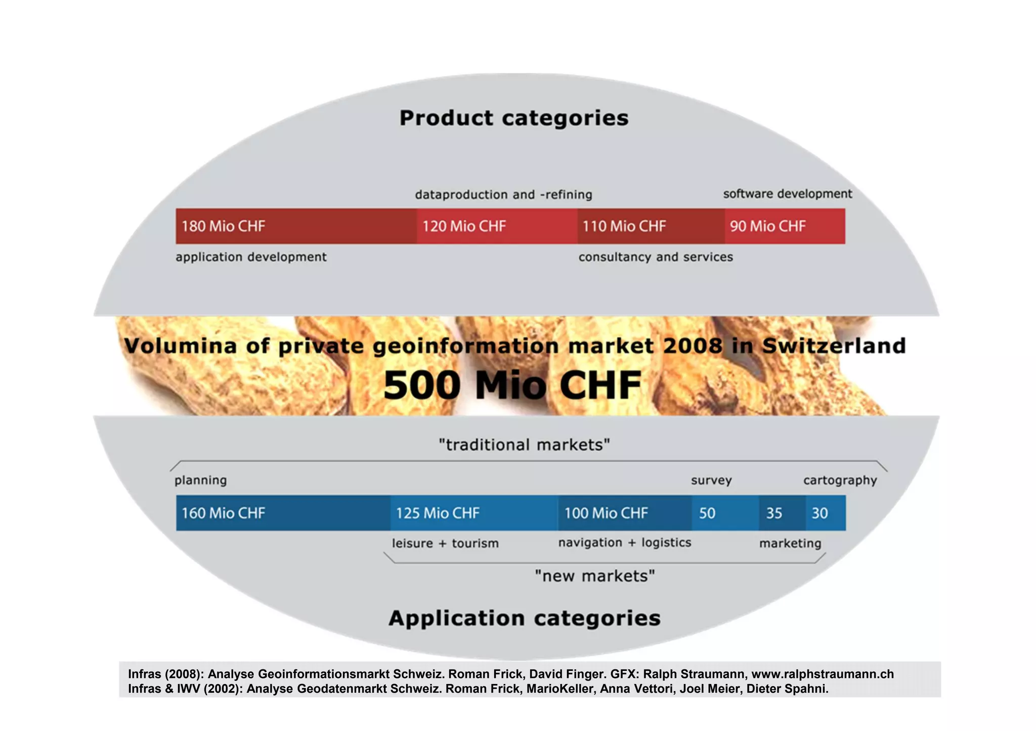
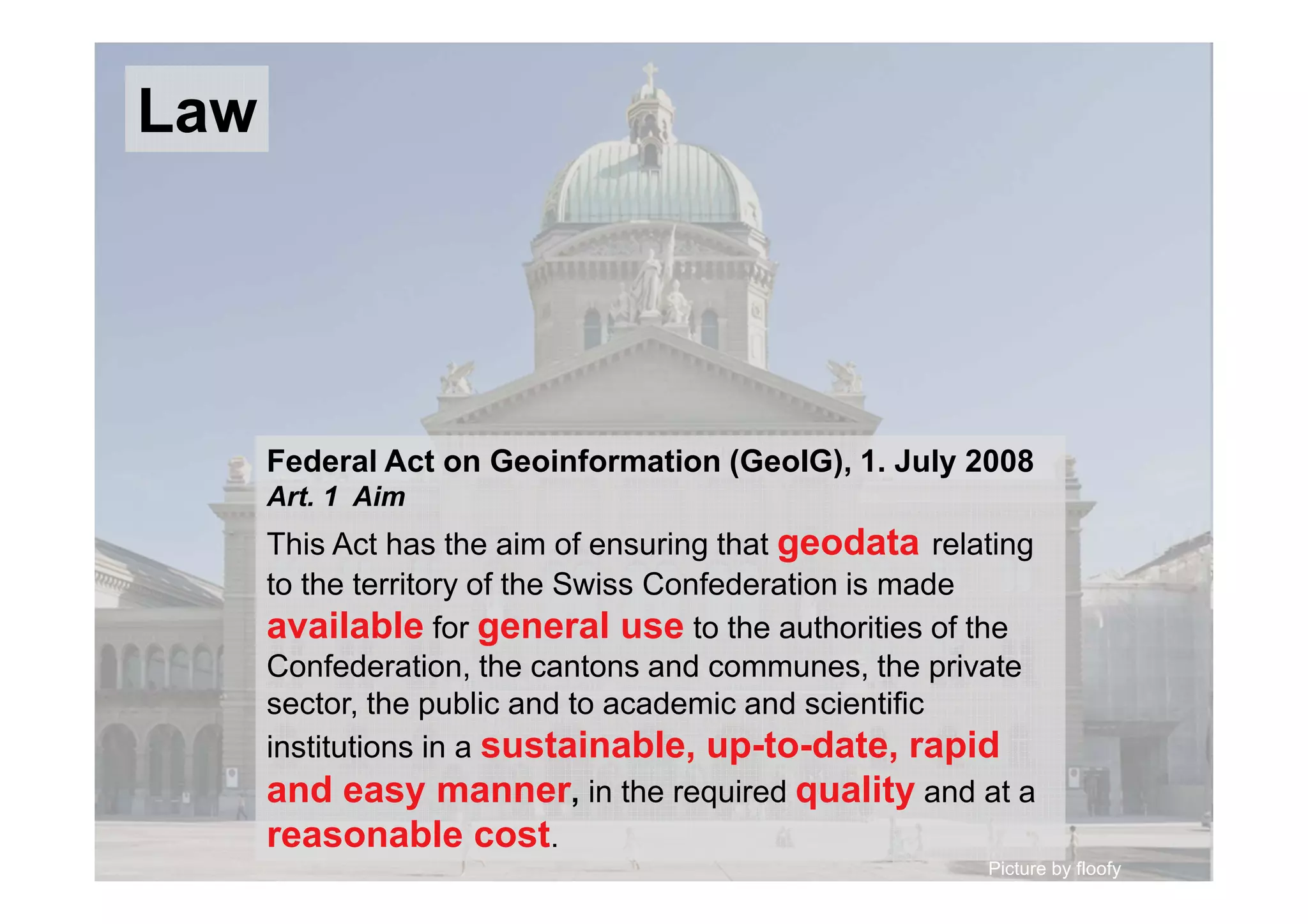
The document presents the five-year experience of the Swiss SDI with cloud computing, detailing the role of swisstopo in producing high-quality spatial data and geoinformation services. It emphasizes the transition from traditional infrastructure to cloud services, enhancing scalability and efficiency in managing geodata. The Swiss Federal Act on Geoinformation aims to ensure easy and affordable access to geodata for various stakeholders, contributing to the sustainability of the geoinformation market.