LiDAR Tech for Forestry Structure Analysis
•Download as PPTX, PDF•
2 likes•608 views

LiDAR Technology & IT’s Application on Forestry

Recommended
Recommended
More Related Content
What's hot
What's hot (20)
Similar to LiDAR Tech for Forestry Structure Analysis
Similar to LiDAR Tech for Forestry Structure Analysis (20)
More from National Cheng Kung University
More from National Cheng Kung University (20)
Recently uploaded
Recently uploaded (20)
LiDAR Tech for Forestry Structure Analysis
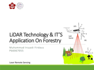
- 1. LiDAR Technology & IT’S Application On Forestry Muhammad Irsyadi Firdaus P66067055 Laser Remote Sensing
- 3. Introduction 3 Forest Structural Diversity Forests are complex spatial structures Most forest stand structure descriptors are traditionally based on measures easily obtainable from the ground level Characterizing forest structure is an important part of any comprehensive biodiversity assessment. Measuring structural complexity require a laborious process that involves many logistically expensive point based measurements
- 4. Introduction 4 BIOMASS COMPONENT ABOVEGROUND-BIOMASS CROWN-BIOMASS STEM-BIOMASSBELOWGROUND-BIOMASS
- 5. Introduction 5 Airborne Laser Scanning is one of remote sensing technology which can provide effective solutions to Forestry
- 6. 6 Estimating and mapping forest structural diversity using airborne laser scanning data [2015] Single Tree Biomass Modelling using Airborne Laser Scanning [2013] Characterizing Forest Ecological Structure Using Pulse Types and Heights of Airbone Laser Scanning [2010] 1 2 3 Papers
- 7. 7 The study had two primary objectives: (i) to estimate indices of structural diversity for the entire study area, and (ii) to construct maps depicting the spatial pattern of the structural diversity indices. Papers 1
- 8. 8 Paper 1 METHODS Study Area The study area is located in the southwestern part of Molise Region in central Italy and includes 36,360 ha. ( Mura, M, et al, 2015)
- 9. 9 Paper 1 METHODS ALS Data Field Data Workflow ALS Data Pre-Processing Structural Diversity Indices Model Development and Spatial Predictions Inference Horizontal structural diversity was assessed using the standard deviation of DBH vertical structural diversity was assessed using the standard deviation of H Removal of outliers, ground/non-ground classification, and computation of normalized height Using a branch-and-bound algorithm addressing the optimization of R2 The model-assisted, generalized regression (GREG) estimators of means and variances were used
- 10. 10 Paper 1 RESULTS ( Mura, M, et al, 2015) Scatterplot of observed against predicted values for σ DBH. Scatterplot of observed against predicted values for σ H.
- 11. 11 Paper 1 RESULTS ( Mura, M, et al, 2015) Spatial predictions for σ DBH for the forested portion of the study area (hillshade background).
- 12. 12 Paper 1 RESULTS ( Mura, M, et al, 2015) Spatial predictions for σ H for the forested portion of the study area (hillshade background).
- 13. 13 Paper 1 CONCLUSION LiDAR data are a valid source of information for estimating and spatially predicting forest structural diversity and gains relevance for its potential role in characterizing forest ecosystems. The maps of structural diversity can be used not only for planning management strategies addressing biodiversity but also for preliminary hypotheses regarding silvicultural management systems because tree diameter and height are basic information for assessing the commercial the value of tree logs.
- 14. 14 Papers 2 The objective of this study: to present protocol for characterizing the ecological structure of a (dry Eucalypt) forest landscape using LiDAR data alone
- 15. 15 Paper 2 METHODS Study Area Lidar Data The study area covers the Rubicon catchment in the Cradle Coast Region of Tasmania, Australia, and is approximately 20,000 ha. LiDAR data was acquired over the study area using a RIEGL LMS-Q560 sensor in February 2007 The overall survey was coordinated using static and rapid static GPS methods.
- 16. 16 Paper 2 METHODS Workflow LiDAR Data Field Data LiDAR data and field plots Derived field variables Characterization scheme To quantify the amount of CWD, total volume was calculated for each plot. To compensate for this GPS error and to obtain a better registration between LiDAR data and the field plot area, the LiDAR point cloud data was first classified into four vertical layers; Ground, low vegetation, medium vegetation and high vegetation. Subsequently, LiDAR returns from each of these layers were sorted into “Types”
- 17. 17 Paper 2 RESULTS ( Miura, N, et al, 2010) LiDAR point cloud classification. (a) LiDAR point cloud data was first classified into four layers; Ground, low vegetation, medium vegetation and high vegetation. (b) Four types of LiDAR returns; Type 1 (singular returns), Type 2 (first of many returns), Type 3 (intermediate returns) and Type 4 (last of many returns).
- 18. 18 Paper 2 RESULTS ( Miura, N, et al, 2010) Illustration of forest characterisation scheme for different forest structures a (sparse foliage or low optical canopy depth) and b (dense foliage or high optical canopy depth). LiDAR returns are symbolised circles as Type 1, triangles as Type 2, crosses as Type 3 and squares as Type 4. V H is the same between a and b, however D H is greater in b and CC is greater in a.
- 19. 19 Paper 2 CONCLUSION In conclusion, the proposed FCS method has the ability to characterize some elements of the ecological structure of a dry Eucalypt forest landscape The proposed scheme demonstrated the potential of different laser pulse return properties from a full waveform LiDAR to provide information on the complexity of habitat structure in an efficient and cost-effective manner
- 20. 20 The objective of this study: To develop the new methods for tree-level biomass estimation using metrics derived from ALS point clouds. Papers 3
- 21. 21 Paper 3 METHODS Study Area Sample trees were collected in Evo, southern during the summer of 2010 and is approximately 2,000 ha. Scots pine and Norway spruce are dominant tree species in the study area BiomassDBH_H_ALS ALS Data Point Cloud Metrics Calculation BiomassALS (Biomass based ALS Data) BiomassDBH_H (Existing Model) DBH (Diameter at Breast Height) and (H) Height Derived from Point Cloud Metrics Workflow
- 22. 22 Paper 3 RESULTS ( Kankere, V, et al, 2013) Example of ALS points inside one tree canopy segment and of CHM with 0.5 m grid size.
- 23. 23 Paper 3 RESULTS Comparison of the RMSE% of biomass estimation between models (BIOMASS DBH_H , BIOMASS DBH_H_ALS AND BIOMASS ALS ) for pine (left) and spruce (right). ( Kankere, V, et al, 2013)
- 24. 24 Paper 3 CONCLUSION The point cloud metrics extracted from ALS data have strong capabilities for tree level AGB estimation. The developed models improved the accuracy for estimating forest AGB.
- 25. 25 References Matteo Mura, Ronald E. McRoberts, Gherardo Chirici, Marco Marchetti. (2015). Estimating and mapping forest structural diversity using airborne laser scanning data. Remote Sensing of Environment, 170,133–142. Naoko Miura, Simon D. Jones. (2010). Characterizing Forest Ecological Structure Using Pulse Types and Heights of Airbone Laser Scanning. Remote Sensing of Environment, 114, 1069–1076. Ville Kankare, Minna Räty, Xiaowei Yu. (2013). Single Tree Biomass Modelling using Airborne Laser Scanning. ISPRS Journal of Photogrammetry and Remote Sensing, 85, 66-73
- 26. 26 Thank you for your attention