This document discusses work package 2 of the EUXDAT project, which focuses on defining requirements and e-infrastructure for extreme data analytics. It provides an overview of the objectives, tasks, and deliverables of WP2. Several pilot scenarios are described in detail to validate the e-infrastructure developments, including enriching an open land use map with morphological characteristics and monitoring crop status using earth observation data. The progress on gathering requirements and defining the e-infrastructure is also summarized.
David Kolitzus:
Towards a Knowledge Hub on Earth Observation for Agriculture
User Driven Requirements
It’s all about agriculture
Elements of the Knowledge Hub
Community building, connecting the dots
Karel Charvat contributed with following topics:
Policy or international initiatives
What can do EO for Food security
Global monitoring initiatives related to EO
Project focused on local monitoring in developing countries
Nairobi Hackathon conclusion
FOODIE project has entered in the last year of its schedule. This seventh issue covers the period from March 2016 to
June 2016 and gives evidence of the more mature technical results and progress in pilot sites. In addition, you are
provided with an overview of the upcoming events and a brief summary of the past events where the FOODIE Team
presented the project. We hope you find the information interesting!
SENSOR BASED SMART IRRIGATION SYSTEM WITH MONITORING AND CONTROLLING USING IN...ijasa
This paper presents the development of a sensor based smart irrigation system with the capabilities of remote monitoring and controlling of water usage in the agriculture field using Internet of Things (IoT). With the employment of IoT in irrigation system, all agricultural information can be viewed and controlled at the user's fingertips. The system consists of a microcontroller (Node MCU), sensors (soil moisture, DHT11), and irrigation of a water pump with a decision-making system. Sensors are linked to a Wi-Fi module (Node MCU) and are interdependent to provide increased sensitivity to the irrigation system. The data obtained will be uploaded to the cloud (ThingSpeak) and presented in the form of graphs accessible via the website. A web page is used to control the water pump for irrigation purposes. This paper is managed to meet all of its aims to help farmers in terms of time, project cost, labor, water consumption, power consumption, and reliability by implementing the IoT-based smart irrigation system.
Development of Automated Solar Watering Systemtheijes
The main purpose of this project is to develop a Solar Watering System capable of performing irrigation or watering task automatically and is powered by Photovoltaic (PV) panels. A moisture sensor in the soil is used to check the need for irrigation in order to operate a pump powered by the PV system and lead acid battery. In addition to the input from moisture sensor, Timer function within the PIC18F4550 was also applied to prevent watering to many times per day. This ensures that the crop or plant in the field will not have growth problems due to overwatering. In order to increase energy harvesting from the sun radiation, sun tracker in the form of single axis was designed. Horizontal Single Axis Tracker (HSAT) was build based on the feedback from two Light Dependent Resistors (LDR) and an opaque sheet dividing them so that shadow will be casted on either one of them when the sun moves. The fully developed prototype has shown that the system able to reduce wastage and human intervention at minimum cost as the entire system runs only using solar energy. Therefore it can be said as a standalone unit which requires no additional devices or powers and requires minimal maintenance and attention
Climate data can provide a great deal of information about the atmospheric environment that impacts almost all aspects of human endeavour. This module explains the importance of climate data, its storage, security, applications and other aspects, in a nutshell.
Abstract - The main objective of this project is to built a
Modular Electromechanical Automated System Device for the
spreading of seeds and use it for mobile robotics agricultural
applications that will serve for the development of new
agricultural technologies. The device is a paintball gun with
electronic and mechanic adaptations with a modular coupling
that can be adapted to the vast majority of agricultural UAV
frames. Likewise, the device is electronically designed to work
with any type of commercial UAV flight control boards that
contains PWM outputs. The seeds firing can be configured
from the flight controller board using different programming
tools or with some flight planning software to achieve a
complete firing autonomy. Eventually the device performance
is tested in real time experiments.
In this project an automated greenhouse robot was built with the purpose of controlling the greenhouse
environment Parameters such as temperature and humidity. The microcontroller used to create the automated
greenhouse robot was an AT89s51. This project utilizes three different sensors, a humidity sensor, a Light
sensor and a temperature sensor. The 2sensors are controlling the two Relays which are a fan (for cooling) and
a bulb (for heating). The fan is used to change the temperature and the bulb is used to heat the plants. The
humidity control system and the temperature control system were tested both separately and together. The
result showed that the temperature and humidity could be maintained in the desired range.
Agrihub INSPIRE Hackathon 2021: Challenge #7: Analysis, processing and standa...plan4all
This is a presentation of results of Challenge #7: Analysis, processing and standardisation of data from agriculture machinery for easier utilization by farmers of the Agrihub INSPIRE Hackathon 2021.
Calculation of agro climatic factors from global climatic dataplan4all
Authors: Pavel Hájek,
Raitis Berzins , Jiří Valeš, Martin Pitoňák , Vincent
Onckelet , Tomáš Andrš, Veronika Osmiková , Ronald
Ssembajwe , Amit Kirschenbaum , Jörg Schliesser , Michal Kepka & Karel Jedlička
Digitalization of indigenous knowledge in African agriculture for fostering f...plan4all
Authors:
Antoine Kantiza, AKANTIZA CONSULT, Burundi
Didier Muyiramye, Swedish University of Agricultural Sciences, Rwanda
Elias Cherenet Weldemariam, HARAMAYA UNIVERSITY, Ethiopia
Petr Horak, WIRELESSINFO, Czech Republic
Robert Sabimana, Frutus Fresco Ltd, Uganda
Pavel Hajek, West Bohemia University, Czech Republic
Tuula Löytty, Smart & Lean Hub Oy, Finland
Demet Osmancelebioglu, Smart & Lean Hub Oy, Finland
Karel charvat map-compositions-format-intro-presentation-by-karel (1)plan4all
Karel Charvat on behalf of Plan4all, Lesprojekt, BOSC and Asplan Viak gave a presentation about the project to create a Google Docs-like map application and map composition format.
Karel charvat map-whiteboard-collaborative-map-making-breakout-sessionplan4all
Karel Charvat on behalf of Plan4all, Lesprojekt, BOSC and Asplan Viak gave a presentation about the project to create a Google Docs-like map application and map composition format.
Adjusting primitives for graph : SHORT REPORT / NOTESSubhajit Sahu
Graph algorithms, like PageRank Compressed Sparse Row (CSR) is an adjacency-list based graph representation that is
Multiply with different modes (map)
1. Performance of sequential execution based vs OpenMP based vector multiply.
2. Comparing various launch configs for CUDA based vector multiply.
Sum with different storage types (reduce)
1. Performance of vector element sum using float vs bfloat16 as the storage type.
Sum with different modes (reduce)
1. Performance of sequential execution based vs OpenMP based vector element sum.
2. Performance of memcpy vs in-place based CUDA based vector element sum.
3. Comparing various launch configs for CUDA based vector element sum (memcpy).
4. Comparing various launch configs for CUDA based vector element sum (in-place).
Sum with in-place strategies of CUDA mode (reduce)
1. Comparing various launch configs for CUDA based vector element sum (in-place).
Techniques to optimize the pagerank algorithm usually fall in two categories. One is to try reducing the work per iteration, and the other is to try reducing the number of iterations. These goals are often at odds with one another. Skipping computation on vertices which have already converged has the potential to save iteration time. Skipping in-identical vertices, with the same in-links, helps reduce duplicate computations and thus could help reduce iteration time. Road networks often have chains which can be short-circuited before pagerank computation to improve performance. Final ranks of chain nodes can be easily calculated. This could reduce both the iteration time, and the number of iterations. If a graph has no dangling nodes, pagerank of each strongly connected component can be computed in topological order. This could help reduce the iteration time, no. of iterations, and also enable multi-iteration concurrency in pagerank computation. The combination of all of the above methods is the STICD algorithm. [sticd] For dynamic graphs, unchanged components whose ranks are unaffected can be skipped altogether.
Opendatabay - Open Data Marketplace.pptxOpendatabay
Opendatabay.com unlocks the power of data for everyone. Open Data Marketplace fosters a collaborative hub for data enthusiasts to explore, share, and contribute to a vast collection of datasets.
First ever open hub for data enthusiasts to collaborate and innovate. A platform to explore, share, and contribute to a vast collection of datasets. Through robust quality control and innovative technologies like blockchain verification, opendatabay ensures the authenticity and reliability of datasets, empowering users to make data-driven decisions with confidence. Leverage cutting-edge AI technologies to enhance the data exploration, analysis, and discovery experience.
From intelligent search and recommendations to automated data productisation and quotation, Opendatabay AI-driven features streamline the data workflow. Finding the data you need shouldn't be a complex. Opendatabay simplifies the data acquisition process with an intuitive interface and robust search tools. Effortlessly explore, discover, and access the data you need, allowing you to focus on extracting valuable insights. Opendatabay breaks new ground with a dedicated, AI-generated, synthetic datasets.
Leverage these privacy-preserving datasets for training and testing AI models without compromising sensitive information. Opendatabay prioritizes transparency by providing detailed metadata, provenance information, and usage guidelines for each dataset, ensuring users have a comprehensive understanding of the data they're working with. By leveraging a powerful combination of distributed ledger technology and rigorous third-party audits Opendatabay ensures the authenticity and reliability of every dataset. Security is at the core of Opendatabay. Marketplace implements stringent security measures, including encryption, access controls, and regular vulnerability assessments, to safeguard your data and protect your privacy.
Show drafts
volume_up
Empowering the Data Analytics Ecosystem: A Laser Focus on Value
The data analytics ecosystem thrives when every component functions at its peak, unlocking the true potential of data. Here's a laser focus on key areas for an empowered ecosystem:
1. Democratize Access, Not Data:
Granular Access Controls: Provide users with self-service tools tailored to their specific needs, preventing data overload and misuse.
Data Catalogs: Implement robust data catalogs for easy discovery and understanding of available data sources.
2. Foster Collaboration with Clear Roles:
Data Mesh Architecture: Break down data silos by creating a distributed data ownership model with clear ownership and responsibilities.
Collaborative Workspaces: Utilize interactive platforms where data scientists, analysts, and domain experts can work seamlessly together.
3. Leverage Advanced Analytics Strategically:
AI-powered Automation: Automate repetitive tasks like data cleaning and feature engineering, freeing up data talent for higher-level analysis.
Right-Tool Selection: Strategically choose the most effective advanced analytics techniques (e.g., AI, ML) based on specific business problems.
4. Prioritize Data Quality with Automation:
Automated Data Validation: Implement automated data quality checks to identify and rectify errors at the source, minimizing downstream issues.
Data Lineage Tracking: Track the flow of data throughout the ecosystem, ensuring transparency and facilitating root cause analysis for errors.
5. Cultivate a Data-Driven Mindset:
Metrics-Driven Performance Management: Align KPIs and performance metrics with data-driven insights to ensure actionable decision making.
Data Storytelling Workshops: Equip stakeholders with the skills to translate complex data findings into compelling narratives that drive action.
Benefits of a Precise Ecosystem:
Sharpened Focus: Precise access and clear roles ensure everyone works with the most relevant data, maximizing efficiency.
Actionable Insights: Strategic analytics and automated quality checks lead to more reliable and actionable data insights.
Continuous Improvement: Data-driven performance management fosters a culture of learning and continuous improvement.
Sustainable Growth: Empowered by data, organizations can make informed decisions to drive sustainable growth and innovation.
By focusing on these precise actions, organizations can create an empowered data analytics ecosystem that delivers real value by driving data-driven decisions and maximizing the return on their data investment.
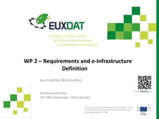
Karel Jedlička - WP2 - Requirements and e-Infractructure Definition
1. WP 2 – Requirements and e-Infrastructure
Definition
General Assembly
(17-18th September, Thessaloniki)
Karel Jedlička (WirelessInfo),
This project has received funding from the European Union’s
Horizon 2020 research and innovation programme under
grant agreement No 777549
www.EUXDAT.eu
European e-Infrastructure
for Extreme Data Analytics
in Sustainable Development
2. 2www.euxdat.eu
WP 2 – Requirements and e-Infrastructure
Definition
1. Status of the WP2
2. Revision Plan M23-M24
3. 3www.euxdat.eu
WP 2 – Objectives
Objective 2.1: Describe the pilots proposed as the validators of the e-
Infrastructure developments to be done in the rest of WPs.
Objective 2.2: Identify and describe those end users communities that might
benefit from the proposed e-Infrastructure, which may have new data
management-related needs.
Objective 2.3: Gather requirements from the pilots and from other
stakeholders, in order to understand the current and future needs for
computation and data management.
Objective 2.4: Define the main features to be fulfilled by the
e-Infrastructure, identifying the key components to be modified and the
potential bottlenecks for scaling up to extremely large data analysis.
4. 4www.euxdat.eu
WP 2 – Tasks
Task 2.1: Pilots and Future Problems Description (WRLS)
Task 2.2: Platform-Driven e-Infrastructure Requirements (WRLS)
Task 2.3: High Level Definition of the e-Infrastructure (ATOSES)
6. 6www.euxdat.eu
T2.1 Pilots description T2.2 e-Infrastructure requirements
T2.3 e-Infrastructure definition
WP 2 – Objectives – Tasks - Deliverables
O2.1:
describe
pilots
Agriculture
experts
group
O2.3: pilots &
users
requirements
O2.4:
e-Infra-
structure
features
D2.1, .3, .5: (Pilot) and e-Infrastructure requirements
O2.2:
describe
users
D2.2, .4, .6:
e-Infra
definition
7. 7www.euxdat.eu
WP 2 – Progress
Objective 2.1: Describe the pilots proposed as the validators of the e-
Infrastructure developments to be done in the rest of WPs.
Scenarios description
• Morphometry characteristics for OpenLandUse
• Monitoring of crop status
• Agroclimatic zones
• Looking for climatic patterns changes
• Information support for field use recommendations
• Effective utilization of natural resources
• Determination of crop and growth stage
• Calculate long time climate and geographic position effects on the mass changes in
Insects
8. 8www.euxdat.eu
Enrichment of OLU by geo-
morphological characteristics
Scenario 1: Open Land Use Map improvement
• Example for a particular field
min_elevation: 186.64203
max_elevation: 196.92177
mean_elevation: 190.70232
median_elevation: 190.44339
min_slope: 0.75737
max_slope: 1.56950
mean_slope: 1.23466
median_slope: 1.25559
min_azimuth: -179.98296
max_azimuth: 179.62314
mean_azimuth: -13.07384
median_azimuth: -30.85966
9. 9www.euxdat.eu
Enrichment of OLU by geo-
morphological characteristics
Data generation
On the fly
The data on user request is generated onfly on ATOS cloud. The
code used for generation on backend is in Python. The API is
written in Flask microframework and deployed as container.
Pregenerated:
The data for the whole Europe are generated at once at HPC in
Stuttgart and then dumped and sent to ATOS cloud. This
approach generates all data at once and allows some analysis
(selection by complex criteria) and visualization of the whole
database
12. 12www.euxdat.eu
Enrichment of OLU by geo-
morphological characteristics
WMS from pregenerated data
https://mapserver.test.euxdat.eu/cgi-
bin/mapserv?map=/maps/elevation/olu.map
14. 14www.euxdat.eu
Stress detection in olive trees
Enhance the ability to differentiate between biotic and
abiotic crop stress
Pathogen identification between the surveyed ones
Objectives
Monitoring of crop status
15. 15www.euxdat.eu
Monitoring of crop status
The monitoring system will include a crop anomaly
detection component based on specific Sentinel 2 image
analysis algorithms to monitor crop condition and
presence of anomalies as deviation.
It will then attribute stress based anomalies to disease or
pests by hyperspectral data and other data sources
16. 16www.euxdat.eu
The service will provide stress maps of the targeted olive
plantations at the tree-polygon level
Using these maps and the new treatments, farmers and
agronomists will be able to be more efficient and
effective in their detection and treatment of diseases
(Sentinel 2 multispectral indices)
Identification will be achieved using UAV-enabled
hyperspectral imagery and its correlation to ground truth
Monitoring of crop status
18. 18www.euxdat.eu
The user creates a polygon (or more) in a provided map (google
earth type). The input polygons will be in geojson format. The
assessment algorithms will be run on the selected polygons.
https://olive.test.euxdat.eu/
The user is provided a list of dates to choose the imagery from
(imagery with cloud cover above a certain % are excluded from the
list)
The user selects his dates the algorithms are run in the backend.
When the results are ready (also in geojson), a table with the
statistics per pixel in each polygon is displayed to the user.
eg:
Polygon 1:
• 20% Verticillium
• 10% Cycloconium
• 70% No stress
Polygon 2:
• …
• …
• …
User interface
Monitoring of crop status
22. 22www.euxdat.eu
Agroclimatic zones
Agro-climatic zones
e-Infrastructure components used
• Data connectors
• Meteo data (CDS- ERA5 / meteoblue API)
• EU-DEM
• Processing tools
• GRASS
• HPC aspects
• Parallelization
for different
time slices
• (Parallelization for hydrology effect
~ for each segment of water stream)
23. 23www.euxdat.eu
Agroclimatic zones
Current status
the algorithm for temperature adjustments according to
altitudes was changed into a procedure with required
inputs and outputs according to the diagram.
the procedure for adjusting the temperature according to
the influence of water was fine-tuned.
Work in progress
automatic download of temperature data from Copernicus
according to user input (period from, to, step).
Future plans
focus on automatic download of DEM according to the
specified area and next part of the diagram.
Integration to GUI
24. 24www.euxdat.eu
1.1 annual potential evapotranspiration, 50%
prob.
1.2 seasonal potential evapotranspiration,
50% prob.
1.3 seasonal water deficits, 50% probability,
1.4 seasonal water deficits, 10% probability,
100 mm
1.5 seasonal water deficits, 50% probability,
25 mm
1.6 seasonal water deficits, 10% probability
1.7 climatic moisture indices
2.1 average dates of last spring freeze, 0C
2.2 average dates of first fall freeze, 0C
2.3 average freeze-free period, 0C
2.4 dates of last spring freeze, 0C, 10% prob.
2.5 dates of first fall freeze, 0C, 10% probability
2.6 average dates of last spring freeze, -2C
2.7 average dates of first fall freeze, -2C
2.8 average freeze-free period, -2C
2.9 dates of last spring freeze, -2C, 10% prob.
2.10 dates of first fall freeze, -2C, 10% prob.
Agroclimatic zones
26. 26www.euxdat.eu
Information support for field use
recommendations
1. Should a tractor with fertilizer enter the field
2. should a tractor with a crop protection enter
the field
3. Should a harvester enter the field
4. Application map for fertilizer and spraying
All scenarios have identical requirements:
• Understanding of Field capacity of soil
moisture
• A good atmospheric correction of the Sentinel-
2 data
• A good biomass monitoring algorithm
27. 27www.euxdat.eu
Multiple notebooks generated to support
‘Information support’ , ‘Olu’ and other scenarios:
- Automatic reading of field borders
- Reading of field-based statistics for biomass as
well as for clouds
29. 29www.euxdat.eu
Figure 38. Soil moisture time-series for a station in Washington state,
USA demonstrating Field Capacities (FC) (red points). The dry/wet
condition classes will be established as a percentage of FCs for given
time-period.
Detection of field capacity required for:
31. 31www.euxdat.eu
Determination of crop and growth stage
A combined approach for crop detection and growth monitoring
would use land use maps for select cropping areas,
use satellite images to build time series on those areas, classify the
time series into winter and summer crops (by using fallow periods
for separation and validating this with meteorological data – e.g.
precipitation sums to confirm growth or absence thereof),
separating the crops using specific rules, such as typical periods
(sowing / emergence, booting, flowering, maturation, harvesting
times), colours (e.g. green for winer cereals vs. yellow for oilseed
rape), temperature min/max and sums , soil moisture.
The resulting classification will be ground truthed with 3 methods:
manually , overlay with statistics, and check by users (customers)."
32. 32www.euxdat.eu
Calculate long time climate and geographic
position effects on the mass changes in Insects
Moths (Tineidae) are an insect group containing many economic important
pests. Pupae formation and dormancy of this insects is triggered by day
length. Whereas day length is a function of the geographic position. The
development and the speed of development of this moths is depending on
temperature.
By this proposition and site climate are selecting the part of population
which goes into dormancy and which forms the start population for the
upcoming year.
Geo-location and the long time weather data in a 3 km grid from MeteoBlue
and Pessl Instruments can be used to calculate for any possible site the day
length dependence of the start population.
This enables a big improve in the modelling of the mass changes in the
population during the season. The calculations are very intense and have to
be employed on high performance computers. It is needed to simulate the
population of every day in multiple objects describing the behaviour of an
individual insect form egg to adult to retrieve the information if this individual
insect will go the dormancy of will form a pupae. All insects which can not
reach the overwintering 5th larvae stage will not contribute to the population
in the next year."
36. Thank you for your attention
jedlicka@wirelessinfo.cz
This project has received funding from the European Union’s Horizon 2020
research and innovation programme under grant agreement No 777549
European e-Infrastructure
for Extreme Data Analytics
in Sustainable Development
www.EUXDAT.eu
Editor's Notes
sháníme data, detekce mrazu z in-situ senzorů. Počasí + pole +senzory – co kdy dělat
vylepšená telemetrie, kus predikce trajektorií na základě morfometrie terénu + plodiny (šířku záběru).
Involvement of external stakeholders
Interviews (Karl – example)
Evaluation (Karl)
Involvement of external stakeholders
Interviews (Karl – example)
Evaluation (Karl)
Involvement of external stakeholders
Interviews (Karl – example)
Evaluation (Karl)
Involvement of external stakeholders
Interviews (Karl – example)
Evaluation (Karl)
Involvement of external stakeholders
Interviews (Karl – example)
Evaluation (Karl)
Karl
Karl
Waiting for D2.4
Waiting for D2.4
After the demonstration, we have dense data about temperature and we can come back to next plans with mentioned scenarios
After the demonstration, we have dense data about temperature and we can come back to next plans with mentioned scenarios